Please register to participate in our discussions with 2 million other members - it's free and quick! Some forums can only be seen by registered members. After you create your account, you'll be able to customize options and access all our 15,000 new posts/day with fewer ads.
Some severe thunderstorms moved through SW Michigan last night. I looked out my hotel window and saw basically continuous lightning flashes and sheets of sideways rain. Lasted quite a while too. It’s been very warm but some very cool temps incoming tomorrow.
What else would one expect in the climatically unstable continent of North America. These wild swings drive me nuts. Why can't we have a few years of very small fluctuations in temperature compared to going from one of the coldest to warmest. Just like the first two weeks of Jan were the coldest on record. This is nuts.
Seems like south of the Jet there's record heat and when the ridge builds north we get it.
North of the Jet there's cold enough air that makes things extremely cold when it dips south.
We are in the middle of the battle as the Jet waves along.
Should be more flatter with ridging at times moving through May which means normal-above normal temps.
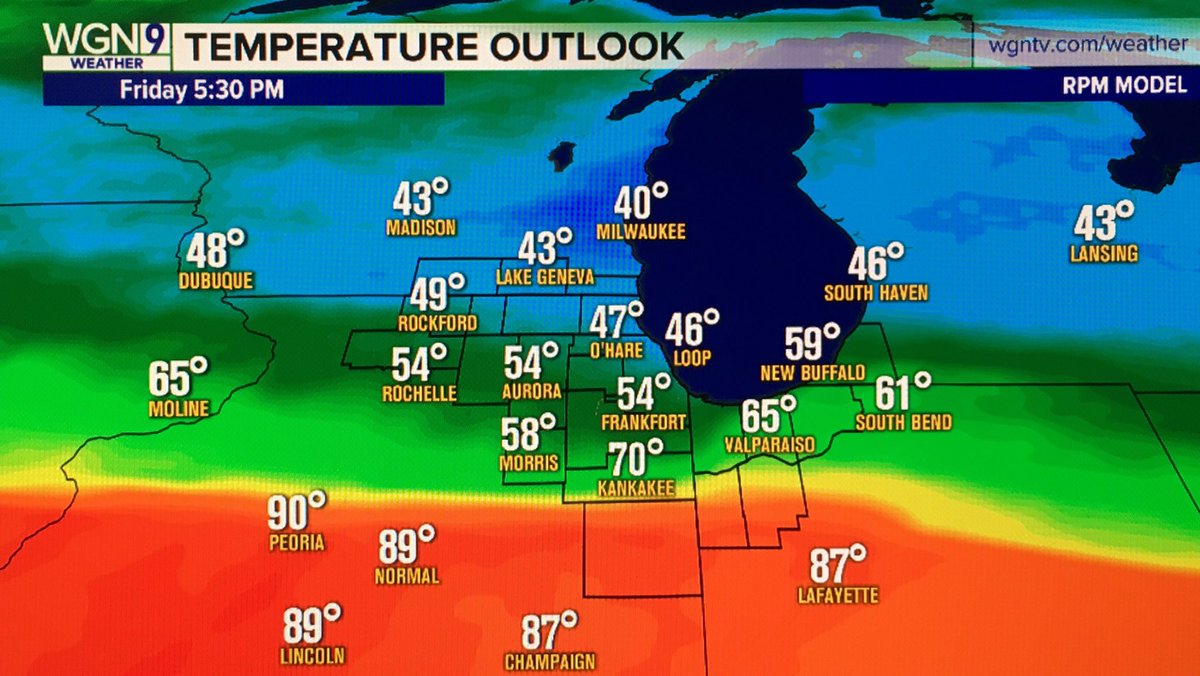
That map is not correct now. Currently 77F here with sun shining.
Its called a still image with a time stamp. Lmao. yeah, warmed up nicely there. I think NYC in 60s. Normal day. Feels great!
Please register to post and access all features of our very popular forum. It is free and quick. Over $68,000 in prizes has already been given out to active posters on our forum. Additional giveaways are planned.
Detailed information about all U.S. cities, counties, and zip codes on our site: City-data.com.

 Please register to participate in our discussions with 2 million other members - it's free and quick! Some forums can only be seen by registered members. After you create your account, you'll be able to customize options and access all our 15,000 new posts/day with fewer ads.


 yeah, warmed up nicely there. I think NYC in 60s. Normal day. Feels great!
