February & Early March 2016 U.S Stormy Pattern (Rain & Snowstorms) (hot, most)
Please register to participate in our discussions with 2 million other members - it's free and quick! Some forums can only be seen by registered members. After you create your account, you'll be able to customize options and access all our 15,000 new posts/day with fewer ads.
Current 850mb temps and Metars. Took a while but that freezing line aloft finally pushed off the coast overnight.
That freezing line is a must to be past you for snow, such as why the MA capes are rain right now, its not cold enough at the mid levels. Then you have those spots on Long Island where it needs to be a tad colder than just near freezing due to Water temps and yesterdays warmth lingering around and such.
The heavier the precip the better it is to cool the column going down.
A look at the Pressure and winds at Surface, Mid Level, and Upper Level.
Basically winds are coming from the north at the surface and mid Levels while there is a Southerly flow at the Upper levels (direction moisture is moving in general)
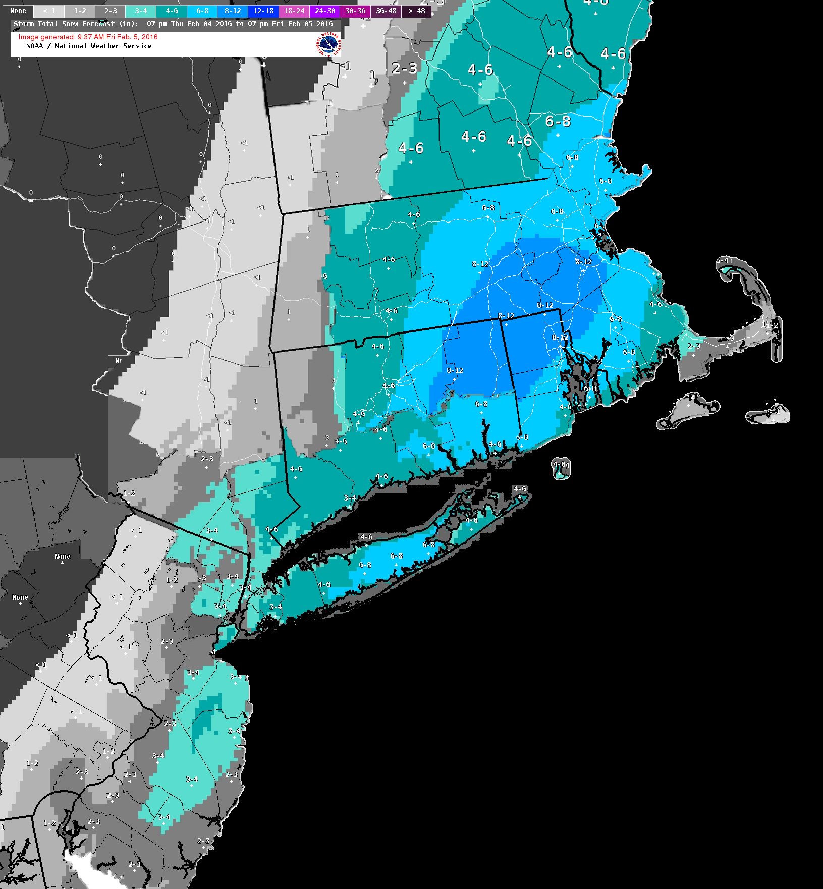
This was a nice morning surprise. Very nice looking outside, sad this is the big snow of the season so far. Wish this happened a couple times a week
Please register to post and access all features of our very popular forum. It is free and quick. Over $68,000 in prizes has already been given out to active posters on our forum. Additional giveaways are planned.
Detailed information about all U.S. cities, counties, and zip codes on our site: City-data.com.

 Please register to participate in our discussions with 2 million other members - it's free and quick! Some forums can only be seen by registered members. After you create your account, you'll be able to customize options and access all our 15,000 new posts/day with fewer ads.