February & Early March 2016 U.S Stormy Pattern (Rain & Snowstorms) (ground, North)
Please register to participate in our discussions with 2 million other members - it's free and quick! Some forums can only be seen by registered members. After you create your account, you'll be able to customize options and access all our 15,000 new posts/day with fewer ads.
Feb 8, 2016 Storm totals. NWS changed their whole map format, sucks. I will grab the map from the other source when they update today. Underperformed in Eastern CT, Over performed in Western CT
Current Alert map. Here comes the next one.
An additional 4 inches to Long Island
Snowpack to remain on ground for a while
Islip,NY forecast.
Another 2-6" coming with thunder possible & the deep freeze this weekend
Any chance of upcoming storms hitting northern Vermont? We are dying for some snow!
Other than scattered stuff and light snows, watch the one on the 16th-17th. Could be a nice one for Vermont. But given the trends this year something tells me not to hold your breath. Pretty crazy. But then again I think typical for points south of Vermont to get more snow in an El Nino winter.
Other than scattered stuff and light snows, watch the one on the 16th-17th. Could be a nice one for Vermont. But given the trends this year something tells me not to hold your breath. Pretty crazy. But then again I think typical for points south of Vermont to get more snow in an El Nino winter.
Season Snowfall so far:
Philly: 24.3"
Burlington: 20.8"
Islip: 37.1"
Concord: 19.9"
Baltimore: 30"
Albany: 6.8"
I noticed on my own that Buffalo has less snow so far this season than NYC. I wonder if it is the latest in the winter this has happened (I can't imagine a full season where this happened but who knows)? There was a winter sometime in the 2000s or perhaps this decade where NYC ended up with more snow than Albany for the whole season and supposedly it was the first time that ever happened going through over a century of mutual record (could happen this year.....at this rate with all the storms going south of Albany and not much lake effect streaming across the state they could be threatening their least snowy winter......(the last of my 4.5 years living up there was that 2nd least snowy winter on their list.....I remember it being a record mid 60s on Feb. 1)
Feb 8, 2016 Storm totals. NWS changed their whole map format, sucks. I will grab the map from the other source when they update today. Underperformed in Eastern CT, Over performed in Western CT
Current Alert map. Here comes the next one.
An additional 4 inches to Long Island
Snowpack to remain on ground for a while
Islip,NY forecast.
Another 2-6" coming with thunder possible & the deep freeze this weekend
NWS has Winter Weather Advisories for most of the metro NYC area except the northernmost parts, but in their discussion admit there is a ton of uncertainty.....it could be flurries/dusting or it could even ramp up to Winter Storm Warning criteria.
Other than scattered stuff and light snows, watch the one on the 16th-17th. Could be a nice one for Vermont. But given the trends this year something tells me not to hold your breath. Pretty crazy. But then again I think typical for points south of Vermont to get more snow in an El Nino winter.
Season Snowfall so far:
Philly: 24.3"
Burlington: 20.8"
Islip: 37.1"
Concord: 19.9"
Baltimore: 30" Albany: 6.8"
Albany has the least. I'm in the "sweet spot" of the least snow this season — inland enough to miss the big coastal snows, but not north enough to get consistent cold and flurries. Though even northern New England got rain in December and January.
Got about 4" yesterday and Friday. This storm felt like more, snowed for longer but not as hard. I think the ground was warm for the first so not as much stuck.
I'm seeing a forecast for a decent sized snowstorm Feb 16-17. Could be promising. GFS just has Maine getting dumped with snow; and most precipitation offshore or just too warm. What is WeatherUnderground seeing? Euro has a big low centered on New England.
I'm seeing a forecast for a decent sized snowstorm Feb 16-17. Could be promising. GFS just has Maine getting dumped with snow; and most precipitation offshore or just too warm. What is WeatherUnderground seeing? Euro has a big low centered on New England.
Yup, Euro has a snow to rain storm for us as the low is waay to close to us. (tracks it on land). But obviously still a week away so that can change. That IS the next bigger storm to watch but .. one at a time.
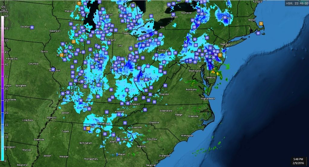
Right now there's a lot of light snow on the map... even in Georgia! Philly area getting snow. 4-6" forecasted for them.
I think I saw models had a little more for this area now tomorrow morning. Have to check. Been busy all day,. Ugh. Wish I got paid to do this
Please register to post and access all features of our very popular forum. It is free and quick. Over $68,000 in prizes has already been given out to active posters on our forum. Additional giveaways are planned.
Detailed information about all U.S. cities, counties, and zip codes on our site: City-data.com.

 Please register to participate in our discussions with 2 million other members - it's free and quick! Some forums can only be seen by registered members. After you create your account, you'll be able to customize options and access all our 15,000 new posts/day with fewer ads.