Please register to participate in our discussions with 2 million other members - it's free and quick! Some forums can only be seen by registered members. After you create your account, you'll be able to customize options and access all our 15,000 new posts/day with fewer ads.
On the coast of South Carolina, a popular beach resort for many East Coasters. I'll be going to my parent's place in a week, about 25 miles NE of there - it'll be much too early for hurricanes though.
A few years back, I did get to ride out a strong tropical storm there (70 mph) - I loved how the house shook and rocked, with the windows bowing in from the wind pressure - exciting stuff. My mom and my sis and her kids were huddling in the bed, guess they were a bit scared...lol.
The Euro has been off a lot this past May so things might not be as grim as indicated by the model
Quote:
The European weekly model has be consistently forecasting colder than average temperatures over much of the eastern two thirds. As we showed in the previous sub-seasonal blog, in addition to the updated 2m-temperature anomaly time-series averaged over the East, the pattern has been extremely changeable in nature.
Quote:
Further, the European weekly model completely missed the highly touted upcoming heat event for the eastern two thirds this week in through next as advertised by out Days 1-5 and 6-10 period forecast.
That being said and until the European modeling group makes the appropriate updates to the model, we promote below average confidence in the European weekly Week 4 forecast of 2m-temperatures.
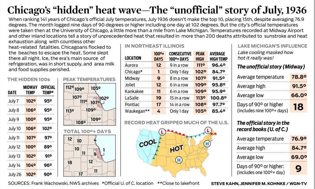
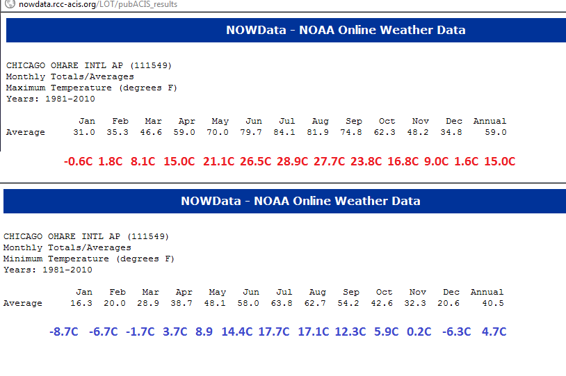
Btw, Chicago/MDS is currently at 91F/33C, third 90F+ temp this year, ORD is at 88F/31C. Still no 90 degree temps "officially".
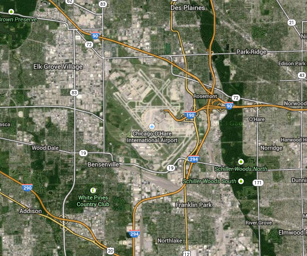
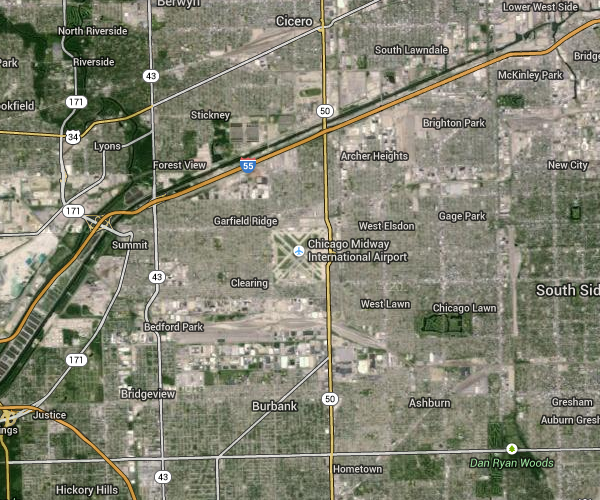
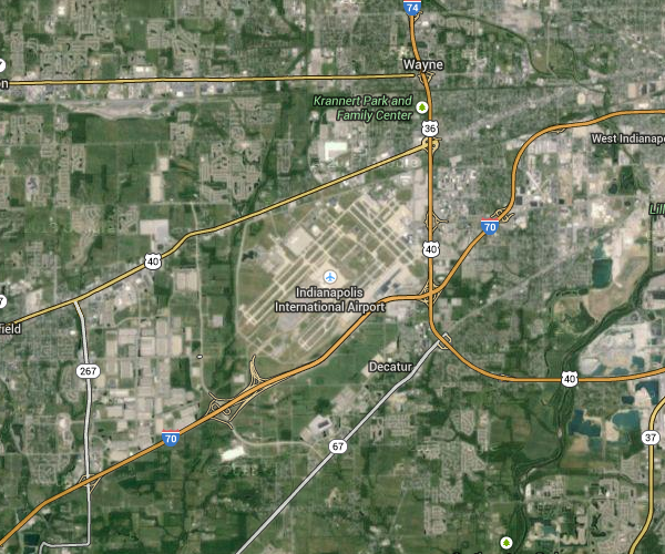
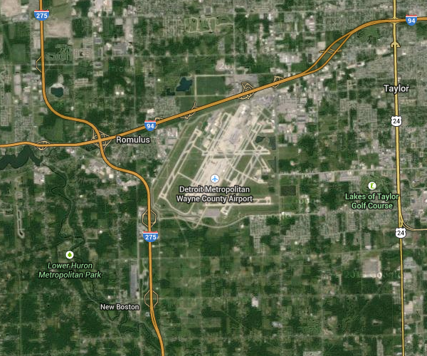
The difference between readings at O'Hare and Midway got me to thinking that Pittsburgh gets robbed of at least two degrees during every heat wave in the eastern United States since there's significantly less of an "urban heat island" affect around Pittsburgh International Airport compared to the airports in the major Midwestern cities. Either that, or the Midwestern cities get boosted by at least two degrees from the urban heat islands around them. Check out these satellite images:
KORD
KMDW
KIND
KDTW
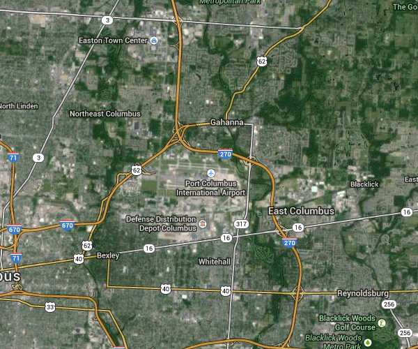
KCMH
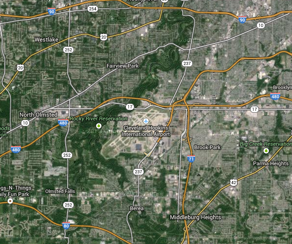
KCLE
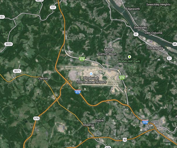
KPIT
Being higher in elevation already keeps somewhat of a lid on the "official" temperatures in Pittsburgh, but as you can see, its airport is also the farthest-removed from urbanity, and that has to have an effect too. Only Detroit even comes close to having an airport that far removed. As for Midway, it's surrounded by steel, glass and stone on all sides, so it makes sense to have O'Hare report the official observations for Chicago since the urbanity around it isn't as intense.
. As for Midway, it's surrounded by steel, glass and stone on all sides, so it makes sense to have O'Hare report the official observations for Chicago since the urbanity around it isn't as intense.
I disagree. O'Hare doesn't represent the "city" it's more of a north suburban station. This was discussed on wunderground back in July 2012
Yes, MDW is more urban than ORD, and the UHI supports higher nightly minimum temps, but many less urban stations outside the city consistently see warmer maximum temps than ORD
If you look at the hottest of heatwaves, suburban stations are almost always higher than the city, and that's due to the lake's influence which negates the UHI
Even when it comes to average maximum, ORD is lower than less urban stations to it's west such as Streamwood
Summer begins with a classic setup. A few bits of drizzle over me and more lightning in store for Screwyville.
Please register to post and access all features of our very popular forum. It is free and quick. Over $68,000 in prizes has already been given out to active posters on our forum. Additional giveaways are planned.
Detailed information about all U.S. cities, counties, and zip codes on our site: City-data.com.

 Please register to participate in our discussions with 2 million other members - it's free and quick! Some forums can only be seen by registered members. After you create your account, you'll be able to customize options and access all our 15,000 new posts/day with fewer ads.


 My mom and my sis and her kids were huddling in the bed, guess they were a bit scared...lol.