Please register to participate in our discussions with 2 million other members - it's free and quick! Some forums can only be seen by registered members. After you create your account, you'll be able to customize options and access all our 15,000 new posts/day with fewer ads.
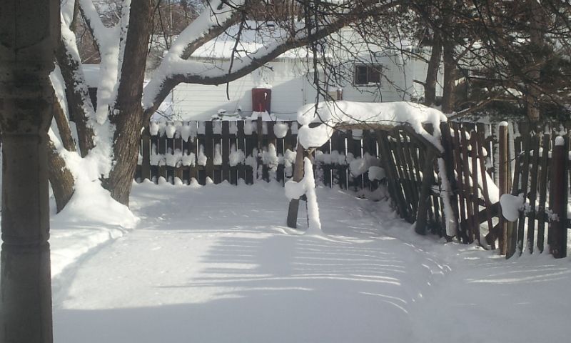
Kept snowing last night, but was the light fluffy stuff. Let the pooches out back today and was so peaceful. The poor old tired privacy fence has just about seen it's last winter. Warming up to the mid 30's by Saturday, but then the bottom falls out of the thermometer after that. Calling for single digits during the day and who knows where it will end up at night.
I saw the Air Idaho helicopter this afternoon and that usually means something serious. Unfortunately, it was a second avalanche fatality. A snowmobiler lost his life in the Palisades Lake area of Idaho (about 25-30 miles south west of here).
Still staying unsettled with a supposedly strong jet stream.
The last few days a few of the computer model runs have pointed towards a colder pattern developing as we head towards mid-January, but they have been in a minority. In other words I’ll be watching how things develop, but unless more and more of the model runs start pointing towards a major change my money will remain firmly on a mostly unsettled outlook with short lived colder incursions.
Deep chill continues pulling back—for now……
Posted on Dec 27 2013 - 1:19 am by tskillingwgntv
Only 21 of the past 143 years since 1871 have produced colder December temps to date. The month’s 23.5-degree average is an eye-catching 14.4-degrees below temps over the same period a year ago and nearly 5-degrees below normal.
Given the overwhelmingly cold environment of late, it’s little wonder ANY news of warming is welcome among Chicagoans.
Area’s snow cover to be the critical variable in how much Saturday “warms”; gusty southwest winds may mix 40-degree temps down to the surface
The core of the frigid air mass, responsible for generating Chicago’s coldest Christmas Eve daytime high of 18-degrees on Tuesday, has retreated north for the time being. But, while gusty southwest winds are to hustle even milder air into the area Saturday, the fact the ground is snow covered is quite likely to put a lid on the degree of warming we see, particularly on Saturday. If the 41-degree high we’re predicting at O’Hare Saturday verifies, it will become the warmest reading to occur here over the past 24 days. Were the ground not covered here by snow, temperatures Saturday would likely reach 60-degrees. But snow’s reflective nature has quite an ability to temper warming and it’s likely mid 30s to low 40s are a more reasonable Saturday high temperature target.
Bitterly cold, sub-zero arctic air heading southbound from North America’s snow-covered northern tundra
There’s a clear message from our analysis of the emerging weather pattern in the days ahead; “Enjoy the warming cycle while it lasts. It’s likely to be brief!”
Chicago is expected to move into a falling temp regime Sunday. Fans of the Bears and Packers would be wise to plan to bundle up warmly for Sunday’s Soldier Field game since air temps are predicted to drop from the low 30s early Sunday to the low 20s by game time mid Sunday afternoon and to the mid teens by nightfall. Sub zero readings are likely to grip many areas by Monday morning and again Monday night and Tuesday morning.
Winter’s most potent arctic blast to sweep into the Plains and upper Midwest first; Minnesota wind chills headed to dangerous 40 to 60-below levels by Sunday morning
The first stop for the bitter blast of arctic air predicted to reach the Lower 48 this weekend is with North Dakota, Minnesota, Wisconsin and western Michigan. There, our in-house RPM computer forecast model is generating wind chills approaching 60-degrees below zero by early Sunday.
Northwest Europe pounding sign of pattern change. ECWMF reversing to mean trough.... Yes, winter is on way
Please register to post and access all features of our very popular forum. It is free and quick. Over $68,000 in prizes has already been given out to active posters on our forum. Additional giveaways are planned.
Detailed information about all U.S. cities, counties, and zip codes on our site: City-data.com.

 Please register to participate in our discussions with 2 million other members - it's free and quick! Some forums can only be seen by registered members. After you create your account, you'll be able to customize options and access all our 15,000 new posts/day with fewer ads.