Please register to participate in our discussions with 2 million other members - it's free and quick! Some forums can only be seen by registered members. After you create your account, you'll be able to customize options and access all our 15,000 new posts/day with fewer ads.
In fact, a massive snowstorm upcoming tommorrow to northern Mexico whilst most you will be on a blowtorch. Certainly More a El Niño vibe than La Niña. Odd
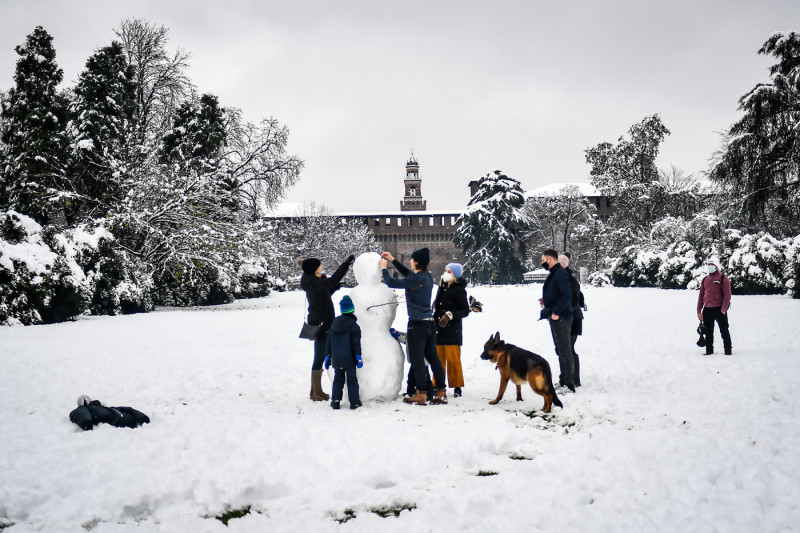
Meanwhile, a lot of snow for Milano and the Po Valley yesterday
SUMMARY...Occasional snow rates of 1+ inch per hour will be likely
late this afternoon into the evening, as precipitation spreads in
from the west. A transition to sleet/freezing rain is expected
across much of this area later tonight.
DISCUSSION...At 2145Z, snow was increasing across northeast IL and
spreading into southeast WI, with rates approaching 1 inch per hour
likely ongoing across the southwest Chicago suburbs, where
saturation of an initially dry airmass has allowed for precipitation
to reach the ground. As a large area of precipitation continues to
spread in from the west, favorable ascent within the dendritic
growth zone will allow for heavier bands of snow with maximum rates
exceeding 1 inch per hour through 00Z. Moderate to locally heavy
precip rates will likely continue into the evening, though continued
low-level warm advection will result in an eventual changeover to
sleet or freezing rain later tonight across northeast IL into far
southeast WI.
Nice! Congrats. I see you're getting light rain this morning. At least you saw some snow. Snow changed to ice in Southern Michigan thanks to the layer above warming up with the southerly push.
Rainy day today. We could see rain mix with some snow before ending tonight. Dry and cloudy tomorrow and then it gets interesting. Some snow starts the second system tomorrow night then transitions to freezing rain for a while. Could see some very light ice accumulations (0.05 to 0.1 inches of ice) before making the changeover to all rain by daybreak Friday. Could even have some thunderstorms Friday as temps soar into the 50s. Snow will continue to be a no go here in Indianapolis.
You can see why Mexico is getting snow at higher elevations. A Cut off low (Cut off from the Jet Stream) is over the region and it dragged the cold air south more.. Below freezing down to I think 7000'? So snow can fall down to 5000' at least
Please register to post and access all features of our very popular forum. It is free and quick. Over $68,000 in prizes has already been given out to active posters on our forum. Additional giveaways are planned.
Detailed information about all U.S. cities, counties, and zip codes on our site: City-data.com.

 Please register to participate in our discussions with 2 million other members - it's free and quick! Some forums can only be seen by registered members. After you create your account, you'll be able to customize options and access all our 15,000 new posts/day with fewer ads.