Spring 2014 (March-May) - Northern Hemisphere (Ohio, Indiana, Texas, Missouri)
Please register to participate in our discussions with 2 million other members - it's free and quick! Some forums can only be seen by registered members. After you create your account, you'll be able to customize options and access all our 15,000 new posts/day with fewer ads.
Thats like something that would happen here. We would get all excited for this snowstorm coming and then in the last minute all this random mild air would come out of nowhere..
It's simple... I'll keep repeating it.. details wont be known until days out UNTIL we find a way to get data from out in the Pacific. The general "storm" idea can be seen weeks away but details like temps & precip amounts rarely.
This is the sole reason why you see your forecast AND the models change even days out. The energy/system needs to get closer to land OR we have to send Flights out there to get more data. This way models have more details to work with.
I haven't heard about any flights going out and that must mean they don't see a big threat.
some pretty extreme spring warmth in south-eastern sweden right now. Norrköping has officially recorded 16.5C today, which is swedens highest temperature this early in the season since 1961.
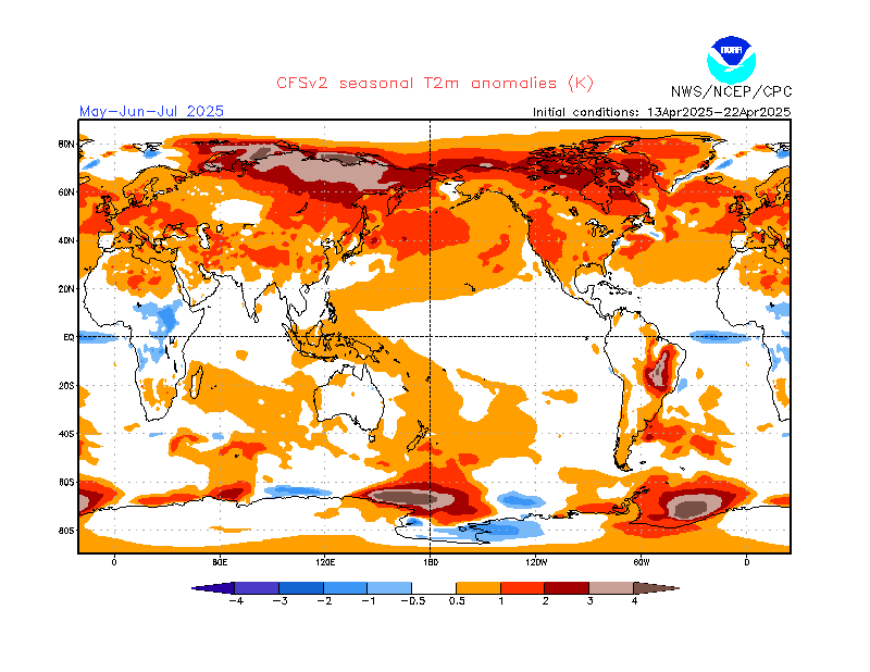
As of right now, the summer looks normal for Chicago
Are there any maps regarding summer precipitation?
Please register to post and access all features of our very popular forum. It is free and quick. Over $68,000 in prizes has already been given out to active posters on our forum. Additional giveaways are planned.
Detailed information about all U.S. cities, counties, and zip codes on our site: City-data.com.

 Please register to participate in our discussions with 2 million other members - it's free and quick! Some forums can only be seen by registered members. After you create your account, you'll be able to customize options and access all our 15,000 new posts/day with fewer ads.