Please register to participate in our discussions with 2 million other members - it's free and quick! Some forums can only be seen by registered members. After you create your account, you'll be able to customize options and access all our 15,000 new posts/day with fewer ads.
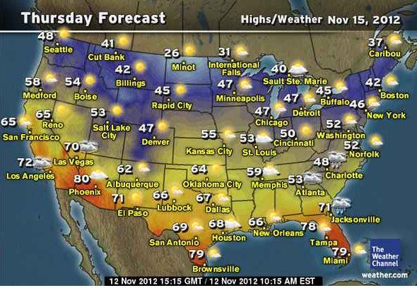
Finally some mild weather. 63 F today, 62 F tomorrow. It gets chillier after that but nothing terribly cold, just temps near 50. Oh yeah and it's finally sunny now after that period of clouds that seemed like it would never end.
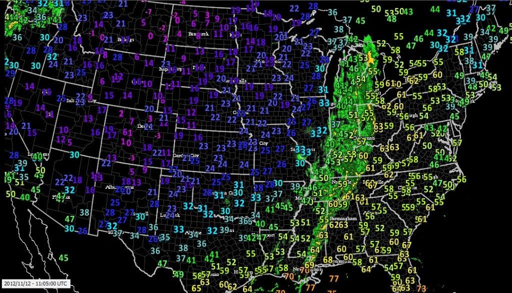
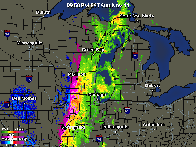
The front is easily defined in this radar shot. The wind is getting stronger. Wind gusts to 42mph so far. Snow suppose to begin tomorrow morning and through tomorrow night. Calling for 2-3 in. but we'll see if it pans out. It's still 59 outside at 10pm and this time of year is unusual. Broke records again around the region for high temps.
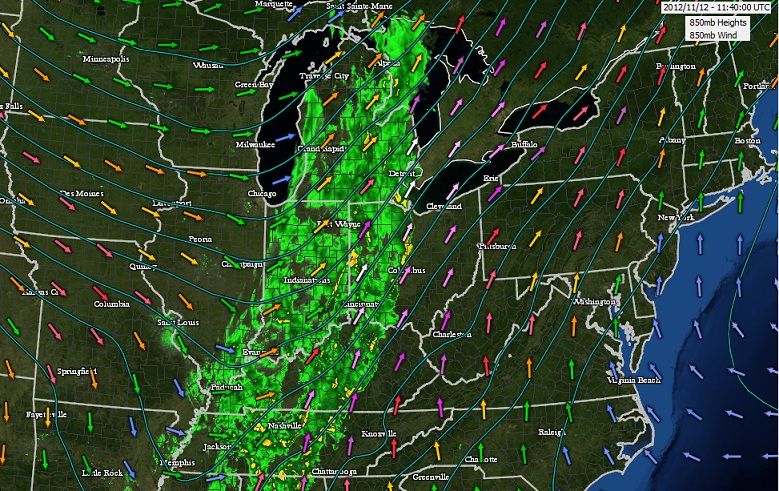
Current 850mb Wind direction shows why we are warming up the east. South SW winds right into us. behind it has NW winds which usually mean cold. Since weather moves West to east you can see whats coming by looking at the upper levels.
Here's a link that shows this level. http://www.spc.noaa.gov/sfctest/new/...r=19&parm=pmsl#
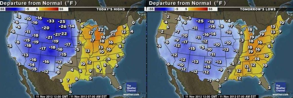
After the front goes by...while it will turn cooler everwhere in the northern USA - I really dont' see any sharp cold air by the end of the week. 30's and 40's in the far northern USA....50's in the central/and coastal areas.....and 60's and 70's in the southern subtropics. If this pattern hold as we get ready to start winter in less than two weeks.....mean temps across the USA should be close to seasonable norms;
Please register to post and access all features of our very popular forum. It is free and quick. Over $68,000 in prizes has already been given out to active posters on our forum. Additional giveaways are planned.
Detailed information about all U.S. cities, counties, and zip codes on our site: City-data.com.

 Please register to participate in our discussions with 2 million other members - it's free and quick! Some forums can only be seen by registered members. After you create your account, you'll be able to customize options and access all our 15,000 new posts/day with fewer ads.


 Nice treat. Usually it's lower than what they forecast, glad to finally see a change for once.