Fall 2012 Thread (September - November) (traffic, calculate, snow, warm)
Please register to participate in our discussions with 2 million other members - it's free and quick! Some forums can only be seen by registered members. After you create your account, you'll be able to customize options and access all our 15,000 new posts/day with fewer ads.
Backwards from here. Our fog is almost always early morning fog that burns off after a few hours. Usually happens at least once, often more a week.
That's how it usually happens here too, but today is different, and the fog is still around. Forecast says fog for the next few days until colder air arrives.
Will you two stop making me jealous with fog pictures?! We've hardly had any here this year so far, and at the moment we've just had the same layer of low-ish grey cloud we've had for days and 9C/damp non-weather with not much to look at. It's a long time since I've seen fog actually get thicker during the course of the day.
Fog is just ridiculously common here. I've seen it too many times to count this year. It's common as dog muck under an easterly wind, especially under high pressure/inversions.
Philly's record high for 10/20 was only 65? That seems a little off, it's significantly lower than nearby cities, Trenton & NYC's record high for 10/20 is 80 while Baltimore's is 87.
Yes, that was an error. 80 was the record so they didnt break. At least you can see I'm not bias. LOL!!
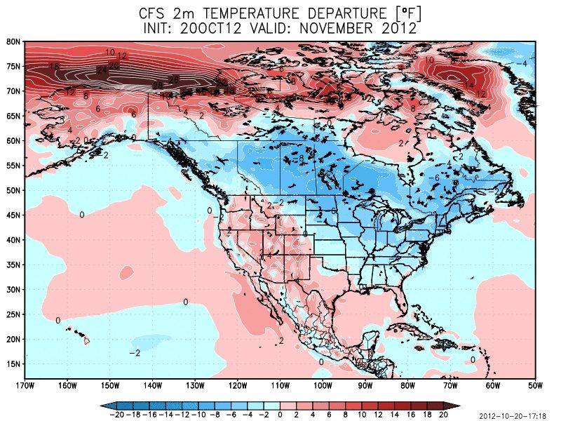
Speaking of not being bias... Warm this week but changes are coming. I've never seen such agreement on every model about this.
Won't higher pressure above Greenland imply a colder Greenland?
When referring to the blocking aka NAO, it's reflecting the upper levels. (The 500mb, 17,000+ feet). The surface is a different story.
Also note, High pressure can mean Hot temps. All depends on where the Ridge sets up. but when referring to the blocking and say warm anomalies over Greenland, thats showing the layer of 500mb. The upper level pattern controls
If anyone has more to add to this for me, please do.
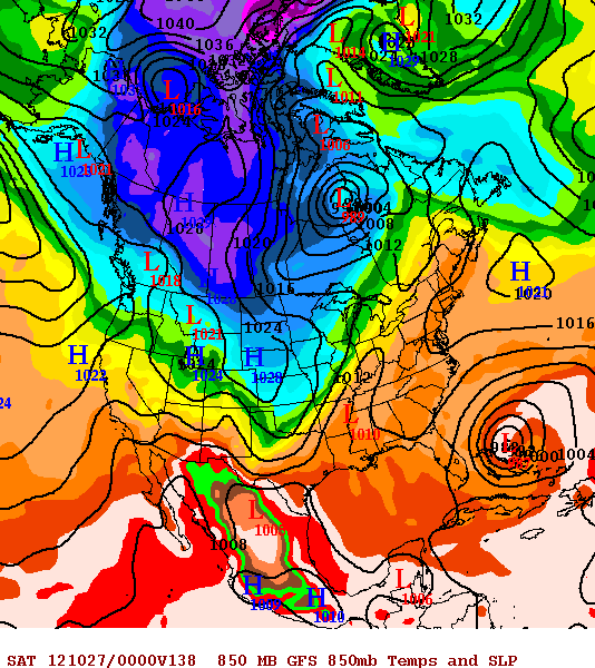
00Z 10/21 Euro and Canadian GEM all have gone back or introduced the idea again of a snow event for eastern ND and northwestern MN for this upcoming Thu-Fri peroid. Both have a deep low near Duluth around 00z-12z Fri. Will see if GFS which did have the low comes around. It isnt uncommon for GFS to have a system....then loose it...only to get it back again later.
Fog never went away but the sun did try to burn it off, but failed, it just went out a bit and became a mist in the distance and now looks like it's coming back in again since the sun is getting weaker and dusk is almost upon us.
Fog never went away but the sun did try to burn it off, but failed, it just went out a bit and became a mist in the distance and now looks like it's coming back in again since the sun is getting weaker and dusk is almost upon us.
What was the warmest it got there today? I'm not sure I can remember an all-day fog event this early from when I lived up there, though maybe you live in a microclimate if you say fog is really common. I've been surprised by how gloomy the last couple of days have been considering it's two whole months until the solstice - 1h15 before sunset and one of the flats opposite me has already felt the need to put the lights on, something which seems more December than October.
Please register to post and access all features of our very popular forum. It is free and quick. Over $68,000 in prizes has already been given out to active posters on our forum. Additional giveaways are planned.
Detailed information about all U.S. cities, counties, and zip codes on our site: City-data.com.

 Please register to participate in our discussions with 2 million other members - it's free and quick! Some forums can only be seen by registered members. After you create your account, you'll be able to customize options and access all our 15,000 new posts/day with fewer ads.