Please register to participate in our discussions with 2 million other members - it's free and quick! Some forums can only be seen by registered members. After you create your account, you'll be able to customize options and access all our 15,000 new posts/day with fewer ads.
Now this is what I like to see... Slowly but surely. After the 24th I believe we start to see the northern Branch dive down again and winter will start to show up again.
GFS18z introduces snow cover across the U.S..
Hopefully if it does in fact snow here again in October it's the 1 inch or so they're forecasting and not another Snowtober.
Hopefully if it does in fact snow here again in October it's the 1 inch or so they're forecasting and not another Snowtober.
Hehehe...I told you it would be funny if there was a Snowtober repeat, and yesterday evening I saw in the long-range GFS a dusting for Pennsylvania on the exact same date - October 29 .
Meanwhile, the GFS seems to be locking on to a huge feature in the West. A truly extreme cold snap is on the way for BC and Montana according to the long-range. Much of interior BC might get to below 0F, and the most extreme model run had temperatures below -20F . That would smash monthly record lows across the board. The models are also locking onto single-digits and snowfall for northern Montana. Snowfall occurs elsewhere, and that entire cold dome drips towards the east, bringing some bone-chilling temperatures far and wide. One model possibility that's been shown was single-digits with 6 inches of snow in parts of Montana for Halloween, and all of the ones I've looked at shows extreme cold and snow, though not quite as extreme as singles. Simultaneously, another cold high-pressure system exits the Northeast and an advancing system (with the only warm air in the country ahead of the cold front) deposits a dusting in Pennsylvania according to one of the runs. Not enough to be devastating, but enough to terrorize those who hated the Snowtober experience.
I'm impressed by the consistency of this extreme feature, which could occur a few days before or a few days after Halloween - the exact timing is still sketchy. We'll see if the forecast holds, since it's at the edge of model range. I'd also like to say that the pattern in Montana is very reminiscent of the later part of November 2010, only the same exact weather is going to occur a month earlier this time. I'd also like to say that the leaves that I've seen are reminding me much more of the autumn of 2010 than 2011, and the "air" smells of a 2010-like pattern (as crazy as that sounds, I think I should inform you of it). The feel and weather, while looking like the autumn of 2011 at first, are now looking more like the autumn of 2010, and of course if it leads into a 2010-11-like winter it will mean fun times for everyone.
On a side note, that extreme cold that's depicted in Montana would even be considered unusual in my dream climate, so I know that's hardcore cold for Halloween. It would even be considered cold in Fairbanks. One place it would be almost exactly average is Yakutsk (they average in the mid singles on Halloween). When the weather anywhere in the lower 48 starts to look more like Yakutsk than any American city, pay attention.
As for the trough in the West, if it's centered on Montana/North Dakota more so than California, I don't think you Easterners need to worry about big heat. The GFS long range has several cold snaps coming pretty far east (at least far into the interior East - I don't even look at the coast). At this point in autumn some cold snaps would be nice for beleaguered winter fans in the East. If the trough can gradually migrate East with a -AO/NAO, you're in business. The same thing happened when November 2010 transitioned to December 2010.
If I was a New Yorker I'd say "Cool spell? What cool spell?". For October, 53F certainly isn't cool. It'll probably be up to a low of 60F before long, knowing that place .
I'll see if I'm right - *goes to Weather.com* *types in "New York, NY"* Nope, I'm not right. But October 19 is forecast to have a low of 59F, so I was close. Boy, that's warm. Of course most of the nights are going to be cooler. Tonight will go down to 42F, then lows will hang around 50F for a while after that 59F. Still not cool for October.
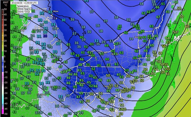
I did see the 00z and 06z gfs 10/16 was quite warmer than the 12z gfs run which did have some cooler air. Now suggest about average wx for late October in the far N Plains.
Always fun though to look that far out on the GFS....more fantasy often then reality but it can give trends overall if looked at consistently day to day.
Just about finished with my mid shift....
Dan
Quote:
Originally Posted by Patricius Maximus
Hehehe...I told you it would be funny if there was a Snowtober repeat, and yesterday evening I saw in the long-range GFS a dusting for Pennsylvania on the exact same date - October 29 .
Meanwhile, the GFS seems to be locking on to a huge feature in the West. A truly extreme cold snap is on the way for BC and Montana according to the long-range. Much of interior BC might get to below 0F, and the most extreme model run had temperatures below -20F . That would smash monthly record lows across the board. The models are also locking onto single-digits and snowfall for northern Montana. Snowfall occurs elsewhere, and that entire cold dome drips towards the east, bringing some bone-chilling temperatures far and wide. One model possibility that's been shown was single-digits with 6 inches of snow in parts of Montana for Halloween, and all of the ones I've looked at shows extreme cold and snow, though not quite as extreme as singles. Simultaneously, another cold high-pressure system exits the Northeast and an advancing system (with the only warm air in the country ahead of the cold front) deposits a dusting in Pennsylvania according to one of the runs. Not enough to be devastating, but enough to terrorize those who hated the Snowtober experience.
I'm impressed by the consistency of this extreme feature, which could occur a few days before or a few days after Halloween - the exact timing is still sketchy. We'll see if the forecast holds, since it's at the edge of model range. I'd also like to say that the pattern in Montana is very reminiscent of the later part of November 2010, only the same exact weather is going to occur a month earlier this time. I'd also like to say that the leaves that I've seen are reminding me much more of the autumn of 2010 than 2011, and the "air" smells of a 2010-like pattern (as crazy as that sounds, I think I should inform you of it). The feel and weather, while looking like the autumn of 2011 at first, are now looking more like the autumn of 2010, and of course if it leads into a 2010-11-like winter it will mean fun times for everyone.
On a side note, that extreme cold that's depicted in Montana would even be considered unusual in my dream climate, so I know that's hardcore cold for Halloween. It would even be considered cold in Fairbanks. One place it would be almost exactly average is Yakutsk (they average in the mid singles on Halloween). When the weather anywhere in the lower 48 starts to look more like Yakutsk than any American city, pay attention.
As for the trough in the West, if it's centered on Montana/North Dakota more so than California, I don't think you Easterners need to worry about big heat. The GFS long range has several cold snaps coming pretty far east (at least far into the interior East - I don't even look at the coast). At this point in autumn some cold snaps would be nice for beleaguered winter fans in the East. If the trough can gradually migrate East with a -AO/NAO, you're in business. The same thing happened when November 2010 transitioned to December 2010.
If I was a New Yorker I'd say "Cool spell? What cool spell?". For October, 53F certainly isn't cool. It'll probably be up to a low of 60F before long, knowing that place .
.
You want to hear a cool stat for this time period?
The normal High is around 64 for NYC and Interior CT but....
NYC Normal Low is 50°F. Interior CT Normal low is 41°F.
Having a normal of 50°F at night compared to near 40°F is pretty noticeable..
That means NYC see's more 50s and upper 40s on average at night whereas Interior CT sees upper 30s and mid 40s on average. And looking at a map the locations are not far off.
Latitude is 41.50°N compared to 40.75°N. Same Elevation. (higher elevation obviously cooler than those numbers)
Temperature got up to 12°C today and is 8°C now at 20:25. Back to the norm of five degrees above the norm.
Please register to post and access all features of our very popular forum. It is free and quick. Over $68,000 in prizes has already been given out to active posters on our forum. Additional giveaways are planned.
Detailed information about all U.S. cities, counties, and zip codes on our site: City-data.com.

 Please register to participate in our discussions with 2 million other members - it's free and quick! Some forums can only be seen by registered members. After you create your account, you'll be able to customize options and access all our 15,000 new posts/day with fewer ads.


 .
. . That would smash monthly record lows across the board. The models are also locking onto single-digits and snowfall for northern Montana. Snowfall occurs elsewhere, and that entire cold dome drips towards the east, bringing some bone-chilling temperatures far and wide. One model possibility that's been shown was single-digits with 6 inches of snow in parts of Montana for Halloween, and all of the ones I've looked at shows extreme cold and snow, though not quite as extreme as singles. Simultaneously, another cold high-pressure system exits the Northeast and an advancing system (with the only warm air in the country ahead of the cold front) deposits a dusting in Pennsylvania according to one of the runs. Not enough to be devastating, but enough to terrorize those who hated the Snowtober experience.

") .
.

