Please register to participate in our discussions with 2 million other members - it's free and quick! Some forums can only be seen by registered members. After you create your account, you'll be able to customize options and access all our 15,000 new posts/day with fewer ads.
And before you ask what this has to do with weather, aside from weather affecting crops, check out my last post where I give a final summary of how weather has been around here with totals. You might find that interesting maybe. :-)
If you're a Winter Fan in the East, you need to worry about this new look coming up.
Trough is setting up in the West and its the very first time I've seen this in months. That constant persistant Ridge of High Pressure in the West is finally off the map. This means the Ridge builds in for the East.
Sure its early... Sure its only October... but the fact that this "change" of look is happening now is worrying me. Upper level patterns do not change like surface events. Things are slower in nature up above.
Lets hope this is temporary (which I think it is) and not permanent for months ahead.
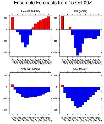
These are one of those times the Negative NAO means nothing. The Negative PNA is more crucial at this point.
15/4°C and mostly sunny today. The 4°C morning felt chillier than the 3°C one we had in September because of the wind. My room dropped to 13°C/55°F. Pleasantly chilly.
Quote:
Originally Posted by nei
Impressive. Our coldest so far is 54°F, though less week was 15°C/59°F and below.
Your 22°F low was more impressive to me. Anyway the daily high record at Orly airport was 5.4°C/41.7°F (1975), so we were quite far.
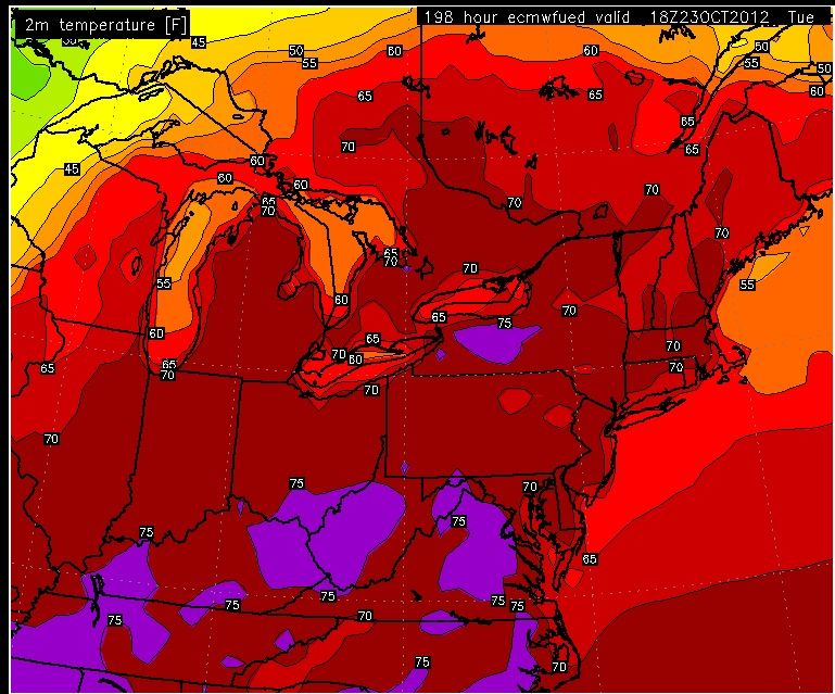
Models continue to support my idea of a warm Eastern U.S. lol
Euro has widespread 70s and pockets of 80s coming. Why is this significant? Because normals have dropped to low 60s in spots so this would mean being above normal by over 10.
If you're a Winter Fan in the East, you need to worry about this new look coming up.
Trough is setting up in the West and its the very first time I've seen this in months. That constant persistant Ridge of High Pressure in the West is finally off the map. This means the Ridge builds in for the East.
I put this in another thread, but this is the latest from Jamstec
Now this is what I like to see... Slowly but surely. After the 24th I believe we start to see the northern Branch dive down again and winter will start to show up again.
Now this is what I like to see... Slowly but surely. After the 24th I believe we start to see the northern Branch dive down again and winter will start to show up again.
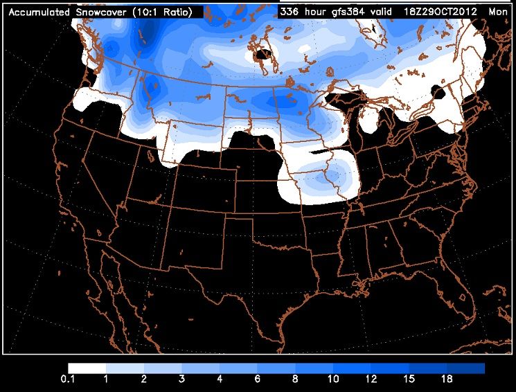
GFS18z introduces snow cover across the U.S..
I'd have to see that to believe it. I ran the GFS yesterday and it showed a lot of blue over Colorado about 10 days out, but that will never happen.
Please register to post and access all features of our very popular forum. It is free and quick. Over $68,000 in prizes has already been given out to active posters on our forum. Additional giveaways are planned.
Detailed information about all U.S. cities, counties, and zip codes on our site: City-data.com.

 Please register to participate in our discussions with 2 million other members - it's free and quick! Some forums can only be seen by registered members. After you create your account, you'll be able to customize options and access all our 15,000 new posts/day with fewer ads.


 lol
lol