Please register to participate in our discussions with 2 million other members - it's free and quick! Some forums can only be seen by registered members. After you create your account, you'll be able to customize options and access all our 15,000 new posts/day with fewer ads.
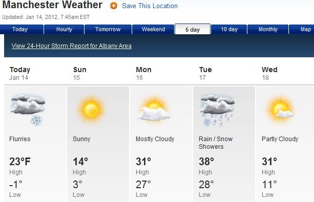
Manchester, VT 5 day forecast. Normal High is 30. Normal Low is 11. Looks like they'll be below to normal next 5 days. 1 day of above with the highs and 2 days with above for the lows.
US National Weather Service Caribou ME
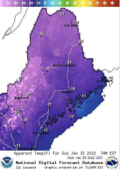
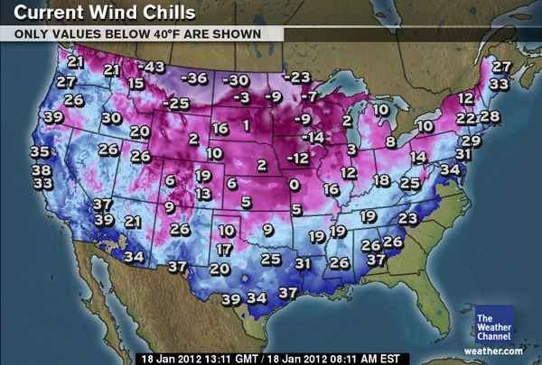
Dangerous wind chills are in store tonight throughout the state. Here are the expected wind chills at 7am Sunday morning. Wind chills to around 30 below are expected for Northern Maine, with 10 to 20 below toward the coast. Wind chill advisories are in effect for many areas, with even wind chill warnings for the Western Maine mountains, where wind chills to 40 below are expected. Temperatures (and wind chills) will gradually become less of an issue as we head toward Tuesday.
That would be very interesting. The warmth looks more in the south, though so it might not effect us. For sure, it looks like the cold snap next week is definite while the longer term forecast is more probabilistic.
Cold snap gone in 2-3 days? My forecast shows, except one day, it staying for the whole week, colder than anything so far this winter.
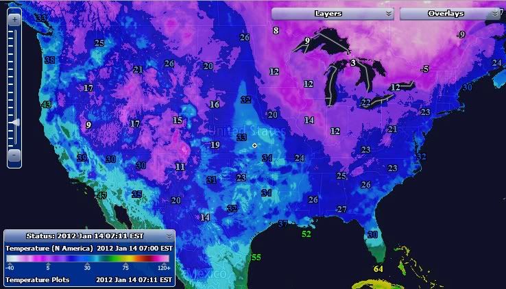
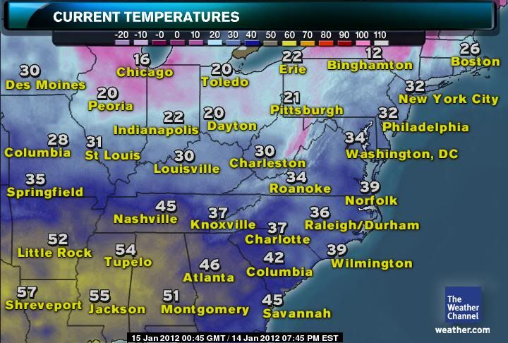
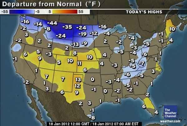
Yes, it seems that the core of this current cold snap will be more directed at the Upper Midwest and upper Northeast (mostly New England) than points west and south. Here are the current temps...it's in the teens in Chicago and upstate New York (Binghampton) and in New England...in the 30's closer to the coast (NYC, Washington DC)...and still in the middle 40's in the south Atlantic states (Savannah, Atlanta):
Freeze Warning Florida for following counties: Alachua, Baker, Bradford, Columbia, Gilchrist, Hamilton,
Marion, Suwannee, Union
* TEMPERATURE...TEMPERATURES WILL FALL TO AROUND 30 DEGREES BY
SUNRISE THIS MORNING...WITH A FEW HOURS OF SUB FREEZING
TEMPERATURES EXPECTED.
-----------------------------------
Wind Chill Advisory: AK MA ME MT NH NY
Wind Chill Warning: ME NH
-----------------------------------
Wind Chill Advisory for NY for following counties:
Albany Columbia Delaware
Fulton Greene Hamilton
Herkimer Montgomery Oneida
Otsego Rensselaer Saratoga
Schenectady Schoharie Sullivan
Ulster Warren Washington
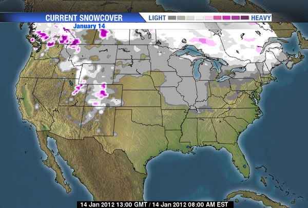
You can see that last storm left some snowcover in the Midwest, but much of the central USA remains snow free. I think this effects these cold waves as they move out of Canada and down in to the USA, as the lack of snowcover allows them to warm a little faster than they would with a snowpack. The way this winter is going, this might be the week with the most snowcover all winter. I guess will find out very soon.
Thats strange snow cover came up. See new topic. We added double the coverage of snow in last few days. Some light cover but some spots picked up over a foot.
Coldest night of the season forecasted for tonight - low of 6 F/-14.5 C. Nights haven't been as cold as they typically are during arctic outbreaks due to cloud cover and lack of snowcover. Today is clear though.
Pretty cold in the Northeast now, and obviously finally getting some snow on the ground, first such snow on the ground since October.
Please register to post and access all features of our very popular forum. It is free and quick. Over $68,000 in prizes has already been given out to active posters on our forum. Additional giveaways are planned.
Detailed information about all U.S. cities, counties, and zip codes on our site: City-data.com.

 Please register to participate in our discussions with 2 million other members - it's free and quick! Some forums can only be seen by registered members. After you create your account, you'll be able to customize options and access all our 15,000 new posts/day with fewer ads.