Welcome to City-Data.com Forum!
U.S. CitiesCity-Data Forum Index
Go Back   City-Data Forum > General Forums > Weather
 [Register]
Please register to participate in our discussions with 2 million other members - it's free and quick! Some forums can only be seen by registered members. After you create your account, you'll be able to customize options and access all our 15,000 new posts/day with fewer ads.
View detailed profile (Advanced) or search
site with Google Custom Search

Search Forums  (Advanced)
 
Old 03-02-2012, 04:34 PM
 
Location: New Jersey
15,318 posts, read 17,212,899 times
Reputation: 6959

Advertisements

Quote:
Originally Posted by Cambium View Post
Work got in the way of everything for me today. Awesome photos! So nice to see Winter is back.

Upper mid west gonna get a ton of snow and they already have this week.

I tell you what, I'll take this over Tornadoes anyday. Another reason why I love cold weather.

Enjoy your snow! Should last until mid March.
Very true. Snow storms typically don't destroy whole towns.
Reply With Quote Quick reply to this message

 
Old 03-02-2012, 10:15 PM
nei nei won $500 in our forum's Most Engaging Poster Contest - Thirteenth Edition (Jan-Feb 2015). 

Over $104,000 in prizes has already been given out to active posters on our forum and additional contests are planned
 
Location: Western Massachusetts
45,983 posts, read 53,447,987 times
Reputation: 15179
Quote:
Originally Posted by Cambium View Post
Enjoy your snow! Should last until mid March.
Tomorrow's upper 40s and rain might be enough to get rid of most of it. If not, will be gone with the warm weather coming in the 2nd half of next week.

Wish I had a bit more time to go out in it.
Reply With Quote Quick reply to this message
 
Old 03-03-2012, 07:17 AM
nei nei won $500 in our forum's Most Engaging Poster Contest - Thirteenth Edition (Jan-Feb 2015). 

Over $104,000 in prizes has already been given out to active posters on our forum and additional contests are planned
 
Location: Western Massachusetts
45,983 posts, read 53,447,987 times
Reputation: 15179
Look how back and forth my weather forecast: we're switching from winter to spring and few days...(from weather.com)

Today
A light mix of wintry precipitation this morning. Then some clearing this afternoon. High 52F. ENE winds shifting to SW at 10 to 20 mph. Chance of rain 50%.

Tonight
Partly cloudy. Low near 30F. Winds WSW at 10 to 20 mph.
Sunday March 4

Sunday
Mostly cloudy skies. High around 45F. Winds W at 10 to 15 mph.

Night
Partly cloudy skies. Low near 20F. Winds WNW at 10 to 15 mph.

Monday March 5
Mix of sun and clouds. Highs in the mid 30s and lows in the mid teens.

Tuesday March 6
Sunshine. Highs in the low 40s and lows in the upper 20s.

Wednesday March 7
A few clouds. Highs in the mid 50s and lows in the low 40s.

Thursday March 8
Mostly Cloudy. Highs in the low 60s and lows in the mid 40s.

Friday March 9
Times of sun and clouds. Highs in the mid 50s and lows in the low 30s.

Saturday March 10
Times of sun and clouds. Highs in the low 40s and lows in the upper 20s.

Sunday March 11
Mainly sunny. Highs in the low 40s and lows in the low 30s.

Monday March 12
Partly cloudy. Highs in the mid 50s and lows in the upper 30s.
Reply With Quote Quick reply to this message
 
Old 03-03-2012, 11:25 AM
 
Location: Leeds, UK
22,112 posts, read 29,570,200 times
Reputation: 8819
Winter is not over, heavy snow for southern and eastern England (again) but none for areas further north and west (again). East Anglia is set to get an absolute deluge of rainfall too, which is good, since they are in a serious drought. 60mm/2in will do them good! Just wish we could get some rain up here too since it's pretty dry here as well, but the heaviest rain always misses here for some reason.
Reply With Quote Quick reply to this message
 
Old 03-03-2012, 02:40 PM
 
Location: Buxton, England
6,990 posts, read 11,409,050 times
Reputation: 3672
Quote:
Originally Posted by dunno what to put here View Post
Winter is not over, heavy snow for southern and eastern England (again) but none for areas further north and west (again).
NW England got 6 inches out of the Feb 5th dumping. Well I and Macclesfield certainly did.
Reply With Quote Quick reply to this message
 
Old 03-03-2012, 03:50 PM
 
Location: Iowa
14,321 posts, read 14,611,366 times
Reputation: 13763
We had 6" of heavy wet snow last night, very pretty out! Heavy shoveling but I took my time, and my neighbor helped. This week 40's are coming so it might disappear pretty fast!
Reply With Quote Quick reply to this message
 
Old 03-04-2012, 11:05 AM
 
Location: New Jersey
15,318 posts, read 17,212,899 times
Reputation: 6959
Perfect March day here. Overcast and 41 F. Refreshing to say the least. If I didn't have to go to work I would certainly be outside taking advantage of the weather. These 40 degree days are numbered.
Reply With Quote Quick reply to this message
 
Old 03-04-2012, 11:34 AM
 
Location: Near the Coast SWCT
83,500 posts, read 75,234,500 times
Reputation: 16619
Besides Kentucky getting snow after the Tornadoes.
here's North Carolinas discussion. I'm posting a good portion of it because its so rare to see them discus all winter like features in March.

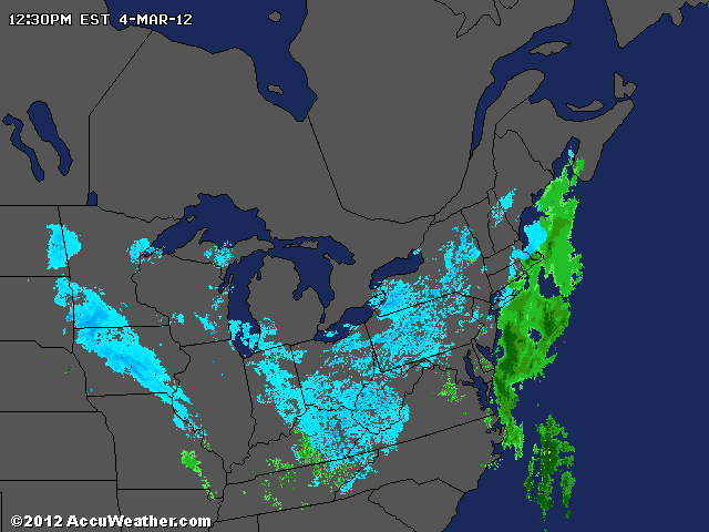
National Weather Service Text Product Display

.SHORT TERM /MONDAY THROUGH MONDAY NIGHT/...
AS OF 245 AM SUNDAY...

SOME SNOW FLURRIES ACROSS THE NORTHERN PIEDMONT EARLY MONDAY?

A HARD FREEZE EXPECTED FOR ALL ZONES MONDAY NIGHT.

AN "ALBERTA CLIPPER" IN THE NORTHWESTERLY FLOW ALOFT WILL MOVE SE
ACROSS THE CENTRAL APPALACHIANS AND MID-ATLANTIC STATES TONIGHT AND
MONDAY MORNING. MODELS CONTINUE TO BE FAIR TO GOOD AGREEMENT WITH
THE STRENGTH/TRACK/SPEED OF THIS SYSTEM. HOWEVER... SOME OF THE
LATEST GUIDANCE IS STRONGER AND FARTHER SOUTH WITH THE TRACK OF THIS
FEATURE GIVING SOME CREDENCE TO THE 4 LETTER WORD... ESPECIALLY IN
VA FOR MONDAY MORNING. MODEL SPEAKING... THE 00Z/GFS IS THE
STRONGEST AND FARTHEST SOUTH. THIS SOLUTION HAS SUPPORT FROM SOME OF
THE LATEST HI-RES MODELS INCLUDING THE WRF-NMM. THE LATEST EUROPEAN
IS CONSISTENT WITH ITS FORMER RUNS... AND HAS SUPPORT FROM THE
CANADIAN WHICH IS THE WEAKEST OF THE MODELS. THESE DIFFERENCES... OF
ONLY 50 MILES OR SO WITH THE TRACK... AND ALSO WITH THE POTENTIAL
NOW ADDED FOR SCATTERED CONVECTION (NAM/GFS/WRF NMM)... THE FORECAST
CONFIDENCE HAS DECREASED TO AVERAGE IN THAT THE P-TYPE WILL BE ALL
RAIN ACROSS THE NORTH. HOWEVER... CONFIDENCE IS HIGH IN THAT ANY
SNOW WOULD BE A LOW IMPACT EVENT AND CONFINED TO AREAS NORTH OF
INTERSTATE 40/85 (ESPECIALLY ROXBORO TO HENDERSON).

ALL THE ABOVE GENERALLY SUPPORT A SURFACE AND H85 LOW TRACK
EAST-SOUTHEAST FROM SE KY TO ALONG THE NC/VA BORDER REGION
09Z-18Z/MONDAY. THIS TRACK WOULD PLACE ALL OF OUR REGION IN THE WARM
SECTOR LESS THE NORTHERN TIER OF COUNTIES ALONG THE VA/NC BORDER.
HOWEVER... THE STRONGER SOLUTIONS SHOW STEEPENING LAPSE RATES AND
MORE IN THE WAY OF INSTABILITY SUGGESTING THAT SCATTERED ELEVATED
CONVECTION WOULD BE POSSIBLE. ANY WINTERY PRECIPITATION WOULD BE
25-50 MILES NORTH OR ON THE COLD SIDE OF THE SURFACE TO H85 LOW
TRACK AND THAT CURRENTLY SUGGESTS A VIRGINIA PROBLEM. WITH THIS
CURRENT FORECAST TRACK... PARTIAL THICKNESSES FOR OUR REGION
INDICATE THE POTENTIAL FOR LIGHT NON-MEASURABLE SNOW WITH RAIN AS
THE PRECIPITATION ENDS ALONG AND NORTH OF THE NC/VA BORDER. SOME
ACCUMULATING SNOW WOULD BE POSSIBLE JUST 25 MILES NORTH OF THE
BORDER.

PARTIAL THICKNESSES SUGGEST ALL LIQUID SOUTH OF THE I-40/I-85
CORRIDOR... WITH VERY LIGHT TO NIL QPF. WITH THIS TRACK... ANY
WINTRY P-TYPE ISSUES WOULD BE 25-50 MILES NORTH OF THE VA/NC BORDER.
UNLESS THE TRACK CHANGES WE WILL CONTINUE TO CARRY EITHER NO POP
(SOUTH ZONES) AND EITHER SLIGHT CHANCE OR CHANCE (20-30 POP) OF RAIN
CENTRAL... AND 40-50 POP FOR RAIN ALONG THE BORDER COUNTIES FROM
ROXBORO TO ROANOKE RAPIDS DURING THE MORNING MONDAY. THE CHANCE OF
RAIN WILL QUICKLY END BETWEEN 15Z/18Z ACROSS THE N-NE TIER AS THE
VORT MAX LIFTS OUT AND STRONG SUBSIDENCE IN THE REAR OF THE TROUGH
BEGINS.

THERE COULD BE A FEW SNOW FLURRIES ALONG THE BORDER JUST AS
THE SYSTEM IS PULLING OUT AND THE COLD AIR CHASES THE DEPARTING
MOISTURE. HOWEVER... NOTHING IS EXPECTED TO ACCUMULATE WITH
TEMPERATURES ABOVE FREEZING. SENSIBLE WEATHER... MOSTLY CLOUDY
OVERNIGHT EXCEPT PARTLY CLOUDY SOUTHERN ZONES. A SLIGHT CHANCE OF A
LIGHT RAIN SHOWER NW LATE. LOWS 34-40. A SLIGHT CHANCE OF A MORNING
LIGHT RAIN SHOWER N-NE ZONES... OTHERWISE BECOMING PARTLY SUNNY AND
WINDY IN THE AFTERNOON. HIGHS 45-50 NORTH AND IN THE MID 50S SOUTH.
NW WINDS 15-25 MPH WITH GUSTS OF 30 MPH. CLEAR WITH DIMINISHING WIND
MONDAY EVENING... AND CLEAR/COLD WITH A HARD FREEZE OVERNIGHT. LOWS
SOLIDLY IN THE 20S AS THE HIGH BUILDS DIRECTLY OVERHEAD BY 12Z.
Reply With Quote Quick reply to this message
 
Old 03-04-2012, 12:15 PM
 
Location: Near the Coast SWCT
83,500 posts, read 75,234,500 times
Reputation: 16619
Its flurrying in Kentucy and TN right now and will be snowing more tonight . Just amazing to see a radar like this in March.

Reply With Quote Quick reply to this message
 
Old 03-04-2012, 02:17 PM
 
Location: Near the Coast SWCT
83,500 posts, read 75,234,500 times
Reputation: 16619
Winter Storm Warning for Carter, Greene, Johnson, Unicoi Counties in Tenessee.

...WINTER STORM WARNING IN EFFECT FROM 10 PM THIS EVENING TO NOON
EST MONDAY...

THE NATIONAL WEATHER SERVICE IN MORRISTOWN HAS ISSUED A WINTER
STORM WARNING FOR SNOW...WHICH IS IN EFFECT FROM 10 PM THIS EVENING
TO NOON EST MONDAY. THE WINTER WEATHER ADVISORY IS NO LONGER IN
EFFECT...HAVING BEEN UPGRADED TO A WARNING.

* EVENT...SNOWFALL AMOUNTS WILL DEPEND GREATLY ON ELEVATION...WITH
3 TO 6 INCHES EXPECTED ABOVE 2500 FEET BY MONDAY MORNING.
LOCALLY HIGHER AMOUNTS WILL BE POSSIBLE ACROSS THE HIGHEST
ELEVATIONS ABOVE 3500 FEET
.

* TIMING...SNOW WILL BEGIN THIS EVENING AND INTENSIFY AFTER
MIDNIGHT...BEFORE GRADUALLY DIMINISHING DURING THE DAY ON
MONDAY.

Winter Weather Advisory for Blount, Campbell, Carter, Claiborne, Cocke, Greene, Hancock, Hawkins, Morgan ,Scott, Sevier, Sullivan ,Washington Counties in Tenessee


Winter Storm Warning
for Bristol city, Lee, Norton city , Russell, Scott, Washington, Wise in Virginia
Reply With Quote Quick reply to this message
Please register to post and access all features of our very popular forum. It is free and quick. Over $68,000 in prizes has already been given out to active posters on our forum. Additional giveaways are planned.

Detailed information about all U.S. cities, counties, and zip codes on our site: City-data.com.


Reply
Please update this thread with any new information or opinions. This open thread is still read by thousands of people, so we encourage all additional points of view.

Quick Reply
Message:


Over $104,000 in prizes was already given out to active posters on our forum and additional giveaways are planned!

Go Back   City-Data Forum > General Forums > Weather

All times are GMT -6.

© 2005-2024, Advameg, Inc. · Please obey Forum Rules · Terms of Use and Privacy Policy · Bug Bounty

City-Data.com - Contact Us - Archive 1, 2, 3, 4, 5, 6, 7, 8, 9, 10, 11, 12, 13, 14, 15, 16, 17, 18, 19, 20, 21, 22, 23, 24, 25, 26, 27, 28, 29, 30, 31, 32, 33, 34, 35, 36, 37 - Top