Welcome to City-Data.com Forum!
U.S. CitiesCity-Data Forum Index
Go Back   City-Data Forum > General Forums > Weather
 [Register]
Please register to participate in our discussions with 2 million other members - it's free and quick! Some forums can only be seen by registered members. After you create your account, you'll be able to customize options and access all our 15,000 new posts/day with fewer ads.
View detailed profile (Advanced) or search
site with Google Custom Search

Search Forums  (Advanced)
 
Old 04-26-2016, 03:23 AM
 
Location: Lizard Lick, NC
6,344 posts, read 4,414,484 times
Reputation: 1996

Advertisements

Quote:
Originally Posted by Cambium View Post
90 with rain in April?

Richmond High forecast is 69. Hartford is 63. Ok.. looks like that wont be the case of a cooler VA vs New England. Warmth too strong?
I dont know how but yeah the forecast high is near 90 and at one point was 90. Seems to me its a case of where if you are south of the front it will be significantly warmer versus north. Could easily be cooler here if the front drops a bit further south.
Reply With Quote Quick reply to this message

 
Old 04-26-2016, 03:27 AM
 
Location: Lizard Lick, NC
6,344 posts, read 4,414,484 times
Reputation: 1996
Quote:
Originally Posted by Cambium View Post
I was curious about this... so I checked. Good info. They arent sure where the front will stop. If goes south enough no way your getting upper 80s. Not even mid 80s. Probably lucky to get past 70s IF it goes south enough. Big temp bust potential coming. Dont get mad at the forecasters. Lol

This time of yr these fronts are so weak by time they get south of Philly, I have my doubts it goes past the VA border there. We'll see

National Weather Service Text Product Display

NATIONAL WEATHER SERVICE RALEIGH NC
930 PM EDT MON APR 25 2016

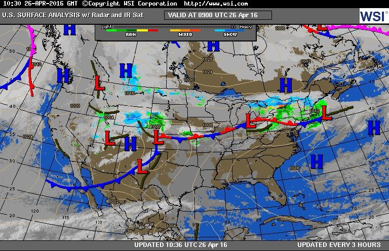
A WEAKENING BACK-DOOR COLD FRONT IS STILL PROGGED TO DROP SOUTH
NEAR THE VIRGINIA STATE LINE LATE TUESDAY NIGHT/WEDNESDAY MORNING.
CONVECTION AHEAD AND ALONG THE FRONT WILL ATTEMPT TO HOLD
TOGETHER AS IT PUSHES SOUTH INTO THE AREA OVERNIGHT. HOWEVER GIVEN
UNFAVORABLE NOCTURNAL TIMING/INCREASING BL CIN COUPLED WITH
INCREASINGLY LOW-LEVEL WESTERLY FLOW...EXPECT ANY ONGOING CONVECTION
TO BE SIMILAR WEAKENING. WILL RETAIN SLIGHT CHANCE POPS TUESDAY NIGHT
ACROSS THE NORTHERN TIER. OTHERWISE...DRY WITH TEMPERATURES IN THE
LOWER TO MID 60S.

THE MAIN ISSUE DURING THIS TIME FRAME WILL BE HOW FAR SOUTH INTO THE
FORECAST AREA A COLD FRONT MAKES IT. TO START THE DAY...THE FRONT
WILL BE NEAR THE NC/VA BORDER AND MAY SLOWLY SHIFT SOUTH INTO THE
NORTHERN COASTAL PLAIN AND NORTHERN PIEDMONT THROUGH THE AFTERNOON
HOURS. WITHIN THE WARM SECTOR...TEMPS ARE EXPECTED TO RISE INTO THE
MID/UPPER 80S. THIS...ALONG WITH DEWPOINTS THAT ARE EXPECTED TO
GENERALLY BE IN THE LOWER 60S...THE AIR MASS SHOULD BECOME
MODERATELY UNSTABLE. HOWEVER...WHERE THE BEST INSTABILITY IS
EXPECTED IS WHERE THE SMALLEST PRECIP CHANCES WILL BE DUE TO THE
EXPECTED LOCATION OF THE FRONT. SHOWER AND THUNDERSTORM COVERAGE
WILL ULTIMATELY HINGE ON WHERE THE FRONT IS LOCATED AND THAT IS
STILL FAIRLY UNCERTAIN. FOR NOW WILL KEEP THE BEST CHANCES ACROSS
THE NORTHERN HALF OF THE FORECAST AREA...WITH ONLY SLIGHT CHANCES
ACROSS THE FAR SOUTH. HOWEVER...IF THE MODELS TREND FURTHER NORTH
WITH THE FRONT...PRECIP CHANCES WILL BE TOO HIGH. WIND SHEAR WILL
NOT BE THE GREATEST...BUT GIVEN THE DECENT INSTABILITY THAT
IS EXPECTED...A FEW SEVERE STORMS WILL BE POSSIBLE.
I know trust me lol. Used to temp bust on days like that, unfortunately we always bust lower lol. At least we get storms.
Reply With Quote Quick reply to this message
 
Old 04-26-2016, 04:02 AM
 
Location: Near the Coast SWCT
83,553 posts, read 75,444,508 times
Reputation: 16634
Thunderstorms around 3-5am


Radar loop last 4 hrs. I'd rather be where its snowing!


That big Lightning Icon is this...


0320 AM LIGHTNING GLEN ROCK 40.96N 74.13W
04/26/2016 BERGEN NJ TRAINED SPOTTER

TWO HOUSES STRUCK BY LIGHTNING...ONE ON GAINER PLACE AND ONE ON RUTLAND AVE...CAUSING FIRES TO EACH.


Reply With Quote Quick reply to this message
 
Old 04-26-2016, 04:41 AM
 
29,559 posts, read 19,653,497 times
Reputation: 4563
^^

Was that from the cold front that crossed us last night? Couldn't be. Too soon.


Blog | Chicago Weather Center: Skilling's Forecast and Chicago Severe Weather Alerts


So the next 10+ days will be below average..... This is what the models said was going to occur back on the 19th for the end of April and start of May


So April will end up being our first below average month since last August (ORD was below average, MDW was just above average)....

Last edited by chicagogeorge; 04-26-2016 at 05:00 AM..
Reply With Quote Quick reply to this message
 
Old 04-26-2016, 05:21 AM
 
Location: Near the Coast SWCT
83,553 posts, read 75,444,508 times
Reputation: 16634
Quote:
Originally Posted by chicagogeorge View Post
^^

Was that from the cold front that crossed us last night? Couldn't be. Too soon.
Looks like some shortwaves developed along the front. Now stalling just south of NYC. Then will start moving south again later on. I guess the High off the coast is making it stall.


Quote:
Originally Posted by nei View Post
Don't think it's backdoor as it's not from cold Atlantic air to the east. .
Apparently a front dropping "south" is considered a backdoor front. I thought was just from the Atlantic myself.
They increased precip amounts when they noticed the radar. lol
Funny how different a Cold Canadian airmass is in April vs February.
Low pressures riding along the front


NATIONAL WEATHER SERVICE NEW YORK NY
1000 PM EDT MON APR 25 2016

A BACKDOOR COLD FRONT PUSHES INTO THE TRI-STATE OVERNIGHT AND LIKELY STALLS JUST TO THE SOUTH OF THE REGION THROUGH TUESDAY AS WAVES OF LOW PRESSURE WAVES TRACK EAST ALONG IT. THE FRONTAL SYSTEM PUSHES WELL TO THE SOUTHEAST TUESDAY NIGHT. HIGH PRESSURE BRIEFLY BUILD OVER THE REGION WEDNESDAY AND WEDNESDAY NIGHT BEFORE MOVING OFFSHORE ON THURSDAY.

ADJUSTED POPS OVERNIGHT BASED ON LATEST TRENDS IN RADAR/HIGH RESOLUTION MODELS. MAIN CHANGE WAS TO CONTINUE TO SLOW ONSET OF RAIN...ESPECIALLY OVER EASTERN AREAS. MODELS IN GOOD AGREEMENT WITH POTENT SHORTWAVE ENERGY CROSSING THE GREAT LAKES OVERNIGHT AND THEN SLIDING SE TOWARDS THE REGION TUESDAY. THE FORECAST CHALLENGE IS BEING THE EXACT PLACEMENT OF THE BACKDOOR COLD FRONT WHICH WILL BE DETERMINED BY THE STRENGTH/DEPTH OF A COLD CANADIAN AIRMASS BEING REINFORCED TO THE NORTH.
Reply With Quote Quick reply to this message
 
Old 04-26-2016, 05:28 AM
 
Location: 44N 89W
808 posts, read 712,681 times
Reputation: 710
Angry Fail whale weather again

Yesterday we had a high of 63.0°F (17.2°C) with partly sunny skies, a welcome change from Sunday's high of just 50.9°F (10.5°C) with light rain. Yesterday we were supposed to get 0.39" (10 mm) of rain from a thunderstorm, but that completely fizzled, as is the case around here. So now it's 26 April and we've seen only 0.96" (24 mm) of rain this month - our average is 2.7" (69 mm). Not a bloody chance.

The forecast calls for cold tripe through Thursday with highs struggling to reach 50°F (10°C), and then after that we'll moderate out, but we won't have any decent heat again until probably June. Our averages are currently 63/45°F (17/7°C), and we shouldn't be much above that the first week of June, either. AccuWeather is predicting another subarctic crummer as is now the norm here.
Reply With Quote Quick reply to this message
 
Old 04-26-2016, 05:45 AM
SFX
 
Location: Tennessee
1,641 posts, read 898,559 times
Reputation: 1343
Reply With Quote Quick reply to this message
 
Old 04-26-2016, 05:46 AM
 
Location: Near the Coast SWCT
83,553 posts, read 75,444,508 times
Reputation: 16634
Not a lot of moisture but the mountains are getting some fresh snow


Snowing in north country this morning. Temps in the 20s and 30s.

In Vermont,,Burlington, Montpelier , Morrisville, Caledonia, Newport All reporting snow right now.


Reply With Quote Quick reply to this message
 
Old 04-26-2016, 05:50 AM
 
Location: Near the Coast SWCT
83,553 posts, read 75,444,508 times
Reputation: 16634
Southeast vs Northeast this week.


Reply With Quote Quick reply to this message
 
Old 04-26-2016, 06:14 AM
 
Location: Alexandria, Louisiana
5,039 posts, read 4,359,415 times
Reputation: 1287
Tomorrow's severe risk.


SPC already has us in a severe risk on Saturday.

Reply With Quote Quick reply to this message
Please register to post and access all features of our very popular forum. It is free and quick. Over $68,000 in prizes has already been given out to active posters on our forum. Additional giveaways are planned.

Detailed information about all U.S. cities, counties, and zip codes on our site: City-data.com.


Reply
Please update this thread with any new information or opinions. This open thread is still read by thousands of people, so we encourage all additional points of view.

Quick Reply
Message:

Over $104,000 in prizes was already given out to active posters on our forum and additional giveaways are planned!

Go Back   City-Data Forum > General Forums > Weather

All times are GMT -6.

© 2005-2024, Advameg, Inc. · Please obey Forum Rules · Terms of Use and Privacy Policy · Bug Bounty

City-Data.com - Contact Us - Archive 1, 2, 3, 4, 5, 6, 7, 8, 9, 10, 11, 12, 13, 14, 15, 16, 17, 18, 19, 20, 21, 22, 23, 24, 25, 26, 27, 28, 29, 30, 31, 32, 33, 34, 35, 36, 37 - Top