Spring 2012 Thread (March-May) (warmest, record, warming, storms)
Please register to participate in our discussions with 2 million other members - it's free and quick! Some forums can only be seen by registered members. After you create your account, you'll be able to customize options and access all our 15,000 new posts/day with fewer ads.
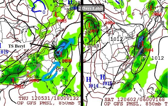
So May 30-31 we have TS Beryl coming up the coast and OTS.
Then we have another Low forming in the southern states which moves up the coast as well..
Gotta love that Negative NAO. So now instead of storms going towards Great lakes, thanks to the blocking the storms are staying along the coast and out to sea.
Yes it was, and yes it does have a reputation for under doing high temperatures, however if something like that happens it will feel like a shock to the system
Thundering here now with dark clouds. Not surprised since it's 85 F with a dewpoint of 73 F!
Edit: Had a decent, somewhat long thunderstorm. Power flickered a few times. Nothing too intense though.
I saw that thunderstorm too, it passed slightly to the north of me though. Good to see nothing bad happened
Next cluster coming in though, and looks like it's going to affect my area too. I don't mind though, it was 84 F before and now it's 75 F. Nice cool down.
Also Severe Thunderstorm Watch until 8 PM. Hopefully nothing too severe happens.
Well now the sun is back out and it feels even more hot and humid!
I saw that thunderstorm too, it passed slightly to the north of me though. Good to see nothing bad happened
Next cluster coming in though, and looks like it's going to affect my area too. I don't mind though, it was 84 F before and now it's 75 F. Nice cool down.
Also Severe Thunderstorm Watch until 8 PM. Hopefully nothing too severe happens.
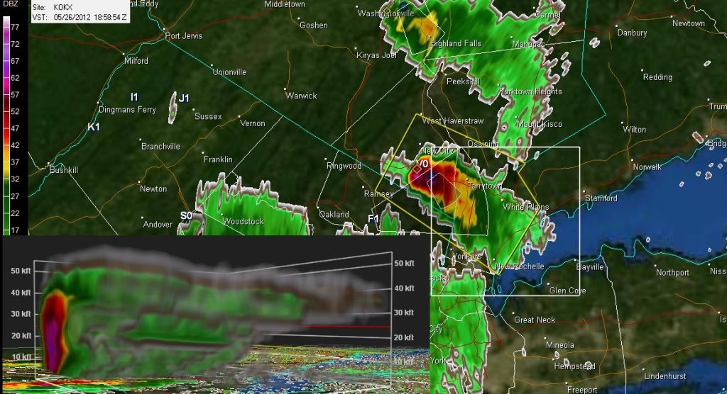
Trees and wires down in Rockland NY from that cell. Here's what it looked like. 50,000 foot tops. Impressive structure with small hail core. Then the coastal air mass was too stable so it collapsed.
in Long Island 74°F. Parent's house is coolish w/o A/C. Completely cloudy. Conneticut on the other side of the sound has a sever thunderstorm warning.
Please register to post and access all features of our very popular forum. It is free and quick. Over $68,000 in prizes has already been given out to active posters on our forum. Additional giveaways are planned.
Detailed information about all U.S. cities, counties, and zip codes on our site: City-data.com.

 Please register to participate in our discussions with 2 million other members - it's free and quick! Some forums can only be seen by registered members. After you create your account, you'll be able to customize options and access all our 15,000 new posts/day with fewer ads.