Please register to participate in our discussions with 2 million other members - it's free and quick! Some forums can only be seen by registered members. After you create your account, you'll be able to customize options and access all our 15,000 new posts/day with fewer ads.
Sure. Why not? Warm body of water, Arctic air. Wont be the same degree as a big Lake or Ocean but sure can develop.
Here's from Louisiana November 2014.
"" Down our way this past weekend, the same arctic air mass blowing along with 20 plus mph winds brought a rare occurrence to Shreveport/Bossier City called "River Effect Snow". The same situation like what happened in Buffalo developed on a much smaller scale in the river cities. Very cold arctic air blowing across a relatively warm Red River created an unstable situation causing light snow showers. Shreveport National Weather Service Meteorologist Jason Hansford describes the rare phenomenon last Saturday on Facebook (See Figure 4):
So Facebook has been lighting up today b/c a few snow flurries actually fell early this morning in Eastern Shreveport and part of Bossier City. Here is a radar image I captured at 631am this morning, with several surface observations overlayed. This was a rare and unusual event, where the snow flurries were actually induced from the Red River. You can actually see the path of the river through the higher reflectivities on radar, with the Shreveport Downtown Airport recording "Light Snow" between 545-1030am. Much like Lake Effect Snow, where snow can develop over the warmer waters (which are a source of lift) and move with the winds downstream, this was what I would call "River Effect Snow", where the light snow developed over the warmer waters of the Red River, and moved west northwest over areas mainly near/just west of the river. Since temperatures were above freezing, the vertical lift weak, and the air just above the ground very dry, no snow accumulation occurred"
Hello to all..
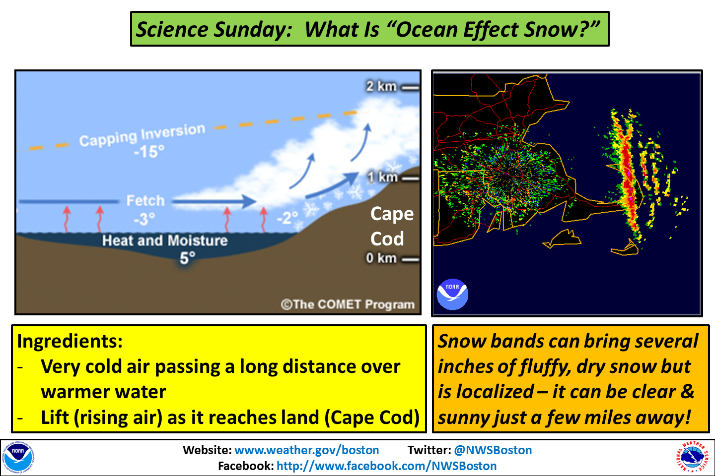
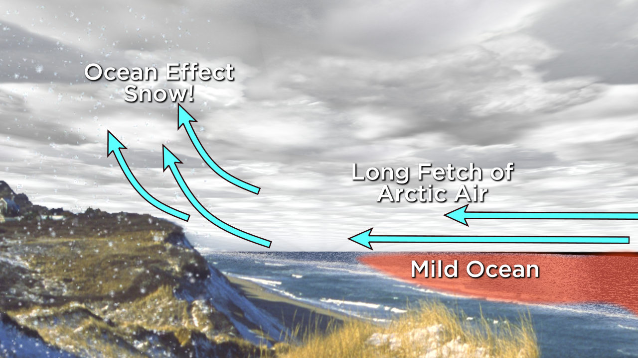
..Ocean Effect Snow will have the potential to cause slippery travel and some light accumulations, particularly over Cape Cod and Nantucket Island Monday Afternoon into Tuesday Morning..
..A Winter Weather Advisory is in effect from 1 PM Monday to 7 AM Tuesday for Cape Cod and Nantucket for 2-4" of snow with isolated higher amounts. East Coastal Plymouth County Massachusetts, Martha's Vineyard and Cape Ann could see a coating to 2 inches of snow. Other areas of East and South Coastal Massachusetts could see a Dusting to 1 inch of snow..
..SKYWARN Self-Activation will monitor light ocean effect snow accumulations Monday Afternoon into Tuesday Morning. Another coordination message will be issued by 9 AM Monday Morning. Below is the NWS Taunton Winter Weather Advisory Statement, Hazardous Weather Outlook and Snowfall Map
Thats what Im talking about! Backyard ice rink and snowing. Need more of it now. I see a lot of folks around here doing backyard rinks. Always fun to see.
Please register to post and access all features of our very popular forum. It is free and quick. Over $68,000 in prizes has already been given out to active posters on our forum. Additional giveaways are planned.
Detailed information about all U.S. cities, counties, and zip codes on our site: City-data.com.

 Please register to participate in our discussions with 2 million other members - it's free and quick! Some forums can only be seen by registered members. After you create your account, you'll be able to customize options and access all our 15,000 new posts/day with fewer ads.