Spring 2015 thread (Northern Hemisphere) (raining, climate, snowfall, warm)
Please register to participate in our discussions with 2 million other members - it's free and quick! Some forums can only be seen by registered members. After you create your account, you'll be able to customize options and access all our 15,000 new posts/day with fewer ads.
The latest 6-10 day period forecast continues to depict cooler than average temperatures across a good part of the East and above average temperatures across the western and central US. Today’s forecast is warmer or not as cold as the previous forecast across much of the south-central and eastern US due to the day shift and model trends. The West and north-central US are cooler. As a result, period GWHDDs are down 2.2 and are 88 for the CONUS.
Quote:
Today’s models are in rather good agreement with this general pattern, especially the ensemble and the ECMWF op run. Given this pattern, there is a slight risk to the colder side across the eastern half of the nation and a slight risk to the warmer side over the western US.
The GFS offers a slightly different solution (above) as it pinches off the tail end of the trough or the frontal system over the southwestern US as opposed to the more progressive pattern. This solution is much cooler than the forecast across the Southwest and the south-central US, but warmer over the Southeast and Northwest
Quote:
Today’s 11-15 day period forecast still depicts below average temperatures across the eastern half of the nation and above average temperatures over much of the West and Plains. The forecast did run a warmer across parts of the southern and eastern US, but a bit cooler over the West and north-central US. As a result, period GWHDDs are down 2.9 to near 84 for the CONUS.
Quote:
The ECMWF ensemble hasn’t backed off since yesterday. It suggests that the trough lifts out of the East and gives way to ridging along the East Coast in response to a potential storm system moving through the West into the south-central US. In doing so, this knocks down the ridge over the western US. This is less of an EPO like pattern and more of a positive NAO like pattern.
The end result is that this solution is much warmer than the GFS camp across the eastern half of the nation and cooler over the West. The 0Z ECMWF only depicts 57.8 for GASCONSEAST, while the GFS ensemble runs are around 68-69. The forecast continues to lean more along the line of the GFS camp again today, though it hedge every so slightly toward the ECMWF.
the northern lights were visible all the way down to southernmost sweden yesterday. was too cloudy to be seen here at the west coast. must be very unusual. i've never seen it here.
Trying to be optimistic here. I want to the next time we'll get spring conditions. And it sticks. From my discussion.
LATE SATURDAY THROUGH TUESDAY...
WHATEVER HAPPENS WITH THE SOUTHERN STREAM LOW PRESSURE...THE BULK
OF ANY IMPACTS SHOULD BE OVER SATURDAY AFTERNOON. A STRONG COLD
FRONT APPROACHES FROM THE WEST LATE SAT AFTERNOON/EVENING...
PERHAPS BRINGING A FEW HIT-AND-MISS SHOWERS/SNOW SHOWERS. THE BIG
STORY WILL BE THE UNSEASONABLY COLD AIR THAT WILL BE USHERED BACK
INTO OUR REGION SAT NIGHT/SUNDAY/MON. WE SHOULD SEE TEMPERATURES
MODERATE SOME BY TUESDAY.
Ten day forecast roughly normal conditions mid-week. Could just be the ten day forecast assuming near normal without any reason to assume otherwise.
Over the past couple of days, my Friday forecast has gone from
"rain" to "<1" of snow" to "~1 inch of snow" to "1-3 inches of snow" to "3-5 inches of snow."
I hope it actually plays out. Snow at this time is quite rare, to say the least.
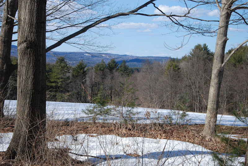
snow cover at the end of March isn't unheard of here once you go up into the hills. Here's some photos from March 30, 2013 which was near average.
Shouldn't get too bothered by the late snow cover as the ground would just be brown and dead looking anyway. As look as it melts soon it shouldn't have much of an impact on the growing season.
Me & you are in the pink. Temps at 4500' in the single digits F°. and all that wind mixing it down. And if that wind stops for nighttime with clear skies, we'll drop even more so the any surface heat can go up up & away.
NATIONAL WEATHER SERVICE TAUNTON MA
403 PM EDT WED MAR 18 2015
4 PM UPDATE...
BLUSTERY CONDITIONS CONTINUE ACROSS SOUTHERN NEW ENGLAND WITH
SEVERAL SITES REACHING WIND ADV CRITERIA.
DIGGING NORTHWEST FLOW WILL CONTINUE OVERNIGHT KEEPING THE ANOMALOUS AIRMASS ALOFT. 850MB TEMPS WILL BE AROUND -18C...WHICH IS 2 TO 3 STANDARD DEVIATIONS AWAY. OVERNIGHT LOWS WILL DROP INTO THE TEENS TO
SINGLE DIGITS. WINDS WILL REMAIN GUSTY THROUGH THE NIGHT KEEPING
MANY SITES FROM TRULY RADIATING OUT DUE TO CLEAR SKIES. HOWEVER IF
WINDS BECOME LIGHT ENOUGH IN THE SHELTER VALLEY REGIONS THEN TEMPS
COULD DROP BELOW FORECAST AND GUIDANCE.
Please register to post and access all features of our very popular forum. It is free and quick. Over $68,000 in prizes has already been given out to active posters on our forum. Additional giveaways are planned.
Detailed information about all U.S. cities, counties, and zip codes on our site: City-data.com.

 Please register to participate in our discussions with 2 million other members - it's free and quick! Some forums can only be seen by registered members. After you create your account, you'll be able to customize options and access all our 15,000 new posts/day with fewer ads.