Please register to participate in our discussions with 2 million other members - it's free and quick! Some forums can only be seen by registered members. After you create your account, you'll be able to customize options and access all our 15,000 new posts/day with fewer ads.
Still looks very odd for below zero weather to slam the south. This very rarely happens. Nashville might not have seen a below 0 F low in the last 20 years or so.
Last time Nashville had a sub zero low was February 1996. Last time was December 1989 for Memphis, Little Rock, and Huntsville. That is a very long time even for South. To be honest I wouldn't be surprised if that changed for Nashville at least.
Yeah, we're all learning (or remembering) that the NAO doesn't have to be negative when you have the proper blocking in the Pacific sending a trough into the U.S. Add a vortex break from the poles in our direction and boom. Winter.
The Pacific blocking is responsible for the record breaking dry weather in California and also making the Pacific Northwest drier. How unusually strong is the blocking?
The Pacific blocking is responsible for the record breaking dry weather in California and also making the Pacific Northwest drier. How unusually strong is the blocking?
Not sure but pretty sure anomalous. Interesting about the dryness.
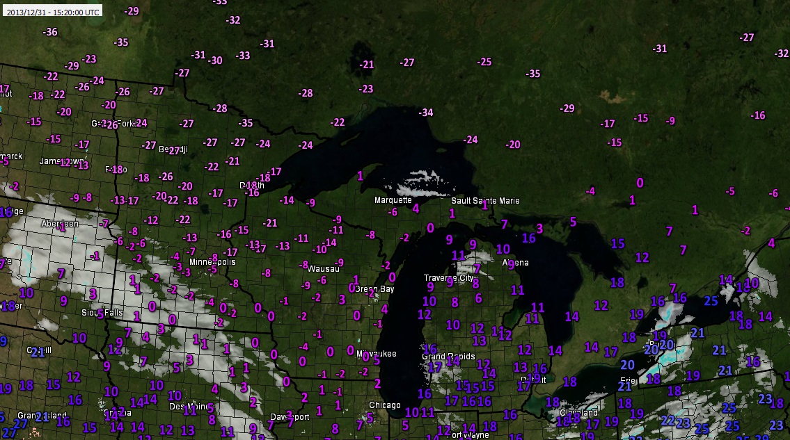
Happy New Year's Eve! Snow's just hours away and the full spectrum of numerical models continue to indicate a long duration, lake enhanced snow event with impressive snow numbers is ahead commencing later today. The bitter cold which saw temps sink below zero in the northwest and west suburbs this morning produced lows of 2 above at Midway and O'Hare. With a snow cover coming back in the days ahead, a frigid blast of arctic air late week could see sub-zero readings make it into the city. And brutally cold outbreak of arctic air--easily the season's coldest to date and one of the colder surges I've seen in years--could hit early next week. The European model overnight run indicates temps next Monday and Tuesday may be hard pressed to make it above 0! That model biases cold--but other models, while not quite that cold, are advertising a brutal brand of chill as well. Lows this morning dipped to -13 at sensors in Mt. Carroll and Rochelle, -8 Marengo, -7 Rockford and -6 Waukegan, Janesville WI and Belvidere.
Getting snow tires put on. Why does everyone wait inside I'm out here enjoying the weather. 25F wind chill of 18F. Jeans and sweatshirt not feeling the cold. Not even gloves.
Please register to post and access all features of our very popular forum. It is free and quick. Over $68,000 in prizes has already been given out to active posters on our forum. Additional giveaways are planned.
Detailed information about all U.S. cities, counties, and zip codes on our site: City-data.com.

 Please register to participate in our discussions with 2 million other members - it's free and quick! Some forums can only be seen by registered members. After you create your account, you'll be able to customize options and access all our 15,000 new posts/day with fewer ads.