Please register to participate in our discussions with 2 million other members - it's free and quick! Some forums can only be seen by registered members. After you create your account, you'll be able to customize options and access all our 15,000 new posts/day with fewer ads.
Nice. Wow. I knew you guys would see this but I didnt expect it in November.. I'm watching the NAM model right now which looks more moist for the snow event in a couple days aorund here. Still rolling.
Record low for the in town Grand Forks climate site for Mon am is -24F set in 1919....so will not get anywhere close. In town itself may not quite get much below zero.... but cool enough.
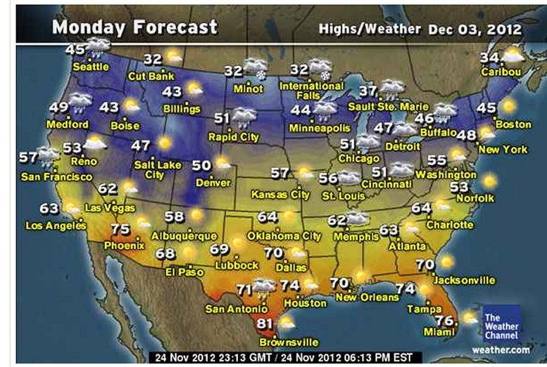
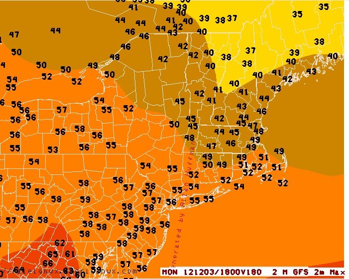
Here is the Monday Dec 3rd forecast...I would think any snow this week in the upper Midwest would stay on the ground, but anywhere else it would be gone quick:
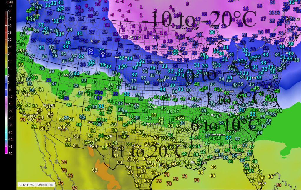
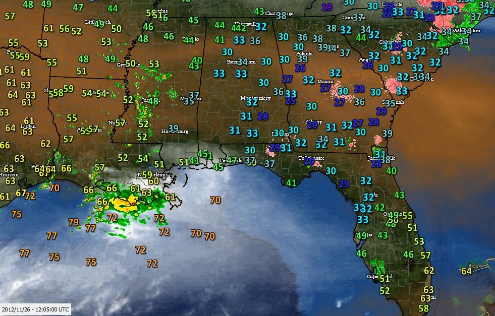
Pretty impressive 850mb temps. Pink background showing negative teens Celcius at the 5000' level. Thats air temp not wind chill. The numbers are surface temps.
As posted in the CT Weather thread.. Over the summer when the pattern was considered to be torch with more heat than none and the Long range models showed cooling, the theory was to ignore them and go with the trend. (The trend is your friend)...
Its vise versa now... We are in a cool pattern in the East so any warming being shown in the "long range" you have to be skeptical about or at least figure its a quick temporary shot.
Also note.... We're not in an Ice Age(yet)....and it's still only November so we can't expect this cold to last forever. Even though it's been since end of October, I think we get this warming next week but its short last again.
Here's the latest GFS for Monday afternoon (7 days away)..
Ridiculous. Ice Age INDEED. I took every high temperature for the city of Chicago in the month of November up until today's date. I compared these temperatures to NORMAL and for the month Chicago was +27° away from the normal highs, giving the months highs a +1.1° ABOVE NORMAL on a daily average basis. .
Chicago is just one city, but an important one. So much for your November Cold Wave.
Yet some in here are in total denial and are still pumping cold nonsense.
Yes, we all agree Jan-Oct was warm (I think), the debate (if you can call it that) is whether the warm pattern has ended. Some are saying we'll have an usually cold phase. I won't go that far, but I'd say we're probably back to neutral. At least for my location, it seemed to have slowly ended in the last few months. Perhaps not for your location but it seems to be at least less consistent nation-wide. There have been short below average spells in the midst of the warm pattern, but my feeling is that the warm spell is over. We shall see soon.
Please register to post and access all features of our very popular forum. It is free and quick. Over $68,000 in prizes has already been given out to active posters on our forum. Additional giveaways are planned.
Detailed information about all U.S. cities, counties, and zip codes on our site: City-data.com.

 Please register to participate in our discussions with 2 million other members - it's free and quick! Some forums can only be seen by registered members. After you create your account, you'll be able to customize options and access all our 15,000 new posts/day with fewer ads.