North Carolina's Three Regions- Tidewater, Greater Appalachia, Deep South (Charlotte: place to live, metropolitan)
Please register to participate in our discussions with 2 million other members - it's free and quick! Some forums can only be seen by registered members. After you create your account, you'll be able to customize options and access all our 15,000 new posts/day with fewer ads.
I would agree that Wilmington has more in common with the Deep South. It's too close to South Carolina to be included in Tidewater.
Northeastern North Carolina (Albemarle Sound, OBX) is pure Tidewater, IMO. It might be a silly example but crabbing seems to be bigger in these parts, and I've always associated crabbing with Tidewater culture.
To offer my two cents on the map, I don't know how I feel about the Triangle and Greensboro being included in Tidewater. It's almost like he didn't know where to place them, because they're clearly not in the Deep South and they're too far east to be included in Greater Appalachia. I'll have to read the book and see. I definitely agree that Winston-Salem is Appalachian-influenced, though. The foothills begin to rise from the western Piedmont around Winston, although the actual Blue Ridge is an hour's drive further west.
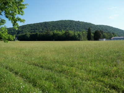
Actually you begin to notice a significant change in elevation with rolling hills in the far northwest corner of Greensboro (particularly northwest Guilford County) much like Winston-Salem. The higher elevation on the west side of Greensboro is the reason Hanging Rock mountain is clearly visible from the ground on I-840.
Downtown Greensboro you have to go up about 8 stories to see Hanging Rock Mountain
Hanging Rock Mountain from downtown Greensboro
Downtown Greensboro viewed from Hanging Rock Mountain
So, Greater Appalachian includes over half of Texas including the western wheat and cattle regions of Texas, the tri-state Ozarks region, and even eastern New Mexico?....
So, Greater Appalachian includes over half of Texas including the western wheat and cattle regions of Texas, the tri-state Ozarks region, and even eastern New Mexico?....
Um, I don't think so.
The regions are named according to their original colonizing settlers.
Actually you begin to notice a significant change in elevation with rolling hills in the far northwest corner of Greensboro (particularly northwest Guilford County) much like Winston-Salem. The higher elevation on the west side of Greensboro is the reason Hanging Rock mountain is clearly visible from the ground on I-840.
Downtown Greensboro you have to go up about 8 stories to see Hanging Rock Mountain
Hanging Rock Mountain from downtown Greensboro
Downtown Greensboro viewed from Hanging Rock Mountain
True. Another example that's fascinating to me in the region is Montgomery County. You go just a few miles and it's semi-mountainous with the eroded Uwharrie Mountains and then you're in the Sandhills, which some geologists classify as the coastal plain, and it definitely looks more like a scene you'd see further towards the coast.
True. Another example that's fascinating to me in the region is Montgomery County. You go just a few miles and it's semi-mountainous with the eroded Uwharrie Mountains and then you're in the Sandhills, which some geologists classify as the coastal plain, and it definitely looks more like a scene you'd see further towards the coast.
Interestingly enough, this book classifies Montgomery County as "Appalachia".
Exactly. When I first went to Montgomery County when I was young I was stunned because I always believed the only mountains or mountain like topography was west of Winston-Salem. The Uwharrie Mountains range actually begins in Randolph County and stretch to the Charlotte area. The Uwharries were once a coastal mountain range which explains the existence of the Sandhills. Isostasy has slowly raised the eastern seabed until today they lie in the Piedmont of North Carolina over 150 miles from the coast. Hundreds of millions ago it is believed that the Uwharrie Mountains rose 20,000 feet tall but over time has eroded to a 1,100 feet.
Its amazing to think these mountains are south of Greensboro and not west of I-77. Its one of the most overlooked parts of the state. Asheboro is in the Uwharrie region so Greensboro is not that far. The mountains themselves are around 45 miles south of Greensboro.
Here is Caraway Mountain in west Randolph County between Asheboro and Lexington.
Exactly. When I first went to Montgomery County when I was young I was stunned because I always believed the only mountains or mountain like topography was west of Winston-Salem. The Uwharrie Mountains range actually begins in Randolph County and stretch to the Charlotte area. The Uwharries were once a coastal mountain range which explains the existence of the Sandhills. Isostasy has slowly raised the eastern seabed until today they lie in the Piedmont of North Carolina over 150 miles from the coast. Hundreds of millions ago it is believed that the Uwharrie Mountains rose 20,000 feet tall but over time has eroded to a 1,100 feet.
Its amazing to think these mountains are south of Greensboro and not west of I-77. Its one of the most overlooked parts of the state. Asheboro is in the Uwharrie region so Greensboro is not that far.
Here is Caraway Mountain in west Randolph County between Asheboro and Lexington.
Actually you begin to notice a significant change in elevation with rolling hills in the far northwest corner of Greensboro (particularly northwest Guilford County) much like Winston-Salem. The higher elevation on the west side of Greensboro is the reason Hanging Rock mountain is clearly visible from the ground on I-840.
Downtown Greensboro you have to go up about 8 stories to see Hanging Rock Mountain
Hanging Rock Mountain from downtown Greensboro
Downtown Greensboro viewed from Hanging Rock Mountain
That's true! I've been to Hanging Rock many times but I always forget that downtown Greensboro is visible from the top, although downtown Winston is obviously more visible.
On a side note, you're right that areas such as Summerfield and Madison do feel like they're on the edge of the foothills, or at least where the Piedmont meets the foothills. A very pretty area IMO, especially in the fall.
I've always overlooked the Uwharries when it comes to places to drive to see fall foliage. I plan to rectify that this year.
Well do you know the location of the wrong pic
Actually it's near Asheville lol
Please register to post and access all features of our very popular forum. It is free and quick. Over $68,000 in prizes has already been given out to active posters on our forum. Additional giveaways are planned.
Detailed information about all U.S. cities, counties, and zip codes on our site: City-data.com.

 Please register to participate in our discussions with 2 million other members - it's free and quick! Some forums can only be seen by registered members. After you create your account, you'll be able to customize options and access all our 15,000 new posts/day with fewer ads.