Please register to participate in our discussions with 2 million other members - it's free and quick! Some forums can only be seen by registered members. After you create your account, you'll be able to customize options and access all our 15,000 new posts/day with fewer ads.
At ColoradoRambler’s suggestion, I cut and copied part of a post I made in the Retirement Chat section:
How appropriate...Devil’s Highway. I’m renaming some places right now. HadesCamp Mesa. Monti-hell-o. Smoggy Draw. McHellMo Canyon. WeatherHell Mesa. Ovenweep Canyon. Fever Creek.
Adding another one now: Scorchez.
Scorchez checking in here! I love pikabike's new place names for our current hellscape. And of course Highway 491 which was originally named Highway 666 will always be the Devil's Highway to we residents of Scorchez and nearby towns.
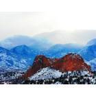
To say it's been a bad summer for fire out here is the understatement of the year. I can't even remember the last time I saw either the La Platas or the San Juans on the horizon. It's just all haze and billows of smoke to the north where two large fires are burning - the Plateau Fire and the Bull Draw fire near Norwood that had burned 7,899 acres last time I checked.
The Plateau Fire north of Dolores expanded aggressively this week, jumping control lines, expanding forest closures and triggering voluntary pre-evacuation orders for residents on the mesa north of town.
By Friday, the fire had grown to 10,673 acres, up from 8,000 acres Tuesday, and was 36 percent contained. It was moving south and burning about 6 miles north of Dolores, down from 13 miles when it started July 22. A more robust Type 2 team took over firefighting efforts on Thursday. It included 223 personnel, four engines, a brush mower, four helicopters and two single-engine air tankers.
Assistance
Assistance is available for residents under pre-evacuation orders north of Dolores.
The Cortez Animal Shelter, 2791 E. Main St., is offering free room and board for cats and dogs under the pre-evacuation notice, said supervisor Jennifer Crouse. Space is limited. The shelter’s number is 970-565-4910.
The Montezuma County Fairgrounds, 30100 U.S. 160 east of Cortez, is offering to board horses whose owners are under pre-evacuation orders, said fairgrounds manager Tanner Young. Those interested must provide advance notice by calling 970-759-1795. Young said livestock such as sheep, chickens and goats also can be accommodated.
Montezuma County has set up a call center for information on the Plateau Fire. Anyone with questions may call 970-564-4998 or 970-564-4999. If it is an emergency, call 911.
The Sheriff’s Office has set up an Emergency Operations Center. Contact Vicki Shaffer or Mike Pasquin there.
The fire had been largely contained in Plateau Canyon, but high winds pushed it over control lines Wednesday in Beaver Canyon.
“It was a witch’s brew of fire conditions that caused the fire to expand rapidly to the south,” said Rob Kopack, the former Type 3 public information officer for the fire.
On Friday, crews continued to ignite burnouts and attempted to hold indirect containment lines on the east and west sides of Plateau Creek and the south side of Beaver Creek canyons. Firefighters also were trying to hold an indirect burned line on west side of the Dolores-Norwood Road (FSR 526).
The fire has not reached the paved House Creek Road (FR 528), and crews planned to keep it north of that point and west of the Dolores-Norwood Road (FR 526), Short said Thursday.
Even the fire crews are starting to indulge in a little gallows humor - "witches brew" and "hellscape" among them. There was even a cartoon on the Internet somewhere that I saw with a picture of two people standing in the flames of hell. "It's not so bad," said one to the other. "It reminds me of a summer's day in Colorado."
About six or seven weeks ago, I noticed that real estate listing photos showing aerials of land were already obscured by smoke. And I don’t think it was intentional.
Just saw that there is a Fry Canyon in UT. No renaming necessary. But Sunnyside should be changed to
SunnysideUp.
Bull Draw Fire Update August 11, 2018 - 9:00 a.m.
Minnesota Incident Command System Type 2 Blue Team Brian Pisarek, Incident Commander
Bull Draw Fire Statistics: Start Date: July 29, 2018 Location: 12 miles northwest of Nucla, CO Size: 18,765 acres Percent Contained: 13% Total Personnel: 216 Cause: Lightning
August 8 Buttermilk Fire Update - Montrose County Crews transition to patrol status
Fire activity:
The fire transitioned down to a Type 4 complexity yesterday. Fire activity has been minimal and some resources are being re-assigned to other fires in the area. Three engines with a total of 3 firefighters will be there today and one local BLM engine (3 personnel) will be patrolling the area in the following days. The final acreage was 748 acres. Areas that could be checked have been cold trailed several hundred feet from the perimeter of the fire. There are some areas that have not been checked because of inaccessibility, but these areas are being monitored closely. There have been no visible heat or smoke within the fire area in the past several days.
The Plateau Fire is burning in steep, rugged terrain off the rim of Plateau Canyon about 13 miles north of the Dolores, Colorado. The fire was reported on July 22, 2018. 14,413 acres 45% contained.
The West Guard Fire was discovered by a helicopter working the Plateau Fire at approximately 6:00 pm on 7/22 and is currently estimated at 5 acres, burning in Ponderosa pine, oak litter and grass. This fire is located just west of the Glade Guard Station approximately 5 miles west of Benchmark Lookout, in Dolores County. This fire was also started by lightning three-to-four days ago. 1,424 acres 90% contained.
Green Mountain Fire - Gunnison 53 acres 15% contained
Crews continue to patrol the Weston Pass fire and rehab dozer lines and other suppression impacts. Currently, there is a dozer and two tracked excavators as well as an engine and small handcrew working in the burn area. Completion of suppression repair is estimated will take five more days depending on weather. Bad weather has been driving crews out of the burn at least once a day. The burn area has received approximately an inch and a half of rain in the last ten days and no visible smokes have been found in the last week. The Burned Area Emergency Rehabilitation (BAER) assessment identifying risks to people, infrastructure, and resources as well as techniques to reduce potential safety concerns and negative impacts is completed. It will be submitted for funding in the next several days. The burn area itself and National Forest lands immediately adjacent to it are currently closed for fire operations and public safety. Currently there is no estimate of when the area will be opened. 13,023 acres 90% contained.
Well into the second month of fire operations, the Lake Christine Fire remains at 12,588 acres with 90% containment. A warming and drying trend in difficult terrain presents the final challenge to firefighters. The remaining hot spots on the fire, located in the central eastern portion of Division U, is smoldering in thick duff, in steep, inaccessible terrain. Rehabilitation efforts are in full swing as 41 miles of fire line are being returned to their original state. Spraying of invasive weeds has commenced - on horseback, and dangerous snags are being taken down along Forest Service Road 509 to improve the safety of firefighters working in the area and eventually the safety of forest visitors when restrictions are withdrawn. Potential for fire spread is minimal, although occasional interior smokes are visible. The continued support and interest of the Basalt and El Jebel communities are felt and appreciated by all firefighters involved in ongoing fire suppression efforts.
Crews and aerial resources continue to suppress the Cache Creek Fire burning approximately 8 miles southwest of Rifle, Colo. in heavy dead and down fuels on White River National Forest lands in Garfield County.
In the past week fireline has been constructed from the Battlement Trail to the Cache Creek Road , east to Houston Mountain and south to North Mam Peak. The fire is active and burning in steep and rugged terrain and access for firefighters on the ground has been challenging. Yesterday crews completed a burnout on the southeast side of the fire to secure and strengthen the dozer line. Firefighters are patrolling and monitoring the line from Cache Creek Road to Houston Mountain to keep the fire from crossing to the north. Future actions will be to confine, contain and control the fire within the fireline. Fire is being allowed to burn towards the rocky slopes to the south.
The fire is burning within the fireline and some torching in heavy fuels may be observed. Private land with three structures and private oil and gas infrastructure is located approximately 2 miles north and downhill of the fire; additionally private oil and gas infrastructure is located two miles to the east of the fire. While not threatened at this time, firefighters continue to work closely to coordinate with landowners and oil and gas companies in the area.
Currently, three engines, one Type 1 Hotshot crew, two Type 2 hand crews, and two Type 1 helicopters, and 1 Type 3 helicopter are working to suppress this fire. The helicopters are conducting water dips at Battlement Mesa Reservoir, please avoid the area while suppression operations take place.
Red Canyon Fire - Rangley A local Type 3 Incident Management Team now in command of the fire. The fire has not grown in several days. Most of the smoke is from unburned islands of vegetation that pose little threat to containment lines. Crews are working to strengthen containment lines. 5,722 acres 95% contained.
Update for August 11, 2018: A wind event late yesterday evening increased fire activity on the Cabin Lake fire growing the fire to 1,850 acres to the northwest and southwest. The shift in wind direction created long and short range spotting conditions and active fire behavior. The fire spotted over control line to the north and northwest, establishing itself outside of control lines yesterday evening and threatening structures. No structures have been lost and seven engines are currently working on structure protection to the west and the north, removing and clearing vegetation and other flammable materials.
The Rio Blanco County Sheriff’s Office issued a reverse 911 and pre-evacuation notice for County Road 17 in Rio Blanco County.
Due to the increased fire activity, County Road 17, also known as the Buford/New Castle Road, is now closed at the County Road 10 and County Road 17 intersection and south to the Meadow Lake Campground Turnoff (Forest Road 601).
Throughout the morning a Type 1 Helicopter, two Single Engine Air Tankers (SEATs), and two large air tankers have used water bucket drops and retardant drops to check and slow the fire spread to the north and northwest between the fire front and structures. Additionally, three, 20-person hand crews are scouting and preparing to create new controls lines that tie into existing features like meadows and roads. Two more hand crews are expected to arrive today.
Today’s weather forecast continues be hot, dry and breezy with low humidity which is expected to increase fire activity into the evening and create large amounts of smoke. Smoke is drifting south, east and west and is visible from Buford, Meeker, and Rifle, CO. 1,850 acres 45% contained.
Silver Creek Fire Statistics:
Approximate size: 2,057 acres
Containment: 13%
Cause: Natural/Lightning
Start Date: Thursday, July 19, 2018
Location: 16 northwest of Kremmling, CO
Current Situation: Active fire behavior such as single tree torching, group tree torching, and short range spotting is expected to continue with the hot and dry weather. Crews continue to construct direct fireline along both the southern and northern edges of the fire. Two helicopters assist crews with water drops on hot spots. Heavy equipment crews continue construction of indirect fireline along Forest Service Roads 250 and 100. There are areas of unburned fuel within the fire’s perimeter and along the edges. Today the public may expect to see patchy smoke in the area as these islands of green ignite with the warmer, dryer weather.
Sugarloaf Fire Update August 10, 2018 Facebook: @usfsarp or https://www.facebook.com/usfsarp/ Twitter: @usfsarp or https://twitter.com/usfsarp #SugarloafFire History: The Sugarloaf Fire started on Thursday, June 28, 2018, from a lightning strike near the South Fork of Darling Creek, just south of Byers Peak Wilderness. The area is rugged and steep, remote with no roads and no safety zones for firefighters. It is part of a mountain pine beetle epidemic that devastated lodgepole pine forests 20 years ago in various parts of the Forest. The numerous dead trees still standing now present a particularly dangerous condition from extreme overhead hazards and high potential for sudden and unexpected tree fall. Management: Type 4 Incident Management Team. The Sugarloaf Fire is being managed under a suppression strategy. The number one goal is to protect the public and firefighters, followed by protection of private and public property and infrastructure. Size: 1,280 acres Contained: 35% Resources Assigned: 7 personnel; 2 Type-6 engines
Crews continue to patrol the Weston Pass fire and rehab dozer lines and other suppression impacts. Currently, there is a dozer and two tracked excavators as well as an engine and small handcrew working in the burn area. Completion of suppression repair is estimated will take five more days depending on weather. Bad weather has been driving crews out of the burn at least once a day. The burn area has received approximately an inch and a half of rain in the last ten days and no visible smokes have been found in the last week. The Burned Area Emergency Rehabilitation (BAER) assessment identifying risks to people, infrastructure, and resources as well as techniques to reduce potential safety concerns and negative impacts is completed. It will be submitted for funding in the next several days. The burn area itself and National Forest lands immediately adjacent to it are currently closed for fire operations and public safety. Currently there is no estimate of when the area will be opened. 13,023 acres 93% contained.
UPDATE 08/12/18, 9:00 am Russell Fire
Authority: Gunnison County Sheriff Rick Besecker
On 08/11/18, at approximately 3:30 pm, Sheriff Officers and Fire responded to a reported blaze roughly 30 mile west of Gunnison and two miles south of US Highway 50. Approximately 40 fire fighters combined from the Gunnison Fire District, Ohio City Fire Department and the Montrose Fire Department responded along with Gunnison County Sheriff’s Officers and Federal entities.
Air support was immediately ordered. A fixed wing air tanker was able to make three sorties and delivered effective retardants on the perimeter. A helicopter made countless runs and delivered water at strategic locations within the fire.
It has been estimated that the fire has consumed approximately 250 acres of private land without structures or other points of value being affected. The fire was monitored overnight and with slight exception did not grow in size. The conflagration was considered self-contain over the evening and ground crews as well as anticipated air support will continue to fight the fire today.
Although the fire has responded well to the initial attack it is still considered non-contained.
I-70 is closed between Palisade and De Beque due to a wildfire, and could result in increased traffic on Highway 65 over the Grand Mesa due to the closure.
Meanwhile, back at the ranch... According to the Durango Herald:
The Colorado Department of Health and Environment has issued an air quality advisory for a large part of western Colorado, including Montezuma, Dolores and La Plata counties.
Widespread smoke from in state and out of state is expected through Wednesday morning. The biggest impact will be in areas near the Bull Draw Fire at the Montrose/Mesa county line, the Cabin Lake Fire in Rio Blanco County and the Silver Creek Fire near the Routt/Grand county line.
The affected area ranges from Moffat County in the northwest to Montezuma County in the southwest and Chaffee County in the east. Towns include Dove Creek, Cortez, Dolores, Mancos, Durango, Telluride and Ouray.
The advisory is in effect through 9 a.m. Wednesday.
Air quality in the Four Corners – and most of the state – currently is rated moderate, meaning that it is at an acceptable level. On a scale that rates air quality from 0 to 500, a “moderate” rating runs from 51 to 100. An “unhealthy” rating runs from 151 to 200, and a “hazardous” rating runs from 301 to 500.
The most affected residents are the very young, the elderly and those with heart disease or respiratory illnesses. Generally, if visibility is less than 5 miles in smoke in your neighborhood, smoke has reached levels that have become unhealthy, the Department of Health and Environment said.
I could barely see the mesas this morning, and it feels like a coyote is sitting on my chest. I don't know what happened to the monsoon, but we haven't seen any evidence of it around here. Just another sorry day in paradise today.
The humidity levels cranked up this afternoon and clouds were building. I thought for sure this was it, a deluge about to burst. And then nothing. A little while ago a weird few blasts of wind shot through. And then nothing but continued heat and this feeling of waiting for the other shoe to drop.
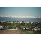
Meanwhile, Denver keeps getting the monsoonal rains. What a very strange weather year.
I-70 is closed between Palisade and De Beque due to a wildfire, and could result in increased traffic on Highway 65 over the Grand Mesa due to the closure.
I can't say enough good things from all the firefighters, my God do they hustle to get to the hot spots. I was over at the Fruita truck stop having lunch, talked to several guys who are en route to Nucla.
The air this morning? Couldn't see the Grand Mesa, could barely see the Bookcliffs. And the media's message to seniors, they're not asking them to stay inside, they're telling them.
The humidity levels cranked up this afternoon and clouds were building. I thought for sure this was it, a deluge about to burst. And then nothing. A little while ago a weird few blasts of wind shot through. And then nothing but continued heat and this feeling of waiting for the other shoe to drop.
Meanwhile, Denver keeps getting the monsoonal rains. What a very strange weather year.
Same here (foothills west of Boulder). Nary a drop of rain in August. Last significant precipitation was July 23. Some days I can see it raining in all directions, but it's as if there is a bubble/dome over this area.
@ HH "I can't say enough good things from all the firefighters, my God do they hustle to get to the hot spots." Amen to that. Heroes all.
There was a small 7 acre fire a few miles from us on Tuesday. May have been a lightning strike (dry thunderstorm). Boy, they were on it immediately and had it contained within a few hours.
Please register to post and access all features of our very popular forum. It is free and quick. Over $68,000 in prizes has already been given out to active posters on our forum. Additional giveaways are planned.
Detailed information about all U.S. cities, counties, and zip codes on our site: City-data.com.

 Please register to participate in our discussions with 2 million other members - it's free and quick! Some forums can only be seen by registered members. After you create your account, you'll be able to customize options and access all our 15,000 new posts/day with fewer ads.


 I love pikabike's new place names for our current hellscape. And of course Highway 491 which was originally named Highway 666 will always be the Devil's Highway to we residents of Scorchez and nearby towns.