Please register to participate in our discussions with 2 million other members - it's free and quick! Some forums can only be seen by registered members. After you create your account, you'll be able to customize options and access all our 15,000 new posts/day with fewer ads.
Looks like mid-summer is definately over now, the weather right now feels more like early autumn with a showery mix of wind and sun and highs in the upper teens (C), however during heavy showers it even drops briefly to 13 or 14°C.
But there is still a chance of a beautiful late summer in late August/September.
I'm having a hard time believing the Euro saying no widespread 80s north of NYC next 10 days. only local 80s a couple times. Pretty much North of Philly staying cooler than normal. The nail is being hammered.
Warmest frame here which is last frame long range August 26th.
Welcome to Atlanta! It's has been abnormally cool and dry the past couple of days (mid-80's), but it will be heating up this week. Mid-90's by Sunday, and upper 90's by the end of next week, and dewpoints in the 70s. This is pretty much what you should expect of a summer here, with 80s through at least the end of September.
PS: Don't call it Hotlanta, that is for tourists . It'll make you stick out like a sore thumb as a new arrival here Refer to this thread:
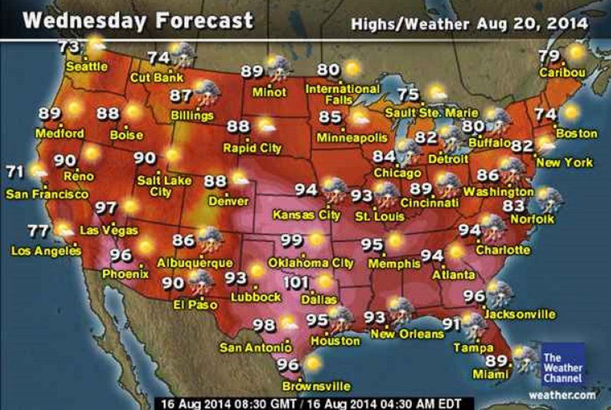
I travel to Atlanta on tue...then to New Orleans Wed to Sunday. It looks like hot tropical weather along the Gulf states and southern USA from Wed on. Not record highs I would think, but a bit above normal it looks like. New Orleans is supposed to be like 93 F and with the high dew points near 100 F from Wed on:
yeah, you might have to escape down south for Summer warmth..
Here's NWS Boston.
So maybe the Euro is onto something struggling past 70s north of NYC next 10 days. Might touch 80s locally or few couple hours maybe.
Quote:
NATIONAL WEATHER SERVICE TAUNTON MA
656 AM EDT SAT AUG 16 2014
OVERVIEW...
MODELS ARE IN GENERALLY GOOD AGREEMENT FOR THE MEDIUM TO LONG RANGE.
LINGER UPPER LEVEL LOW WILL MOVE TOWARDS THE MARITIMES ON MONDAY. BY
THIS TIME THE UPPER-LEVEL JET INTENSIFIES ACROSS THE NORTHERN
PACIFIC LEADING TO THE TRANSITION FROM HIGH-AMPLITUDE TROUGH OVER
THE NORTHEAST TO A MORE ZONAL AND FLATTER LOW AMPLITUDE/PROGRESSIVE
PATTERN FOR THE THIS MEDIUM RANGE PERIOD. BY THE END OF THE
PERIOD A MORE AMPLIFIED PATTERN WILL PERSIST AS STRONG HIGH
PRESSURE BUILDS ACROSS THE CENTRAL CONUS AND TROUGHING DIPS BACK
INTO THE NORTHEAST.
Please register to post and access all features of our very popular forum. It is free and quick. Over $68,000 in prizes has already been given out to active posters on our forum. Additional giveaways are planned.
Detailed information about all U.S. cities, counties, and zip codes on our site: City-data.com.

 Please register to participate in our discussions with 2 million other members - it's free and quick! Some forums can only be seen by registered members. After you create your account, you'll be able to customize options and access all our 15,000 new posts/day with fewer ads.


")


 . It'll make you stick out like a sore thumb as a new arrival here
  :
: