Please register to participate in our discussions with 2 million other members - it's free and quick! Some forums can only be seen by registered members. After you create your account, you'll be able to customize options and access all our 15,000 new posts/day with fewer ads.
I really like these maps. Do you know when the first map is supposed to actually be implemented?
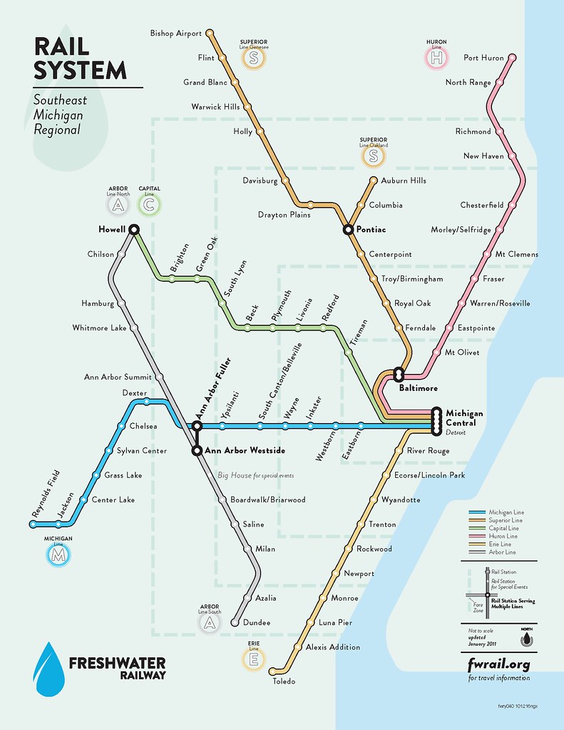
Probably never, but my understanding is that the first map is based upon actual plans collecting dust in the MBTA archives. Everything on it has been studied or officially suggested. Some of the MBTA's predecessor agencies had these plans in place as far back as the 30s!
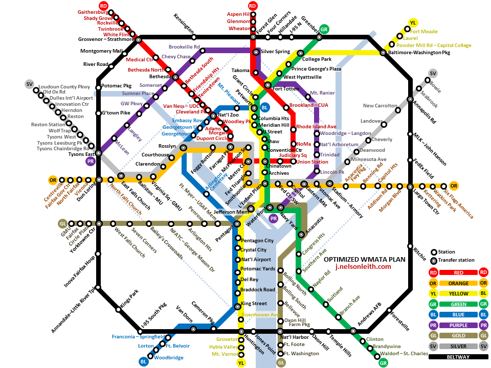
The DC silver line, purple line, and DC 37 mile Streetcar network are not fantasy. The silver line and streetcar network are under construction and the purple line is going for federal funding as we speak.
The DC silver line, purple line, and DC 37 mile Streetcar network are not fantasy. The silver line and streetcar network are under construction and the purple line is going for federal funding as we speak.
These were put together by the owner of futurembta.com who posted quite a few others, too, but I thought these were particularly cool:
Once upon a time the Green Line extended to Forest Hills...and it was a disaster. Because Green Line is light rail. Same problems with the Blue Line in Los Angeles. If it were subway that would be different. All in all, there are some great ideas here. I agree that certain places like Lynn and Roslindale should easily be more incorporated into the bus and subway system. Although that is the thing, a lot of this is too much subway and light rail because certain people don't want to take the bus when really the bus is a great mode of transportation. Don't forget the bus takes you to a lot of these places already.
Please register to post and access all features of our very popular forum. It is free and quick. Over $68,000 in prizes has already been given out to active posters on our forum. Additional giveaways are planned.
Detailed information about all U.S. cities, counties, and zip codes on our site: City-data.com.

 Please register to participate in our discussions with 2 million other members - it's free and quick! Some forums can only be seen by registered members. After you create your account, you'll be able to customize options and access all our 15,000 new posts/day with fewer ads.