Bridge Statistics for Boulder, Colorado (CO)
Condition, Traffic, Stress, Structural Evaluation, Project Costs
- National Bridge Inventory (NBI) Statistics
- 126Number of bridges
- 958ft / 292mTotal length
- $10,476,000Total costs
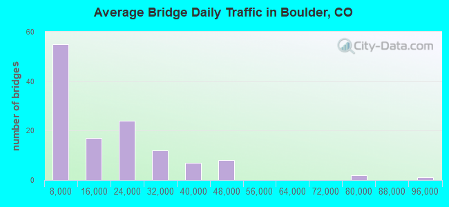
- 1,968,611Total average daily traffic
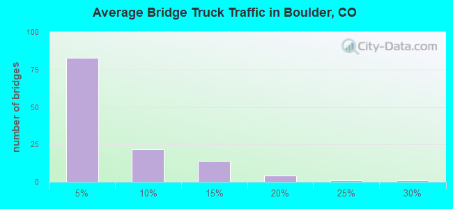
- 80,310Total average daily truck traffic
- National Bridge Inventory (NBI) Registered Bridges for Boulder
- No street view available for this location
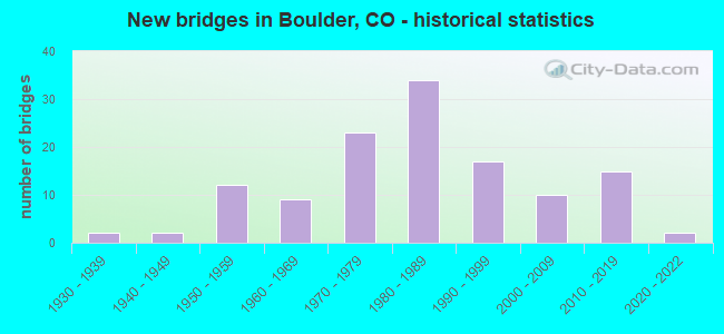
- New bridges - historical statistics
- 21930-1939
- 21940-1949
- 121950-1959
- 91960-1969
- 231970-1979
- 341980-1989
- 171990-1999
- 102000-2009
- 152010-2019
- 22020-2022
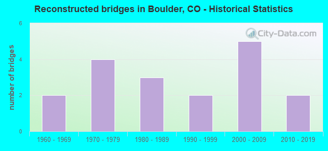
- Reconstructed bridges - Historical Statistics
- 21960-1969
- 41970-1979
- 31980-1989
- 21990-1999
- 52000-2009
- 22010-2019
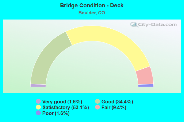
- Bridge Condition - Deck
- 1.6%Very good
- 34.4%Good
- 53.1%Satisfactory
- 9.4%Fair
- 1.6%Poor
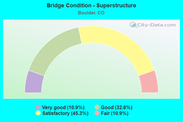
- Bridge Condition - Superstructure
- 10.9%Very good
- 32.8%Good
- 45.3%Satisfactory
- 10.9%Fair
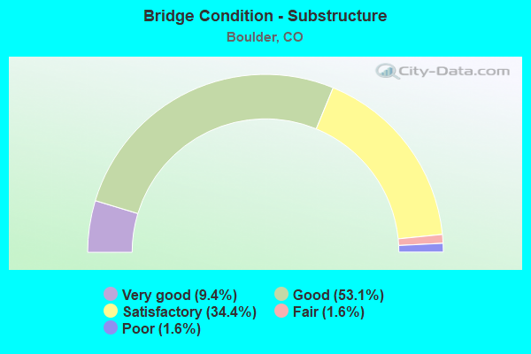
- Bridge Condition - Substructure
- 9.4%Very good
- 53.1%Good
- 34.4%Satisfactory
- 1.6%Fair
- 1.6%Poor
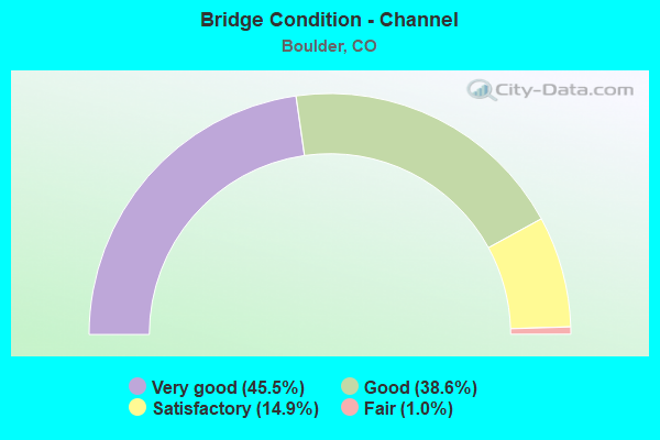
- Bridge Condition - Channel
- 45.5%Very good
- 38.6%Good
- 14.9%Satisfactory
- 1.0%Fair
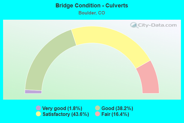
- Bridge Condition - Culverts
- 1.8%Very good
- 38.2%Good
- 43.6%Satisfactory
- 16.4%Fair
Find on map >> Show street view
Structure Number: E-16-HW, Location: IN BOULDER (Lat: 39.985150, Lng: -105.232300), Route carried "under" structure: US 36B, Year Built: 1971, Structure Length: 0. m, Average Daily Traffic: 72,000 (year 2011), Truck Traffic: 4%, Features Intersected: US 36 ML, Facility Carried by Structure: SH 157 RAMP
Minimum Vertical Clearance: 5.08m (16.67ft), Kilometerpoint: 63.169, Lanes on structure: 2, Lanes under structure: 6, Material/Design: Steel continuous, Design/Construction: Stringer/Multi-beam, Length of Maximum Span: 34.8m (114.2ft)
Find on map >> Show street view
Structure Number: E-16-QT, Location: 1.4 MI E OF JCT SH 157 (Lat: 39.976108, Lng: -105.212767), Route carried "under" structure: US 36B, Year Built: 2009, Structure Length: 0. m, Average Daily Traffic: 88,000 (year 2018), Truck Traffic: 4%, Features Intersected: SH 36 ML, Facility Carried by Structure: CHERRYVALE ROAD
Minimum Vertical Clearance: 5.11m (16.77ft), Kilometerpoint: 2.971, Lanes on structure: 2, Lanes under structure: 4, Material/Design: Prestressed concrete continuous, Design/Construction: Stringer/Multi-beam, Length of Maximum Span: 42.5m (139.4ft)