Please register to participate in our discussions with 2 million other members - it's free and quick! Some forums can only be seen by registered members. After you create your account, you'll be able to customize options and access all our 15,000 new posts/day with fewer ads.
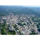
I'm currently taking classes monday-wednesday at ETSU in Johnson City, TN, so I've got quite a bit of down time at the end of the week that i'd like to use to take some fairly long trips in the area. That being said, a couple people i know have mentioned "this guy i know" or "i heard of somebody" taking a walk from JC all the way to Asheville. It's about sixty miles by car, and it looks like there are quite a few natural formations along the way so i don't doubt that there are trails going from ETSU to Asheville. I was wondering if anyone on here had any information on taking a trip like that or had made the walk themselves. Thanks!
I'm currently taking classes monday-wednesday at ETSU in Johnson City, TN, so I've got quite a bit of down time at the end of the week that i'd like to use to take some fairly long trips in the area. That being said, a couple people i know have mentioned "this guy i know" or "i heard of somebody" taking a walk from JC all the way to Asheville. It's about sixty miles by car, and it looks like there are quite a few natural formations along the way so i don't doubt that there are trails going from ETSU to Asheville. I was wondering if anyone on here had any information on taking a trip like that or had made the walk themselves. Thanks!
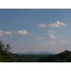
The area from Asheville toward Johnson City is mostly made up of the Pisgah National Forest. I'd start with researching trails in the forest to find what you are looking for. I am not aware of any one trail that runs from one city to the other. Most likely you'd use a series of trails to traverse the whole area, including part of the AT.
Thanks that really helps. I checked out some stuff about Pisgah and I think what we'll do is hike from Buffalo Mountain into Erwin and pick up the AT near the Nolichucky River. The AT takes you about half the way there it looks like, so we'd have to find a way to cross 26 and hit Craggy Pinnacle maybe? I'm not certain from then on. It looks like there's a ten or twelve mile section without any really well established trails from Faust to Weaverville... does anyone know of anything in that area?
Quote:
Originally Posted by lovesMountains
The area from Asheville toward Johnson City is mostly made up of the Pisgah National Forest. I'd start with researching trails in the forest to find what you are looking for. I am not aware of any one trail that runs from one city to the other. Most likely you'd use a series of trails to traverse the whole area, including part of the AT.
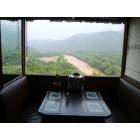
All I know is, you can get on the Appalachian Trail just south of Elizabethton TN near the lake, and you can hike all the way down to Hot Springs NC. Now, Hot Springs is a familiar town to people who live in Asheville, and folks to drive up there and back. Seems like they have rebuilt an old inn that you can take a dip in the literal hot springs and stay overnight and all. But as for trails from there to Asheville, via Weaverville as you mentioned, I am only aware of shorter ones that just go several miles out of Hot Springs.
Please register to post and access all features of our very popular forum. It is free and quick. Over $68,000 in prizes has already been given out to active posters on our forum. Additional giveaways are planned.
Detailed information about all U.S. cities, counties, and zip codes on our site: City-data.com.

 Please register to participate in our discussions with 2 million other members - it's free and quick! Some forums can only be seen by registered members. After you create your account, you'll be able to customize options and access all our 15,000 new posts/day with fewer ads.