Pecan Valley in the 70's (San Antonio, New Braunfels: homes, neighborhood, club)
Please register to participate in our discussions with 2 million other members - it's free and quick! Some forums can only be seen by registered members. After you create your account, you'll be able to customize options and access all our 15,000 new posts/day with fewer ads.
Thanks, wayover20, for sharing your remembrances of the area. NOW I remember that they were the Pennystone Apartments!
I am very glad to hear that there's new development going on in the area. I believe someone posted on another thread that a new center was going in on Goliad just past Military. Back in the day, Goliad turned "rural" almost immediately when you crossed Military!
I'm also glad to hear that there are several other old Southsiders on this forum. I'm proud that I grew up in the area and miss it, although I know things aren't the same.
Drove through the Pecan Valley area today. Took Southcross Blvd from 37 east to 410 and then onto Sulpher Springs Road (which is what Southcross Blvd apparently turns into right after 410). That hill on Southcross when you're coming up to Pecan Valley Dr. is quite nice and I would assume breathe taking at night with the lights.
I do have some suggestions though about the portion of Southcross Blvd from Pecan Valley Dr to W W White Road. The city needs to bury the power lines and phone lines so that the wooden poles (that also have the lights on them) in the grassy median can be removed and... once the poles are removed the grassy medians can be better landscaped as well as new street lights put in. It would make for a much more aesthetics pleasing drive.
Also, Pecan Valley golf course should remove their leaning chain link fence that borders Southcross Drive and build something with stone. It's not like it's a poor/run down golf course, heck, it's rated as one of the best golf courses in the state it has a really nice club house.
I've been doing some searching trying to find more information on the Pafrey Ranch scenerio and came across an interesting little tidbit about Highland Hills and HIghland Park.
Thanks for the info, Bob. I had no idea that the 1965 Miss America Pageant was held at McCreless! Could that be right? I thought it was always in Atlantic City. Maybe they meant Miss USA.
I worked at Southeast Baptist hospital in the late 70's and I used to live at the Pennystone apartments (now Summerview) and paid $170.00 for a large very nice 1 bed/1 bath apt and the complex was very nice. Not so now. I also lived at the Pecan Valley golf club apts and paid I believe $280.00 for a 1 bed 1 bath townhouse. That was very nice as well.
The Reserve apartments right next to SEB hosp. used to be called the Southcross Villa aparts. and it was THE place to live for professionals who worked at the hospital. It featured a very nice club within the complex (and the name escapes me right now), saunas, pools, and beautiful landscaping. You were hip if you lived there back then.
This and other apartments have changed names and now accept government subsidies...section 8.
I have a close friend who lived at the Southcross Villa apts in the same apartment for 22 years. She had to move due to heavy increase in crime in that complex. That along with other apt complex's that now take section 8 and have the same decline in building/landscape maintenance and increase in crime all up and down E. Southcross street. Ask any cop who's been patrolling that area and he'll tell you it's nothing like the beauty it was back 20-30 years ago.
I lived at both the Pennystone and Southcross Villa between 1977 and 1981. I remember paying $1.00 for a gallon of gas for the first time at the Circle K across from the Southcross Villa sometime in 1979.
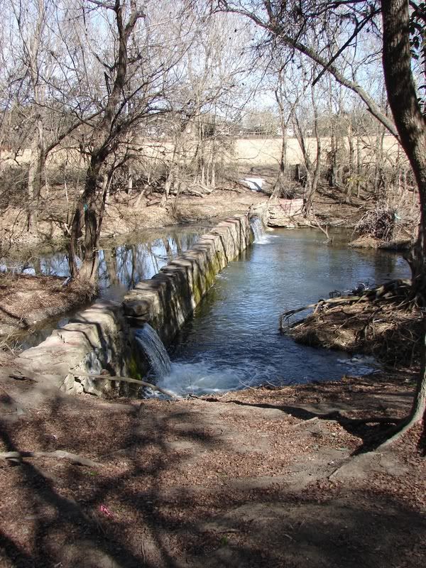
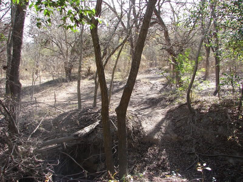
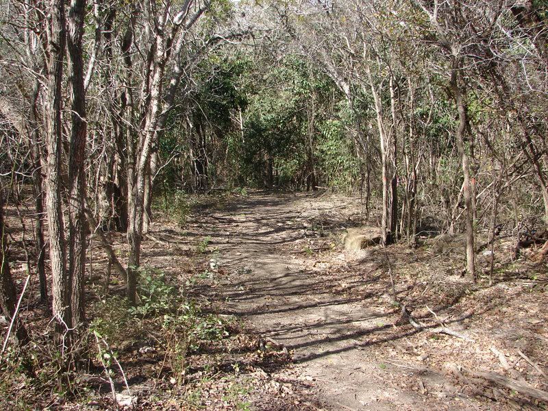
I finally had a chance to take a walk down in the woods today and took my camera along. I didn't go very far in due to lack of time. I just went to the dam on the creek and ot a place that is called the Camel Humps by motor cycle and bike riders. Eventually I would like to go and find the house that I mentioned earlier.
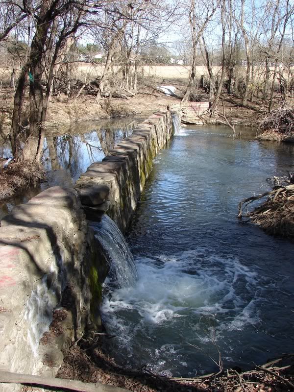
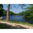
Here are some shots of the dam. It's really quit nice here in the winter. No bugs or snakes and the weeds are not bad. I used to go down there frequently with a six pack and just sit on the dam and hang out. This is about a 10 minute walk from my house.
IMG]http://img.photobucket.com/albums/v226/bschultz/dam2.jpg[/IMG]
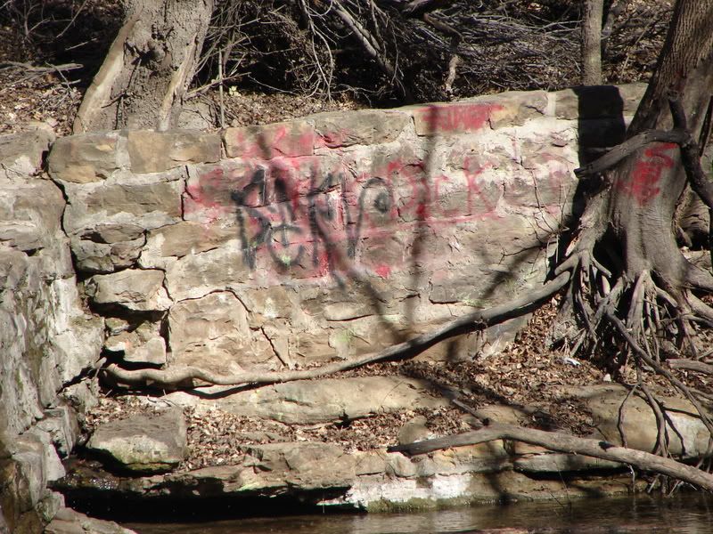
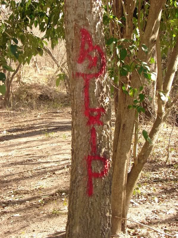
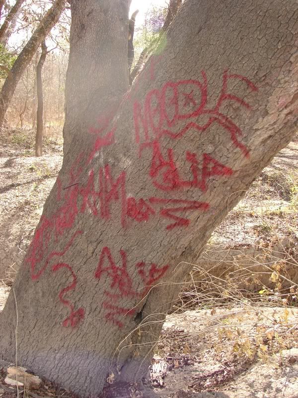
Here I zoomed in on the far side to get a shot of some ugly graffiti.
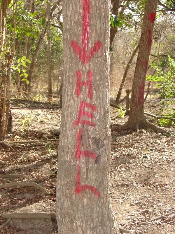
Graffiti on some of the trees.
This is the area called the Camel Humps. It's a series of hills really close together. On two wheels you can get some serious air. My theory is that they originated when the neighborhood was built. I'll bet the use to dump their unwanted dirt there.
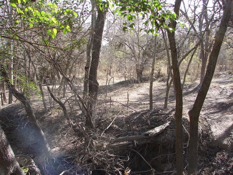
This is a side trail leading upstream to the Pecan Valley Golf Course.
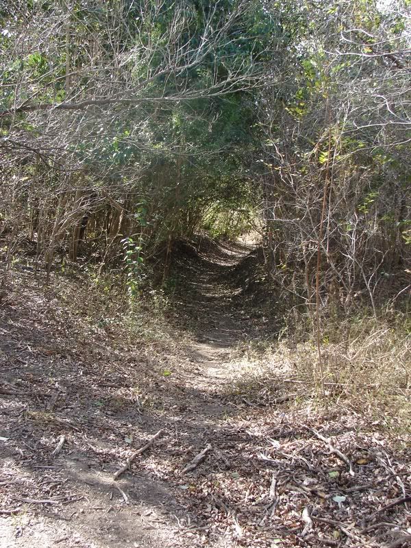
This is the trail leading in and out by the water substation. It forms a tunnel. You really have to duck if your on a bike.
That's all I have today. Before it gets hot I want to take a day when I can go a lot farther, probably by bike. I need to take my guide and find that house with the grave.
I remember walking through the 'Trails', that is what we used to call them, with friends once in the late 80s. We saw a huge bird flying in there on one of the hills then it disappeared. It had a wingspan between 6 to 10 feet. I am not sure if it was an eagle or a vulture, it did not look like a typical eagle since it was pretty ragged and different colors.
There was also another place that used to be called the 700 Acres which I never had a chance to go visit, since mainly BMX bikers used to go trail riding, and by time I was old enough to stray farther from the neighborhood BMX biking fell out of style.
I found some interesting information about the area:
Quote:
Ferdinand Theis Sr. a member of a prominent German family settled in southeastern Bexar County Texas around 1857. He owned a large portion of what is now known as Pecan Valley in San Antonio, including the Pecan Valley Golf Course. Along with other landowners, He formed the Salado Water Supply Company around 1912; drilled an artesian well near Fort Sam Houston and directed the flow into the Salado Creek. In the early 1960's over 500 acres were sold by his heirs and other landowners to Mr. E. J. Burke for the development of the Pecan Valley Apartments, Pecan Valley Country Club and Golf Course and the Pecan Valley Subdivision.
A son, Joe Theis, raised pecan trees in 210 acres of the Pecan Valley area. Joe grafted his pecan trees and collected a sampling of over 96 different varieties. Some were so large that 4 unshelled and 9 shelled pecans would make a pound of the tasty nuts.
Quote:
Theis-Smith House
Ferdinand Theis built the house in 1887 on hi plantation of 396-1/3 acres. The location in those days was described as being 6 miles southeast of San Antonio, Texas, on the old Sulphur Springs Road which today is Roland Avenue. It was built by local carpenters and Mexican -Americans who cut the limestone blocks from limestone on the property. Ferdinand's daughter, the late Clara Theis Amanda, described how her father developed a system whereby the stones were lifted by turning a wagon wheel. The house is constructed of stone and plaster, hard, wide heart-of pine floors, oak woodwork and a steep tin roof. The woodwork has its original finish and is in the beading stage. It has a beautiful luster. A one story house of its quality was seldom found in the country. The house sits away from the road approximately 300 feet.
Beginning October 12, 1912, Theis was instrumental in providing 400 farmers along the Salado Creek with water for many things, excluding personal consumption. This was vital to the economy of farming and ranching in Southeast Bexar County. For this, Theis was highly praised.
According to Clara, her father was 5 years old when he came to America from Germany in 1859 with his parents, George (11/1/1816-8/4/1881) and Anna Maria Baldus (8/24/1821-1/23/1907) Theis. Ferdinand married Clara S. Sultenfuss in 1887. They raised six boys and three girls.
The house is unique in that it has nine exterior doors; four are walnut. Seven of the doors open onto the porch and one may exit ont o the porch without going through another room. The ceilings are 12'8" in height. All doors have transoms in good working condition which allows for effective ventilation. Ceiling fans have also been installed in all rooms by its present owner. The walls a re fourteen inches thick with inset windows and workable sliding screen. The shutters are constructed with wooden pegs. The 125 foot porch is 8-1/2 feet wide and has 14 matching columns. The main entrance is walnut with deep beveled oval glass. It also has two walnut side panels with beveled oval glass. It opens into a reception hall (25' x 8-1/2') which has matching beveled oval glass doors at the opposite end leading onto the south side porch. All are original and in good condition. Two other walnut door s have etched glass scenes. The only addition to the house was a bathroom in the 1920's. This was added by taking in 10 feet of the porch which was originally 135', on the backside of the house. The addition did not alter the appearance and did not change the shape of the house in any way. The architecture does not conform to a particular style but seems to be nearer to French Colonial. The house contains two entrance halls, living room, dining room, kitchen, three bedrooms (with closets) and one bathroom. Two rooms are located on the basement level of the house and originally used as bedrooms.
There is an underground rain water cistern in good condition. The property originally had a stone milk house, huge barn, a stone smokehouse, a frame (20' x 30') gara ge and storeroom and a blacksmith shop. The storm cellar, which was built in 1928 is now in ruins. The garage was built after automobiles came into being and is weathered with a tin roof. The barn , smokehouse and blacksmith shops were torn down but the hi storical milk house still stands and is in dire need of restoration. This is presently being considered. The house is surrounded by Anaqua trees which are rare. The Indians believed they had great healing power and would sit under them for hours.
Ferdinand Theis spent all but five years of his life on the plantation. After the death of his wife, twin daughters, Mathilda and Mary inherited the house. The house remained in the family until August 8, 1974 when it was purchased from the surviving twin, Mathilda and her administrator.
Salado Water Supply Company
Quote:
1912 The Salado Well, An Historical Perspective by Clarence F. Theis
In the last half of the 19th century my great grandfather, Ferdinand Theis, Sr. came to San Antonio, Texas. He purchased a farm of some four to five hundred acres ($2.00 acre) on the Salado River, Southeast of San Antonio. The farm was located between t he east bank of the Salado and on the West Side of the New Sulphur Springs Road. (The name of the road tells you something.) This area, now in the city limits, is known as Pecan Valley. When the land was taken into the city limits, the name of the New Sulphur Springs Road was changed to Roland Ave. This land is about two miles north of the Old George Dullnig Field. The story of George Dullnig and my Great Grandfather are interrelated. They were both concerned about water.
When my Great Grandfather came to this area, it must have been a beautiful land. The Salado evidently was a river. He stated that the Salado had an abundance of fish of many types and there were huge flocks of geese and ducks.
The Theis property, along with the Dullnig propert y is located in the bad water zone of the Edwards Aquifer. The December 1986 article in the STGS Bulletin stated that Mr. Dullnig got gas, oil, and sulphur wells, but no good water wells. Today in this area, Holt Machinery has a sulphur well.
This bad water zone was no problem to the settlers. They built their houses with tin roofs and installed gutters to catch the rain water. The water was piped from the gutters to a charcoal filter trap to remove all the impurities such as bird droppings on the roof. The rain water was then piped to a cistern. The cistern was located above or below ground. In my great grandfather's house, the cistern was located under the kitchen and a hand pump extended down into the cistern from the kitchen sink. This gave them their drinking water, but they had lots of livestock to water. The answer was the Salado. All along the Salado, the farmers used the water for their livestock, and sometimes for drinking. At that time it was safe for human consumption.
At the beginning of the 20th century, the headwaters of the Salado dried up. This created a problem for the people along the Salado and they formed the Salado Water Supply Company. Ferdinand Theis, Sr. went around to the farmers and collected $100.00 from each t o drill the Salado well. Some told him they would give the money after they got the water. Upon finally receiving the water, they said there was no need to donate because they already had water. \par \par Mr. Herman Eisenhauer gave an acre of land for the well si te which is located on the rear part of Fort Sam Houston. In 1912, Fort Sam Houston did not extend back to the Salado, The well is located near W. W. White Road and Nursery, just north of the Salado Park. The water well was drilled in 1912 (this is the 7 5th anniversary) to a depth of 702 feet, into the Edwards Aquifer. The well came in at 10,000,000 gallons of water per day or approximately 6,950 gallons per minute.
At a later date, the government expanded Fort Sam Houston and acquired all the land a round the well site. Since Fort Sam Houston owned all the land around the well, it attempted to claim the well, but was unsuccessful because the well belonged to the Salado Water Supply Company, a group of investors, not an individual.
The following article appeared in the October 12, 1912 edition of the San Antonio Light.
"SALADO RIVER NOW IS REALLY A RIVER
Well flowing 10,000,000 gallons a day. Supplies water for formally almost dry bed.
With the bringing in of the big well on the Salado River, mor e than 10,000,000 gallons of water flows daily into that erstwhile dry bed, making it a river in more than name. The well is the property of the Salado Water Supply Company, a concern composed of land owners in the vicinity, each of whom contributed to th e fund of about $4000, which paid for boring the well.
The well is twelve inches in diameter and came in at a depth of 650 feet on Thursday about noon. The flow at that time was estimated to be about 2000 gallons a minute. In the belief that a still lar ger flow would be encountered, Jacob Wolfe the driller, decided to go lower. About ten feet farther down, the drill pipe dropped abruptly for four or five feet and instantly there came up such a volume of water that the entire rig was in danger of being f orced out. The drill pipe was hastily removed and the full power of the well was seen. Driller Wolfe believes that the drop of several feet was into a cave of water which given an outlet, rushed upward. When drilling stopped, the well was 702 feet d eep. An estimate places the daily volume of the gusher at 10,000,000 gallons and during the time it has been running there has been no perceptible diminution of the flow.
The Salado Water Supply Company drilled the well to supply water for the creek in order that stock might be supplied and people living along it might have a good supply of water. No irrigation with the water will be permitted. Herman Eisenhauer gave the acre of land on which the well is situated and land owners made up the fund to drill. The trustees of the company are Ferdinand Theis, W. F. Kelsey, Herman Eisenhauer, William Icke and Dr. John V. Spring. The well is located about a quarter of a mile down the Salado from the big Brekenridge well of twenty-two inches in diameter. Proportionally the flow is said to be heavier than in that well."
In 1925 my grandfather, Ferdinand Theis jr. had a well hand dug on the Theis property near the New Sulphur Springs Road. The well produced good drinkable water at a depth of about forty feet out of limestone gravel. This was the first well in the area. It produced a sufficient amount of water, but the water was hard.
A neighboring German farmer and blacksmith by the name of Paul Neitzel, made his own home built portable cable tool drilling rig, and started drilling water wells. Mr. Neitzel's drilling rig was constructed on a four-wheel trailer and was originally powered by a Ford Model T engine. He continued to drill water wells in the area for many years. In the 1960's the population had gr own tremendously in the area. With the population growth, came pollution.. These shallow wells became contaminated, but by this time suburban water was available to the area.
The story of the Salado River, the Salado well , the shallow wells and water leav es a distinctive pattern. In the middle of the 19th century the Salado was a beautiful river, but at the beginning of the 20th century, population and progress caused the headwaters to dry up. In the 1920's the 40 foot deep water wells in the limestone gravel produced good water for years, but in the 1960's population and progress caused these wells to become contaminated. In the last fourth of the 20th century, the Salado well has slowed up considerably and the creek water is no longer safe to drink, a gain, because of population and progress. How long will it be before population and progress destroys the Edwards Aquifer?
Thanks, Merovee. I never knew who owned the valley originally.
E.J. Burke also developed the area above the valley in the early 1950s. Our house was built in 1952. I guess that Mr. Palfrey's ranch covered Highland Hills, while the Theis family owned the valley.
I found out more information about Mr. Palfrey's house from my mom. His house was in the area of the bluff overlooking the valley (present day Fairlawn - behind Rogers Middle School and near Killarney Drive). Mr. Palfrey sold the land to E.J. Burke for development. Apparently, Mr. Palfrey took 5 years to move out of his home. He had workmen remove all of the chandeliers, doors, etc. - essentially anything that wasn't part of the main structure of the house! Mr. Palfrey did business with my dad even after he sold his land.
Here is some information concerning George Dullnig from the Highland Forest Elementary site. I am assuming his ranch stretched from at least from SE Military Dr and Fairlawn all the way to E Dullnig Ct which falls on both sides of I-37, off of Clark Ave and S Presa St.
Quote:
Highland Forest Elementary is located on what was once a 1,000-acre ranch owned by George Dullnig, who immigrated from Austria in 1853. He and his wife had 14 children and dreamed of building a model farm with fruit trees, corn, cattle and horses. After twelve costly attempts to find water, he found only crude oil, natural gas and sulfur water. Finally resigning himself to the production of oil and gas instead of fruit and livestock, his wells produced the first oil in Texas, fifteen years before the Texas oil boom of the famous Spindletop in Beaumont. The natural gas was pumped along a one-inch main into the ranch house, making it the brightest-lit building in South Texas!
The bubbling sulfuric water was siphoned into tanks and sold as a "cure-all". After Mr. Dullnig died in 1908, his family leased a two-story wooden ranch house nearby and made it into Dullnig Wells Hotel and Bath House, a spa where San Antonians sought cures for rheumatism from its 11 mineral water wells. City dwellers came to the screened cottages for weekend vacations "out in the country". In the 1930's the water stopped flowing and the wells shut down. In the '40's, the buildings burned and the property was sold for housing development.
Highland Forest Elementary School, serving grades K-4, was built in 2002 to relieve overcrowding at several of East Central Independent School District's elementary schools. The school is a single story, 75,000-square-foot, limestone brick building composed of five interconnected pods. Each pod houses a grade level, and overlooks a beautifully landscaped courtyard. Centered around a state-of-the-art library and computer labs, the school is designed to accommodate 700 students. Current enrollment is over 600 students.
On April 18, 2002, the name "Highland Forest Elementary" was selected by the district's Board of Trustees. Since the 1940's, Highland Forest has been the official name of the neighborhood in which the school is located on Southeast Military Drive at IH37 on San Antonio's southeast side.
According to 'San Antonio de Bexar: A Guide and History' by William Corner (1890), George Dullnig found petroleum on his ranch while digging for artesian water on December 2, 1887. In the 'Book of Texas' by Harry Yandell Benedict and John Avery Lomax (1916) it states that, "The first appearance of Texas as an oil producer in statistical tables was in 1889, when forty-eight barrels came from two wells of George Dullnig, seven miles south of San Antonio. This oil sold for $5.50 a barrel, a price that makes an interesting comparison with the 5 cents received during the early period of the Spindle Top oil overflow."
He was also in the banking, hotel, and grocery business in downtown.
Quote:
George Dullnig, who founded the Alamo National Bank and helped establish the San Antonio and Gulf Railroad.
Austrian immigrant George Dullnig and his two brothers, Christian and John, opened their wholesale and retail grocery business in 1864 on Commerce and Alamo Streets. As their business prospered, George hired Austin architect James Murphy to design a grand mercantile store. The resulting three-story building became a distinct, somewhat imposing landmark among the simple one-story structures in the neighborhood.
For the next 20 years, the area enjoyed a rich architectural explosion. Alamo Plaza was developed and landscaped and several more buildings were built on and around River Street. Today only the Menger Hotel, Crockett Block and the Riverwalk Vista remain as a tribute to this important era in San Antonio history. By 1887, George Dullnig's business was described as "the oldest run under one firm name in San Antonio" and one of the largest in the Southwest, employing 30 people with seven delivery wagons trading as far as western Texas.
In 1892, George Dullnig founded the Fifth National Bank on the first floor of the building, where it operated until 1896. He was also a stockholder in the Opera House and the San Antonio and Arkansas Pass Railroad and a board member of the San Antonio and Gulf Railroad. Dullnig became a pioneer in the Texas oil industry when in 1886 he struck oil just six miles south of San Antonio. George Dullnig died on December 19, 1908, and the store continued to operate under a variety of names until 1920 when it was sold to J. M. Frost who operated the business under the name "The Fair" until 1930.
Over the years the building housed a number of businesses and was threatened with demolition in 1978. But the property persevered, and in 2001 the Riverwalk Vista Inn opened on the second and third floors of the renovated building.
Riverwalk Vista, Historic Hotels of America (http://www.historichotels.org/hotel/Riverwalk_Vista/1032 - broken link)
The family even has their own section at the San Antonio Cemetery off of New Braunfels. I wonder if Mr. Dullnig even lived at the ranch he owned or at the family home on Nolan. I can imagine the commute from downtown to his ranch would have taken a considerably larger amount of time than it does today. Maybe on really busy days he just lodged at his own hotel instead.
Quote:
The majority of early San Antonio families of note were buried in group cemeteries. Two exceptions are the Dignowity and Dullnig plots.
...
Members of the Dullnig Family are buried at the northern edge of City Cemetery #5. There is no official title to this land. The Dullnigs, like other families, purchased lots from the city, built a private walled enclosure and buried family members there. George Dullnig was born in Austria in 1846 and came to the United States as a child. With little education, he established a small shoe store that grew into the city’s largest early department store. The family home still stands at 124 Nolan.
Beyond the Alamo East Side / Ellis Alley (http://209.85.165.104/search?q=cache:2LNRj1Ao_J4J:www.sanantonio.gov/art/website/PDFs/Eastside_rtf.pdf+george+dullnig+san+antonio+histor y&hl=en&ct=clnk&cd=11&gl=us&client=firefox-a - broken link)
Please register to post and access all features of our very popular forum. It is free and quick. Over $68,000 in prizes has already been given out to active posters on our forum. Additional giveaways are planned.
Detailed information about all U.S. cities, counties, and zip codes on our site: City-data.com.

 Please register to participate in our discussions with 2 million other members - it's free and quick! Some forums can only be seen by registered members. After you create your account, you'll be able to customize options and access all our 15,000 new posts/day with fewer ads.