Please register to participate in our discussions with 2 million other members - it's free and quick! Some forums can only be seen by registered members. After you create your account, you'll be able to customize options and access all our 15,000 new posts/day with fewer ads.
I really want to check out the American Tobacco Trail. I have found some online maps, but it is unclear to me where it is convenient to park and start on the Trail. I have been focusing mainly on where the trail is located in Durham. Anybody have some tips? I am most interested in parts of the trail that are wooded or provide at least some shade as you walk along the trail.
Thank you very much for your help!
Last edited by North_Raleigh_Guy; 07-26-2009 at 09:33 AM..
I'm no expert, NRG, but the spot that immediately springs to my mind is the shopping center that contains the Kroger on the northwest corner of the intersection at Hwy 54 & Fayetteville St (just north of Southpoint). The American Tobacco Trail is on the east side of that large shopping center. Go north on the trail & I you'll be shaded by trees for a couple of miles I think.
Yup, many people often park and pick up the trail there. There's parking right at the entrance to the trail, and signs. You should have no trouble finding it.
I really want to check out the American Tobacco Trail. I have found some online maps, but it is unclear to me where it is convenient to park and start on the Trail. I have been focusing mainly on where the trail is located in Durham. Anybody have some tips? I am most interested in parts of the trail that are wooded or provide at least some shade as you walk along the trail.
Thank you very much for your help!
on the Southern section I would recommend White Oak Church Road car park which has plenty of parking and toilets as well. It is off of Green Level Church Road adjacent to Apex / West Cary. You can walk or cycle about 5 miles south and a mile north along the trail, and soon the Chatham County section will be open too and will add about the same distance again
To access the northern trailhead, there is a gravel parking lot at the corner of Blackwell and Morehead in downtown Durham, under the Durham Freeway and the adjacent to the DBAP and the American Tobacco Campus. The trailhead is directly across Morehead from this lot.
Jimmy, thanks! NRG, if I'm not mistaken, that parking lot that Jimmy mentions is directly north of the Adam and Eve store. Should be easy to spot.
There are some interesting videos of the American Tobacco Trail on YouTube. They allow you to get a better idea of what different parts of the trail look like, usually from the perspective of a bike. I really like the videos made by jimconabike because he speeds up the video & labels each street and mile marker as he passes them. Here's a link to the video he made that covers the section of the trail that Jimmy and I mentioned.
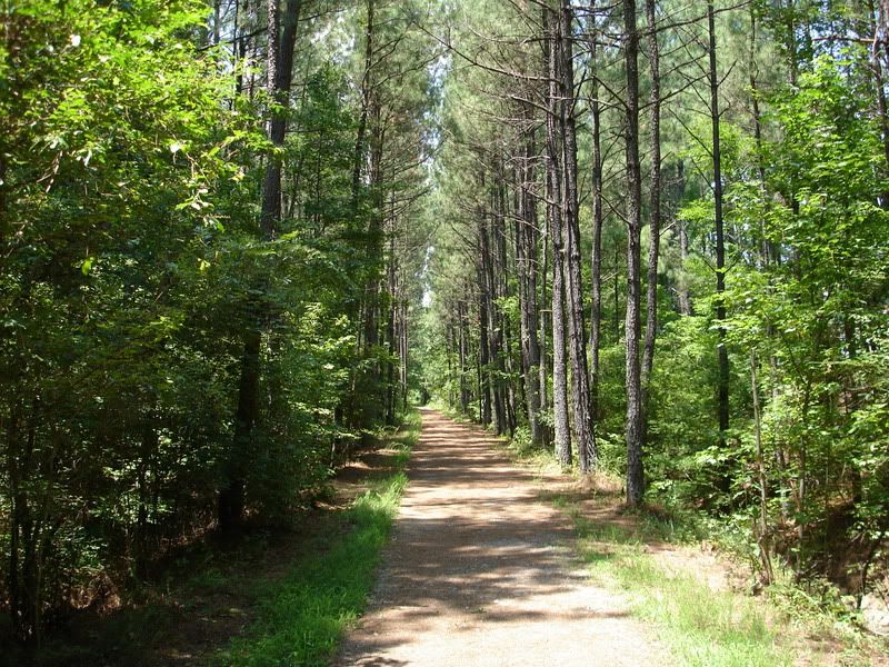
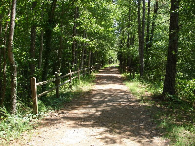
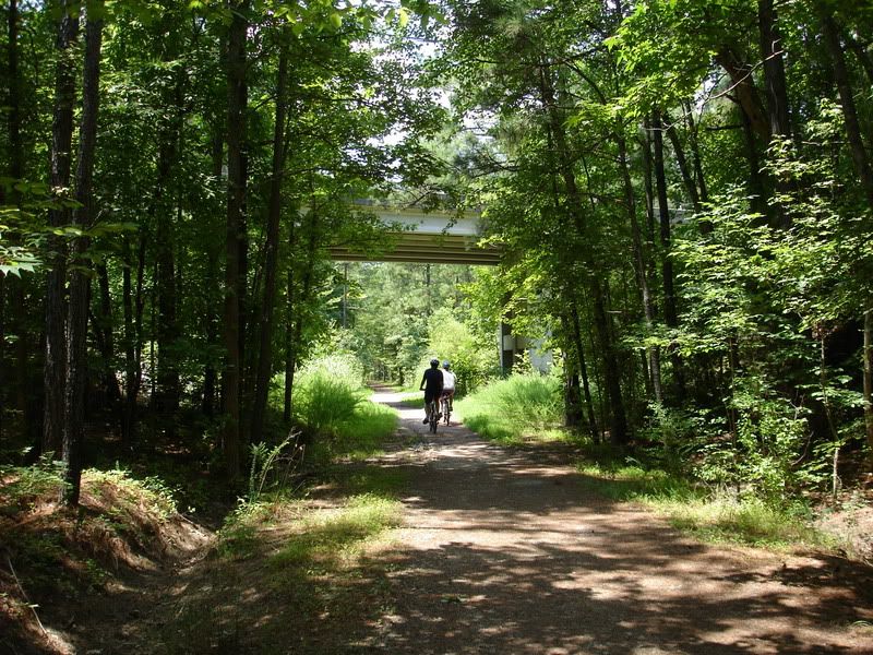
Thanks for the help everyone. I have made notes of all your suggestions and will check them out. I would really like to get much more familiar with the Trail and it's various access points. Today we ended up picking up the trail just south of the Southpoint Mall. There is a small gravel parking lot by the trail across from the New Hope Church. I plan to go back next time and take the trail a little further. It was pretty hot today!
Thanks again for all the help!
Here are a few quick pics from that part of the trail.
I'm no expert, NRG, but the spot that immediately springs to my mind is the shopping center that contains the Kroger on the northwest corner of the intersection at Hwy 54 & Fayetteville St (just north of Southpoint). The American Tobacco Trail is on the east side of that large shopping center. Go north on the trail & I you'll be shaded by trees for a couple of miles I think.
For the Durham section, your best bet is to park at either end of the completed stretch of trail. The park & ride lot at NC54 and Fayetteville mentioned previously may be preferred, as there is plenty of parking and I would not hesitate to leave my car here. Exit I-40 (exit 276) at Fayetteville heading north. Turn left and park in lot near Kroger/Adam&Eve.
The other (northern) end of the trail is just under the NC147 freeway from the Durham Bulls Athletic Park. Perhaps not as ideal place to leave your car, but very close to the ball park and American Tobacco Complex (Mellow Mushroom, Tylers, etc).
This section is about a 13 mile round trip, all paved.
Please register to post and access all features of our very popular forum. It is free and quick. Over $68,000 in prizes has already been given out to active posters on our forum. Additional giveaways are planned.
Detailed information about all U.S. cities, counties, and zip codes on our site: City-data.com.

 Please register to participate in our discussions with 2 million other members - it's free and quick! Some forums can only be seen by registered members. After you create your account, you'll be able to customize options and access all our 15,000 new posts/day with fewer ads.