Please register to participate in our discussions with 2 million other members - it's free and quick! Some forums can only be seen by registered members. After you create your account, you'll be able to customize options and access all our 15,000 new posts/day with fewer ads.
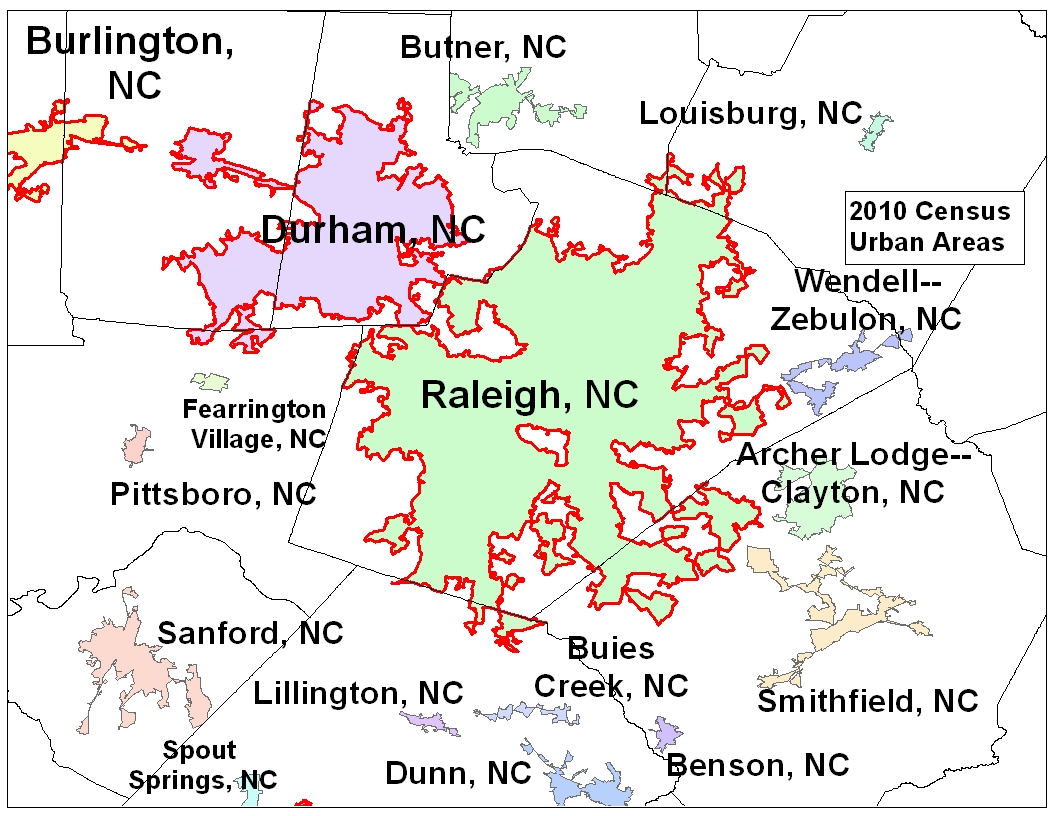
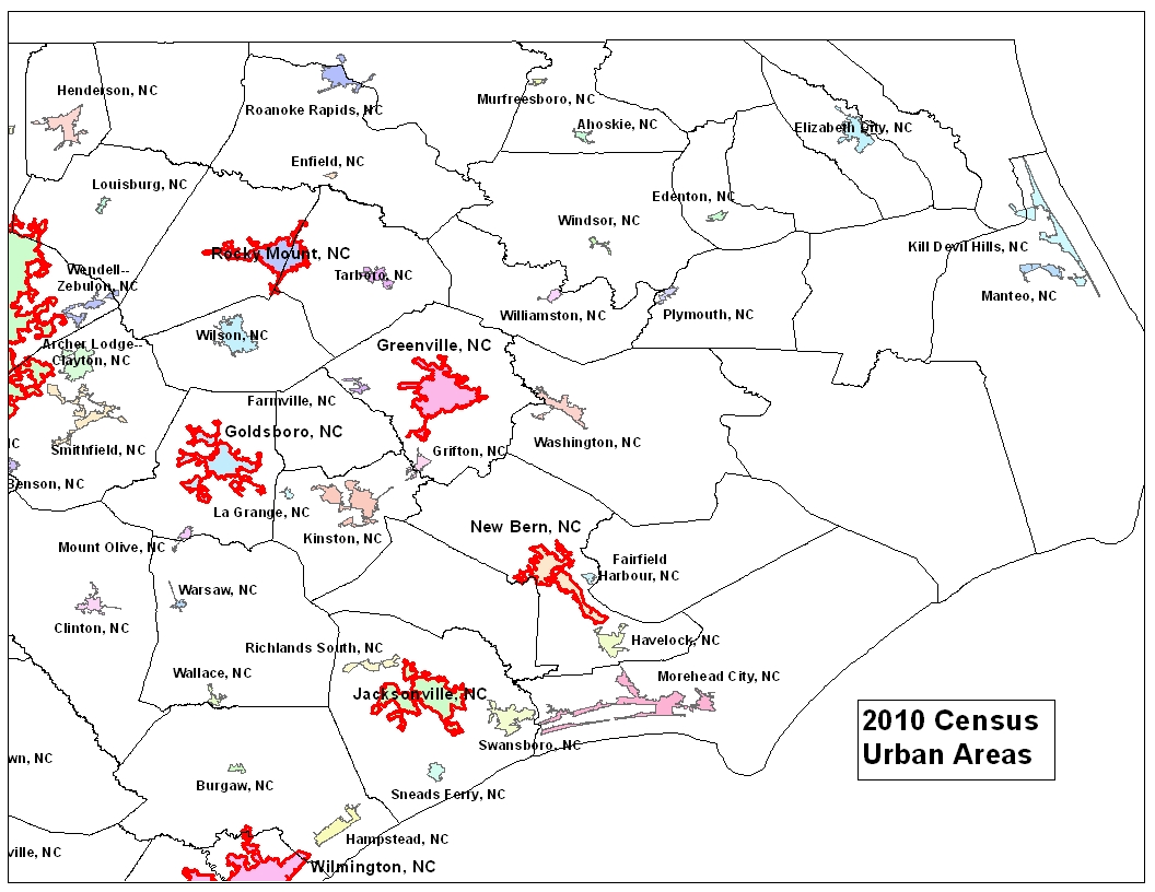
The Census Bureau released the urban areas from the 2010 census last week. More information is here; 2010 Urban and Rural Classification Main Page. Areas with a population of 50,000 or more are classified as urbanized areas, and are the basis for qualifying metropolitan areas. Areas with a population of 2,500 to 49,999 are classified as urban clusters. An urban cluster with a population of 10,000 or more is the basis for qualifying an area as a micropolitan area.
I made these maps quickly to show the areas in North carolina. Urbanized areas are outlined in red. Urban clusters are not outlined.
These are from the shapefiles available for downloading from the census web site. I opened them in ArcMap, made the maps, and exported them to JPG iles. The Census Bureau won't have detailed maps available until this summer.
Am a bit taken aback that anyone, anywhere, even in the gubment could include Cedar Island in any connotation of URBAN. Guess I learned something today.
I've looked at those. They show mountains from above but I am looking for side views that give me a better idea of the rise and or fall of the landscape. Even topos that give me the actual elevation don't really give the the effect of what an area looks like since I don't have a good frame of reference. But thanks for your 'helpful?' suggestion anyway.
There has been an outcry against the census for its seemingly arbitrary designation of urbanized areas. The Charlotte urbanized area is being cited as the most egregious illustration of how nonsensical the Census Bureau's designations are.
Location: The place where the road & the sky collide
23,814 posts, read 34,678,989 times
Reputation: 10256
Quote:
Originally Posted by Tarheelhombre
There has been an outcry against the census for its seemingly arbitrary designation of urbanized areas. The Charlotte urbanized area is being cited as the most egregious illustration of how nonsensical the Census Bureau's designations are.
Where's the problem?
Please register to post and access all features of our very popular forum. It is free and quick. Over $68,000 in prizes has already been given out to active posters on our forum. Additional giveaways are planned.
Detailed information about all U.S. cities, counties, and zip codes on our site: City-data.com.

 Please register to participate in our discussions with 2 million other members - it's free and quick! Some forums can only be seen by registered members. After you create your account, you'll be able to customize options and access all our 15,000 new posts/day with fewer ads.