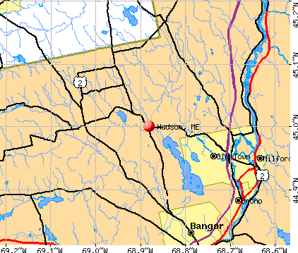
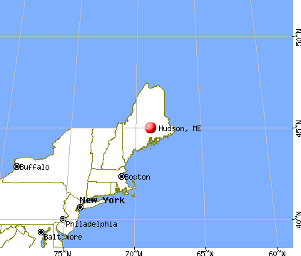
Hudson, Maine
Submit your own pictures of this town and show them to the world
- OSM Map
- General Map
- Google Map
- MSN Map
Population change since 2000: +10.3%
 |
| Males: 766 | |
| Females: 770 |
| Median resident age: | 40.0 years |
| Maine median age: | 43.0 years |
Zip codes: 04449.
| Hudson: | $68,840 |
| ME: | $69,543 |
Estimated per capita income in 2022: $31,863 (it was $15,850 in 2000)
Hudson town income, earnings, and wages data
Estimated median house or condo value in 2022: $196,976 (it was $75,700 in 2000)
| Hudson: | $196,976 |
| ME: | $290,600 |
Mean prices in 2022: all housing units: $235,563; detached houses: $252,705; townhouses or other attached units: $267,749; in 2-unit structures: $255,332; in 3-to-4-unit structures: $815,300; in 5-or-more-unit structures: $185,873; mobile homes: $93,017; occupied boats, rvs, vans, etc.: $21,333
Detailed information about poverty and poor residents in Hudson, ME
Compare current foreclosures near Hudson, ME:
| Photo | Address | Area | Beds / Baths | Price | Details |
|---|---|---|---|---|---|

|
#1
Upper Cross Rd
Hudson, ME 04449
|
1,344 sq. feet
|
2 baths 3 beds |
show details | |

|
#2
Davenport St
Milford, ME 04461
|
1,200 sq. feet
|
2 baths 3 beds |
$269,900
|
show details |

|
#3
Hudson Hill Rd
Hudson, ME 04449
|
- sq. feet
|
- baths - beds |
show details | |

|
#4
Hudson Rd
Hudson, ME 04449
|
- sq. feet
|
- baths - beds |
show details | |

|
#5
Kenduskeag Levant Rd
Kenduskeag, ME 04450
|
- sq. feet
|
2 baths 3 beds |
show details | |

|
#6
Elm St
Bangor, ME 04401
|
1,700 sq. feet
|
2 baths 4 beds |
show details | |

|
#7
Lincoln St
Old Town, ME 04468
|
725 sq. feet
|
1 baths 3 beds |
show details | |

|
#8
Allen St
Bangor, ME 04401
|
1,200 sq. feet
|
1 baths 3 beds |
show details | |

|
#9
Grove St
Bangor, ME 04401
|
910 sq. feet
|
1 baths 3 beds |
show details | |

|
#10
Baker Blvd Ste 205
Brewer, ME 04412
|
- sq. feet
|
- baths - beds |
show details |
| Photo | Address | Area | Beds / Baths | Price | Details |
|---|---|---|---|---|---|

|
#11
Cedar St Apt 4
Bangor, ME 04401
|
- sq. feet
|
- baths - beds |
show details | |

|
#12
Pine St # B
Bangor, ME 04401
|
- sq. feet
|
- baths - beds |
show details | |

|
#13
Stillwater Ave
Bangor, ME 04401
|
- sq. feet
|
- baths - beds |
show details | |

|
#14
Harris Rd Apt 31
Orono, ME 04473
|
- sq. feet
|
- baths - beds |
show details | |

|
#15
Wolfboro Rd
Stetson, ME 04488
|
- sq. feet
|
- baths - beds |
show details | |

|
#16
Summer St
Old Town, ME 04468
|
- sq. feet
|
- baths - beds |
show details | |

|
#17
Call Rd # D
Milford, ME 04461
|
- sq. feet
|
- baths - beds |
show details | |

|
#18
Exeter Rd
Corinth, ME 04427
|
- sq. feet
|
- baths - beds |
show details | |

|
#19
Morison Ave
Corinth, ME 04427
|
- sq. feet
|
- baths - beds |
show details | |

|
#20
Broadway
Kenduskeag, ME 04450
|
- sq. feet
|
- baths - beds |
show details |
| Photo | Address | Area | Beds / Baths | Price | Details |
|---|---|---|---|---|---|

|
#21
Hampden Rd
Carmel, ME 04419
|
- sq. feet
|
- baths - beds |
show details | |

|
#22
Kenduskeag Ave # 24
Bangor, ME 04401
|
- sq. feet
|
- baths - beds |
show details | |

|
#23
Greenfield Rd
Greenbush, ME 04418
|
- sq. feet
|
- baths - beds |
show details | |
|
|
#24
York Rd
Bangor, ME 04401
|
- sq. feet
|
- baths - beds |
show details | |

|
#25
Main St
Bangor, ME 04401
|
- sq. feet
|
- baths - beds |
show details | |

|
#26
Aa Landing Rd
Bangor, ME 04401
|
- sq. feet
|
- baths - beds |
show details | |

|
#27
Ash Ln
Bangor, ME 04401
|
- sq. feet
|
- baths - beds |
show details | |

|
#28
Treats Falls Dr
Brewer, ME 04412
|
- sq. feet
|
- baths - beds |
show details | |

|
#29
Cedar Breeze N
Bangor, ME 04401
|
- sq. feet
|
- baths - beds |
show details | |

|
Check over 1 million property listings on Foreclosure.com!
|
browse all offers | |||

- 1,49097.0%White alone
- 201.3%Two or more races
- 100.7%American Indian alone
- 110.7%Hispanic
- 30.2%Asian alone
- 20.1%Black alone

Races in Hudson detailed stats: ancestries, foreign born residents, place of birth
According to our research of Maine and other state lists, there were 5 registered sex offenders living in Hudson, Maine as of May 23, 2024.
The ratio of all residents to sex offenders in Hudson is 307 to 1.
 Recent articles from our blog. Our writers, many of them Ph.D. graduates or candidates, create easy-to-read articles on a wide variety of topics.

 | Relocating to the Northern Maine area (10 replies) |
| Anyone have a good route VA to ME- by Monday (43 replies) |
| Looking to move outside Bangor with kids (6 replies) |
| How best to get from Atlanta, Georgia to Augusta, Maine? (18 replies) |
| I'm In Maine (13 replies) |
| Does Sebec exist? (20 replies) |
Latest news from Hudson, ME collected exclusively by city-data.com from local newspapers, TV, and radio stations
Ancestries: French (15.0%), Irish (14.9%), English (12.7%), United States (12.5%), German (6.0%), French Canadian (5.5%).
Current Local Time: EST time zone
Incorporated on 02/25/1825
Elevation: 137 feet
Land area: 37.8 square miles.
Population density: 41 people per square mile (very low).
22 residents are foreign born
| This town: | 1.6% |
| Maine: | 2.9% |
| Hudson town: | 1.1% ($864) |
| Maine: | 1.5% ($1,417) |
Nearest city with pop. 50,000+: Portland, ME  (115.1 miles , pop. 64,249).
Nearest city with pop. 200,000+: Boston, MA (215.7 miles , pop. 589,141).
Nearest city with pop. 1,000,000+: Bronx, NY (382.6 miles , pop. 1,332,650).
Nearest cities:
), ), ), ), ), ), Latitude: 45.00 N, Longitude: 68.88 W
Area code commonly used in this area: 207


Single-family new house construction building permits:
- 2022: 6 buildings, average cost: $279,200
- 2017: 2 buildings, average cost: $114,500
- 2016: 3 buildings, average cost: $76,700
- 2015: 1 building, cost: $82,500
- 2014: 4 buildings, average cost: $132,500
- 2013: 3 buildings, average cost: $45,000
- 2012: 4 buildings, average cost: $107,800
- 2011: 4 buildings, average cost: $95,000
- 2010: 2 buildings, average cost: $112,500
- 2009: 2 buildings, average cost: $70,000
- 2008: 3 buildings, average cost: $136,700
- 2007: 1 building, cost: $125,000
- 2006: 9 buildings, average cost: $84,300
- 2005: 13 buildings, average cost: $81,600
- 2004: 9 buildings, average cost: $140,000
- 2003: 13 buildings, average cost: $120,000
- 2002: 12 buildings, average cost: $130,700


| Here: | 2.6% |
| Maine: | 3.4% |


- Health care (11.2%)
- Construction (9.9%)
- Educational services (7.4%)
- Accommodation & food services (5.5%)
- Food & beverage stores (5.1%)
- Public administration (3.9%)
- Motor vehicle & parts dealers (3.6%)

- Construction (17.1%)
- Motor vehicle & parts dealers (6.1%)
- Public administration (4.5%)
- Educational services (4.5%)
- Paper (4.3%)
- Transportation equipment (4.0%)
- Machinery (3.7%)

- Health care (21.5%)
- Educational services (10.9%)
- Food & beverage stores (9.6%)
- Accommodation & food services (9.6%)
- Department & other general merchandise stores (5.5%)
- Social assistance (4.5%)
- Professional, scientific, technical services (3.5%)

- Vehicle and mobile equipment mechanics, installers, and repairers (6.9%)
- Building and grounds cleaning and maintenance occupations (4.8%)
- Other office and administrative support workers, including supervisors (4.2%)
- Electrical equipment mechanics and other installation, maintenance, and repair workers, including supervisors (3.6%)
- Other sales and related occupations, including supervisors (3.5%)
- Other production occupations, including supervisors (3.4%)
- Metal workers and plastic workers (3.4%)

- Vehicle and mobile equipment mechanics, installers, and repairers (11.5%)
- Electrical equipment mechanics and other installation, maintenance, and repair workers, including supervisors (6.1%)
- Carpenters (5.6%)
- Building and grounds cleaning and maintenance occupations (5.3%)
- Metal workers and plastic workers (5.3%)
- Construction traders workers except carpenters, electricians, painters, plumbers, and construction laborers (4.8%)
- Other production occupations, including supervisors (4.8%)

- Secretaries and administrative assistants (7.1%)
- Other office and administrative support workers, including supervisors (6.1%)
- Nursing, psychiatric, and home health aides (5.8%)
- Waiters and waitresses (4.8%)
- Other sales and related occupations, including supervisors (4.8%)
- Cashiers (4.8%)
- Building and grounds cleaning and maintenance occupations (4.2%)
Average climate in Hudson, Maine
Based on data reported by over 4,000 weather stations


(lower is better)

Air Quality Index (AQI) level in 2023 was 61.1. This is about average.
| City: | 61.1 |
| U.S.: | 72.6 |

Ozone [ppb] level in 2023 was 33.6. This is about average. Closest monitor was 11.8 miles away from the city center.
| City: | 33.6 |
| U.S.: | 33.3 |

Particulate Matter (PM2.5) [µg/m3] level in 2023 was 5.62. This is significantly better than average. Closest monitor was 12.3 miles away from the city center.
| City: | 5.62 |
| U.S.: | 8.11 |
Earthquake activity:
Hudson-area historical earthquake activity is significantly above Maine state average. It is 81% smaller than the overall U.S. average.On 4/20/2002 at 10:50:47, a magnitude 5.3 (5.3 ML, Depth: 3.0 mi, Class: Moderate, Intensity: VI - VII) earthquake occurred 239.0 miles away from Hudson center
On 10/16/2012 at 23:12:25, a magnitude 4.7 (4.7 ML, Depth: 10.0 mi, Class: Light, Intensity: IV - V) earthquake occurred 131.0 miles away from Hudson center
On 4/20/2002 at 10:50:47, a magnitude 5.2 (5.2 MB, 4.2 MS, 5.2 MW, 5.0 MW) earthquake occurred 240.3 miles away from Hudson center
On 10/7/1983 at 10:18:46, a magnitude 5.3 (5.1 MB, 5.3 LG, 5.1 ML) earthquake occurred 279.1 miles away from Hudson center
On 1/19/1982 at 00:14:42, a magnitude 4.7 (4.5 MB, 4.7 MD, 4.5 LG) earthquake occurred 170.1 miles away from Hudson center
On 2/26/1999 at 03:38:43, a magnitude 3.8 (3.8 LG, Depth: 2.0 mi, Class: Light, Intensity: II - III) earthquake occurred 47.8 miles away from Hudson center
Magnitude types: regional Lg-wave magnitude (LG), body-wave magnitude (MB), duration magnitude (MD), local magnitude (ML), surface-wave magnitude (MS), moment magnitude (MW)
Natural disasters:
The number of natural disasters in Penobscot County (19) is greater than the US average (15).Major Disasters (Presidential) Declared: 11
Emergencies Declared: 7
Causes of natural disasters: Floods: 9, Storms: 8, Snows: 5, Heavy Rains: 2, Blizzard: 1, Hurricane: 1, Ice Storm: 1, Snowfall: 1, Wind: 1, Winter Storm: 1, Other: 2 (Note: some incidents may be assigned to more than one category).
Hospitals and medical centers near Hudson:
- ORONO COMMONS (Nursing Home, about 13 miles away; ORONO, ME)
- BANGOR AREA VISITING NURSES (Home Health Center, about 14 miles away; BANGOR, ME)
- HOSPICE OF EASTERN MAINE (Hospital, about 14 miles away; BANGOR, ME)
- TREATS FALLS HOUSE (Hospital, about 14 miles away; ORONO, ME)
- ROSS MANOR (Nursing Home, about 14 miles away; BANGOR, ME)
- STILLWATER HEALTH CARE (Nursing Home, about 14 miles away; BANGOR, ME)
- KINDRED NURSING AND REHABILITATION-WESTGATE (Nursing Home, about 14 miles away; BANGOR, ME)
Colleges/universities with over 2000 students nearest to Hudson:
- University of Maine (about 13 miles; Orono, ME; Full-time enrollment: 8,931)
- Husson University (about 13 miles; Bangor, ME; FT enrollment: 2,421)
- University of Maine at Augusta (about 65 miles; Augusta, ME; FT enrollment: 3,204)
- University of Maine at Farmington (about 67 miles; Farmington, ME; FT enrollment: 2,036)
- Saint Joseph's College of Maine (about 114 miles; Standish, ME; FT enrollment: 2,010)
- Southern Maine Community College (about 115 miles; South Portland, ME; FT enrollment: 4,666)
- University of Southern Maine (about 116 miles; Portland, ME; FT enrollment: 6,647)
Public elementary/middle school in Hudson:
- HUDSON ELEMENTARY SCHOOL (Location: 2150 HUDSON RD, Grades: 3-4)
Points of interest:
Notable locations in Hudson: Ricker Siding (A), Hudson Volunteer Fire Department (B). Display/hide their locations on the map
Church in Hudson: Penobscot Valley Church of Christ (A). Display/hide its location on the map
Lakes and swamps: Little Pushaw Pond (A), Call Bog (B). Display/hide their locations on the map
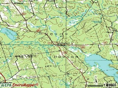
Streams, rivers, and creeks: Logan Brook (A), Keyser Brook (B), Forbes Brook (C), Hudson Brook (D), Mohawk Stream (E), Beaver Meadow (F), Bear Brook (G). Display/hide their locations on the map
| This town: | 2.6 people |
| Maine: | 2.3 people |
| This town: | 72.4% |
| Whole state: | 62.9% |
| This town: | 13.4% |
| Whole state: | 9.4% |
Likely homosexual households (counted as self-reported same-sex unmarried-partner households)
- Lesbian couples: 0.8% of all households
- Gay men: 0.3% of all households
| This town: | 13.0% |
| Whole state: | 10.9% |
| This town: | 5.1% |
| Whole state: | 4.1% |
For population 15 years and over in Hudson:

- Never married: 23.1%
- Now married: 63.0%
- Separated: 1.0%
- Widowed: 3.1%
- Divorced: 9.8%
For population 25 years and over in Hudson:
- High school or higher: 80.0%
- Bachelor's degree or higher: 13.5%
- Graduate or professional degree: 4.5%
- Unemployed: 7.4%
- Mean travel time to work (commute): 29.3 minutes


| Here: | 10.9 |
| Maine average: | 11.2 |


Graphs represent county-level data. Detailed 2008 Election Results
Religion statistics for Hudson, ME (based on Penobscot County data)


| Religion | Adherents | Congregations |
|---|---|---|
| Catholic | 16,581 | 15 |
| Mainline Protestant | 9,715 | 59 |
| Evangelical Protestant | 7,523 | 80 |
| Other | 2,936 | 22 |
| Orthodox | 300 | 1 |
| None | 116,868 | - |
Food Environment Statistics:
| Penobscot County: | 2.29 / 10,000 pop. |
| Maine: | 2.80 / 10,000 pop. |
| Penobscot County: | 0.13 / 10,000 pop. |
| Maine: | 0.14 / 10,000 pop. |
| Penobscot County: | 2.56 / 10,000 pop. |
| Maine: | 2.20 / 10,000 pop. |
| Penobscot County: | 5.72 / 10,000 pop. |
| Maine: | 5.75 / 10,000 pop. |
| This county: | 7.41 / 10,000 pop. |
| Maine: | 11.02 / 10,000 pop. |
| This county: | 9.0% |
| Maine: | 8.2% |
| Here: | 28.0% |
| State: | 25.0% |
Strongest AM radio stations in Hudson:
- WZON (620 AM; 5 kW; BANGOR, ME; Owner: THE ZONE CORPORATION)
- WABI (910 AM; 5 kW; BANGOR, ME; Owner: CLEAR CHANNEL BROADCASTING LICENSES, INC.)
- WSKW (1160 AM; 10 kW; SKOWHEGAN, ME; Owner: MOUNTAIN WIRELESS, INCORPORATED)
- WNZS (1340 AM; 1 kW; VEAZIE, ME; Owner: WATERFRONT COMMUNICATIONS INC.)
- WDEA (1370 AM; 5 kW; ELLSWORTH, ME; Owner: CUMULUS LICENSING CORP.)
- WTME (780 AM; 10 kW; RUMFORD, ME; Owner: MOUNTAIN VALLEY BROADCASTING, INC.)
- WRKO (680 AM; 50 kW; BOSTON, MA; Owner: ENTERCOM BOSTON LICENSE, LLC)
- WEEI (850 AM; 50 kW; BOSTON, MA; Owner: ENTERCOM BOSTON LICENSE, LLC)
- WBZ (1030 AM; 50 kW; BOSTON, MA; Owner: INFINITY BROADCASTING OPERATIONS, INC.)
- WCRN (830 AM; 50 kW; WORCESTER, MA; Owner: CARTER BROADCASTING CORPORATION)
- WNNZ (640 AM; 50 kW; WESTFIELD, MA; Owner: CLEAR CHANNEL BROADCASTING LICENSES, INC.)
- WCHP (760 AM; 35 kW; CHAMPLAIN, NY; Owner: CHAMPLAIN RADIO, INC.)
- WFAU (1280 AM; 5 kW; GARDINER, ME; Owner: CAPSTAR TX LIMITED PARTNERSHIP)
Strongest FM radio stations in Hudson:
- WBZN (107.3 FM; OLD TOWN, ME; Owner: CUMULUS LICENSING CORP.)
- WVOM (103.9 FM; HOWLAND, ME; Owner: CLEAR CHANNEL BROADCASTING LICENSES, INC.)
- WQCB (106.5 FM; BREWER, ME; Owner: CUMULUS LICENSING CORP.)
- WHCF (88.5 FM; BANGOR, ME; Owner: BANGOR BAPTIST CHURCH)
- WWBX (97.1 FM; BANGOR, ME; Owner: CLEAR CHANNEL BROADCASTING LICENSES, INC.)
- WKIT-FM (100.3 FM; BREWER, ME; Owner: THE ZONE CORPORATION)
- WMEH (90.9 FM; BANGOR, ME; Owner: MAINE PUBLIC BROADCASTING CORPORATION)
- WWMJ (95.7 FM; ELLSWORTH, ME; Owner: CUMULUS LICENSING CORP.)
- WGUY (102.1 FM; DEXTER, ME; Owner: CONCORD MEDIA GROUP, INC.)
- WBFB (104.7 FM; BELFAST, ME; Owner: CLEAR CHANNEL BROADCASTING LICENSES, INC.)
- WEZQ (92.9 FM; BANGOR, ME; Owner: CUMULUS LICENSING CORP.)
- WFZX (101.7 FM; SEARSPORT, ME; Owner: CLEAR CHANNEL BROADCASTING LICENSES, INC.)
- WMEB-FM (91.9 FM; ORONO, ME; Owner: UNIVERSITY OF MAINE SYSTEM)
- WERU-FM (89.9 FM; BLUE HILL, ME; Owner: SALT POND COMMUNITY B/C COMPANY)
- WDME-FM (103.1 FM; DOVER-FOXCROFT, ME; Owner: THE ZONE CORPORATION)
- WHMX (105.7 FM; LINCOLN, ME; Owner: BANGOR BAPTIST CHURCH)
- WJCX (99.5 FM; PITTSFIELD, ME; Owner: CSN INTERNATIONAL)
TV broadcast stations around Hudson:
- WABI-TV (Channel 5; BANGOR, ME; Owner: COMMUNITY BROADCASTING SERVICE)
- WMEB-TV (Channel 12; ORONO, ME; Owner: MAINE PUBLIC BROADCASTING CORPORATION)
- WLBZ (Channel 2; BANGOR, ME; Owner: PACIFIC AND SOUTHERN COMPANY, INC.)
- WBGR-LP (Channel 33; BANGOR/DEDHAM, ME; Owner: MAINE FAMILY BROADCASTING, INC.)
- W36CK (Channel 36; BANGOR, ME; Owner: TRINITY BROADCASTING NETWORK)
- WCKD-LP (Channel 30; BANGOR/DEDHAM, ME; Owner: J. MCLEOD, ME FAMILY B/CING., INC.)
- Hudson, Maine
- Fatal accident count9
- Vehicles involved in fatal accidents11
- Fatal accidents involving drunk persons:5
- Fatalities10
- Persons involved in fatal accidents20
- Pedestrians involved in fatal accidents0
- Maine average
- Fatal accident count1466
- Vehicles involved in fatal accidents2115
- Fatal accidents involving drunk persons556
- Fatalities1587
- Persons involved in fatal accidents3303
- Pedestrians involved in fatal accidents98
- National Bridge Inventory (NBI) Statistics
- 1Number of bridges
- 3ft / 0.9mTotal length
- 2,224Total average daily traffic
- 111Total average daily truck traffic
- 3,114Total future (year 2036) average daily traffic
FCC Registered Antenna Towers:
7- Peter M Connolly, 258 Potter Road (Lat: 44.950556 Lon: -68.910472), Type: 76.2, Overall height: 73.1 m, Registrant: Holland & Knight LLP, Pconnolly@hklaw.Com, , Washi-ngton, Phone: (202) 862-5989
- Peter M Connolly, 258 Potter Road (Lat: 44.950556 Lon: -68.910472), Type: 76.2, Overall height: 73.1 m, Registrant: Holland & Knight LLP, Pconnolly@hklaw.Com, , Washi-ngton, Phone: (202) 862-5989
- Cayla Gamble, 258 Potter Road (Lat: 44.950611 Lon: -68.910472), Type: 76.2, Structure height: 23019 m, Overall height: 73.2 m, Registrant: Holland & Knight LLP, Peter.Connolly@hklaw.Com, , Washi-ngton, Phone: (202) 862-5989
- Cayla Gamble, 258 Potter Road (Lat: 44.950611 Lon: -68.910472), Type: 76.2, Structure height: 23019 m, Overall height: 73.2 m, Licensee ID: C, Registrant: United States Cellular Corporation, Regulatoryaffairs@uscellular.Com, , Chica-go, Phone: (800) 510-6091
- Cayla Gamble, 258 Potter Road (Lat: 44.950611 Lon: -68.910472), Type: 76.2, Structure height: 23019 m, Overall height: 73.2 m, Registrant: Wilkinson Barker Knauer, LLP, Gwerner@wbklaw.Com, , Washi-ngton, Phone: (202) 383-3420
- Cayla Gamble, 258 Potter Road (Lat: 44.950611 Lon: -68.910472), Type: 76.2, Structure height: 23019 m, Overall height: 73.2 m, Registrant: Wilkinson Barker Knauer, LLP, Gwerner@wbklaw.Com, , Washi-ngton, Phone: (202) 383-3420
- Cayla Gamble, 258 Potter Road (Lat: 44.950611 Lon: -68.910472), Type: 76.2, Structure height: 23019 m, Overall height: 73.2 m, Registrant: Wilkinson Barker Knauer, LLP, Gwerner@wbklaw.Com, , Washi-ngton, Phone: (202) 383-3420
FCC Registered Microwave Towers:
1- Hudson, 258 Potter Road (Lat: 44.950556 Lon: -68.910472), Type: Ltower, Structure height: 73.5 m, Overall height: 75.3 m, Call Sign: WQTQ592,
Assigned Frequencies: 11385.0 MHz, 11225.0 MHz, 11385.0 MHz, 11225.0 MHz, 11385.0 MHz, 11225.0 MHz, 11385.0 MHz, 11225.0 MHz, 11385.0 MHz, 11225.0 MHz... (+17 more), Grant Date: 03/25/2014, Expiration Date: 03/25/2024, Cancellation Date: 09/17/2020, Certifier: Jessica B Lyons, Registrant: At&t Services, Inc., 208 S. Akard St., Room 2100, Dallas, TX 75202, Phone: (855) 699-7073, Email:
FCC Registered Amateur Radio Licenses:
8 (See the full list of FCC Registered Amateur Radio Licenses in Hudson)FAA Registered Aircraft:
3- Aircraft: WEST KENNETH C STINGRAY (Category: Amphibian, Weight: Up to 12,499 Pounds), Engine: BOMBARDIER ROTAX (ALL) (Reciprocating)
N-Number: 1144D, N1144D, N-1144D, Serial Number: 2DK005, Year manufactured: 1997, Airworthiness Date: 02/21/1997, Certificate Issue Date: 11/12/2003
Registrant (Individual): Mark A Mackinnon, Po Box 241, Hudson, ME 04449 - Aircraft: STINSON 108-3 (Category: Land, Seats: 4, Weight: Up to 12,499 Pounds, Speed: 94 mph), Engine: FRANKLIN 6A4165 SERIES (165 HP) (Reciprocating)
N-Number: 4023C, N4023C, N-4023C, Serial Number: 108-5023, Year manufactured: 1948, Certificate Issue Date: 09/03/2019
Registrant (Individual): Peter J Hooke, 502 Hudson Hill Rd, Hudson, ME 04449 - Aircraft: JONES MICHAEL C SONEX (Category: Land, Seats: 2, Weight: Up to 12,499 Pounds), Engine: AMA/EXPR UNKNOWN ENG (Reciprocating)
N-Number: 838SX, N838SX, N-838SX, Serial Number: 0838, Year manufactured: 2006, Airworthiness Date: 10/07/2006, Certificate Issue Date: 06/05/2006
Registrant (Individual): Michael C Jones, 2576 Hudson Rd, Hudson, ME 04449
2003 - 2018 National Fire Incident Reporting System (NFIRS) incidents
- Fire incident types reported to NFIRS in Hudson, ME
- 7170.3%Structure Fires
- 1817.8%Outside Fires
- 65.9%Mobile Property/Vehicle Fires
- 65.9%Other
 According to the data from the years 2003 - 2018 the average number of fire incidents per year is 6. The highest number of reported fire incidents - 18 took place in 2004, and the least - 2 in 2007. The data has an increasing trend.
 When looking into fire subcategories, the most incidents belonged to: Structure Fires (70.3%), and Outside Fires (17.8%).
- 84.5%Fuel oil, kerosene, etc.
- 9.7%Wood
- 5.3%Bottled, tank, or LP gas
- 0.4%Electricity

- 81.8%Fuel oil, kerosene, etc.
- 10.9%Wood
- 3.6%Bottled, tank, or LP gas
- 3.6%Electricity
Hudson compared to Maine state average:
- Unemployed percentage below state average.
- Black race population percentage significantly below state average.
- Hispanic race population percentage below state average.
- Foreign-born population percentage significantly below state average.
- Renting percentage below state average.
- Length of stay since moving in significantly above state average.
- Number of rooms per house significantly below state average.
- House age significantly below state average.
- Percentage of population with a bachelor's degree or higher below state average.