Los Angeles, California Neighborhood Map - Income, House Prices, Occupations, Boundaries
Settings
X

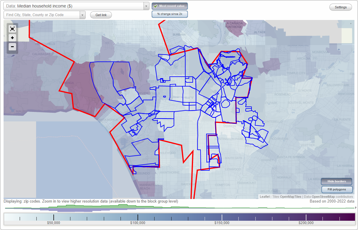
- City boundary
- Neighborhood boundaries
Business Search - 14 Million verified businesses
Neighborhoods:
Arroyo Seco, Artists District, Atwater Village, Bandini, Bel Air, Belvedere, Boyle Heights, Brentwood, Bunker Hill, Center City, Century City, Chinatown, City Terrace, Civic Center, Colorado Boulevard, Crenshaw, Culver West, Cypress Park, Downtown Los Angeles, Eagle Rock, East Hollywood, East L.A., Eastmont, Echo Park, El Sereno, Fashion District, Financial District, Florence, Gallery Row, Glassel Park, Glassell Park, Graham, Hancock Park, Helms District, Hermon, Highland Park, Historic Core, Hollywood Hills, Imperial Highway, Koreatown, Laguna, Lincoln Heights, Little Armenia, Little Tokyo, Los Feliz, Mar Vista, McLaughlin, Media District, Mid-Wilshire, Montecito Heights, Monterey Hills, Mount Washington, Northeast Los Angeles, Palms, Pico-Union, Playa Del Rey, Rosewood Park, Silverlake, Simons, Skid Row, SoFo, South park, Southeast Los Angeles, Thai Town, Toy District, Watts, Wellington Heights, West Adams, West Hollywood West, West LA, Westside, Westwood, Whittier, Wholesale District, WilshireArroyo Seco neighborhood in Los Angeles statistics: (Find on map)
Area: 0.825 square miles
Population: 13,463
Population density:
Median household income in 2021:
Median rent in in 2021:
Male vs Females
Median age
Housing prices:
Average estimated value of detached houses in 2021 (25.4% of all units):
Average estimated value of townhouses or other attached units in 2021 (16.6% of all units):
Most popular occupations of males: construction, extraction, and maintenance occupations (17.9%); service occupations (15.0%); sales and office occupations (11.3%); production occupations (10.6%); transportation occupations (8.6%); management occupations (except farmers) (7.5%); material moving occupations (5.1%)
Most popular occupations of females: service occupations (32.8%); sales and office occupations (24.9%); production occupations (10.4%); management occupations (except farmers) (6.2%); business and financial operations occupations (5.8%); education, training, and library occupations (4.3%); material moving occupations (4.2%)
Limited-access highways (interstate or state) in this neighborhood: US Hwy 101 (I- 5, Santa Ana Fwy); I- 10 (San Bernardino Fwy); San Bernardino Fwy; Golden State Fwy; US Hwy 101.
Roads and streets: W San Bernadino Fwy; E Cesar E Chavez Ave; E 1st St; Echandia St; Pennsylvania Ave; N Saint Louis St; Michigan Ave; N State St; N Cummings St; N Boyle Ave; N Chicago St; Bridge St; E 3rd St; Pleasant Ave; Bailey St; E 2nd St; City View Ave; Sheridan St; E 4th St; N Breed St; Brittania St; Cornwell St; S Gless St; S Pecan St; New Jersey St; S Boyle Ave; E San Bernadino Fwy; Kearney St; Pso el Coronel; S State St; San Benito St; N Clarence St; Judson St; S Cummings St; Via Los Santos St; Progress Pl; Warren St; S Saint Louis St; Bird St; Mitchell Pl; S Santa Ana Fwy; Via Las Vegas; E Via Francisca; Pso la Zanja; Gillette St; S Chicago St; Via Nicola St; Hammond St; Sheridan Pl; Fairview Ave; Pso Valdez; Gertrude St; Bodie St; Rivera Ct; Cancion Ct; Summit Ave; Deodara St; N Gless St; Dahlia Ct; Solana Ct; Via Nicola; Via Portola; Kolster St; Bodega Ct; Enero Ct; Eudora Ct; Estepona Ct; Las Vegas St; Kemmett Ct.
Railroad features: Southern Pacific RR.
Arroyo Seco neighborhood detailed profile
Area: 0.825 square miles
Population: 13,463
Population density:
| Arroyo Seco: | 16,324 people per square mile |
| Los Angeles: | 8,206 people per square mile |
Median household income in 2021:
| Arroyo Seco: | $47,801 |
| Los Angeles: | $70,372 |
Median rent in in 2021:
| Arroyo Seco: | $948 |
| Los Angeles: | $1,570 |
Male vs Females
| Males: | 6,599 |
| Females: | 6,864 |
Median age
| Males: | 35.3 years |
| Females: | 38.0 years |
Housing prices:
Average estimated value of detached houses in 2021 (25.4% of all units):
| Arroyo Seco: | $517,662 |
| Los Angeles: | $1,179,880 |
Average estimated value of townhouses or other attached units in 2021 (16.6% of all units):
| This neighborhood: | $571,429 |
| city: | $809,932 |
Most popular occupations of males: construction, extraction, and maintenance occupations (17.9%); service occupations (15.0%); sales and office occupations (11.3%); production occupations (10.6%); transportation occupations (8.6%); management occupations (except farmers) (7.5%); material moving occupations (5.1%)
Most popular occupations of females: service occupations (32.8%); sales and office occupations (24.9%); production occupations (10.4%); management occupations (except farmers) (6.2%); business and financial operations occupations (5.8%); education, training, and library occupations (4.3%); material moving occupations (4.2%)
Limited-access highways (interstate or state) in this neighborhood: US Hwy 101 (I- 5, Santa Ana Fwy); I- 10 (San Bernardino Fwy); San Bernardino Fwy; Golden State Fwy; US Hwy 101.
Roads and streets: W San Bernadino Fwy; E Cesar E Chavez Ave; E 1st St; Echandia St; Pennsylvania Ave; N Saint Louis St; Michigan Ave; N State St; N Cummings St; N Boyle Ave; N Chicago St; Bridge St; E 3rd St; Pleasant Ave; Bailey St; E 2nd St; City View Ave; Sheridan St; E 4th St; N Breed St; Brittania St; Cornwell St; S Gless St; S Pecan St; New Jersey St; S Boyle Ave; E San Bernadino Fwy; Kearney St; Pso el Coronel; S State St; San Benito St; N Clarence St; Judson St; S Cummings St; Via Los Santos St; Progress Pl; Warren St; S Saint Louis St; Bird St; Mitchell Pl; S Santa Ana Fwy; Via Las Vegas; E Via Francisca; Pso la Zanja; Gillette St; S Chicago St; Via Nicola St; Hammond St; Sheridan Pl; Fairview Ave; Pso Valdez; Gertrude St; Bodie St; Rivera Ct; Cancion Ct; Summit Ave; Deodara St; N Gless St; Dahlia Ct; Solana Ct; Via Nicola; Via Portola; Kolster St; Bodega Ct; Enero Ct; Eudora Ct; Estepona Ct; Las Vegas St; Kemmett Ct.
Railroad features: Southern Pacific RR.
Arroyo Seco neighborhood detailed profile
Artists District neighborhood in Los Angeles statistics: (Find on map)
Area: 0.565 square miles
Population: 851
Population density:
Median household income in 2021:
Median rent in in 2021:
Male vs Females
Median age
Most popular occupations of males: service occupations (24.9%); sales and office occupations (17.8%); material moving occupations (11.6%); construction, extraction, and maintenance occupations (9.5%); arts, design, entertainment, sports, and media occupations (8.3%); production occupations (6.4%); business and financial operations occupations (5.4%)
Most popular occupations of females: service occupations (38.5%); sales and office occupations (23.0%); education, training, and library occupations (14.6%); management occupations (except farmers) (10.3%); architecture and engineering occupations (5.7%); material moving occupations (4.1%); production occupations (3.8%)
Roads and streets: S Santa Fe Ave; E 4th St; E 1st St; S Hewitt St; E 4th Pl; Mateo St; Palmetto St; E 6th St; Mesquit St; E 7th St; E 3rd St; E 2nd St; Traction Ave; Imperial St; Colyton St; Seaton St; Jesse St; Rose St; Center St; S Garey St; Molino St; Banning St; Mill St; E 5th St; Willow St; Industrial St; Conway Pl; N Santa Fe Ave; E Temple St; S Vignes St; Merrick St; Jackson St; Avery St; N Vignes St.
Railroad features: at and Sf Rlwy.
Artists District neighborhood detailed profile
Area: 0.565 square miles
Population: 851
Population density:
| Artists District: | 1,506 people per square mile |
| Los Angeles: | 8,206 people per square mile |
Median household income in 2021:
| Artists District: | $41,750 |
| Los Angeles: | $70,372 |
Median rent in in 2021:
| Artists District: | $935 |
| Los Angeles: | $1,570 |
Male vs Females
| Males: | 345 |
| Females: | 506 |
Median age
| Males: | 28.9 years |
| Females: | 39.2 years |
Most popular occupations of males: service occupations (24.9%); sales and office occupations (17.8%); material moving occupations (11.6%); construction, extraction, and maintenance occupations (9.5%); arts, design, entertainment, sports, and media occupations (8.3%); production occupations (6.4%); business and financial operations occupations (5.4%)
Most popular occupations of females: service occupations (38.5%); sales and office occupations (23.0%); education, training, and library occupations (14.6%); management occupations (except farmers) (10.3%); architecture and engineering occupations (5.7%); material moving occupations (4.1%); production occupations (3.8%)
Roads and streets: S Santa Fe Ave; E 4th St; E 1st St; S Hewitt St; E 4th Pl; Mateo St; Palmetto St; E 6th St; Mesquit St; E 7th St; E 3rd St; E 2nd St; Traction Ave; Imperial St; Colyton St; Seaton St; Jesse St; Rose St; Center St; S Garey St; Molino St; Banning St; Mill St; E 5th St; Willow St; Industrial St; Conway Pl; N Santa Fe Ave; E Temple St; S Vignes St; Merrick St; Jackson St; Avery St; N Vignes St.
Railroad features: at and Sf Rlwy.
Artists District neighborhood detailed profile
Atwater Village neighborhood in Los Angeles statistics: (Find on map)
Area: 2.075 square miles
Population: 13,897
Population density:
Median household income in 2021:
Median rent in in 2021:
Male vs Females
Median age
Housing prices:
Average estimated value of detached houses in 2021 (49.2% of all units):
Average estimated value of townhouses or other attached units in 2021 (11.7% of all units):
Average estimated value of housing units in 2-unit structures in 2021 (8.9% of all units):
Average estimated '21 value of housing units in 5-or-more-unit structures (29.7% of all units):
Most popular occupations of males: arts, design, entertainment, sports, and media occupations (18.4%); service occupations (16.8%); management occupations (except farmers) (13.4%); sales and office occupations (12.2%); business and financial operations occupations (4.7%); construction, extraction, and maintenance occupations (4.6%); computer and mathematical occupations (4.1%)
Most popular occupations of females: sales and office occupations (25.6%); service occupations (19.2%); arts, design, entertainment, sports, and media occupations (18.9%); management occupations (except farmers) (9.7%); healthcare practitioners and technical occupations (8.3%); education, training, and library occupations (5.6%); production occupations (2.9%)
Limited-access highways (interstate or state) in this neighborhood: Golden State Fwy; Ventura Fwy (State Rte 134); State Rte 2 (Glendale Fwy).
Highways in this neighborhood: San Fernando Rd.
Roads and streets: Glendale Blvd; Perlita Ave; Brunswick Ave; Edenhurst Ave; Garden Ave; la Clede Ave (Laclede Ave); Atwater Ave; Larga Ave; Casitas Ave; Glenhurst Ave; Tyburn St; Gardena Ave; Los Feliz Blvd; Fletcher Dr; Hollydale Dr; Glenfeliz Blvd; Dover St; Madera Ave; Silver Lake Blvd; Boyce Ave; Revere Ave; Verdant St; Seneca Ave; Gracia St; Valley Brink Rd (Valleybrink Rd); Chevy Chase Dr; Goodwin Ave; Colorado St Fwy; Alger St; Rigali Ave; Appleton St; Los Angeles St; W San Fernando Rd; Sunnynook Dr; Ingledale Ter; Glenmanor Pl; Colorado Blvd; Bemis St; Baywood St; Legion Ln; Sequoia St; Carillon St; Minneapolis St; Veselich Ave; Ferncroft Rd; Griffith View Dr; Greensward Rd; Exchange St; N Fletcher Dr; W Cerritos Ave; Fernando Ct; Dover Pl; Railroad St; N Glendale Blvd; Hollypark Pl; Gardenside Ln; Finch St; Vassar St; W Los Feliz Rd; Topock St; la Clede Ave; S Brand Blvd; S Central Ave; Acresite St; W Cypress St; Willimet St; Mira Loma Ave; el Bonita Ave; Crystal St; Princeton St; Sperry St; W Legion Ln; W Casitas Ave; Petite Ct; W Los Feliz Blvd; W Chevy Chase Dr; Brazil St; Seneca Ct; Los Feliz Pl; W Colorado Blvd; W Garfield Ave; Fletcher Ave.
Railroad features: Southern Pacific RR.
Other features: Angeles Riv.
Atwater Village neighborhood detailed profile
Area: 2.075 square miles
Population: 13,897
Population density:
| Atwater Village: | 6,697 people per square mile |
| Los Angeles: | 8,206 people per square mile |
Median household income in 2021:
| Atwater Village: | $73,360 |
| Los Angeles: | $70,372 |
Median rent in in 2021:
| Atwater Village: | $1,856 |
| Los Angeles: | $1,570 |
Male vs Females
| Males: | 7,266 |
| Females: | 6,630 |
Median age
| Males: | 39.1 years |
| Females: | 42.0 years |
Housing prices:
Average estimated value of detached houses in 2021 (49.2% of all units):
| Atwater Village: | $1,035,915 |
| Los Angeles: | $1,179,880 |
Average estimated value of townhouses or other attached units in 2021 (11.7% of all units):
| This neighborhood: | $1,196,144 |
| city: | $809,932 |
Average estimated value of housing units in 2-unit structures in 2021 (8.9% of all units):
| This neighborhood: | $1,191,882 |
| Los Angeles: | $906,968 |
Average estimated '21 value of housing units in 5-or-more-unit structures (29.7% of all units):
| Atwater Village: | $640,781 |
| Los Angeles: | $760,192 |
Most popular occupations of males: arts, design, entertainment, sports, and media occupations (18.4%); service occupations (16.8%); management occupations (except farmers) (13.4%); sales and office occupations (12.2%); business and financial operations occupations (4.7%); construction, extraction, and maintenance occupations (4.6%); computer and mathematical occupations (4.1%)
Most popular occupations of females: sales and office occupations (25.6%); service occupations (19.2%); arts, design, entertainment, sports, and media occupations (18.9%); management occupations (except farmers) (9.7%); healthcare practitioners and technical occupations (8.3%); education, training, and library occupations (5.6%); production occupations (2.9%)
Limited-access highways (interstate or state) in this neighborhood: Golden State Fwy; Ventura Fwy (State Rte 134); State Rte 2 (Glendale Fwy).
Highways in this neighborhood: San Fernando Rd.
Roads and streets: Glendale Blvd; Perlita Ave; Brunswick Ave; Edenhurst Ave; Garden Ave; la Clede Ave (Laclede Ave); Atwater Ave; Larga Ave; Casitas Ave; Glenhurst Ave; Tyburn St; Gardena Ave; Los Feliz Blvd; Fletcher Dr; Hollydale Dr; Glenfeliz Blvd; Dover St; Madera Ave; Silver Lake Blvd; Boyce Ave; Revere Ave; Verdant St; Seneca Ave; Gracia St; Valley Brink Rd (Valleybrink Rd); Chevy Chase Dr; Goodwin Ave; Colorado St Fwy; Alger St; Rigali Ave; Appleton St; Los Angeles St; W San Fernando Rd; Sunnynook Dr; Ingledale Ter; Glenmanor Pl; Colorado Blvd; Bemis St; Baywood St; Legion Ln; Sequoia St; Carillon St; Minneapolis St; Veselich Ave; Ferncroft Rd; Griffith View Dr; Greensward Rd; Exchange St; N Fletcher Dr; W Cerritos Ave; Fernando Ct; Dover Pl; Railroad St; N Glendale Blvd; Hollypark Pl; Gardenside Ln; Finch St; Vassar St; W Los Feliz Rd; Topock St; la Clede Ave; S Brand Blvd; S Central Ave; Acresite St; W Cypress St; Willimet St; Mira Loma Ave; el Bonita Ave; Crystal St; Princeton St; Sperry St; W Legion Ln; W Casitas Ave; Petite Ct; W Los Feliz Blvd; W Chevy Chase Dr; Brazil St; Seneca Ct; Los Feliz Pl; W Colorado Blvd; W Garfield Ave; Fletcher Ave.
Railroad features: Southern Pacific RR.
Other features: Angeles Riv.
Atwater Village neighborhood detailed profile
Bandini neighborhood in Los Angeles statistics: (Find on map)
Area: 1.761 square miles
Population: 6,829
Population density:
Median household income in 2021:
Median rent in in 2021:
Male vs Females
Median age
Average estimated value of detached houses in 2021 (76.5% of all units):
Most popular occupations of males: service occupations (20.3%); transportation occupations (15.1%); construction, extraction, and maintenance occupations (13.6%); sales and office occupations (12.4%); production occupations (10.9%); material moving occupations (6.4%); management occupations (except farmers) (4.9%)
Most popular occupations of females: sales and office occupations (35.6%); service occupations (25.1%); production occupations (13.2%); education, training, and library occupations (10.3%); healthcare practitioners and technical occupations (4.8%); community and social services occupations (4.3%); management occupations (except farmers) (3.2%)
Limited-access highways (interstate or state) in this neighborhood: I- 710 (Long Beach Fwy); I- 5 (Santa Ana Fwy).
Roads and streets: S Eastern Ave; S Atlantic Blvd; Bandini Blvd; Telegraph Rd; E Washington Blvd; Triggs St; Sheila St; E Slauson Ave; H St; Lindbergh Ln; Cowlin Ave; Astor Ave; Jillson St; E 26th St; Wilma Ave; Couts Ave; Harbor St; G St; Strong Ave; Leonis St; Jardine St; Noble St; Fitzgerald Ave; Everington St; Kinsie St; Ransom St; Hepworth Ave; 1st; S Duncan Ave; S Mc Bride Ave; Quigley St; 3rd St; S Sydney Dr; Mansfield Way; Gafford St; 6th St; Fair St; Noakes St; Connor Ave; Ralph Lieberman; Dunham St; O Neill Ave; Stevens Pl; S McDonnell Ave; Amelia Earhart Way; Yeager Way; Rickenbacker Rd; E Farrar St; I St; Bewley Ave; Wiley Post Rd; Como St; 5th St; Barney St; Dennis Ave.
Railroad features: at and Sf Rlwy; Union Pacific RR.
Bandini neighborhood detailed profile
Area: 1.761 square miles
Population: 6,829
Population density:
| Bandini: | 3,879 people per square mile |
| Los Angeles: | 8,206 people per square mile |
Median household income in 2021:
| Bandini: | $59,037 |
| Los Angeles: | $70,372 |
Median rent in in 2021:
| Bandini: | $1,147 |
| Los Angeles: | $1,570 |
Male vs Females
| Males: | 3,590 |
| Females: | 3,238 |
Median age
| Males: | 36.5 years |
| Females: | 40.1 years |
Average estimated value of detached houses in 2021 (76.5% of all units):
| Bandini: | $569,541 |
| Los Angeles: | $1,179,880 |
Most popular occupations of males: service occupations (20.3%); transportation occupations (15.1%); construction, extraction, and maintenance occupations (13.6%); sales and office occupations (12.4%); production occupations (10.9%); material moving occupations (6.4%); management occupations (except farmers) (4.9%)
Most popular occupations of females: sales and office occupations (35.6%); service occupations (25.1%); production occupations (13.2%); education, training, and library occupations (10.3%); healthcare practitioners and technical occupations (4.8%); community and social services occupations (4.3%); management occupations (except farmers) (3.2%)
Limited-access highways (interstate or state) in this neighborhood: I- 710 (Long Beach Fwy); I- 5 (Santa Ana Fwy).
Roads and streets: S Eastern Ave; S Atlantic Blvd; Bandini Blvd; Telegraph Rd; E Washington Blvd; Triggs St; Sheila St; E Slauson Ave; H St; Lindbergh Ln; Cowlin Ave; Astor Ave; Jillson St; E 26th St; Wilma Ave; Couts Ave; Harbor St; G St; Strong Ave; Leonis St; Jardine St; Noble St; Fitzgerald Ave; Everington St; Kinsie St; Ransom St; Hepworth Ave; 1st; S Duncan Ave; S Mc Bride Ave; Quigley St; 3rd St; S Sydney Dr; Mansfield Way; Gafford St; 6th St; Fair St; Noakes St; Connor Ave; Ralph Lieberman; Dunham St; O Neill Ave; Stevens Pl; S McDonnell Ave; Amelia Earhart Way; Yeager Way; Rickenbacker Rd; E Farrar St; I St; Bewley Ave; Wiley Post Rd; Como St; 5th St; Barney St; Dennis Ave.
Railroad features: at and Sf Rlwy; Union Pacific RR.
Bandini neighborhood detailed profile
Bel Air neighborhood in Los Angeles statistics: (Find on map)
Area: 9.141 square miles
Population: 24,489
Population density:
Median household income in 2021:
Median rent in in 2021:
Male vs Females
Median age
Housing prices:
Average estimated value of detached houses in 2021 (85.8% of all units):
Average estimated value of townhouses or other attached units in 2021 (47.5% of all units):
Average estimated '21 value of housing units in 5-or-more-unit structures (76.7% of all units):
Most popular occupations of males: management occupations (except farmers) (17.1%); sales and office occupations (14.4%); legal occupations (13.0%); arts, design, entertainment, sports, and media occupations (9.5%); business and financial operations occupations (9.3%); healthcare practitioners and technical occupations (8.6%); education, training, and library occupations (7.2%)
Most popular occupations of females: management occupations (except farmers) (23.3%); sales and office occupations (12.1%); arts, design, entertainment, sports, and media occupations (11.9%); healthcare practitioners and technical occupations (10.8%); legal occupations (9.6%); business and financial operations occupations (8.6%); education, training, and library occupations (6.1%)
Limited-access highways (interstate or state) in this neighborhood: .
Highways in this neighborhood: N Beverly Glen Blvd; W Sunset Blvd (Sunset Blvd).
Roads and streets: Bellagio Rd; Roscomare Rd; Stone Canyon Rd; Stradella Rd; Chalon Rd; Bel Air Rd; Angelo Dr; Linda Flora Dr; Casiano Rd; N Basil Ln; Benedict Canyon Dr (Benedict Canon); Bel Air Crest Rd; Moraga Dr; N Rial Ln; N Dellwood Ln; Chantilly Rd; Cielo Dr; Sarbonne Rd; N Pointer Ln; N Latimer Ln; Somera Rd; N Bernardine Ln; Stratford Cir; N Carolwood Dr; Davies Dr; Nimes Rd; Maybrook Dr; St Pierre Rd; Westwanda Dr; N Faring Rd; N Hermos Ln; N Bushrod Ln; N Langtry Ln; Nicada Dr; Bottlebrush Dr; Brooklawn Dr; Lisbon Ln; Saint Cloud Rd; Thurston Cir; N Peralta Ln; Fernbush Ln; Oletha Ln; Roberto Ln; Scenario Ln; Perugia Way (N Perugia Way); N Glenroy Ave; Woodwardia Dr; N Columbine Ln; Claray Dr; N Magenta Ln; W Bonpas Ln; Basil Ln; Arimo Ln; Antelo View Dr; W Cerrola Ln; Aqua Verde Dr; Levico Way; N Melody Ln; Mulholland Dr; Savona Rd; W Devore Ln; N Elm Tree Ln; Hamner Dr; N Calgary Ln; W Manasquan Ln; Nalin Dr; W Selkirk Ln; Bella Dr; Ashdale Pl; Briarwood Dr; Siena Way; W Louvain Ln; Baroda Dr; Vestone Way; W Ortiz Ln; W Ruthven Ln; W Chrysanthemum Ln; Seabury Ln; Hollybush Ln; Hillgrove Dr; Shadybrook Dr; Colina Way; Caribou Ln; W Scenario Ln; N Mirabel Ln; Rocca Pl; Somma Way; N Wild Rose Ln; Perdido Ln; Cascada Way; W Montier Ln; Earls Ct; W Forum Ln; Tupelo Ln; Hebron Ln; Moraga Ln; Queensborough Ln; Montline Ln; W Polo Ln; N Mapleton Dr; Reevesbury Dr; W Tupelo Ln; W Seabury Ln; Parkwood Dr (N Parkwood Dr); W Hector Ln; Bentley Cir; N Bentley Ave; Quito Ln; Tiffany Cir; N Beverly Glen Cir (Beverly Glen Cir); Skirball Center Dr; N Angola Ln; Milldale Dr; N Perdido Ln; Dellwood Ln; Summer Holly Cir; Monovale Dr; Crater Ln; N Thurston Ave; Funchal Rd; Delfern Dr; Vicenza Way; W Oletha Ln; Sandall Ln; Liebe Dr; W Cymbal Ln; Via Verona St; Lindamere Dr; W Ridgetop Ln; Baywood Ct; Buckingham Ln; Antelo Pl; Madrono Ln; Devonport Ln; Weybridge Ln; Beverly Glen Pl; Corfu Ln; Vis Moraga; Bellagio Ter; Selkirk Ln; Verano Rd; Collina Strada St; Aqua Verde Cir; Duluth Ln; Copa de Oro Rd; Hollow Glen Cir; Mossy Rock Cir; Mars Ln; Wetherby Ln; Carcassone Rd; Belcanto; N Thurston Pl; Cardigan Ct; Greendale Dr; Airole Way; Chrysanthemum Ln; N Dessery Ln; Ortiz Ln; Isadore Ln (Isadora Ln); Folkstone Ln; W Burford Ln; Charter Oak Ln; Stowell Ln; Worthing Ln; Stonehenge Ln; W Tulip Ln; Benwood Ln; Glenroy Pl (N Glenroy Pl); Windtree Dr; Ravensfield Ln; N Portage Ln; Acanto St; Portofino Pl; W Quito Ln; Beverly View Dr; N Lillis Ln; Cecina Way; Spiros Dr; W Urlan Ln; Ambazac Way; Ashdale Ave; Larned Ln; Gwynne Ln; Ledo Way; Montego Dr; Viretta Ln; Bellagio Pl; Autumn Leaf Cir; Henley Ln; W Lockett Ln; Brookshire Ln; N Culebra Ln; N Beverly Glen Pl; Yonkers Ln; Belle Dr; Orum Rd; Lelia Ln; W Berwyn Ln; Tortuoso Way; Clearwood Ct; Raybet Rd; Fontenelle Way; Almaden Ct; Ruthven Ln (Ruthaven Ln); Rial Ln; W Monango Ln; Greentree Ct; N Sprucewood Ln; Lausanne Rd; W Fawn Ln; Bel Ter; Donella Cir; Angelo Cir; N Elk Ln; Ottone Way; Cuesta Way; Calgary Ln; Angelo View Dr; Sprucewood Ln; Sheringham Ln; N Hanover Dr; Stradella Ct; Amapola Ln; Stephen S Wise Dr; Dolcedo Way; Anzio Rd; Casiano Ct; Bel Air Pl; Barnaby Rd; de Camp Dr (Decamp Dr); Estrellita Way; Tarcuto Way; Lancelot Ln; Duomo Via; Philbert Dr; Capello Way; Bel Air Ct; Bellagio Way; N Duluth Ln; Ravenwood Ct; W Lelia Ln; Taranto Way; Eventide Pl; Sunbrook Dr; Antelo Rd; Hillgrove Pl; Brownwood Pl; Pointer Ln; Clematis Ct; Ruthaven Ln; Latimer Ln; W Madras Ln; Lawrence Ln; N Hook Ln; Cobham Ct; Ampara Ln; N Nicada Dr; Lindamere Pl; Sundial Ln; Portage Ln; Clusterberry Ct; Velma Ln; Strada Vecchia Rd; Adagio Ct; N Crater Ln; S Carolwood Dr; N Kleinart Ln; Tione Rd; Norfield Ct; Ovada Pl; Spiros Pl; Rocca Wy Pl; N Fernbush Ln; Ipswich Ct; W Ampara Ln; Tunbridge Ct; Claygate Ct; Hilary Ln; W Bellagio Pl; Via Cantare; Rocca Way; Nalin Pl; Azzure Ct; Dolo Way; Southampton Ct; Nimes Pl; Taro Way; Moraga Walk; Brownfield Dr; Bushrod Ln; W Rocca Ct.
Bel Air neighborhood detailed profile
Area: 9.141 square miles
Population: 24,489
Population density:
| Bel Air: | 2,679 people per square mile |
| Los Angeles: | 8,206 people per square mile |
Median household income in 2021:
| Bel Air: | $198,491 |
| Los Angeles: | $70,372 |
Median rent in in 2021:
| Bel Air: | $1,926 |
| Los Angeles: | $1,570 |
Male vs Females
| Males: | 12,693 |
| Females: | 11,795 |
Median age
| Males: | 46.6 years |
| Females: | 53.2 years |
Housing prices:
Average estimated value of detached houses in 2021 (85.8% of all units):
| Bel Air: | $3,129,209 |
| Los Angeles: | $1,179,880 |
Average estimated value of townhouses or other attached units in 2021 (47.5% of all units):
| This neighborhood: | $1,189,826 |
| city: | $809,932 |
Average estimated '21 value of housing units in 5-or-more-unit structures (76.7% of all units):
| Bel Air: | $1,032,039 |
| Los Angeles: | $760,192 |
Most popular occupations of males: management occupations (except farmers) (17.1%); sales and office occupations (14.4%); legal occupations (13.0%); arts, design, entertainment, sports, and media occupations (9.5%); business and financial operations occupations (9.3%); healthcare practitioners and technical occupations (8.6%); education, training, and library occupations (7.2%)
Most popular occupations of females: management occupations (except farmers) (23.3%); sales and office occupations (12.1%); arts, design, entertainment, sports, and media occupations (11.9%); healthcare practitioners and technical occupations (10.8%); legal occupations (9.6%); business and financial operations occupations (8.6%); education, training, and library occupations (6.1%)
Limited-access highways (interstate or state) in this neighborhood: .
Highways in this neighborhood: N Beverly Glen Blvd; W Sunset Blvd (Sunset Blvd).
Roads and streets: Bellagio Rd; Roscomare Rd; Stone Canyon Rd; Stradella Rd; Chalon Rd; Bel Air Rd; Angelo Dr; Linda Flora Dr; Casiano Rd; N Basil Ln; Benedict Canyon Dr (Benedict Canon); Bel Air Crest Rd; Moraga Dr; N Rial Ln; N Dellwood Ln; Chantilly Rd; Cielo Dr; Sarbonne Rd; N Pointer Ln; N Latimer Ln; Somera Rd; N Bernardine Ln; Stratford Cir; N Carolwood Dr; Davies Dr; Nimes Rd; Maybrook Dr; St Pierre Rd; Westwanda Dr; N Faring Rd; N Hermos Ln; N Bushrod Ln; N Langtry Ln; Nicada Dr; Bottlebrush Dr; Brooklawn Dr; Lisbon Ln; Saint Cloud Rd; Thurston Cir; N Peralta Ln; Fernbush Ln; Oletha Ln; Roberto Ln; Scenario Ln; Perugia Way (N Perugia Way); N Glenroy Ave; Woodwardia Dr; N Columbine Ln; Claray Dr; N Magenta Ln; W Bonpas Ln; Basil Ln; Arimo Ln; Antelo View Dr; W Cerrola Ln; Aqua Verde Dr; Levico Way; N Melody Ln; Mulholland Dr; Savona Rd; W Devore Ln; N Elm Tree Ln; Hamner Dr; N Calgary Ln; W Manasquan Ln; Nalin Dr; W Selkirk Ln; Bella Dr; Ashdale Pl; Briarwood Dr; Siena Way; W Louvain Ln; Baroda Dr; Vestone Way; W Ortiz Ln; W Ruthven Ln; W Chrysanthemum Ln; Seabury Ln; Hollybush Ln; Hillgrove Dr; Shadybrook Dr; Colina Way; Caribou Ln; W Scenario Ln; N Mirabel Ln; Rocca Pl; Somma Way; N Wild Rose Ln; Perdido Ln; Cascada Way; W Montier Ln; Earls Ct; W Forum Ln; Tupelo Ln; Hebron Ln; Moraga Ln; Queensborough Ln; Montline Ln; W Polo Ln; N Mapleton Dr; Reevesbury Dr; W Tupelo Ln; W Seabury Ln; Parkwood Dr (N Parkwood Dr); W Hector Ln; Bentley Cir; N Bentley Ave; Quito Ln; Tiffany Cir; N Beverly Glen Cir (Beverly Glen Cir); Skirball Center Dr; N Angola Ln; Milldale Dr; N Perdido Ln; Dellwood Ln; Summer Holly Cir; Monovale Dr; Crater Ln; N Thurston Ave; Funchal Rd; Delfern Dr; Vicenza Way; W Oletha Ln; Sandall Ln; Liebe Dr; W Cymbal Ln; Via Verona St; Lindamere Dr; W Ridgetop Ln; Baywood Ct; Buckingham Ln; Antelo Pl; Madrono Ln; Devonport Ln; Weybridge Ln; Beverly Glen Pl; Corfu Ln; Vis Moraga; Bellagio Ter; Selkirk Ln; Verano Rd; Collina Strada St; Aqua Verde Cir; Duluth Ln; Copa de Oro Rd; Hollow Glen Cir; Mossy Rock Cir; Mars Ln; Wetherby Ln; Carcassone Rd; Belcanto; N Thurston Pl; Cardigan Ct; Greendale Dr; Airole Way; Chrysanthemum Ln; N Dessery Ln; Ortiz Ln; Isadore Ln (Isadora Ln); Folkstone Ln; W Burford Ln; Charter Oak Ln; Stowell Ln; Worthing Ln; Stonehenge Ln; W Tulip Ln; Benwood Ln; Glenroy Pl (N Glenroy Pl); Windtree Dr; Ravensfield Ln; N Portage Ln; Acanto St; Portofino Pl; W Quito Ln; Beverly View Dr; N Lillis Ln; Cecina Way; Spiros Dr; W Urlan Ln; Ambazac Way; Ashdale Ave; Larned Ln; Gwynne Ln; Ledo Way; Montego Dr; Viretta Ln; Bellagio Pl; Autumn Leaf Cir; Henley Ln; W Lockett Ln; Brookshire Ln; N Culebra Ln; N Beverly Glen Pl; Yonkers Ln; Belle Dr; Orum Rd; Lelia Ln; W Berwyn Ln; Tortuoso Way; Clearwood Ct; Raybet Rd; Fontenelle Way; Almaden Ct; Ruthven Ln (Ruthaven Ln); Rial Ln; W Monango Ln; Greentree Ct; N Sprucewood Ln; Lausanne Rd; W Fawn Ln; Bel Ter; Donella Cir; Angelo Cir; N Elk Ln; Ottone Way; Cuesta Way; Calgary Ln; Angelo View Dr; Sprucewood Ln; Sheringham Ln; N Hanover Dr; Stradella Ct; Amapola Ln; Stephen S Wise Dr; Dolcedo Way; Anzio Rd; Casiano Ct; Bel Air Pl; Barnaby Rd; de Camp Dr (Decamp Dr); Estrellita Way; Tarcuto Way; Lancelot Ln; Duomo Via; Philbert Dr; Capello Way; Bel Air Ct; Bellagio Way; N Duluth Ln; Ravenwood Ct; W Lelia Ln; Taranto Way; Eventide Pl; Sunbrook Dr; Antelo Rd; Hillgrove Pl; Brownwood Pl; Pointer Ln; Clematis Ct; Ruthaven Ln; Latimer Ln; W Madras Ln; Lawrence Ln; N Hook Ln; Cobham Ct; Ampara Ln; N Nicada Dr; Lindamere Pl; Sundial Ln; Portage Ln; Clusterberry Ct; Velma Ln; Strada Vecchia Rd; Adagio Ct; N Crater Ln; S Carolwood Dr; N Kleinart Ln; Tione Rd; Norfield Ct; Ovada Pl; Spiros Pl; Rocca Wy Pl; N Fernbush Ln; Ipswich Ct; W Ampara Ln; Tunbridge Ct; Claygate Ct; Hilary Ln; W Bellagio Pl; Via Cantare; Rocca Way; Nalin Pl; Azzure Ct; Dolo Way; Southampton Ct; Nimes Pl; Taro Way; Moraga Walk; Brownfield Dr; Bushrod Ln; W Rocca Ct.
Bel Air neighborhood detailed profile
Belvedere neighborhood in Los Angeles statistics: (Find on map)
Area: 0.250 square miles
Population: 3,831
Population density:
Median household income in 2021:
Median rent in in 2021:
Male vs Females
Median age
Housing prices:
Average estimated value of detached houses in 2021 (56.3% of all units):
Average estimated value of townhouses or other attached units in 2021 (14.1% of all units):
Most popular occupations of males: construction, extraction, and maintenance occupations (29.1%); service occupations (19.1%); production occupations (11.8%); material moving occupations (10.6%); transportation occupations (7.0%); sales and office occupations (4.7%); education, training, and library occupations (4.2%)
Most popular occupations of females: sales and office occupations (38.4%); service occupations (28.0%); material moving occupations (15.4%); production occupations (8.6%); transportation occupations (4.5%); business and financial operations occupations (1.5%); community and social services occupations (1.1%)
Limited-access highways (interstate or state) in this neighborhood: .
Highways in this neighborhood: Pomona Fwy (State Rte 60).
Roads and streets: E 1st St (Pomona Fwy Rmp); E Cesar E Chavez Ave; Michigan Ave; N McDonnell Ave; N Ford Blvd; N Dangler Ave; N Arizona Ave; N Kern Ave; N Mednik Ave; Vancouver Ave; Eugene St; New York Ave (New York St); E Gleason St; S Ford Blvd; N Fetterly Ave; S Mednik Ave.
Belvedere neighborhood detailed profile
Area: 0.250 square miles
Population: 3,831
Population density:
| Belvedere: | 15,347 people per square mile |
| Los Angeles: | 8,206 people per square mile |
Median household income in 2021:
| Belvedere: | $56,100 |
| Los Angeles: | $70,372 |
Median rent in in 2021:
| Belvedere: | $1,121 |
| Los Angeles: | $1,570 |
Male vs Females
| Males: | 1,679 |
| Females: | 2,152 |
Median age
| Males: | 32.6 years |
| Females: | 35.8 years |
Housing prices:
Average estimated value of detached houses in 2021 (56.3% of all units):
| Belvedere: | $438,455 |
| Los Angeles: | $1,179,880 |
Average estimated value of townhouses or other attached units in 2021 (14.1% of all units):
| This neighborhood: | $496,816 |
| city: | $809,932 |
Most popular occupations of males: construction, extraction, and maintenance occupations (29.1%); service occupations (19.1%); production occupations (11.8%); material moving occupations (10.6%); transportation occupations (7.0%); sales and office occupations (4.7%); education, training, and library occupations (4.2%)
Most popular occupations of females: sales and office occupations (38.4%); service occupations (28.0%); material moving occupations (15.4%); production occupations (8.6%); transportation occupations (4.5%); business and financial operations occupations (1.5%); community and social services occupations (1.1%)
Limited-access highways (interstate or state) in this neighborhood: .
Highways in this neighborhood: Pomona Fwy (State Rte 60).
Roads and streets: E 1st St (Pomona Fwy Rmp); E Cesar E Chavez Ave; Michigan Ave; N McDonnell Ave; N Ford Blvd; N Dangler Ave; N Arizona Ave; N Kern Ave; N Mednik Ave; Vancouver Ave; Eugene St; New York Ave (New York St); E Gleason St; S Ford Blvd; N Fetterly Ave; S Mednik Ave.
Belvedere neighborhood detailed profile
Boyle Heights neighborhood in Los Angeles statistics: (Find on map)
Area: 6.177 square miles
Population: 107,406
Population density:
Median household income in 2021:
Median rent in in 2021:
Male vs Females
Median age
Housing prices:
Average estimated value of detached houses in 2021 (42.2% of all units):
Average estimated value of townhouses or other attached units in 2021 (16.7% of all units):
Average estimated value of housing units in 2-unit structures in 2021 (5.9% of all units):
Most popular occupations of males: service occupations (19.0%); construction, extraction, and maintenance occupations (17.9%); sales and office occupations (15.2%); production occupations (12.2%); transportation occupations (8.4%); material moving occupations (7.9%); management occupations (except farmers) (4.3%)
Most popular occupations of females: sales and office occupations (31.7%); service occupations (30.3%); production occupations (7.1%); education, training, and library occupations (6.6%); management occupations (except farmers) (5.0%); material moving occupations (4.6%); business and financial operations occupations (3.2%)
Limited-access highways (interstate or state) in this neighborhood: I- 5; I- 10 (Santa Monica Fwy); US Hwy 101; San Bernardino Fwy; Golden State Fwy; E Santa Monica Fwy.
Highways in this neighborhood: State Rte 60 (Pomona Fwy); State Rte 60.
Roads and streets: W San Bernadino Fwy; E 4th St; E 1st St; Whittier Blvd; E Cesar E Chavez Ave; E Olympic Blvd; E 3rd St; S Soto St; E 7th St; E 6th St; E 2nd St; S Lorena St; E 8th St; Marengo St; S Indiana St; S Boyle Ave; S Grande Vista Ave; S Santa Ana Fwy; N Mission Rd; Garnet St; E Washington Blvd; E Pico Blvd; Michigan Ave; S Concord St; Union Pacific Ave; Lanfranco St; Atlantic St; S Mission Rd; Spence St; N Evergreen Ave; Folsom St; S Mott St; Esperanza St; Glenn Ave; S Fresno St; E 5th St; N Santa Ana Fwy; Pennsylvania Ave; Malabar St; N Fickett St; Euclid Ave; Beswick St; S Anderson St; Camulos St; Eagle St; S Evergreen Ave; N Soto St; E 12th St; Wabash Ave; S Mathews St; S Clarence St; Inez St; Gleason Ave; Boulder St; S Dacotah St; S Breed St; Pomeroy Ave; N State St; N Mott St; S Fickett St; Orme Ave; Echandia St; S Chicago St; N Breed St; E 11th St; Guirado St; N Saint Louis St; N Cummings St; Winter St; S Saint Louis St; Noakes St; Hunter St; Rio Vista Ave; Blanchard St; Stone St; Calzona St; Siskiyou St; Fairmount St; S Pecan St; Ganahl St; Opal St; N Chicago St; S Gless St; Percy St; N Indiana St; N Boyle Ave; Cincinnati St; City View Ave; Sheridan St; Velasco St; Mirasol St; E 14th St; Bridge St; Oregon St; N Forest Ave (Forest Ave); The Mall St; Emery St; Pleasant Ave; Los Palos St; Bailey St; S Cummings St; New Jersey St; Estrada St; S Bernal Ave; Kearney St; Cornwell St; E 15th St; E San Bernadino Fwy; W Pomona Fwy; Lee St; Estudillo Ave; Marietta St; Terrace Heights Ave; Judson St; Calada St; Dobinson St; Via Las Vegas; N Myers St; Sabina St; N Lorena St; E Side Blvd; S Myers St; N Fresno St; Brittania St; S Savannah St; Prado St; S State St; Jesse St; Mission Eastway St; Camulos Pl; E Fairmount St; E Houston St; de la Torre Way; Pso el Rio; N Concord St; Pso Los Alisos; Richmond St; Sussex Ln; Pso el Coronel; Sloat St; N Savannah St; N Saratoga St; N Mathews St; San Benito St; Rosalind Pl; la Puerta St; N Clarence St; E Via Francisca; Wyn Glen Ln; Perrino Pl; Boyd St; Blades St; Artemus St; E Pomona Fwy; Rogers Ave; Hostetter St; Via Los Santos St; S Utah St; Lugo St; Via Nicola St; Mines Ave; Progress Pl; Cheesebroughs Ln; Penrith Dr; Hollins St; S Rio St (Rio St); E 3rd Pl; N Bernal Ave; Tremont St; N Ezra St; Warren St; Via la Reina; Lord St; Sentinel Ave; Dundas St; Rosalind Ave; Short St; Barlow St; Gallardo St; Via Los Pimenteros; Lydia Dr; N Utah St; Industrial Way; Via Portola; Willow St; Bird St; Sunrise St; Mitchell Pl; Glenn Field Ct; Glenn Cross Ct; S Saratoga St; E 7th Pl; Jullien St; Rivera St; Brittania (Brittania St); Atwood St; E 16th St; Kingston Ave; Concord Aly; S Marietta St; Mono St; Mark St; Clement St; Thornton St; Pso la Zanja; E Opal St; Lamar St; S State St (State St); Gillette St; Hollenbeck Dr; W Glencoe St; Downey Rd (S Grande Vista Ave); E Aliso St; S Calzona St; Azusa St; Lara St; Hammond St; Sheridan Pl; Fairview Ave; S Ezra St; Albertine St; Cll Pedro Infante; Pso Valdez; Gertrude St; E Union Pacific Ave; Bodie St; Marengo Pl; Rivera Ct; Cancion Ct; E Mathews Pl; Summit Ave; Villa St; Boyne St; Brooklyn Pl; Deodara St; Meyers St; City Terrace Dr; N Anderson St; N Gless St; Atwood Pl; Los Angeles River S; Dahlia Ct; W Tichenor St; Solana Ct; Via Nicola; Kolster St; Plz del Sol; Bodega Ct; E Garnet St; Elliott St; Enero Ct; Eudora Ct; W Caldwell St; Estepona Ct; Las Vegas St; Kemmett Ct; S Concord Ave; E Gabriel Garcia Marquez St; E Marengo St.
Railroad features: Union Pacific RR; Southern Pacific RR; at and Sf Rlwy.
Boyle Heights neighborhood detailed profile
Area: 6.177 square miles
Population: 107,406
Population density:
| Boyle Heights: | 17,388 people per square mile |
| Los Angeles: | 8,206 people per square mile |
Median household income in 2021:
| Boyle Heights: | $59,799 |
| Los Angeles: | $70,372 |
Median rent in in 2021:
| Boyle Heights: | $1,070 |
| Los Angeles: | $1,570 |
Male vs Females
| Males: | 56,512 |
| Females: | 50,893 |
Median age
| Males: | 30.6 years |
| Females: | 33.6 years |
Housing prices:
Average estimated value of detached houses in 2021 (42.2% of all units):
| Boyle Heights: | $466,642 |
| Los Angeles: | $1,179,880 |
Average estimated value of townhouses or other attached units in 2021 (16.7% of all units):
| This neighborhood: | $571,429 |
| city: | $809,932 |
Average estimated value of housing units in 2-unit structures in 2021 (5.9% of all units):
| This neighborhood: | $293,850 |
| Los Angeles: | $906,968 |
Most popular occupations of males: service occupations (19.0%); construction, extraction, and maintenance occupations (17.9%); sales and office occupations (15.2%); production occupations (12.2%); transportation occupations (8.4%); material moving occupations (7.9%); management occupations (except farmers) (4.3%)
Most popular occupations of females: sales and office occupations (31.7%); service occupations (30.3%); production occupations (7.1%); education, training, and library occupations (6.6%); management occupations (except farmers) (5.0%); material moving occupations (4.6%); business and financial operations occupations (3.2%)
Limited-access highways (interstate or state) in this neighborhood: I- 5; I- 10 (Santa Monica Fwy); US Hwy 101; San Bernardino Fwy; Golden State Fwy; E Santa Monica Fwy.
Highways in this neighborhood: State Rte 60 (Pomona Fwy); State Rte 60.
Roads and streets: W San Bernadino Fwy; E 4th St; E 1st St; Whittier Blvd; E Cesar E Chavez Ave; E Olympic Blvd; E 3rd St; S Soto St; E 7th St; E 6th St; E 2nd St; S Lorena St; E 8th St; Marengo St; S Indiana St; S Boyle Ave; S Grande Vista Ave; S Santa Ana Fwy; N Mission Rd; Garnet St; E Washington Blvd; E Pico Blvd; Michigan Ave; S Concord St; Union Pacific Ave; Lanfranco St; Atlantic St; S Mission Rd; Spence St; N Evergreen Ave; Folsom St; S Mott St; Esperanza St; Glenn Ave; S Fresno St; E 5th St; N Santa Ana Fwy; Pennsylvania Ave; Malabar St; N Fickett St; Euclid Ave; Beswick St; S Anderson St; Camulos St; Eagle St; S Evergreen Ave; N Soto St; E 12th St; Wabash Ave; S Mathews St; S Clarence St; Inez St; Gleason Ave; Boulder St; S Dacotah St; S Breed St; Pomeroy Ave; N State St; N Mott St; S Fickett St; Orme Ave; Echandia St; S Chicago St; N Breed St; E 11th St; Guirado St; N Saint Louis St; N Cummings St; Winter St; S Saint Louis St; Noakes St; Hunter St; Rio Vista Ave; Blanchard St; Stone St; Calzona St; Siskiyou St; Fairmount St; S Pecan St; Ganahl St; Opal St; N Chicago St; S Gless St; Percy St; N Indiana St; N Boyle Ave; Cincinnati St; City View Ave; Sheridan St; Velasco St; Mirasol St; E 14th St; Bridge St; Oregon St; N Forest Ave (Forest Ave); The Mall St; Emery St; Pleasant Ave; Los Palos St; Bailey St; S Cummings St; New Jersey St; Estrada St; S Bernal Ave; Kearney St; Cornwell St; E 15th St; E San Bernadino Fwy; W Pomona Fwy; Lee St; Estudillo Ave; Marietta St; Terrace Heights Ave; Judson St; Calada St; Dobinson St; Via Las Vegas; N Myers St; Sabina St; N Lorena St; E Side Blvd; S Myers St; N Fresno St; Brittania St; S Savannah St; Prado St; S State St; Jesse St; Mission Eastway St; Camulos Pl; E Fairmount St; E Houston St; de la Torre Way; Pso el Rio; N Concord St; Pso Los Alisos; Richmond St; Sussex Ln; Pso el Coronel; Sloat St; N Savannah St; N Saratoga St; N Mathews St; San Benito St; Rosalind Pl; la Puerta St; N Clarence St; E Via Francisca; Wyn Glen Ln; Perrino Pl; Boyd St; Blades St; Artemus St; E Pomona Fwy; Rogers Ave; Hostetter St; Via Los Santos St; S Utah St; Lugo St; Via Nicola St; Mines Ave; Progress Pl; Cheesebroughs Ln; Penrith Dr; Hollins St; S Rio St (Rio St); E 3rd Pl; N Bernal Ave; Tremont St; N Ezra St; Warren St; Via la Reina; Lord St; Sentinel Ave; Dundas St; Rosalind Ave; Short St; Barlow St; Gallardo St; Via Los Pimenteros; Lydia Dr; N Utah St; Industrial Way; Via Portola; Willow St; Bird St; Sunrise St; Mitchell Pl; Glenn Field Ct; Glenn Cross Ct; S Saratoga St; E 7th Pl; Jullien St; Rivera St; Brittania (Brittania St); Atwood St; E 16th St; Kingston Ave; Concord Aly; S Marietta St; Mono St; Mark St; Clement St; Thornton St; Pso la Zanja; E Opal St; Lamar St; S State St (State St); Gillette St; Hollenbeck Dr; W Glencoe St; Downey Rd (S Grande Vista Ave); E Aliso St; S Calzona St; Azusa St; Lara St; Hammond St; Sheridan Pl; Fairview Ave; S Ezra St; Albertine St; Cll Pedro Infante; Pso Valdez; Gertrude St; E Union Pacific Ave; Bodie St; Marengo Pl; Rivera Ct; Cancion Ct; E Mathews Pl; Summit Ave; Villa St; Boyne St; Brooklyn Pl; Deodara St; Meyers St; City Terrace Dr; N Anderson St; N Gless St; Atwood Pl; Los Angeles River S; Dahlia Ct; W Tichenor St; Solana Ct; Via Nicola; Kolster St; Plz del Sol; Bodega Ct; E Garnet St; Elliott St; Enero Ct; Eudora Ct; W Caldwell St; Estepona Ct; Las Vegas St; Kemmett Ct; S Concord Ave; E Gabriel Garcia Marquez St; E Marengo St.
Railroad features: Union Pacific RR; Southern Pacific RR; at and Sf Rlwy.
Boyle Heights neighborhood detailed profile
Brentwood neighborhood in Los Angeles statistics: (Find on map)
Area: 15.963 square miles
Population: 25,745
Population density:
Median household income in 2021:
Median rent in in 2021:
Male vs Females
Median age
Housing prices:
Average estimated value of detached houses in 2021 (84.0% of all units):
Average estimated value of townhouses or other attached units in 2021 (13.4% of all units):
Average estimated '21 value of housing units in 5-or-more-unit structures (23.8% of all units):
Most popular occupations of males: management occupations (except farmers) (26.7%); sales and office occupations (19.8%); business and financial operations occupations (14.4%); legal occupations (8.9%); arts, design, entertainment, sports, and media occupations (7.9%); healthcare practitioners and technical occupations (5.5%); education, training, and library occupations (5.0%)
Most popular occupations of females: management occupations (except farmers) (19.1%); sales and office occupations (15.4%); arts, design, entertainment, sports, and media occupations (14.3%); business and financial operations occupations (9.2%); legal occupations (8.7%); healthcare practitioners and technical occupations (8.5%); service occupations (8.3%)
Limited-access highways (interstate or state) in this neighborhood: I- 405 (San Diego Fwy); San Diego Fwy.
Highways in this neighborhood: Sunset Blvd (W Sunset Blvd).
Roads and streets: Mandeville Canyon Rd; Farmers Fire Rd; N Kenter Ave; W Mandeville Fire Rd; Westridge Rd; W San Vicente Blvd (San Vicente Blvd); Chalon Rd; N Sepulveda Blvd; N Tigertail Rd; N Bundy Dr; Canyonback Rd; W San Vicente Blvd; Wilshire Blvd; S Sepulveda Blvd; Mission Dump Rd; Mount St Marys Fire Rd; Montana Ave; Sepulveda Blvd; Promontory Rd; S Bundy Dr; S Barrington Ave; S Westgate Ave; Water and Power Pole Rd; Hanley Ave; Mountaingate Dr; Darlington Ave; Bonsall Ave; Homewood Rd; S Church Ln; Gorham Ave; Old Ranch Rd; Goshen Ave; San Remo Dr; N Saltair Ave; Beloit Ave; Bayliss Rd; Oakmont St; S Carmelina Ave; Dorothy St; Banyan Dr; N Bonhill Rd; Dowlen Dr; N Norman Pl; Mayfield Ave; Bel Ter; Veteran Ave; N Carmelina Ave; N Rockingham Ave; N Bowling Green Way; N Cliffwood Ave; S Gretna Green Way (Gretna Green Way); S Saltair Ave; Kiowa Ave; Granville Ave; Chenault St; N Bristol Ave; Wellesley Ave; S Burlingame Ave (Burlingame Ave); S Rockingham Ave; Teakwood Rd; Allenford Ave; S Bristol Ave; Hanover St; Evanston St; S Gretna Green Way; Constitution Ave; S Cliffwood Ave; N Barrington Ave; S Canyon View Dr; Sullivan Fire Rd; W D Este Dr; Anita Ave (S Anita Ave); Marlboro St; Eisenhower Ave; W Mountaingate Dr; Alta Mura Rd; S Medio Dr; Firth Ave; Mountaingate Ridge Rd; Stoney Hill Rd; Cordelia Rd; Tuallitan Rd; Park Lane Cir; Rochedale Ln; Arbutus Dr; S Centinela Ave (Centinela Ave); Elkins Rd; Avondale Ave; Kearsarge St; Bluestone Trl; Highwood St; Chaparal St; Walt Disney Dr; Monaco Dr; Rivers Rd; Queensferry Rd; N Greencraig Rd; N Robinwood Dr; Amherst Ave; la Condessa Dr; N Skyewiay Rd; Bringham Ave; Parkyns St; Oakmont Dr; N Gunston Dr; Old Oak Rd; Deerbrook Ln; Casale Rd; Corda Dr; Pesquera Dr; N Canyon View Dr; Halvern Dr; D Este Dr; Elvido Dr; N Layton Dr; S Woodburn Dr; S Amherst Ave; Foxboro Dr; Sloan Dr; Zeldins Way; S Chadbourne Ave; Ashford St; Capri Dr; N Church Ln; S Barrington Pl; Olney Way; San Onofre Dr; Stone Oak Dr; S Kenter Ave; Longworth Dr; Amalfi Dr; Kenter Ave; Kenfield Ave; Bellagio Rd; Beckwith Ave; Benmore Ter; Jonesboro Dr; Bluegrass Ln; Mango Way; N Anita Ave; Oceano Dr; Ridge Dr; Brinkley Ave; Acari Dr; Leonard Rd; Promontary Rd; Westboro St; S Layton Dr; Albata St; Bolas St; Burnham St; Ridge Cir; Fordyce Rd; Berwick St; Heard Pl; Shetland Ln; Elvill Dr; Waterford St; Sorrento Dr; Stonehill Ln; Lucca Dr; Crestline Dr; Riviera Ranch Rd; Cashmere St; Shady Dr; Homedale St; Greenock Ln; Santa Catalina View St; Barry Ave; Crescenda St; Park Lane Dr; Sky Ln; Travis St; Layton Way; Sky Valley Rd; Halliday Ave; Lockearn St; McClellan Dr; Homewood Way; Bronze Ln; N Woodburn Dr; Merrimac Rd; Marzella Ave; Coyne St; Gladwin St; Crown Dr; Gorham Pl; S Bristol Cir; Walther Way; S Burlingame Ave; Canna Rd; Farlin St; Tanners Rd; Beverly Park Dr; Isleta St; Dunoon Ln; Carrara Pl; Ayrshire Rd; N Westgate Ave; S Gunston Dr; Elderwood St; Stoney Ln; Norway Ln; Claymont Dr; Hilltop Way; S Bowling Green Way; N Bristol Cir; Pontoon Pl; Lorna Ln; Correa Way; Bentel Ave; Hadley Ln; Mandeville Ln; Terryhill Pl; Kimberly Ln; Boca de Canyon Ln; Downes Rd; la Casa Ln; Jeffersonia Way; Glenmere Way; Grace Ln; Sherry Ln; Westridge Ter; Stonehaven Way; Romany Dr; Jonesboro Pl; Denair St; Sunrise Hill; Saltair Ter; Old Oak Ln; Macculloch Dr; Honeywood Rd; Stone Oak Park; Ridge Rd; Joffre St; Chayote St; Norman Pl; Paisley Ln; Hanley Pl; Dunstan Way; Falkirk Ln; Saltair Pl; Currituck Dr; Lindenwood Ln; Rochedale Way; Park Lane Pl; Kenter Way; Brentwood Grove Dr; Leven Ln; Wilshire Ct; Bonny Ln; Hanley Way; Cheryl Pl; Arbutus Way; Barrington Ct; Cloud Ln; Wadsworth Pl; Eric Dr; Hollyhock Pl; Helena St; The Vista; Oceano Pl; Old Orchard Rd; Banff Ln; E Downes Rd; Mountain Crest Ln; Westcove Dr; Ponderosa Dr; Octagon St; Beverly Ct; 1st Helena Dr; Getty Center Dr; S Tenneb Dr; Barrington Walk; Renfrew Rd; Richwood Dr; Tweed Ln; Highland Vista Ln; W The Vista; Brentridge Dr; 13th Helena Dr; 12th Helena Dr; Rose Marie Ln; Corda Ln; 14th Helena Dr; 18th Helena Dr; 17th Helena Dr; 16th Helena Dr; 15th Helena Dr; Chicory Ln; 10th Helena Dr; 9th Helena Dr; 11th Helena Dr; 4th Helena Dr; 3rd Helena Dr; Castlegate Dr; 2nd Helena Dr; Deer Run Ln; 5th Helena Dr; Altair Dr; Raywood Dr; 8th Helena Dr; Kiel St; 20th Helena Dr; Bramble Way; 7th Helena Dr; 19th Helena Dr; 25th Helena Dr; 6th Helena Dr; 5th Anita Dr; 24th Helena Dr; Skirball Center Dr; 1st Anita Dr; 3rd Anita Dr; 2nd Anita Dr; 21st Helena Dr; Bluegrass Way; 22nd Helena Dr; Inavale Pl; 4th Anita Dr; 23rd Helena Dr; Majorca Pl; S Montana Ave; Reedvale Ln; Little Park Ln; Brentridge Ln; The Terrace; Hadley Ct; Melhill Way; Franklin St; Broom Way; Sunrise Hill Dr; Garden Land Rd; Oakmont Ln; Dobbins Pl; Country Hill Ln; Dean Cir; City Vista Dr; Azure Pl; Strathmore Dr; Haney Pl; Rimerton Rd; Ari Ln; N Old Ranch Rd; S Hanover St; Ridge Point Dr; Casiano Rd.
Other features: Mulholland Dr.
Brentwood neighborhood detailed profile
Area: 15.963 square miles
Population: 25,745
Population density:
| Brentwood: | 1,613 people per square mile |
| Los Angeles: | 8,206 people per square mile |
Median household income in 2021:
| Brentwood: | $164,806 |
| Los Angeles: | $70,372 |
Median rent in in 2021:
| Brentwood: | $2,491 |
| Los Angeles: | $1,570 |
Male vs Females
| Males: | 12,747 |
| Females: | 12,998 |
Median age
| Males: | 45.2 years |
| Females: | 47.8 years |
Housing prices:
Average estimated value of detached houses in 2021 (84.0% of all units):
| Brentwood: | $3,973,689 |
| Los Angeles: | $1,179,880 |
Average estimated value of townhouses or other attached units in 2021 (13.4% of all units):
| This neighborhood: | $2,369,417 |
| city: | $809,932 |
Average estimated '21 value of housing units in 5-or-more-unit structures (23.8% of all units):
| Brentwood: | $754,286 |
| Los Angeles: | $760,192 |
Most popular occupations of males: management occupations (except farmers) (26.7%); sales and office occupations (19.8%); business and financial operations occupations (14.4%); legal occupations (8.9%); arts, design, entertainment, sports, and media occupations (7.9%); healthcare practitioners and technical occupations (5.5%); education, training, and library occupations (5.0%)
Most popular occupations of females: management occupations (except farmers) (19.1%); sales and office occupations (15.4%); arts, design, entertainment, sports, and media occupations (14.3%); business and financial operations occupations (9.2%); legal occupations (8.7%); healthcare practitioners and technical occupations (8.5%); service occupations (8.3%)
Limited-access highways (interstate or state) in this neighborhood: I- 405 (San Diego Fwy); San Diego Fwy.
Highways in this neighborhood: Sunset Blvd (W Sunset Blvd).
Roads and streets: Mandeville Canyon Rd; Farmers Fire Rd; N Kenter Ave; W Mandeville Fire Rd; Westridge Rd; W San Vicente Blvd (San Vicente Blvd); Chalon Rd; N Sepulveda Blvd; N Tigertail Rd; N Bundy Dr; Canyonback Rd; W San Vicente Blvd; Wilshire Blvd; S Sepulveda Blvd; Mission Dump Rd; Mount St Marys Fire Rd; Montana Ave; Sepulveda Blvd; Promontory Rd; S Bundy Dr; S Barrington Ave; S Westgate Ave; Water and Power Pole Rd; Hanley Ave; Mountaingate Dr; Darlington Ave; Bonsall Ave; Homewood Rd; S Church Ln; Gorham Ave; Old Ranch Rd; Goshen Ave; San Remo Dr; N Saltair Ave; Beloit Ave; Bayliss Rd; Oakmont St; S Carmelina Ave; Dorothy St; Banyan Dr; N Bonhill Rd; Dowlen Dr; N Norman Pl; Mayfield Ave; Bel Ter; Veteran Ave; N Carmelina Ave; N Rockingham Ave; N Bowling Green Way; N Cliffwood Ave; S Gretna Green Way (Gretna Green Way); S Saltair Ave; Kiowa Ave; Granville Ave; Chenault St; N Bristol Ave; Wellesley Ave; S Burlingame Ave (Burlingame Ave); S Rockingham Ave; Teakwood Rd; Allenford Ave; S Bristol Ave; Hanover St; Evanston St; S Gretna Green Way; Constitution Ave; S Cliffwood Ave; N Barrington Ave; S Canyon View Dr; Sullivan Fire Rd; W D Este Dr; Anita Ave (S Anita Ave); Marlboro St; Eisenhower Ave; W Mountaingate Dr; Alta Mura Rd; S Medio Dr; Firth Ave; Mountaingate Ridge Rd; Stoney Hill Rd; Cordelia Rd; Tuallitan Rd; Park Lane Cir; Rochedale Ln; Arbutus Dr; S Centinela Ave (Centinela Ave); Elkins Rd; Avondale Ave; Kearsarge St; Bluestone Trl; Highwood St; Chaparal St; Walt Disney Dr; Monaco Dr; Rivers Rd; Queensferry Rd; N Greencraig Rd; N Robinwood Dr; Amherst Ave; la Condessa Dr; N Skyewiay Rd; Bringham Ave; Parkyns St; Oakmont Dr; N Gunston Dr; Old Oak Rd; Deerbrook Ln; Casale Rd; Corda Dr; Pesquera Dr; N Canyon View Dr; Halvern Dr; D Este Dr; Elvido Dr; N Layton Dr; S Woodburn Dr; S Amherst Ave; Foxboro Dr; Sloan Dr; Zeldins Way; S Chadbourne Ave; Ashford St; Capri Dr; N Church Ln; S Barrington Pl; Olney Way; San Onofre Dr; Stone Oak Dr; S Kenter Ave; Longworth Dr; Amalfi Dr; Kenter Ave; Kenfield Ave; Bellagio Rd; Beckwith Ave; Benmore Ter; Jonesboro Dr; Bluegrass Ln; Mango Way; N Anita Ave; Oceano Dr; Ridge Dr; Brinkley Ave; Acari Dr; Leonard Rd; Promontary Rd; Westboro St; S Layton Dr; Albata St; Bolas St; Burnham St; Ridge Cir; Fordyce Rd; Berwick St; Heard Pl; Shetland Ln; Elvill Dr; Waterford St; Sorrento Dr; Stonehill Ln; Lucca Dr; Crestline Dr; Riviera Ranch Rd; Cashmere St; Shady Dr; Homedale St; Greenock Ln; Santa Catalina View St; Barry Ave; Crescenda St; Park Lane Dr; Sky Ln; Travis St; Layton Way; Sky Valley Rd; Halliday Ave; Lockearn St; McClellan Dr; Homewood Way; Bronze Ln; N Woodburn Dr; Merrimac Rd; Marzella Ave; Coyne St; Gladwin St; Crown Dr; Gorham Pl; S Bristol Cir; Walther Way; S Burlingame Ave; Canna Rd; Farlin St; Tanners Rd; Beverly Park Dr; Isleta St; Dunoon Ln; Carrara Pl; Ayrshire Rd; N Westgate Ave; S Gunston Dr; Elderwood St; Stoney Ln; Norway Ln; Claymont Dr; Hilltop Way; S Bowling Green Way; N Bristol Cir; Pontoon Pl; Lorna Ln; Correa Way; Bentel Ave; Hadley Ln; Mandeville Ln; Terryhill Pl; Kimberly Ln; Boca de Canyon Ln; Downes Rd; la Casa Ln; Jeffersonia Way; Glenmere Way; Grace Ln; Sherry Ln; Westridge Ter; Stonehaven Way; Romany Dr; Jonesboro Pl; Denair St; Sunrise Hill; Saltair Ter; Old Oak Ln; Macculloch Dr; Honeywood Rd; Stone Oak Park; Ridge Rd; Joffre St; Chayote St; Norman Pl; Paisley Ln; Hanley Pl; Dunstan Way; Falkirk Ln; Saltair Pl; Currituck Dr; Lindenwood Ln; Rochedale Way; Park Lane Pl; Kenter Way; Brentwood Grove Dr; Leven Ln; Wilshire Ct; Bonny Ln; Hanley Way; Cheryl Pl; Arbutus Way; Barrington Ct; Cloud Ln; Wadsworth Pl; Eric Dr; Hollyhock Pl; Helena St; The Vista; Oceano Pl; Old Orchard Rd; Banff Ln; E Downes Rd; Mountain Crest Ln; Westcove Dr; Ponderosa Dr; Octagon St; Beverly Ct; 1st Helena Dr; Getty Center Dr; S Tenneb Dr; Barrington Walk; Renfrew Rd; Richwood Dr; Tweed Ln; Highland Vista Ln; W The Vista; Brentridge Dr; 13th Helena Dr; 12th Helena Dr; Rose Marie Ln; Corda Ln; 14th Helena Dr; 18th Helena Dr; 17th Helena Dr; 16th Helena Dr; 15th Helena Dr; Chicory Ln; 10th Helena Dr; 9th Helena Dr; 11th Helena Dr; 4th Helena Dr; 3rd Helena Dr; Castlegate Dr; 2nd Helena Dr; Deer Run Ln; 5th Helena Dr; Altair Dr; Raywood Dr; 8th Helena Dr; Kiel St; 20th Helena Dr; Bramble Way; 7th Helena Dr; 19th Helena Dr; 25th Helena Dr; 6th Helena Dr; 5th Anita Dr; 24th Helena Dr; Skirball Center Dr; 1st Anita Dr; 3rd Anita Dr; 2nd Anita Dr; 21st Helena Dr; Bluegrass Way; 22nd Helena Dr; Inavale Pl; 4th Anita Dr; 23rd Helena Dr; Majorca Pl; S Montana Ave; Reedvale Ln; Little Park Ln; Brentridge Ln; The Terrace; Hadley Ct; Melhill Way; Franklin St; Broom Way; Sunrise Hill Dr; Garden Land Rd; Oakmont Ln; Dobbins Pl; Country Hill Ln; Dean Cir; City Vista Dr; Azure Pl; Strathmore Dr; Haney Pl; Rimerton Rd; Ari Ln; N Old Ranch Rd; S Hanover St; Ridge Point Dr; Casiano Rd.
Other features: Mulholland Dr.
Brentwood neighborhood detailed profile
Bunker Hill neighborhood in Los Angeles statistics: (Find on map)
Area: 0.173 square miles
Population: 1,544
Population density:
Median household income in 2021:
Median rent in in 2021:
Male vs Females
Median age
Most popular occupations of males: arts, design, entertainment, sports, and media occupations (52.0%); sales and office occupations (15.9%); management occupations (except farmers) (6.6%); service occupations (6.5%); architecture and engineering occupations (3.8%); business and financial operations occupations (3.4%); community and social services occupations (2.2%)
Most popular occupations of females: healthcare practitioners and technical occupations (22.7%); sales and office occupations (17.5%); management occupations (except farmers) (15.7%); community and social services occupations (12.4%); education, training, and library occupations (10.9%); service occupations (5.1%); business and financial operations occupations (3.9%)
Limited-access highways (interstate or state) in this neighborhood: .
Roads and streets: W 2nd St; W 3rd St; S Hope St; W 1st St; S Grand Ave; S Figueroa St; S Olive St; W Gen Thad Kosciuszko Way; S Flower St; W 3rd Pl; S Hill St; Clay St; N 3rd St; W 4th St.
Bunker Hill neighborhood detailed profile
Area: 0.173 square miles
Population: 1,544
Population density:
| Bunker Hill: | 8,902 people per square mile |
| Los Angeles: | 8,206 people per square mile |
Median household income in 2021:
| Bunker Hill: | $72,750 |
| Los Angeles: | $70,372 |
Median rent in in 2021:
| Bunker Hill: | $19 |
| Los Angeles: | $1,570 |
Male vs Females
| Males: | 1,002 |
| Females: | 542 |
Median age
| Males: | 34.1 years |
| Females: | 29.2 years |
Most popular occupations of males: arts, design, entertainment, sports, and media occupations (52.0%); sales and office occupations (15.9%); management occupations (except farmers) (6.6%); service occupations (6.5%); architecture and engineering occupations (3.8%); business and financial operations occupations (3.4%); community and social services occupations (2.2%)
Most popular occupations of females: healthcare practitioners and technical occupations (22.7%); sales and office occupations (17.5%); management occupations (except farmers) (15.7%); community and social services occupations (12.4%); education, training, and library occupations (10.9%); service occupations (5.1%); business and financial operations occupations (3.9%)
Limited-access highways (interstate or state) in this neighborhood: .
Roads and streets: W 2nd St; W 3rd St; S Hope St; W 1st St; S Grand Ave; S Figueroa St; S Olive St; W Gen Thad Kosciuszko Way; S Flower St; W 3rd Pl; S Hill St; Clay St; N 3rd St; W 4th St.
Bunker Hill neighborhood detailed profile
Center City neighborhood in Los Angeles statistics: (Find on map)
Area: 0.162 square miles
Population: 1,845
Population density:
Median household income in 2021:
Median rent in in 2021:
Male vs Females
Median age
Housing prices:
Average estimated value of detached houses in 2021 (26.6% of all units):
Average estimated '21 value of housing units in 5-or-more-unit structures (5.6% of all units):
Most popular occupations of males: sales and office occupations (18.9%); arts, design, entertainment, sports, and media occupations (17.1%); service occupations (16.8%); healthcare practitioners and technical occupations (15.3%); business and financial operations occupations (8.3%); management occupations (except farmers) (7.9%); life, physical, and social science occupations (4.2%)
Most popular occupations of females: business and financial operations occupations (22.7%); arts, design, entertainment, sports, and media occupations (18.3%); sales and office occupations (14.5%); service occupations (12.5%); material moving occupations (11.8%); management occupations (except farmers) (10.5%); computer and mathematical occupations (10.0%)
Highways in this neighborhood: State Rte 2 (Santa Monica Blvd); W Sunset Blvd (Sunset Blvd).
Roads and streets: N Hayworth Ave; N Laurel Ave; N Fairfax Ave; N Orange Grove Ave; Fountain Ave; Norton Ave.
Center City neighborhood detailed profile
Area: 0.162 square miles
Population: 1,845
Population density:
| Center City: | 11,355 people per square mile |
| Los Angeles: | 8,206 people per square mile |
Median household income in 2021:
| Center City: | $97,665 |
| Los Angeles: | $70,372 |
Median rent in in 2021:
| Center City: | $1,984 |
| Los Angeles: | $1,570 |
Male vs Females
| Males: | 1,064 |
| Females: | 781 |
Median age
| Males: | 45.2 years |
| Females: | 47.2 years |
Housing prices:
Average estimated value of detached houses in 2021 (26.6% of all units):
| Center City: | $1,705,822 |
| Los Angeles: | $1,179,880 |
Average estimated '21 value of housing units in 5-or-more-unit structures (5.6% of all units):
| Center City: | $665,913 |
| Los Angeles: | $760,192 |
Most popular occupations of males: sales and office occupations (18.9%); arts, design, entertainment, sports, and media occupations (17.1%); service occupations (16.8%); healthcare practitioners and technical occupations (15.3%); business and financial operations occupations (8.3%); management occupations (except farmers) (7.9%); life, physical, and social science occupations (4.2%)
Most popular occupations of females: business and financial operations occupations (22.7%); arts, design, entertainment, sports, and media occupations (18.3%); sales and office occupations (14.5%); service occupations (12.5%); material moving occupations (11.8%); management occupations (except farmers) (10.5%); computer and mathematical occupations (10.0%)
Highways in this neighborhood: State Rte 2 (Santa Monica Blvd); W Sunset Blvd (Sunset Blvd).
Roads and streets: N Hayworth Ave; N Laurel Ave; N Fairfax Ave; N Orange Grove Ave; Fountain Ave; Norton Ave.
Center City neighborhood detailed profile
Century City neighborhood in Los Angeles statistics: (Find on map)
Area: 1.949 square miles
Population: 13,087
Population density:
Median household income in 2021:
Median rent in in 2021:
Male vs Females
Median age
Housing prices:
Average estimated value of detached houses in 2021 (48.1% of all units):
Average estimated value of townhouses or other attached units in 2021 (8.1% of all units):
Average estimated '21 value of housing units in 5-or-more-unit structures (23.7% of all units):
Most popular occupations of males: management occupations (except farmers) (21.4%); sales and office occupations (18.7%); arts, design, entertainment, sports, and media occupations (12.3%); legal occupations (10.6%); service occupations (8.2%); education, training, and library occupations (7.4%); computer and mathematical occupations (5.8%)
Most popular occupations of females: sales and office occupations (19.4%); business and financial operations occupations (11.2%); arts, design, entertainment, sports, and media occupations (10.9%); service occupations (10.4%); management occupations (except farmers) (10.2%); education, training, and library occupations (10.2%); legal occupations (7.0%)
Highways in this neighborhood: State Rte 2 (W Santa Monica Blvd).
Roads and streets: Santa Monica Blvd; W Olympic Blvd; W Pico Blvd; Tennessee Ave; Missouri Ave; la Grange Ave; Mississippi Ave; Westwood Blvd; Veteran Ave; Kelton Ave; Midvale Ave; Greenfield Ave; S Ave of the Stars; Century Park E; S Bentley Ave; Ave of the Stars; S Beverly Glen Blvd; Exposition Blvd; Camden Ave; Overland Ave; Prosser Ave; Fox Hills Dr; Parnell Ave; Manning Ave; Pelham Ave; Glendon Ave; Selby Ave; Malcolm Ave; Kerwood Ave; Almayo Ave; Benecia Ave; Ilona Ave; S Sepulveda Blvd; Louisiana Ave; Heath Ave; Century Park W; Patricia Ave; Holmby Ave; Thayer Ave; Constellation Blvd; Linnington Ave; Lauriston Ave; Century Hill; Century Woods Dr; Fairburn Ave; Ayres Ave; Keswick Ave; Comstock Ave; Balsam Ave; Westholme Ave; Galaxy Way; Military Ave; Pandora Ave; Empyrean Way; Calvin Ave; Garden Ln (Mgm Dr); Century Woods Way; Bellwood Ave; Orton Ave; Dunkirk Ave; W Galaxy Way; Verona Ave; W Mississippi Ave; Exposition Boulevard N R; S Greenfield Ave; S Veteran Ave; S Kelton Ave; S Midvale Ave; Century Park Ln.
Railroad features: Southern Pacific RR.
Century City neighborhood detailed profile
Area: 1.949 square miles
Population: 13,087
Population density:
| Century City: | 6,714 people per square mile |
| Los Angeles: | 8,206 people per square mile |
Median household income in 2021:
| Century City: | $125,641 |
| Los Angeles: | $70,372 |
Median rent in in 2021:
| Century City: | $2,171 |
| Los Angeles: | $1,570 |
Male vs Females
| Males: | 6,069 |
| Females: | 7,017 |
Median age
| Males: | 42.5 years |
| Females: | 43.6 years |
Housing prices:
Average estimated value of detached houses in 2021 (48.1% of all units):
| Century City: | $1,559,090 |
| Los Angeles: | $1,179,880 |
Average estimated value of townhouses or other attached units in 2021 (8.1% of all units):
| This neighborhood: | $521,053 |
| city: | $809,932 |
Average estimated '21 value of housing units in 5-or-more-unit structures (23.7% of all units):
| Century City: | $555,667 |
| Los Angeles: | $760,192 |
Most popular occupations of males: management occupations (except farmers) (21.4%); sales and office occupations (18.7%); arts, design, entertainment, sports, and media occupations (12.3%); legal occupations (10.6%); service occupations (8.2%); education, training, and library occupations (7.4%); computer and mathematical occupations (5.8%)
Most popular occupations of females: sales and office occupations (19.4%); business and financial operations occupations (11.2%); arts, design, entertainment, sports, and media occupations (10.9%); service occupations (10.4%); management occupations (except farmers) (10.2%); education, training, and library occupations (10.2%); legal occupations (7.0%)
Highways in this neighborhood: State Rte 2 (W Santa Monica Blvd).
Roads and streets: Santa Monica Blvd; W Olympic Blvd; W Pico Blvd; Tennessee Ave; Missouri Ave; la Grange Ave; Mississippi Ave; Westwood Blvd; Veteran Ave; Kelton Ave; Midvale Ave; Greenfield Ave; S Ave of the Stars; Century Park E; S Bentley Ave; Ave of the Stars; S Beverly Glen Blvd; Exposition Blvd; Camden Ave; Overland Ave; Prosser Ave; Fox Hills Dr; Parnell Ave; Manning Ave; Pelham Ave; Glendon Ave; Selby Ave; Malcolm Ave; Kerwood Ave; Almayo Ave; Benecia Ave; Ilona Ave; S Sepulveda Blvd; Louisiana Ave; Heath Ave; Century Park W; Patricia Ave; Holmby Ave; Thayer Ave; Constellation Blvd; Linnington Ave; Lauriston Ave; Century Hill; Century Woods Dr; Fairburn Ave; Ayres Ave; Keswick Ave; Comstock Ave; Balsam Ave; Westholme Ave; Galaxy Way; Military Ave; Pandora Ave; Empyrean Way; Calvin Ave; Garden Ln (Mgm Dr); Century Woods Way; Bellwood Ave; Orton Ave; Dunkirk Ave; W Galaxy Way; Verona Ave; W Mississippi Ave; Exposition Boulevard N R; S Greenfield Ave; S Veteran Ave; S Kelton Ave; S Midvale Ave; Century Park Ln.
Railroad features: Southern Pacific RR.
Century City neighborhood detailed profile
Chinatown neighborhood in Los Angeles statistics: (Find on map)
Area: 0.320 square miles
Population: 2,478
Population density:
Median household income in 2021:
Median rent in in 2021:
Male vs Females
Median age
Most popular occupations of males: service occupations (13.7%); business and financial operations occupations (12.8%); management occupations (except farmers) (12.7%); sales and office occupations (10.6%); arts, design, entertainment, sports, and media occupations (10.1%); education, training, and library occupations (7.2%); production occupations (6.1%)
Most popular occupations of females: sales and office occupations (22.7%); arts, design, entertainment, sports, and media occupations (17.5%); service occupations (16.0%); management occupations (except farmers) (11.0%); business and financial operations occupations (11.0%); education, training, and library occupations (5.5%); production occupations (4.5%)
Highways in this neighborhood: Pasadena Fwy (State Rte 110).
Roads and streets: N Pasadena Fwy; N Broadway; Alpine St; N Hill St; W College St; Yale St; Ord St; N Alameda St; New Depot St; N Spring St; N Bunker Hill Ave; Bernard St; Cleveland St; S Pasadena Fwy; N Grand Ave; W Cottage Home St; Bartlett St; Bishops Rd; Hill St; New High St; N Hill Pl; Chun King Rd (Chung King Rd); Mei Ling Way; Adobe St; Cottage Home St; N Figueroa St; Bamboo Ln; Gin Ling Way; Sun Mun Way; Lei Min Way; Doyle Pl; Jung Jing Rd; N New High St; Bunker Hill Ave; Stadium Way; Bernard St Exd; Chun King Ct (Chung King Ct); W Pasadena Fwy.
Chinatown neighborhood detailed profile
Area: 0.320 square miles
Population: 2,478
Population density:
| Chinatown: | 7,750 people per square mile |
| Los Angeles: | 8,206 people per square mile |
Median household income in 2021:
| Chinatown: | $93,462 |
| Los Angeles: | $70,372 |
Median rent in in 2021:
| Chinatown: | $1,650 |
| Los Angeles: | $1,570 |
Male vs Females
| Males: | 1,174 |
| Females: | 1,304 |
Median age
| Males: | 34.2 years |
| Females: | 31.0 years |
Most popular occupations of males: service occupations (13.7%); business and financial operations occupations (12.8%); management occupations (except farmers) (12.7%); sales and office occupations (10.6%); arts, design, entertainment, sports, and media occupations (10.1%); education, training, and library occupations (7.2%); production occupations (6.1%)
Most popular occupations of females: sales and office occupations (22.7%); arts, design, entertainment, sports, and media occupations (17.5%); service occupations (16.0%); management occupations (except farmers) (11.0%); business and financial operations occupations (11.0%); education, training, and library occupations (5.5%); production occupations (4.5%)
Highways in this neighborhood: Pasadena Fwy (State Rte 110).
Roads and streets: N Pasadena Fwy; N Broadway; Alpine St; N Hill St; W College St; Yale St; Ord St; N Alameda St; New Depot St; N Spring St; N Bunker Hill Ave; Bernard St; Cleveland St; S Pasadena Fwy; N Grand Ave; W Cottage Home St; Bartlett St; Bishops Rd; Hill St; New High St; N Hill Pl; Chun King Rd (Chung King Rd); Mei Ling Way; Adobe St; Cottage Home St; N Figueroa St; Bamboo Ln; Gin Ling Way; Sun Mun Way; Lei Min Way; Doyle Pl; Jung Jing Rd; N New High St; Bunker Hill Ave; Stadium Way; Bernard St Exd; Chun King Ct (Chung King Ct); W Pasadena Fwy.
Chinatown neighborhood detailed profile
City Terrace neighborhood in Los Angeles statistics: (Find on map)
Area: 0.492 square miles
Population: 13,662
Population density:
Median household income in 2021:
Median rent in in 2021:
Male vs Females
Median age
Housing prices:
Average estimated value of detached houses in 2021 (68.6% of all units):
Average estimated value of townhouses or other attached units in 2021 (18.6% of all units):
Most popular occupations of males: construction, extraction, and maintenance occupations (21.7%); service occupations (20.3%); production occupations (10.8%); sales and office occupations (10.7%); material moving occupations (7.7%); transportation occupations (6.8%); management occupations (except farmers) (5.2%)
Most popular occupations of females: sales and office occupations (30.0%); service occupations (21.5%); production occupations (13.7%); education, training, and library occupations (12.1%); management occupations (except farmers) (7.2%); arts, design, entertainment, sports, and media occupations (4.5%); business and financial operations occupations (3.7%)
Roads and streets: City Terrace Dr; Woolwine Dr; Ramboz Dr; Dwiggins St; Service St; Rogers St; Van Pelt Ave; N Eastern Ave; Hazard Ave; Miller Ave; Bostwick St; Milburn Dr; Luella Dr; Stringer Ave; Helen Dr; Geraghty Ave; N Bonnie Beach Pl; Snow Dr; Mandalay Dr; Perry St; Buelah Ave; Coates Ave; N Eastman Ave; Pomeroy St; Schick Ave; Rosilyn Dr; Machado St; Comly St; Cordon Dr; Mc Gilvrey Ave; N Cordon Dr; Volney Dr; N Carmelita Ave; la Veque St; N Herbert Ave; Buelah Cir; Lafler Dr; Wybro Way; N Steele Ave; N Hazard Ave; Meisner St; Lott Ave; Ramona Blvd; Loren St; E Almanza Ln; Norman Pl; N Connell Pl; Sampson Pl; Tarzon St; Gravois Ave; Lotta Dr; Machado Dr; Ramboz Pl; Shorey Pl; Harris Ave.
City Terrace neighborhood detailed profile
Area: 0.492 square miles
Population: 13,662
Population density:
| City Terrace: | 27,776 people per square mile |
| Los Angeles: | 8,206 people per square mile |
Median household income in 2021:
| City Terrace: | $51,701 |
| Los Angeles: | $70,372 |
Median rent in in 2021:
| City Terrace: | $1,366 |
| Los Angeles: | $1,570 |
Male vs Females
| Males: | 7,257 |
| Females: | 6,405 |
Median age
| Males: | 33.4 years |
| Females: | 36.9 years |
Housing prices:
Average estimated value of detached houses in 2021 (68.6% of all units):
| City Terrace: | $433,875 |
| Los Angeles: | $1,179,880 |
Average estimated value of townhouses or other attached units in 2021 (18.6% of all units):
| This neighborhood: | $639,085 |
| city: | $809,932 |
Most popular occupations of males: construction, extraction, and maintenance occupations (21.7%); service occupations (20.3%); production occupations (10.8%); sales and office occupations (10.7%); material moving occupations (7.7%); transportation occupations (6.8%); management occupations (except farmers) (5.2%)
Most popular occupations of females: sales and office occupations (30.0%); service occupations (21.5%); production occupations (13.7%); education, training, and library occupations (12.1%); management occupations (except farmers) (7.2%); arts, design, entertainment, sports, and media occupations (4.5%); business and financial operations occupations (3.7%)
Roads and streets: City Terrace Dr; Woolwine Dr; Ramboz Dr; Dwiggins St; Service St; Rogers St; Van Pelt Ave; N Eastern Ave; Hazard Ave; Miller Ave; Bostwick St; Milburn Dr; Luella Dr; Stringer Ave; Helen Dr; Geraghty Ave; N Bonnie Beach Pl; Snow Dr; Mandalay Dr; Perry St; Buelah Ave; Coates Ave; N Eastman Ave; Pomeroy St; Schick Ave; Rosilyn Dr; Machado St; Comly St; Cordon Dr; Mc Gilvrey Ave; N Cordon Dr; Volney Dr; N Carmelita Ave; la Veque St; N Herbert Ave; Buelah Cir; Lafler Dr; Wybro Way; N Steele Ave; N Hazard Ave; Meisner St; Lott Ave; Ramona Blvd; Loren St; E Almanza Ln; Norman Pl; N Connell Pl; Sampson Pl; Tarzon St; Gravois Ave; Lotta Dr; Machado Dr; Ramboz Pl; Shorey Pl; Harris Ave.
City Terrace neighborhood detailed profile
Civic Center neighborhood in Los Angeles statistics: (Find on map)
Area: 0.410 square miles
Population: 6,878
Population density:
Median household income in 2021:
Median rent in in 2021:
Male vs Females
Median age
Most popular occupations of males: arts, design, entertainment, sports, and media occupations (51.9%); sales and office occupations (15.9%); management occupations (except farmers) (6.6%); service occupations (6.5%); architecture and engineering occupations (3.8%); business and financial operations occupations (3.4%); community and social services occupations (2.2%)
Most popular occupations of females: healthcare practitioners and technical occupations (22.6%); sales and office occupations (17.5%); management occupations (except farmers) (15.7%); community and social services occupations (12.4%); education, training, and library occupations (10.9%); service occupations (5.1%); business and financial operations occupations (3.9%)
Limited-access highways (interstate or state) in this neighborhood: Hollywood Fwy (US Hwy 101); S Harbor Fwy; N Harbor Fwy.
Highways in this neighborhood: Harbor Frwy & Transit Way (State Rte 110); State Rte 110 (Pasadena Fwy).
Roads and streets: W Temple St; W Cesar E Chavez Ave; N Main St; N Figueroa St; Fort Moore Pl; N Los Angeles St; Arcadia St; N Fremont Ave; N Broadway; N Spring St; N Hill St; Boston St; S Hollywood Fwy; W Aliso St; N Grand Ave; E Temple St; N Hill Pl; E Aliso St; E Jackson St; Olvera St; N Hollywood Fwy; New High St; N Flower St; Republic St; Diamond St; N San Pedro St (Judge John Aiso St); N Santa Ana Fwy; N Alameda St; N Bunker Hill Ave; S Santa Ana Fwy; N North Spring St; Paseo de la Plz; Dewap Rd; E Cesar E Chavez Ave; Stevens Pl; N Pasadena Fwy; W Sunset Blvd; W Court St; N New High St.
Civic Center neighborhood detailed profile
Area: 0.410 square miles
Population: 6,878
Population density:
| Civic Center: | 16,772 people per square mile |
| Los Angeles: | 8,206 people per square mile |
Median household income in 2021:
| Civic Center: | $55,525 |
| Los Angeles: | $70,372 |
Median rent in in 2021:
| Civic Center: | $1,875 |
| Los Angeles: | $1,570 |
Male vs Females
| Males: | 4,462 |
| Females: | 2,416 |
Median age
| Males: | 31.9 years |
| Females: | 29.9 years |
Most popular occupations of males: arts, design, entertainment, sports, and media occupations (51.9%); sales and office occupations (15.9%); management occupations (except farmers) (6.6%); service occupations (6.5%); architecture and engineering occupations (3.8%); business and financial operations occupations (3.4%); community and social services occupations (2.2%)
Most popular occupations of females: healthcare practitioners and technical occupations (22.6%); sales and office occupations (17.5%); management occupations (except farmers) (15.7%); community and social services occupations (12.4%); education, training, and library occupations (10.9%); service occupations (5.1%); business and financial operations occupations (3.9%)
Limited-access highways (interstate or state) in this neighborhood: Hollywood Fwy (US Hwy 101); S Harbor Fwy; N Harbor Fwy.
Highways in this neighborhood: Harbor Frwy & Transit Way (State Rte 110); State Rte 110 (Pasadena Fwy).
Roads and streets: W Temple St; W Cesar E Chavez Ave; N Main St; N Figueroa St; Fort Moore Pl; N Los Angeles St; Arcadia St; N Fremont Ave; N Broadway; N Spring St; N Hill St; Boston St; S Hollywood Fwy; W Aliso St; N Grand Ave; E Temple St; N Hill Pl; E Aliso St; E Jackson St; Olvera St; N Hollywood Fwy; New High St; N Flower St; Republic St; Diamond St; N San Pedro St (Judge John Aiso St); N Santa Ana Fwy; N Alameda St; N Bunker Hill Ave; S Santa Ana Fwy; N North Spring St; Paseo de la Plz; Dewap Rd; E Cesar E Chavez Ave; Stevens Pl; N Pasadena Fwy; W Sunset Blvd; W Court St; N New High St.
Civic Center neighborhood detailed profile
Colorado Boulevard neighborhood in Los Angeles statistics: (Find on map)
Area: 0.171 square miles
Population: 1,445
Population density:
Median household income in 2021:
Median rent in in 2021:
Male vs Females
Median age
Housing prices:
Average estimated value of detached houses in 2021 (59.3% of all units):
Average estimated value of townhouses or other attached units in 2021 (12.8% of all units):
Average estimated '21 value of housing units in 5-or-more-unit structures (11.0% of all units):
Most popular occupations of males: management occupations (except farmers) (21.2%); sales and office occupations (14.8%); arts, design, entertainment, sports, and media occupations (12.2%); service occupations (11.0%); healthcare practitioners and technical occupations (5.8%); business and financial operations occupations (5.0%); transportation occupations (4.5%)
Most popular occupations of females: sales and office occupations (24.6%); service occupations (16.4%); management occupations (except farmers) (15.1%); healthcare practitioners and technical occupations (11.6%); education, training, and library occupations (7.2%); business and financial operations occupations (5.7%); arts, design, entertainment, sports, and media occupations (4.4%)
Roads and streets: Colorado Blvd; W Colorado Blvd; W Broadway; Sierra Villa Dr; Eagle Rock Blvd; N Eagle Rock Blvd; el Verano Ave; N el Verano Ave; Merton Ave.
Colorado Boulevard neighborhood detailed profile
Area: 0.171 square miles
Population: 1,445
Population density:
| Colorado Boulevard: | 8,427 people per square mile |
| Los Angeles: | 8,206 people per square mile |
Median household income in 2021:
| Colorado Boulevard: | $109,740 |
| Los Angeles: | $70,372 |
Median rent in in 2021:
| Colorado Boulevard: | $1,735 |
| Los Angeles: | $1,570 |
Male vs Females
| Males: | 759 |
| Females: | 686 |
Median age
| Males: | 39.7 years |
| Females: | 45.6 years |
Housing prices:
Average estimated value of detached houses in 2021 (59.3% of all units):
| Colorado Boulevard: | $1,041,153 |
| Los Angeles: | $1,179,880 |
Average estimated value of townhouses or other attached units in 2021 (12.8% of all units):
| This neighborhood: | $792,308 |
| city: | $809,932 |
Average estimated '21 value of housing units in 5-or-more-unit structures (11.0% of all units):
| Colorado Boulevard: | $516,216 |
| Los Angeles: | $760,192 |
Most popular occupations of males: management occupations (except farmers) (21.2%); sales and office occupations (14.8%); arts, design, entertainment, sports, and media occupations (12.2%); service occupations (11.0%); healthcare practitioners and technical occupations (5.8%); business and financial operations occupations (5.0%); transportation occupations (4.5%)
Most popular occupations of females: sales and office occupations (24.6%); service occupations (16.4%); management occupations (except farmers) (15.1%); healthcare practitioners and technical occupations (11.6%); education, training, and library occupations (7.2%); business and financial operations occupations (5.7%); arts, design, entertainment, sports, and media occupations (4.4%)
Roads and streets: Colorado Blvd; W Colorado Blvd; W Broadway; Sierra Villa Dr; Eagle Rock Blvd; N Eagle Rock Blvd; el Verano Ave; N el Verano Ave; Merton Ave.
Colorado Boulevard neighborhood detailed profile
Crenshaw neighborhood in Los Angeles statistics: (Find on map)
Area: 2.424 square miles
Population: 19,783
Population density:
Median household income in 2021:
Median rent in in 2021:
Male vs Females
Median age
Housing prices:
Average estimated value of detached houses in 2021 (48.9% of all units):
Average estimated value of townhouses or other attached units in 2021 (11.7% of all units):
Average estimated '21 value of housing units in 5-or-more-unit structures (4.7% of all units):
Most popular occupations of males: management occupations (except farmers) (20.5%); sales and office occupations (20.2%); service occupations (18.0%); arts, design, entertainment, sports, and media occupations (7.9%); education, training, and library occupations (7.1%); business and financial operations occupations (6.4%); healthcare practitioners and technical occupations (5.0%)
Most popular occupations of females: management occupations (except farmers) (21.6%); sales and office occupations (17.4%); education, training, and library occupations (11.9%); service occupations (10.3%); arts, design, entertainment, sports, and media occupations (8.8%); business and financial operations occupations (7.0%); legal occupations (6.8%)
Roads and streets: Rodeo Rd; W Martin Luther King Jr Blvd (Martin Luther King Jr Blvd); Coliseum St; Don Felipe Dr; Hillcrest Dr; Santa Rosalia Dr; Buckingham Rd; S la Brea Ave (la Brea Ave); Don Luis Dr; Bowcroft St; Somerset Dr; Marlton Ave; S Muirfield Rd; S Crenshaw Blvd; West Blvd; S la Brea Ave; Santo Tomas Dr; Rodeo Pl; S Cloverdale Ave; Stocker St; Don Diablo Dr; S Victoria Ave; Sanchez Dr; Nicolet Ave; The Village Green; Don Miguel Dr; Don Milagro Dr; Wellington Rd; Potomac Ave; August St; S Sycamore Ave; Pinafore St; Don Tomaso Dr; Virginia Rd; Veronica St; Don Zarembo Dr; W Martin Luther King; Don Jose Dr; S la Cienega Blvd; Crenshaw Blvd; Weatherford Dr; Don Ricardo Dr; Don Mariano Dr; W Jefferson Blvd; W 39th St; Carmona Ave; W Rodeo Rd; Aladdin St; Stevely Ave; Punta Alta Dr; Coco Ave; S Orange Dr; Linscott Pl; Brushton St; Rodeo Ln; Fallsgrove St; el Mirador Dr; Hauser Blvd; S Genesee Ave; Ursula Ave; Don Valdes Dr; Don Quixote Dr; Mantova Dr; Lenawee Ave; Don Arellanes Dr; Chesapeake Ave; Glenford St; Abourne Rd; S Ridgeley Dr; Don Carlos Dr; Palmyra Rd; Don Ibarra Pl; S Burnside Ave; Clyde Ave; Don Diego Dr; Don Rodolfo Pl; Don Timoteo Dr; Alsace Ave; Kalsman Dr; Lockland Dr; Gibraltar Ave; Palmwood Dr; Orange Pl; S Cochran Ave; Wenlock St; Stillwater Dr; S Redondo Blvd; Don Tonito Dr; Don Alanis Pl; Holdrege Ave; Gelber Pl; Don Lorenzo Dr; Rodeo Dr; Tacana St; Don Porfirio Pl; S Dunsmuir Ave; Don Ortega Pl; Roxanne Ave; Duray Pl; Coliseum Pl; Don Arturo Pl; Don Alegre Pl; Don Pablo Pl; Lockland Pl; Padilla Pl; Don Cota Pl.
Other features: Ballona Crk.
Crenshaw neighborhood detailed profile
Area: 2.424 square miles
Population: 19,783
Population density:
| Crenshaw: | 8,163 people per square mile |
| Los Angeles: | 8,206 people per square mile |
Median household income in 2021:
| Crenshaw: | $98,544 |
| Los Angeles: | $70,372 |
Median rent in in 2021:
| Crenshaw: | $1,457 |
| Los Angeles: | $1,570 |
Male vs Females
| Males: | 8,904 |
| Females: | 10,878 |
Median age
| Males: | 44.5 years |
| Females: | 48.0 years |
Housing prices:
Average estimated value of detached houses in 2021 (48.9% of all units):
| Crenshaw: | $1,099,909 |
| Los Angeles: | $1,179,880 |
Average estimated value of townhouses or other attached units in 2021 (11.7% of all units):
| This neighborhood: | $1,125,130 |
| city: | $809,932 |
Average estimated '21 value of housing units in 5-or-more-unit structures (4.7% of all units):
| Crenshaw: | $185,403 |
| Los Angeles: | $760,192 |
Most popular occupations of males: management occupations (except farmers) (20.5%); sales and office occupations (20.2%); service occupations (18.0%); arts, design, entertainment, sports, and media occupations (7.9%); education, training, and library occupations (7.1%); business and financial operations occupations (6.4%); healthcare practitioners and technical occupations (5.0%)
Most popular occupations of females: management occupations (except farmers) (21.6%); sales and office occupations (17.4%); education, training, and library occupations (11.9%); service occupations (10.3%); arts, design, entertainment, sports, and media occupations (8.8%); business and financial operations occupations (7.0%); legal occupations (6.8%)
Roads and streets: Rodeo Rd; W Martin Luther King Jr Blvd (Martin Luther King Jr Blvd); Coliseum St; Don Felipe Dr; Hillcrest Dr; Santa Rosalia Dr; Buckingham Rd; S la Brea Ave (la Brea Ave); Don Luis Dr; Bowcroft St; Somerset Dr; Marlton Ave; S Muirfield Rd; S Crenshaw Blvd; West Blvd; S la Brea Ave; Santo Tomas Dr; Rodeo Pl; S Cloverdale Ave; Stocker St; Don Diablo Dr; S Victoria Ave; Sanchez Dr; Nicolet Ave; The Village Green; Don Miguel Dr; Don Milagro Dr; Wellington Rd; Potomac Ave; August St; S Sycamore Ave; Pinafore St; Don Tomaso Dr; Virginia Rd; Veronica St; Don Zarembo Dr; W Martin Luther King; Don Jose Dr; S la Cienega Blvd; Crenshaw Blvd; Weatherford Dr; Don Ricardo Dr; Don Mariano Dr; W Jefferson Blvd; W 39th St; Carmona Ave; W Rodeo Rd; Aladdin St; Stevely Ave; Punta Alta Dr; Coco Ave; S Orange Dr; Linscott Pl; Brushton St; Rodeo Ln; Fallsgrove St; el Mirador Dr; Hauser Blvd; S Genesee Ave; Ursula Ave; Don Valdes Dr; Don Quixote Dr; Mantova Dr; Lenawee Ave; Don Arellanes Dr; Chesapeake Ave; Glenford St; Abourne Rd; S Ridgeley Dr; Don Carlos Dr; Palmyra Rd; Don Ibarra Pl; S Burnside Ave; Clyde Ave; Don Diego Dr; Don Rodolfo Pl; Don Timoteo Dr; Alsace Ave; Kalsman Dr; Lockland Dr; Gibraltar Ave; Palmwood Dr; Orange Pl; S Cochran Ave; Wenlock St; Stillwater Dr; S Redondo Blvd; Don Tonito Dr; Don Alanis Pl; Holdrege Ave; Gelber Pl; Don Lorenzo Dr; Rodeo Dr; Tacana St; Don Porfirio Pl; S Dunsmuir Ave; Don Ortega Pl; Roxanne Ave; Duray Pl; Coliseum Pl; Don Arturo Pl; Don Alegre Pl; Don Pablo Pl; Lockland Pl; Padilla Pl; Don Cota Pl.
Other features: Ballona Crk.
Crenshaw neighborhood detailed profile
Culver West neighborhood in Los Angeles statistics: (Find on map)
Area: 0.409 square miles
Population: 4,400
Population density:
Median household income in 2021:
Median rent in in 2021:
Male vs Females
Median age
Housing prices:
Average estimated value of detached houses in 2021 (58.8% of all units):
Average estimated value of townhouses or other attached units in 2021 (12.1% of all units):
Average estimated '21 value of housing units in 5-or-more-unit structures (3.9% of all units):
Most popular occupations of males: management occupations (except farmers) (24.1%); arts, design, entertainment, sports, and media occupations (16.1%); sales and office occupations (15.7%); service occupations (9.5%); computer and mathematical occupations (6.6%); construction, extraction, and maintenance occupations (4.2%); education, training, and library occupations (3.3%)
Most popular occupations of females: sales and office occupations (25.6%); education, training, and library occupations (16.6%); management occupations (except farmers) (15.4%); service occupations (13.2%); arts, design, entertainment, sports, and media occupations (11.4%); life, physical, and social science occupations (5.0%); business and financial operations occupations (3.0%)
Roads and streets: S Centinela Ave; W Washington Blvd (Washington Blvd); Beethoven St; Gilmore Ave; McConnell Blvd (McConnell Ave); Moore St; Short Ave; Louise Ave; Chase Ave; Neosho Ave; Washington Pl; Kenyon Ave; Maxella Ave; Mildred Ave; Stewart Ave; Westlawn Ave; Wade St; Colonial Ave; Wasatch Ave; Rosabell St; Harding Ave; Meier St; Boise Ave; S Westlawn Ave; Mascagni St; Ida Ave; Zanja St; S Beethoven St.
Culver West neighborhood detailed profile
Area: 0.409 square miles
Population: 4,400
Population density:
| Culver West: | 10,769 people per square mile |
| Los Angeles: | 8,206 people per square mile |
Median household income in 2021:
| Culver West: | $91,122 |
| Los Angeles: | $70,372 |
Median rent in in 2021:
| Culver West: | $1,940 |
| Los Angeles: | $1,570 |
Male vs Females
| Males: | 2,277 |
| Females: | 2,123 |
Median age
| Males: | 40.7 years |
| Females: | 47.3 years |
Housing prices:
Average estimated value of detached houses in 2021 (58.8% of all units):
| Culver West: | $1,042,188 |
| Los Angeles: | $1,179,880 |
Average estimated value of townhouses or other attached units in 2021 (12.1% of all units):
| This neighborhood: | $1,035,043 |
| city: | $809,932 |
Average estimated '21 value of housing units in 5-or-more-unit structures (3.9% of all units):
| Culver West: | $414,084 |
| Los Angeles: | $760,192 |
Most popular occupations of males: management occupations (except farmers) (24.1%); arts, design, entertainment, sports, and media occupations (16.1%); sales and office occupations (15.7%); service occupations (9.5%); computer and mathematical occupations (6.6%); construction, extraction, and maintenance occupations (4.2%); education, training, and library occupations (3.3%)
Most popular occupations of females: sales and office occupations (25.6%); education, training, and library occupations (16.6%); management occupations (except farmers) (15.4%); service occupations (13.2%); arts, design, entertainment, sports, and media occupations (11.4%); life, physical, and social science occupations (5.0%); business and financial operations occupations (3.0%)
Roads and streets: S Centinela Ave; W Washington Blvd (Washington Blvd); Beethoven St; Gilmore Ave; McConnell Blvd (McConnell Ave); Moore St; Short Ave; Louise Ave; Chase Ave; Neosho Ave; Washington Pl; Kenyon Ave; Maxella Ave; Mildred Ave; Stewart Ave; Westlawn Ave; Wade St; Colonial Ave; Wasatch Ave; Rosabell St; Harding Ave; Meier St; Boise Ave; S Westlawn Ave; Mascagni St; Ida Ave; Zanja St; S Beethoven St.
Culver West neighborhood detailed profile
Cypress Park neighborhood in Los Angeles statistics: (Find on map)
Area: 0.120 square miles
Population: 2,537
Population density:
Median household income in 2021:
Median rent in in 2021:
Male vs Females
Median age
Most popular occupations of males: sales and office occupations (14.8%); service occupations (13.9%); production occupations (13.8%); construction, extraction, and maintenance occupations (12.3%); arts, design, entertainment, sports, and media occupations (6.4%); management occupations (except farmers) (6.2%); transportation occupations (6.0%)
Most popular occupations of females: service occupations (31.6%); sales and office occupations (26.0%); production occupations (8.2%); business and financial operations occupations (6.1%); community and social services occupations (6.1%); management occupations (except farmers) (5.7%); arts, design, entertainment, sports, and media occupations (3.8%)
Highways in this neighborhood: I- 5 Bus (N San Fernando Rd).
Roads and streets: Maceo St; Thorpe Ave; Merced St; Pepper Ave; Cypress Ave; Aragon Ave; Loosmore St; Carleton Ave; Isabel St; W Ave 28.
Cypress Park neighborhood detailed profile
Area: 0.120 square miles
Population: 2,537
Population density:
| Cypress Park: | 21,216 people per square mile |
| Los Angeles: | 8,206 people per square mile |
Median household income in 2021:
| Cypress Park: | $59,550 |
| Los Angeles: | $70,372 |
Median rent in in 2021:
| Cypress Park: | $1,235 |
| Los Angeles: | $1,570 |
Male vs Females
| Males: | 1,323 |
| Females: | 1,213 |
Median age
| Males: | 37.8 years |
| Females: | 38.6 years |
Most popular occupations of males: sales and office occupations (14.8%); service occupations (13.9%); production occupations (13.8%); construction, extraction, and maintenance occupations (12.3%); arts, design, entertainment, sports, and media occupations (6.4%); management occupations (except farmers) (6.2%); transportation occupations (6.0%)
Most popular occupations of females: service occupations (31.6%); sales and office occupations (26.0%); production occupations (8.2%); business and financial operations occupations (6.1%); community and social services occupations (6.1%); management occupations (except farmers) (5.7%); arts, design, entertainment, sports, and media occupations (3.8%)
Highways in this neighborhood: I- 5 Bus (N San Fernando Rd).
Roads and streets: Maceo St; Thorpe Ave; Merced St; Pepper Ave; Cypress Ave; Aragon Ave; Loosmore St; Carleton Ave; Isabel St; W Ave 28.
Cypress Park neighborhood detailed profile
Downtown Los Angeles neighborhood in Los Angeles statistics: (Find on map)
Area: 4.417 square miles
Population: 26,049
Population density:
Median household income in 2021:
Median rent in in 2021:
Male vs Females
Median age
Most popular occupations of males: arts, design, entertainment, sports, and media occupations (19.7%); sales and office occupations (17.6%); service occupations (15.8%); production occupations (11.1%); construction, extraction, and maintenance occupations (8.6%); material moving occupations (4.6%); transportation occupations (4.5%)
Most popular occupations of females: sales and office occupations (30.2%); service occupations (16.5%); healthcare practitioners and technical occupations (14.0%); management occupations (except farmers) (11.6%); education, training, and library occupations (8.1%); community and social services occupations (5.1%); production occupations (4.1%)
Limited-access highways (interstate or state) in this neighborhood: Santa Monica Fwy (I- 10); Hollywood Fwy (US Hwy 101); W Santa Monica Fwy; N Harbor Fwy; S Harbor Fwy.
Highways in this neighborhood: State Rte 110 (Harbor Frwy & Transit Way).
Roads and streets: S Grand Ave; E 8th St; S Figueroa St; S Olive St; S Hope St; S Los Angeles St; S Main St; S Hill St; S Broadway; S Flower St; E 7th St; S Central Ave; S San Pedro St; S Alameda St; E 6th St; Wall St; E 14th St; W 4th St; S Santa Fe Ave; E Olympic Blvd; E 16th St; E 4th St; E 12th St; E 15th St; Stanford Ave; San Julian St; Maple Ave; Towne Ave; E Pico Blvd; E 1st St; S Spring St; Crocker St; E 5th St; E 3rd St; W Olympic Blvd; Mateo St; W Pico Blvd; Santee St; E 11th St; W 2nd St; W 9th St (James M Wood Blvd); E 2nd St; W 7th St; W 8th St; E Temple St; W 6th St; W 5th St; W 1st St; Venice Blvd; Gladys Ave; W 3rd St; E 10th St; W Temple St; Ceres Ave; E 9th St; Bay St; Industrial St; Sacramento St; Newton St; W 12th St; E 4th Pl; E Commercial St; W 11th St; E 7th Pl; Hooper Ave; E 14th Pl; Kohler St; Ducommun St; Palmetto St; Francisco St; S Hewitt St; Lawrence St; Banning St; Naomi Ave; Hunter St; Wilshire Blvd; Lebanon St; Center St; Harlem Pl; Violet St; N Figueroa St; W 17th St; N Alameda St; Long Beach Ave; Werdin Pl; Traction Ave; Mesquit St; Warehouse St; Winston St; N Vignes St; N Fremont Ave; Paloma St; Georgia St; N Main St; N Los Angeles St; N Hill St; N Grand Ave; Merchant St; N Spring St; N Broadway; McGarry St; Dewap Rd; W 14th St; Wilson St; Produce St; Factory Pl; Boyd St; S Hollywood Fwy; Cameron Ln; W Gen Thad Kosciuszko Way; Wholesale St; Terminal St; E Jackson St; Hemlock St; Blackstone Ct; Midway Pl; Clay St; Market Ct; W 15th St; Jackson St; Agatha St; Chick Hearn Ct; Imperial St; Margo St; W Aliso St; N Hope St; Mill St; Saint Josephs Pl; Channing St; Colyton St; Seaton St; Jesse St; W Pomona Fwy; Rose St; Griffith Ave; S Pembroke Ln; W 8th Pl; N Santa Ana Fwy; Essex St; S Santa Ana Fwy; N Garey St; S Garey St; Molino St; Arcadia St; Myrtle St; W 3rd Pl; S Werdin Pl; S Crocker St; Compton Ave; N San Pedro St (Judge John Aiso St); W 14th Pl; Willow St; S Birch St; Produce Row; Damon St; S Cecelia St; Onizuka St (Astronaut E S Onizuka St); E Aliso St; N Central Ave; S Maple Ave; Florida St; Frank Ct; S Harlem Pl; Lindley Pl; Clock St; Conway Pl; Birch St; Cottage Pl; Linden St; Omar St; N Santa Fe Ave; S Fremont Ave; E 9th Pl; Decatur St; Japanese Village Plaza Mall; Midway Ln; Lemon St; Enterprise St; Turner St; N Flower St; Broadway Pl; Mercury Ct; Diamond St; N 3rd St; Wilde St; Hope Pl; S Vignes St; St Vincent Ct; Wright St; E 17th St; Merrick St; Azusa St; Catesby Ln; Produce Ct; Avery St; E Atlantic Ct; Gilbert W Lindsay; Elwood St; S Bixel St; N Hewitt St; S Lemon St; Trinity St; W Court St; S Wilson St; Delong St; S Mateo St; St Vincent Pl.
Railroad features: at and Sf Rlwy.
Downtown Los Angeles neighborhood detailed profile
Area: 4.417 square miles
Population: 26,049
Population density:
| Downtown Los Angeles: | 5,898 people per square mile |
| Los Angeles: | 8,206 people per square mile |
Median household income in 2021:
| Downtown Los Angeles: | $73,560 |
| Los Angeles: | $70,372 |
Median rent in in 2021:
| Downtown Los Angeles: | $1,106 |
| Los Angeles: | $1,570 |
Male vs Females
| Males: | 14,654 |
| Females: | 11,395 |
Median age
| Males: | 32.5 years |
| Females: | 30.7 years |
Most popular occupations of males: arts, design, entertainment, sports, and media occupations (19.7%); sales and office occupations (17.6%); service occupations (15.8%); production occupations (11.1%); construction, extraction, and maintenance occupations (8.6%); material moving occupations (4.6%); transportation occupations (4.5%)
Most popular occupations of females: sales and office occupations (30.2%); service occupations (16.5%); healthcare practitioners and technical occupations (14.0%); management occupations (except farmers) (11.6%); education, training, and library occupations (8.1%); community and social services occupations (5.1%); production occupations (4.1%)
Limited-access highways (interstate or state) in this neighborhood: Santa Monica Fwy (I- 10); Hollywood Fwy (US Hwy 101); W Santa Monica Fwy; N Harbor Fwy; S Harbor Fwy.
Highways in this neighborhood: State Rte 110 (Harbor Frwy & Transit Way).
Roads and streets: S Grand Ave; E 8th St; S Figueroa St; S Olive St; S Hope St; S Los Angeles St; S Main St; S Hill St; S Broadway; S Flower St; E 7th St; S Central Ave; S San Pedro St; S Alameda St; E 6th St; Wall St; E 14th St; W 4th St; S Santa Fe Ave; E Olympic Blvd; E 16th St; E 4th St; E 12th St; E 15th St; Stanford Ave; San Julian St; Maple Ave; Towne Ave; E Pico Blvd; E 1st St; S Spring St; Crocker St; E 5th St; E 3rd St; W Olympic Blvd; Mateo St; W Pico Blvd; Santee St; E 11th St; W 2nd St; W 9th St (James M Wood Blvd); E 2nd St; W 7th St; W 8th St; E Temple St; W 6th St; W 5th St; W 1st St; Venice Blvd; Gladys Ave; W 3rd St; E 10th St; W Temple St; Ceres Ave; E 9th St; Bay St; Industrial St; Sacramento St; Newton St; W 12th St; E 4th Pl; E Commercial St; W 11th St; E 7th Pl; Hooper Ave; E 14th Pl; Kohler St; Ducommun St; Palmetto St; Francisco St; S Hewitt St; Lawrence St; Banning St; Naomi Ave; Hunter St; Wilshire Blvd; Lebanon St; Center St; Harlem Pl; Violet St; N Figueroa St; W 17th St; N Alameda St; Long Beach Ave; Werdin Pl; Traction Ave; Mesquit St; Warehouse St; Winston St; N Vignes St; N Fremont Ave; Paloma St; Georgia St; N Main St; N Los Angeles St; N Hill St; N Grand Ave; Merchant St; N Spring St; N Broadway; McGarry St; Dewap Rd; W 14th St; Wilson St; Produce St; Factory Pl; Boyd St; S Hollywood Fwy; Cameron Ln; W Gen Thad Kosciuszko Way; Wholesale St; Terminal St; E Jackson St; Hemlock St; Blackstone Ct; Midway Pl; Clay St; Market Ct; W 15th St; Jackson St; Agatha St; Chick Hearn Ct; Imperial St; Margo St; W Aliso St; N Hope St; Mill St; Saint Josephs Pl; Channing St; Colyton St; Seaton St; Jesse St; W Pomona Fwy; Rose St; Griffith Ave; S Pembroke Ln; W 8th Pl; N Santa Ana Fwy; Essex St; S Santa Ana Fwy; N Garey St; S Garey St; Molino St; Arcadia St; Myrtle St; W 3rd Pl; S Werdin Pl; S Crocker St; Compton Ave; N San Pedro St (Judge John Aiso St); W 14th Pl; Willow St; S Birch St; Produce Row; Damon St; S Cecelia St; Onizuka St (Astronaut E S Onizuka St); E Aliso St; N Central Ave; S Maple Ave; Florida St; Frank Ct; S Harlem Pl; Lindley Pl; Clock St; Conway Pl; Birch St; Cottage Pl; Linden St; Omar St; N Santa Fe Ave; S Fremont Ave; E 9th Pl; Decatur St; Japanese Village Plaza Mall; Midway Ln; Lemon St; Enterprise St; Turner St; N Flower St; Broadway Pl; Mercury Ct; Diamond St; N 3rd St; Wilde St; Hope Pl; S Vignes St; St Vincent Ct; Wright St; E 17th St; Merrick St; Azusa St; Catesby Ln; Produce Ct; Avery St; E Atlantic Ct; Gilbert W Lindsay; Elwood St; S Bixel St; N Hewitt St; S Lemon St; Trinity St; W Court St; S Wilson St; Delong St; S Mateo St; St Vincent Pl.
Railroad features: at and Sf Rlwy.
Downtown Los Angeles neighborhood detailed profile
Eagle Rock neighborhood in Los Angeles statistics: (Find on map)
Area: 4.956 square miles
Population: 33,790
Population density:
Median household income in 2021:
Median rent in in 2021:
Male vs Females
Median age
Housing prices:
Average estimated value of detached houses in 2021 (64.5% of all units):
Average estimated value of townhouses or other attached units in 2021 (8.3% of all units):
Average estimated '21 value of housing units in 5-or-more-unit structures (18.7% of all units):
Most popular occupations of males: arts, design, entertainment, sports, and media occupations (17.3%); management occupations (except farmers) (16.1%); sales and office occupations (13.3%); service occupations (10.5%); business and financial operations occupations (5.3%); healthcare practitioners and technical occupations (4.6%); transportation occupations (4.2%)
Most popular occupations of females: sales and office occupations (22.1%); service occupations (18.1%); management occupations (except farmers) (12.2%); education, training, and library occupations (10.2%); healthcare practitioners and technical occupations (8.5%); arts, design, entertainment, sports, and media occupations (7.8%); business and financial operations occupations (6.3%)
Limited-access highways (interstate or state) in this neighborhood: State Rte 134; State Rte 2 (Glendale Fwy).
Roads and streets: Colorado Blvd; Yosemite Dr; Las Flores Dr; York Blvd; Townsend Ave; Ellenwood Dr; Eagle Rock Blvd; N Figueroa St; Hill Dr; Colorado Fwy; College View Ave; N Eagle Rock Blvd; Lincoln Ave; Fair Park Ave; Oak Grove Dr; Campus Rd; Wawona St; Norwalk Ave; Toland Way; Scholl Canyon Rd; W Colorado Blvd; la Roda Ave; Linda Rosa Ave; Wildwood Dr; Vincent Ave; W Hill Dr; Round Top Dr; N Ave 46; Loleta Ave; Mount Royal Dr; Addison Way; Ridgeview Ave; Hartwick St; Eagle Vista Dr; Chickasaw Ave; Yosemite Way; el Paso Dr; N Ave 45; Argus Dr; Highland View Ave; Buena Vista Ter; Neola St; Tipton Way; N Maywood Ave; Medlow Ave; Dahlia Dr; Delevan Dr (Frontage Rd); Mont Eagle Pl; Merton Ave; Mount Helena Ave; Alumni Ave; W Ave 42; Wiota St; Glen Arbor Ave; Valle Vista Dr; Sierra Villa Dr; Laverna Ave; Hermosa Ave; Floristan Ave; Coons Rd; Armadale Ave; Crestwood Way; Silverwood Dr; Escarpa Dr; Lockhaven Ave; Nolden St; Kipling Ave; N Ave 50; Las Colinas Ave; Langdale Ave; Baltimore St; Loy Ln; Brixton Rd; Blue Hill Rd; Rock Glen Ave; Avoca St; Coringa Dr; el Roble Dr; Glen Iris Ave; Glen Aylsa Ave; Hepner Ave; Corliss St; Shearin Ave; Genevieve Ave; Oak Tree Dr; la Loma Rd; N Ave 51; Monte Bonito Dr; N Ave 47; Estes Rd; Caspar Ave; W Ave 43; Palmer Dr; N Ave 49; Glacier Dr; W Broadway; Hazelwood Ave; Bird Rd; Rockdale Ave; Westdale Ave; Buchanan St; Paulhan Ave; Range Rd; Stratford Rd; Range View Ave; Marwood Dr; Sycamore Glen; Upton Pl; Saginaw St; Windermere Ave; Sleepy Hollow Pl; Kinchelof Dr; el Rio Ave; Upperton Ave; Rockland Ave; Weller Rd; Saxon Dr; Cedaredge Ave; Lanark St; Cunard St; el Verano Ave; Neola Pl; Live Oak View Ave; Lawndale Dr; Arbor Dell Rd; el Reposo Dr; N Scandia Way; Hyler Ave; Patrician Way; Verd Oaks Dr; Eucalyptus Ln; Rock View St; Sleepy Hollow Dr; Glengarry Rd; Waldran Ave; Eagledale Ave; Holbrook St; Maemurray Dr; Hillmont Ave; Delor Rd; Prismo Dr; Munson Ave; Onteora Way; Windsor Rd; Dicturn St; Lunsford Dr; Eaton St; Castle Crest Dr; W Begonia Ave; Wicopee Ave; Ellenwood Pl; Gilman Rd; Lytelle Pl; Almaden Dr; Eagle Rock View Dr; Los Robles St; Lompoc St; Pine Grove Ave; Ruth Ave; Silver Oak Ter; Meridian St; Trent Way; Raber St; E Ventura Fwy; Wameda Ave; Fyler Pl; Grandola Ave; Sumner Ave; Poppy St; Candace Pl; York Hill Pl; Cindy Ln; W Fair Park Ave; Tonawanda Ave; Stanton Dr; W Ave 41; Banbury Pl; Algoma Ave; Shelby Pl; Montiflora Ave; Baer Rd; Neal Dr; Colorado Aly; College View Pl; Mount Pleasant St; Rosemary Dr; Plumas St; Waldo Pl; Delrosa Dr; Hilltop Rd; Crestwood Ter; Minden Pl; Nordyke St; Niagara Way; Resthaven Dr; Ave 43; N High St; E Maple St; N Avoca St; Nekoma St; Conrad St; W Ventura Fwy; Toland Pl; N Ave 52; Ray Ct; Brampton Rd; Charters Ave; Wawona Pl; Zinnia Ln; Rockview Ter; Woodrow Ave; Highline Rd; Emmons Rd; Brayton Pl; High Crest Ave; Tenshaw Pl; N Goode St; Delaware Ave; W Linda Rosa Ave; Upperton Pl; Frackelton Pl; W Onteora Way; Rydal St; Phillips Way; W Ave 49; el Canto Dr; Olson St; Delrosa Walk; Osceola St; Trent Ct; Highland View Pl; N Ave 44; Maison Ave; Haneman St; Kerwin Pl; Maywood Ave; Rice St; Cherokee Ln; Zaca Pl; N Barryknoll Dr; Scholl Canyon Arc; Lick St; Janet Pl; N Algoma Ave; Oak Grove Pl; Cedaredge Ct; Southwood Dr; Barryknoll Dr; Upton Ct; W Blue Hill Rd; P Palmer Dr; Rodin Pl; N Ave 56; Loleta Pl; Oak Grove Cir; High St; Eagle View Cir; Tipton Ter; Betty Pl; Harlow Dr; N el Verano Ave; N Corliss St.
Eagle Rock neighborhood detailed profile
Area: 4.956 square miles
Population: 33,790
Population density:
| Eagle Rock: | 6,818 people per square mile |
| Los Angeles: | 8,206 people per square mile |
Median household income in 2021:
| Eagle Rock: | $111,826 |
| Los Angeles: | $70,372 |
Median rent in in 2021:
| Eagle Rock: | $1,629 |
| Los Angeles: | $1,570 |
Male vs Females
| Males: | 16,899 |
| Females: | 16,890 |
Median age
| Males: | 38.1 years |
| Females: | 41.4 years |
Housing prices:
Average estimated value of detached houses in 2021 (64.5% of all units):
| Eagle Rock: | $1,133,261 |
| Los Angeles: | $1,179,880 |
Average estimated value of townhouses or other attached units in 2021 (8.3% of all units):
| This neighborhood: | $705,599 |
| city: | $809,932 |
Average estimated '21 value of housing units in 5-or-more-unit structures (18.7% of all units):
| Eagle Rock: | $345,342 |
| Los Angeles: | $760,192 |
Most popular occupations of males: arts, design, entertainment, sports, and media occupations (17.3%); management occupations (except farmers) (16.1%); sales and office occupations (13.3%); service occupations (10.5%); business and financial operations occupations (5.3%); healthcare practitioners and technical occupations (4.6%); transportation occupations (4.2%)
Most popular occupations of females: sales and office occupations (22.1%); service occupations (18.1%); management occupations (except farmers) (12.2%); education, training, and library occupations (10.2%); healthcare practitioners and technical occupations (8.5%); arts, design, entertainment, sports, and media occupations (7.8%); business and financial operations occupations (6.3%)
Limited-access highways (interstate or state) in this neighborhood: State Rte 134; State Rte 2 (Glendale Fwy).
Roads and streets: Colorado Blvd; Yosemite Dr; Las Flores Dr; York Blvd; Townsend Ave; Ellenwood Dr; Eagle Rock Blvd; N Figueroa St; Hill Dr; Colorado Fwy; College View Ave; N Eagle Rock Blvd; Lincoln Ave; Fair Park Ave; Oak Grove Dr; Campus Rd; Wawona St; Norwalk Ave; Toland Way; Scholl Canyon Rd; W Colorado Blvd; la Roda Ave; Linda Rosa Ave; Wildwood Dr; Vincent Ave; W Hill Dr; Round Top Dr; N Ave 46; Loleta Ave; Mount Royal Dr; Addison Way; Ridgeview Ave; Hartwick St; Eagle Vista Dr; Chickasaw Ave; Yosemite Way; el Paso Dr; N Ave 45; Argus Dr; Highland View Ave; Buena Vista Ter; Neola St; Tipton Way; N Maywood Ave; Medlow Ave; Dahlia Dr; Delevan Dr (Frontage Rd); Mont Eagle Pl; Merton Ave; Mount Helena Ave; Alumni Ave; W Ave 42; Wiota St; Glen Arbor Ave; Valle Vista Dr; Sierra Villa Dr; Laverna Ave; Hermosa Ave; Floristan Ave; Coons Rd; Armadale Ave; Crestwood Way; Silverwood Dr; Escarpa Dr; Lockhaven Ave; Nolden St; Kipling Ave; N Ave 50; Las Colinas Ave; Langdale Ave; Baltimore St; Loy Ln; Brixton Rd; Blue Hill Rd; Rock Glen Ave; Avoca St; Coringa Dr; el Roble Dr; Glen Iris Ave; Glen Aylsa Ave; Hepner Ave; Corliss St; Shearin Ave; Genevieve Ave; Oak Tree Dr; la Loma Rd; N Ave 51; Monte Bonito Dr; N Ave 47; Estes Rd; Caspar Ave; W Ave 43; Palmer Dr; N Ave 49; Glacier Dr; W Broadway; Hazelwood Ave; Bird Rd; Rockdale Ave; Westdale Ave; Buchanan St; Paulhan Ave; Range Rd; Stratford Rd; Range View Ave; Marwood Dr; Sycamore Glen; Upton Pl; Saginaw St; Windermere Ave; Sleepy Hollow Pl; Kinchelof Dr; el Rio Ave; Upperton Ave; Rockland Ave; Weller Rd; Saxon Dr; Cedaredge Ave; Lanark St; Cunard St; el Verano Ave; Neola Pl; Live Oak View Ave; Lawndale Dr; Arbor Dell Rd; el Reposo Dr; N Scandia Way; Hyler Ave; Patrician Way; Verd Oaks Dr; Eucalyptus Ln; Rock View St; Sleepy Hollow Dr; Glengarry Rd; Waldran Ave; Eagledale Ave; Holbrook St; Maemurray Dr; Hillmont Ave; Delor Rd; Prismo Dr; Munson Ave; Onteora Way; Windsor Rd; Dicturn St; Lunsford Dr; Eaton St; Castle Crest Dr; W Begonia Ave; Wicopee Ave; Ellenwood Pl; Gilman Rd; Lytelle Pl; Almaden Dr; Eagle Rock View Dr; Los Robles St; Lompoc St; Pine Grove Ave; Ruth Ave; Silver Oak Ter; Meridian St; Trent Way; Raber St; E Ventura Fwy; Wameda Ave; Fyler Pl; Grandola Ave; Sumner Ave; Poppy St; Candace Pl; York Hill Pl; Cindy Ln; W Fair Park Ave; Tonawanda Ave; Stanton Dr; W Ave 41; Banbury Pl; Algoma Ave; Shelby Pl; Montiflora Ave; Baer Rd; Neal Dr; Colorado Aly; College View Pl; Mount Pleasant St; Rosemary Dr; Plumas St; Waldo Pl; Delrosa Dr; Hilltop Rd; Crestwood Ter; Minden Pl; Nordyke St; Niagara Way; Resthaven Dr; Ave 43; N High St; E Maple St; N Avoca St; Nekoma St; Conrad St; W Ventura Fwy; Toland Pl; N Ave 52; Ray Ct; Brampton Rd; Charters Ave; Wawona Pl; Zinnia Ln; Rockview Ter; Woodrow Ave; Highline Rd; Emmons Rd; Brayton Pl; High Crest Ave; Tenshaw Pl; N Goode St; Delaware Ave; W Linda Rosa Ave; Upperton Pl; Frackelton Pl; W Onteora Way; Rydal St; Phillips Way; W Ave 49; el Canto Dr; Olson St; Delrosa Walk; Osceola St; Trent Ct; Highland View Pl; N Ave 44; Maison Ave; Haneman St; Kerwin Pl; Maywood Ave; Rice St; Cherokee Ln; Zaca Pl; N Barryknoll Dr; Scholl Canyon Arc; Lick St; Janet Pl; N Algoma Ave; Oak Grove Pl; Cedaredge Ct; Southwood Dr; Barryknoll Dr; Upton Ct; W Blue Hill Rd; P Palmer Dr; Rodin Pl; N Ave 56; Loleta Pl; Oak Grove Cir; High St; Eagle View Cir; Tipton Ter; Betty Pl; Harlow Dr; N el Verano Ave; N Corliss St.
Eagle Rock neighborhood detailed profile
East Hollywood neighborhood in Los Angeles statistics: (Find on map)
Area: 1.856 square miles
Population: 48,165
Population density:
Median household income in 2021:
Median rent in in 2021:
Male vs Females
Median age
Housing prices:
Average estimated value of detached houses in 2021 (11.1% of all units):
Average estimated value of housing units in 2-unit structures in 2021 (5.5% of all units):
Most popular occupations of males: service occupations (21.4%); sales and office occupations (13.0%); construction, extraction, and maintenance occupations (9.9%); arts, design, entertainment, sports, and media occupations (9.7%); management occupations (except farmers) (8.6%); material moving occupations (6.4%); transportation occupations (5.4%)
Most popular occupations of females: service occupations (33.2%); sales and office occupations (24.0%); management occupations (except farmers) (7.9%); arts, design, entertainment, sports, and media occupations (5.9%); healthcare practitioners and technical occupations (4.7%); community and social services occupations (4.6%); business and financial operations occupations (4.2%)
Limited-access highways (interstate or state) in this neighborhood: State Rte 2 (Hollywood Fwy, US Hwy 101).
Roads and streets: Santa Monica Blvd; Fountain Ave; N Vermont Ave; W Sunset Blvd (Sunset Blvd); N Virgil Ave; Lexington Ave; N Normandie Ave; N Edgemont St; N Kingsley Dr; N Kenmore Ave; N Alexandria Ave; N Madison Ave; N Hobart Blvd; N Serrano Ave; N Mariposa Ave; N New Hampshire Ave; Melrose Ave; Monroe St; N Heliotrope Dr; Clinton St; N Ardmore Ave; N Berendo St; de Longpre Ave; N Commonwealth Ave; Marathon St; Lower Rd; N Westmoreland Ave; Willow Brook Ave; Romaine St; N Oxford Ave; Lyman Pl; N Harvard Blvd; Lemon Grove Ave; Middlebury St; Hollywood Blvd; la Mirada Ave; Normal Ave; Burns Ave; Lockwood Ave; Virginia Ave; N Juanita Ave; N Hollywood Fwy; Lily Crest Ave; Upper Rd; N Catalina St; L Ron Hubbard Way; Hollywood Fwy Rmp; Melrose Hill St; Maubert Ave; Flemish Ln; Harold Way; Vermont Pl; Rodney Dr; Sierra Vista Ave; Winona Blvd; E Barnsdall Ave; Virgil Pl; Serrano Pl; Swansea Pl; W Sunset Blvd.
East Hollywood neighborhood detailed profile
Area: 1.856 square miles
Population: 48,165
Population density:
| East Hollywood: | 25,956 people per square mile |
| Los Angeles: | 8,206 people per square mile |
Median household income in 2021:
| East Hollywood: | $47,004 |
| Los Angeles: | $70,372 |
Median rent in in 2021:
| East Hollywood: | $1,272 |
| Los Angeles: | $1,570 |
Male vs Females
| Males: | 24,873 |
| Females: | 23,291 |
Median age
| Males: | 37.1 years |
| Females: | 39.5 years |
Housing prices:
Average estimated value of detached houses in 2021 (11.1% of all units):
| East Hollywood: | $1,025,574 |
| Los Angeles: | $1,179,880 |
Average estimated value of housing units in 2-unit structures in 2021 (5.5% of all units):
| This neighborhood: | $724,902 |
| Los Angeles: | $906,968 |
Most popular occupations of males: service occupations (21.4%); sales and office occupations (13.0%); construction, extraction, and maintenance occupations (9.9%); arts, design, entertainment, sports, and media occupations (9.7%); management occupations (except farmers) (8.6%); material moving occupations (6.4%); transportation occupations (5.4%)
Most popular occupations of females: service occupations (33.2%); sales and office occupations (24.0%); management occupations (except farmers) (7.9%); arts, design, entertainment, sports, and media occupations (5.9%); healthcare practitioners and technical occupations (4.7%); community and social services occupations (4.6%); business and financial operations occupations (4.2%)
Limited-access highways (interstate or state) in this neighborhood: State Rte 2 (Hollywood Fwy, US Hwy 101).
Roads and streets: Santa Monica Blvd; Fountain Ave; N Vermont Ave; W Sunset Blvd (Sunset Blvd); N Virgil Ave; Lexington Ave; N Normandie Ave; N Edgemont St; N Kingsley Dr; N Kenmore Ave; N Alexandria Ave; N Madison Ave; N Hobart Blvd; N Serrano Ave; N Mariposa Ave; N New Hampshire Ave; Melrose Ave; Monroe St; N Heliotrope Dr; Clinton St; N Ardmore Ave; N Berendo St; de Longpre Ave; N Commonwealth Ave; Marathon St; Lower Rd; N Westmoreland Ave; Willow Brook Ave; Romaine St; N Oxford Ave; Lyman Pl; N Harvard Blvd; Lemon Grove Ave; Middlebury St; Hollywood Blvd; la Mirada Ave; Normal Ave; Burns Ave; Lockwood Ave; Virginia Ave; N Juanita Ave; N Hollywood Fwy; Lily Crest Ave; Upper Rd; N Catalina St; L Ron Hubbard Way; Hollywood Fwy Rmp; Melrose Hill St; Maubert Ave; Flemish Ln; Harold Way; Vermont Pl; Rodney Dr; Sierra Vista Ave; Winona Blvd; E Barnsdall Ave; Virgil Pl; Serrano Pl; Swansea Pl; W Sunset Blvd.
East Hollywood neighborhood detailed profile
East L.A. neighborhood in Los Angeles statistics: (Find on map)
Area: 7.520 square miles
Population: 153,687
Population density:
Median household income in 2021:
Median rent in in 2021:
Male vs Females
Median age
Housing prices:
Average estimated value of detached houses in 2021 (59.0% of all units):
Average estimated value of townhouses or other attached units in 2021 (14.8% of all units):
Average estimated value of housing units in 2-unit structures in 2021 (7.9% of all units):
Most popular occupations of males: sales and office occupations (16.9%); service occupations (16.2%); construction, extraction, and maintenance occupations (16.0%); material moving occupations (11.4%); production occupations (9.9%); transportation occupations (8.6%); management occupations (except farmers) (4.7%)
Most popular occupations of females: sales and office occupations (31.5%); service occupations (28.0%); education, training, and library occupations (7.7%); production occupations (7.5%); management occupations (except farmers) (5.5%); material moving occupations (4.7%); healthcare practitioners and technical occupations (3.9%)
Limited-access highways (interstate or state) in this neighborhood: Long Beach Fwy (I- 710); I- 10 (San Bernardino Fwy); I- 5 (Santa Ana Fwy).
Highways in this neighborhood: Pomona Fwy (State Rte 60).
Roads and streets: Whittier Blvd; E Olympic Blvd; S Atlantic Blvd; Hubbard St; E 6th St; E 3rd St; S Arizona Ave; E Cesar E Chavez Ave; E 1st St; Eagle St; E Southside Dr; City Terrace Dr; E Beverly Blvd; Floral Dr; W Northside Dr (Northside Dr); N Eastern Ave; Union Pacific Ave; S Woods Ave; Michigan Ave; Verona St; Hammel St; S Vancouver Ave; Dozier St; E 4th St; S Ford Blvd; S la Verne Ave; Fraser Ave; N Rowan Ave; E Hereford Dr (Hereford Dr); S McDonnell Ave; Clela Ave; S Fetterly Ave; S Kern Ave; S Hillview Ave; S Bonnie Beach Pl; S Eastern Ave; N Bonnie Beach Pl; N Ditman Ave; Telegraph Rd; Ferguson Dr; S Ferris Ave; Amalia Ave; S Rowan Ave; Blanchard St; Repetto Ave; N Herbert Ave; S Ditman Ave; N Hicks Ave; S Gage Ave; E Allston St (Allston St); S Downey Rd; Simmons Ave; S Eastman Ave; Dennison St; Fisher St; S McBride Ave; S Gerhart Ave (Gerhart Ave); Hazard Ave; Via Corona St; N Gage Ave; E Easton St (Easton St); S Sadler Ave; Fairfield St; S Mednik Ave; N Eastman Ave; Medford St; S Herbert Ave; Ramboz Dr; E 5th St; Folsom St; Whiteside St; S Margaret Ave (Margaret Ave); Woolwine Dr; S Townsend Ave; Via Campo St; S Record Ave; N Townsend Ave; E 2nd St; Hendricks Ave (S Hendricks Ave); N Alma Ave; S Duncan Ave; S Alma Ave; Van Pelt Ave; S Oakford Dr (Oakford Dr); N Marianna Ave; S Humphreys Ave; Miller Ave; S Burger Ave; N Humphreys Ave; N Record Ave; Dwiggins St; Goodrich Blvd; S Marianna Ave; S Concourse Ave (Concourse Ave); Pomona Blvd; Leonard Ave; S Hicks Ave; Via San Delarro St; Belden Ave (S Belden Ave); Eastmont Ave (S Eastmont Ave); Service St; Rogers St; Saybrook Ave; S Sunol Dr; Hoefner Ave; Gleason St; Geraghty Ave; Montebello Park Way; Dewar Ave; Eugene St; Helen Dr; S Williamson Ave; Westside Dr; N Dangler Ave; Fowler St; N Ford Blvd; N Mednik Ave; Pomeroy St; Garfield Ave; Percy St; S Sydney Dr; S Keenan Ave (Keenan Ave); N McDonnell Ave; E Gleason St; N Brannick Ave; Bradshawe Ave; Hanover Ave (S Hanover Ave); Gifford Ave; Gloucester St; Sheriff Rd; School Ave; Rollins Dr; Princeton St; Harding Ave; Bostwick St; Winter St; Milburn Dr; S Brannick Ave; Luella Dr; Ellison St; Boswell Pl; Stringer Ave; Perry St; New York Ave (New York St); Volney Dr; Server Ave; Gratian St; Blackshear Ave; Zaring St; Findlay Ave; Snow Dr; Mandalay Dr; Strang St; Telford St; N Sunol Dr; N Steele Ave; Buelah Ave; N Arizona Ave; N Kern Ave; Colonia de Las Palmas; Fishburn Ave; Marengo St; N Carmelita Ave; Dickson Ave; Louis Pl; Comly St; Tuttle St; Vancouver Ave; Ramona Blvd; Attridge Ave; Meisner St; Dobinson St; Coates Ave; de Garmo Dr; E Clarendon St (Clarendon St); Hay Ave (S Hay Ave); S Leonard Pl (Leonard Pl); Schick Ave; Capistrano Way; S Dangler Ave; San Carlos St; N Sydney Ave; Rosilyn Dr; Adkisson Ave; Wilkins Ave; Mobile Ave (S Mobile Ave); S Brady Ave (Brady Ave); Harris Ave; Dunn Ave; Knowles Ave; Ganahl St; E Cody Dr (Cody Dr); Twickenham Ave; N Herbert Cir; Mines St; Machado St; E Hastings St (Hastings St); S Coolidge Way; Via del Oro St; Carolina Pl; Cordon Dr; Kurtz Ave; Escuela St; Lanfranco St; E Colonia de Los Pinos; Dodds Cir; Nassau Ave; Loren St; Mc Gilvrey Ave; S Carmelita Ave; Fairmount St; Betty Ave; N Record Dr; S Bleakwood Ave; Morrow Pl; Langford St; S Wyman Ave; Brookfield St (E Brookfield St); N Cordon Dr; S Twickenham Ave; Rockwood St; Dodds Ave; S Woods Pl; Via del Coronado St; Dundas St; Grace Pl; S Roscommon Ave; Nevada Ave; Tarzon St; W Beverly Blvd; S Brady Ave; Hauck St; Cordova Ave; Middle Rd; Dickerson Ave; Via Clemente St; Gaspar Ave; Pacific Pl; Lopez Ave; la Veque St; Worth St; Nairn Ave; S Augusta Ave; E San Carlos St; E Hubbard St; Buelah Cir; Fernfield Dr; Lafler Dr; N Watland Ave; Story St; S Westcott Ave; Wybro Way; McBride Ave; S Elton Ave (Elton Ave); N Colonia de Los Cedros (Colonia de Los Cedros); Hayes St; Augusta Ave; Colonia de Las Magnolias; N Fetterly Ave; N Hazard Ave; Lott Ave; Center Pl; Steele Ave; E Almanza Ln; Purcell Dr; Norman Pl; N Connell Pl; Sampson Pl; Gravois Ave; Lotta Dr; Machado Dr; Ramboz Pl; Shorey Pl; Nassau Ct; Denman Ave; Yates Ave; Davie Ave; E Colonia de Las Rosas; Nicola Ave; Burrard Ave; Tolmie Ave; Via San Delarro (Via San Delarro St); Campus Rd.
Railroad features: Southern Pacific RR; Union Pacific RR.
East L.A. neighborhood detailed profile
Area: 7.520 square miles
Population: 153,687
Population density:
| East L.A. (The Eastside): | 20,438 people per square mile |
| Los Angeles: | 8,206 people per square mile |
Median household income in 2021:
| East L.A. (The Eastside): | $58,644 |
| Los Angeles: | $70,372 |
Median rent in in 2021:
| East L.A. (The Eastside): | $1,183 |
| Los Angeles: | $1,570 |
Male vs Females
| Males: | 76,996 |
| Females: | 76,690 |
Median age
| Males: | 34.0 years |
| Females: | 36.0 years |
Housing prices:
Average estimated value of detached houses in 2021 (59.0% of all units):
| East L.A. (The Eastside): | $450,272 |
| Los Angeles: | $1,179,880 |
Average estimated value of townhouses or other attached units in 2021 (14.8% of all units):
| This neighborhood: | $550,252 |
| city: | $809,932 |
Average estimated value of housing units in 2-unit structures in 2021 (7.9% of all units):
| This neighborhood: | $293,850 |
| Los Angeles: | $906,968 |
Most popular occupations of males: sales and office occupations (16.9%); service occupations (16.2%); construction, extraction, and maintenance occupations (16.0%); material moving occupations (11.4%); production occupations (9.9%); transportation occupations (8.6%); management occupations (except farmers) (4.7%)
Most popular occupations of females: sales and office occupations (31.5%); service occupations (28.0%); education, training, and library occupations (7.7%); production occupations (7.5%); management occupations (except farmers) (5.5%); material moving occupations (4.7%); healthcare practitioners and technical occupations (3.9%)
Limited-access highways (interstate or state) in this neighborhood: Long Beach Fwy (I- 710); I- 10 (San Bernardino Fwy); I- 5 (Santa Ana Fwy).
Highways in this neighborhood: Pomona Fwy (State Rte 60).
Roads and streets: Whittier Blvd; E Olympic Blvd; S Atlantic Blvd; Hubbard St; E 6th St; E 3rd St; S Arizona Ave; E Cesar E Chavez Ave; E 1st St; Eagle St; E Southside Dr; City Terrace Dr; E Beverly Blvd; Floral Dr; W Northside Dr (Northside Dr); N Eastern Ave; Union Pacific Ave; S Woods Ave; Michigan Ave; Verona St; Hammel St; S Vancouver Ave; Dozier St; E 4th St; S Ford Blvd; S la Verne Ave; Fraser Ave; N Rowan Ave; E Hereford Dr (Hereford Dr); S McDonnell Ave; Clela Ave; S Fetterly Ave; S Kern Ave; S Hillview Ave; S Bonnie Beach Pl; S Eastern Ave; N Bonnie Beach Pl; N Ditman Ave; Telegraph Rd; Ferguson Dr; S Ferris Ave; Amalia Ave; S Rowan Ave; Blanchard St; Repetto Ave; N Herbert Ave; S Ditman Ave; N Hicks Ave; S Gage Ave; E Allston St (Allston St); S Downey Rd; Simmons Ave; S Eastman Ave; Dennison St; Fisher St; S McBride Ave; S Gerhart Ave (Gerhart Ave); Hazard Ave; Via Corona St; N Gage Ave; E Easton St (Easton St); S Sadler Ave; Fairfield St; S Mednik Ave; N Eastman Ave; Medford St; S Herbert Ave; Ramboz Dr; E 5th St; Folsom St; Whiteside St; S Margaret Ave (Margaret Ave); Woolwine Dr; S Townsend Ave; Via Campo St; S Record Ave; N Townsend Ave; E 2nd St; Hendricks Ave (S Hendricks Ave); N Alma Ave; S Duncan Ave; S Alma Ave; Van Pelt Ave; S Oakford Dr (Oakford Dr); N Marianna Ave; S Humphreys Ave; Miller Ave; S Burger Ave; N Humphreys Ave; N Record Ave; Dwiggins St; Goodrich Blvd; S Marianna Ave; S Concourse Ave (Concourse Ave); Pomona Blvd; Leonard Ave; S Hicks Ave; Via San Delarro St; Belden Ave (S Belden Ave); Eastmont Ave (S Eastmont Ave); Service St; Rogers St; Saybrook Ave; S Sunol Dr; Hoefner Ave; Gleason St; Geraghty Ave; Montebello Park Way; Dewar Ave; Eugene St; Helen Dr; S Williamson Ave; Westside Dr; N Dangler Ave; Fowler St; N Ford Blvd; N Mednik Ave; Pomeroy St; Garfield Ave; Percy St; S Sydney Dr; S Keenan Ave (Keenan Ave); N McDonnell Ave; E Gleason St; N Brannick Ave; Bradshawe Ave; Hanover Ave (S Hanover Ave); Gifford Ave; Gloucester St; Sheriff Rd; School Ave; Rollins Dr; Princeton St; Harding Ave; Bostwick St; Winter St; Milburn Dr; S Brannick Ave; Luella Dr; Ellison St; Boswell Pl; Stringer Ave; Perry St; New York Ave (New York St); Volney Dr; Server Ave; Gratian St; Blackshear Ave; Zaring St; Findlay Ave; Snow Dr; Mandalay Dr; Strang St; Telford St; N Sunol Dr; N Steele Ave; Buelah Ave; N Arizona Ave; N Kern Ave; Colonia de Las Palmas; Fishburn Ave; Marengo St; N Carmelita Ave; Dickson Ave; Louis Pl; Comly St; Tuttle St; Vancouver Ave; Ramona Blvd; Attridge Ave; Meisner St; Dobinson St; Coates Ave; de Garmo Dr; E Clarendon St (Clarendon St); Hay Ave (S Hay Ave); S Leonard Pl (Leonard Pl); Schick Ave; Capistrano Way; S Dangler Ave; San Carlos St; N Sydney Ave; Rosilyn Dr; Adkisson Ave; Wilkins Ave; Mobile Ave (S Mobile Ave); S Brady Ave (Brady Ave); Harris Ave; Dunn Ave; Knowles Ave; Ganahl St; E Cody Dr (Cody Dr); Twickenham Ave; N Herbert Cir; Mines St; Machado St; E Hastings St (Hastings St); S Coolidge Way; Via del Oro St; Carolina Pl; Cordon Dr; Kurtz Ave; Escuela St; Lanfranco St; E Colonia de Los Pinos; Dodds Cir; Nassau Ave; Loren St; Mc Gilvrey Ave; S Carmelita Ave; Fairmount St; Betty Ave; N Record Dr; S Bleakwood Ave; Morrow Pl; Langford St; S Wyman Ave; Brookfield St (E Brookfield St); N Cordon Dr; S Twickenham Ave; Rockwood St; Dodds Ave; S Woods Pl; Via del Coronado St; Dundas St; Grace Pl; S Roscommon Ave; Nevada Ave; Tarzon St; W Beverly Blvd; S Brady Ave; Hauck St; Cordova Ave; Middle Rd; Dickerson Ave; Via Clemente St; Gaspar Ave; Pacific Pl; Lopez Ave; la Veque St; Worth St; Nairn Ave; S Augusta Ave; E San Carlos St; E Hubbard St; Buelah Cir; Fernfield Dr; Lafler Dr; N Watland Ave; Story St; S Westcott Ave; Wybro Way; McBride Ave; S Elton Ave (Elton Ave); N Colonia de Los Cedros (Colonia de Los Cedros); Hayes St; Augusta Ave; Colonia de Las Magnolias; N Fetterly Ave; N Hazard Ave; Lott Ave; Center Pl; Steele Ave; E Almanza Ln; Purcell Dr; Norman Pl; N Connell Pl; Sampson Pl; Gravois Ave; Lotta Dr; Machado Dr; Ramboz Pl; Shorey Pl; Nassau Ct; Denman Ave; Yates Ave; Davie Ave; E Colonia de Las Rosas; Nicola Ave; Burrard Ave; Tolmie Ave; Via San Delarro (Via San Delarro St); Campus Rd.
Railroad features: Southern Pacific RR; Union Pacific RR.
East L.A. neighborhood detailed profile
Eastmont neighborhood in Los Angeles statistics: (Find on map)
Area: 0.316 square miles
Population: 7,988
Population density:
Median household income in 2021:
Median rent in in 2021:
Male vs Females
Median age
Average estimated value of detached houses in 2021 (61.4% of all units):
Most popular occupations of males: service occupations (20.5%); sales and office occupations (14.9%); construction, extraction, and maintenance occupations (13.7%); production occupations (10.5%); transportation occupations (7.2%); material moving occupations (6.8%); management occupations (except farmers) (6.3%)
Most popular occupations of females: service occupations (28.2%); sales and office occupations (20.0%); education, training, and library occupations (13.6%); production occupations (9.4%); healthcare practitioners and technical occupations (5.8%); management occupations (except farmers) (5.3%); community and social services occupations (4.4%)
Highways in this neighborhood: Whittier Blvd (State Rte 72).
Roads and streets: E 6th St; E Hubbard St (Hubbard St); S Sadler Ave; Eastmont Ave (S Eastmont Ave); S Williamson Ave; Belden Ave (S Belden Ave); Hoefner Ave; S Gerhart Ave (Gerhart Ave); Eagle St; S Margaret Ave (Margaret Ave); Simmons Ave; Oakford Dr (S Oakford Dr); Keenan Ave (S Keenan Ave); Repetto Ave; Percy St; E Hastings St (Hastings St).
Eastmont neighborhood detailed profile
Area: 0.316 square miles
Population: 7,988
Population density:
| Eastmont: | 25,264 people per square mile |
| Los Angeles: | 8,206 people per square mile |
Median household income in 2021:
| Eastmont: | $65,276 |
| Los Angeles: | $70,372 |
Median rent in in 2021:
| Eastmont: | $1,082 |
| Los Angeles: | $1,570 |
Male vs Females
| Males: | 3,799 |
| Females: | 4,189 |
Median age
| Males: | 36.4 years |
| Females: | 35.0 years |
Average estimated value of detached houses in 2021 (61.4% of all units):
| Eastmont: | $472,310 |
| Los Angeles: | $1,179,880 |
Most popular occupations of males: service occupations (20.5%); sales and office occupations (14.9%); construction, extraction, and maintenance occupations (13.7%); production occupations (10.5%); transportation occupations (7.2%); material moving occupations (6.8%); management occupations (except farmers) (6.3%)
Most popular occupations of females: service occupations (28.2%); sales and office occupations (20.0%); education, training, and library occupations (13.6%); production occupations (9.4%); healthcare practitioners and technical occupations (5.8%); management occupations (except farmers) (5.3%); community and social services occupations (4.4%)
Highways in this neighborhood: Whittier Blvd (State Rte 72).
Roads and streets: E 6th St; E Hubbard St (Hubbard St); S Sadler Ave; Eastmont Ave (S Eastmont Ave); S Williamson Ave; Belden Ave (S Belden Ave); Hoefner Ave; S Gerhart Ave (Gerhart Ave); Eagle St; S Margaret Ave (Margaret Ave); Simmons Ave; Oakford Dr (S Oakford Dr); Keenan Ave (S Keenan Ave); Repetto Ave; Percy St; E Hastings St (Hastings St).
Eastmont neighborhood detailed profile
Echo Park neighborhood in Los Angeles statistics: (Find on map)
Area: 4.522 square miles
Population: 61,535
Population density:
Median household income in 2021:
Median rent in in 2021:
Male vs Females
Median age
Housing prices:
Average estimated value of detached houses in 2021 (31.6% of all units):
Average estimated value of townhouses or other attached units in 2021 (9.7% of all units):
Average estimated value of housing units in 2-unit structures in 2021 (6.6% of all units):
Average estimated '21 value of housing units in 5-or-more-unit structures (10.5% of all units):
Most popular occupations of males: service occupations (20.4%); arts, design, entertainment, sports, and media occupations (15.1%); sales and office occupations (12.8%); management occupations (except farmers) (9.7%); production occupations (6.3%); business and financial operations occupations (5.4%); construction, extraction, and maintenance occupations (5.0%)
Most popular occupations of females: sales and office occupations (22.5%); service occupations (22.0%); arts, design, entertainment, sports, and media occupations (16.3%); management occupations (except farmers) (11.3%); business and financial operations occupations (6.8%); education, training, and library occupations (5.4%); legal occupations (3.7%)
Limited-access highways (interstate or state) in this neighborhood: State Rte 2 (Glendale Fwy); US Hwy 101 (Hollywood Fwy, State Rte 2); Golden State Fwy; Golden State Fwy (I- 5); S Harbor Fwy.
Highways in this neighborhood: N Alvarado St (State Rte 2); State Rte 110 (Pasadena Fwy); State Rte 110 (Harbor Frwy & Transit Way).
Roads and streets: Elysian Park Dr; Stadium Way; W Sunset Blvd; Echo Park Ave; Glendale Blvd; W Temple St; Bellevue Ave; Scott Ave; N Boylston St; Academy Rd; Lemoyne St; Lake Shore Ave; W Baxter St; Allesandro St; W Court St; Beverly Blvd; N Coronado St; Laveta Ter; Douglas St; Waterloo St; N Bonnie Brae St; N Beaudry Ave; Coronado Ter; Montana St; Cerro Gordo St; Rosemont Ave; Ewing St; Baxter St; Riverside Dr; Avon St; Mohawk St; Solano Ave; Landa St; N Hollywood Fwy; Park Dr; Figueroa Ter; Lucretia Ave; Kent St; Effie St; E Edgeware Rd; W 1st St; W Kensington Rd; Colton St; Vestal Ave; Berkeley Ave; Council St; Reservoir St; Elysian Park Ave; Belmont Ave; Clinton St; S Hollywood Fwy; Park Row St; Dawson St; Valentine St; Morton Ave; N Glendale Blvd; Avalon St; N Burlington Ave; N Rampart Blvd; White Knoll Dr; Lilac Ter; Preston Ave; N Westlake Ave; S Pasadena Fwy; Cortez St; Logan St; Rockwood St; N Mountain View Ave; Marathon St; Allison Ave; N Pasadena Fwy; N Park View St; Everett St; Santa Ynez St; Laguna Ave; Duane St; N Lake St; N Union Ave; E Kensington Rd; Donaldson St; Park Ave; W Edgeware Rd; Branden St; Lobdell Pl; Sargent Pl; W Phoenix St; W Effie St; Patton St; Portia St; Rosebud Ave; Lilac Pl; W Lilac Ter; W College St; Amador St; Carroll Ave; Aaron St; Clifford St; Calumet Ave; Roselake Ave; Solano Cyn Dr; Fellowship Pkwy; N Bixel St; Marview Ave; N Carondelet St; Altivo Way; Centennial St; Princeton Ave; Sutherland St; Walcott Way; Fargo St; Wallace Ave; Whitmore Ave; Elsinore St; Grafton St; Angelina St; Kellam Ave; McDuff St; Spruce St; Delta St; Oak Glen Pl; Liberty St; Loma Vista Pl; Peru St; Allesandro Way; N Toluca St; Ridge Way; Innes Ave; Alpine St; Lookout Dr; Quintero St; Montrose St; Ashmore Pl; Sunflower Ave; Fairbanks Pl; Boston St; Parmer Ave; Avon Park Ter; Chavez Ravine Pl; Welcome St; London St; Mayberry St; Fair Oak View Ter; Bard St; Brooks Ave; Valley View Dr; Cove Ave; W Sunset Blvd (Sunset Blvd); Sargent Ct; Scout Way; N Edgeware Rd; Avon Ter; Firmin St; Zalvidea St; Vista Gordo Dr; W Boston St; Curran St; Bouett St; Corralitas Dr; Bruce Ct; el Moran St; W Avon Pl; Merwin St; Coronel St; W Jarvis St; Palo Alto St; Crosby Ln; Park Rd; N Kensington Rd (E Kensington Rd); Modjeska St; Rosenell Ter; N Niles Pl; Echo Park Ter; Marion Ave; Bernard St; New Depot St; N Liberty St; Ravine Rd; Plata St; N Lake Shore Ave; Bartlett St; Newell St; Morton Pl; Sunvue Pl; Pizarro St; Jarvis St; Champlain Ter; Lake Shore Ter; Mignonette St; Marsden St; Armitage St; W Beverly Blvd; S Park View St; N Echo Park Ave; Paul Ter; W Riverside Dr; Malvina Ave; Crosby Pl; Macbeth St; Ross Loos Pl; W Reservoir St; Galveston St; Morton Ter; W Modjeska St; N Jarvis St; Montezuma Pl; W Council St; Victor St; Shoreland Dr; Diamond St; Aqua Pura Ave; W Elmoran St; Twin Oak St; W Bellevue Ave; N Huron St; Amador Pl; Earl St; Custer Ave; Everett Pl; Knox St; W Plata St; Union Pl; N Lobdell Pl; N Scout Way; N Victor St; Chavez Ravine Rd; Earl Ct; Cove Way; W Curran St; Coolidge Ave; W Curtis St; W Duane St; Morton Walk; W Donaldson St; S Union Ave; Bernard St Exd; W Kent St.
Other features: Academy Dr.
Echo Park neighborhood detailed profile
Area: 4.522 square miles
Population: 61,535
Population density:
| Echo Park (Enendale): | 13,609 people per square mile |
| Los Angeles: | 8,206 people per square mile |
Median household income in 2021:
| Echo Park (Enendale): | $77,282 |
| Los Angeles: | $70,372 |
Median rent in in 2021:
| Echo Park (Enendale): | $1,582 |
| Los Angeles: | $1,570 |
Male vs Females
| Males: | 31,697 |
| Females: | 29,837 |
Median age
| Males: | 36.8 years |
| Females: | 37.0 years |
Housing prices:
Average estimated value of detached houses in 2021 (31.6% of all units):
| Echo Park (Enendale): | $1,054,761 |
| Los Angeles: | $1,179,880 |
Average estimated value of townhouses or other attached units in 2021 (9.7% of all units):
| This neighborhood: | $1,184,286 |
| city: | $809,932 |
Average estimated value of housing units in 2-unit structures in 2021 (6.6% of all units):
| This neighborhood: | $820,636 |
| Los Angeles: | $906,968 |
Average estimated '21 value of housing units in 5-or-more-unit structures (10.5% of all units):
| Echo Park (Enendale): | $69,541 |
| Los Angeles: | $760,192 |
Most popular occupations of males: service occupations (20.4%); arts, design, entertainment, sports, and media occupations (15.1%); sales and office occupations (12.8%); management occupations (except farmers) (9.7%); production occupations (6.3%); business and financial operations occupations (5.4%); construction, extraction, and maintenance occupations (5.0%)
Most popular occupations of females: sales and office occupations (22.5%); service occupations (22.0%); arts, design, entertainment, sports, and media occupations (16.3%); management occupations (except farmers) (11.3%); business and financial operations occupations (6.8%); education, training, and library occupations (5.4%); legal occupations (3.7%)
Limited-access highways (interstate or state) in this neighborhood: State Rte 2 (Glendale Fwy); US Hwy 101 (Hollywood Fwy, State Rte 2); Golden State Fwy; Golden State Fwy (I- 5); S Harbor Fwy.
Highways in this neighborhood: N Alvarado St (State Rte 2); State Rte 110 (Pasadena Fwy); State Rte 110 (Harbor Frwy & Transit Way).
Roads and streets: Elysian Park Dr; Stadium Way; W Sunset Blvd; Echo Park Ave; Glendale Blvd; W Temple St; Bellevue Ave; Scott Ave; N Boylston St; Academy Rd; Lemoyne St; Lake Shore Ave; W Baxter St; Allesandro St; W Court St; Beverly Blvd; N Coronado St; Laveta Ter; Douglas St; Waterloo St; N Bonnie Brae St; N Beaudry Ave; Coronado Ter; Montana St; Cerro Gordo St; Rosemont Ave; Ewing St; Baxter St; Riverside Dr; Avon St; Mohawk St; Solano Ave; Landa St; N Hollywood Fwy; Park Dr; Figueroa Ter; Lucretia Ave; Kent St; Effie St; E Edgeware Rd; W 1st St; W Kensington Rd; Colton St; Vestal Ave; Berkeley Ave; Council St; Reservoir St; Elysian Park Ave; Belmont Ave; Clinton St; S Hollywood Fwy; Park Row St; Dawson St; Valentine St; Morton Ave; N Glendale Blvd; Avalon St; N Burlington Ave; N Rampart Blvd; White Knoll Dr; Lilac Ter; Preston Ave; N Westlake Ave; S Pasadena Fwy; Cortez St; Logan St; Rockwood St; N Mountain View Ave; Marathon St; Allison Ave; N Pasadena Fwy; N Park View St; Everett St; Santa Ynez St; Laguna Ave; Duane St; N Lake St; N Union Ave; E Kensington Rd; Donaldson St; Park Ave; W Edgeware Rd; Branden St; Lobdell Pl; Sargent Pl; W Phoenix St; W Effie St; Patton St; Portia St; Rosebud Ave; Lilac Pl; W Lilac Ter; W College St; Amador St; Carroll Ave; Aaron St; Clifford St; Calumet Ave; Roselake Ave; Solano Cyn Dr; Fellowship Pkwy; N Bixel St; Marview Ave; N Carondelet St; Altivo Way; Centennial St; Princeton Ave; Sutherland St; Walcott Way; Fargo St; Wallace Ave; Whitmore Ave; Elsinore St; Grafton St; Angelina St; Kellam Ave; McDuff St; Spruce St; Delta St; Oak Glen Pl; Liberty St; Loma Vista Pl; Peru St; Allesandro Way; N Toluca St; Ridge Way; Innes Ave; Alpine St; Lookout Dr; Quintero St; Montrose St; Ashmore Pl; Sunflower Ave; Fairbanks Pl; Boston St; Parmer Ave; Avon Park Ter; Chavez Ravine Pl; Welcome St; London St; Mayberry St; Fair Oak View Ter; Bard St; Brooks Ave; Valley View Dr; Cove Ave; W Sunset Blvd (Sunset Blvd); Sargent Ct; Scout Way; N Edgeware Rd; Avon Ter; Firmin St; Zalvidea St; Vista Gordo Dr; W Boston St; Curran St; Bouett St; Corralitas Dr; Bruce Ct; el Moran St; W Avon Pl; Merwin St; Coronel St; W Jarvis St; Palo Alto St; Crosby Ln; Park Rd; N Kensington Rd (E Kensington Rd); Modjeska St; Rosenell Ter; N Niles Pl; Echo Park Ter; Marion Ave; Bernard St; New Depot St; N Liberty St; Ravine Rd; Plata St; N Lake Shore Ave; Bartlett St; Newell St; Morton Pl; Sunvue Pl; Pizarro St; Jarvis St; Champlain Ter; Lake Shore Ter; Mignonette St; Marsden St; Armitage St; W Beverly Blvd; S Park View St; N Echo Park Ave; Paul Ter; W Riverside Dr; Malvina Ave; Crosby Pl; Macbeth St; Ross Loos Pl; W Reservoir St; Galveston St; Morton Ter; W Modjeska St; N Jarvis St; Montezuma Pl; W Council St; Victor St; Shoreland Dr; Diamond St; Aqua Pura Ave; W Elmoran St; Twin Oak St; W Bellevue Ave; N Huron St; Amador Pl; Earl St; Custer Ave; Everett Pl; Knox St; W Plata St; Union Pl; N Lobdell Pl; N Scout Way; N Victor St; Chavez Ravine Rd; Earl Ct; Cove Way; W Curran St; Coolidge Ave; W Curtis St; W Duane St; Morton Walk; W Donaldson St; S Union Ave; Bernard St Exd; W Kent St.
Other features: Academy Dr.
Echo Park neighborhood detailed profile
El Sereno neighborhood in Los Angeles statistics: (Find on map)
Area: 4.112 square miles
Population: 38,853
Population density:
Median household income in 2021:
Median rent in in 2021:
Male vs Females
Median age
Housing prices:
Average estimated value of detached houses in 2021 (60.8% of all units):
Average estimated value of townhouses or other attached units in 2021 (9.4% of all units):
Average estimated '21 value of housing units in 5-or-more-unit structures (12.6% of all units):
Most popular occupations of males: service occupations (19.3%); sales and office occupations (14.2%); construction, extraction, and maintenance occupations (11.4%); production occupations (7.7%); transportation occupations (7.7%); management occupations (except farmers) (7.5%); material moving occupations (5.1%)
Most popular occupations of females: service occupations (26.6%); sales and office occupations (26.5%); management occupations (except farmers) (11.0%); education, training, and library occupations (10.2%); community and social services occupations (4.9%); business and financial operations occupations (3.8%); healthcare practitioners and technical occupations (3.7%)
Limited-access highways (interstate or state) in this neighborhood: San Bernardino Fwy (I- 10); I- 710.
Roads and streets: Valley Blvd; Huntington Dr N; Huntington Dr S; Templeton St; N Eastern Ave; Alhambra Ave; Lowell Ave; Pso Rancho Castilla; Circle Dr; Pueblo Ave; Portola Ave; Navarro St; Stockbridge Ave; Locke Ave; Ithaca Ave; Bohlig Rd; Warwick Ave; Budau Ave; Randolph Ave; Harriman Ave; Twining St; Chadwick Dr; Mariondale Ave; Multnomah St; Guardia Ave; Druid St; Almont St; Collis Ave; Borland Rd; O Sullivan Dr; Sheffield Ave; N Indiana St; Drysdale Ave; Catalpa St; Lombardy Blvd; Barrett Rd; N Marianna Ave; Oakland St; Van Horne Ave; Adkins Ave; Lansdowne Ave; Yellowstone St; Round Dr; Worth St; Gambier St; Lathrop St; Newtonia Dr; Burr St; Dartmouth Ave; Chester St; Lynnfield St; Farnsworth Ave; Dorchester Ave; Thelma Ave; Bowman Blvd; la Calandria Dr; Corona Dr; N Ditman Ave; Stillwell Ave; Castalia Ave; Hillsdale Dr; Vaquero Ave; Richelieu Ave; la Calandria Way; Novgorod St; Yoakum St; Phelps Ave; Pullman St; Allan St; Hatfield Pl; Edna St; Tampico Ave; Axtell St; Lynnfield Cir; Cyril Ave; Ballard St; Boca Ave; Wilson Way; E Gravois Ave; Lifur Ave; Abner St; Haven St; Hollister Ave; Ronda Dr; Vineburn Ave; Kenneth Dr; Poplar Blvd; Cavanagh Rd; Heidleman Rd; N Soto St; Edison St; Gateside Dr; Klamath St; Jennings Dr; Barnett Way; Edloft Ave; Grey Dr; Alpha St; Martin St; Linda Vista Ter; Williams Pl; N Rowan Ave; Zane St; Chadwick Cir; N Lansdowne Ave; Garden Homes Ave; Berkshire Dr; Kimball St; Kendall Ave; Bullard Ave; Wadena St; Barnett Rd; Castleman Ave; Norelle St; Shelly St; Seigneur Ave; Lillyvale Ave; Remstoy Dr; McPherson Ave; Seldner St; Rosemead Ave; Coney Rd; Klamath Pl; Norwich Ave; Cronus St; Cudahy St; Maycrest Ave; Paola Ave; Highbury Ave; el Sereno Ave; Bedilion St; Fithian Ave; Atlas St; Kewanee St; Berkshire Ave; Farquhar St; Carnegie St; Henderson St; Cavanagh Cir; Campus Rd; del Paso Ave; State University Dr; Barstow St; Belleglade Ave; Jones Ave; N Otero Dr; Endicott St; Mc Pherson Pl; Placer Pl; Minto Ct; Carter Dr; Converse St; Tuller Rd; Verdemour Ave; Winchester Ave; Ringgold Dr; Brawley St; Hicks Ave (N Hicks Ave); Almadale St (Almadale Ave); Levanda Ave; Copeland Pl; Mallory St; Butterfly Ln; Cato St; Ladd Ave; Marney Ave; Concord Ave; Lafler Rd; N Warwick Ave; Richelieu Ter; Dobbs St; N Harriman Ave; Richard Cir; Budau Pl; E Berridge Rd; Academy St; Betty Dr; Klamath St (Harmony Ln); Dudley Dr; Jade St; Zella Pl; Westmont Dr; Richard Dr; Delor Dr; Hyde St; Edelle Pl; Covina St; Drucker St; Somerset St; Vandalia Ave; Sherwood Ave; Jasper St; Edison Walk; N Bullard Ave; Beatie Pl; Randolph St; N Mariondale Ave; Waldo Ct; E Harriman Ave; Keats St; Richelieu Pl; Newark Ave; Cato Way; Hall St; Renovo St; N Glidden Dr; Patio Pl; N Levanda Ave; N Golden Hills Dr; Gravois Ave; del Paso Ct; Block Pl; Gratiot St; N Yellowstone St; College Square Dr; E Green Hills Dr; O Neill St; Far Pl; N Lathrop St; Okell Dr; N Ringgold Dr; Kings Pl; N McGhie Ave; N Highbury Ave; N Lillyvale Ave.
Railroad features: Southern Pacific RR.
Other features: Luguna Chnnl.
El Sereno neighborhood detailed profile
Area: 4.112 square miles
Population: 38,853
Population density:
| El Sereno: | 9,449 people per square mile |
| Los Angeles: | 8,206 people per square mile |
Median household income in 2021:
| El Sereno: | $75,396 |
| Los Angeles: | $70,372 |
Median rent in in 2021:
| El Sereno: | $1,213 |
| Los Angeles: | $1,570 |
Male vs Females
| Males: | 19,483 |
| Females: | 19,370 |
Median age
| Males: | 37.5 years |
| Females: | 40.1 years |
Housing prices:
Average estimated value of detached houses in 2021 (60.8% of all units):
| El Sereno: | $660,809 |
| Los Angeles: | $1,179,880 |
Average estimated value of townhouses or other attached units in 2021 (9.4% of all units):
| This neighborhood: | $618,095 |
| city: | $809,932 |
Average estimated '21 value of housing units in 5-or-more-unit structures (12.6% of all units):
| El Sereno: | $199,376 |
| Los Angeles: | $760,192 |
Most popular occupations of males: service occupations (19.3%); sales and office occupations (14.2%); construction, extraction, and maintenance occupations (11.4%); production occupations (7.7%); transportation occupations (7.7%); management occupations (except farmers) (7.5%); material moving occupations (5.1%)
Most popular occupations of females: service occupations (26.6%); sales and office occupations (26.5%); management occupations (except farmers) (11.0%); education, training, and library occupations (10.2%); community and social services occupations (4.9%); business and financial operations occupations (3.8%); healthcare practitioners and technical occupations (3.7%)
Limited-access highways (interstate or state) in this neighborhood: San Bernardino Fwy (I- 10); I- 710.
Roads and streets: Valley Blvd; Huntington Dr N; Huntington Dr S; Templeton St; N Eastern Ave; Alhambra Ave; Lowell Ave; Pso Rancho Castilla; Circle Dr; Pueblo Ave; Portola Ave; Navarro St; Stockbridge Ave; Locke Ave; Ithaca Ave; Bohlig Rd; Warwick Ave; Budau Ave; Randolph Ave; Harriman Ave; Twining St; Chadwick Dr; Mariondale Ave; Multnomah St; Guardia Ave; Druid St; Almont St; Collis Ave; Borland Rd; O Sullivan Dr; Sheffield Ave; N Indiana St; Drysdale Ave; Catalpa St; Lombardy Blvd; Barrett Rd; N Marianna Ave; Oakland St; Van Horne Ave; Adkins Ave; Lansdowne Ave; Yellowstone St; Round Dr; Worth St; Gambier St; Lathrop St; Newtonia Dr; Burr St; Dartmouth Ave; Chester St; Lynnfield St; Farnsworth Ave; Dorchester Ave; Thelma Ave; Bowman Blvd; la Calandria Dr; Corona Dr; N Ditman Ave; Stillwell Ave; Castalia Ave; Hillsdale Dr; Vaquero Ave; Richelieu Ave; la Calandria Way; Novgorod St; Yoakum St; Phelps Ave; Pullman St; Allan St; Hatfield Pl; Edna St; Tampico Ave; Axtell St; Lynnfield Cir; Cyril Ave; Ballard St; Boca Ave; Wilson Way; E Gravois Ave; Lifur Ave; Abner St; Haven St; Hollister Ave; Ronda Dr; Vineburn Ave; Kenneth Dr; Poplar Blvd; Cavanagh Rd; Heidleman Rd; N Soto St; Edison St; Gateside Dr; Klamath St; Jennings Dr; Barnett Way; Edloft Ave; Grey Dr; Alpha St; Martin St; Linda Vista Ter; Williams Pl; N Rowan Ave; Zane St; Chadwick Cir; N Lansdowne Ave; Garden Homes Ave; Berkshire Dr; Kimball St; Kendall Ave; Bullard Ave; Wadena St; Barnett Rd; Castleman Ave; Norelle St; Shelly St; Seigneur Ave; Lillyvale Ave; Remstoy Dr; McPherson Ave; Seldner St; Rosemead Ave; Coney Rd; Klamath Pl; Norwich Ave; Cronus St; Cudahy St; Maycrest Ave; Paola Ave; Highbury Ave; el Sereno Ave; Bedilion St; Fithian Ave; Atlas St; Kewanee St; Berkshire Ave; Farquhar St; Carnegie St; Henderson St; Cavanagh Cir; Campus Rd; del Paso Ave; State University Dr; Barstow St; Belleglade Ave; Jones Ave; N Otero Dr; Endicott St; Mc Pherson Pl; Placer Pl; Minto Ct; Carter Dr; Converse St; Tuller Rd; Verdemour Ave; Winchester Ave; Ringgold Dr; Brawley St; Hicks Ave (N Hicks Ave); Almadale St (Almadale Ave); Levanda Ave; Copeland Pl; Mallory St; Butterfly Ln; Cato St; Ladd Ave; Marney Ave; Concord Ave; Lafler Rd; N Warwick Ave; Richelieu Ter; Dobbs St; N Harriman Ave; Richard Cir; Budau Pl; E Berridge Rd; Academy St; Betty Dr; Klamath St (Harmony Ln); Dudley Dr; Jade St; Zella Pl; Westmont Dr; Richard Dr; Delor Dr; Hyde St; Edelle Pl; Covina St; Drucker St; Somerset St; Vandalia Ave; Sherwood Ave; Jasper St; Edison Walk; N Bullard Ave; Beatie Pl; Randolph St; N Mariondale Ave; Waldo Ct; E Harriman Ave; Keats St; Richelieu Pl; Newark Ave; Cato Way; Hall St; Renovo St; N Glidden Dr; Patio Pl; N Levanda Ave; N Golden Hills Dr; Gravois Ave; del Paso Ct; Block Pl; Gratiot St; N Yellowstone St; College Square Dr; E Green Hills Dr; O Neill St; Far Pl; N Lathrop St; Okell Dr; N Ringgold Dr; Kings Pl; N McGhie Ave; N Highbury Ave; N Lillyvale Ave.
Railroad features: Southern Pacific RR.
Other features: Luguna Chnnl.
El Sereno neighborhood detailed profile
Fashion District neighborhood in Los Angeles statistics: (Find on map)
Area: 0.701 square miles
Population: 9,400
Population density:
Median household income in 2021:
Median rent in in 2021:
Male vs Females
Median age
Most popular occupations of males: sales and office occupations (26.5%); construction, extraction, and maintenance occupations (21.3%); service occupations (12.4%); production occupations (8.6%); business and financial operations occupations (8.2%); transportation occupations (8.0%); education, training, and library occupations (7.2%)
Most popular occupations of females: sales and office occupations (49.6%); healthcare practitioners and technical occupations (20.7%); management occupations (except farmers) (14.9%); arts, design, entertainment, sports, and media occupations (12.6%); education, training, and library occupations (4.1%); service occupations (3.7%); production occupations (3.7%)
Limited-access highways (interstate or state) in this neighborhood: Santa Monica Fwy (I- 10); W Santa Monica Fwy.
Roads and streets: S Main St; S Los Angeles St; Maple Ave; S San Pedro St; Wall St; Santee St; San Julian St; E 16th St; E Pico Blvd; E 12th St; Stanford Ave; E 9th St; E 8th St; Crocker St; Towne Ave; E 7th St; E 15th St; E 14th St; E 11th St; E Olympic Blvd; S Spring St; E 10th St; Saint Josephs Pl; Agatha St; Myrtle St; Werdin Pl; S Cecelia St; E 9th Pl; W Pico Blvd; E 17th St; W 7th St; W 8th St; W 9th St; Trinity St; S Wall St.
Fashion District neighborhood detailed profile
Area: 0.701 square miles
Population: 9,400
Population density:
| Fashion District: | 13,413 people per square mile |
| Los Angeles: | 8,206 people per square mile |
Median household income in 2021:
| Fashion District: | $30,417 |
| Los Angeles: | $70,372 |
Median rent in in 2021:
| Fashion District: | $719 |
| Los Angeles: | $1,570 |
Male vs Females
| Males: | 5,405 |
| Females: | 3,995 |
Median age
| Males: | 39.0 years |
| Females: | 27.7 years |
Most popular occupations of males: sales and office occupations (26.5%); construction, extraction, and maintenance occupations (21.3%); service occupations (12.4%); production occupations (8.6%); business and financial operations occupations (8.2%); transportation occupations (8.0%); education, training, and library occupations (7.2%)
Most popular occupations of females: sales and office occupations (49.6%); healthcare practitioners and technical occupations (20.7%); management occupations (except farmers) (14.9%); arts, design, entertainment, sports, and media occupations (12.6%); education, training, and library occupations (4.1%); service occupations (3.7%); production occupations (3.7%)
Limited-access highways (interstate or state) in this neighborhood: Santa Monica Fwy (I- 10); W Santa Monica Fwy.
Roads and streets: S Main St; S Los Angeles St; Maple Ave; S San Pedro St; Wall St; Santee St; San Julian St; E 16th St; E Pico Blvd; E 12th St; Stanford Ave; E 9th St; E 8th St; Crocker St; Towne Ave; E 7th St; E 15th St; E 14th St; E 11th St; E Olympic Blvd; S Spring St; E 10th St; Saint Josephs Pl; Agatha St; Myrtle St; Werdin Pl; S Cecelia St; E 9th Pl; W Pico Blvd; E 17th St; W 7th St; W 8th St; W 9th St; Trinity St; S Wall St.
Fashion District neighborhood detailed profile
Financial District neighborhood in Los Angeles statistics: (Find on map)
Area: 0.201 square miles
Limited-access highways (interstate or state) in this neighborhood: S Harbor Fwy; N Harbor Fwy.
Highways in this neighborhood: State Rte 110 (Harbor Frwy & Transit Way).
Roads and streets: W 4th St; W 6th St; W 5th St; Wilshire Blvd; S Figueroa St; S Flower St; S Grand Ave; S Hill St; S Olive St; S Hope St; S Fremont Ave; Hope Pl; Lebanon St.
Financial District neighborhood detailed profile
Florence neighborhood in Los Angeles statistics: (Find on map)
Area: 2.761 square miles
Population: 52,358
Population density:
Median household income in 2021:
Median rent in in 2021:
Male vs Females
Median age
Housing prices:
Average estimated value of detached houses in 2021 (57.8% of all units):
Average estimated value of townhouses or other attached units in 2021 (16.6% of all units):
Most popular occupations of males: construction, extraction, and maintenance occupations (16.8%); service occupations (15.0%); material moving occupations (14.2%); production occupations (13.9%); transportation occupations (11.5%); sales and office occupations (11.4%); management occupations (except farmers) (5.1%)
Most popular occupations of females: service occupations (35.5%); sales and office occupations (24.5%); production occupations (12.6%); education, training, and library occupations (6.6%); material moving occupations (5.7%); business and financial operations occupations (4.1%); healthcare practitioners and technical occupations (3.4%)
Roads and streets: S Alameda St; Hooper Ave; Compton Ave; Nadeau St; S Central Ave; Miramonte Blvd; Florence Ave (E Florence Ave); E Slauson Ave; Gage Ave (E Gage Ave); Holmes Ave; E 76th Pl; E 57th St; E 70th St; E 76th St; E 60th St; E 78th St; E 68th St; E 64th St; E 62nd St; E 81st St; E 67th St; E 77th St; E 66th St; Randolph St; E 71st St; E 65th St; E 75th St; Makee Ave (Makee St); Wilmington Ave; E 61st St; Parmelee Ave; E 58th Pl; E 74th St; E 69th St; Converse Ave; E 73rd St; E 58th Dr; E 77th Pl; E 56th St; E 59th St; E 80th St; Bell Ave; E 63rd St; Alameda St (S Alameda St); Wadsworth Ave; Walnut Dr; Maie Ave; E 59th Pl; E 58th St; Graham Ave; Crockett Blvd; Whitsett Ave; Lou Dillon Ave; Naomi Ave; South Ave; Wilson Ave; Regent St; Roseberry Ave; Beach St; Cottage St; Ascot Ave; Fortuna St; E Gage Ave; Elsie St; E Florence Ave; Mace Pl; E 79th St; Long Beach Ave W; E Long Beach Ave; S 1st St; Hawkins Cir; Alba St; Bandera St; Duarte St; Morgan Ave; Antwerp St (Antwerp Ave); Zamora Ave; Marbrisa Ave; Lillian St; Zoe Ave; Junction St; Center St; E Long Beach Ave E; Leota St.
Railroad features: Southern Pacific RR; at and Sf Rlwy.
Florence neighborhood detailed profile
Area: 2.761 square miles
Population: 52,358
Population density:
| Florence: | 18,965 people per square mile |
| Los Angeles: | 8,206 people per square mile |
Median household income in 2021:
| Florence: | $52,297 |
| Los Angeles: | $70,372 |
Median rent in in 2021:
| Florence: | $1,152 |
| Los Angeles: | $1,570 |
Male vs Females
| Males: | 26,713 |
| Females: | 25,644 |
Median age
| Males: | 30.1 years |
| Females: | 30.9 years |
Housing prices:
Average estimated value of detached houses in 2021 (57.8% of all units):
| Florence: | $363,925 |
| Los Angeles: | $1,179,880 |
Average estimated value of townhouses or other attached units in 2021 (16.6% of all units):
| This neighborhood: | $574,537 |
| city: | $809,932 |
Most popular occupations of males: construction, extraction, and maintenance occupations (16.8%); service occupations (15.0%); material moving occupations (14.2%); production occupations (13.9%); transportation occupations (11.5%); sales and office occupations (11.4%); management occupations (except farmers) (5.1%)
Most popular occupations of females: service occupations (35.5%); sales and office occupations (24.5%); production occupations (12.6%); education, training, and library occupations (6.6%); material moving occupations (5.7%); business and financial operations occupations (4.1%); healthcare practitioners and technical occupations (3.4%)
Roads and streets: S Alameda St; Hooper Ave; Compton Ave; Nadeau St; S Central Ave; Miramonte Blvd; Florence Ave (E Florence Ave); E Slauson Ave; Gage Ave (E Gage Ave); Holmes Ave; E 76th Pl; E 57th St; E 70th St; E 76th St; E 60th St; E 78th St; E 68th St; E 64th St; E 62nd St; E 81st St; E 67th St; E 77th St; E 66th St; Randolph St; E 71st St; E 65th St; E 75th St; Makee Ave (Makee St); Wilmington Ave; E 61st St; Parmelee Ave; E 58th Pl; E 74th St; E 69th St; Converse Ave; E 73rd St; E 58th Dr; E 77th Pl; E 56th St; E 59th St; E 80th St; Bell Ave; E 63rd St; Alameda St (S Alameda St); Wadsworth Ave; Walnut Dr; Maie Ave; E 59th Pl; E 58th St; Graham Ave; Crockett Blvd; Whitsett Ave; Lou Dillon Ave; Naomi Ave; South Ave; Wilson Ave; Regent St; Roseberry Ave; Beach St; Cottage St; Ascot Ave; Fortuna St; E Gage Ave; Elsie St; E Florence Ave; Mace Pl; E 79th St; Long Beach Ave W; E Long Beach Ave; S 1st St; Hawkins Cir; Alba St; Bandera St; Duarte St; Morgan Ave; Antwerp St (Antwerp Ave); Zamora Ave; Marbrisa Ave; Lillian St; Zoe Ave; Junction St; Center St; E Long Beach Ave E; Leota St.
Railroad features: Southern Pacific RR; at and Sf Rlwy.
Florence neighborhood detailed profile
Gallery Row neighborhood in Los Angeles statistics: (Find on map)
Area: 0.057 square miles
Population: 961
Population density:
Median household income in 2021:
Median rent in in 2021:
Male vs Females
Median age
Most popular occupations of males: arts, design, entertainment, sports, and media occupations (52.0%); sales and office occupations (15.9%); management occupations (except farmers) (6.6%); service occupations (6.5%); architecture and engineering occupations (3.8%); business and financial operations occupations (3.4%); community and social services occupations (2.2%)
Most popular occupations of females: healthcare practitioners and technical occupations (22.7%); sales and office occupations (17.5%); management occupations (except farmers) (15.7%); community and social services occupations (12.4%); education, training, and library occupations (10.9%); service occupations (5.1%); business and financial operations occupations (3.9%)
Roads and streets: S Main St; Harlem Pl; S Harlem Pl; W 3rd St; W 2nd St; W 4th St; W 5th St; W 6th St; W 7th St.
Gallery Row neighborhood detailed profile
Area: 0.057 square miles
Population: 961
Population density:
| Gallery Row: | 16,814 people per square mile |
| Los Angeles: | 8,206 people per square mile |
Median household income in 2021:
| Gallery Row: | $72,750 |
| Los Angeles: | $70,372 |
Median rent in in 2021:
| Gallery Row: | $12 |
| Los Angeles: | $1,570 |
Male vs Females
| Males: | 623 |
| Females: | 337 |
Median age
| Males: | 34.1 years |
| Females: | 29.2 years |
Most popular occupations of males: arts, design, entertainment, sports, and media occupations (52.0%); sales and office occupations (15.9%); management occupations (except farmers) (6.6%); service occupations (6.5%); architecture and engineering occupations (3.8%); business and financial operations occupations (3.4%); community and social services occupations (2.2%)
Most popular occupations of females: healthcare practitioners and technical occupations (22.7%); sales and office occupations (17.5%); management occupations (except farmers) (15.7%); community and social services occupations (12.4%); education, training, and library occupations (10.9%); service occupations (5.1%); business and financial operations occupations (3.9%)
Roads and streets: S Main St; Harlem Pl; S Harlem Pl; W 3rd St; W 2nd St; W 4th St; W 5th St; W 6th St; W 7th St.
Gallery Row neighborhood detailed profile
Glassel Park neighborhood in Los Angeles statistics: (Find on map)
Area: 2.474 square miles
Population: 30,598
Population density:
Median household income in 2021:
Median rent in in 2021:
Male vs Females
Median age
Housing prices:
Average estimated value of detached houses in 2021 (45.1% of all units):
Average estimated value of townhouses or other attached units in 2021 (7.7% of all units):
Average estimated '21 value of housing units in 5-or-more-unit structures (8.4% of all units):
Most popular occupations of males: service occupations (17.8%); sales and office occupations (15.5%); management occupations (except farmers) (11.0%); arts, design, entertainment, sports, and media occupations (10.3%); production occupations (10.1%); construction, extraction, and maintenance occupations (6.6%); material moving occupations (5.5%)
Most popular occupations of females: sales and office occupations (32.2%); service occupations (18.3%); healthcare practitioners and technical occupations (13.2%); management occupations (except farmers) (7.3%); arts, design, entertainment, sports, and media occupations (6.6%); education, training, and library occupations (5.5%); production occupations (5.1%)
Highways in this neighborhood: N San Fernando Rd (I- 5 Bus).
Roads and streets: Glendale Fwy; Verdugo Rd; Eagle Rock Blvd; Cazador St; N Eagle Rock Blvd; Fletcher Dr; W Ave 32; W Ave 33; Moss Ave; W Ave 42; W Ave 41; York Blvd; W Ave 31; Estara Ave; Scandia Way; Lavell Dr; W Ave 30; W Ave 40; Andrita St; Verdugo View Dr; Barryknoll Dr; W Ave 35; W San Fernando Rd; Roderick Rd; Toland Way; Division St; W Ave 34; Brilliant Dr; Marguerite St; Wawona St; Filion St; Ackerman Dr; Carlyle St; Weldon Ave; Verdugo Vista Ter; Bushwick St; Roderick Pl; Kinney St; Inglis Dr; Drew St; Arthur St; Chapman St; Crestmoore Pl; The Paseo; Aguilar St; N Fletcher Dr; Hines Dr; Cathedral Dr; Richardson Dr; Delay Dr; Edward Ave; Somers Ave; Sundown Dr; Portner St; Sunbeam Dr; Maricopa Dr; Mimosa Dr; Shasta Cir S; W Verdugo Rd; Parrish Ave; Roswell St; Hallett Ave; Wollam St; Valle Vista Dr; Verdugo Pl; Cazador Dr; Sagamore Way; Panamint Dr; Ranons Ave; Shasta Cir N; Arlington Rd; N Scandia Way; W Ave 43; Haverhill Dr; Loma Lada Dr; N Parrish Ave; Cypress Ave; Gassen Pl; Kinney Pl; Loveland Dr; Yorkshire Dr; Raysel Rd; Camorilla Dr; Holyoke Dr; S Glendale Ave; Treadwell St; Delevan Dr; el Rosa Dr; Primavera Way; N Paseo Dr; Fierro St; W Yorkshire Dr; College Crest Dr; W Ave 36; el Paseo Dr; Kinney Cir (Kenny Dr); W Ave 37; Mendocino Ct; Forest Ave; College Crest Walk; Rosslyn St; N Barryknoll Dr; W Ave 38; Canada St; Cazador Ct; Haverhill Way; Curlew Ct; Carlyle Pl; Aguilar Way; Yosemite Way; Round Top Dr; Trent Way; Brilliant Pl; Manor Ct; Brilliant Way; W Haverhill Dr; W Hines Dr; Dolores St; Media Center Dr; Carmel St; P Palmer Dr; York Pl.
Railroad features: Southern Pacific RR.
Glassel Park neighborhood detailed profile
Area: 2.474 square miles
Population: 30,598
Population density:
| Glassel Park: | 12,370 people per square mile |
| Los Angeles: | 8,206 people per square mile |
Median household income in 2021:
| Glassel Park: | $93,437 |
| Los Angeles: | $70,372 |
Median rent in in 2021:
| Glassel Park: | $1,443 |
| Los Angeles: | $1,570 |
Male vs Females
| Males: | 15,624 |
| Females: | 14,974 |
Median age
| Males: | 36.6 years |
| Females: | 39.1 years |
Housing prices:
Average estimated value of detached houses in 2021 (45.1% of all units):
| Glassel Park: | $843,514 |
| Los Angeles: | $1,179,880 |
Average estimated value of townhouses or other attached units in 2021 (7.7% of all units):
| This neighborhood: | $2,389,061 |
| city: | $809,932 |
Average estimated '21 value of housing units in 5-or-more-unit structures (8.4% of all units):
| Glassel Park: | $335,579 |
| Los Angeles: | $760,192 |
Most popular occupations of males: service occupations (17.8%); sales and office occupations (15.5%); management occupations (except farmers) (11.0%); arts, design, entertainment, sports, and media occupations (10.3%); production occupations (10.1%); construction, extraction, and maintenance occupations (6.6%); material moving occupations (5.5%)
Most popular occupations of females: sales and office occupations (32.2%); service occupations (18.3%); healthcare practitioners and technical occupations (13.2%); management occupations (except farmers) (7.3%); arts, design, entertainment, sports, and media occupations (6.6%); education, training, and library occupations (5.5%); production occupations (5.1%)
Highways in this neighborhood: N San Fernando Rd (I- 5 Bus).
Roads and streets: Glendale Fwy; Verdugo Rd; Eagle Rock Blvd; Cazador St; N Eagle Rock Blvd; Fletcher Dr; W Ave 32; W Ave 33; Moss Ave; W Ave 42; W Ave 41; York Blvd; W Ave 31; Estara Ave; Scandia Way; Lavell Dr; W Ave 30; W Ave 40; Andrita St; Verdugo View Dr; Barryknoll Dr; W Ave 35; W San Fernando Rd; Roderick Rd; Toland Way; Division St; W Ave 34; Brilliant Dr; Marguerite St; Wawona St; Filion St; Ackerman Dr; Carlyle St; Weldon Ave; Verdugo Vista Ter; Bushwick St; Roderick Pl; Kinney St; Inglis Dr; Drew St; Arthur St; Chapman St; Crestmoore Pl; The Paseo; Aguilar St; N Fletcher Dr; Hines Dr; Cathedral Dr; Richardson Dr; Delay Dr; Edward Ave; Somers Ave; Sundown Dr; Portner St; Sunbeam Dr; Maricopa Dr; Mimosa Dr; Shasta Cir S; W Verdugo Rd; Parrish Ave; Roswell St; Hallett Ave; Wollam St; Valle Vista Dr; Verdugo Pl; Cazador Dr; Sagamore Way; Panamint Dr; Ranons Ave; Shasta Cir N; Arlington Rd; N Scandia Way; W Ave 43; Haverhill Dr; Loma Lada Dr; N Parrish Ave; Cypress Ave; Gassen Pl; Kinney Pl; Loveland Dr; Yorkshire Dr; Raysel Rd; Camorilla Dr; Holyoke Dr; S Glendale Ave; Treadwell St; Delevan Dr; el Rosa Dr; Primavera Way; N Paseo Dr; Fierro St; W Yorkshire Dr; College Crest Dr; W Ave 36; el Paseo Dr; Kinney Cir (Kenny Dr); W Ave 37; Mendocino Ct; Forest Ave; College Crest Walk; Rosslyn St; N Barryknoll Dr; W Ave 38; Canada St; Cazador Ct; Haverhill Way; Curlew Ct; Carlyle Pl; Aguilar Way; Yosemite Way; Round Top Dr; Trent Way; Brilliant Pl; Manor Ct; Brilliant Way; W Haverhill Dr; W Hines Dr; Dolores St; Media Center Dr; Carmel St; P Palmer Dr; York Pl.
Railroad features: Southern Pacific RR.
Glassel Park neighborhood detailed profile
Glassell Park neighborhood in Los Angeles statistics: (Find on map)
Area: 2.790 square miles
Population: 34,625
Population density:
Median household income in 2021:
Median rent in in 2021:
Male vs Females
Median age
Housing prices:
Average estimated value of detached houses in 2021 (49.4% of all units):
Average estimated value of townhouses or other attached units in 2021 (7.7% of all units):
Average estimated '21 value of housing units in 5-or-more-unit structures (8.2% of all units):
Most popular occupations of males: service occupations (17.3%); sales and office occupations (15.7%); arts, design, entertainment, sports, and media occupations (11.6%); management occupations (except farmers) (11.2%); production occupations (9.3%); construction, extraction, and maintenance occupations (5.9%); material moving occupations (5.0%)
Most popular occupations of females: sales and office occupations (32.0%); service occupations (17.7%); healthcare practitioners and technical occupations (13.0%); management occupations (except farmers) (7.8%); arts, design, entertainment, sports, and media occupations (7.2%); education, training, and library occupations (5.1%); production occupations (4.5%)
Limited-access highways (interstate or state) in this neighborhood: Glendale Fwy (State Rte 2).
Highways in this neighborhood: N San Fernando Rd (I- 5 Bus); San Fernando Rd.
Roads and streets: Verdugo Rd; Eagle Rock Blvd; Division St; Cazador St; Fletcher Dr; N Eagle Rock Blvd; W Ave 42; York Blvd; W Ave 32; W Ave 33; Palmero Dr; Moss Ave; Toland Way; W Ave 40; W Ave 31; el Paso Dr; Estara Ave; W Ave 41; Scandia Way; Lavell Dr; W Ave 30; Barryknoll Dr; Andrita St; Verdugo View Dr; W Ave 35; W San Fernando Rd; Wawona St; Roderick Rd; W Ave 34; Oneonta Dr; Brilliant Dr; Marguerite St; Filion St; Ackerman Dr; Carlyle St; Weldon Ave; Verdugo Vista Ter; Bushwick St; Roderick Pl; Kinney St; Inglis Dr; Drew St; Arthur St; Oban Dr; Chapman St; Crestmoore Pl; The Paseo; Olancha Dr; Aguilar St; N Fletcher Dr; Nordica Dr; Hines Dr; Richardson Dr; Delay Dr; Edward Ave; Somers Ave; Sundown Dr; Portner St; Delevan Dr; Sunbeam Dr; Sagamore Way; Maricopa Dr; Mimosa Dr; W Ave 43; Shasta Cir S; W Verdugo Rd; Parrish Ave; Roswell St; Hallett Ave; Valle Vista Dr; Verdugo Pl; Cazador Dr; Caledonia Way; Panamint Dr; Shasta Cir N; N Scandia Way; Haverhill Dr; Loma Lada Dr; N Parrish Ave; Cypress Ave; Gassen Pl; Mendota Ave; Hub St; Kinney Pl; N Ave 49; Panamint St; Loveland Dr; Yorkshire Dr; Raysel Rd; Camorilla Dr; Holyoke Dr; Bend Dr; Treadwell St; Cleland Ave; Jessica Dr; el Rosa Dr; Primavera Way; Rosslyn St; N Paseo Dr; Fierro St; W Yorkshire Dr; College Crest Dr; Ranons Ave; W Ave 36; el Paseo Dr; Ave 43; Kinney Cir (Kenny Dr); W Ave 37; Cathedral Dr; College Crest Walk; Yosemite Way; N Barryknoll Dr; W Ave 38; Canada St; Cazador Ct; Haverhill Way; Dolores St; Curlew Ct; Tyburn St; Carlyle Pl; Carmel St; Aguilar Way; Division Pl; Bamford Pl; Wollam St; Trent Way; Brilliant Pl; Palmer Dr; Manor Ct; Brilliant Way; W Haverhill Dr; W Hines Dr; Latin Way; S Glendale Ave; Media Center Dr; S Verdugo Rd; Alegre Pl; York Pl.
Railroad features: Southern Pacific RR.
Glassell Park neighborhood detailed profile
Area: 2.790 square miles
Population: 34,625
Population density:
| Glassell Park: | 12,411 people per square mile |
| Los Angeles: | 8,206 people per square mile |
Median household income in 2021:
| Glassell Park: | $85,544 |
| Los Angeles: | $70,372 |
Median rent in in 2021:
| Glassell Park: | $1,461 |
| Los Angeles: | $1,570 |
Male vs Females
| Males: | 17,683 |
| Females: | 16,941 |
Median age
| Males: | 35.7 years |
| Females: | 37.6 years |
Housing prices:
Average estimated value of detached houses in 2021 (49.4% of all units):
| Glassell Park: | $841,256 |
| Los Angeles: | $1,179,880 |
Average estimated value of townhouses or other attached units in 2021 (7.7% of all units):
| This neighborhood: | $1,916,294 |
| city: | $809,932 |
Average estimated '21 value of housing units in 5-or-more-unit structures (8.2% of all units):
| Glassell Park: | $417,398 |
| Los Angeles: | $760,192 |
Most popular occupations of males: service occupations (17.3%); sales and office occupations (15.7%); arts, design, entertainment, sports, and media occupations (11.6%); management occupations (except farmers) (11.2%); production occupations (9.3%); construction, extraction, and maintenance occupations (5.9%); material moving occupations (5.0%)
Most popular occupations of females: sales and office occupations (32.0%); service occupations (17.7%); healthcare practitioners and technical occupations (13.0%); management occupations (except farmers) (7.8%); arts, design, entertainment, sports, and media occupations (7.2%); education, training, and library occupations (5.1%); production occupations (4.5%)
Limited-access highways (interstate or state) in this neighborhood: Glendale Fwy (State Rte 2).
Highways in this neighborhood: N San Fernando Rd (I- 5 Bus); San Fernando Rd.
Roads and streets: Verdugo Rd; Eagle Rock Blvd; Division St; Cazador St; Fletcher Dr; N Eagle Rock Blvd; W Ave 42; York Blvd; W Ave 32; W Ave 33; Palmero Dr; Moss Ave; Toland Way; W Ave 40; W Ave 31; el Paso Dr; Estara Ave; W Ave 41; Scandia Way; Lavell Dr; W Ave 30; Barryknoll Dr; Andrita St; Verdugo View Dr; W Ave 35; W San Fernando Rd; Wawona St; Roderick Rd; W Ave 34; Oneonta Dr; Brilliant Dr; Marguerite St; Filion St; Ackerman Dr; Carlyle St; Weldon Ave; Verdugo Vista Ter; Bushwick St; Roderick Pl; Kinney St; Inglis Dr; Drew St; Arthur St; Oban Dr; Chapman St; Crestmoore Pl; The Paseo; Olancha Dr; Aguilar St; N Fletcher Dr; Nordica Dr; Hines Dr; Richardson Dr; Delay Dr; Edward Ave; Somers Ave; Sundown Dr; Portner St; Delevan Dr; Sunbeam Dr; Sagamore Way; Maricopa Dr; Mimosa Dr; W Ave 43; Shasta Cir S; W Verdugo Rd; Parrish Ave; Roswell St; Hallett Ave; Valle Vista Dr; Verdugo Pl; Cazador Dr; Caledonia Way; Panamint Dr; Shasta Cir N; N Scandia Way; Haverhill Dr; Loma Lada Dr; N Parrish Ave; Cypress Ave; Gassen Pl; Mendota Ave; Hub St; Kinney Pl; N Ave 49; Panamint St; Loveland Dr; Yorkshire Dr; Raysel Rd; Camorilla Dr; Holyoke Dr; Bend Dr; Treadwell St; Cleland Ave; Jessica Dr; el Rosa Dr; Primavera Way; Rosslyn St; N Paseo Dr; Fierro St; W Yorkshire Dr; College Crest Dr; Ranons Ave; W Ave 36; el Paseo Dr; Ave 43; Kinney Cir (Kenny Dr); W Ave 37; Cathedral Dr; College Crest Walk; Yosemite Way; N Barryknoll Dr; W Ave 38; Canada St; Cazador Ct; Haverhill Way; Dolores St; Curlew Ct; Tyburn St; Carlyle Pl; Carmel St; Aguilar Way; Division Pl; Bamford Pl; Wollam St; Trent Way; Brilliant Pl; Palmer Dr; Manor Ct; Brilliant Way; W Haverhill Dr; W Hines Dr; Latin Way; S Glendale Ave; Media Center Dr; S Verdugo Rd; Alegre Pl; York Pl.
Railroad features: Southern Pacific RR.
Glassell Park neighborhood detailed profile
Graham neighborhood in Los Angeles statistics: (Find on map)
Area: 3.304 square miles
Population: 61,815
Population density:
Median household income in 2021:
Median rent in in 2021:
Male vs Females
Median age
Housing prices:
Average estimated value of detached houses in 2021 (57.6% of all units):
Average estimated value of townhouses or other attached units in 2021 (15.6% of all units):
Most popular occupations of males: sales and office occupations (17.7%); service occupations (17.2%); construction, extraction, and maintenance occupations (13.4%); transportation occupations (12.3%); material moving occupations (10.6%); production occupations (10.5%); management occupations (except farmers) (3.8%)
Most popular occupations of females: sales and office occupations (32.1%); service occupations (29.5%); production occupations (11.2%); material moving occupations (8.6%); education, training, and library occupations (5.5%); management occupations (except farmers) (2.7%); community and social services occupations (2.6%)
Highways in this neighborhood: State Rte 42 (Firestone Blvd); E Manchester Ave (State Rte 42, Manchester Ave).
Roads and streets: S Alameda St; S Central Ave; E 92nd St; Wadsworth Ave; E 83rd St; Nadeau St; E Century Blvd; Compton Ave; E 88th St; Maie Ave; Beach St; Holmes Ave; E 81st St; E 87th St; E 97th St; Juniper St; Hooper Ave; Zamora Ave; E 90th St; E 89th St; E 95th St; Graham Ave; E 85th St; E 82nd St; E 84th St; Grape St; Bandera St; E 87th Pl; E 91st St; Croesus Ave; Clovis Ave; E 78th St; Hickory St; Kalmia St; E 101st St; E 99th St; E 80th St; E 105th St; S Fir Ave; E 103rd St; E 107th St; Pace Ave; E 96th St; Bell Ave; Lou Dillon Ave; E 94th St; Miramonte Blvd; Parmelee Ave; Elm St; Success Ave; E 100th St; Wilmington Ave (S Wilmington Ave); Anzac Ave; E 88th Pl; Project St; E 84th Pl; Weigand Ave; Gorman Ave; Baird Ave; E 99th Pl; Grandee Ave; Crockett Blvd; E 98th St; Laurel St; Walnut Dr; E 104th St; E 106th St; Alix Ave; Morton Ave; Firth Blvd; E 93rd St; E 82nd Pl; E 108th St; Defiance Ave; Plevka Ave; Prince Ave; Mary Ave; John Ave; Marbrisa Ave; Naomi Ave; Miner St; Antwerp St (Antwerp Ave); Park Ln; E 102nd St; Ivy St; Mona Blvd; E Colden Ave; Glendale Ave; E Manchester Ave; E 103rd Pl; E 79th St; E 107th Pl; Aldis St (Aldis Ave); Antwerp St; Evers Ave; E 96th Pl; Tweedy Blvd; Belhaven Ave; Laurel Pl; E 95th Pl; Southern Ave; Center St; Sequoia Dr; Leota St; Watts Ave; Key Way; Stabe St; Short St.
Railroad features: Southern Pacific RR.
Graham neighborhood detailed profile
Area: 3.304 square miles
Population: 61,815
Population density:
| Graham: | 18,709 people per square mile |
| Los Angeles: | 8,206 people per square mile |
Median household income in 2021:
| Graham: | $55,067 |
| Los Angeles: | $70,372 |
Median rent in in 2021:
| Graham: | $1,193 |
| Los Angeles: | $1,570 |
Male vs Females
| Males: | 30,737 |
| Females: | 31,077 |
Median age
| Males: | 29.9 years |
| Females: | 30.2 years |
Housing prices:
Average estimated value of detached houses in 2021 (57.6% of all units):
| Graham: | $379,015 |
| Los Angeles: | $1,179,880 |
Average estimated value of townhouses or other attached units in 2021 (15.6% of all units):
| This neighborhood: | $521,950 |
| city: | $809,932 |
Most popular occupations of males: sales and office occupations (17.7%); service occupations (17.2%); construction, extraction, and maintenance occupations (13.4%); transportation occupations (12.3%); material moving occupations (10.6%); production occupations (10.5%); management occupations (except farmers) (3.8%)
Most popular occupations of females: sales and office occupations (32.1%); service occupations (29.5%); production occupations (11.2%); material moving occupations (8.6%); education, training, and library occupations (5.5%); management occupations (except farmers) (2.7%); community and social services occupations (2.6%)
Highways in this neighborhood: State Rte 42 (Firestone Blvd); E Manchester Ave (State Rte 42, Manchester Ave).
Roads and streets: S Alameda St; S Central Ave; E 92nd St; Wadsworth Ave; E 83rd St; Nadeau St; E Century Blvd; Compton Ave; E 88th St; Maie Ave; Beach St; Holmes Ave; E 81st St; E 87th St; E 97th St; Juniper St; Hooper Ave; Zamora Ave; E 90th St; E 89th St; E 95th St; Graham Ave; E 85th St; E 82nd St; E 84th St; Grape St; Bandera St; E 87th Pl; E 91st St; Croesus Ave; Clovis Ave; E 78th St; Hickory St; Kalmia St; E 101st St; E 99th St; E 80th St; E 105th St; S Fir Ave; E 103rd St; E 107th St; Pace Ave; E 96th St; Bell Ave; Lou Dillon Ave; E 94th St; Miramonte Blvd; Parmelee Ave; Elm St; Success Ave; E 100th St; Wilmington Ave (S Wilmington Ave); Anzac Ave; E 88th Pl; Project St; E 84th Pl; Weigand Ave; Gorman Ave; Baird Ave; E 99th Pl; Grandee Ave; Crockett Blvd; E 98th St; Laurel St; Walnut Dr; E 104th St; E 106th St; Alix Ave; Morton Ave; Firth Blvd; E 93rd St; E 82nd Pl; E 108th St; Defiance Ave; Plevka Ave; Prince Ave; Mary Ave; John Ave; Marbrisa Ave; Naomi Ave; Miner St; Antwerp St (Antwerp Ave); Park Ln; E 102nd St; Ivy St; Mona Blvd; E Colden Ave; Glendale Ave; E Manchester Ave; E 103rd Pl; E 79th St; E 107th Pl; Aldis St (Aldis Ave); Antwerp St; Evers Ave; E 96th Pl; Tweedy Blvd; Belhaven Ave; Laurel Pl; E 95th Pl; Southern Ave; Center St; Sequoia Dr; Leota St; Watts Ave; Key Way; Stabe St; Short St.
Railroad features: Southern Pacific RR.
Graham neighborhood detailed profile
Hancock Park neighborhood in Los Angeles statistics: (Find on map)
Area: 0.041 square miles
Hancock Park neighborhood detailed profile
Area: 0.041 square miles
Hancock Park neighborhood detailed profile
Helms District neighborhood in Los Angeles statistics: (Find on map)
Area: 0.567 square miles
Population: 5,213
Population density:
Median household income in 2021:
Median rent in in 2021:
Male vs Females
Median age
Housing prices:
Average estimated value of detached houses in 2021 (30.1% of all units):
Average estimated value of townhouses or other attached units in 2021 (7.4% of all units):
Average estimated '21 value of housing units in 5-or-more-unit structures (17.2% of all units):
Most popular occupations of males: business and financial operations occupations (17.2%); sales and office occupations (17.1%); arts, design, entertainment, sports, and media occupations (13.2%); management occupations (except farmers) (11.6%); service occupations (6.6%); architecture and engineering occupations (5.5%); construction, extraction, and maintenance occupations (4.3%)
Most popular occupations of females: sales and office occupations (20.5%); service occupations (15.4%); business and financial operations occupations (12.8%); arts, design, entertainment, sports, and media occupations (12.5%); management occupations (except farmers) (11.7%); healthcare practitioners and technical occupations (7.4%); architecture and engineering occupations (5.1%)
Limited-access highways (interstate or state) in this neighborhood: Santa Monica Fwy (I- 10); E Santa Monica Fwy.
Highways in this neighborhood: State Rte 187 (Venice Blvd).
Roads and streets: W Washington Blvd (Washington Blvd); David Ave; Cattaraugus Ave; S la Cienega Blvd; National Blvd; Regent St; Exposition Blvd; S Robertson Blvd; Hargis St; Dauphin St (Dauphin Ave); Melvil St; Comey Ave; Helms Ave; Ernest Ave; Hutchison Ave; la Cienega Ave; W Washington Blvd; S Corning St; Olin St; Fay Ave; Beverlywood St; S Halm Ave; Ellis Ave; S Garth Ave; McManus Ave; Vera Ave; S Sherbourne Dr; Ivy St; Curts Ave (Curtis Ave); Livonia Ave; S Holt Ave; Chariton St; Robertson Blvd; S Fairfax Ave; Apple St; Burchard Ave; Hoke Ave; Robertson Pl; Cullen St; Hervey St; Exposition Boulevard S R; Alvira St; Willat Ave; Hines Ave; Sentney Ave; Smiley Dr; Landmark St; W 25th St; Reid St (Reid Ave); Roberts Ave; Sherbourne Dr; Caroline Ave.
Railroad features: Southern Pacific RR.
Other features: Ballona Crk.
Helms District neighborhood detailed profile
Area: 0.567 square miles
Population: 5,213
Population density:
| Helms District: | 9,189 people per square mile |
| Los Angeles: | 8,206 people per square mile |
Median household income in 2021:
| Helms District: | $113,699 |
| Los Angeles: | $70,372 |
Median rent in in 2021:
| Helms District: | $1,698 |
| Los Angeles: | $1,570 |
Male vs Females
| Males: | 2,558 |
| Females: | 2,655 |
Median age
| Males: | 34.7 years |
| Females: | 39.7 years |
Housing prices:
Average estimated value of detached houses in 2021 (30.1% of all units):
| Helms District: | $1,200,059 |
| Los Angeles: | $1,179,880 |
Average estimated value of townhouses or other attached units in 2021 (7.4% of all units):
| This neighborhood: | $1,334,901 |
| city: | $809,932 |
Average estimated '21 value of housing units in 5-or-more-unit structures (17.2% of all units):
| Helms District: | $519,318 |
| Los Angeles: | $760,192 |
Most popular occupations of males: business and financial operations occupations (17.2%); sales and office occupations (17.1%); arts, design, entertainment, sports, and media occupations (13.2%); management occupations (except farmers) (11.6%); service occupations (6.6%); architecture and engineering occupations (5.5%); construction, extraction, and maintenance occupations (4.3%)
Most popular occupations of females: sales and office occupations (20.5%); service occupations (15.4%); business and financial operations occupations (12.8%); arts, design, entertainment, sports, and media occupations (12.5%); management occupations (except farmers) (11.7%); healthcare practitioners and technical occupations (7.4%); architecture and engineering occupations (5.1%)
Limited-access highways (interstate or state) in this neighborhood: Santa Monica Fwy (I- 10); E Santa Monica Fwy.
Highways in this neighborhood: State Rte 187 (Venice Blvd).
Roads and streets: W Washington Blvd (Washington Blvd); David Ave; Cattaraugus Ave; S la Cienega Blvd; National Blvd; Regent St; Exposition Blvd; S Robertson Blvd; Hargis St; Dauphin St (Dauphin Ave); Melvil St; Comey Ave; Helms Ave; Ernest Ave; Hutchison Ave; la Cienega Ave; W Washington Blvd; S Corning St; Olin St; Fay Ave; Beverlywood St; S Halm Ave; Ellis Ave; S Garth Ave; McManus Ave; Vera Ave; S Sherbourne Dr; Ivy St; Curts Ave (Curtis Ave); Livonia Ave; S Holt Ave; Chariton St; Robertson Blvd; S Fairfax Ave; Apple St; Burchard Ave; Hoke Ave; Robertson Pl; Cullen St; Hervey St; Exposition Boulevard S R; Alvira St; Willat Ave; Hines Ave; Sentney Ave; Smiley Dr; Landmark St; W 25th St; Reid St (Reid Ave); Roberts Ave; Sherbourne Dr; Caroline Ave.
Railroad features: Southern Pacific RR.
Other features: Ballona Crk.
Helms District neighborhood detailed profile
Hermon neighborhood in Los Angeles statistics: (Find on map)
Area: 0.556 square miles
Population: 2,515
Population density:
Median household income in 2021:
Median rent in in 2021:
Male vs Females
Median age
Housing prices:
Average estimated value of detached houses in 2021 (30.9% of all units):
Average estimated value of townhouses or other attached units in 2021 (15.1% of all units):
Average estimated '21 value of housing units in 5-or-more-unit structures (69.5% of all units):
Most popular occupations of males: management occupations (except farmers) (28.4%); sales and office occupations (14.2%); service occupations (11.0%); arts, design, entertainment, sports, and media occupations (10.5%); business and financial operations occupations (8.4%); construction, extraction, and maintenance occupations (7.0%); architecture and engineering occupations (5.5%)
Most popular occupations of females: sales and office occupations (29.0%); service occupations (18.7%); management occupations (except farmers) (16.2%); arts, design, entertainment, sports, and media occupations (9.9%); business and financial operations occupations (8.7%); healthcare practitioners and technical occupations (4.7%); education, training, and library occupations (4.4%)
Roads and streets: Monterey Rd; Via Marisol; S Ave 60; Ebey Ave; Pine Crest Dr; Pullman St; Terrill Ave; Wheeling Way; Kendall Ave; Redfield Ave; E Wheeling Way; Bushnell Way; S Ave 59; E Ave 61; Lomitas Dr; la Due Way; Toltec Way; Coleman Ave; Milford St; Lodge Ave; E Ave 59; E Pullman St; Arroyo Dr; Marmion Way; Hardison Way; Oak Hill Ave; Hawley Ave; Shafter Way; Hellman Ave; N Pasadena Fwy; Arroyo Verde St; E Milford St; E Ebey Dr.
Railroad features: at and Sf Rlwy.
Hermon neighborhood detailed profile
Area: 0.556 square miles
Population: 2,515
Population density:
| Hermon: | 4,527 people per square mile |
| Los Angeles: | 8,206 people per square mile |
Median household income in 2021:
| Hermon: | $133,608 |
| Los Angeles: | $70,372 |
Median rent in in 2021:
| Hermon: | $1,206 |
| Los Angeles: | $1,570 |
Male vs Females
| Males: | 1,388 |
| Females: | 1,126 |
Median age
| Males: | 42.6 years |
| Females: | 46.2 years |
Housing prices:
Average estimated value of detached houses in 2021 (30.9% of all units):
| Hermon: | $884,467 |
| Los Angeles: | $1,179,880 |
Average estimated value of townhouses or other attached units in 2021 (15.1% of all units):
| This neighborhood: | $224,094 |
| city: | $809,932 |
Average estimated '21 value of housing units in 5-or-more-unit structures (69.5% of all units):
| Hermon: | $644,956 |
| Los Angeles: | $760,192 |
Most popular occupations of males: management occupations (except farmers) (28.4%); sales and office occupations (14.2%); service occupations (11.0%); arts, design, entertainment, sports, and media occupations (10.5%); business and financial operations occupations (8.4%); construction, extraction, and maintenance occupations (7.0%); architecture and engineering occupations (5.5%)
Most popular occupations of females: sales and office occupations (29.0%); service occupations (18.7%); management occupations (except farmers) (16.2%); arts, design, entertainment, sports, and media occupations (9.9%); business and financial operations occupations (8.7%); healthcare practitioners and technical occupations (4.7%); education, training, and library occupations (4.4%)
Roads and streets: Monterey Rd; Via Marisol; S Ave 60; Ebey Ave; Pine Crest Dr; Pullman St; Terrill Ave; Wheeling Way; Kendall Ave; Redfield Ave; E Wheeling Way; Bushnell Way; S Ave 59; E Ave 61; Lomitas Dr; la Due Way; Toltec Way; Coleman Ave; Milford St; Lodge Ave; E Ave 59; E Pullman St; Arroyo Dr; Marmion Way; Hardison Way; Oak Hill Ave; Hawley Ave; Shafter Way; Hellman Ave; N Pasadena Fwy; Arroyo Verde St; E Milford St; E Ebey Dr.
Railroad features: at and Sf Rlwy.
Hermon neighborhood detailed profile
Highland Park neighborhood in Los Angeles statistics: (Find on map)
Area: 3.815 square miles
Population: 57,152
Population density:
Median household income in 2021:
Median rent in in 2021:
Male vs Females
Median age
Housing prices:
Average estimated value of detached houses in 2021 (50.5% of all units):
Average estimated value of townhouses or other attached units in 2021 (8.5% of all units):
Most popular occupations of males: sales and office occupations (16.7%); construction, extraction, and maintenance occupations (14.5%); service occupations (14.3%); arts, design, entertainment, sports, and media occupations (9.1%); management occupations (except farmers) (8.1%); transportation occupations (7.2%); production occupations (5.3%)
Most popular occupations of females: service occupations (24.9%); sales and office occupations (24.7%); arts, design, entertainment, sports, and media occupations (8.5%); management occupations (except farmers) (8.1%); business and financial operations occupations (7.9%); education, training, and library occupations (5.6%); healthcare practitioners and technical occupations (4.1%)
Highways in this neighborhood: State Rte 110 (Pasadena Fwy).
Roads and streets: N Figueroa St; Marmion Way; York Blvd; Meridian St; N Ave 51; N Ave 52; Aldama St; N Ave 57; N Ave 53; N Ave 56; Nolden St; N Ave 54; N Ave 63; Monte Vista St; Buchanan St; San Pasqual Ave; N Griffin Ave (Griffin Ave); Wildwood Dr; N Ave 66; Baltimore St; Stratford Rd; Echo St; N Ave 64; N Ave 55; Irvington Pl; Burwood Ave; Buena Vista Ter; Fayette St; N Ave 65; Tipton Way; Hub St; Oak Grove Dr; Chestnut Ave; Springvale Dr; Homer St; Annan Way; Roy St; Mount Washington Dr; Piedmont Ave; Raphael St; Carlota Blvd; Church St; Glenalbyn Dr; Milwaukee Ave; Raber St; Mesa Ave; Marie Ave; Berenice Ave; Phillips Way; Pollard St; Arroyo Dr; Hayes Ave; Crestwood Way; Hillandale Dr; Silverwood Dr; Toledo St; Ash St; S Ave 57; N Ave 61; Elgin St; Range View Ave; Mount Angelus Dr (Mount Angeles Dr); E Ave 43; Benner St; Lincoln Ave; S Ave 56; Cresthaven Dr; Granada St; Crescent St; N Ave 50; Coringa Dr; S Ave 55; Fallston St; N Ave 67; S Ave 60; Holland Ave; Bridewell St; N Ave 59; Highgate Ave; Abbott Pl; Sycamore Ter; Garvanza Ave; Oleander Dr; S Ave 52; Aratina St; Ruby St; Rangeview Ave; Strickland Ave; Larker Ave; S Pasadena Fwy; Le Gray Ave; S Ave 63; Ruby Pl; E Ave 39; S Ave 54; Adelante Ave; Midland St; E Ave 41; Delphi St; Longfellow St; San Rafael Ave; Woodside Dr; S Ave 50; Newland St; Outlook Ave; Poppy Peak Dr; Eaton St; S Ave 59; Hough St; Repton St; S Ave 58; Fortune Way; Easy St; Elder St; Lewis St; Myosotis St; Upperton Ave; la Prada St; Neva Pl; Oak Crest Way; Rutland Ave; Almaden Dr; E Ave 40; N Marmion Way; W Ave 45; S Ave 66; Arroyo Glen St; Hackett Pl; Kirby St; Omaha St; S Ave 64; E Ave 42; Branch St; el Mio Dr; Media Dr; Eucalyptus Ln; Tipton Ter; Mosher Ave; N Ave 60; la Riba Way; Cooper Ave; N Ave 58; Montezuma St; Saylin Ln; Terrace Dr; Eastview Dr; la Follette St (la Follette Dr); S Ave 53; Tehama St; Miriam St; Garrison Dr; W Begonia Ave; Via Marisol; Lamont Dr; Highgrove Ter; Saint Albans St; S Ave 49; Montecito Dr; Hamlet St; Glen Ellen Pl; Milo Ter; Weaver St; Meridian Ter; Planada Ave; S Ave 51; Pine Grove Ave; Wayland St; Lantana Dr; Ferrara St; Shipley Glen Dr; Aldama Ter; Leslie Way; Vista Pl; S Ave 61; N Ave 62; Poppy St; W Ave 43; Fisher St; Barker Dr; Roble Ave; Shelburn Ct; Loleta Ave; Irvington Ter; Princess Dr; Comet St; la Prada Ter; Stoll Dr; Oak Terrace Dr; E Ave 44; Ter 52; Roselawn Pl; Crestwood Ter; Great Oak Cir; Church Pl; Nordyke St; E Ave 38; W Ave 41; Livermore Ter; N High St; Onarga Ave; E Ave 45; Annan Trl; N Carlota Blvd; Farrington Ln; Bertha St; Palmview Dr; Adelaide Pl; Salonica St; Eaton Ter; Stowe Ter; W Ave 42; Gracita Pl; Ellita Pl; Burwood Ter; W Ave 44; Weaver Ln; Mount Angeles Pl (Mount Angelus Pl); Rosswood Ter; Shipley Glen Ct; Vidette St; Silverwood Ln; Eunice Ave; Pickwick St; Bomer Dr; Upperton Pl; Thorne St; Rosewood Ter; Cheviotdale Pl; Shults St; Umbria St; Beard St; W Archer St; Dogwood Pl; N Brevis St; Elder Ct; N Eaton St; N Pasadena Fwy; Haneman St; Rice St; Annan Ter; Canyon Vista Dr; Gold Pl; Jacqueline St; E Ter 52; Sumter Dr; Loleta Pl; Oak Grove Cir; San Ramon Dr; High St; Betty Pl; Fortune Pl; E Ave 52; Joy St.
Railroad features: at and Sf Rlwy.
Other features: Arroyo Seco Chnnl.
Highland Park neighborhood detailed profile
Area: 3.815 square miles
Population: 57,152
Population density:
| Highland Park: | 14,983 people per square mile |
| Los Angeles: | 8,206 people per square mile |
Median household income in 2021:
| Highland Park: | $84,970 |
| Los Angeles: | $70,372 |
Median rent in in 2021:
| Highland Park: | $1,360 |
| Los Angeles: | $1,570 |
Male vs Females
| Males: | 28,796 |
| Females: | 28,355 |
Median age
| Males: | 36.3 years |
| Females: | 38.9 years |
Housing prices:
Average estimated value of detached houses in 2021 (50.5% of all units):
| Highland Park: | $925,263 |
| Los Angeles: | $1,179,880 |
Average estimated value of townhouses or other attached units in 2021 (8.5% of all units):
| This neighborhood: | $831,661 |
| city: | $809,932 |
Most popular occupations of males: sales and office occupations (16.7%); construction, extraction, and maintenance occupations (14.5%); service occupations (14.3%); arts, design, entertainment, sports, and media occupations (9.1%); management occupations (except farmers) (8.1%); transportation occupations (7.2%); production occupations (5.3%)
Most popular occupations of females: service occupations (24.9%); sales and office occupations (24.7%); arts, design, entertainment, sports, and media occupations (8.5%); management occupations (except farmers) (8.1%); business and financial operations occupations (7.9%); education, training, and library occupations (5.6%); healthcare practitioners and technical occupations (4.1%)
Highways in this neighborhood: State Rte 110 (Pasadena Fwy).
Roads and streets: N Figueroa St; Marmion Way; York Blvd; Meridian St; N Ave 51; N Ave 52; Aldama St; N Ave 57; N Ave 53; N Ave 56; Nolden St; N Ave 54; N Ave 63; Monte Vista St; Buchanan St; San Pasqual Ave; N Griffin Ave (Griffin Ave); Wildwood Dr; N Ave 66; Baltimore St; Stratford Rd; Echo St; N Ave 64; N Ave 55; Irvington Pl; Burwood Ave; Buena Vista Ter; Fayette St; N Ave 65; Tipton Way; Hub St; Oak Grove Dr; Chestnut Ave; Springvale Dr; Homer St; Annan Way; Roy St; Mount Washington Dr; Piedmont Ave; Raphael St; Carlota Blvd; Church St; Glenalbyn Dr; Milwaukee Ave; Raber St; Mesa Ave; Marie Ave; Berenice Ave; Phillips Way; Pollard St; Arroyo Dr; Hayes Ave; Crestwood Way; Hillandale Dr; Silverwood Dr; Toledo St; Ash St; S Ave 57; N Ave 61; Elgin St; Range View Ave; Mount Angelus Dr (Mount Angeles Dr); E Ave 43; Benner St; Lincoln Ave; S Ave 56; Cresthaven Dr; Granada St; Crescent St; N Ave 50; Coringa Dr; S Ave 55; Fallston St; N Ave 67; S Ave 60; Holland Ave; Bridewell St; N Ave 59; Highgate Ave; Abbott Pl; Sycamore Ter; Garvanza Ave; Oleander Dr; S Ave 52; Aratina St; Ruby St; Rangeview Ave; Strickland Ave; Larker Ave; S Pasadena Fwy; Le Gray Ave; S Ave 63; Ruby Pl; E Ave 39; S Ave 54; Adelante Ave; Midland St; E Ave 41; Delphi St; Longfellow St; San Rafael Ave; Woodside Dr; S Ave 50; Newland St; Outlook Ave; Poppy Peak Dr; Eaton St; S Ave 59; Hough St; Repton St; S Ave 58; Fortune Way; Easy St; Elder St; Lewis St; Myosotis St; Upperton Ave; la Prada St; Neva Pl; Oak Crest Way; Rutland Ave; Almaden Dr; E Ave 40; N Marmion Way; W Ave 45; S Ave 66; Arroyo Glen St; Hackett Pl; Kirby St; Omaha St; S Ave 64; E Ave 42; Branch St; el Mio Dr; Media Dr; Eucalyptus Ln; Tipton Ter; Mosher Ave; N Ave 60; la Riba Way; Cooper Ave; N Ave 58; Montezuma St; Saylin Ln; Terrace Dr; Eastview Dr; la Follette St (la Follette Dr); S Ave 53; Tehama St; Miriam St; Garrison Dr; W Begonia Ave; Via Marisol; Lamont Dr; Highgrove Ter; Saint Albans St; S Ave 49; Montecito Dr; Hamlet St; Glen Ellen Pl; Milo Ter; Weaver St; Meridian Ter; Planada Ave; S Ave 51; Pine Grove Ave; Wayland St; Lantana Dr; Ferrara St; Shipley Glen Dr; Aldama Ter; Leslie Way; Vista Pl; S Ave 61; N Ave 62; Poppy St; W Ave 43; Fisher St; Barker Dr; Roble Ave; Shelburn Ct; Loleta Ave; Irvington Ter; Princess Dr; Comet St; la Prada Ter; Stoll Dr; Oak Terrace Dr; E Ave 44; Ter 52; Roselawn Pl; Crestwood Ter; Great Oak Cir; Church Pl; Nordyke St; E Ave 38; W Ave 41; Livermore Ter; N High St; Onarga Ave; E Ave 45; Annan Trl; N Carlota Blvd; Farrington Ln; Bertha St; Palmview Dr; Adelaide Pl; Salonica St; Eaton Ter; Stowe Ter; W Ave 42; Gracita Pl; Ellita Pl; Burwood Ter; W Ave 44; Weaver Ln; Mount Angeles Pl (Mount Angelus Pl); Rosswood Ter; Shipley Glen Ct; Vidette St; Silverwood Ln; Eunice Ave; Pickwick St; Bomer Dr; Upperton Pl; Thorne St; Rosewood Ter; Cheviotdale Pl; Shults St; Umbria St; Beard St; W Archer St; Dogwood Pl; N Brevis St; Elder Ct; N Eaton St; N Pasadena Fwy; Haneman St; Rice St; Annan Ter; Canyon Vista Dr; Gold Pl; Jacqueline St; E Ter 52; Sumter Dr; Loleta Pl; Oak Grove Cir; San Ramon Dr; High St; Betty Pl; Fortune Pl; E Ave 52; Joy St.
Railroad features: at and Sf Rlwy.
Other features: Arroyo Seco Chnnl.
Highland Park neighborhood detailed profile
Historic Core neighborhood in Los Angeles statistics: (Find on map)
Area: 0.231 square miles
Population: 3,872
Population density:
Median household income in 2021:
Median rent in in 2021:
Male vs Females
Median age
Most popular occupations of males: arts, design, entertainment, sports, and media occupations (52.0%); sales and office occupations (15.9%); management occupations (except farmers) (6.6%); service occupations (6.5%); architecture and engineering occupations (3.8%); business and financial operations occupations (3.4%); community and social services occupations (2.2%)
Most popular occupations of females: healthcare practitioners and technical occupations (22.7%); sales and office occupations (17.5%); management occupations (except farmers) (15.7%); community and social services occupations (12.4%); education, training, and library occupations (10.9%); service occupations (5.1%); business and financial operations occupations (3.9%)
Roads and streets: S Broadway; S Spring St; S Main St; S Los Angeles St; Harlem Pl; W 5th St; Werdin Pl; W 6th St; W 3rd St; W 4th St; W 2nd St; W 1st St; S Werdin Pl; Frank Ct; S Harlem Pl; Lindley Pl; E 3rd St; E 2nd St; E 4th St; Winston St; E 5th St; St Vincent Pl.
Historic Core neighborhood detailed profile
Area: 0.231 square miles
Population: 3,872
Population density:
| Historic Core: | 16,762 people per square mile |
| Los Angeles: | 8,206 people per square mile |
Median household income in 2021:
| Historic Core: | $72,750 |
| Los Angeles: | $70,372 |
Median rent in in 2021:
| Historic Core: | $661 |
| Los Angeles: | $1,570 |
Male vs Females
| Males: | 2,513 |
| Females: | 1,359 |
Median age
| Males: | 34.1 years |
| Females: | 29.2 years |
Most popular occupations of males: arts, design, entertainment, sports, and media occupations (52.0%); sales and office occupations (15.9%); management occupations (except farmers) (6.6%); service occupations (6.5%); architecture and engineering occupations (3.8%); business and financial operations occupations (3.4%); community and social services occupations (2.2%)
Most popular occupations of females: healthcare practitioners and technical occupations (22.7%); sales and office occupations (17.5%); management occupations (except farmers) (15.7%); community and social services occupations (12.4%); education, training, and library occupations (10.9%); service occupations (5.1%); business and financial operations occupations (3.9%)
Roads and streets: S Broadway; S Spring St; S Main St; S Los Angeles St; Harlem Pl; W 5th St; Werdin Pl; W 6th St; W 3rd St; W 4th St; W 2nd St; W 1st St; S Werdin Pl; Frank Ct; S Harlem Pl; Lindley Pl; E 3rd St; E 2nd St; E 4th St; Winston St; E 5th St; St Vincent Pl.
Historic Core neighborhood detailed profile
Hollywood Hills neighborhood in Los Angeles statistics: (Find on map)
Area: 11.548 square miles
Population: 48,569
Population density:
Median household income in 2021:
Median rent in in 2021:
Male vs Females
Median age
Housing prices:
Average estimated value of detached houses in 2021 (52.5% of all units):
Average estimated '21 value of housing units in 5-or-more-unit structures (25.8% of all units):
Most popular occupations of males: arts, design, entertainment, sports, and media occupations (26.2%); management occupations (except farmers) (17.4%); sales and office occupations (13.5%); service occupations (11.3%); business and financial operations occupations (7.2%); education, training, and library occupations (5.3%); legal occupations (3.0%)
Most popular occupations of females: arts, design, entertainment, sports, and media occupations (29.7%); management occupations (except farmers) (15.0%); sales and office occupations (14.6%); service occupations (8.9%); business and financial operations occupations (7.3%); healthcare practitioners and technical occupations (6.3%); education, training, and library occupations (4.3%)
Limited-access highways (interstate or state) in this neighborhood: State Rte 170 (Hollywood Fwy, US Hwy 101); State Rte 134 (Ventura Fwy).
Highways in this neighborhood: Mulholland Dr; Laurel Canyon Blvd; W Sunset Blvd (Sunset Blvd); State Rte 170 (N Highland Ave).
Roads and streets: Nichols Canyon Rd; Hollywood Blvd; Franklin Ave; Woodrow Wilson Dr; Lake Hollywood Dr; Mulholland Hwy; Cahuenga Blvd W; Hollyridge Dr; Canyon Dr; N Beachwood Dr; Willow Glen Rd; Multiview Dr; Outpost Dr; Cahuenga Blvd E; Yucca St; Hillside Ave; Memorial Dr; Barham Blvd; Forest Lawn Dr; Astral Dr; N Crescent Heights Blvd; Montlake Dr; N Gower St; Durand Dr; N Knoll Dr; N Fuller Ave; Mount Olympus Dr; Fountain Ave; S Hollywood Fwy; Pacific View Dr; Rodgerton Dr; N Cahuenga Blvd; N Curson Ave; Belden Dr; Hercules Dr; Wonder View Dr; N Hollywood Fwy; Tuxedo Ter; Innsdale Dr; N Stanley Ave; N Vista St; Mount Lee Dr; Blair Dr; Castilian Dr; la Presa Dr; Selma Ave; Magnolia Dr; Tareco Dr; Holly Dr; Runyan Canyon Rd; Ivar Ave; Hawthorn Ave; Runyon Canyon Rd; Fredonia Dr; Deronda Dr; Vine St; Ledgewood Dr; N Sierra Bonita Ave; Vista del Mar Ave (Vista del Mar St); N Orange Grove Ave; Woodstock Rd; N Wattles Dr; Troy Dr; la Cuesta Dr; Creston Dr; Whitley Ter; S Coyote Canyon Dr; N Gardner St; Briar Summit Dr; N Bronson Ave; Canyon Lake Dr; Bonnie Hill Dr; San Marco Dr; Kirkwood Dr; Bennett Dr; Zorada Dr; Cheremoya Ave; Gould Ave; N Gramercy Pl; Fareholm Dr; de Longpre Ave; Primera Ave; N Sycamore Ave; Whitley Ave; N Ogden Dr; Valley Oak Dr; Argyle Ave; W Live Oak Dr; Pyramid Pl; Jupiter Dr; Graciosa Dr; Sennett Dr; Passmore Dr; Hargrave Dr; Primrose Ave; la Castana Dr; N Genesee Ave; Courtney Ave; N Formosa Ave; N Poinsettia Pl; Oak Glen Dr; N Martel Ave; Tyrolean Dr; Foothill Dr; Rinconia Dr; Solar Dr; Bryn Mawr Dr; Ivarene Ave; Floyd Ter; Park Oak Dr; Westshire Dr; Dark Canyon Dr; Apollo Dr; Laurelmont Dr; Grace Ave; Weidlake Dr; Carlos Ave; N Fairfax Ave; Taft Ave; Mannix Dr; Senalda Rd; Temple Hill Dr; N la Brea Ave; Utica Dr; N Western Ave; N Van Ness Ave; Lakeridge Rd; Quebec Dr; Oakshire Dr; Goodview Trl; Macapa Dr; Jalmia Dr; Deep Dell Pl; Lulu Glen Dr; Vasanta Way; Wattles Dr; el Cerrito Pl; el Contento Dr; Ascension Rd; W Granito Dr; Carman Crest Dr; Mountain Oak Dr; N Wilton Pl; Alcyona Dr; Green Oak Dr; Grandview Dr; N Detroit St; Los Tilos Rd; Wild Oak Dr; Oceanus Dr; Hill Oak Dr; Bronson Hill Dr; Camrose Dr; Marmont Ln; Achilles Dr; Hillcrest Rd; Spring Oak Dr; Glencoe Way; N Las Palmas Ave; Verde Oak Dr; N Coyote Canyon Dr; Linforth Dr; Yucca Trl; Briarcliff Rd; Arrowhead Dr; Glen Oak St; Woodview; Bulwer Dr; Oakden Dr; Odin St; Broadlawn Dr; Hollycrest Dr; Holly Oak Dr; Electra Dr; Ellington Dr; Adina Dr; Marmont Ave; Tahoe Dr; la Sombra Dr; Oakley Dr; Spreading Oak Dr; Cahuenga Ter; Beech Knoll Rd; Rockcliff Dr; Hillpark Dr; Alta Loma Ter; N Laurel Ave; Sunnydell Trl; Marlay Dr; Canyon Oak Dr; N Dominion Ln; Woods Dr; Venus Dr; Valevista Trl; Chelan Dr; la Punta Dr; Tamarind Ave; Hillock Dr; Firenze Ave; Scenic Ave; Leicester Dr; N Alta Vista Blvd; Garfield Pl; Beckman Rd; N Spaulding Ave; Merrywood Dr; Caverna Dr; Pyramid Dr; Palo Vista Dr; N Kings Rd; Lakeridge Dr; Woodshire Dr; Mullholland Dr; Fairfield Ave; Laurel View Dr; la Rocha Dr; Dearborn Dr; Charleston Way; Emmett Ter; Winans Dr; Lindo St; N Cherokee Ave; Larmar Rd; Craig Dr; Devista Dr; Glen Green St; Seattle Dr; Milner Rd; Camino Palmero St; Tryon Rd; Skyhill Dr; Las Alturas St; la Brea Ter; Pacific View Trl; Treasure Trl; Baird Rd; Sycamore Trl; Outpost Cove Dr; Dix St; Westbrook Ave; Logandale Dr; Pinehurst Rd; Rutherford Dr; Curson Pl; Dos Palos Dr; Montcalm Ave; Wrightwood Ln; W Wyndham Rd; Velma Dr; Tianna Rd; N Hayworth Ave; Astral Pl; Whitman Pl; de Witt Dr; Cahuenga Park Trl; Marshfield Way; Hermes Dr; Verbena Dr; Outpost Cir; Chandelle Rd; N Orchid Ave; Rothdell Trl; Benda St; Oporto Dr; Fitch Dr; la Suvida Dr; Bronholly Dr; Lambert Dr; Barbara Ct; Stanley Hills Dr; Iris Dr; Jovenita Canyon Dr; Woodview Dr; Chula Vista Way; Lakeridge Pl; Willetta Ave; Wilcox Ave; High Tower Dr; Malaga Rd; Hockey Trl; Hemet Pl; Sunnydip Trl; Longview Ave; Woody Trl; Broadview Ter; Jorderr Ave; Weepah Way; N Sweetzer Ave; Wedgewood Pl; Canyon Heights Ln; Amor Rd; Pelham Pl; Franklin Pl; W Mulholland Hwy; Elusive Dr; Packwood Trl; Los Altos Pl; N Laurel Canyon Pl; Maravilla Dr; Valleyton Trl; Thames Pl; Dominion Way; Carmen Ave; Cornett Dr; Carse Dr; Thames St; Monteel Rd; Curson Ter; Park Oak Pl; Universal Center Dr; Park Center Dr; Morgan Hill Dr; Beachwood Ter; Merrywood Trl; High Oak Dr; Kentucky Dr; Pitcher Rd; Red Oak Dr; Spring Oak Ter; N Las Alturas St; W Dominion Way; Grape Pl; Oak Point Dr; E Live Oak Dr; Woodhaven Dr; Cazaux Dr; Zeus Dr; Green Oak Pl; Holly Mont Dr; Wonder View Pl; la Granada Dr; Mount Beacon Ter; Bonair Pl; Iris Cir; Locksley Pl; Loyal Trl; Canyon Cove; Carob Dr; Oakcrest Dr; Helios Dr; Harlesden Ct; Chaudet Ln; Glen Alder St; N Wetona Dr; Carolus Dr; McKim Ct; Nicholas Canyon Pl; Allview Ter E; Vedanta Ter; Oak Run Trl; Crisler Way; Roxbury Rd; Woodland Ln; Hollywood Bowl Rd; Paulcrest Dr; del Zuro Dr; Seaview Trl; S Yucca St; Okean Ter; Cadet Ct; Desmond Estates Rd; Vanland Trl; Fink St; Vulcan Dr; el Rita Dr; St Francis Ter; Glen Holly St; Manola Way; N Bulwer Way; Firenxe Pl; Highland Trl; Merrywood Ter; Chandelle Pl; Bonita Ter; Mound St; Gilday Dr; Creston Way; Lolina Ln; Floye Dr; N Wilcox Ave; Cerritos Pl; Ridpath Dr; Cardwell Pl; Longdale Ln; Argosy Way; Winnie Dr; Lucille Trl; Neindorff Dr; Lorenzo Dr; Paramount Dr; Courtney Ter; Springlet Trl; Bella Vista Way; Hollycrest Pl; Glen Tower St; N St Andrews Pl; W Alta Loma Ter; Allview Ter W; Milner Ave; Flagmoor Pl; W Yucca Trl; Timmons Trl; N Oakden Dr; Bellfield Way; Lechner Pl; Hollyridge Loop; Benda Pl; Honey Dr; Heather Dr; N Hollyridge Dr; Sunset View Dr; Yuma Pl; Roundup Trl; Zorada Ct; Pso del Serra; N Merrywood Dr; N Argyle Ave; Soper Dr; Sunnywood Ln; Wonder View Plz; Briar Knoll Dr; W Binkley Dr; Blair Cres; Cervantes Pl; W Quebec Dr; Detour Dr; Lisco Pl; Torreyson Pl; Vista Pl; Yeager Pl; Selma Dr; Iris Pl; N Laurel Canyon Blvd; Floral Ave; Electra Ct; Alto Oak Dr; la Baig Ave; Aspen Dr; Chelan Way; W Gould Ave; W Dresden Dr; Cocos Dr; Woodshill Trl; W Franklin Ave; Lookout Mountain Ave; Ione Dr; Park Oak Ct; Ada St; Kimdale Ln; Rockledge Rd; Havenhurst Dr; Watsonia Ter; N Hillcrest Way; Anthony Cir; Holly Hill Ter; Crest Way; Woodland Dr; Prospect Dr; Sunny Cove; Sunday Trl; Vista Crest Dr; Presson Pl; Glen Airy St; Ridge Oak Dr; Algodon Ct; Dell Oak Dr; Whitley Terrace Steps; Torreyson Dr; W Woodshill Trl; Happy Ln; Lincoln Ter; W Georgius Way; W Lucille Trl; Munro Cir; Mirror Lake Dr; Baseline Trl; Pilgrimage Trl; Percival Ln; Primera Pl; N Oak Point Trl; Jalmia Way; Chelan Pl; la Falda Pl; Libby Way; W Loyal Trl; Kendra Ct; Viso Dr; W Glen Oak; Hillside Way; W Hiller Pl; Cazaux Pl; Flynn Ranch Rd; Glen Green Ter; Johnny Grant Way; Okean Pl; Lash Ln; Firenze Pl; Cash Trl; Vista del Mar Pl; Carmen Pl; Colecrest Dr; W Maple Dr; West Dr; Devista Pl; Seattle Pl; W Hollywood Blvd; Bellgave Pl; N Scott Trl; Lugano Pl; W Leoti Ter; Canyon Ter; Livingston Way; Reppert Ct; Padre Ter; Dorcas Pl; Jalmia Pl; N Castair Dr; Rugby Pl; Woodland Way; Cantata Dr; Watsonia Ct; Weid Pl; Maple Dr; Arrowhead Pl; Fink Pl; Vedanta Pl; Hilo Ct; Tavern Trl; Bryn Mawr Ct; Hollywood Fwy Ovp; Tahoe Pl; Macal Pl; Myra Trl; Lorae Pl; Laurelmont Pl; San Marco Cir; Vine Way; Rinconia Pl; Grand View Dr; Flag St; Jet Pl; N Ivar Ave; N Vista del Mar Ave.
Other features: Angeles Riv; Los Angeles Riv.
Hollywood Hills neighborhood detailed profile
Area: 11.548 square miles
Population: 48,569
Population density:
| Hollywood Hills: | 4,206 people per square mile |
| Los Angeles: | 8,206 people per square mile |
Median household income in 2021:
| Hollywood Hills: | $132,940 |
| Los Angeles: | $70,372 |
Median rent in in 2021:
| Hollywood Hills: | $1,842 |
| Los Angeles: | $1,570 |
Male vs Females
| Males: | 25,763 |
| Females: | 22,806 |
Median age
| Males: | 45.0 years |
| Females: | 45.4 years |
Housing prices:
Average estimated value of detached houses in 2021 (52.5% of all units):
| Hollywood Hills: | $1,569,711 |
| Los Angeles: | $1,179,880 |
Average estimated '21 value of housing units in 5-or-more-unit structures (25.8% of all units):
| Hollywood Hills: | $642,963 |
| Los Angeles: | $760,192 |
Most popular occupations of males: arts, design, entertainment, sports, and media occupations (26.2%); management occupations (except farmers) (17.4%); sales and office occupations (13.5%); service occupations (11.3%); business and financial operations occupations (7.2%); education, training, and library occupations (5.3%); legal occupations (3.0%)
Most popular occupations of females: arts, design, entertainment, sports, and media occupations (29.7%); management occupations (except farmers) (15.0%); sales and office occupations (14.6%); service occupations (8.9%); business and financial operations occupations (7.3%); healthcare practitioners and technical occupations (6.3%); education, training, and library occupations (4.3%)
Limited-access highways (interstate or state) in this neighborhood: State Rte 170 (Hollywood Fwy, US Hwy 101); State Rte 134 (Ventura Fwy).
Highways in this neighborhood: Mulholland Dr; Laurel Canyon Blvd; W Sunset Blvd (Sunset Blvd); State Rte 170 (N Highland Ave).
Roads and streets: Nichols Canyon Rd; Hollywood Blvd; Franklin Ave; Woodrow Wilson Dr; Lake Hollywood Dr; Mulholland Hwy; Cahuenga Blvd W; Hollyridge Dr; Canyon Dr; N Beachwood Dr; Willow Glen Rd; Multiview Dr; Outpost Dr; Cahuenga Blvd E; Yucca St; Hillside Ave; Memorial Dr; Barham Blvd; Forest Lawn Dr; Astral Dr; N Crescent Heights Blvd; Montlake Dr; N Gower St; Durand Dr; N Knoll Dr; N Fuller Ave; Mount Olympus Dr; Fountain Ave; S Hollywood Fwy; Pacific View Dr; Rodgerton Dr; N Cahuenga Blvd; N Curson Ave; Belden Dr; Hercules Dr; Wonder View Dr; N Hollywood Fwy; Tuxedo Ter; Innsdale Dr; N Stanley Ave; N Vista St; Mount Lee Dr; Blair Dr; Castilian Dr; la Presa Dr; Selma Ave; Magnolia Dr; Tareco Dr; Holly Dr; Runyan Canyon Rd; Ivar Ave; Hawthorn Ave; Runyon Canyon Rd; Fredonia Dr; Deronda Dr; Vine St; Ledgewood Dr; N Sierra Bonita Ave; Vista del Mar Ave (Vista del Mar St); N Orange Grove Ave; Woodstock Rd; N Wattles Dr; Troy Dr; la Cuesta Dr; Creston Dr; Whitley Ter; S Coyote Canyon Dr; N Gardner St; Briar Summit Dr; N Bronson Ave; Canyon Lake Dr; Bonnie Hill Dr; San Marco Dr; Kirkwood Dr; Bennett Dr; Zorada Dr; Cheremoya Ave; Gould Ave; N Gramercy Pl; Fareholm Dr; de Longpre Ave; Primera Ave; N Sycamore Ave; Whitley Ave; N Ogden Dr; Valley Oak Dr; Argyle Ave; W Live Oak Dr; Pyramid Pl; Jupiter Dr; Graciosa Dr; Sennett Dr; Passmore Dr; Hargrave Dr; Primrose Ave; la Castana Dr; N Genesee Ave; Courtney Ave; N Formosa Ave; N Poinsettia Pl; Oak Glen Dr; N Martel Ave; Tyrolean Dr; Foothill Dr; Rinconia Dr; Solar Dr; Bryn Mawr Dr; Ivarene Ave; Floyd Ter; Park Oak Dr; Westshire Dr; Dark Canyon Dr; Apollo Dr; Laurelmont Dr; Grace Ave; Weidlake Dr; Carlos Ave; N Fairfax Ave; Taft Ave; Mannix Dr; Senalda Rd; Temple Hill Dr; N la Brea Ave; Utica Dr; N Western Ave; N Van Ness Ave; Lakeridge Rd; Quebec Dr; Oakshire Dr; Goodview Trl; Macapa Dr; Jalmia Dr; Deep Dell Pl; Lulu Glen Dr; Vasanta Way; Wattles Dr; el Cerrito Pl; el Contento Dr; Ascension Rd; W Granito Dr; Carman Crest Dr; Mountain Oak Dr; N Wilton Pl; Alcyona Dr; Green Oak Dr; Grandview Dr; N Detroit St; Los Tilos Rd; Wild Oak Dr; Oceanus Dr; Hill Oak Dr; Bronson Hill Dr; Camrose Dr; Marmont Ln; Achilles Dr; Hillcrest Rd; Spring Oak Dr; Glencoe Way; N Las Palmas Ave; Verde Oak Dr; N Coyote Canyon Dr; Linforth Dr; Yucca Trl; Briarcliff Rd; Arrowhead Dr; Glen Oak St; Woodview; Bulwer Dr; Oakden Dr; Odin St; Broadlawn Dr; Hollycrest Dr; Holly Oak Dr; Electra Dr; Ellington Dr; Adina Dr; Marmont Ave; Tahoe Dr; la Sombra Dr; Oakley Dr; Spreading Oak Dr; Cahuenga Ter; Beech Knoll Rd; Rockcliff Dr; Hillpark Dr; Alta Loma Ter; N Laurel Ave; Sunnydell Trl; Marlay Dr; Canyon Oak Dr; N Dominion Ln; Woods Dr; Venus Dr; Valevista Trl; Chelan Dr; la Punta Dr; Tamarind Ave; Hillock Dr; Firenze Ave; Scenic Ave; Leicester Dr; N Alta Vista Blvd; Garfield Pl; Beckman Rd; N Spaulding Ave; Merrywood Dr; Caverna Dr; Pyramid Dr; Palo Vista Dr; N Kings Rd; Lakeridge Dr; Woodshire Dr; Mullholland Dr; Fairfield Ave; Laurel View Dr; la Rocha Dr; Dearborn Dr; Charleston Way; Emmett Ter; Winans Dr; Lindo St; N Cherokee Ave; Larmar Rd; Craig Dr; Devista Dr; Glen Green St; Seattle Dr; Milner Rd; Camino Palmero St; Tryon Rd; Skyhill Dr; Las Alturas St; la Brea Ter; Pacific View Trl; Treasure Trl; Baird Rd; Sycamore Trl; Outpost Cove Dr; Dix St; Westbrook Ave; Logandale Dr; Pinehurst Rd; Rutherford Dr; Curson Pl; Dos Palos Dr; Montcalm Ave; Wrightwood Ln; W Wyndham Rd; Velma Dr; Tianna Rd; N Hayworth Ave; Astral Pl; Whitman Pl; de Witt Dr; Cahuenga Park Trl; Marshfield Way; Hermes Dr; Verbena Dr; Outpost Cir; Chandelle Rd; N Orchid Ave; Rothdell Trl; Benda St; Oporto Dr; Fitch Dr; la Suvida Dr; Bronholly Dr; Lambert Dr; Barbara Ct; Stanley Hills Dr; Iris Dr; Jovenita Canyon Dr; Woodview Dr; Chula Vista Way; Lakeridge Pl; Willetta Ave; Wilcox Ave; High Tower Dr; Malaga Rd; Hockey Trl; Hemet Pl; Sunnydip Trl; Longview Ave; Woody Trl; Broadview Ter; Jorderr Ave; Weepah Way; N Sweetzer Ave; Wedgewood Pl; Canyon Heights Ln; Amor Rd; Pelham Pl; Franklin Pl; W Mulholland Hwy; Elusive Dr; Packwood Trl; Los Altos Pl; N Laurel Canyon Pl; Maravilla Dr; Valleyton Trl; Thames Pl; Dominion Way; Carmen Ave; Cornett Dr; Carse Dr; Thames St; Monteel Rd; Curson Ter; Park Oak Pl; Universal Center Dr; Park Center Dr; Morgan Hill Dr; Beachwood Ter; Merrywood Trl; High Oak Dr; Kentucky Dr; Pitcher Rd; Red Oak Dr; Spring Oak Ter; N Las Alturas St; W Dominion Way; Grape Pl; Oak Point Dr; E Live Oak Dr; Woodhaven Dr; Cazaux Dr; Zeus Dr; Green Oak Pl; Holly Mont Dr; Wonder View Pl; la Granada Dr; Mount Beacon Ter; Bonair Pl; Iris Cir; Locksley Pl; Loyal Trl; Canyon Cove; Carob Dr; Oakcrest Dr; Helios Dr; Harlesden Ct; Chaudet Ln; Glen Alder St; N Wetona Dr; Carolus Dr; McKim Ct; Nicholas Canyon Pl; Allview Ter E; Vedanta Ter; Oak Run Trl; Crisler Way; Roxbury Rd; Woodland Ln; Hollywood Bowl Rd; Paulcrest Dr; del Zuro Dr; Seaview Trl; S Yucca St; Okean Ter; Cadet Ct; Desmond Estates Rd; Vanland Trl; Fink St; Vulcan Dr; el Rita Dr; St Francis Ter; Glen Holly St; Manola Way; N Bulwer Way; Firenxe Pl; Highland Trl; Merrywood Ter; Chandelle Pl; Bonita Ter; Mound St; Gilday Dr; Creston Way; Lolina Ln; Floye Dr; N Wilcox Ave; Cerritos Pl; Ridpath Dr; Cardwell Pl; Longdale Ln; Argosy Way; Winnie Dr; Lucille Trl; Neindorff Dr; Lorenzo Dr; Paramount Dr; Courtney Ter; Springlet Trl; Bella Vista Way; Hollycrest Pl; Glen Tower St; N St Andrews Pl; W Alta Loma Ter; Allview Ter W; Milner Ave; Flagmoor Pl; W Yucca Trl; Timmons Trl; N Oakden Dr; Bellfield Way; Lechner Pl; Hollyridge Loop; Benda Pl; Honey Dr; Heather Dr; N Hollyridge Dr; Sunset View Dr; Yuma Pl; Roundup Trl; Zorada Ct; Pso del Serra; N Merrywood Dr; N Argyle Ave; Soper Dr; Sunnywood Ln; Wonder View Plz; Briar Knoll Dr; W Binkley Dr; Blair Cres; Cervantes Pl; W Quebec Dr; Detour Dr; Lisco Pl; Torreyson Pl; Vista Pl; Yeager Pl; Selma Dr; Iris Pl; N Laurel Canyon Blvd; Floral Ave; Electra Ct; Alto Oak Dr; la Baig Ave; Aspen Dr; Chelan Way; W Gould Ave; W Dresden Dr; Cocos Dr; Woodshill Trl; W Franklin Ave; Lookout Mountain Ave; Ione Dr; Park Oak Ct; Ada St; Kimdale Ln; Rockledge Rd; Havenhurst Dr; Watsonia Ter; N Hillcrest Way; Anthony Cir; Holly Hill Ter; Crest Way; Woodland Dr; Prospect Dr; Sunny Cove; Sunday Trl; Vista Crest Dr; Presson Pl; Glen Airy St; Ridge Oak Dr; Algodon Ct; Dell Oak Dr; Whitley Terrace Steps; Torreyson Dr; W Woodshill Trl; Happy Ln; Lincoln Ter; W Georgius Way; W Lucille Trl; Munro Cir; Mirror Lake Dr; Baseline Trl; Pilgrimage Trl; Percival Ln; Primera Pl; N Oak Point Trl; Jalmia Way; Chelan Pl; la Falda Pl; Libby Way; W Loyal Trl; Kendra Ct; Viso Dr; W Glen Oak; Hillside Way; W Hiller Pl; Cazaux Pl; Flynn Ranch Rd; Glen Green Ter; Johnny Grant Way; Okean Pl; Lash Ln; Firenze Pl; Cash Trl; Vista del Mar Pl; Carmen Pl; Colecrest Dr; W Maple Dr; West Dr; Devista Pl; Seattle Pl; W Hollywood Blvd; Bellgave Pl; N Scott Trl; Lugano Pl; W Leoti Ter; Canyon Ter; Livingston Way; Reppert Ct; Padre Ter; Dorcas Pl; Jalmia Pl; N Castair Dr; Rugby Pl; Woodland Way; Cantata Dr; Watsonia Ct; Weid Pl; Maple Dr; Arrowhead Pl; Fink Pl; Vedanta Pl; Hilo Ct; Tavern Trl; Bryn Mawr Ct; Hollywood Fwy Ovp; Tahoe Pl; Macal Pl; Myra Trl; Lorae Pl; Laurelmont Pl; San Marco Cir; Vine Way; Rinconia Pl; Grand View Dr; Flag St; Jet Pl; N Ivar Ave; N Vista del Mar Ave.
Other features: Angeles Riv; Los Angeles Riv.
Hollywood Hills neighborhood detailed profile
Imperial Highway neighborhood in Los Angeles statistics: (Find on map)
Area: 1.188 square miles
Population: 12,352
Population density:
Median household income in 2021:
Median rent in in 2021:
Male vs Females
Median age
Housing prices:
Average estimated value of detached houses in 2021 (48.5% of all units):
Average estimated value of townhouses or other attached units in 2021 (5.5% of all units):
Average estimated '21 value of housing units in 5-or-more-unit structures (21.9% of all units):
Most popular occupations of males: architecture and engineering occupations (15.3%); sales and office occupations (13.5%); service occupations (12.1%); computer and mathematical occupations (11.4%); management occupations (except farmers) (10.8%); production occupations (5.4%); education, training, and library occupations (5.0%)
Most popular occupations of females: sales and office occupations (31.2%); business and financial operations occupations (13.4%); service occupations (10.6%); healthcare practitioners and technical occupations (10.0%); management occupations (except farmers) (9.4%); education, training, and library occupations (6.9%); computer and mathematical occupations (6.4%)
Limited-access highways (interstate or state) in this neighborhood: Century Fwy (Glenn Anderson Frwy Eastbound Ln, I- 105).
Highways in this neighborhood: E Imperial Hwy; W Imperial Hwy; State Rte 1 (S Sepulveda Blvd).
Roads and streets: E Imperial Ave; W Imperial Ave; E Acacia Ave; W Acacia Ave; Aviation Blvd; W 116th St; California St; Pepper St; Loma Vista St; Eucalyptus Dr; Hillcrest St; Cedar St; Cypress St; Virginia St; Center St; Main St; N Nash St; Imperial Hwy.
Railroad features: at and Sf Rlwy.
Imperial Highway neighborhood detailed profile
Area: 1.188 square miles
Population: 12,352
Population density:
| Imperial Highway (Imperial): | 10,394 people per square mile |
| Los Angeles: | 8,206 people per square mile |
Median household income in 2021:
| Imperial Highway (Imperial): | $122,435 |
| Los Angeles: | $70,372 |
Median rent in in 2021:
| Imperial Highway (Imperial): | $1,932 |
| Los Angeles: | $1,570 |
Male vs Females
| Males: | 6,592 |
| Females: | 5,760 |
Median age
| Males: | 35.9 years |
| Females: | 40.1 years |
Housing prices:
Average estimated value of detached houses in 2021 (48.5% of all units):
| Imperial Highway (Imperial): | $1,183,456 |
| Los Angeles: | $1,179,880 |
Average estimated value of townhouses or other attached units in 2021 (5.5% of all units):
| This neighborhood: | $653,917 |
| city: | $809,932 |
Average estimated '21 value of housing units in 5-or-more-unit structures (21.9% of all units):
| Imperial Highway (Imperial): | $349,282 |
| Los Angeles: | $760,192 |
Most popular occupations of males: architecture and engineering occupations (15.3%); sales and office occupations (13.5%); service occupations (12.1%); computer and mathematical occupations (11.4%); management occupations (except farmers) (10.8%); production occupations (5.4%); education, training, and library occupations (5.0%)
Most popular occupations of females: sales and office occupations (31.2%); business and financial operations occupations (13.4%); service occupations (10.6%); healthcare practitioners and technical occupations (10.0%); management occupations (except farmers) (9.4%); education, training, and library occupations (6.9%); computer and mathematical occupations (6.4%)
Limited-access highways (interstate or state) in this neighborhood: Century Fwy (Glenn Anderson Frwy Eastbound Ln, I- 105).
Highways in this neighborhood: E Imperial Hwy; W Imperial Hwy; State Rte 1 (S Sepulveda Blvd).
Roads and streets: E Imperial Ave; W Imperial Ave; E Acacia Ave; W Acacia Ave; Aviation Blvd; W 116th St; California St; Pepper St; Loma Vista St; Eucalyptus Dr; Hillcrest St; Cedar St; Cypress St; Virginia St; Center St; Main St; N Nash St; Imperial Hwy.
Railroad features: at and Sf Rlwy.
Imperial Highway neighborhood detailed profile
Koreatown neighborhood in Los Angeles statistics: (Find on map)
Area: 4.132 square miles
Population: 123,080
Population density:
Median household income in 2021:
Median rent in in 2021:
Male vs Females
Median age
Housing prices:
Average estimated value of detached houses in 2021 (8.8% of all units):
Average estimated '21 value of housing units in 5-or-more-unit structures (24.6% of all units):
Most popular occupations of males: service occupations (25.1%); sales and office occupations (17.6%); construction, extraction, and maintenance occupations (12.1%); management occupations (except farmers) (7.9%); arts, design, entertainment, sports, and media occupations (5.9%); transportation occupations (5.2%); production occupations (4.9%)
Most popular occupations of females: service occupations (37.0%); sales and office occupations (23.9%); management occupations (except farmers) (8.1%); business and financial operations occupations (5.5%); arts, design, entertainment, sports, and media occupations (4.5%); healthcare practitioners and technical occupations (4.4%); education, training, and library occupations (4.3%)
Limited-access highways (interstate or state) in this neighborhood: Hollywood Fwy (US Hwy 101, State Rte 2).
Roads and streets: Beverly Blvd; W 8th St; W 9th St; Wilshire Blvd; W 4th St; W 6th St; San Marino St; W 11th St; W Olympic Blvd; W 3rd St; W 5th St; Oakwood Ave; W 1st St; S Kingsley Dr; S Ardmore Ave; S Hobart Blvd; S Serrano Ave; W 7th St; S Western Ave; S Mariposa Ave; S Harvard Blvd; S Normandie Ave; S Oxford Ave; S St Andrews Pl; S New Hampshire Ave; S Berendo St; S Vermont Ave; S Westmoreland Ave; S Catalina St; S Manhattan Pl; S Gramercy Pl; W 12th St; S Kenmore Ave; W 2nd St; Rosewood Ave; S Hoover St; Council St; Clinton St; Irolo St; Maplewood Ave; S Commonwealth Ave; S Virgil Ave; S Alexandria Ave; Fedora St; W Pico Blvd; Gramercy Dr (S Gramercy Dr); S Wilton Pl; N Alexandria Ave; N Kenmore Ave; N St Andrews Pl; N Western Ave; N Mariposa Ave; N Normandie Ave; N Oxford Ave; N Serrano Ave; N Hobart Blvd; N Kingsley Dr; N Harvard Blvd; N Wilton Pl; N Ardmore Ave; N Vermont Ave; Leeward Ave; Francis Ave; Dewey Ave; Shatto Pl; N New Hampshire Ave; N Heliotrope Dr; Magnolia Ave; N Berendo St; Arapahoe St; Elden Ave; N Virgil Ave; N Gramercy Pl; N Juanita Ave; Elmwood Ave; N Westmoreland Ave; Menlo Ave; S Hollywood Fwy; Country Club Dr; N Manhattan Pl; Normandie Pl; Sunset Pl; N Catalina St; N Madison Ave; N Edgemont St; Silver Lake Blvd; Geneva St; N Commonwealth Ave; W 12th Pl; Bimini Pl; W Temple St; Ingraham St; Wilshire Pl; S Madison Ave; Harrington Ave; Monette Pl; Connecticut St; S Edgemont St; Cosmopolitan St; S Juanita Ave; Smilax St; Hobart Pl; Diana St; Alexandria Pl; White House Pl; Gilbert Pl; Commonwealth Pl; N Hoover St; W 10th St; W Smilax St; S Irolo St; W Council St.
Koreatown neighborhood detailed profile
Area: 4.132 square miles
Population: 123,080
Population density:
| Koreatown (Wilshire Center): | 29,790 people per square mile |
| Los Angeles: | 8,206 people per square mile |
Median household income in 2021:
| Koreatown (Wilshire Center): | $48,064 |
| Los Angeles: | $70,372 |
Median rent in in 2021:
| Koreatown (Wilshire Center): | $1,354 |
| Los Angeles: | $1,570 |
Male vs Females
| Males: | 61,714 |
| Females: | 61,365 |
Median age
| Males: | 35.6 years |
| Females: | 37.4 years |
Housing prices:
Average estimated value of detached houses in 2021 (8.8% of all units):
| Koreatown (Wilshire Center): | $1,293,099 |
| Los Angeles: | $1,179,880 |
Average estimated '21 value of housing units in 5-or-more-unit structures (24.6% of all units):
| Koreatown (Wilshire Center): | $542,905 |
| Los Angeles: | $760,192 |
Most popular occupations of males: service occupations (25.1%); sales and office occupations (17.6%); construction, extraction, and maintenance occupations (12.1%); management occupations (except farmers) (7.9%); arts, design, entertainment, sports, and media occupations (5.9%); transportation occupations (5.2%); production occupations (4.9%)
Most popular occupations of females: service occupations (37.0%); sales and office occupations (23.9%); management occupations (except farmers) (8.1%); business and financial operations occupations (5.5%); arts, design, entertainment, sports, and media occupations (4.5%); healthcare practitioners and technical occupations (4.4%); education, training, and library occupations (4.3%)
Limited-access highways (interstate or state) in this neighborhood: Hollywood Fwy (US Hwy 101, State Rte 2).
Roads and streets: Beverly Blvd; W 8th St; W 9th St; Wilshire Blvd; W 4th St; W 6th St; San Marino St; W 11th St; W Olympic Blvd; W 3rd St; W 5th St; Oakwood Ave; W 1st St; S Kingsley Dr; S Ardmore Ave; S Hobart Blvd; S Serrano Ave; W 7th St; S Western Ave; S Mariposa Ave; S Harvard Blvd; S Normandie Ave; S Oxford Ave; S St Andrews Pl; S New Hampshire Ave; S Berendo St; S Vermont Ave; S Westmoreland Ave; S Catalina St; S Manhattan Pl; S Gramercy Pl; W 12th St; S Kenmore Ave; W 2nd St; Rosewood Ave; S Hoover St; Council St; Clinton St; Irolo St; Maplewood Ave; S Commonwealth Ave; S Virgil Ave; S Alexandria Ave; Fedora St; W Pico Blvd; Gramercy Dr (S Gramercy Dr); S Wilton Pl; N Alexandria Ave; N Kenmore Ave; N St Andrews Pl; N Western Ave; N Mariposa Ave; N Normandie Ave; N Oxford Ave; N Serrano Ave; N Hobart Blvd; N Kingsley Dr; N Harvard Blvd; N Wilton Pl; N Ardmore Ave; N Vermont Ave; Leeward Ave; Francis Ave; Dewey Ave; Shatto Pl; N New Hampshire Ave; N Heliotrope Dr; Magnolia Ave; N Berendo St; Arapahoe St; Elden Ave; N Virgil Ave; N Gramercy Pl; N Juanita Ave; Elmwood Ave; N Westmoreland Ave; Menlo Ave; S Hollywood Fwy; Country Club Dr; N Manhattan Pl; Normandie Pl; Sunset Pl; N Catalina St; N Madison Ave; N Edgemont St; Silver Lake Blvd; Geneva St; N Commonwealth Ave; W 12th Pl; Bimini Pl; W Temple St; Ingraham St; Wilshire Pl; S Madison Ave; Harrington Ave; Monette Pl; Connecticut St; S Edgemont St; Cosmopolitan St; S Juanita Ave; Smilax St; Hobart Pl; Diana St; Alexandria Pl; White House Pl; Gilbert Pl; Commonwealth Pl; N Hoover St; W 10th St; W Smilax St; S Irolo St; W Council St.
Koreatown neighborhood detailed profile
Laguna neighborhood in Los Angeles statistics: (Find on map)
Area: 3.811 square miles
Population: 19,703
Population density:
Median household income in 2021:
Median rent in in 2021:
Male vs Females
Median age
Average estimated value of detached houses in 2021 (63.4% of all units):
Most popular occupations of males: production occupations (18.6%); service occupations (17.2%); construction, extraction, and maintenance occupations (14.6%); sales and office occupations (12.3%); material moving occupations (11.5%); transportation occupations (9.3%); management occupations (except farmers) (3.2%)
Most popular occupations of females: sales and office occupations (32.3%); service occupations (20.8%); production occupations (10.7%); management occupations (except farmers) (6.8%); material moving occupations (6.7%); education, training, and library occupations (6.3%); community and social services occupations (5.4%)
Limited-access highways (interstate or state) in this neighborhood: Long Beach Fwy (I- 710); I- 5 (Santa Ana Fwy).
Roads and streets: E Slauson Ave; Bandini Blvd; E Gage Ave (Gage Ave); Garfield Ave; Loveland St; Randolph St; Watcher St; Telegraph Rd; Agra St; S Eastern Ave; Lanto St; Foster Bridge Blvd; Hannon St; Suva St; Peachtree St; H St; Lindbergh Ln; S Malt Ave; Dos Rios Rd; Bluff Rd; E 61st St; Eastern Ave; Greenwood Ave; Emil Ave; Rickenbacker Rd; Chalet Dr; G St; Scout Ave; Pso del Rio; Rivergrove Dr; Boxford Ave; Darwell Ave; Triangle Dr; Perry Rd; Canning St; Jaboneria Rd; el Selinda Ave; Specht Ave; Ajax Ave; 1st; Wellman St; Alexander St; Granger Ave; Colmar Ave; Zambrano St; 3rd St; Kuhl Dr; Cassandra Dr; Pacific Dr; Toler Ave; Mansfield Way; Charner St; 6th St; Priam Dr; Neenah St; Scott Way; Nye Ave (Nye St); Glencliff Dr; Shady Oak Dr; Finevale Dr; Zindell Ave; Alvina St; Coolgrove Dr; Cleargrove Dr; Oxford Way; Bairnsdale St; Ira Ave; S Atlantic Blvd; Kress Ave; Amelia Earhart Way; Sun Ln; Yeager Way; I St; Allengrove St; Wiley Post Rd; Cll Las Flores; Todd Ave; Volmer Ave; Travis Ave; Danielson Ct; 5th St; Dominion Cir; Cam del Sol; Ramon Ct; Via Verde.
Railroad features: at and Sf Rlwy; Southern Pacific RR.
Other features: Hondo.
Laguna neighborhood detailed profile
Area: 3.811 square miles
Population: 19,703
Population density:
| Laguna: | 5,170 people per square mile |
| Los Angeles: | 8,206 people per square mile |
Median household income in 2021:
| Laguna: | $60,963 |
| Los Angeles: | $70,372 |
Median rent in in 2021:
| Laguna: | $1,205 |
| Los Angeles: | $1,570 |
Male vs Females
| Males: | 9,426 |
| Females: | 10,276 |
Median age
| Males: | 34.1 years |
| Females: | 33.4 years |
Average estimated value of detached houses in 2021 (63.4% of all units):
| Laguna: | $467,259 |
| Los Angeles: | $1,179,880 |
Most popular occupations of males: production occupations (18.6%); service occupations (17.2%); construction, extraction, and maintenance occupations (14.6%); sales and office occupations (12.3%); material moving occupations (11.5%); transportation occupations (9.3%); management occupations (except farmers) (3.2%)
Most popular occupations of females: sales and office occupations (32.3%); service occupations (20.8%); production occupations (10.7%); management occupations (except farmers) (6.8%); material moving occupations (6.7%); education, training, and library occupations (6.3%); community and social services occupations (5.4%)
Limited-access highways (interstate or state) in this neighborhood: Long Beach Fwy (I- 710); I- 5 (Santa Ana Fwy).
Roads and streets: E Slauson Ave; Bandini Blvd; E Gage Ave (Gage Ave); Garfield Ave; Loveland St; Randolph St; Watcher St; Telegraph Rd; Agra St; S Eastern Ave; Lanto St; Foster Bridge Blvd; Hannon St; Suva St; Peachtree St; H St; Lindbergh Ln; S Malt Ave; Dos Rios Rd; Bluff Rd; E 61st St; Eastern Ave; Greenwood Ave; Emil Ave; Rickenbacker Rd; Chalet Dr; G St; Scout Ave; Pso del Rio; Rivergrove Dr; Boxford Ave; Darwell Ave; Triangle Dr; Perry Rd; Canning St; Jaboneria Rd; el Selinda Ave; Specht Ave; Ajax Ave; 1st; Wellman St; Alexander St; Granger Ave; Colmar Ave; Zambrano St; 3rd St; Kuhl Dr; Cassandra Dr; Pacific Dr; Toler Ave; Mansfield Way; Charner St; 6th St; Priam Dr; Neenah St; Scott Way; Nye Ave (Nye St); Glencliff Dr; Shady Oak Dr; Finevale Dr; Zindell Ave; Alvina St; Coolgrove Dr; Cleargrove Dr; Oxford Way; Bairnsdale St; Ira Ave; S Atlantic Blvd; Kress Ave; Amelia Earhart Way; Sun Ln; Yeager Way; I St; Allengrove St; Wiley Post Rd; Cll Las Flores; Todd Ave; Volmer Ave; Travis Ave; Danielson Ct; 5th St; Dominion Cir; Cam del Sol; Ramon Ct; Via Verde.
Railroad features: at and Sf Rlwy; Southern Pacific RR.
Other features: Hondo.
Laguna neighborhood detailed profile
Lincoln Heights neighborhood in Los Angeles statistics: (Find on map)
Area: 2.355 square miles
Population: 29,087
Population density:
Median household income in 2021:
Median rent in in 2021:
Male vs Females
Median age
Housing prices:
Average estimated value of detached houses in 2021 (39.6% of all units):
Average estimated value of townhouses or other attached units in 2021 (10.3% of all units):
Average estimated '21 value of housing units in 5-or-more-unit structures (7.9% of all units):
Most popular occupations of males: service occupations (17.7%); sales and office occupations (16.9%); construction, extraction, and maintenance occupations (13.1%); production occupations (7.1%); arts, design, entertainment, sports, and media occupations (6.4%); transportation occupations (5.8%); management occupations (except farmers) (5.3%)
Most popular occupations of females: service occupations (32.2%); sales and office occupations (20.4%); management occupations (except farmers) (7.8%); healthcare practitioners and technical occupations (7.3%); education, training, and library occupations (7.0%); production occupations (4.8%); community and social services occupations (4.3%)
Limited-access highways (interstate or state) in this neighborhood: I- 5 (Golden State Fwy); Golden State Fwy.
Highways in this neighborhood: Pasadena Fwy (State Rte 110).
Roads and streets: N Mission Rd; Johnston St; Griffin Ave; N Broadway; Sichel St; Pasadena Ave; Workman St; Manitou Ave; Eastlake Ave; Thomas St; Daly St; Baldwin St; N Main St; Hancock St; Alta St; Darwin Ave; E Ave 28; Gates St; Valley Blvd; Marmion Way; Lincoln Park Ave; W Ave 26; Zonal Ave; N Figueroa St; Alcazar St; Alhambra Ave; Humboldt St; San Pablo St; Altura St; E Ave 33; N Soto St; Arroyo Seco Ave; Charlotte St; Mozart St; Barbee St; Emma Ave; Barranca St; Artesian St; S Ave 21; Carlota Blvd; Minnesota St; S Ave 24; N Ave 23; W Ave 33; N Ave 25; N North Main St; E Von Keithian Ave; N State St; Clifton St; E Ave 26; Selig Pl; Lacy St; Norfolk St; E Ave 32; Abrigo Ave; S Ave 22; Vallejo St; Biggy St; Parkside Ave; Prewett St; W Ave 34; Playground St; Lambie St; E Ave 38; E Ave 31; W Ave 28; W Ave 29; E Ave 37; E Elreno St; W Ave 30; Hospital Pl; Metzler Dr; Keith St; W Ave 31; Cornwell St; Artesian Pl; Lincoln High Dr; N Eastlake Ave; Prince St; Montecito St; E Waldon Pl; Carr Ln; E Ave 35; S Pasadena Fwy; Smith St; French Ave; Manitou Pl; N North Main Connector Rd; W Ave 37; E Ave 39; Tree Ave; N Coral St; Duke St; Inyo St; E Ave 36; W Ave 38; N Cummings St; Pomona St; S Ave 23; Altura Walk; E Zonal Ave; Holgate Sq; George St; Aylesworth Pl; Terry Pl; N Ashland Ave; Lincoln High Pl; Ashland Ave; Park Heights Ter; Coral St; W Ave 27; W Ave 35; River St; Midland St; E Lupin Ter; Narva St; Sierra St; Cypress Ave; Augustine Ct; Amabel St; Theresa St; Lincoln High Ct; N Henry St; W Loreto St; N Artesian St; North Pl; Idywild Ave; N Livingstone Ave; N Altura St; Richmond St; Chile St; N Johnston St; Manuel St; Fonda Way; Commodore St; N Hancock Walk; N Sierra St; W Ave 26 (Ave 26).
Railroad features: at and Sf Rlwy; Southern Pacific RR; Union Pacific RR.
Other features: Arroyo Seco Chnnl.
Lincoln Heights neighborhood detailed profile
Area: 2.355 square miles
Population: 29,087
Population density:
| Lincoln Heights: | 12,349 people per square mile |
| Los Angeles: | 8,206 people per square mile |
Median household income in 2021:
| Lincoln Heights: | $59,604 |
| Los Angeles: | $70,372 |
Median rent in in 2021:
| Lincoln Heights: | $1,126 |
| Los Angeles: | $1,570 |
Male vs Females
| Males: | 14,498 |
| Females: | 14,588 |
Median age
| Males: | 34.0 years |
| Females: | 36.5 years |
Housing prices:
Average estimated value of detached houses in 2021 (39.6% of all units):
| Lincoln Heights: | $738,816 |
| Los Angeles: | $1,179,880 |
Average estimated value of townhouses or other attached units in 2021 (10.3% of all units):
| This neighborhood: | $876,078 |
| city: | $809,932 |
Average estimated '21 value of housing units in 5-or-more-unit structures (7.9% of all units):
| Lincoln Heights: | $171,800 |
| Los Angeles: | $760,192 |
Most popular occupations of males: service occupations (17.7%); sales and office occupations (16.9%); construction, extraction, and maintenance occupations (13.1%); production occupations (7.1%); arts, design, entertainment, sports, and media occupations (6.4%); transportation occupations (5.8%); management occupations (except farmers) (5.3%)
Most popular occupations of females: service occupations (32.2%); sales and office occupations (20.4%); management occupations (except farmers) (7.8%); healthcare practitioners and technical occupations (7.3%); education, training, and library occupations (7.0%); production occupations (4.8%); community and social services occupations (4.3%)
Limited-access highways (interstate or state) in this neighborhood: I- 5 (Golden State Fwy); Golden State Fwy.
Highways in this neighborhood: Pasadena Fwy (State Rte 110).
Roads and streets: N Mission Rd; Johnston St; Griffin Ave; N Broadway; Sichel St; Pasadena Ave; Workman St; Manitou Ave; Eastlake Ave; Thomas St; Daly St; Baldwin St; N Main St; Hancock St; Alta St; Darwin Ave; E Ave 28; Gates St; Valley Blvd; Marmion Way; Lincoln Park Ave; W Ave 26; Zonal Ave; N Figueroa St; Alcazar St; Alhambra Ave; Humboldt St; San Pablo St; Altura St; E Ave 33; N Soto St; Arroyo Seco Ave; Charlotte St; Mozart St; Barbee St; Emma Ave; Barranca St; Artesian St; S Ave 21; Carlota Blvd; Minnesota St; S Ave 24; N Ave 23; W Ave 33; N Ave 25; N North Main St; E Von Keithian Ave; N State St; Clifton St; E Ave 26; Selig Pl; Lacy St; Norfolk St; E Ave 32; Abrigo Ave; S Ave 22; Vallejo St; Biggy St; Parkside Ave; Prewett St; W Ave 34; Playground St; Lambie St; E Ave 38; E Ave 31; W Ave 28; W Ave 29; E Ave 37; E Elreno St; W Ave 30; Hospital Pl; Metzler Dr; Keith St; W Ave 31; Cornwell St; Artesian Pl; Lincoln High Dr; N Eastlake Ave; Prince St; Montecito St; E Waldon Pl; Carr Ln; E Ave 35; S Pasadena Fwy; Smith St; French Ave; Manitou Pl; N North Main Connector Rd; W Ave 37; E Ave 39; Tree Ave; N Coral St; Duke St; Inyo St; E Ave 36; W Ave 38; N Cummings St; Pomona St; S Ave 23; Altura Walk; E Zonal Ave; Holgate Sq; George St; Aylesworth Pl; Terry Pl; N Ashland Ave; Lincoln High Pl; Ashland Ave; Park Heights Ter; Coral St; W Ave 27; W Ave 35; River St; Midland St; E Lupin Ter; Narva St; Sierra St; Cypress Ave; Augustine Ct; Amabel St; Theresa St; Lincoln High Ct; N Henry St; W Loreto St; N Artesian St; North Pl; Idywild Ave; N Livingstone Ave; N Altura St; Richmond St; Chile St; N Johnston St; Manuel St; Fonda Way; Commodore St; N Hancock Walk; N Sierra St; W Ave 26 (Ave 26).
Railroad features: at and Sf Rlwy; Southern Pacific RR; Union Pacific RR.
Other features: Arroyo Seco Chnnl.
Lincoln Heights neighborhood detailed profile
Little Armenia neighborhood in Los Angeles statistics: (Find on map)
Area: 0.721 square miles
Population: 20,020
Population density:
Median household income in 2021:
Median rent in in 2021:
Male vs Females
Median age
Average estimated value of detached houses in 2021 (11.4% of all units):
Most popular occupations of males: service occupations (18.4%); sales and office occupations (14.4%); arts, design, entertainment, sports, and media occupations (12.1%); management occupations (except farmers) (9.4%); construction, extraction, and maintenance occupations (8.9%); healthcare practitioners and technical occupations (5.5%); transportation occupations (4.8%)
Most popular occupations of females: sales and office occupations (26.4%); service occupations (26.0%); management occupations (except farmers) (7.4%); community and social services occupations (7.1%); arts, design, entertainment, sports, and media occupations (5.9%); legal occupations (5.8%); healthcare practitioners and technical occupations (5.6%)
Roads and streets: W Sunset Blvd (Sunset Blvd); Fountain Ave; Lower Rd; Lexington Ave; N Serrano Ave; N Hobart Blvd; N Kingsley Dr; N Edgemont St; de Longpre Ave; N Kenmore Ave; N New Hampshire Ave; Virginia Ave; N Normandie Ave; N Mariposa Ave; N Alexandria Ave; Upper Rd; N Catalina St; L Ron Hubbard Way; N Harvard Blvd; la Mirada Ave; N Berendo St; Harold Way; Winona Blvd.
Little Armenia neighborhood detailed profile
Area: 0.721 square miles
Population: 20,020
Population density:
| Little Armenia: | 27,752 people per square mile |
| Los Angeles: | 8,206 people per square mile |
Median household income in 2021:
| Little Armenia: | $40,241 |
| Los Angeles: | $70,372 |
Median rent in in 2021:
| Little Armenia: | $1,237 |
| Los Angeles: | $1,570 |
Male vs Females
| Males: | 10,131 |
| Females: | 9,889 |
Median age
| Males: | 39.7 years |
| Females: | 43.3 years |
Average estimated value of detached houses in 2021 (11.4% of all units):
| Little Armenia: | $939,156 |
| Los Angeles: | $1,179,880 |
Most popular occupations of males: service occupations (18.4%); sales and office occupations (14.4%); arts, design, entertainment, sports, and media occupations (12.1%); management occupations (except farmers) (9.4%); construction, extraction, and maintenance occupations (8.9%); healthcare practitioners and technical occupations (5.5%); transportation occupations (4.8%)
Most popular occupations of females: sales and office occupations (26.4%); service occupations (26.0%); management occupations (except farmers) (7.4%); community and social services occupations (7.1%); arts, design, entertainment, sports, and media occupations (5.9%); legal occupations (5.8%); healthcare practitioners and technical occupations (5.6%)
Roads and streets: W Sunset Blvd (Sunset Blvd); Fountain Ave; Lower Rd; Lexington Ave; N Serrano Ave; N Hobart Blvd; N Kingsley Dr; N Edgemont St; de Longpre Ave; N Kenmore Ave; N New Hampshire Ave; Virginia Ave; N Normandie Ave; N Mariposa Ave; N Alexandria Ave; Upper Rd; N Catalina St; L Ron Hubbard Way; N Harvard Blvd; la Mirada Ave; N Berendo St; Harold Way; Winona Blvd.
Little Armenia neighborhood detailed profile
Little Tokyo neighborhood in Los Angeles statistics: (Find on map)
Area: 0.107 square miles
Population: 1,790
Population density:
Median household income in 2021:
Median rent in in 2021:
Male vs Females
Median age
Most popular occupations of males: arts, design, entertainment, sports, and media occupations (52.0%); sales and office occupations (15.9%); management occupations (except farmers) (6.6%); service occupations (6.5%); architecture and engineering occupations (3.8%); business and financial operations occupations (3.4%); community and social services occupations (2.2%)
Most popular occupations of females: healthcare practitioners and technical occupations (22.7%); sales and office occupations (17.5%); management occupations (except farmers) (15.7%); community and social services occupations (12.4%); education, training, and library occupations (10.9%); service occupations (5.1%); business and financial operations occupations (3.9%)
Roads and streets: E 1st St; E 2nd St; S San Pedro St; N Alameda St; S Alameda St; Onizuka St (Astronaut E S Onizuka St); N Central Ave; Japanese Village Plaza Mall; S Central Ave; Azusa St; E Jackson St; Gilbert W Lindsay.
Little Tokyo neighborhood detailed profile
Area: 0.107 square miles
Population: 1,790
Population density:
| Little Tokyo (Japantown): | 16,773 people per square mile |
| Los Angeles: | 8,206 people per square mile |
Median household income in 2021:
| Little Tokyo (Japantown): | $72,654 |
| Los Angeles: | $70,372 |
Median rent in in 2021:
| Little Tokyo (Japantown): | $55 |
| Los Angeles: | $1,570 |
Male vs Females
| Males: | 1,161 |
| Females: | 628 |
Median age
| Males: | 34.1 years |
| Females: | 29.2 years |
Most popular occupations of males: arts, design, entertainment, sports, and media occupations (52.0%); sales and office occupations (15.9%); management occupations (except farmers) (6.6%); service occupations (6.5%); architecture and engineering occupations (3.8%); business and financial operations occupations (3.4%); community and social services occupations (2.2%)
Most popular occupations of females: healthcare practitioners and technical occupations (22.7%); sales and office occupations (17.5%); management occupations (except farmers) (15.7%); community and social services occupations (12.4%); education, training, and library occupations (10.9%); service occupations (5.1%); business and financial operations occupations (3.9%)
Roads and streets: E 1st St; E 2nd St; S San Pedro St; N Alameda St; S Alameda St; Onizuka St (Astronaut E S Onizuka St); N Central Ave; Japanese Village Plaza Mall; S Central Ave; Azusa St; E Jackson St; Gilbert W Lindsay.
Little Tokyo neighborhood detailed profile
Los Feliz neighborhood in Los Angeles statistics: (Find on map)
Area: 7.960 square miles
Population: 70,000
Population density:
Median household income in 2021:
Median rent in in 2021:
Male vs Females
Median age
Housing prices:
Average estimated value of detached houses in 2021 (62.9% of all units):
Average estimated value of housing units in 2-unit structures in 2021 (7.9% of all units):
Most popular occupations of males: arts, design, entertainment, sports, and media occupations (42.0%); sales and office occupations (16.3%); management occupations (except farmers) (10.2%); business and financial operations occupations (7.6%); legal occupations (6.0%); service occupations (4.5%); healthcare practitioners and technical occupations (3.4%)
Most popular occupations of females: arts, design, entertainment, sports, and media occupations (20.6%); sales and office occupations (19.5%); management occupations (except farmers) (17.2%); service occupations (10.6%); healthcare practitioners and technical occupations (7.7%); education, training, and library occupations (7.4%); community and social services occupations (6.4%)
Limited-access highways (interstate or state) in this neighborhood: I- 5 (Golden State Fwy); Ventura Fwy (State Rte 134); Golden State Fwy.
Roads and streets: Zoo Dr; Vista del Valle Dr; Griffith Park Dr; Crystal Springs Dr; Los Feliz Blvd; Mount Hollywood Dr; Franklin Ave; N Vermont Ave; Western Canyon Rd; Glendower Ave; N Commonwealth Ave; Ambrose Ave; Finley Ave; Hillhurst Ave; Cromwell Ave; N Edgemont St; Talmadge St; Prospect Ave; Hollywood Blvd; Russell Ave; Rowena Ave; Lowry Rd; Riverside Dr; Vermont Canyon Rd; Amesbury Rd; N Hobart Blvd; N Catalina St; Griffith Park Blvd; Monon St; St George St; N Berendo St; Dundee Dr; Commonwealth Canyon Dr; Melbourne Ave; Rodney Dr; E Observatory Ave; Nottingham Ave; Tracy St; N New Hampshire Ave; Kingswell Ave; Waverly Dr; Hyperion Ave; Winona Blvd; Shannon Rd; N Kenmore Ave; N Alexandria Ave; Chislehurst Dr; N Normandie Ave; Avocado St; Holly Knoll Dr; Western Heritage Way; N Hoover St; Aberdeen Ave; Camero Ave; Gainsborough Ave; Clarissa Ave; de Mille Dr; Fern Dell Dr; Clayton Ave; N Serrano Ave; Parva Ave; Mulholland Hwy; Mineral Wells Rd; N Mariposa Ave; Laughlin Park Dr; Bonvue Ave; Cummings Dr; Los Bonitos Way; Los Adornos Way; Holboro Dr; Los Caballeros Way; Price St; Los Diegos Way; Dracena Dr; N Hillhurst Ave; Ames St; W Los Feliz Blvd; Los Hermosos Way; Los Encantos Way; E Live Oak Dr; Myra Ave; Sunset Dr; Los Franciscos Way; Inverness Ave; Ben Lomond Pl; N Kingsley Dr; N Harvard Blvd; Farmouth Dr; Ettrick St; N Hyperion Ave; Los Grandes Way; Linwood Dr; Carnavon Way; Ben Lomond Dr; Rosalia Rd; Ley Dr; Cedarhurst Dr; W Ventura Fwy; Prestwick Dr; Cadman Dr; Glencairn Rd; Bryn Mawr Rd; Roble Vista Dr; Maxwell St; Arbolada Rd; Effingham Pl; Palmerston Pl; Nella Vista Ave; Woking Way; N Oxford Ave; Los Nietos Dr; Richland Ave; Observatory Ave; Cedarhurst Cir; Braeburn Way; Wayne Ave; Loma Linda Ave; Wood Ter; Ronda Vista Dr; Lambeth St; Forest Lawn Dr; Newdale Dr; Surry St; W Franklin Ave; W North Zoo Dr; Lyman Pl; Hazel Kirk Dr; Welch Pl; Hollyvista Ave; Cheswic Ln; Greenwood Pl; N Huxley St; Huxley St; Lyric Ave; Red Oak Dr; Black Oak Dr; Sanborn Ave; Cockerham Dr; Glendower Rd; Chislehurst Pl; Tica Dr; Glendower Pl; Colony Cir; Baskin Robbins Pl; Deloz Ave; Garden St; E Ventura Fwy; Ambrose Ter; Victory Blvd; Dundee Pl; Cummings Ln; Wanda Dr; Nottingham Pl; N Fern Dell Dr; Sonora Ave; Moco Ln; Bellota Way.
Other features: Angeles Riv; Los Angeles R Chann.
Los Feliz neighborhood detailed profile
Area: 7.960 square miles
Population: 70,000
Population density:
| Los Feliz (Griffith Park): | 8,794 people per square mile |
| Los Angeles: | 8,206 people per square mile |
Median household income in 2021:
| Los Feliz (Griffith Park): | $78,083 |
| Los Angeles: | $70,372 |
Median rent in in 2021:
| Los Feliz (Griffith Park): | $1,470 |
| Los Angeles: | $1,570 |
Male vs Females
| Males: | 35,773 |
| Females: | 34,227 |
Median age
| Males: | 41.5 years |
| Females: | 42.6 years |
Housing prices:
Average estimated value of detached houses in 2021 (62.9% of all units):
| Los Feliz (Griffith Park): | $1,774,670 |
| Los Angeles: | $1,179,880 |
Average estimated value of housing units in 2-unit structures in 2021 (7.9% of all units):
| This neighborhood: | $724,902 |
| Los Angeles: | $906,968 |
Most popular occupations of males: arts, design, entertainment, sports, and media occupations (42.0%); sales and office occupations (16.3%); management occupations (except farmers) (10.2%); business and financial operations occupations (7.6%); legal occupations (6.0%); service occupations (4.5%); healthcare practitioners and technical occupations (3.4%)
Most popular occupations of females: arts, design, entertainment, sports, and media occupations (20.6%); sales and office occupations (19.5%); management occupations (except farmers) (17.2%); service occupations (10.6%); healthcare practitioners and technical occupations (7.7%); education, training, and library occupations (7.4%); community and social services occupations (6.4%)
Limited-access highways (interstate or state) in this neighborhood: I- 5 (Golden State Fwy); Ventura Fwy (State Rte 134); Golden State Fwy.
Roads and streets: Zoo Dr; Vista del Valle Dr; Griffith Park Dr; Crystal Springs Dr; Los Feliz Blvd; Mount Hollywood Dr; Franklin Ave; N Vermont Ave; Western Canyon Rd; Glendower Ave; N Commonwealth Ave; Ambrose Ave; Finley Ave; Hillhurst Ave; Cromwell Ave; N Edgemont St; Talmadge St; Prospect Ave; Hollywood Blvd; Russell Ave; Rowena Ave; Lowry Rd; Riverside Dr; Vermont Canyon Rd; Amesbury Rd; N Hobart Blvd; N Catalina St; Griffith Park Blvd; Monon St; St George St; N Berendo St; Dundee Dr; Commonwealth Canyon Dr; Melbourne Ave; Rodney Dr; E Observatory Ave; Nottingham Ave; Tracy St; N New Hampshire Ave; Kingswell Ave; Waverly Dr; Hyperion Ave; Winona Blvd; Shannon Rd; N Kenmore Ave; N Alexandria Ave; Chislehurst Dr; N Normandie Ave; Avocado St; Holly Knoll Dr; Western Heritage Way; N Hoover St; Aberdeen Ave; Camero Ave; Gainsborough Ave; Clarissa Ave; de Mille Dr; Fern Dell Dr; Clayton Ave; N Serrano Ave; Parva Ave; Mulholland Hwy; Mineral Wells Rd; N Mariposa Ave; Laughlin Park Dr; Bonvue Ave; Cummings Dr; Los Bonitos Way; Los Adornos Way; Holboro Dr; Los Caballeros Way; Price St; Los Diegos Way; Dracena Dr; N Hillhurst Ave; Ames St; W Los Feliz Blvd; Los Hermosos Way; Los Encantos Way; E Live Oak Dr; Myra Ave; Sunset Dr; Los Franciscos Way; Inverness Ave; Ben Lomond Pl; N Kingsley Dr; N Harvard Blvd; Farmouth Dr; Ettrick St; N Hyperion Ave; Los Grandes Way; Linwood Dr; Carnavon Way; Ben Lomond Dr; Rosalia Rd; Ley Dr; Cedarhurst Dr; W Ventura Fwy; Prestwick Dr; Cadman Dr; Glencairn Rd; Bryn Mawr Rd; Roble Vista Dr; Maxwell St; Arbolada Rd; Effingham Pl; Palmerston Pl; Nella Vista Ave; Woking Way; N Oxford Ave; Los Nietos Dr; Richland Ave; Observatory Ave; Cedarhurst Cir; Braeburn Way; Wayne Ave; Loma Linda Ave; Wood Ter; Ronda Vista Dr; Lambeth St; Forest Lawn Dr; Newdale Dr; Surry St; W Franklin Ave; W North Zoo Dr; Lyman Pl; Hazel Kirk Dr; Welch Pl; Hollyvista Ave; Cheswic Ln; Greenwood Pl; N Huxley St; Huxley St; Lyric Ave; Red Oak Dr; Black Oak Dr; Sanborn Ave; Cockerham Dr; Glendower Rd; Chislehurst Pl; Tica Dr; Glendower Pl; Colony Cir; Baskin Robbins Pl; Deloz Ave; Garden St; E Ventura Fwy; Ambrose Ter; Victory Blvd; Dundee Pl; Cummings Ln; Wanda Dr; Nottingham Pl; N Fern Dell Dr; Sonora Ave; Moco Ln; Bellota Way.
Other features: Angeles Riv; Los Angeles R Chann.
Los Feliz neighborhood detailed profile
Mar Vista neighborhood in Los Angeles statistics: (Find on map)
Area: 4.057 square miles
Population: 45,228
Population density:
Median household income in 2021:
Median rent in in 2021:
Male vs Females
Median age
Housing prices:
Average estimated value of detached houses in 2021 (50.9% of all units):
Average estimated value of townhouses or other attached units in 2021 (2.2% of all units):
Average estimated value of housing units in 2-unit structures in 2021 (4.7% of all units):
Average estimated '21 value of housing units in 5-or-more-unit structures (13.1% of all units):
Most popular occupations of males: management occupations (except farmers) (16.2%); service occupations (15.3%); sales and office occupations (13.3%); arts, design, entertainment, sports, and media occupations (11.5%); computer and mathematical occupations (7.8%); business and financial operations occupations (7.4%); education, training, and library occupations (5.2%)
Most popular occupations of females: sales and office occupations (21.3%); management occupations (except farmers) (14.7%); service occupations (14.6%); education, training, and library occupations (8.8%); business and financial operations occupations (8.6%); healthcare practitioners and technical occupations (8.6%); arts, design, entertainment, sports, and media occupations (8.0%)
Limited-access highways (interstate or state) in this neighborhood: San Diego Fwy (I- 405); San Diego Fwy.
Highways in this neighborhood: Venice Blvd (State Rte 187).
Roads and streets: Palms Blvd; Charnock Rd; Victoria Ave; Rose Ave; Inglewood Blvd; Grand View Blvd; National Blvd; S Centinela Ave; Sawtelle Blvd; Stoner Ave; S Barrington Ave; McLaughlin Ave; Westminster Ave; Butler Ave; Federal Ave; Barry Ave; Coolidge Ave; Mountain View Ave; Stanwood Dr; Pacific Ave; Moore St; Woodbine St; Beethoven St; Wade St; Granville Ave; S Bundy Dr; Stewart Ave; S Sepulveda Blvd; Clover Ave; Purdue Ave; McCune Ave (Mc Cune Ave); Military Ave; Greenfield Ave; Corinth Ave; Colonial Ave; Veteran Ave; Kelton Ave; Rosewood Ave; Matteson Ave; Queensland St; Wasatch Ave; Meier St; S Bentley Ave; Colby Ave; Washington Pl; Maplewood Ave; Glendon Ave; Brookhaven Ave; Marco Pl; Indianapolis St; Appleton Way; Tilden Ave; Dewey St; Lawler St; Marcasel Ave; Armacost Ave; East Blvd; Greenwood Ave; Caswell Ave; Ocean View Ave; Redwood Ave; Pearl St; Kingsland St; May St; Clarkson Rd; Cabrillo Blvd; Ashwood Ave; Midvale Ave; Keeshen Dr; S Westgate Ave; Berryman Ave; Tabor St; N Park Ave; Navy St; Sardis Ave; Richland Ave; Frances Ave; Woodgreen St; Tuller Ave; Ocean Park Blvd; Minerva Ave; Bledsoe Ave; Windward Ave; Brooklake St; Lucille Ave; Biona Dr; Wellesley Ave; Zanja St; Malcolm Ave; Overland Ave; Amherst Ave; Boise Ave; Globe Ave; Everglade St; Mitchell Ave; Colbert St (Colbert Ave); Burkshire Ave; Morningside Way; W Charnock Rd; Barbara Ave; Marine St; Stanwood Pl; Preston Way; Gateway Blvd; Lyceum Ave; Ceilhunt Ave; Psomas Way; Saint Susan Pl; National Pl; Graham Pl; S Gateway Blvd; Ellenda Ave; Halderman St; Warren Ave; S Barry Ave; Herbert St; Regent St; Selby Ave; Radio Dr; Ivy Pl; Lamanda St; S Sepulveda Ct; Allaseba Dr; Evensong Dr; Westwood Blvd; Sunset Pkwy; Francis Pl; Marcasel Ct; Modjeska Pl; Thermo St; Malone St; Manor Ln; Dahlgren Ave; Westminster Pl; Coolidge Pl; Rowles Ct; Ferndale Ave; Bentley Ave; S Corinth Ave; S Purdue Ave; Ellenda Pl; W Gateway Blvd; Pearl Pl; Vienna Way; Craigview Ave; W Palms Blvd; W Windward Ave.
Mar Vista neighborhood detailed profile
Area: 4.057 square miles
Population: 45,228
Population density:
| Mar Vista: | 11,147 people per square mile |
| Los Angeles: | 8,206 people per square mile |
Median household income in 2021:
| Mar Vista: | $105,301 |
| Los Angeles: | $70,372 |
Median rent in in 2021:
| Mar Vista: | $2,178 |
| Los Angeles: | $1,570 |
Male vs Females
| Males: | 21,605 |
| Females: | 23,622 |
Median age
| Males: | 40.7 years |
| Females: | 42.3 years |
Housing prices:
Average estimated value of detached houses in 2021 (50.9% of all units):
| Mar Vista: | $1,580,764 |
| Los Angeles: | $1,179,880 |
Average estimated value of townhouses or other attached units in 2021 (2.2% of all units):
| This neighborhood: | $2,000,651 |
| city: | $809,932 |
Average estimated value of housing units in 2-unit structures in 2021 (4.7% of all units):
| This neighborhood: | $2,206,420 |
| Los Angeles: | $906,968 |
Average estimated '21 value of housing units in 5-or-more-unit structures (13.1% of all units):
| Mar Vista: | $912,282 |
| Los Angeles: | $760,192 |
Most popular occupations of males: management occupations (except farmers) (16.2%); service occupations (15.3%); sales and office occupations (13.3%); arts, design, entertainment, sports, and media occupations (11.5%); computer and mathematical occupations (7.8%); business and financial operations occupations (7.4%); education, training, and library occupations (5.2%)
Most popular occupations of females: sales and office occupations (21.3%); management occupations (except farmers) (14.7%); service occupations (14.6%); education, training, and library occupations (8.8%); business and financial operations occupations (8.6%); healthcare practitioners and technical occupations (8.6%); arts, design, entertainment, sports, and media occupations (8.0%)
Limited-access highways (interstate or state) in this neighborhood: San Diego Fwy (I- 405); San Diego Fwy.
Highways in this neighborhood: Venice Blvd (State Rte 187).
Roads and streets: Palms Blvd; Charnock Rd; Victoria Ave; Rose Ave; Inglewood Blvd; Grand View Blvd; National Blvd; S Centinela Ave; Sawtelle Blvd; Stoner Ave; S Barrington Ave; McLaughlin Ave; Westminster Ave; Butler Ave; Federal Ave; Barry Ave; Coolidge Ave; Mountain View Ave; Stanwood Dr; Pacific Ave; Moore St; Woodbine St; Beethoven St; Wade St; Granville Ave; S Bundy Dr; Stewart Ave; S Sepulveda Blvd; Clover Ave; Purdue Ave; McCune Ave (Mc Cune Ave); Military Ave; Greenfield Ave; Corinth Ave; Colonial Ave; Veteran Ave; Kelton Ave; Rosewood Ave; Matteson Ave; Queensland St; Wasatch Ave; Meier St; S Bentley Ave; Colby Ave; Washington Pl; Maplewood Ave; Glendon Ave; Brookhaven Ave; Marco Pl; Indianapolis St; Appleton Way; Tilden Ave; Dewey St; Lawler St; Marcasel Ave; Armacost Ave; East Blvd; Greenwood Ave; Caswell Ave; Ocean View Ave; Redwood Ave; Pearl St; Kingsland St; May St; Clarkson Rd; Cabrillo Blvd; Ashwood Ave; Midvale Ave; Keeshen Dr; S Westgate Ave; Berryman Ave; Tabor St; N Park Ave; Navy St; Sardis Ave; Richland Ave; Frances Ave; Woodgreen St; Tuller Ave; Ocean Park Blvd; Minerva Ave; Bledsoe Ave; Windward Ave; Brooklake St; Lucille Ave; Biona Dr; Wellesley Ave; Zanja St; Malcolm Ave; Overland Ave; Amherst Ave; Boise Ave; Globe Ave; Everglade St; Mitchell Ave; Colbert St (Colbert Ave); Burkshire Ave; Morningside Way; W Charnock Rd; Barbara Ave; Marine St; Stanwood Pl; Preston Way; Gateway Blvd; Lyceum Ave; Ceilhunt Ave; Psomas Way; Saint Susan Pl; National Pl; Graham Pl; S Gateway Blvd; Ellenda Ave; Halderman St; Warren Ave; S Barry Ave; Herbert St; Regent St; Selby Ave; Radio Dr; Ivy Pl; Lamanda St; S Sepulveda Ct; Allaseba Dr; Evensong Dr; Westwood Blvd; Sunset Pkwy; Francis Pl; Marcasel Ct; Modjeska Pl; Thermo St; Malone St; Manor Ln; Dahlgren Ave; Westminster Pl; Coolidge Pl; Rowles Ct; Ferndale Ave; Bentley Ave; S Corinth Ave; S Purdue Ave; Ellenda Pl; W Gateway Blvd; Pearl Pl; Vienna Way; Craigview Ave; W Palms Blvd; W Windward Ave.
Mar Vista neighborhood detailed profile
McLaughlin neighborhood in Los Angeles statistics: (Find on map)
Area: 1.407 square miles
Population: 18,519
Population density:
Median household income in 2021:
Median rent in in 2021:
Male vs Females
Median age
Housing prices:
Average estimated value of detached houses in 2021 (37.1% of all units):
Average estimated value of townhouses or other attached units in 2021 (3.6% of all units):
Average estimated '21 value of housing units in 5-or-more-unit structures (8.8% of all units):
Most popular occupations of males: service occupations (20.0%); sales and office occupations (13.6%); management occupations (except farmers) (10.7%); arts, design, entertainment, sports, and media occupations (9.5%); computer and mathematical occupations (6.6%); business and financial operations occupations (6.3%); architecture and engineering occupations (6.0%)
Most popular occupations of females: sales and office occupations (25.7%); service occupations (14.8%); management occupations (except farmers) (11.5%); education, training, and library occupations (9.9%); arts, design, entertainment, sports, and media occupations (9.0%); business and financial operations occupations (8.3%); healthcare practitioners and technical occupations (6.7%)
Limited-access highways (interstate or state) in this neighborhood: San Diego Fwy (I- 405).
Highways in this neighborhood: State Rte 187 (Venice Blvd).
Roads and streets: Culver Blvd; Washington Blvd (W Washington Blvd); Washington Pl; S Centinela Ave; Inglewood Blvd; Grand View Blvd; McLaughlin Ave; Coolidge Ave; Berryman Ave; Sawtelle Blvd; East Blvd; Marcasel Ave; Sepulveda Blvd; Herbert St; Minerva Ave; Bledsoe Ave; Albright Ave; Globe Ave; Pacific Ave; Tuller Ave; Louise Ave; Campbell Dr; Matteson Ave; Lindblade Dr; N Park Ave; Mitchell Ave; Biona Dr; S Park Ave; McCune Ave (Mc Cune Ave); Colonial Ave; Avon Way; Courtleigh Dr; Corinth Ave; Center St; Gilmore Ave; Purdue Ave; Commonwealth Ave; Greene Ave; Keeshen Dr; Kensington Rd; Atlantic Ave; Harding Ave; Short Ave; Huntley Ave; Lamanda St; S Barrington Ave; Pigott Dr (Piggott Dr); Sylvester St; Butler Ave; W South Park Ave; Nutmeg Ave; Marcasel Ct; S Sepulveda Blvd; Tenino Ave; Bentley Ave; Rowles Ct; Kenyon Ave; Chase Ave; Herbert Way.
Other features: Sepulveda Cannel; Sepulveda Chnnl.
McLaughlin neighborhood detailed profile
Area: 1.407 square miles
Population: 18,519
Population density:
| McLaughlin: | 13,159 people per square mile |
| Los Angeles: | 8,206 people per square mile |
Median household income in 2021:
| McLaughlin: | $95,192 |
| Los Angeles: | $70,372 |
Median rent in in 2021:
| McLaughlin: | $1,770 |
| Los Angeles: | $1,570 |
Male vs Females
| Males: | 9,522 |
| Females: | 8,997 |
Median age
| Males: | 39.5 years |
| Females: | 45.1 years |
Housing prices:
Average estimated value of detached houses in 2021 (37.1% of all units):
| McLaughlin: | $1,408,076 |
| Los Angeles: | $1,179,880 |
Average estimated value of townhouses or other attached units in 2021 (3.6% of all units):
| This neighborhood: | $988,596 |
| city: | $809,932 |
Average estimated '21 value of housing units in 5-or-more-unit structures (8.8% of all units):
| McLaughlin: | $591,159 |
| Los Angeles: | $760,192 |
Most popular occupations of males: service occupations (20.0%); sales and office occupations (13.6%); management occupations (except farmers) (10.7%); arts, design, entertainment, sports, and media occupations (9.5%); computer and mathematical occupations (6.6%); business and financial operations occupations (6.3%); architecture and engineering occupations (6.0%)
Most popular occupations of females: sales and office occupations (25.7%); service occupations (14.8%); management occupations (except farmers) (11.5%); education, training, and library occupations (9.9%); arts, design, entertainment, sports, and media occupations (9.0%); business and financial operations occupations (8.3%); healthcare practitioners and technical occupations (6.7%)
Limited-access highways (interstate or state) in this neighborhood: San Diego Fwy (I- 405).
Highways in this neighborhood: State Rte 187 (Venice Blvd).
Roads and streets: Culver Blvd; Washington Blvd (W Washington Blvd); Washington Pl; S Centinela Ave; Inglewood Blvd; Grand View Blvd; McLaughlin Ave; Coolidge Ave; Berryman Ave; Sawtelle Blvd; East Blvd; Marcasel Ave; Sepulveda Blvd; Herbert St; Minerva Ave; Bledsoe Ave; Albright Ave; Globe Ave; Pacific Ave; Tuller Ave; Louise Ave; Campbell Dr; Matteson Ave; Lindblade Dr; N Park Ave; Mitchell Ave; Biona Dr; S Park Ave; McCune Ave (Mc Cune Ave); Colonial Ave; Avon Way; Courtleigh Dr; Corinth Ave; Center St; Gilmore Ave; Purdue Ave; Commonwealth Ave; Greene Ave; Keeshen Dr; Kensington Rd; Atlantic Ave; Harding Ave; Short Ave; Huntley Ave; Lamanda St; S Barrington Ave; Pigott Dr (Piggott Dr); Sylvester St; Butler Ave; W South Park Ave; Nutmeg Ave; Marcasel Ct; S Sepulveda Blvd; Tenino Ave; Bentley Ave; Rowles Ct; Kenyon Ave; Chase Ave; Herbert Way.
Other features: Sepulveda Cannel; Sepulveda Chnnl.
McLaughlin neighborhood detailed profile
Media District neighborhood in Los Angeles statistics: (Find on map)
Area: 4.257 square miles
Population: 18,285
Population density:
Median household income in 2021:
Median rent in in 2021:
Male vs Females
Median age
Average estimated value of detached houses in 2021 (72.2% of all units):
Most popular occupations of males: service occupations (28.2%); arts, design, entertainment, sports, and media occupations (19.6%); sales and office occupations (13.6%); management occupations (except farmers) (10.3%); business and financial operations occupations (7.5%); legal occupations (3.3%); transportation occupations (3.2%)
Most popular occupations of females: sales and office occupations (27.7%); production occupations (18.4%); arts, design, entertainment, sports, and media occupations (15.1%); management occupations (except farmers) (9.1%); service occupations (7.3%); healthcare practitioners and technical occupations (6.3%); legal occupations (5.9%)
Limited-access highways (interstate or state) in this neighborhood: Ventura Fwy (State Rte 134); US Hwy 101 (State Rte 170, Hollywood Fwy).
Highways in this neighborhood: Ventura Blvd (US Hwy 101 Bus).
Roads and streets: Forest Lawn Dr; W Olive Ave; Cahuenga Blvd W; W Alameda Ave; Riverside Dr (W Riverside Dr); Memorial Dr; Barham Blvd; N Knoll Dr; Wonder View Dr; Lake Hollywood Dr; Universal Terrace Pkwy; Blair Dr; Magnolia Dr; Tareco Dr; W Riverside Dr; Valleyheart Dr; Troy Dr; Warner Blvd; S Coyote Canyon Dr; Bluffside Dr; Primera Ave; Coral Dr; Lankershim Blvd; S California St; Floyd Ter; N Hollywood Fwy; Dark Canyon Dr; Bob Hope Dr; Cahuenga Blvd E; Universal Center Dr; Parkside Ave; Cahuenga Blvd; Ascension Rd; S Fairview St; N Coyote Canyon Dr; Morningside Dr; Willowcrest Ave; S Buena Vista St; Hollycrest Dr; la Sombra Dr; N Pass Ave; N Maple St; Hillock Dr; S Keystone St; Vineland Ave; S Hollywood Fwy; W Valleyheart Dr; N Kenwood St; Charleston Way; Lindo St; Craig Dr; N Vineland Ave; S Niagara St; Velma Dr; S Parish Pl; de Witt Dr; Benda St; S Beachwood Dr; la Suvida Dr; S Orchard Dr; N Hollywood Way; N Screenland Dr; S Cordova St; Wonder View Pl; Cartwright Ave; Riverton Ave; S Avon St; S Gaylord Dr; S Hollywood Way; N Avon St; S Reese Pl; Universal Pl; Winnie Dr; Denny Ave; Hollycrest Pl; Benda Pl; S Lima St; N Lima St; Wonder View Plz; Blair Cres; Primera Pl; la Falda Pl; Lakeridge Pl; Heart Dr; Pass Ave (N Pass Ave); N Cordova St; S Griffith Park Dr; Hood Ave; N California St; S Mariposa St; Ione Dr; Oakley Dr; W Brookview Dr.
Other features: Los Angeles Riv; Angeles Riv.
Media District neighborhood detailed profile
Area: 4.257 square miles
Population: 18,285
Population density:
| Media District: | 4,295 people per square mile |
| Los Angeles: | 8,206 people per square mile |
Median household income in 2021:
| Media District: | $130,147 |
| Los Angeles: | $70,372 |
Median rent in in 2021:
| Media District: | $1,888 |
| Los Angeles: | $1,570 |
Male vs Females
| Males: | 8,404 |
| Females: | 9,881 |
Median age
| Males: | 44.7 years |
| Females: | 49.4 years |
Average estimated value of detached houses in 2021 (72.2% of all units):
| Media District: | $1,422,481 |
| Los Angeles: | $1,179,880 |
Most popular occupations of males: service occupations (28.2%); arts, design, entertainment, sports, and media occupations (19.6%); sales and office occupations (13.6%); management occupations (except farmers) (10.3%); business and financial operations occupations (7.5%); legal occupations (3.3%); transportation occupations (3.2%)
Most popular occupations of females: sales and office occupations (27.7%); production occupations (18.4%); arts, design, entertainment, sports, and media occupations (15.1%); management occupations (except farmers) (9.1%); service occupations (7.3%); healthcare practitioners and technical occupations (6.3%); legal occupations (5.9%)
Limited-access highways (interstate or state) in this neighborhood: Ventura Fwy (State Rte 134); US Hwy 101 (State Rte 170, Hollywood Fwy).
Highways in this neighborhood: Ventura Blvd (US Hwy 101 Bus).
Roads and streets: Forest Lawn Dr; W Olive Ave; Cahuenga Blvd W; W Alameda Ave; Riverside Dr (W Riverside Dr); Memorial Dr; Barham Blvd; N Knoll Dr; Wonder View Dr; Lake Hollywood Dr; Universal Terrace Pkwy; Blair Dr; Magnolia Dr; Tareco Dr; W Riverside Dr; Valleyheart Dr; Troy Dr; Warner Blvd; S Coyote Canyon Dr; Bluffside Dr; Primera Ave; Coral Dr; Lankershim Blvd; S California St; Floyd Ter; N Hollywood Fwy; Dark Canyon Dr; Bob Hope Dr; Cahuenga Blvd E; Universal Center Dr; Parkside Ave; Cahuenga Blvd; Ascension Rd; S Fairview St; N Coyote Canyon Dr; Morningside Dr; Willowcrest Ave; S Buena Vista St; Hollycrest Dr; la Sombra Dr; N Pass Ave; N Maple St; Hillock Dr; S Keystone St; Vineland Ave; S Hollywood Fwy; W Valleyheart Dr; N Kenwood St; Charleston Way; Lindo St; Craig Dr; N Vineland Ave; S Niagara St; Velma Dr; S Parish Pl; de Witt Dr; Benda St; S Beachwood Dr; la Suvida Dr; S Orchard Dr; N Hollywood Way; N Screenland Dr; S Cordova St; Wonder View Pl; Cartwright Ave; Riverton Ave; S Avon St; S Gaylord Dr; S Hollywood Way; N Avon St; S Reese Pl; Universal Pl; Winnie Dr; Denny Ave; Hollycrest Pl; Benda Pl; S Lima St; N Lima St; Wonder View Plz; Blair Cres; Primera Pl; la Falda Pl; Lakeridge Pl; Heart Dr; Pass Ave (N Pass Ave); N Cordova St; S Griffith Park Dr; Hood Ave; N California St; S Mariposa St; Ione Dr; Oakley Dr; W Brookview Dr.
Other features: Los Angeles Riv; Angeles Riv.
Media District neighborhood detailed profile
Mid-Wilshire neighborhood in Los Angeles statistics: (Find on map)
Area: 17.191 square miles
Population: 303,239
Population density:
Median household income in 2021:
Median rent in in 2021:
Male vs Females
Median age
Housing prices:
Average estimated value of detached houses in 2021 (20.1% of all units):
Average estimated value of townhouses or other attached units in 2021 (5.6% of all units):
Average estimated value of housing units in 2-unit structures in 2021 (9.6% of all units):
Average estimated '21 value of housing units in 3-to-4-unit structures (16.6% of all units):
Average estimated '21 value of housing units in 5-or-more-unit structures (25.2% of all units):
Most popular occupations of males: service occupations (21.2%); sales and office occupations (16.8%); management occupations (except farmers) (10.7%); construction, extraction, and maintenance occupations (10.1%); arts, design, entertainment, sports, and media occupations (8.0%); business and financial operations occupations (4.6%); transportation occupations (4.5%)
Most popular occupations of females: service occupations (29.5%); sales and office occupations (24.6%); management occupations (except farmers) (9.3%); arts, design, entertainment, sports, and media occupations (7.9%); business and financial operations occupations (6.6%); education, training, and library occupations (5.7%); healthcare practitioners and technical occupations (4.7%)
Limited-access highways (interstate or state) in this neighborhood: I- 10 (Santa Monica Fwy); Hollywood Fwy (US Hwy 101, State Rte 2); W Santa Monica Fwy; E Santa Monica Fwy.
Roads and streets: Venice Blvd; Beverly Blvd; W Pico Blvd; W Olympic Blvd; W 3rd St; Wilshire Blvd; W 6th St; W Washington Blvd; W 4th St; W 8th St; San Vicente Blvd; W 1st St; Rosewood Ave; Oakwood Ave; W 9th St; Clinton St; W 5th St; W 2nd St; S Highland Ave; W 12th St; S Fairfax Ave; W 21st St; la Brea Ave (S la Brea Ave); S Burnside Ave; Hauser Blvd; S Orange Dr; S Normandie Ave; S Sycamore Ave; S Hobart Blvd; Pickford St; S Western Ave; S Harvard Blvd; W 20th St; S Vermont Ave; S Rimpau Blvd; S Curson Ave; S Norton Ave; S Wilton Pl; S Gramercy Pl; S Oxford Ave; W 18th St; S Ardmore Ave; S Mansfield Ave; S Bronson Ave; S St Andrews Pl; S Berendo St; S New Hampshire Ave; S Westmoreland Ave; S Ogden Dr; S Cochran Ave; S Crescent Heights Blvd; S Cloverdale Ave; Saturn St; W 11th St; San Marino St; W 7th St; Packard St; Crenshaw Blvd; W 15th St; S Manhattan Pl; S Kingsley Dr; S Mariposa Ave; S Catalina St; S Orange Grove Ave; S Genesee Ave; S Hoover St; S Windsor Blvd; S Hudson Ave; S Plymouth Blvd; S Spaulding Ave; S Hayworth Ave; S Serrano Ave; S Longwood Ave; S Victoria Ave; S Dunsmuir Ave; S San Vicente Blvd; Edgewood Pl; S Lucerne Blvd; Colgate Ave; S Citrus Ave; S Ridgeley Dr; S Kenmore Ave; S Muirfield Rd; 5th Ave; W 23rd St; S Redondo Blvd; 3rd Ave; Carmona Ave; West Blvd; Stearns Dr; W 17th St; S la Cienega Blvd; S Stanley Ave; Country Club Dr; S Van Ness Ave; 4th Ave; Lindenhurst Ave; S Sierra Bonita Ave; Council St; Whitworth Dr; Magnolia Ave; S Point View St; W Wilshire Blvd; Arapahoe St; S la Jolla Ave; Airdrome St; Masselin Ave; Drexel Ave; S Detroit St; N Highland Ave; Arlington Ave; Maryland Dr; Menlo Ave; Alvira St; Blackburn Ave; Cologne St; Maplewood Ave; Hi Point St; S Tremaine Ave; Keniston Ave; Lorraine Blvd; Irolo St; Vineyard Ave; S Orlando Ave; Meadowbrook Ave; St Charles Pl; Fedora St; Buckingham Rd; S June St; N Larchmont Blvd; Virginia Rd; S Commonwealth Ave; Westchester Pl; S Virgil Ave; 6th Ave; S Mc Cadden Pl (S McCadden Pl); S Mullen Ave; S Irving Blvd; Wellington Rd; Leeward Ave; Dockweiler St; Orange Ave (Orange St); S Rossmore Ave; S Arden Blvd; S Alexandria Ave; Saint Elmo Dr; Francis Ave; S Sweetzer Ave; N Rossmore Ave; Gramercy Dr (S Gramercy Dr); Orchard Ave; N Alexandria Ave; N Arden Blvd; Bangor St; N Van Ness Ave; N Wilton Pl; Sawyer St; N Normandie Ave; Dewey Ave; N Kenmore Ave; S Fuller Ave; N Gower St; W 10th St; Cambridge St; Elmwood Ave; S Las Palmas Ave; N Lucerne Blvd; N Irving Blvd; N St Andrews Pl; N Norton Ave; N Western Ave; N Windsor Blvd; N Mariposa Ave; N Las Palmas Ave; Cordova St; N Mc Cadden Pl (N McCadden Pl); N Citrus Ave; N Mansfield Ave; N Orange Dr; N Sycamore Ave; N la Brea Ave; Clyde Ave; N Detroit St; N Formosa Ave; N Alta Vista Blvd; N Poinsettia Pl; N Fuller Ave; N Martel Ave; N Vista St; N Gardner St; N June St; N Plymouth Blvd; S Larchmont Blvd; W 14th St; Ingraham St; N Beachwood Dr; Thurman Ave; N Oxford Ave; N Serrano Ave; N Hobart Blvd; Queen Anne Pl; N Kingsley Dr; N Harvard Blvd; Warner Dr; Elden Ave; N Ardmore Ave; Commodore Sloat Dr; N Vermont Ave; 7th Ave; 2nd Ave; N Fairfax Ave; N Hayworth Ave; N Edinburgh Ave; 12th Ave; N Laurel Ave; N Crescent Heights Blvd; N Kilkea Dr; N la Jolla Ave; N Harper Ave; Shatto Pl; Fremont Pl; Alandele Ave; N New Hampshire Ave; W San Vicente Blvd; N Heliotrope Dr; Guthrie Ave; Ellsmere Ave; Cadillac Ave; Fremont Pl W; W North Venice Blvd; Schumacher Dr; S Alfred St; N Berendo St; S Marvin Ave; Cimarron St; McCarthy Vis; N Sweetzer Ave; S Edinburgh Ave; N Spaulding Ave; N Curson Ave; N Genesee Ave; N Stanley Ave; Sierra Bonita Ave (N Sierra Bonita Ave); Alsace Ave; N Croft Ave; S Alta Vista Blvd; Carling Way; W 16th Pl; Victoria Park Dr; N Ridgewood Pl; N Bronson Ave; Chariton St; Mascot St; Hillcrest Dr; S Harcourt Ave; Stanley Ave; Lomita St; del Valle Dr; W South Venice Blvd; David Ave; N Virgil Ave; 8th Ave; Moore Dr; S Formosa Ave; N Gramercy Pl; N Juanita Ave; W View St; Curson Ave E; N Westmoreland Ave; S Palm Grove Ave; S la Salle Ave; S Hollywood Fwy; 10th Ave; S Poinsettia Pl; N Alfred St; N Ogden Dr; N Orange Grove Ave; N Manhattan Pl; S Gardner St; N Hamilton Dr; Hayes Dr; Alcott St; Metropolitan Pl (Metropolitan Plz); N Flores St; W St Charles Pl; N Kings Rd; Normandie Pl; S Martel Ave; Roosevelt Ave; Westminster Ave; Westmoreland Blvd; Sunset Pl; N Orlando Ave; N Catalina St; N Madison Ave; N Edgemont St; Silver Lake Blvd; S Beachwood Dr; S Vista St; Foster Dr; Cashio St; Highland Dr; Barrows Dr; Geneva St; S New England St; Genesee Ave; Horner St; la Fayette Rd; W 22nd Pl; Claudina Ave; N Commonwealth Ave; W 17th Pl; Carrillo Dr; Gregory Way; Wilcox Ave; W 12th Pl; Bimini Pl; Pickford Pl; Lillian Way; N Cahuenga Blvd; Victoria Park Pl; S Alandele Cir; Budlong Ave; Wilton Dr; Cochran Pl; Ellendale Pl; S Gale Dr; S Hamilton Dr; S Tower Dr (Tower Dr); N Gale Dr; W Temple St; Walton Ave; Raymond Ave; S Laurel Ave; Hudson Pl; N Hudson Ave; Santa Ynez Way; Raleigh St; 9th Ave; S Highland Dr; Wilshire Pl; S Kilkea Dr; S Glennie Ln; Olympic Pl; S Garth Ave; S Madison Ave; Roland Walk; S New England St (New England St); Dockweiler Pl; Carmel Way; Longwood Pl; S Harper Ave; Le Claire Pl; Harrington Ave; Monette Pl; Connecticut St; S Flores St; N Cherokee Ave; Burchard Ave; S Kings Rd; S Edgemont St; Apple St; S Alandele Ave; Lucerne Ave; S la Brea Ave; Cosmopolitan St; S Juanita Ave; S Croft Ave; Smilax St; Ramona Ct; Hobart Pl; W Cologne St; Dunsmuir Ave; Diana St; Alexandria Pl; White House Pl; la Vista Ct; Gilbert Pl; Nadeau Dr; San Gabriel Way; Capistrano Way; Glennie Ln; S West Blvd; Washington St; N Wilshire Blvd; S Sierr Bonita Ave; Abbey Pl; W Bangor St; Arden Pl; W 11th Pl; Commonwealth Pl; Amey St; N Hoover St; S Congress Ave; S Ridgewood Pl; Wilmot St; 11th Ave; W Smilax St; S Irolo St; Curson Ave; W Edgewood Pl; Curson Ave W; Mc Carthy Vis.
Other features: Ballona Crk.
Mid-Wilshire neighborhood detailed profile
Area: 17.191 square miles
Population: 303,239
Population density:
| Mid-Wilshire: | 17,640 people per square mile |
| Los Angeles: | 8,206 people per square mile |
Median household income in 2021:
| Mid-Wilshire: | $63,587 |
| Los Angeles: | $70,372 |
Median rent in in 2021:
| Mid-Wilshire: | $1,490 |
| Los Angeles: | $1,570 |
Male vs Females
| Males: | 150,838 |
| Females: | 152,400 |
Median age
| Males: | 36.7 years |
| Females: | 37.7 years |
Housing prices:
Average estimated value of detached houses in 2021 (20.1% of all units):
| Mid-Wilshire: | $1,591,196 |
| Los Angeles: | $1,179,880 |
Average estimated value of townhouses or other attached units in 2021 (5.6% of all units):
| This neighborhood: | $979,464 |
| city: | $809,932 |
Average estimated value of housing units in 2-unit structures in 2021 (9.6% of all units):
| This neighborhood: | $1,320,938 |
| Los Angeles: | $906,968 |
Average estimated '21 value of housing units in 3-to-4-unit structures (16.6% of all units):
| Mid-Wilshire: | $9,914,383 |
| city: | $752,598 |
Average estimated '21 value of housing units in 5-or-more-unit structures (25.2% of all units):
| Mid-Wilshire: | $441,332 |
| Los Angeles: | $760,192 |
Most popular occupations of males: service occupations (21.2%); sales and office occupations (16.8%); management occupations (except farmers) (10.7%); construction, extraction, and maintenance occupations (10.1%); arts, design, entertainment, sports, and media occupations (8.0%); business and financial operations occupations (4.6%); transportation occupations (4.5%)
Most popular occupations of females: service occupations (29.5%); sales and office occupations (24.6%); management occupations (except farmers) (9.3%); arts, design, entertainment, sports, and media occupations (7.9%); business and financial operations occupations (6.6%); education, training, and library occupations (5.7%); healthcare practitioners and technical occupations (4.7%)
Limited-access highways (interstate or state) in this neighborhood: I- 10 (Santa Monica Fwy); Hollywood Fwy (US Hwy 101, State Rte 2); W Santa Monica Fwy; E Santa Monica Fwy.
Roads and streets: Venice Blvd; Beverly Blvd; W Pico Blvd; W Olympic Blvd; W 3rd St; Wilshire Blvd; W 6th St; W Washington Blvd; W 4th St; W 8th St; San Vicente Blvd; W 1st St; Rosewood Ave; Oakwood Ave; W 9th St; Clinton St; W 5th St; W 2nd St; S Highland Ave; W 12th St; S Fairfax Ave; W 21st St; la Brea Ave (S la Brea Ave); S Burnside Ave; Hauser Blvd; S Orange Dr; S Normandie Ave; S Sycamore Ave; S Hobart Blvd; Pickford St; S Western Ave; S Harvard Blvd; W 20th St; S Vermont Ave; S Rimpau Blvd; S Curson Ave; S Norton Ave; S Wilton Pl; S Gramercy Pl; S Oxford Ave; W 18th St; S Ardmore Ave; S Mansfield Ave; S Bronson Ave; S St Andrews Pl; S Berendo St; S New Hampshire Ave; S Westmoreland Ave; S Ogden Dr; S Cochran Ave; S Crescent Heights Blvd; S Cloverdale Ave; Saturn St; W 11th St; San Marino St; W 7th St; Packard St; Crenshaw Blvd; W 15th St; S Manhattan Pl; S Kingsley Dr; S Mariposa Ave; S Catalina St; S Orange Grove Ave; S Genesee Ave; S Hoover St; S Windsor Blvd; S Hudson Ave; S Plymouth Blvd; S Spaulding Ave; S Hayworth Ave; S Serrano Ave; S Longwood Ave; S Victoria Ave; S Dunsmuir Ave; S San Vicente Blvd; Edgewood Pl; S Lucerne Blvd; Colgate Ave; S Citrus Ave; S Ridgeley Dr; S Kenmore Ave; S Muirfield Rd; 5th Ave; W 23rd St; S Redondo Blvd; 3rd Ave; Carmona Ave; West Blvd; Stearns Dr; W 17th St; S la Cienega Blvd; S Stanley Ave; Country Club Dr; S Van Ness Ave; 4th Ave; Lindenhurst Ave; S Sierra Bonita Ave; Council St; Whitworth Dr; Magnolia Ave; S Point View St; W Wilshire Blvd; Arapahoe St; S la Jolla Ave; Airdrome St; Masselin Ave; Drexel Ave; S Detroit St; N Highland Ave; Arlington Ave; Maryland Dr; Menlo Ave; Alvira St; Blackburn Ave; Cologne St; Maplewood Ave; Hi Point St; S Tremaine Ave; Keniston Ave; Lorraine Blvd; Irolo St; Vineyard Ave; S Orlando Ave; Meadowbrook Ave; St Charles Pl; Fedora St; Buckingham Rd; S June St; N Larchmont Blvd; Virginia Rd; S Commonwealth Ave; Westchester Pl; S Virgil Ave; 6th Ave; S Mc Cadden Pl (S McCadden Pl); S Mullen Ave; S Irving Blvd; Wellington Rd; Leeward Ave; Dockweiler St; Orange Ave (Orange St); S Rossmore Ave; S Arden Blvd; S Alexandria Ave; Saint Elmo Dr; Francis Ave; S Sweetzer Ave; N Rossmore Ave; Gramercy Dr (S Gramercy Dr); Orchard Ave; N Alexandria Ave; N Arden Blvd; Bangor St; N Van Ness Ave; N Wilton Pl; Sawyer St; N Normandie Ave; Dewey Ave; N Kenmore Ave; S Fuller Ave; N Gower St; W 10th St; Cambridge St; Elmwood Ave; S Las Palmas Ave; N Lucerne Blvd; N Irving Blvd; N St Andrews Pl; N Norton Ave; N Western Ave; N Windsor Blvd; N Mariposa Ave; N Las Palmas Ave; Cordova St; N Mc Cadden Pl (N McCadden Pl); N Citrus Ave; N Mansfield Ave; N Orange Dr; N Sycamore Ave; N la Brea Ave; Clyde Ave; N Detroit St; N Formosa Ave; N Alta Vista Blvd; N Poinsettia Pl; N Fuller Ave; N Martel Ave; N Vista St; N Gardner St; N June St; N Plymouth Blvd; S Larchmont Blvd; W 14th St; Ingraham St; N Beachwood Dr; Thurman Ave; N Oxford Ave; N Serrano Ave; N Hobart Blvd; Queen Anne Pl; N Kingsley Dr; N Harvard Blvd; Warner Dr; Elden Ave; N Ardmore Ave; Commodore Sloat Dr; N Vermont Ave; 7th Ave; 2nd Ave; N Fairfax Ave; N Hayworth Ave; N Edinburgh Ave; 12th Ave; N Laurel Ave; N Crescent Heights Blvd; N Kilkea Dr; N la Jolla Ave; N Harper Ave; Shatto Pl; Fremont Pl; Alandele Ave; N New Hampshire Ave; W San Vicente Blvd; N Heliotrope Dr; Guthrie Ave; Ellsmere Ave; Cadillac Ave; Fremont Pl W; W North Venice Blvd; Schumacher Dr; S Alfred St; N Berendo St; S Marvin Ave; Cimarron St; McCarthy Vis; N Sweetzer Ave; S Edinburgh Ave; N Spaulding Ave; N Curson Ave; N Genesee Ave; N Stanley Ave; Sierra Bonita Ave (N Sierra Bonita Ave); Alsace Ave; N Croft Ave; S Alta Vista Blvd; Carling Way; W 16th Pl; Victoria Park Dr; N Ridgewood Pl; N Bronson Ave; Chariton St; Mascot St; Hillcrest Dr; S Harcourt Ave; Stanley Ave; Lomita St; del Valle Dr; W South Venice Blvd; David Ave; N Virgil Ave; 8th Ave; Moore Dr; S Formosa Ave; N Gramercy Pl; N Juanita Ave; W View St; Curson Ave E; N Westmoreland Ave; S Palm Grove Ave; S la Salle Ave; S Hollywood Fwy; 10th Ave; S Poinsettia Pl; N Alfred St; N Ogden Dr; N Orange Grove Ave; N Manhattan Pl; S Gardner St; N Hamilton Dr; Hayes Dr; Alcott St; Metropolitan Pl (Metropolitan Plz); N Flores St; W St Charles Pl; N Kings Rd; Normandie Pl; S Martel Ave; Roosevelt Ave; Westminster Ave; Westmoreland Blvd; Sunset Pl; N Orlando Ave; N Catalina St; N Madison Ave; N Edgemont St; Silver Lake Blvd; S Beachwood Dr; S Vista St; Foster Dr; Cashio St; Highland Dr; Barrows Dr; Geneva St; S New England St; Genesee Ave; Horner St; la Fayette Rd; W 22nd Pl; Claudina Ave; N Commonwealth Ave; W 17th Pl; Carrillo Dr; Gregory Way; Wilcox Ave; W 12th Pl; Bimini Pl; Pickford Pl; Lillian Way; N Cahuenga Blvd; Victoria Park Pl; S Alandele Cir; Budlong Ave; Wilton Dr; Cochran Pl; Ellendale Pl; S Gale Dr; S Hamilton Dr; S Tower Dr (Tower Dr); N Gale Dr; W Temple St; Walton Ave; Raymond Ave; S Laurel Ave; Hudson Pl; N Hudson Ave; Santa Ynez Way; Raleigh St; 9th Ave; S Highland Dr; Wilshire Pl; S Kilkea Dr; S Glennie Ln; Olympic Pl; S Garth Ave; S Madison Ave; Roland Walk; S New England St (New England St); Dockweiler Pl; Carmel Way; Longwood Pl; S Harper Ave; Le Claire Pl; Harrington Ave; Monette Pl; Connecticut St; S Flores St; N Cherokee Ave; Burchard Ave; S Kings Rd; S Edgemont St; Apple St; S Alandele Ave; Lucerne Ave; S la Brea Ave; Cosmopolitan St; S Juanita Ave; S Croft Ave; Smilax St; Ramona Ct; Hobart Pl; W Cologne St; Dunsmuir Ave; Diana St; Alexandria Pl; White House Pl; la Vista Ct; Gilbert Pl; Nadeau Dr; San Gabriel Way; Capistrano Way; Glennie Ln; S West Blvd; Washington St; N Wilshire Blvd; S Sierr Bonita Ave; Abbey Pl; W Bangor St; Arden Pl; W 11th Pl; Commonwealth Pl; Amey St; N Hoover St; S Congress Ave; S Ridgewood Pl; Wilmot St; 11th Ave; W Smilax St; S Irolo St; Curson Ave; W Edgewood Pl; Curson Ave W; Mc Carthy Vis.
Other features: Ballona Crk.
Mid-Wilshire neighborhood detailed profile
Montecito Heights neighborhood in Los Angeles statistics: (Find on map)
Area: 0.741 square miles
Population: 4,286
Population density:
Median household income in 2021:
Median rent in in 2021:
Male vs Females
Median age
Housing prices:
Average estimated value of detached houses in 2021 (60.5% of all units):
Average estimated value of townhouses or other attached units in 2021 (13.0% of all units):
Most popular occupations of males: service occupations (18.9%); sales and office occupations (18.0%); construction, extraction, and maintenance occupations (12.3%); management occupations (except farmers) (12.2%); transportation occupations (7.0%); production occupations (6.6%); arts, design, entertainment, sports, and media occupations (5.4%)
Most popular occupations of females: service occupations (22.2%); sales and office occupations (21.8%); business and financial operations occupations (12.0%); management occupations (except farmers) (9.8%); production occupations (7.2%); education, training, and library occupations (6.4%); healthcare practitioners and technical occupations (5.3%)
Roads and streets: Montecito Dr; N Griffin Ave (Griffin Ave); Latrobe St; N Reynolds Ave; N Ruthupham Ave; Homer St; S Ave 52; Roberta St; Berenice Ave; E Ave 43; Berenice Pl; Elderbank Dr; Evadale Dr; Latona Ave; Paige St; E Ave 39; Sierra St; N Latrobe St; Montecito Cir; E Ave 35; Latona Rd; N Sinova St; Pagoda Pl; N Paige St; Sinova St; W Ave 35; Pagoda Ct; E Ave 41; Reynolds Ave; Pasadena Ave; N Colusa St; N Yorba St; Mosher Ave; N Roberta St.
Railroad features: .
Other features: Arroyo Seco Chnnl.
Montecito Heights neighborhood detailed profile
Area: 0.741 square miles
Population: 4,286
Population density:
| Montecito Heights: | 5,781 people per square mile |
| Los Angeles: | 8,206 people per square mile |
Median household income in 2021:
| Montecito Heights: | $84,926 |
| Los Angeles: | $70,372 |
Median rent in in 2021:
| Montecito Heights: | $1,150 |
| Los Angeles: | $1,570 |
Male vs Females
| Males: | 2,051 |
| Females: | 2,234 |
Median age
| Males: | 39.3 years |
| Females: | 41.6 years |
Housing prices:
Average estimated value of detached houses in 2021 (60.5% of all units):
| Montecito Heights: | $693,161 |
| Los Angeles: | $1,179,880 |
Average estimated value of townhouses or other attached units in 2021 (13.0% of all units):
| This neighborhood: | $537,500 |
| city: | $809,932 |
Most popular occupations of males: service occupations (18.9%); sales and office occupations (18.0%); construction, extraction, and maintenance occupations (12.3%); management occupations (except farmers) (12.2%); transportation occupations (7.0%); production occupations (6.6%); arts, design, entertainment, sports, and media occupations (5.4%)
Most popular occupations of females: service occupations (22.2%); sales and office occupations (21.8%); business and financial operations occupations (12.0%); management occupations (except farmers) (9.8%); production occupations (7.2%); education, training, and library occupations (6.4%); healthcare practitioners and technical occupations (5.3%)
Roads and streets: Montecito Dr; N Griffin Ave (Griffin Ave); Latrobe St; N Reynolds Ave; N Ruthupham Ave; Homer St; S Ave 52; Roberta St; Berenice Ave; E Ave 43; Berenice Pl; Elderbank Dr; Evadale Dr; Latona Ave; Paige St; E Ave 39; Sierra St; N Latrobe St; Montecito Cir; E Ave 35; Latona Rd; N Sinova St; Pagoda Pl; N Paige St; Sinova St; W Ave 35; Pagoda Ct; E Ave 41; Reynolds Ave; Pasadena Ave; N Colusa St; N Yorba St; Mosher Ave; N Roberta St.
Railroad features: .
Other features: Arroyo Seco Chnnl.
Montecito Heights neighborhood detailed profile
Monterey Hills neighborhood in Los Angeles statistics: (Find on map)
Area: 2.505 square miles
Population: 22,675
Population density:
Median household income in 2021:
Median rent in in 2021:
Male vs Females
Median age
Housing prices:
Average estimated value of detached houses in 2021 (47.7% of all units):
Average estimated value of townhouses or other attached units in 2021 (11.0% of all units):
Average estimated '21 value of housing units in 5-or-more-unit structures (28.8% of all units):
Most popular occupations of males: sales and office occupations (13.3%); service occupations (13.0%); management occupations (except farmers) (11.5%); construction, extraction, and maintenance occupations (10.6%); arts, design, entertainment, sports, and media occupations (9.0%); transportation occupations (6.6%); business and financial operations occupations (5.6%)
Most popular occupations of females: sales and office occupations (28.4%); service occupations (22.3%); management occupations (except farmers) (10.9%); education, training, and library occupations (10.5%); healthcare practitioners and technical occupations (5.7%); business and financial operations occupations (5.4%); arts, design, entertainment, sports, and media occupations (5.3%)
Highways in this neighborhood: Pasadena Fwy (State Rte 110).
Roads and streets: Huntington Dr N; Via Marisol; Huntington Dr S; Monterey Rd; Collis Ave; Locke Ave; Harriman Ave; Randolph Ave; Pueblo Ave; Pullman St; Portola Ave; Kendall Ave; Via Arbolada; Edison St; Van Horne Ave; Guardia Ave; Almont St; Cam Verde; Drysdale Ave; Burr St; Hanscom Dr; Yoakum St; Barrett Rd; Lathrop St; Newtonia Dr; Maycrest Ave; E Moffatt St; Corona Dr; Carnegie St; Via Colina; Stillwell Ave; Lowell Ave; Hillsdale Dr; Novgorod St; Cudahy St; Tampico Ave; S Ave 52; Redfield Ave; Alpha St; Mc Kenzie Ave; N Hellman Ave; Hellman Ave; Oak Hill Ave; Ebey Ave; E Wheeling Way; Cassatt St; Garden Homes Ave; Terrill Ave; Jennings Dr; Coleman Ave; Lomitas Dr; Wheeling Way; N Huntington Dr; Berkshire Ave; Berkshire Dr; W Main St; Wadena St; Temple Ter; Remstoy Dr; Rosemead Ave; Via Mia; Richard Dr; Vallejo Villas St (Via Marisqo); Bushnell Way; S Ave 59; Valley View Rd; Peterson Ave; el Sereno Ave; Atlas St; N Junipero St; N Riecker Ave; Armour Ave; Paula St; Portola Ter; Browne Ave; Henderson St; Via del Rey; N Paige St; Mercury Ave; Hawley Ave; Placer Pl; la Due Way; E Pullman St; Ringgold Dr; la Fremontia St; Castalia Ave; N Armour Ave; E Elkins St; Lodge Ave; la Terraza St; Glen Ellen Pl; Carlota Blvd; N Randolph Ave; N Harriman Ave; Richard Cir; Sinova St; Academy St; N Cassatt St; N Ruthupham Ave; N Reynolds Ave; N Monterey Rd; Meridian Ave; Beryl St; Illinois Dr; N Sinova St; Cambridge Pl; College Square Dr; S Pasadena Fwy; Edison Walk; Florizel St; Randolph St; N Edison St; N Carnegie St; Winchester Ave; el Coronado St; N Walnut Hill Ave; E Harriman Ave; Hall St; Hillview Pl; Renovo St; N Glidden Dr; E Kendall Ave; N Park Vista Ter; N Hawley Ave; N Golden Hills Dr; S Ave 56; S Ave 57; N Ringgold Dr; Westmont Dr; E Green Hills Dr; Cabrillo Villas St; Los Alisos; S Ave 55; Arroyo Dr; el Tesorito St; Yorba St; N Lathrop St; Hampden Ter; Thelma Ave; N McKenzie Ave; N Eastern Ave; E Ave 52; Poplar Blvd.
Other features: Arroyo Seco Chnnl.
Monterey Hills neighborhood detailed profile
Area: 2.505 square miles
Population: 22,675
Population density:
| Monterey Hills: | 9,050 people per square mile |
| Los Angeles: | 8,206 people per square mile |
Median household income in 2021:
| Monterey Hills: | $82,211 |
| Los Angeles: | $70,372 |
Median rent in in 2021:
| Monterey Hills: | $1,353 |
| Los Angeles: | $1,570 |
Male vs Females
| Males: | 11,969 |
| Females: | 10,705 |
Median age
| Males: | 36.6 years |
| Females: | 41.3 years |
Housing prices:
Average estimated value of detached houses in 2021 (47.7% of all units):
| Monterey Hills: | $971,235 |
| Los Angeles: | $1,179,880 |
Average estimated value of townhouses or other attached units in 2021 (11.0% of all units):
| This neighborhood: | $631,654 |
| city: | $809,932 |
Average estimated '21 value of housing units in 5-or-more-unit structures (28.8% of all units):
| Monterey Hills: | $146,610 |
| Los Angeles: | $760,192 |
Most popular occupations of males: sales and office occupations (13.3%); service occupations (13.0%); management occupations (except farmers) (11.5%); construction, extraction, and maintenance occupations (10.6%); arts, design, entertainment, sports, and media occupations (9.0%); transportation occupations (6.6%); business and financial operations occupations (5.6%)
Most popular occupations of females: sales and office occupations (28.4%); service occupations (22.3%); management occupations (except farmers) (10.9%); education, training, and library occupations (10.5%); healthcare practitioners and technical occupations (5.7%); business and financial operations occupations (5.4%); arts, design, entertainment, sports, and media occupations (5.3%)
Highways in this neighborhood: Pasadena Fwy (State Rte 110).
Roads and streets: Huntington Dr N; Via Marisol; Huntington Dr S; Monterey Rd; Collis Ave; Locke Ave; Harriman Ave; Randolph Ave; Pueblo Ave; Pullman St; Portola Ave; Kendall Ave; Via Arbolada; Edison St; Van Horne Ave; Guardia Ave; Almont St; Cam Verde; Drysdale Ave; Burr St; Hanscom Dr; Yoakum St; Barrett Rd; Lathrop St; Newtonia Dr; Maycrest Ave; E Moffatt St; Corona Dr; Carnegie St; Via Colina; Stillwell Ave; Lowell Ave; Hillsdale Dr; Novgorod St; Cudahy St; Tampico Ave; S Ave 52; Redfield Ave; Alpha St; Mc Kenzie Ave; N Hellman Ave; Hellman Ave; Oak Hill Ave; Ebey Ave; E Wheeling Way; Cassatt St; Garden Homes Ave; Terrill Ave; Jennings Dr; Coleman Ave; Lomitas Dr; Wheeling Way; N Huntington Dr; Berkshire Ave; Berkshire Dr; W Main St; Wadena St; Temple Ter; Remstoy Dr; Rosemead Ave; Via Mia; Richard Dr; Vallejo Villas St (Via Marisqo); Bushnell Way; S Ave 59; Valley View Rd; Peterson Ave; el Sereno Ave; Atlas St; N Junipero St; N Riecker Ave; Armour Ave; Paula St; Portola Ter; Browne Ave; Henderson St; Via del Rey; N Paige St; Mercury Ave; Hawley Ave; Placer Pl; la Due Way; E Pullman St; Ringgold Dr; la Fremontia St; Castalia Ave; N Armour Ave; E Elkins St; Lodge Ave; la Terraza St; Glen Ellen Pl; Carlota Blvd; N Randolph Ave; N Harriman Ave; Richard Cir; Sinova St; Academy St; N Cassatt St; N Ruthupham Ave; N Reynolds Ave; N Monterey Rd; Meridian Ave; Beryl St; Illinois Dr; N Sinova St; Cambridge Pl; College Square Dr; S Pasadena Fwy; Edison Walk; Florizel St; Randolph St; N Edison St; N Carnegie St; Winchester Ave; el Coronado St; N Walnut Hill Ave; E Harriman Ave; Hall St; Hillview Pl; Renovo St; N Glidden Dr; E Kendall Ave; N Park Vista Ter; N Hawley Ave; N Golden Hills Dr; S Ave 56; S Ave 57; N Ringgold Dr; Westmont Dr; E Green Hills Dr; Cabrillo Villas St; Los Alisos; S Ave 55; Arroyo Dr; el Tesorito St; Yorba St; N Lathrop St; Hampden Ter; Thelma Ave; N McKenzie Ave; N Eastern Ave; E Ave 52; Poplar Blvd.
Other features: Arroyo Seco Chnnl.
Monterey Hills neighborhood detailed profile
Mount Washington neighborhood in Los Angeles statistics: (Find on map)
Area: 2.747 square miles
Population: 33,251
Population density:
Median household income in 2021:
Median rent in in 2021:
Male vs Females
Median age
Housing prices:
Average estimated value of detached houses in 2021 (46.6% of all units):
Average estimated value of townhouses or other attached units in 2021 (9.3% of all units):
Most popular occupations of males: arts, design, entertainment, sports, and media occupations (19.0%); service occupations (15.1%); material moving occupations (13.1%); management occupations (except farmers) (11.2%); construction, extraction, and maintenance occupations (6.7%); transportation occupations (5.7%); education, training, and library occupations (5.5%)
Most popular occupations of females: arts, design, entertainment, sports, and media occupations (27.3%); management occupations (except farmers) (15.3%); service occupations (13.7%); education, training, and library occupations (12.0%); life, physical, and social science occupations (5.7%); business and financial operations occupations (5.5%); sales and office occupations (4.7%)
Roads and streets: Glenalbyn Dr; Division St; Mount Washington Dr; San Rafael Ave; Cazador St; Marmion Way; W Ave 37; Crane Blvd; Palmero Dr; Isabel St; Rome Dr; Oneonta Dr; Museum Dr; Cleland Ave; Quail Dr; Ter 49; Lavell Dr; Isabel Dr; Cam Real; Barryknoll Dr; W Ave 42; Verdugo View Dr; Sunny Heights Dr; Toland Way; Scandia Way; Future St; Brilliant Dr; Ackerman Dr; Wollam St; Canyon Vista Dr; San Andreas Ave; Carlyle St; N Nobhill Dr (Nob Hill Dr); Verdugo Vista Ter; Sea View Ave; Cliff Dr; W Ave 45; Andalusia Ave (Andalusia St); Jessica Dr; Kinney St; Moss Ave; Roseview Ave; Inglis Dr; W Ave 44; Sea View Dr; W Ave 33; Burnell Dr; Oban Dr; Kemper St; W Ave 46; The Paseo; Killarney Ave; Primavera Ave; Olancha Dr; Mavis Dr; Beech St; N Ave 50; Seaview Ln; W Ave 31; Frontenac Ave; Nordica Dr; Pheasant Dr; el Paso Dr; Hines Dr; Rustic Dr; Elyria Dr; Kilbourn St; Richardson Dr; W Ave 30; Ganymede Dr; Winmar Dr; Furness Ave; W Point Dr; Monterey St; Sundown Dr; Glenmuir Ave; Moon Ave; Sunbeam Dr; Tacoma Ave; Maricopa Dr; Mimosa Dr; Tropico Way; Arthur St; Scarboro St; Dimmick Dr; Canon Crest St; Parrish Ave; Sunnyhill Dr; Mayo St; Crestmoore Pl; Monte Vista St; Montalvo St; Malta St; Aldama St; James St; Frieda Dr; Lynn St; Verdugo Pl; Cross Ave; Cazador Dr; Danforth Dr; Panamint Dr; W Ave 41; N Scandia Way; Colina Aly; Haverhill Dr; Loma Lada Dr; N Parrish Ave; Ulysses St; Elm St; Bridgeport Dr; Vista Gloriosa Dr; N Ave 49; Asbury St; Gassen Pl; Karelia St; Starling Way; Kinney Pl; Loosmore St; Wren Dr; Loveland Dr; Yorkshire Dr; Lotus St; W Thorpe Ave; Raysel Rd; Camorilla Dr; Holyoke Dr; del Norte St; Marchena Dr; Bend Dr; Altamont St; Glenwood Ave; San Marcos Pl; Riverview St; W Ave 32; Granada St; Alder Dr; W Frontenac Ave; Otay Dr; Maceo St; Rainbow Ave; Mayfair Dr; Knob Dr; Eldred St; el Rosa Dr; Primavera Way; Dustin Dr; N Paseo Dr; W Ave 43; Tillie St; N Ave 48; Shanley Ave; del Rio Ave; Dove Dr; W Yorkshire Dr; College Crest Dr; el Paseo Dr; Kinney Cir (Kenny Dr); Etta St; Randall Ct; W Ave 35; Tacuba St; W Ave 38; College Crest Walk; Rome Ct; Cynthia Ave; Arbol St; N Davenport Dr; Monterico St; N Barryknoll Dr; Canada St; Cazador Ct; Haverhill Way; Beauvais Ave; N Figueroa St; Carlyle Pl; Bank St; Sonata Ln; Annette St; Division Pl; Future Pl; Milton Ct; Lark Ct; Sanitorium Park Dr; W Cedar St; W Furness Ave; W Ave 40; Glenalbyn Pl; Clermont St; W Rainbow Ave; Brilliant Pl; Cedar St; Brilliant Way; W Haverhill Dr; W Hines Dr; Sano St; Tatum St; el Atajo St; Honig Ln; W Point Pl; W Pheasant Dr; Cleland Pl; Latin Way; Macon St; N Loma Lada Dr; Kemper Cir; N Calaveras St; Chaucer Walk; Alegre Pl; Lasley Walk; W Cross Ave; Kemper Ct; el Cedro St; W James St; W Ave 34; W Ulysses St.
Railroad features: at and Sf Rlwy.
Mount Washington neighborhood detailed profile
Area: 2.747 square miles
Population: 33,251
Population density:
| Mount Washington: | 12,104 people per square mile |
| Los Angeles: | 8,206 people per square mile |
Median household income in 2021:
| Mount Washington: | $67,549 |
| Los Angeles: | $70,372 |
Median rent in in 2021:
| Mount Washington: | $1,301 |
| Los Angeles: | $1,570 |
Male vs Females
| Males: | 17,830 |
| Females: | 15,421 |
Median age
| Males: | 34.7 years |
| Females: | 36.4 years |
Housing prices:
Average estimated value of detached houses in 2021 (46.6% of all units):
| Mount Washington: | $738,816 |
| Los Angeles: | $1,179,880 |
Average estimated value of townhouses or other attached units in 2021 (9.3% of all units):
| This neighborhood: | $876,078 |
| city: | $809,932 |
Most popular occupations of males: arts, design, entertainment, sports, and media occupations (19.0%); service occupations (15.1%); material moving occupations (13.1%); management occupations (except farmers) (11.2%); construction, extraction, and maintenance occupations (6.7%); transportation occupations (5.7%); education, training, and library occupations (5.5%)
Most popular occupations of females: arts, design, entertainment, sports, and media occupations (27.3%); management occupations (except farmers) (15.3%); service occupations (13.7%); education, training, and library occupations (12.0%); life, physical, and social science occupations (5.7%); business and financial operations occupations (5.5%); sales and office occupations (4.7%)
Roads and streets: Glenalbyn Dr; Division St; Mount Washington Dr; San Rafael Ave; Cazador St; Marmion Way; W Ave 37; Crane Blvd; Palmero Dr; Isabel St; Rome Dr; Oneonta Dr; Museum Dr; Cleland Ave; Quail Dr; Ter 49; Lavell Dr; Isabel Dr; Cam Real; Barryknoll Dr; W Ave 42; Verdugo View Dr; Sunny Heights Dr; Toland Way; Scandia Way; Future St; Brilliant Dr; Ackerman Dr; Wollam St; Canyon Vista Dr; San Andreas Ave; Carlyle St; N Nobhill Dr (Nob Hill Dr); Verdugo Vista Ter; Sea View Ave; Cliff Dr; W Ave 45; Andalusia Ave (Andalusia St); Jessica Dr; Kinney St; Moss Ave; Roseview Ave; Inglis Dr; W Ave 44; Sea View Dr; W Ave 33; Burnell Dr; Oban Dr; Kemper St; W Ave 46; The Paseo; Killarney Ave; Primavera Ave; Olancha Dr; Mavis Dr; Beech St; N Ave 50; Seaview Ln; W Ave 31; Frontenac Ave; Nordica Dr; Pheasant Dr; el Paso Dr; Hines Dr; Rustic Dr; Elyria Dr; Kilbourn St; Richardson Dr; W Ave 30; Ganymede Dr; Winmar Dr; Furness Ave; W Point Dr; Monterey St; Sundown Dr; Glenmuir Ave; Moon Ave; Sunbeam Dr; Tacoma Ave; Maricopa Dr; Mimosa Dr; Tropico Way; Arthur St; Scarboro St; Dimmick Dr; Canon Crest St; Parrish Ave; Sunnyhill Dr; Mayo St; Crestmoore Pl; Monte Vista St; Montalvo St; Malta St; Aldama St; James St; Frieda Dr; Lynn St; Verdugo Pl; Cross Ave; Cazador Dr; Danforth Dr; Panamint Dr; W Ave 41; N Scandia Way; Colina Aly; Haverhill Dr; Loma Lada Dr; N Parrish Ave; Ulysses St; Elm St; Bridgeport Dr; Vista Gloriosa Dr; N Ave 49; Asbury St; Gassen Pl; Karelia St; Starling Way; Kinney Pl; Loosmore St; Wren Dr; Loveland Dr; Yorkshire Dr; Lotus St; W Thorpe Ave; Raysel Rd; Camorilla Dr; Holyoke Dr; del Norte St; Marchena Dr; Bend Dr; Altamont St; Glenwood Ave; San Marcos Pl; Riverview St; W Ave 32; Granada St; Alder Dr; W Frontenac Ave; Otay Dr; Maceo St; Rainbow Ave; Mayfair Dr; Knob Dr; Eldred St; el Rosa Dr; Primavera Way; Dustin Dr; N Paseo Dr; W Ave 43; Tillie St; N Ave 48; Shanley Ave; del Rio Ave; Dove Dr; W Yorkshire Dr; College Crest Dr; el Paseo Dr; Kinney Cir (Kenny Dr); Etta St; Randall Ct; W Ave 35; Tacuba St; W Ave 38; College Crest Walk; Rome Ct; Cynthia Ave; Arbol St; N Davenport Dr; Monterico St; N Barryknoll Dr; Canada St; Cazador Ct; Haverhill Way; Beauvais Ave; N Figueroa St; Carlyle Pl; Bank St; Sonata Ln; Annette St; Division Pl; Future Pl; Milton Ct; Lark Ct; Sanitorium Park Dr; W Cedar St; W Furness Ave; W Ave 40; Glenalbyn Pl; Clermont St; W Rainbow Ave; Brilliant Pl; Cedar St; Brilliant Way; W Haverhill Dr; W Hines Dr; Sano St; Tatum St; el Atajo St; Honig Ln; W Point Pl; W Pheasant Dr; Cleland Pl; Latin Way; Macon St; N Loma Lada Dr; Kemper Cir; N Calaveras St; Chaucer Walk; Alegre Pl; Lasley Walk; W Cross Ave; Kemper Ct; el Cedro St; W James St; W Ave 34; W Ulysses St.
Railroad features: at and Sf Rlwy.
Mount Washington neighborhood detailed profile
Northeast Los Angeles neighborhood in Los Angeles statistics: (Find on map)
Area: 23.379 square miles
Population: 230,905
Population density:
Median household income in 2021:
Median rent in in 2021:
Male vs Females
Median age
Housing prices:
Average estimated value of detached houses in 2021 (53.7% of all units):
Average estimated value of townhouses or other attached units in 2021 (10.4% of all units):
Average estimated '21 value of housing units in 5-or-more-unit structures (15.3% of all units):
Most popular occupations of males: service occupations (15.9%); sales and office occupations (14.7%); construction, extraction, and maintenance occupations (10.3%); management occupations (except farmers) (9.9%); arts, design, entertainment, sports, and media occupations (9.7%); transportation occupations (5.9%); production occupations (5.7%)
Most popular occupations of females: sales and office occupations (24.3%); service occupations (24.2%); management occupations (except farmers) (9.7%); education, training, and library occupations (7.8%); arts, design, entertainment, sports, and media occupations (7.1%); business and financial operations occupations (5.8%); healthcare practitioners and technical occupations (5.7%)
Limited-access highways (interstate or state) in this neighborhood: State Rte 134; Glendale Fwy (State Rte 2); I- 5 (Golden State Fwy); I- 10 (San Bernardino Fwy); Golden State Fwy; I- 710 (Long Beach Fwy); Ventura Fwy (State Rte 134).
Highways in this neighborhood: State Rte 110 (Pasadena Fwy); I- 5 Bus (N San Fernando Rd).
Roads and streets: N Figueroa St; York Blvd; Marmion Way; Colorado Blvd; Huntington Dr N; Glenalbyn Dr; Valley Blvd; Eagle Rock Blvd; Griffin Ave; Huntington Dr S; N Eagle Rock Blvd; Monterey Rd; Yosemite Dr; N Mission Rd; Via Marisol; Meridian St; Division St; Montecito Dr; Verdugo Rd; Isabel St; N Soto St; Cypress Ave; Aldama St; N Broadway; San Rafael Ave; Mount Washington Dr; Alhambra Ave; N Eastern Ave; W Ave 42; Las Flores Dr; Pasadena Ave; Toland Way; N Ave 51; Wawona St; Johnston St; Glendale Blvd; N Ave 52; Cazador St; Lincoln Ave; N Ave 50; Perlita Ave; N Ave 57; Townsend Ave; Ellenwood Dr; Brunswick Ave; Templeton St; N Ave 53; Hill Dr; Baltimore St; N Ave 56; Buchanan St; N Main St; W San Fernando Rd; Monte Vista St; Campus Rd; Lowell Ave; Pso Rancho Castilla; Colorado Fwy; el Paso Dr; W Ave 33; Pueblo Ave; Sichel St; Workman St; W Ave 37; Stratford Rd; College View Ave; Edenhurst Ave; Portola Ave; Circle Dr; Fletcher Dr; Manitou Ave; Thomas St; Collis Ave; Eastlake Ave; Nolden St; Fair Park Ave; Oak Grove Dr; W Ave 41; Norwalk Ave; Darwin Ave; N Ave 54; Garden Ave; N Ave 63; N Indiana St; W Ave 30; W Colorado Blvd; Granada St; Navarro St; Stockbridge Ave; Lincoln Park Ave; la Roda Ave; Crane Blvd; Daly St; Linda Rosa Ave; S Ave 60; Locke Ave; Wildwood Dr; W Ave 32; Alcazar St; Vincent Ave; W Hill Dr; W Ave 26; San Pasqual Ave; Round Top Dr; W Ave 31; la Clede Ave (Laclede Ave); Roseview Ave; Atwater Ave; Palmero Dr; Yosemite Way; Cleland Ave; N Ave 46; N Ave 66; N Ave 64; Moss Ave; Larga Ave; Rome Dr; Casitas Ave; Glenhurst Ave; Baldwin St; Randolph Ave; Humboldt St; Oneonta Dr; S Ave 52; Loleta Ave; Alta St; Mercury Ave; Mount Royal Dr; Addison Way; Range View Ave; Ridgeview Ave; Hartwick St; Ithaca Ave; Eagle Vista Dr; Bohlig Rd; Hancock St; Chickasaw Ave; Echo St; Carlota Blvd; E Ave 28; Pullman St; Museum Dr; Zonal Ave; Quail Dr; W Ave 34; N Ave 55; Hub St; N Ave 45; W Ave 40; N Ave 49; Warwick Ave; S Pasadena Fwy; Budau Ave; Coringa Dr; Tyburn St; Future St; Irvington Pl; Amethyst St; Scandia Way; W Ave 35; Ter 49; Harriman Ave; Twining St; Gates St; Via Arbolada; Lavell Dr; Isabel Dr; Cam Real; Winchester Ave; Delevan Dr; Loosmore St; Barryknoll Dr; Argus Dr; Chadwick Dr; Mozart St; Edison St; Kendall Ave; Burwood Ave; Maceo St; N Ave 19; Van Horne Ave; Mariondale Ave; Multnomah St; Verdugo View Dr; Guardia Ave; Sierra St; Druid St; W Ave 43; E Ave 43; Bridewell St; Highland View Ave; Hollydale Dr; Estara Ave; W Ave 28; Almont St; Glenfeliz Blvd; Borland Rd; N San Fernando Rd; Buena Vista Ter; Neola St; Sunny Heights Dr; O Sullivan Dr; Sheffield Ave; Church St; Fayette St; S Ave 20; Oak Hill Ave; N Ave 65; Drysdale Ave; Tipton Way; Burr St; Dover St; Catalpa St; Madera Ave; Lancaster Ave; Lombardy Blvd; Yoakum St; Chestnut Ave; Los Feliz Blvd; W Ave 45; N Maywood Ave; Barrett Rd; Medlow Ave; Lomitas Dr; N Marianna Ave; Arroyo Seco Ave; Dahlia Dr; Springvale Dr; Silver Lake Blvd; Oakland St; S Ave 19; Latrobe St; Arroyo Dr; N Reynolds Ave; Ricardo St; N Ruthupham Ave; Barranca St; Homer St; Mont Eagle Pl; Annan Way; Adkins Ave; N Riecker Ave; Lansdowne Ave; Roy St; Merton Ave; Boyce Ave; Mount Helena Ave; N Junipero St; Piedmont Ave; Yellowstone St; Brilliant Dr; Round Dr; Marguerite St; Tremont St; W Ave 44; S Ave 59; Raphael St; Murchison St; Alumni Ave; Gambier St; Revere Ave; Lathrop St; Newtonia Dr; Dartmouth Ave; Wiota St; Verdant St; Pine Crest Dr; Roberta St; Ackerman Dr; Seneca Ave; Wollam St; Canyon Vista Dr; Milwaukee Ave; Chester St; Forest Park Dr; San Andreas Ave; Carlyle St; Raber St; Mesa Ave; Lynnfield St; S Ave 21; Marie Ave; N Nobhill Dr (Nob Hill Dr); Glen Arbor Ave; Elgin St; Gracia St; Verdugo Vista Ter; Sea View Ave; Pyrites St; Valley Brink Rd (Valleybrink Rd); Farnsworth Ave; Tacoma Ave; Westmont Dr; Thorpe Ave; Corona Dr; Sierra Villa Dr; State University Dr; Dorchester Ave; Berenice Ave; Chevy Chase Dr; Clifton St; Phillips Way; Carnegie St; Cliff Dr; Laverna Ave; Andalusia Ave (Andalusia St); Thelma Ave; Bowman Blvd; Idell St; Hermosa Ave; Bushwick St; Jessica Dr; Pollard St; la Calandria Dr; Huron St; Merced St; Via Colina; Floristan Ave; Coons Rd; Armadale Ave; Crescent St; Hayes Ave; Fenn St; Crestwood Way; Hillandale Dr; Kinney St; San Pablo St; Caledonia Way; Inglis Dr; S Ave 57; Silverwood Dr; Andrita St; Altura St; Toledo St; Ash St; Escarpa Dr; Sea View Dr; Lockhaven Ave; Cresthaven Dr; Norfolk St; N Ditman Ave; Stillwell Ave; Palmer Dr; Kipling Ave; Castalia Ave; Burnell Dr; E Ave 33; Hillsdale Dr; Arthur St; Vaquero Ave; Oban Dr; Goodwin Ave; Richelieu Ave; Jeffries Ave; la Calandria Way; Novgorod St; Hellman Ave; Las Colinas Ave; Eaton St; N Ave 61; Cudahy St; Phelps Ave; Alger St; Kemper St; W Ave 46; Langdale Ave; Allan St; Ebey Ave; Rigali Ave; Albion St; Crestmoore Pl; Pepper Ave; The Paseo; Appleton St; Poplar Blvd; Killarney Ave; Loy Ln; Hatfield Pl; Mount Angelus Dr (Mount Angeles Dr); Benner St; N Pasadena Fwy; Edna St; Primavera Ave; Tampico Ave; E Ave 39; Axtell St; S Ave 18; Raynol St; Colorado St Fwy; Lynnfield Cir; Aragon Ave; S Ave 56; Redfield Ave; Cyril Ave; Ballard St; Mc Kenzie Ave; Rutland Ave; Paradise Dr; Olancha Dr; Alice St; N Hellman Ave; Mavis Dr; Blue Hill Rd; Maycrest Ave; Avoca St; Weldon Ave; Almaden Dr; Beech St; Charlotte St; Aguilar St; el Roble Dr; Sunnynook Dr; Tourmaline St; Glen Iris Ave; Mendota Ave; S Ave 55; Boca Ave; Glen Aylsa Ave; Drew St; Fallston St; Esmeralda St; N Ave 67; Berenice Pl; Hepner Ave; Corliss St; Ingledale Ter; Shearin Ave; Wilson Way; Lacy St; W Rose Hill Dr; E Gravois Ave; Genevieve Ave; Lifur Ave; Abner St; Haven St; Seaview Ln; Dexter St; Oak Tree Dr; Hollister Ave; Ronda Dr; Fowler St; Monte Bonito Dr; Holland Ave; Vineburn Ave; Onyx Dr; W Ave 27; Frontenac Ave; Farnam St; Glenmanor Pl; Nordica Dr; N Fletcher Dr; Shasta Cir N; E Wheeling Way; Kenneth Dr; N Ave 47; Cavanagh Rd; Bemis St; N Ave 59; Medford St; Pheasant Dr; Rolle St; Heidleman Rd; Highgate Ave; Cassatt St; Abbott Pl; Estes Rd; N Roberta St; Lamar St; Barbee St; Gateside Dr; Baywood St; Seigneur Ave; Sycamore Ter; Garvanza Ave; Legion Ln; Garden Homes Ave; Turquoise St; N Ave 21; Barnett Rd; Oleander Dr; Hines Dr; Terrill Ave; Worth St; Caspar Ave; Klamath St; Arvia St; Rustic Dr; Elyria Dr; Kilbourn St; Alpha St; Jennings Dr; Coleman Ave; Barnett Way; Elderbank Dr; Eldred St; Wheeling Way; N Huntington Dr; Aratina St; Edloft Ave; Ruby St; Grey Dr; Rangeview Ave; Martin St; Linda Vista Ter; Richardson Dr; Williams Pl; Strickland Ave; N Rowan Ave; Emma Ave; Larker Ave; Crusado Ln; Zane St; Sagamore Way; Chadwick Cir; Ganymede Dr; Rock Glen Ave; N Lansdowne Ave; Victorine St; Winmar Dr; Gillig Ave; Washburn Rd; Glacier Dr; Topaz St; Furness Ave; Evadale Dr; Ulysses St; Berkshire Dr; Le Gray Ave; Hazelwood Ave; Edward Ave; Kimball St; Sequoia St; Somers Ave; Reynolds Ave; W Point Dr; Monterey St; Sundown Dr; Bird Rd; Brazil St; Eva Ter; S Ave 63; Artesian St; Bullard Ave; Wadena St; Ruby Pl; Elm St; S Ave 54; Rockdale Ave; Portner St; Castleman Ave; Norelle St; Adelante Ave; Glenmuir Ave; Westdale Ave; Paulhan Ave; Midland St; Range Rd; Moon Ave; la Loma Rd; Minnesota St; S Ave 24; E Ave 41; Sunbeam Dr; Shelly St; Delphi St; Longfellow St; Carillon St; Woodside Dr; S Ave 50; Newland St; Outlook Ave; Maricopa Dr; Temple Ter; Poppy Peak Dr; Lillyvale Ave; N Ave 23; Remstoy Dr; Minneapolis St; McPherson Ave; Seldner St; Latona Ave; Marwood Dr; Rosemead Ave; Via Mia; Norwich Ave; Richard Dr; Hough St; N Ave 25; Coney Rd; N Sinova St; N North Main St; Mimosa Dr; E Von Keithian Ave; N State St; Shasta Cir S; Upton Pl; Vallejo Villas St (Via Marisqo); E Moffatt St; Klamath Pl; W Verdugo Rd; Gibbons St; E Ave 26; Saginaw St; Selig Pl; Tropico Way; Bushnell Way; Electronics Pl; Commodore St; Cronus St; Repton St; Pomona St; N Paige St; Sperry St; Windermere Ave; Paige St; Scarboro St; Veselich Ave; Paola Ave; Dimmick Dr; Ferncroft Rd; Kinchelof Dr; S Ave 58; Canon Crest St; Parrish Ave; Cato St; Radium Dr; Sunnyhill Dr; Fortune Way; Easy St; el Rio Ave; Highbury Ave; N Alhambra Ave; el Sereno Ave; Elder St; Lewis St; Bedilion St; Myosotis St; Upperton Ave; Fithian Ave; Rockland Ave; Mayo St; Berkshire Ave; la Prada St; Locust St; Neva Pl; Atlas St; Weller Rd; Kewanee St; E Ave 32; Saxon Dr; Roderick Rd; E Ave 61; W Broadway; Florizel St; Montalvo St; Malta St; Oak Crest Way; Abrigo Ave; Cedaredge Ave; Armour Ave; Lanark St; Paula St; Farquhar St; Cunard St; Oak Hill Pl; Portola Ter; E Ave 40; Browne Ave; Carleton Ave; el Verano Ave; Sinova St; Valle Vista Dr; James St; Henderson St; N Marmion Way; S Ave 22; Ferrara St; Flora Ave; S Ave 17; Trent Way; Frieda Dr; Lynn St; Neola Pl; Griffith View Dr; Cavanagh Cir; Live Oak View Ave; Vallejo St; S Ave 66; Chelsea St; Altamont St; Verdugo Pl; Marney Ave; Cross Ave; Arroyo Glen St; del Paso Ave; Cazador Dr; Milo Ter; N Colusa St; N Yorba St; Galena St; Danforth Dr; Greensward Rd; Barstow St; Hackett Pl; Lawndale Dr; Exchange St; Kirby St; Panamint Dr; W Thorpe Ave; Belleglade Ave; Arbor Dell Rd; Omaha St; el Reposo Dr; Moulton Ave; W San Bernadino Fwy; N Scandia Way; Jones Ave; N Otero Dr; Biggy St; Colina Aly; Endicott St; S Ave 64; Beagle St; Hyler Ave; E Ave 42; Parkside Ave; Branch St; Mc Pherson Pl; Prewett St; Hawley Ave; Haverhill Dr; Placer Pl; O Neill St; Dudley Dr; N Walnut Hill Ave; N Hawley Ave; Loma Lada Dr; Moonstone Dr; Minto Ct; N Parrish Ave; el Mio Dr; Carter Dr; Media Dr; Converse St; Bridgeport Dr; Eucalyptus Ln; Tuller Rd; Tipton Ter; Vista Gloriosa Dr; Rock View St; la Due Way; Glengarry Rd; Waldran Ave; Asbury St; Playground St; Mosher Ave; N Ave 60; Romulo St; Verdemour Ave; la Riba Way; Cooper Ave; N Ave 58; Montezuma St; Saylin Ln; Holbrook St; E Pullman St; Gassen Pl; W Ave 38; Chaucer St; Ringgold Dr; Terrace Dr; N Ave 18; Borel St; Maemurray Dr; Karelia St; Brawley St; Starling Way; Hillmont Ave; N Ave 22; Frederick St; Kinney Pl; Ranons Ave; Verde St; Eastview Dr; Delor Rd; Hicks Ave (N Hicks Ave); la Follette St (la Follette Dr); Toltec Way; Prismo Dr; N Evergreen Ave; Almadale St (Almadale Ave); S Ave 53; Levanda Ave; Munson Ave; Copeland Pl; Onteora Way; Tehama St; Miriam St; Windsor Rd; Dover Pl; Lambie St; Dicturn St; Gladden Pl; Lunsford Dr; E Ave 59; Mallory St; Concord Ave; Butterfly Ln; Beryl St; Castle Crest Dr; Wren Dr; E Ave 38; E Ave 31; Garrison Dr; Ladd Ave; Panamint St; Loveland Dr; W Begonia Ave; Ave 21; Hollypark Pl; N Latrobe St; Gardenside Ln; Hallett Ave; Keats St; Lamont Dr; Highgrove Ter; Yorkshire Dr; Wicopee Ave; Ellenwood Pl; N Armour Ave; Gilman Rd; W Ave 19; Lytelle Pl; Lotus St; Milford St; Saint Albans St; Lodge Ave; S Ave 49; Raysel Rd; Camorilla Dr; N Spring St; Hamlet St; Zuniga Ln; Holyoke Dr; del Norte St; Marchena Dr; Lafler Rd; N Warwick Ave; College Square Dr; Glen Ellen Pl; Bend Dr; Finch St; Los Robles St; Lompoc St; Glenwood Ave; Delay Dr; San Marcos Pl; W Ave 29; Weaver St; Meridian Ter; Planada Ave; S Ave 51; Pine Grove Ave; E Ave 37; Wayland St; Lantana Dr; E Elreno St; Ruth Ave; Silver Oak Ter; Hospital Pl; Metzler Dr; Richelieu Ter; la Clede Ave; Riverview St; Shipley Glen Dr; Short Way; Aldama Ter; Keith St; E Ventura Fwy; Wameda Ave; Alder Dr; W Frontenac Ave; Otay Dr; Leslie Way; Rainbow Ave; Drucker St; E Rose Hill Dr; Dobbs St; Vista Pl; Doran St; Mayfair Dr; Cornwell St; Fyler Pl; Knob Dr; S Ave 61; Ferntop Dr; Artesian Pl; Grandola Ave; N Ave 62; Sumner Ave; Poppy St; Candace Pl; Lincoln High Dr; Fisher St; Barker Dr; York Hill Pl; Roble Ave; el Rosa Dr; Cindy Ln; Telluride St; W Fair Park Ave; Cutter St; N Eastlake Ave; Tonawanda Ave; Stanton Dr; Banbury Pl; Shelburn Ct; Algoma Ave; Shelby Pl; Ruez Ln; Primavera Way; Mc Carthy Dr; Irvington Ter; Princess Dr; Acresite St; Prince St; Montiflora Ave; N Harriman Ave; Baer Rd; American Pl; Dustin Dr; Comet St; N Paseo Dr; Richard Cir; Neal Dr; Montecito St; Colorado Aly; Orilla Ave; Budau Pl; la Prada Ter; E Waldon Pl; E Berridge Rd; Stoll Dr; Tillie St; Oak Terrace Dr; College View Pl; Mount Pleasant St; Rosemary Dr; Academy St; N Ave 48; Montecito Cir; Waldo Pl; Shanley Ave; Seymour St; Delrosa Dr; Betty Dr; Klamath St (Harmony Ln); Carr Ln; E Ave 44; Willimet St; Ter 52; N Cassatt St; Roselawn Pl; E Ave 35; E Milford St; del Rio Ave; Jade St; Clover St; Hilltop Rd; Crestwood Ter; Minden Pl; Dove Dr; Great Oak Cir; W Yorkshire Dr; Smith St; Boundary Ave; Amabel St; Zella Pl; College Crest Dr; French Ave; Church Pl; N Monterey Rd; Nordyke St; Latona Rd; Niagara Way; Delor Dr; W Ave 36; Resthaven Dr; el Paseo Dr; Livermore Ter; Ave 43; N High St; Kinney Cir (Kenny Dr); Onarga Ave; Perris St; Etta St; Pasadena Avenue Ter; E Ave 45; Annan Trl; Pagoda Pl; N Sierra St; Randall Ct; E Jetty St; Hyde St; Manitou Pl; N Avoca St; Mendocino Ct; N Carlota Blvd; N North Main Connector Rd; Edelle Pl; Amber Pl; Rising Dr; Silver St; Farrington Ln; Nekoma St; Sardonyx St; Tree Ave; Covina St; N Coral St; Tacuba St; Somerset St; Conrad St; Joy St; Duke St; Bertha St; Vandalia Ave; W Ventura Fwy; Roswell St; Inyo St; Sherwood Ave; Gay St; E Ave 36; Palmview Dr; Jasper St; Soto St Rmp; Adelaide Pl; Terzilla Pl; Toland Pl; Salonica St; Hardison Way; College Crest Walk; N Cummings St; Nieto Ln; Eaton Ter; Stowe Ter; S Ave 23; Gracita Pl; Ray Ct; Rome Ct; Edison Walk; N Bullard Ave; Banks Court Dr; Beatie Pl; Brampton Rd; Ellita Pl; Altura Walk; S Ave 16; Burwood Ter; E Zonal Ave; Charters Ave; Cynthia Ave; Holgate Sq; Shurtleff Ct; George St; Aylesworth Pl; Arbol St; N Davenport Dr; Weaver Ln; Terry Pl; Wawona Pl; Fern Pl; N Ashland Ave; Monterico St; N Barryknoll Dr; Pleasant View Ave; Randolph St; N Edison St; N Carnegie St; Macon St; N Mariondale Ave; Canada St; Waldo Ct; Cazador Ct; Brixton Rd; Haverhill Way; Lincoln High Pl; Ashland Ave; Curlew Ct; Beauvais Ave; Rockview Ter; Park Heights Ter; Carlyle Pl; E Harriman Ave; Bank St; Sonata Ln; N Pomona St; Mount Angeles Pl (Mount Angelus Pl); Rosswood Ter; Annette St; Woodrow Ave; Rose Hill Ct; Canto Dr; Richelieu Pl; Shipley Glen Ct; Emmons Rd; Vidette St; Aguilar Way; Brayton Pl; Division Pl; Mallard St; W Legion Ln; Future Pl; Silverwood Ln; Cardinal St; Perez Ln; Milton Ct; N Gillig Ave; Lark Ct; Coral St; Eunice Ave; Newark Ave; Poplar St; Bamford Pl; High Crest Ave; Cato Way; W Casitas Ave; Tenshaw Pl; Hall St; Petite Ct; Sanitorium Park Dr; N Goode St; Hillview Pl; Renovo St; River St; Pagoda Ct; E Lupin Ter; W Cedar St; Narva St; Plz San Antonio; W Furness Ave; N Luther St; N Glidden Dr; Pickwick St; Amethyst Ct; Delaware Ave; Glenalbyn Pl; Clermont St; Bomer Dr; W Linda Rosa Ave; Topock St; N Daly St; Upperton Pl; Thorne St; Frackelton Pl; Shafter Way; Rosewood Ter; Richmond St; N Park Vista Ter; Salient Dr; W Rainbow Ave; W Onteora Way; Cheviotdale Pl; Brilliant Pl; N River St; Cedar St; Rydal St; W Los Feliz Blvd; Shults St; Umbria St; de Neve Ln; N Pyrites St; Patio Pl; Loreto St; Beard St; W Archer St; N Levanda Ave; Manor Ct; W Ave 49; Augustine Ct; el Canto Dr; Olson St; Delrosa Walk; Brilliant Way; Theresa St; Filion St; Lincoln High Ct; Mc Clure St; Dudley Way; W Haverhill Dr; N Henry St; W Hines Dr; Dogwood Pl; N Golden Hills Dr; Sano St; Gravois Ave; N Flora Ave; del Paso Ct; Patrician Way; N Brevis St; Elder Ct; W Loreto St; Trent Ct; N Artesian St; Block Pl; E Kendall Ave; Tatum St; N Eaton St; Superior Ct; el Atajo St; Highland View Pl; Gratiot St; Honig Ln; N Ave 44; N Ringgold Dr; Maison Ave; Haneman St; N Yellowstone St; W Point Pl; W Pheasant Dr; Kerwin Pl; Arroyo Verde St; Cleland Pl; W River St; Latin Way; North Pl; Maywood Ave; Idywild Ave; E Green Hills Dr; N Livingstone Ave; Cabrillo Villas St; N Altura St; Rice St; Annan Ter; Supreme Ct; Chile St; Zaca Pl; N Johnston St; Manuel St; N Loma Lada Dr; W Doran St; Kemper Cir; W San Fernando Road Northeast Roadway; Gold Pl; Lick St; Kaweah Dr; Janet Pl; N Algoma Ave; Seneca Ct; Oak Grove Pl; Los Feliz Pl; Jacqueline St; N Calaveras St; Cedaredge Ct; Far Pl; Vanegas Ln; Yorba St; Chaucer Walk; Fonda Way; Upton Ct; Tim Ave; W Blue Hill Rd; Alegre Pl; E Ter 52; P Palmer Dr; Front St; Rodin Pl; N Lathrop St; Moonstone Ct; Sumter Dr; Lasley Walk; N Topaz St; Luisa St; W Cross Ave; N Hancock Walk; Loleta Pl; Oak Grove Cir; Kemper Ct; E Ebey Dr; Doremus Rd; High St; el Cedro St; N McKenzie Ave; Okell Dr; W James St; Eagle View Cir; Kings Pl; Betty Pl; N McGhie Ave; W Ave 26 (Ave 26); Sunnycrest Dr; N Randolph Ave; N el Verano Ave; W Ave 21; N Forest Park Dr; N Glendale Blvd; Fortune Pl; E Ave 52; Stoney Dr; W Ulysses St; N Highbury Ave; N Lillyvale Ave.
Railroad features: Southern Pacific RR; at and Sf Rlwy; Union Pacific RR.
Other features: Arroyo Seco Chnnl.
Other features: Luguna Chnnl.
Other features: Seco.
Northeast Los Angeles neighborhood detailed profile
Area: 23.379 square miles
Population: 230,905
Population density:
| Northeast Los Angeles: | 9,876 people per square mile |
| Los Angeles: | 8,206 people per square mile |
Median household income in 2021:
| Northeast Los Angeles: | $85,019 |
| Los Angeles: | $70,372 |
Median rent in in 2021:
| Northeast Los Angeles: | $1,378 |
| Los Angeles: | $1,570 |
Male vs Females
| Males: | 117,171 |
| Females: | 113,734 |
Median age
| Males: | 37.4 years |
| Females: | 39.9 years |
Housing prices:
Average estimated value of detached houses in 2021 (53.7% of all units):
| Northeast Los Angeles: | $924,205 |
| Los Angeles: | $1,179,880 |
Average estimated value of townhouses or other attached units in 2021 (10.4% of all units):
| This neighborhood: | $843,901 |
| city: | $809,932 |
Average estimated '21 value of housing units in 5-or-more-unit structures (15.3% of all units):
| Northeast Los Angeles: | $197,966 |
| Los Angeles: | $760,192 |
Most popular occupations of males: service occupations (15.9%); sales and office occupations (14.7%); construction, extraction, and maintenance occupations (10.3%); management occupations (except farmers) (9.9%); arts, design, entertainment, sports, and media occupations (9.7%); transportation occupations (5.9%); production occupations (5.7%)
Most popular occupations of females: sales and office occupations (24.3%); service occupations (24.2%); management occupations (except farmers) (9.7%); education, training, and library occupations (7.8%); arts, design, entertainment, sports, and media occupations (7.1%); business and financial operations occupations (5.8%); healthcare practitioners and technical occupations (5.7%)
Limited-access highways (interstate or state) in this neighborhood: State Rte 134; Glendale Fwy (State Rte 2); I- 5 (Golden State Fwy); I- 10 (San Bernardino Fwy); Golden State Fwy; I- 710 (Long Beach Fwy); Ventura Fwy (State Rte 134).
Highways in this neighborhood: State Rte 110 (Pasadena Fwy); I- 5 Bus (N San Fernando Rd).
Roads and streets: N Figueroa St; York Blvd; Marmion Way; Colorado Blvd; Huntington Dr N; Glenalbyn Dr; Valley Blvd; Eagle Rock Blvd; Griffin Ave; Huntington Dr S; N Eagle Rock Blvd; Monterey Rd; Yosemite Dr; N Mission Rd; Via Marisol; Meridian St; Division St; Montecito Dr; Verdugo Rd; Isabel St; N Soto St; Cypress Ave; Aldama St; N Broadway; San Rafael Ave; Mount Washington Dr; Alhambra Ave; N Eastern Ave; W Ave 42; Las Flores Dr; Pasadena Ave; Toland Way; N Ave 51; Wawona St; Johnston St; Glendale Blvd; N Ave 52; Cazador St; Lincoln Ave; N Ave 50; Perlita Ave; N Ave 57; Townsend Ave; Ellenwood Dr; Brunswick Ave; Templeton St; N Ave 53; Hill Dr; Baltimore St; N Ave 56; Buchanan St; N Main St; W San Fernando Rd; Monte Vista St; Campus Rd; Lowell Ave; Pso Rancho Castilla; Colorado Fwy; el Paso Dr; W Ave 33; Pueblo Ave; Sichel St; Workman St; W Ave 37; Stratford Rd; College View Ave; Edenhurst Ave; Portola Ave; Circle Dr; Fletcher Dr; Manitou Ave; Thomas St; Collis Ave; Eastlake Ave; Nolden St; Fair Park Ave; Oak Grove Dr; W Ave 41; Norwalk Ave; Darwin Ave; N Ave 54; Garden Ave; N Ave 63; N Indiana St; W Ave 30; W Colorado Blvd; Granada St; Navarro St; Stockbridge Ave; Lincoln Park Ave; la Roda Ave; Crane Blvd; Daly St; Linda Rosa Ave; S Ave 60; Locke Ave; Wildwood Dr; W Ave 32; Alcazar St; Vincent Ave; W Hill Dr; W Ave 26; San Pasqual Ave; Round Top Dr; W Ave 31; la Clede Ave (Laclede Ave); Roseview Ave; Atwater Ave; Palmero Dr; Yosemite Way; Cleland Ave; N Ave 46; N Ave 66; N Ave 64; Moss Ave; Larga Ave; Rome Dr; Casitas Ave; Glenhurst Ave; Baldwin St; Randolph Ave; Humboldt St; Oneonta Dr; S Ave 52; Loleta Ave; Alta St; Mercury Ave; Mount Royal Dr; Addison Way; Range View Ave; Ridgeview Ave; Hartwick St; Ithaca Ave; Eagle Vista Dr; Bohlig Rd; Hancock St; Chickasaw Ave; Echo St; Carlota Blvd; E Ave 28; Pullman St; Museum Dr; Zonal Ave; Quail Dr; W Ave 34; N Ave 55; Hub St; N Ave 45; W Ave 40; N Ave 49; Warwick Ave; S Pasadena Fwy; Budau Ave; Coringa Dr; Tyburn St; Future St; Irvington Pl; Amethyst St; Scandia Way; W Ave 35; Ter 49; Harriman Ave; Twining St; Gates St; Via Arbolada; Lavell Dr; Isabel Dr; Cam Real; Winchester Ave; Delevan Dr; Loosmore St; Barryknoll Dr; Argus Dr; Chadwick Dr; Mozart St; Edison St; Kendall Ave; Burwood Ave; Maceo St; N Ave 19; Van Horne Ave; Mariondale Ave; Multnomah St; Verdugo View Dr; Guardia Ave; Sierra St; Druid St; W Ave 43; E Ave 43; Bridewell St; Highland View Ave; Hollydale Dr; Estara Ave; W Ave 28; Almont St; Glenfeliz Blvd; Borland Rd; N San Fernando Rd; Buena Vista Ter; Neola St; Sunny Heights Dr; O Sullivan Dr; Sheffield Ave; Church St; Fayette St; S Ave 20; Oak Hill Ave; N Ave 65; Drysdale Ave; Tipton Way; Burr St; Dover St; Catalpa St; Madera Ave; Lancaster Ave; Lombardy Blvd; Yoakum St; Chestnut Ave; Los Feliz Blvd; W Ave 45; N Maywood Ave; Barrett Rd; Medlow Ave; Lomitas Dr; N Marianna Ave; Arroyo Seco Ave; Dahlia Dr; Springvale Dr; Silver Lake Blvd; Oakland St; S Ave 19; Latrobe St; Arroyo Dr; N Reynolds Ave; Ricardo St; N Ruthupham Ave; Barranca St; Homer St; Mont Eagle Pl; Annan Way; Adkins Ave; N Riecker Ave; Lansdowne Ave; Roy St; Merton Ave; Boyce Ave; Mount Helena Ave; N Junipero St; Piedmont Ave; Yellowstone St; Brilliant Dr; Round Dr; Marguerite St; Tremont St; W Ave 44; S Ave 59; Raphael St; Murchison St; Alumni Ave; Gambier St; Revere Ave; Lathrop St; Newtonia Dr; Dartmouth Ave; Wiota St; Verdant St; Pine Crest Dr; Roberta St; Ackerman Dr; Seneca Ave; Wollam St; Canyon Vista Dr; Milwaukee Ave; Chester St; Forest Park Dr; San Andreas Ave; Carlyle St; Raber St; Mesa Ave; Lynnfield St; S Ave 21; Marie Ave; N Nobhill Dr (Nob Hill Dr); Glen Arbor Ave; Elgin St; Gracia St; Verdugo Vista Ter; Sea View Ave; Pyrites St; Valley Brink Rd (Valleybrink Rd); Farnsworth Ave; Tacoma Ave; Westmont Dr; Thorpe Ave; Corona Dr; Sierra Villa Dr; State University Dr; Dorchester Ave; Berenice Ave; Chevy Chase Dr; Clifton St; Phillips Way; Carnegie St; Cliff Dr; Laverna Ave; Andalusia Ave (Andalusia St); Thelma Ave; Bowman Blvd; Idell St; Hermosa Ave; Bushwick St; Jessica Dr; Pollard St; la Calandria Dr; Huron St; Merced St; Via Colina; Floristan Ave; Coons Rd; Armadale Ave; Crescent St; Hayes Ave; Fenn St; Crestwood Way; Hillandale Dr; Kinney St; San Pablo St; Caledonia Way; Inglis Dr; S Ave 57; Silverwood Dr; Andrita St; Altura St; Toledo St; Ash St; Escarpa Dr; Sea View Dr; Lockhaven Ave; Cresthaven Dr; Norfolk St; N Ditman Ave; Stillwell Ave; Palmer Dr; Kipling Ave; Castalia Ave; Burnell Dr; E Ave 33; Hillsdale Dr; Arthur St; Vaquero Ave; Oban Dr; Goodwin Ave; Richelieu Ave; Jeffries Ave; la Calandria Way; Novgorod St; Hellman Ave; Las Colinas Ave; Eaton St; N Ave 61; Cudahy St; Phelps Ave; Alger St; Kemper St; W Ave 46; Langdale Ave; Allan St; Ebey Ave; Rigali Ave; Albion St; Crestmoore Pl; Pepper Ave; The Paseo; Appleton St; Poplar Blvd; Killarney Ave; Loy Ln; Hatfield Pl; Mount Angelus Dr (Mount Angeles Dr); Benner St; N Pasadena Fwy; Edna St; Primavera Ave; Tampico Ave; E Ave 39; Axtell St; S Ave 18; Raynol St; Colorado St Fwy; Lynnfield Cir; Aragon Ave; S Ave 56; Redfield Ave; Cyril Ave; Ballard St; Mc Kenzie Ave; Rutland Ave; Paradise Dr; Olancha Dr; Alice St; N Hellman Ave; Mavis Dr; Blue Hill Rd; Maycrest Ave; Avoca St; Weldon Ave; Almaden Dr; Beech St; Charlotte St; Aguilar St; el Roble Dr; Sunnynook Dr; Tourmaline St; Glen Iris Ave; Mendota Ave; S Ave 55; Boca Ave; Glen Aylsa Ave; Drew St; Fallston St; Esmeralda St; N Ave 67; Berenice Pl; Hepner Ave; Corliss St; Ingledale Ter; Shearin Ave; Wilson Way; Lacy St; W Rose Hill Dr; E Gravois Ave; Genevieve Ave; Lifur Ave; Abner St; Haven St; Seaview Ln; Dexter St; Oak Tree Dr; Hollister Ave; Ronda Dr; Fowler St; Monte Bonito Dr; Holland Ave; Vineburn Ave; Onyx Dr; W Ave 27; Frontenac Ave; Farnam St; Glenmanor Pl; Nordica Dr; N Fletcher Dr; Shasta Cir N; E Wheeling Way; Kenneth Dr; N Ave 47; Cavanagh Rd; Bemis St; N Ave 59; Medford St; Pheasant Dr; Rolle St; Heidleman Rd; Highgate Ave; Cassatt St; Abbott Pl; Estes Rd; N Roberta St; Lamar St; Barbee St; Gateside Dr; Baywood St; Seigneur Ave; Sycamore Ter; Garvanza Ave; Legion Ln; Garden Homes Ave; Turquoise St; N Ave 21; Barnett Rd; Oleander Dr; Hines Dr; Terrill Ave; Worth St; Caspar Ave; Klamath St; Arvia St; Rustic Dr; Elyria Dr; Kilbourn St; Alpha St; Jennings Dr; Coleman Ave; Barnett Way; Elderbank Dr; Eldred St; Wheeling Way; N Huntington Dr; Aratina St; Edloft Ave; Ruby St; Grey Dr; Rangeview Ave; Martin St; Linda Vista Ter; Richardson Dr; Williams Pl; Strickland Ave; N Rowan Ave; Emma Ave; Larker Ave; Crusado Ln; Zane St; Sagamore Way; Chadwick Cir; Ganymede Dr; Rock Glen Ave; N Lansdowne Ave; Victorine St; Winmar Dr; Gillig Ave; Washburn Rd; Glacier Dr; Topaz St; Furness Ave; Evadale Dr; Ulysses St; Berkshire Dr; Le Gray Ave; Hazelwood Ave; Edward Ave; Kimball St; Sequoia St; Somers Ave; Reynolds Ave; W Point Dr; Monterey St; Sundown Dr; Bird Rd; Brazil St; Eva Ter; S Ave 63; Artesian St; Bullard Ave; Wadena St; Ruby Pl; Elm St; S Ave 54; Rockdale Ave; Portner St; Castleman Ave; Norelle St; Adelante Ave; Glenmuir Ave; Westdale Ave; Paulhan Ave; Midland St; Range Rd; Moon Ave; la Loma Rd; Minnesota St; S Ave 24; E Ave 41; Sunbeam Dr; Shelly St; Delphi St; Longfellow St; Carillon St; Woodside Dr; S Ave 50; Newland St; Outlook Ave; Maricopa Dr; Temple Ter; Poppy Peak Dr; Lillyvale Ave; N Ave 23; Remstoy Dr; Minneapolis St; McPherson Ave; Seldner St; Latona Ave; Marwood Dr; Rosemead Ave; Via Mia; Norwich Ave; Richard Dr; Hough St; N Ave 25; Coney Rd; N Sinova St; N North Main St; Mimosa Dr; E Von Keithian Ave; N State St; Shasta Cir S; Upton Pl; Vallejo Villas St (Via Marisqo); E Moffatt St; Klamath Pl; W Verdugo Rd; Gibbons St; E Ave 26; Saginaw St; Selig Pl; Tropico Way; Bushnell Way; Electronics Pl; Commodore St; Cronus St; Repton St; Pomona St; N Paige St; Sperry St; Windermere Ave; Paige St; Scarboro St; Veselich Ave; Paola Ave; Dimmick Dr; Ferncroft Rd; Kinchelof Dr; S Ave 58; Canon Crest St; Parrish Ave; Cato St; Radium Dr; Sunnyhill Dr; Fortune Way; Easy St; el Rio Ave; Highbury Ave; N Alhambra Ave; el Sereno Ave; Elder St; Lewis St; Bedilion St; Myosotis St; Upperton Ave; Fithian Ave; Rockland Ave; Mayo St; Berkshire Ave; la Prada St; Locust St; Neva Pl; Atlas St; Weller Rd; Kewanee St; E Ave 32; Saxon Dr; Roderick Rd; E Ave 61; W Broadway; Florizel St; Montalvo St; Malta St; Oak Crest Way; Abrigo Ave; Cedaredge Ave; Armour Ave; Lanark St; Paula St; Farquhar St; Cunard St; Oak Hill Pl; Portola Ter; E Ave 40; Browne Ave; Carleton Ave; el Verano Ave; Sinova St; Valle Vista Dr; James St; Henderson St; N Marmion Way; S Ave 22; Ferrara St; Flora Ave; S Ave 17; Trent Way; Frieda Dr; Lynn St; Neola Pl; Griffith View Dr; Cavanagh Cir; Live Oak View Ave; Vallejo St; S Ave 66; Chelsea St; Altamont St; Verdugo Pl; Marney Ave; Cross Ave; Arroyo Glen St; del Paso Ave; Cazador Dr; Milo Ter; N Colusa St; N Yorba St; Galena St; Danforth Dr; Greensward Rd; Barstow St; Hackett Pl; Lawndale Dr; Exchange St; Kirby St; Panamint Dr; W Thorpe Ave; Belleglade Ave; Arbor Dell Rd; Omaha St; el Reposo Dr; Moulton Ave; W San Bernadino Fwy; N Scandia Way; Jones Ave; N Otero Dr; Biggy St; Colina Aly; Endicott St; S Ave 64; Beagle St; Hyler Ave; E Ave 42; Parkside Ave; Branch St; Mc Pherson Pl; Prewett St; Hawley Ave; Haverhill Dr; Placer Pl; O Neill St; Dudley Dr; N Walnut Hill Ave; N Hawley Ave; Loma Lada Dr; Moonstone Dr; Minto Ct; N Parrish Ave; el Mio Dr; Carter Dr; Media Dr; Converse St; Bridgeport Dr; Eucalyptus Ln; Tuller Rd; Tipton Ter; Vista Gloriosa Dr; Rock View St; la Due Way; Glengarry Rd; Waldran Ave; Asbury St; Playground St; Mosher Ave; N Ave 60; Romulo St; Verdemour Ave; la Riba Way; Cooper Ave; N Ave 58; Montezuma St; Saylin Ln; Holbrook St; E Pullman St; Gassen Pl; W Ave 38; Chaucer St; Ringgold Dr; Terrace Dr; N Ave 18; Borel St; Maemurray Dr; Karelia St; Brawley St; Starling Way; Hillmont Ave; N Ave 22; Frederick St; Kinney Pl; Ranons Ave; Verde St; Eastview Dr; Delor Rd; Hicks Ave (N Hicks Ave); la Follette St (la Follette Dr); Toltec Way; Prismo Dr; N Evergreen Ave; Almadale St (Almadale Ave); S Ave 53; Levanda Ave; Munson Ave; Copeland Pl; Onteora Way; Tehama St; Miriam St; Windsor Rd; Dover Pl; Lambie St; Dicturn St; Gladden Pl; Lunsford Dr; E Ave 59; Mallory St; Concord Ave; Butterfly Ln; Beryl St; Castle Crest Dr; Wren Dr; E Ave 38; E Ave 31; Garrison Dr; Ladd Ave; Panamint St; Loveland Dr; W Begonia Ave; Ave 21; Hollypark Pl; N Latrobe St; Gardenside Ln; Hallett Ave; Keats St; Lamont Dr; Highgrove Ter; Yorkshire Dr; Wicopee Ave; Ellenwood Pl; N Armour Ave; Gilman Rd; W Ave 19; Lytelle Pl; Lotus St; Milford St; Saint Albans St; Lodge Ave; S Ave 49; Raysel Rd; Camorilla Dr; N Spring St; Hamlet St; Zuniga Ln; Holyoke Dr; del Norte St; Marchena Dr; Lafler Rd; N Warwick Ave; College Square Dr; Glen Ellen Pl; Bend Dr; Finch St; Los Robles St; Lompoc St; Glenwood Ave; Delay Dr; San Marcos Pl; W Ave 29; Weaver St; Meridian Ter; Planada Ave; S Ave 51; Pine Grove Ave; E Ave 37; Wayland St; Lantana Dr; E Elreno St; Ruth Ave; Silver Oak Ter; Hospital Pl; Metzler Dr; Richelieu Ter; la Clede Ave; Riverview St; Shipley Glen Dr; Short Way; Aldama Ter; Keith St; E Ventura Fwy; Wameda Ave; Alder Dr; W Frontenac Ave; Otay Dr; Leslie Way; Rainbow Ave; Drucker St; E Rose Hill Dr; Dobbs St; Vista Pl; Doran St; Mayfair Dr; Cornwell St; Fyler Pl; Knob Dr; S Ave 61; Ferntop Dr; Artesian Pl; Grandola Ave; N Ave 62; Sumner Ave; Poppy St; Candace Pl; Lincoln High Dr; Fisher St; Barker Dr; York Hill Pl; Roble Ave; el Rosa Dr; Cindy Ln; Telluride St; W Fair Park Ave; Cutter St; N Eastlake Ave; Tonawanda Ave; Stanton Dr; Banbury Pl; Shelburn Ct; Algoma Ave; Shelby Pl; Ruez Ln; Primavera Way; Mc Carthy Dr; Irvington Ter; Princess Dr; Acresite St; Prince St; Montiflora Ave; N Harriman Ave; Baer Rd; American Pl; Dustin Dr; Comet St; N Paseo Dr; Richard Cir; Neal Dr; Montecito St; Colorado Aly; Orilla Ave; Budau Pl; la Prada Ter; E Waldon Pl; E Berridge Rd; Stoll Dr; Tillie St; Oak Terrace Dr; College View Pl; Mount Pleasant St; Rosemary Dr; Academy St; N Ave 48; Montecito Cir; Waldo Pl; Shanley Ave; Seymour St; Delrosa Dr; Betty Dr; Klamath St (Harmony Ln); Carr Ln; E Ave 44; Willimet St; Ter 52; N Cassatt St; Roselawn Pl; E Ave 35; E Milford St; del Rio Ave; Jade St; Clover St; Hilltop Rd; Crestwood Ter; Minden Pl; Dove Dr; Great Oak Cir; W Yorkshire Dr; Smith St; Boundary Ave; Amabel St; Zella Pl; College Crest Dr; French Ave; Church Pl; N Monterey Rd; Nordyke St; Latona Rd; Niagara Way; Delor Dr; W Ave 36; Resthaven Dr; el Paseo Dr; Livermore Ter; Ave 43; N High St; Kinney Cir (Kenny Dr); Onarga Ave; Perris St; Etta St; Pasadena Avenue Ter; E Ave 45; Annan Trl; Pagoda Pl; N Sierra St; Randall Ct; E Jetty St; Hyde St; Manitou Pl; N Avoca St; Mendocino Ct; N Carlota Blvd; N North Main Connector Rd; Edelle Pl; Amber Pl; Rising Dr; Silver St; Farrington Ln; Nekoma St; Sardonyx St; Tree Ave; Covina St; N Coral St; Tacuba St; Somerset St; Conrad St; Joy St; Duke St; Bertha St; Vandalia Ave; W Ventura Fwy; Roswell St; Inyo St; Sherwood Ave; Gay St; E Ave 36; Palmview Dr; Jasper St; Soto St Rmp; Adelaide Pl; Terzilla Pl; Toland Pl; Salonica St; Hardison Way; College Crest Walk; N Cummings St; Nieto Ln; Eaton Ter; Stowe Ter; S Ave 23; Gracita Pl; Ray Ct; Rome Ct; Edison Walk; N Bullard Ave; Banks Court Dr; Beatie Pl; Brampton Rd; Ellita Pl; Altura Walk; S Ave 16; Burwood Ter; E Zonal Ave; Charters Ave; Cynthia Ave; Holgate Sq; Shurtleff Ct; George St; Aylesworth Pl; Arbol St; N Davenport Dr; Weaver Ln; Terry Pl; Wawona Pl; Fern Pl; N Ashland Ave; Monterico St; N Barryknoll Dr; Pleasant View Ave; Randolph St; N Edison St; N Carnegie St; Macon St; N Mariondale Ave; Canada St; Waldo Ct; Cazador Ct; Brixton Rd; Haverhill Way; Lincoln High Pl; Ashland Ave; Curlew Ct; Beauvais Ave; Rockview Ter; Park Heights Ter; Carlyle Pl; E Harriman Ave; Bank St; Sonata Ln; N Pomona St; Mount Angeles Pl (Mount Angelus Pl); Rosswood Ter; Annette St; Woodrow Ave; Rose Hill Ct; Canto Dr; Richelieu Pl; Shipley Glen Ct; Emmons Rd; Vidette St; Aguilar Way; Brayton Pl; Division Pl; Mallard St; W Legion Ln; Future Pl; Silverwood Ln; Cardinal St; Perez Ln; Milton Ct; N Gillig Ave; Lark Ct; Coral St; Eunice Ave; Newark Ave; Poplar St; Bamford Pl; High Crest Ave; Cato Way; W Casitas Ave; Tenshaw Pl; Hall St; Petite Ct; Sanitorium Park Dr; N Goode St; Hillview Pl; Renovo St; River St; Pagoda Ct; E Lupin Ter; W Cedar St; Narva St; Plz San Antonio; W Furness Ave; N Luther St; N Glidden Dr; Pickwick St; Amethyst Ct; Delaware Ave; Glenalbyn Pl; Clermont St; Bomer Dr; W Linda Rosa Ave; Topock St; N Daly St; Upperton Pl; Thorne St; Frackelton Pl; Shafter Way; Rosewood Ter; Richmond St; N Park Vista Ter; Salient Dr; W Rainbow Ave; W Onteora Way; Cheviotdale Pl; Brilliant Pl; N River St; Cedar St; Rydal St; W Los Feliz Blvd; Shults St; Umbria St; de Neve Ln; N Pyrites St; Patio Pl; Loreto St; Beard St; W Archer St; N Levanda Ave; Manor Ct; W Ave 49; Augustine Ct; el Canto Dr; Olson St; Delrosa Walk; Brilliant Way; Theresa St; Filion St; Lincoln High Ct; Mc Clure St; Dudley Way; W Haverhill Dr; N Henry St; W Hines Dr; Dogwood Pl; N Golden Hills Dr; Sano St; Gravois Ave; N Flora Ave; del Paso Ct; Patrician Way; N Brevis St; Elder Ct; W Loreto St; Trent Ct; N Artesian St; Block Pl; E Kendall Ave; Tatum St; N Eaton St; Superior Ct; el Atajo St; Highland View Pl; Gratiot St; Honig Ln; N Ave 44; N Ringgold Dr; Maison Ave; Haneman St; N Yellowstone St; W Point Pl; W Pheasant Dr; Kerwin Pl; Arroyo Verde St; Cleland Pl; W River St; Latin Way; North Pl; Maywood Ave; Idywild Ave; E Green Hills Dr; N Livingstone Ave; Cabrillo Villas St; N Altura St; Rice St; Annan Ter; Supreme Ct; Chile St; Zaca Pl; N Johnston St; Manuel St; N Loma Lada Dr; W Doran St; Kemper Cir; W San Fernando Road Northeast Roadway; Gold Pl; Lick St; Kaweah Dr; Janet Pl; N Algoma Ave; Seneca Ct; Oak Grove Pl; Los Feliz Pl; Jacqueline St; N Calaveras St; Cedaredge Ct; Far Pl; Vanegas Ln; Yorba St; Chaucer Walk; Fonda Way; Upton Ct; Tim Ave; W Blue Hill Rd; Alegre Pl; E Ter 52; P Palmer Dr; Front St; Rodin Pl; N Lathrop St; Moonstone Ct; Sumter Dr; Lasley Walk; N Topaz St; Luisa St; W Cross Ave; N Hancock Walk; Loleta Pl; Oak Grove Cir; Kemper Ct; E Ebey Dr; Doremus Rd; High St; el Cedro St; N McKenzie Ave; Okell Dr; W James St; Eagle View Cir; Kings Pl; Betty Pl; N McGhie Ave; W Ave 26 (Ave 26); Sunnycrest Dr; N Randolph Ave; N el Verano Ave; W Ave 21; N Forest Park Dr; N Glendale Blvd; Fortune Pl; E Ave 52; Stoney Dr; W Ulysses St; N Highbury Ave; N Lillyvale Ave.
Railroad features: Southern Pacific RR; at and Sf Rlwy; Union Pacific RR.
Other features: Arroyo Seco Chnnl.
Other features: Luguna Chnnl.
Other features: Seco.
Northeast Los Angeles neighborhood detailed profile
Palms neighborhood in Los Angeles statistics: (Find on map)
Area: 1.131 square miles
Population: 13,081
Population density:
Median household income in 2021:
Median rent in in 2021:
Male vs Females
Median age
Housing prices:
Average estimated value of detached houses in 2021 (27.3% of all units):
Average estimated value of townhouses or other attached units in 2021 (4.3% of all units):
Average estimated '21 value of housing units in 5-or-more-unit structures (15.8% of all units):
Most popular occupations of males: management occupations (except farmers) (20.7%); sales and office occupations (15.4%); business and financial operations occupations (13.5%); arts, design, entertainment, sports, and media occupations (12.8%); service occupations (10.6%); computer and mathematical occupations (5.6%); life, physical, and social science occupations (5.6%)
Most popular occupations of females: sales and office occupations (21.5%); management occupations (except farmers) (15.4%); service occupations (11.2%); business and financial operations occupations (10.3%); arts, design, entertainment, sports, and media occupations (9.2%); computer and mathematical occupations (7.7%); life, physical, and social science occupations (5.7%)
Limited-access highways (interstate or state) in this neighborhood: I- 10 (Santa Monica Fwy); W Santa Monica Fwy.
Highways in this neighborhood: State Rte 187 (Venice Blvd).
Roads and streets: Regent St; National Blvd; Exposition Blvd; Motor Ave; Keystone Ave; Mentone Ave; Overland Ave; Vinton Ave; Jasmine Ave; Clarington Ave; Tabor St; Hughes Ave; Dunn Dr; Palms Blvd; Harlow Ave; Woodbine St; Manning Ave; Watseka Ave; Bagley Ave; Cardiff Ave; S Canfield Ave; Glendon Ave; Military Ave; S Robertson Blvd; Midvale Ave; S Sepulveda Blvd; Exposition Dr; Empire Dr; Delmas Ter; Faris Dr; Valparaiso St; Kelton Ave; Tilden Ave; Greenfield Ave; Veteran Ave; Rose Ave; Ellis Ave; Francis Pl; McCune Ave; Culver Blvd; Charnock Ave; Goldwyn Ter; Cheviot Vista Pl; Hannum Dr; Dufresne Ct; S Durango Ave; S Overland Ave; Irene St; Selby Ave; Robertson Pl; Exposition Boulevard S R; Livonia Ave; Hoke Ave; Las Flores Ct; Prospect Ave.
Railroad features: Southern Pacific RR.
Palms neighborhood detailed profile
Area: 1.131 square miles
Population: 13,081
Population density:
| Palms: | 11,564 people per square mile |
| Los Angeles: | 8,206 people per square mile |
Median household income in 2021:
| Palms: | $114,377 |
| Los Angeles: | $70,372 |
Median rent in in 2021:
| Palms: | $1,888 |
| Los Angeles: | $1,570 |
Male vs Females
| Males: | 6,820 |
| Females: | 6,261 |
Median age
| Males: | 39.7 years |
| Females: | 38.3 years |
Housing prices:
Average estimated value of detached houses in 2021 (27.3% of all units):
| Palms: | $1,550,082 |
| Los Angeles: | $1,179,880 |
Average estimated value of townhouses or other attached units in 2021 (4.3% of all units):
| This neighborhood: | $1,334,901 |
| city: | $809,932 |
Average estimated '21 value of housing units in 5-or-more-unit structures (15.8% of all units):
| Palms: | $710,896 |
| Los Angeles: | $760,192 |
Most popular occupations of males: management occupations (except farmers) (20.7%); sales and office occupations (15.4%); business and financial operations occupations (13.5%); arts, design, entertainment, sports, and media occupations (12.8%); service occupations (10.6%); computer and mathematical occupations (5.6%); life, physical, and social science occupations (5.6%)
Most popular occupations of females: sales and office occupations (21.5%); management occupations (except farmers) (15.4%); service occupations (11.2%); business and financial operations occupations (10.3%); arts, design, entertainment, sports, and media occupations (9.2%); computer and mathematical occupations (7.7%); life, physical, and social science occupations (5.7%)
Limited-access highways (interstate or state) in this neighborhood: I- 10 (Santa Monica Fwy); W Santa Monica Fwy.
Highways in this neighborhood: State Rte 187 (Venice Blvd).
Roads and streets: Regent St; National Blvd; Exposition Blvd; Motor Ave; Keystone Ave; Mentone Ave; Overland Ave; Vinton Ave; Jasmine Ave; Clarington Ave; Tabor St; Hughes Ave; Dunn Dr; Palms Blvd; Harlow Ave; Woodbine St; Manning Ave; Watseka Ave; Bagley Ave; Cardiff Ave; S Canfield Ave; Glendon Ave; Military Ave; S Robertson Blvd; Midvale Ave; S Sepulveda Blvd; Exposition Dr; Empire Dr; Delmas Ter; Faris Dr; Valparaiso St; Kelton Ave; Tilden Ave; Greenfield Ave; Veteran Ave; Rose Ave; Ellis Ave; Francis Pl; McCune Ave; Culver Blvd; Charnock Ave; Goldwyn Ter; Cheviot Vista Pl; Hannum Dr; Dufresne Ct; S Durango Ave; S Overland Ave; Irene St; Selby Ave; Robertson Pl; Exposition Boulevard S R; Livonia Ave; Hoke Ave; Las Flores Ct; Prospect Ave.
Railroad features: Southern Pacific RR.
Palms neighborhood detailed profile
Pico-Union neighborhood in Los Angeles statistics: (Find on map)
Area: 1.605 square miles
Population: 38,790
Population density:
Median household income in 2021:
Median rent in in 2021:
Male vs Females
Median age
Housing prices:
Average estimated value of detached houses in 2021 (12.6% of all units):
Average estimated value of townhouses or other attached units in 2021 (6.1% of all units):
Average estimated '21 value of housing units in 5-or-more-unit structures (21.1% of all units):
Most popular occupations of males: service occupations (25.0%); construction, extraction, and maintenance occupations (17.2%); sales and office occupations (15.0%); production occupations (9.7%); transportation occupations (7.8%); material moving occupations (7.4%); management occupations (except farmers) (4.1%)
Most popular occupations of females: service occupations (43.2%); sales and office occupations (26.8%); production occupations (7.0%); education, training, and library occupations (4.6%); management occupations (except farmers) (3.8%); business and financial operations occupations (3.2%); material moving occupations (2.3%)
Limited-access highways (interstate or state) in this neighborhood: I- 10 (Santa Monica Fwy); S Harbor Fwy; W Santa Monica Fwy; E Santa Monica Fwy; N Harbor Fwy.
Highways in this neighborhood: State Rte 110 (Harbor Frwy & Transit Way).
Roads and streets: W 11th St; W Pico Blvd; W 12th St; Venice Blvd; W Washington Blvd; S Hoover St; S Vermont Ave; Magnolia Ave; W 20th St; Arapahoe St; Menlo Ave; S Union Ave; S Westmoreland Ave; S Berendo St; W 17th St; S New Hampshire Ave; Orchard Ave; S Burlington Ave; W 14th St; S Bonnie Brae St; W 11th Pl; Albany St; Valencia St; S Catalina St; S Mariposa Ave; W 12th Pl; W 15th St; W 18th St; Toberman St; S Alvarado St; S Westlake Ave; Dewey Ave; S Kenmore Ave; Fedora St; Elden Ave; Cherry St; Cordova St; Alvarado Ter; W Olympic Blvd; S Lake St; Constance St; Oak St; S New England St; W 17th Pl; Budlong Ave; Ellendale Pl; Connecticut St; Walton Ave; Raymond Ave; Blaine St; S Grand View St; Malvern Ave; W 21st St; S New England St (New England St); Bond St; Courtland St; Washington St; Amey St; Wilmot St; S Park View St; Chick Hearn Ct.
Pico-Union neighborhood detailed profile
Area: 1.605 square miles
Population: 38,790
Population density:
| Pico-Union: | 24,174 people per square mile |
| Los Angeles: | 8,206 people per square mile |
Median household income in 2021:
| Pico-Union: | $41,042 |
| Los Angeles: | $70,372 |
Median rent in in 2021:
| Pico-Union: | $1,025 |
| Los Angeles: | $1,570 |
Male vs Females
| Males: | 19,020 |
| Females: | 19,769 |
Median age
| Males: | 33.8 years |
| Females: | 35.9 years |
Housing prices:
Average estimated value of detached houses in 2021 (12.6% of all units):
| Pico-Union: | $732,218 |
| Los Angeles: | $1,179,880 |
Average estimated value of townhouses or other attached units in 2021 (6.1% of all units):
| This neighborhood: | $579,487 |
| city: | $809,932 |
Average estimated '21 value of housing units in 5-or-more-unit structures (21.1% of all units):
| Pico-Union: | $1,525,343 |
| Los Angeles: | $760,192 |
Most popular occupations of males: service occupations (25.0%); construction, extraction, and maintenance occupations (17.2%); sales and office occupations (15.0%); production occupations (9.7%); transportation occupations (7.8%); material moving occupations (7.4%); management occupations (except farmers) (4.1%)
Most popular occupations of females: service occupations (43.2%); sales and office occupations (26.8%); production occupations (7.0%); education, training, and library occupations (4.6%); management occupations (except farmers) (3.8%); business and financial operations occupations (3.2%); material moving occupations (2.3%)
Limited-access highways (interstate or state) in this neighborhood: I- 10 (Santa Monica Fwy); S Harbor Fwy; W Santa Monica Fwy; E Santa Monica Fwy; N Harbor Fwy.
Highways in this neighborhood: State Rte 110 (Harbor Frwy & Transit Way).
Roads and streets: W 11th St; W Pico Blvd; W 12th St; Venice Blvd; W Washington Blvd; S Hoover St; S Vermont Ave; Magnolia Ave; W 20th St; Arapahoe St; Menlo Ave; S Union Ave; S Westmoreland Ave; S Berendo St; W 17th St; S New Hampshire Ave; Orchard Ave; S Burlington Ave; W 14th St; S Bonnie Brae St; W 11th Pl; Albany St; Valencia St; S Catalina St; S Mariposa Ave; W 12th Pl; W 15th St; W 18th St; Toberman St; S Alvarado St; S Westlake Ave; Dewey Ave; S Kenmore Ave; Fedora St; Elden Ave; Cherry St; Cordova St; Alvarado Ter; W Olympic Blvd; S Lake St; Constance St; Oak St; S New England St; W 17th Pl; Budlong Ave; Ellendale Pl; Connecticut St; Walton Ave; Raymond Ave; Blaine St; S Grand View St; Malvern Ave; W 21st St; S New England St (New England St); Bond St; Courtland St; Washington St; Amey St; Wilmot St; S Park View St; Chick Hearn Ct.
Pico-Union neighborhood detailed profile
Playa Del Rey neighborhood in Los Angeles statistics: (Find on map)
Area: 11.772 square miles
Population: 91,937
Population density:
Median household income in 2021:
Median rent in in 2021:
Male vs Females
Median age
Housing prices:
Average estimated value of detached houses in 2021 (68.6% of all units):
Average estimated value of townhouses or other attached units in 2021 (10.4% of all units):
Average estimated '21 value of housing units in 5-or-more-unit structures (73.3% of all units):
Most popular occupations of males: management occupations (except farmers) (20.0%); sales and office occupations (16.9%); arts, design, entertainment, sports, and media occupations (10.5%); business and financial operations occupations (10.1%); service occupations (7.7%); computer and mathematical occupations (6.5%); education, training, and library occupations (5.0%)
Most popular occupations of females: sales and office occupations (19.7%); management occupations (except farmers) (16.6%); education, training, and library occupations (12.0%); service occupations (11.5%); business and financial operations occupations (10.6%); arts, design, entertainment, sports, and media occupations (9.6%); healthcare practitioners and technical occupations (9.0%)
Limited-access highways (interstate or state) in this neighborhood: I- 405 (San Diego Fwy); Century Fwy (Glenn Anderson Frwy Eastbound Ln, I- 105); San Diego Fwy.
Highways in this neighborhood: State Rte 42 (W Manchester Ave); State Rte 1 (S Sepulveda Blvd); E Imperial Hwy; Vis del Mar; State Rte 1 (Lincoln Blvd); State Rte 1 (S Sepulveda Blvd, Sepulveda Blvd); W Imperial Hwy.
Roads and streets: W 83rd St; W Century Blvd; la Tijera Blvd (S la Tijera Blvd); W Jefferson Blvd; Airport Blvd; W 77th St; W 80th St; World Way W; W 96th St; Westchester Pkwy; W 85th Pl; W 78th St; Aviation Blvd; W 82nd St; Kentwood Ave; W 79th St; Kittyhawk Ave; S la Cienega Blvd; W 98th St; W 76th St; World Way; Alverstone Ave; Flight Ave; W Centinela Ave; Emerson Ave; Ramsgate Ave; E Imperial Ave; McConnell Ave; W 74th St; Pershing Dr; S Pershing Dr; Dunbarton Ave; Westlawn Ave; W 85th St; Stewart Ave; Truxton Ave; el Manor Ave; W 86th Pl; W Westchester Pkwy; W 75th St; Reading Ave; Bellanca Ave; Belford Ave; Denrock Ave; Naylor Ave; Isis Ave; Hindry Ave; W 88th St; W Runway Rd; Cabora Dr; Vicksburg Ave; W Imperial Ave; Osage Ave; Bleriot Ave; Glasgow Pl; Ignatius Cir; W 87th St; Kenyon Ave; Croydon Ave; W 84th Pl; W 80th Pl; Airlane Ave; Avion Dr; W 81st St; Cowan Ave; Midfield Ave; Yorktown Ave; W Bluff Creek Dr; Chase Ave; Dunfield Ave; W 84th St; W 104th St; W 87th Pl; Center Dr; Loyola Blvd; W 111th St; Agnew Ave; W 93rd St; Boeing Ave; Arizona Ave; W Howard Hughes Pkwy; Fordham Rd; W 102nd St; Winsford Ave; Portal Ave; W 77th Pl; Thornburn St; W Center Dr; Sepulveda Eastway; Wiley Post Ave; Arbor Vitae St; Hughes Way; Glider Ave; Henefer Ave; Riggs Pl; Sepulveda Westway; Altavan Ave; W 83rd Pl; Sandpiper St; Interceptor St; Georgetown Ave; W Pacific Promenade; W Discovery Creek; S Georgetown Ave; Grand Ave; Lilienthal Ave; Jenny Ave; Hindry Pl; Abernathy Dr; Leavey Rd; W 63rd St; Center Way; Campion Dr; Oglesby Ave; Regis Way; Gonzaga Ave; Holy Cross Pl; Barnsley Ave; S Playa Vista Dr; Toland Ave; Nardian Way; Firebrand St; Will Rogers St; Kentwood Bluffs Dr; W 95th St; Glasgow Ave; S Seawalk Dr; W 99th Pl; Nancy St; Liberator Ave; W Arbor Vitae St; W 64th St; Goddard Ave; Sky Way; McCool Ave; Breen Ave; Wynkoop St; Continental City Dr; Knowlton Pl; W 94th St; S la Tijera Blvd; Park Ter; S Park Ter; W 99th St; Flight Pl; S Crescent Park E; Creighton Ave; Center Way N; Belton Dr; Piper Ave; W 78th Pl; Knowlton St; Arizona Cir; Center Way S; Handley Ave; Beland Ave; Benjamin Ave; Latiera Pkwy (la Tiera Pkwy); W 75th Pl; Anise Ave; Century Blvd; S Westlawn Ave; Airport Rd; S para Way; Alvern Cir; de Haviland Ave; S Campus Center Dr; S Kiyot Way; S Seabluff Dr; S Celedon Creek; S Dawn Creek; California St; Compass Dr; Alvern St; Earhart Ave; East Way; West Way; Altamor Dr; Laxfuel Rd; W 88th Pl; W Villosa Pl; W Agustin Pl; W 97th St; W 91st Pl; Post Way; W Bay Park Dr; Continental City Drive Way; Fleetwing Ave; Hosford Ave; Grimsby Ave; Bradley Pl; Andover Ln; Arizona Pl; Brisa; Playa Vista Dr; S Concourse Way; 96th Pl; Hedding St; S Crescent Park W; Glasgow Way; Center Dr W; Yorktown Pl; S Center Dr W; W 92nd St; Ramsgate Pl; W 76th Pl; S Alla Rd; la Brea Ave (S la Brea Ave); Fairview Blvd; Glasgow Ct; Kentwood Ct; Morley St; Fountain Park Dr; W 89th St; Boeing Pl; Atwell Pl; Stetson Ave; Pardee St; Main St; N Nash St; W 97th Pl; Acacia St; W 79th Pl; la Cienega Westway St; S Fairfax Ave; Piper Pl; Imperial Hwy; S McConnell Ave; W 95th Pl; Abigail Pl; Entertainment Way; Bristol Pkwy.
Railroad features: at and Sf Rlwy.
Other features: Centinela Crk.
Other features: Centinela Creek Chnnl.
Playa Del Rey neighborhood detailed profile
Area: 11.772 square miles
Population: 91,937
Population density:
| Playa Del Rey: | 7,810 people per square mile |
| Los Angeles: | 8,206 people per square mile |
Median household income in 2021:
| Playa Del Rey: | $130,561 |
| Los Angeles: | $70,372 |
Median rent in in 2021:
| Playa Del Rey: | $2,498 |
| Los Angeles: | $1,570 |
Male vs Females
| Males: | 43,881 |
| Females: | 48,055 |
Median age
| Males: | 38.1 years |
| Females: | 41.4 years |
Housing prices:
Average estimated value of detached houses in 2021 (68.6% of all units):
| Playa Del Rey: | $1,236,138 |
| Los Angeles: | $1,179,880 |
Average estimated value of townhouses or other attached units in 2021 (10.4% of all units):
| This neighborhood: | $654,790 |
| city: | $809,932 |
Average estimated '21 value of housing units in 5-or-more-unit structures (73.3% of all units):
| Playa Del Rey: | $354,001 |
| Los Angeles: | $760,192 |
Most popular occupations of males: management occupations (except farmers) (20.0%); sales and office occupations (16.9%); arts, design, entertainment, sports, and media occupations (10.5%); business and financial operations occupations (10.1%); service occupations (7.7%); computer and mathematical occupations (6.5%); education, training, and library occupations (5.0%)
Most popular occupations of females: sales and office occupations (19.7%); management occupations (except farmers) (16.6%); education, training, and library occupations (12.0%); service occupations (11.5%); business and financial operations occupations (10.6%); arts, design, entertainment, sports, and media occupations (9.6%); healthcare practitioners and technical occupations (9.0%)
Limited-access highways (interstate or state) in this neighborhood: I- 405 (San Diego Fwy); Century Fwy (Glenn Anderson Frwy Eastbound Ln, I- 105); San Diego Fwy.
Highways in this neighborhood: State Rte 42 (W Manchester Ave); State Rte 1 (S Sepulveda Blvd); E Imperial Hwy; Vis del Mar; State Rte 1 (Lincoln Blvd); State Rte 1 (S Sepulveda Blvd, Sepulveda Blvd); W Imperial Hwy.
Roads and streets: W 83rd St; W Century Blvd; la Tijera Blvd (S la Tijera Blvd); W Jefferson Blvd; Airport Blvd; W 77th St; W 80th St; World Way W; W 96th St; Westchester Pkwy; W 85th Pl; W 78th St; Aviation Blvd; W 82nd St; Kentwood Ave; W 79th St; Kittyhawk Ave; S la Cienega Blvd; W 98th St; W 76th St; World Way; Alverstone Ave; Flight Ave; W Centinela Ave; Emerson Ave; Ramsgate Ave; E Imperial Ave; McConnell Ave; W 74th St; Pershing Dr; S Pershing Dr; Dunbarton Ave; Westlawn Ave; W 85th St; Stewart Ave; Truxton Ave; el Manor Ave; W 86th Pl; W Westchester Pkwy; W 75th St; Reading Ave; Bellanca Ave; Belford Ave; Denrock Ave; Naylor Ave; Isis Ave; Hindry Ave; W 88th St; W Runway Rd; Cabora Dr; Vicksburg Ave; W Imperial Ave; Osage Ave; Bleriot Ave; Glasgow Pl; Ignatius Cir; W 87th St; Kenyon Ave; Croydon Ave; W 84th Pl; W 80th Pl; Airlane Ave; Avion Dr; W 81st St; Cowan Ave; Midfield Ave; Yorktown Ave; W Bluff Creek Dr; Chase Ave; Dunfield Ave; W 84th St; W 104th St; W 87th Pl; Center Dr; Loyola Blvd; W 111th St; Agnew Ave; W 93rd St; Boeing Ave; Arizona Ave; W Howard Hughes Pkwy; Fordham Rd; W 102nd St; Winsford Ave; Portal Ave; W 77th Pl; Thornburn St; W Center Dr; Sepulveda Eastway; Wiley Post Ave; Arbor Vitae St; Hughes Way; Glider Ave; Henefer Ave; Riggs Pl; Sepulveda Westway; Altavan Ave; W 83rd Pl; Sandpiper St; Interceptor St; Georgetown Ave; W Pacific Promenade; W Discovery Creek; S Georgetown Ave; Grand Ave; Lilienthal Ave; Jenny Ave; Hindry Pl; Abernathy Dr; Leavey Rd; W 63rd St; Center Way; Campion Dr; Oglesby Ave; Regis Way; Gonzaga Ave; Holy Cross Pl; Barnsley Ave; S Playa Vista Dr; Toland Ave; Nardian Way; Firebrand St; Will Rogers St; Kentwood Bluffs Dr; W 95th St; Glasgow Ave; S Seawalk Dr; W 99th Pl; Nancy St; Liberator Ave; W Arbor Vitae St; W 64th St; Goddard Ave; Sky Way; McCool Ave; Breen Ave; Wynkoop St; Continental City Dr; Knowlton Pl; W 94th St; S la Tijera Blvd; Park Ter; S Park Ter; W 99th St; Flight Pl; S Crescent Park E; Creighton Ave; Center Way N; Belton Dr; Piper Ave; W 78th Pl; Knowlton St; Arizona Cir; Center Way S; Handley Ave; Beland Ave; Benjamin Ave; Latiera Pkwy (la Tiera Pkwy); W 75th Pl; Anise Ave; Century Blvd; S Westlawn Ave; Airport Rd; S para Way; Alvern Cir; de Haviland Ave; S Campus Center Dr; S Kiyot Way; S Seabluff Dr; S Celedon Creek; S Dawn Creek; California St; Compass Dr; Alvern St; Earhart Ave; East Way; West Way; Altamor Dr; Laxfuel Rd; W 88th Pl; W Villosa Pl; W Agustin Pl; W 97th St; W 91st Pl; Post Way; W Bay Park Dr; Continental City Drive Way; Fleetwing Ave; Hosford Ave; Grimsby Ave; Bradley Pl; Andover Ln; Arizona Pl; Brisa; Playa Vista Dr; S Concourse Way; 96th Pl; Hedding St; S Crescent Park W; Glasgow Way; Center Dr W; Yorktown Pl; S Center Dr W; W 92nd St; Ramsgate Pl; W 76th Pl; S Alla Rd; la Brea Ave (S la Brea Ave); Fairview Blvd; Glasgow Ct; Kentwood Ct; Morley St; Fountain Park Dr; W 89th St; Boeing Pl; Atwell Pl; Stetson Ave; Pardee St; Main St; N Nash St; W 97th Pl; Acacia St; W 79th Pl; la Cienega Westway St; S Fairfax Ave; Piper Pl; Imperial Hwy; S McConnell Ave; W 95th Pl; Abigail Pl; Entertainment Way; Bristol Pkwy.
Railroad features: at and Sf Rlwy.
Other features: Centinela Crk.
Other features: Centinela Creek Chnnl.
Playa Del Rey neighborhood detailed profile
Rosewood Park neighborhood in Los Angeles statistics: (Find on map)
Area: 1.648 square miles
Population: 2,945
Population density:
Median household income in 2021:
Median rent in in 2021:
Male vs Females
Median age
Average estimated value of detached houses in 2021 (61.4% of all units):
Most popular occupations of males: sales and office occupations (24.1%); service occupations (17.8%); construction, extraction, and maintenance occupations (10.1%); arts, design, entertainment, sports, and media occupations (9.4%); material moving occupations (9.1%); production occupations (7.3%); business and financial operations occupations (3.1%)
Most popular occupations of females: sales and office occupations (38.9%); service occupations (24.9%); healthcare practitioners and technical occupations (10.1%); education, training, and library occupations (10.0%); architecture and engineering occupations (5.4%); management occupations (except farmers) (4.5%); community and social services occupations (2.4%)
Limited-access highways (interstate or state) in this neighborhood: I- 5 (Santa Ana Fwy).
Roads and streets: E Slauson Ave; Telegraph Rd; S Eastern Ave; Bandini Blvd; E Washington Blvd; Sheila St; Garfield Ave; E 26th St; Jillson St; Commerce Way; Bartmus St; Rickenbacker Rd; S Atlantic Blvd; Harbor St; Senta Ave; Elkgrove Ave; Leo Ave; Canning St; S Malt Ave; Jardine St; Gaspar Ave; Fidelia Ave; Alexander St; Stevens Pl; Zambrano St; Boxford Ave; Village Dr (E Village Dr); Travers Ave; E Mission Way (Mission Way); E Joaquin Ct (Joaquin Ct); Kurt Ave; Pueblo Ct; Daniel Ave; Plaza St; Everington St; Boris Ave; Estrada Ct; Fairgrounds St; Goodrich Blvd; School House Ct.
Railroad features: at and Sf Rlwy; Union Pacific RR.
Rosewood Park neighborhood detailed profile
Area: 1.648 square miles
Population: 2,945
Population density:
| Rosewood Park (Rosewood): | 1,787 people per square mile |
| Los Angeles: | 8,206 people per square mile |
Median household income in 2021:
| Rosewood Park (Rosewood): | $54,047 |
| Los Angeles: | $70,372 |
Median rent in in 2021:
| Rosewood Park (Rosewood): | $992 |
| Los Angeles: | $1,570 |
Male vs Females
| Males: | 1,397 |
| Females: | 1,548 |
Median age
| Males: | 40.9 years |
| Females: | 44.8 years |
Average estimated value of detached houses in 2021 (61.4% of all units):
| Rosewood Park (Rosewood): | $516,946 |
| Los Angeles: | $1,179,880 |
Most popular occupations of males: sales and office occupations (24.1%); service occupations (17.8%); construction, extraction, and maintenance occupations (10.1%); arts, design, entertainment, sports, and media occupations (9.4%); material moving occupations (9.1%); production occupations (7.3%); business and financial operations occupations (3.1%)
Most popular occupations of females: sales and office occupations (38.9%); service occupations (24.9%); healthcare practitioners and technical occupations (10.1%); education, training, and library occupations (10.0%); architecture and engineering occupations (5.4%); management occupations (except farmers) (4.5%); community and social services occupations (2.4%)
Limited-access highways (interstate or state) in this neighborhood: I- 5 (Santa Ana Fwy).
Roads and streets: E Slauson Ave; Telegraph Rd; S Eastern Ave; Bandini Blvd; E Washington Blvd; Sheila St; Garfield Ave; E 26th St; Jillson St; Commerce Way; Bartmus St; Rickenbacker Rd; S Atlantic Blvd; Harbor St; Senta Ave; Elkgrove Ave; Leo Ave; Canning St; S Malt Ave; Jardine St; Gaspar Ave; Fidelia Ave; Alexander St; Stevens Pl; Zambrano St; Boxford Ave; Village Dr (E Village Dr); Travers Ave; E Mission Way (Mission Way); E Joaquin Ct (Joaquin Ct); Kurt Ave; Pueblo Ct; Daniel Ave; Plaza St; Everington St; Boris Ave; Estrada Ct; Fairgrounds St; Goodrich Blvd; School House Ct.
Railroad features: at and Sf Rlwy; Union Pacific RR.
Rosewood Park neighborhood detailed profile
Silverlake neighborhood in Los Angeles statistics: (Find on map)
Area: 2.968 square miles
Population: 29,670
Population density:
Median household income in 2021:
Median rent in in 2021:
Male vs Females
Median age
Housing prices:
Average estimated value of detached houses in 2021 (50.1% of all units):
Average estimated value of townhouses or other attached units in 2021 (12.2% of all units):
Average estimated value of housing units in 2-unit structures in 2021 (8.1% of all units):
Average estimated '21 value of housing units in 5-or-more-unit structures (12.3% of all units):
Most popular occupations of males: arts, design, entertainment, sports, and media occupations (29.4%); sales and office occupations (15.3%); management occupations (except farmers) (14.3%); service occupations (10.2%); business and financial operations occupations (6.3%); education, training, and library occupations (3.4%); healthcare practitioners and technical occupations (2.9%)
Most popular occupations of females: management occupations (except farmers) (17.8%); arts, design, entertainment, sports, and media occupations (16.7%); sales and office occupations (16.5%); service occupations (13.9%); business and financial operations occupations (9.5%); healthcare practitioners and technical occupations (8.2%); education, training, and library occupations (3.6%)
Limited-access highways (interstate or state) in this neighborhood: US Hwy 101 (State Rte 2, Hollywood Fwy); I- 5 (Golden State Fwy); Golden State Fwy.
Roads and streets: Silver Lake Blvd; Micheltorena St; Hyperion Ave; Lucile Ave; Sunset Blvd (W Sunset Blvd); W Silver Lake Dr; Glendale Blvd; Griffith Park Blvd; Maltman Ave; Effie St; N Occidental Blvd; N Benton Way; Sanborn Ave; Riverside Dr; N Dillon St; Kenilworth Ave; Westerly Ter; Marathon St; N Hoover St; McCollum St; Panorama Ter; Redcliff St; Silver Ridge Ave; Moreno Dr; Clayton Ave; Redesdale Ave; Bellevue Ave; Manzanita St; N Vendome St; Fernwood Ave; Waverly Dr; Lake View Ave; Landa St; Myra Ave; Edgecliffe Dr; Berkeley Ave; Parkman Ave; Angus St; Descanso Dr; Ivanhoe Dr; Tularosa Dr; Silverwood Ter; Armstrong Ave; Robinson St; London St; Easterly Ter; Fountain Ave; Golden Gate Ave; Lyric Ave; Angelus Ave; Apex Ave; Meadow Valley Ter; N la Fayette Park Pl; Mayview Dr; Hidalgo Ave; Rowena Ave; Rotary Dr; Sunset Dr; Edgewater Ter; Bates Ave; Locksley Pl; N Reno St; Elevado St; Ivan Hill Ter; Earl St; Tesla Ave; Bancroft Ave; Carnation Ave; Hamilton Way; Ellsworth St; Santa Monica Blvd; N Hollywood Fwy; Cumberland Ave; Murray Dr; Cove Ave; Larissa Dr; Lakewood Ave; McCollum Pl; Fletcher Dr; Rockford Rd; Gateway Ave; Lanterman Ter; Duane St; India St; Teviot St; del Mar Ave; Reservoir St; Scotland St; Balmer Dr; Baxter St; Webster Ave; N Rampart Blvd; Tracy Ter; Winslow Dr; W Descanso Dr; Crestmont Ave; Franklin Ave; Windsor Ave; Imogen Ave; de Longpre Ave; N McCollum St; Adelbert Ave; Swan Pl; Rendall Pl; Scott Pl; Silverado Dr; Brier Ave; Fanning St; Hollyvista Ave; Tracy St; Avenel St; Castle St; Lake View Ter E; Claremont Ave; Berkeley Cir; Marcia Dr; Dahlia Ave; Rokeby St; Herkimer St; McCready Ave; Clearwater St; Lexington Ave; Fargo St; Ewing St; Murray Cir; Kodak Dr; Auburn St; Cedar Lodge Ter; del Monte Dr; Scott Ave; Silver Lea Ter; Sayre Ln; Virginia Ave; Farwell Ave; N Adelbert Ave; Silver Lake Ct; Udell Ct; Lake View Ter W; Branden St; Venango Ave; Edendale Pl; Loma Vista Pl; Putnam St; San Jacinto St; Avenel Ter; Silver Lake Ave; Electric St; Ellett Pl; Dryden Pl; Lindsay Ln; Redrock Ct; Van Pelt Pl; Shadowlawn Ave; Riverside Pl; Fall Ave; Tesla Ter; Rock St; Bright Ln; Kent St; Silver Lake Ter; Entrance Dr; Neutra Pl; Venango Cir; Wit Pl; Drury Ln; Deane St; Ronda Vista Dr; Cicero Dr; Roselin Pl; Fanita St; Jewel St; W Loma Vista Pl; Ayr St; Adrian St; N Golden Gate Ave; Hawick St; Evans St; Riverside Ter; Aaron St; Ivan Ct; Radio St; Melrose Ave; Effie Pl; Silver Ridge Way; Rector Pl; Audrey Pl; Gleneden St; Childs Ct; N Hidalgo Ave; Fruitdale St; N Riverside Ter; Deloz Ave; Gilroy St; Joseph F Farivar Dr; W Reservoir St; N Silver Lake Ter; N Meadow Valley Ter; N Redesdale Ave; N Silver Lake Blvd.
Silverlake neighborhood detailed profile
Area: 2.968 square miles
Population: 29,670
Population density:
| Silverlake (Ivanhoe): | 9,996 people per square mile |
| Los Angeles: | 8,206 people per square mile |
Median household income in 2021:
| Silverlake (Ivanhoe): | $90,387 |
| Los Angeles: | $70,372 |
Median rent in in 2021:
| Silverlake (Ivanhoe): | $1,737 |
| Los Angeles: | $1,570 |
Male vs Females
| Males: | 15,614 |
| Females: | 14,056 |
Median age
| Males: | 40.2 years |
| Females: | 41.1 years |
Housing prices:
Average estimated value of detached houses in 2021 (50.1% of all units):
| Silverlake (Ivanhoe): | $1,555,632 |
| Los Angeles: | $1,179,880 |
Average estimated value of townhouses or other attached units in 2021 (12.2% of all units):
| This neighborhood: | $1,184,286 |
| city: | $809,932 |
Average estimated value of housing units in 2-unit structures in 2021 (8.1% of all units):
| This neighborhood: | $820,562 |
| Los Angeles: | $906,968 |
Average estimated '21 value of housing units in 5-or-more-unit structures (12.3% of all units):
| Silverlake (Ivanhoe): | $881,818 |
| Los Angeles: | $760,192 |
Most popular occupations of males: arts, design, entertainment, sports, and media occupations (29.4%); sales and office occupations (15.3%); management occupations (except farmers) (14.3%); service occupations (10.2%); business and financial operations occupations (6.3%); education, training, and library occupations (3.4%); healthcare practitioners and technical occupations (2.9%)
Most popular occupations of females: management occupations (except farmers) (17.8%); arts, design, entertainment, sports, and media occupations (16.7%); sales and office occupations (16.5%); service occupations (13.9%); business and financial operations occupations (9.5%); healthcare practitioners and technical occupations (8.2%); education, training, and library occupations (3.6%)
Limited-access highways (interstate or state) in this neighborhood: US Hwy 101 (State Rte 2, Hollywood Fwy); I- 5 (Golden State Fwy); Golden State Fwy.
Roads and streets: Silver Lake Blvd; Micheltorena St; Hyperion Ave; Lucile Ave; Sunset Blvd (W Sunset Blvd); W Silver Lake Dr; Glendale Blvd; Griffith Park Blvd; Maltman Ave; Effie St; N Occidental Blvd; N Benton Way; Sanborn Ave; Riverside Dr; N Dillon St; Kenilworth Ave; Westerly Ter; Marathon St; N Hoover St; McCollum St; Panorama Ter; Redcliff St; Silver Ridge Ave; Moreno Dr; Clayton Ave; Redesdale Ave; Bellevue Ave; Manzanita St; N Vendome St; Fernwood Ave; Waverly Dr; Lake View Ave; Landa St; Myra Ave; Edgecliffe Dr; Berkeley Ave; Parkman Ave; Angus St; Descanso Dr; Ivanhoe Dr; Tularosa Dr; Silverwood Ter; Armstrong Ave; Robinson St; London St; Easterly Ter; Fountain Ave; Golden Gate Ave; Lyric Ave; Angelus Ave; Apex Ave; Meadow Valley Ter; N la Fayette Park Pl; Mayview Dr; Hidalgo Ave; Rowena Ave; Rotary Dr; Sunset Dr; Edgewater Ter; Bates Ave; Locksley Pl; N Reno St; Elevado St; Ivan Hill Ter; Earl St; Tesla Ave; Bancroft Ave; Carnation Ave; Hamilton Way; Ellsworth St; Santa Monica Blvd; N Hollywood Fwy; Cumberland Ave; Murray Dr; Cove Ave; Larissa Dr; Lakewood Ave; McCollum Pl; Fletcher Dr; Rockford Rd; Gateway Ave; Lanterman Ter; Duane St; India St; Teviot St; del Mar Ave; Reservoir St; Scotland St; Balmer Dr; Baxter St; Webster Ave; N Rampart Blvd; Tracy Ter; Winslow Dr; W Descanso Dr; Crestmont Ave; Franklin Ave; Windsor Ave; Imogen Ave; de Longpre Ave; N McCollum St; Adelbert Ave; Swan Pl; Rendall Pl; Scott Pl; Silverado Dr; Brier Ave; Fanning St; Hollyvista Ave; Tracy St; Avenel St; Castle St; Lake View Ter E; Claremont Ave; Berkeley Cir; Marcia Dr; Dahlia Ave; Rokeby St; Herkimer St; McCready Ave; Clearwater St; Lexington Ave; Fargo St; Ewing St; Murray Cir; Kodak Dr; Auburn St; Cedar Lodge Ter; del Monte Dr; Scott Ave; Silver Lea Ter; Sayre Ln; Virginia Ave; Farwell Ave; N Adelbert Ave; Silver Lake Ct; Udell Ct; Lake View Ter W; Branden St; Venango Ave; Edendale Pl; Loma Vista Pl; Putnam St; San Jacinto St; Avenel Ter; Silver Lake Ave; Electric St; Ellett Pl; Dryden Pl; Lindsay Ln; Redrock Ct; Van Pelt Pl; Shadowlawn Ave; Riverside Pl; Fall Ave; Tesla Ter; Rock St; Bright Ln; Kent St; Silver Lake Ter; Entrance Dr; Neutra Pl; Venango Cir; Wit Pl; Drury Ln; Deane St; Ronda Vista Dr; Cicero Dr; Roselin Pl; Fanita St; Jewel St; W Loma Vista Pl; Ayr St; Adrian St; N Golden Gate Ave; Hawick St; Evans St; Riverside Ter; Aaron St; Ivan Ct; Radio St; Melrose Ave; Effie Pl; Silver Ridge Way; Rector Pl; Audrey Pl; Gleneden St; Childs Ct; N Hidalgo Ave; Fruitdale St; N Riverside Ter; Deloz Ave; Gilroy St; Joseph F Farivar Dr; W Reservoir St; N Silver Lake Ter; N Meadow Valley Ter; N Redesdale Ave; N Silver Lake Blvd.
Silverlake neighborhood detailed profile
Simons neighborhood in Los Angeles statistics: (Find on map)
Area: 1.659 square miles
Population: 4,868
Population density:
Median household income in 2021:
Median rent in in 2021:
Male vs Females
Median age
Average estimated value of detached houses in 2021 (51.7% of all units):
Most popular occupations of males: sales and office occupations (22.5%); service occupations (19.3%); transportation occupations (13.5%); production occupations (8.9%); material moving occupations (8.9%); management occupations (except farmers) (8.1%); construction, extraction, and maintenance occupations (6.6%)
Most popular occupations of females: sales and office occupations (33.9%); service occupations (18.9%); healthcare practitioners and technical occupations (13.1%); material moving occupations (10.8%); production occupations (8.7%); education, training, and library occupations (5.4%); management occupations (except farmers) (3.4%)
Limited-access highways (interstate or state) in this neighborhood: I- 5 (Santa Ana Fwy).
Roads and streets: Garfield Ave; E Washington Blvd; Telegraph Rd; S Greenwood Ave; E Slauson Ave; Bandini Blvd; Yates Ave; Sycamore St; S Malt Ave; Date St; S Maple Ave; S Vail Ave; Vail Ave; Tanager Ave; Supply Ave; Condor St (Condor Ave); Elm St; Peerless Way; Acco St; Greenwood Ave; S Taylor Ave; Frankel Ave; Church Rd; E 26th St; Sycamore Connector Rd; Carrier Ave; 14th St; Espanol Ave; Travis Ave; E Acco St; Wellman St; Neenah St; Ramon Ct.
Railroad features: at and Sf Rlwy.
Simons neighborhood detailed profile
Area: 1.659 square miles
Population: 4,868
Population density:
| Simons: | 2,934 people per square mile |
| Los Angeles: | 8,206 people per square mile |
Median household income in 2021:
| Simons: | $60,778 |
| Los Angeles: | $70,372 |
Median rent in in 2021:
| Simons: | $1,325 |
| Los Angeles: | $1,570 |
Male vs Females
| Males: | 2,576 |
| Females: | 2,291 |
Median age
| Males: | 38.8 years |
| Females: | 40.4 years |
Average estimated value of detached houses in 2021 (51.7% of all units):
| Simons: | $469,715 |
| Los Angeles: | $1,179,880 |
Most popular occupations of males: sales and office occupations (22.5%); service occupations (19.3%); transportation occupations (13.5%); production occupations (8.9%); material moving occupations (8.9%); management occupations (except farmers) (8.1%); construction, extraction, and maintenance occupations (6.6%)
Most popular occupations of females: sales and office occupations (33.9%); service occupations (18.9%); healthcare practitioners and technical occupations (13.1%); material moving occupations (10.8%); production occupations (8.7%); education, training, and library occupations (5.4%); management occupations (except farmers) (3.4%)
Limited-access highways (interstate or state) in this neighborhood: I- 5 (Santa Ana Fwy).
Roads and streets: Garfield Ave; E Washington Blvd; Telegraph Rd; S Greenwood Ave; E Slauson Ave; Bandini Blvd; Yates Ave; Sycamore St; S Malt Ave; Date St; S Maple Ave; S Vail Ave; Vail Ave; Tanager Ave; Supply Ave; Condor St (Condor Ave); Elm St; Peerless Way; Acco St; Greenwood Ave; S Taylor Ave; Frankel Ave; Church Rd; E 26th St; Sycamore Connector Rd; Carrier Ave; 14th St; Espanol Ave; Travis Ave; E Acco St; Wellman St; Neenah St; Ramon Ct.
Railroad features: at and Sf Rlwy.
Simons neighborhood detailed profile
Skid Row neighborhood in Los Angeles statistics: (Find on map)
Area: 0.392 square miles
Roads and streets: E 6th St; E 5th St; E 4th St; S Central Ave; Towne Ave; S Los Angeles St; Wall St; S San Pedro St; E 3rd St; Stanford Ave; Winston St; S Alameda St; Boyd St; Crocker St; Industrial St; Gladys Ave; Werdin Pl; S Crocker St; Ceres Ave; San Julian St; S Maple Ave; Omar St; Kohler St; Wilde St; S Werdin Pl.
Skid Row neighborhood detailed profile
SoFo neighborhood in Los Angeles statistics: (Find on map)
Area: 0.061 square miles
Highways in this neighborhood: Santa Monica Blvd (State Rte 2).
Roads and streets: Hampton Ave; Norton Ave; Lexington Ave; N Genesee Ave; N Spaulding Ave; N Curson Ave.
SoFo neighborhood detailed profile
Area: 0.061 square miles
Highways in this neighborhood: Santa Monica Blvd (State Rte 2).
Roads and streets: Hampton Ave; Norton Ave; Lexington Ave; N Genesee Ave; N Spaulding Ave; N Curson Ave.
SoFo neighborhood detailed profile
South park neighborhood in Los Angeles statistics: (Find on map)
Area: 0.753 square miles
Population: 13,496
Population density:
Median household income in 2021:
Median rent in in 2021:
Male vs Females
Median age
Most popular occupations of males: production occupations (29.0%); service occupations (27.1%); material moving occupations (11.2%); sales and office occupations (10.3%); transportation occupations (7.1%); construction, extraction, and maintenance occupations (6.2%); arts, design, entertainment, sports, and media occupations (3.4%)
Most popular occupations of females: sales and office occupations (37.4%); service occupations (25.9%); material moving occupations (8.9%); production occupations (8.5%); healthcare practitioners and technical occupations (7.1%); construction, extraction, and maintenance occupations (4.1%); management occupations (except farmers) (3.8%)
Limited-access highways (interstate or state) in this neighborhood: Santa Monica Fwy (I- 10); W Santa Monica Fwy; N Harbor Fwy.
Roads and streets: S Olive St; S Flower St; S Figueroa St; S Grand Ave; S Hill St; S Broadway; S Hope St; W Olympic Blvd; W Pico Blvd; W 9th St (James M Wood Blvd); W 8th St; Venice Blvd; W 7th St; W 12th St; W 11th St; Francisco St; Georgia St; W 17th St; Cameron Ln; Lebanon St; Blackstone Ct; Midway Pl; Chick Hearn Ct; Margo St; W 14th St; S Pembroke Ln; W 8th Pl; W 15th St; Florida St; Cottage Pl; Midway Ln; Wright St; W 14th Pl; Catesby Ln; S Bixel St; Delong St; S Lebanon St.
South park neighborhood detailed profile
Area: 0.753 square miles
Population: 13,496
Population density:
| South park: | 17,924 people per square mile |
| Los Angeles: | 8,206 people per square mile |
Median household income in 2021:
| South park: | $37,647 |
| Los Angeles: | $70,372 |
Median rent in in 2021:
| South park: | $1,090 |
| Los Angeles: | $1,570 |
Male vs Females
| Males: | 6,681 |
| Females: | 6,815 |
Median age
| Males: | 32.9 years |
| Females: | 30.3 years |
Most popular occupations of males: production occupations (29.0%); service occupations (27.1%); material moving occupations (11.2%); sales and office occupations (10.3%); transportation occupations (7.1%); construction, extraction, and maintenance occupations (6.2%); arts, design, entertainment, sports, and media occupations (3.4%)
Most popular occupations of females: sales and office occupations (37.4%); service occupations (25.9%); material moving occupations (8.9%); production occupations (8.5%); healthcare practitioners and technical occupations (7.1%); construction, extraction, and maintenance occupations (4.1%); management occupations (except farmers) (3.8%)
Limited-access highways (interstate or state) in this neighborhood: Santa Monica Fwy (I- 10); W Santa Monica Fwy; N Harbor Fwy.
Roads and streets: S Olive St; S Flower St; S Figueroa St; S Grand Ave; S Hill St; S Broadway; S Hope St; W Olympic Blvd; W Pico Blvd; W 9th St (James M Wood Blvd); W 8th St; Venice Blvd; W 7th St; W 12th St; W 11th St; Francisco St; Georgia St; W 17th St; Cameron Ln; Lebanon St; Blackstone Ct; Midway Pl; Chick Hearn Ct; Margo St; W 14th St; S Pembroke Ln; W 8th Pl; W 15th St; Florida St; Cottage Pl; Midway Ln; Wright St; W 14th Pl; Catesby Ln; S Bixel St; Delong St; S Lebanon St.
South park neighborhood detailed profile
Southeast Los Angeles neighborhood in Los Angeles statistics: (Find on map)
Area: 14.178 square miles
Population: 302,016
Population density:
Median household income in 2021:
Median rent in in 2021:
Male vs Females
Median age
Housing prices:
Average estimated value of detached houses in 2021 (44.5% of all units):
Average estimated value of townhouses or other attached units in 2021 (16.1% of all units):
Average estimated value of housing units in 2-unit structures in 2021 (8.8% of all units):
Most popular occupations of males: service occupations (21.8%); construction, extraction, and maintenance occupations (15.1%); production occupations (13.7%); sales and office occupations (13.5%); transportation occupations (9.9%); material moving occupations (9.5%); management occupations (except farmers) (3.1%)
Most popular occupations of females: service occupations (32.4%); sales and office occupations (28.0%); production occupations (11.9%); material moving occupations (5.9%); education, training, and library occupations (5.4%); management occupations (except farmers) (3.6%); healthcare practitioners and technical occupations (3.4%)
Limited-access highways (interstate or state) in this neighborhood: Interstate Highway 105 (I- 105, Glenn M Anderson Freeway and Transit, Century Fwy, Glenn M Anderson Freeway and Transit, Century Freeway); I- 10 (Santa Monica Fwy); Harbor Fwy (Harbor Frwy & Transit Way, I- 110); N Harbor Fwy; E Santa Monica Fwy; E Glenn M Anderson Fwy; S Harbor Fwy.
Highways in this neighborhood: State Rte 90 (Imperial Hwy); State Rte 42 (E Manchester Ave); E Manchester Ave (State Rte 42, Manchester Ave).
Roads and streets: S San Pedro St; Avalon Blvd (S Avalon Blvd); S Central Ave; S Broadway; S Main St; McKinley Ave; S Grand Ave; Stanford Ave; Wadsworth Ave; Compton Ave; Wall St; E Washington Blvd (E Washington Boulevard); Towne Ave; E 103rd St; E Century Blvd; Hooper Ave; E 107th St; E 108th St; E 112th St; E 55th St; E 51st St; E Vernon Ave; E 53rd St; E 43rd St; E Martin Luther King Jr Blvd; E 105th St; S Alameda St; E 115th St; E 46th St; E 52nd St; E 41st Pl; Long Beach Ave W; E Long Beach Ave; E 47th St; E 49th St; E 57th St; E 50th St; E 54th St; E 97th St; E 48th St; E 41st St; E 104th St; E 92nd St; E 23rd St; E 56th St; E 33rd St; E 114th St; E Adams Blvd; E Gage Ave; E 25th St; E 95th St; S Hill St; E 106th St; E Lanzit Ave; E 109th St; E 113th St; E 27th St; E 22nd St; E 45th St; E 21st St; E 111th St; E 43rd Pl; Santa Ana Blvd; E 98th St; E 32nd St; Trinity St; E 42nd St; Wilmington Ave (S Wilmington Ave); Maple Ave; E 20th St; E 102nd St; Grape St; E 101st St; Naomi Ave; E 28th St; E 42nd Pl; E 110th St; E 24th St; Griffith Ave; Ascot Ave; E 40th Pl; E 111th Pl; E 91st St; Graham Ave; Clovis Ave; E 35th St; E 29th St; E Jefferson Blvd; E Florence Ave; E 74th St; E 73rd St; E 75th St; E 76th St; E 79th St; E 80th St; E 81st St; E 60th St; E 82nd St; E 61st St; E 62nd St; E 83rd St; E 84th St; E 58th St; E Slauson Ave; W Washington Blvd; Croesus Ave; E 18th St; Anzac Ave; S Hope St; E 120th St; E 93rd St; E Colden Ave; E 119th St; E 89th St; E 90th St; Holmes Ave; E 94th St; Woodlawn Ave; E 76th Pl; E 78th St; E 118th St; E 84th Pl; E 88th Pl; E 87th Pl; E 116th St; E 31st St; E 116th Pl; E 99th St; Grandee Ave (S Grandee Ave); E 118th Pl; Bandera St; Morgan Ave; Hickory St; E 48th Pl; E 85th St; Crocker St; E 77th St; S Olive St; E 103rd Pl; Mettler Ave; Maie Ave; Beach St; E 36th St; Staunton Ave; Juniper St; Gorman Ave; E 87th St; E 17th St; W 18th St; E 109th Pl; Mona Blvd; Broadway Pl; S Los Angeles St; San Pedro Pl; Belhaven Ave; S Flower St; E 71st St; E 70th St; E 69th St; E 68th St; E 67th St; E 65th St; E 64th St; E 52nd Pl; E 59th Pl; E 59th St; E 47th Pl; Paloma St; Weigand Ave; Adair St; E 30th St; E 37th St; Alameda St (S Alameda St); Kalmia St; Willowbrook Ave; Lou Dillon Ave; W 38th St; Paloma Ave; E 38th St; E 34th St; W Martin Luther King Jr Blvd (Martin Luther King Jr Blvd); W 43rd St; W 22nd St; W 79th St; W 21st St; W 83rd St; W 39th St; W Gage Ave; Project St; W Adams Blvd; W 23rd St; W 42nd St; W 51st St; W Vernon Ave; E 88th St; W 81st St; W 45th St; W 46th St; W 47th Pl; W 80th St; W 82nd St; W 41st Pl; W 49th St; W 47th St; W 66th St; W 41st St; W 54th St; W 52nd Pl; W Florence Ave; W 84th St; W 73rd St; W 84th Pl; W 76th St; W 75th St; W 28th St; W 78th St; W 74th St; W 48th St; W 69th St; W 77th St; W 67th St; W 59th Pl; W 70th St; W 71st St; W 65th St; W Slauson Ave; W 64th St; W 56th St; W 37th St; Honduras St; W 55th St; W 30th St; W 52nd St; W 53rd St; W 57th St; W 58th St; W 50th St; W 62nd St; W 61st St; W 60th St; McGarry St; W Jefferson Blvd; E 99th Pl; Duarte St; E 66th St; S Figueroa St; W 31st St; W 40th Pl; W 33rd St; E 118th Dr; Caliburn Dr; Zamora Ave; Alba St; Fortuna St; Evers Ave; E 16th St; Walnut St; E 111th Dr; Camelot Way; Crawford St; E 49th Pl; Park Front Walk; E 82nd Pl; W 43rd Pl; W 59th St; W 42nd Pl; Firth Blvd; Parmelee Ave; W 35th St; W 37th Pl; Antwerp St; Defiance Ave; W 24th St; W 25th St; W 27th St; W 32nd St; Monitor Ave; Mary Ave; E 121st St; Nevin Ave; Tarleton St; Latham St; E 36th Pl; Long Beach Ave; Lima St; Success Ave; Alvaro St; Pace Ave; S Avalon Blvd; N Florence Ave; Zamora St; W 36th Pl; W 36th St; Georgia St; Lebanon St; S McKinley Pl; Inskeep Ave; Brentwood St; W Zamora Ave; E Zamora Ave; W 58th Pl; Hooper Pl; Woodlawn Ct; W 17th St; W 68th St; Santee St; E 96th St; E 15th St; W 63rd Pl; Ascot Walk; S Pembroke Ln; Essex St; W 29th Pl; S Clovis Ave; E 50th Pl; W 20th St; 54th St; Dorsey St; Kimberly St; E 104th Pl; E 95th Pl; S Wadsworth Ave; S San Pedro Pl; Slater Ave; Palm Dr; W 29th St; Geraldine St; Boaz St; Mettler St; E 100th St; Link St; Courtney St; Leta St; E Long Beach Ave E; Anderson Ave; S Croesus Ave; Stansbury Way; S Griffith Ave; S Towne Ave; Unit St; S Willowbrook Ave; S Hickory St; Exposition Blvd.
Railroad features: Southern Pacific RR; at and Sf Rlwy; Pacific Electric Rlwy.
Other features: Compton Crk.
Southeast Los Angeles neighborhood detailed profile
Area: 14.178 square miles
Population: 302,016
Population density:
| Southeast Los Angeles: | 21,302 people per square mile |
| Los Angeles: | 8,206 people per square mile |
Median household income in 2021:
| Southeast Los Angeles: | $47,764 |
| Los Angeles: | $70,372 |
Median rent in in 2021:
| Southeast Los Angeles: | $1,106 |
| Los Angeles: | $1,570 |
Male vs Females
| Males: | 149,832 |
| Females: | 152,184 |
Median age
| Males: | 29.2 years |
| Females: | 31.0 years |
Housing prices:
Average estimated value of detached houses in 2021 (44.5% of all units):
| Southeast Los Angeles: | $382,394 |
| Los Angeles: | $1,179,880 |
Average estimated value of townhouses or other attached units in 2021 (16.1% of all units):
| This neighborhood: | $511,567 |
| city: | $809,932 |
Average estimated value of housing units in 2-unit structures in 2021 (8.8% of all units):
| This neighborhood: | $515,106 |
| Los Angeles: | $906,968 |
Most popular occupations of males: service occupations (21.8%); construction, extraction, and maintenance occupations (15.1%); production occupations (13.7%); sales and office occupations (13.5%); transportation occupations (9.9%); material moving occupations (9.5%); management occupations (except farmers) (3.1%)
Most popular occupations of females: service occupations (32.4%); sales and office occupations (28.0%); production occupations (11.9%); material moving occupations (5.9%); education, training, and library occupations (5.4%); management occupations (except farmers) (3.6%); healthcare practitioners and technical occupations (3.4%)
Limited-access highways (interstate or state) in this neighborhood: Interstate Highway 105 (I- 105, Glenn M Anderson Freeway and Transit, Century Fwy, Glenn M Anderson Freeway and Transit, Century Freeway); I- 10 (Santa Monica Fwy); Harbor Fwy (Harbor Frwy & Transit Way, I- 110); N Harbor Fwy; E Santa Monica Fwy; E Glenn M Anderson Fwy; S Harbor Fwy.
Highways in this neighborhood: State Rte 90 (Imperial Hwy); State Rte 42 (E Manchester Ave); E Manchester Ave (State Rte 42, Manchester Ave).
Roads and streets: S San Pedro St; Avalon Blvd (S Avalon Blvd); S Central Ave; S Broadway; S Main St; McKinley Ave; S Grand Ave; Stanford Ave; Wadsworth Ave; Compton Ave; Wall St; E Washington Blvd (E Washington Boulevard); Towne Ave; E 103rd St; E Century Blvd; Hooper Ave; E 107th St; E 108th St; E 112th St; E 55th St; E 51st St; E Vernon Ave; E 53rd St; E 43rd St; E Martin Luther King Jr Blvd; E 105th St; S Alameda St; E 115th St; E 46th St; E 52nd St; E 41st Pl; Long Beach Ave W; E Long Beach Ave; E 47th St; E 49th St; E 57th St; E 50th St; E 54th St; E 97th St; E 48th St; E 41st St; E 104th St; E 92nd St; E 23rd St; E 56th St; E 33rd St; E 114th St; E Adams Blvd; E Gage Ave; E 25th St; E 95th St; S Hill St; E 106th St; E Lanzit Ave; E 109th St; E 113th St; E 27th St; E 22nd St; E 45th St; E 21st St; E 111th St; E 43rd Pl; Santa Ana Blvd; E 98th St; E 32nd St; Trinity St; E 42nd St; Wilmington Ave (S Wilmington Ave); Maple Ave; E 20th St; E 102nd St; Grape St; E 101st St; Naomi Ave; E 28th St; E 42nd Pl; E 110th St; E 24th St; Griffith Ave; Ascot Ave; E 40th Pl; E 111th Pl; E 91st St; Graham Ave; Clovis Ave; E 35th St; E 29th St; E Jefferson Blvd; E Florence Ave; E 74th St; E 73rd St; E 75th St; E 76th St; E 79th St; E 80th St; E 81st St; E 60th St; E 82nd St; E 61st St; E 62nd St; E 83rd St; E 84th St; E 58th St; E Slauson Ave; W Washington Blvd; Croesus Ave; E 18th St; Anzac Ave; S Hope St; E 120th St; E 93rd St; E Colden Ave; E 119th St; E 89th St; E 90th St; Holmes Ave; E 94th St; Woodlawn Ave; E 76th Pl; E 78th St; E 118th St; E 84th Pl; E 88th Pl; E 87th Pl; E 116th St; E 31st St; E 116th Pl; E 99th St; Grandee Ave (S Grandee Ave); E 118th Pl; Bandera St; Morgan Ave; Hickory St; E 48th Pl; E 85th St; Crocker St; E 77th St; S Olive St; E 103rd Pl; Mettler Ave; Maie Ave; Beach St; E 36th St; Staunton Ave; Juniper St; Gorman Ave; E 87th St; E 17th St; W 18th St; E 109th Pl; Mona Blvd; Broadway Pl; S Los Angeles St; San Pedro Pl; Belhaven Ave; S Flower St; E 71st St; E 70th St; E 69th St; E 68th St; E 67th St; E 65th St; E 64th St; E 52nd Pl; E 59th Pl; E 59th St; E 47th Pl; Paloma St; Weigand Ave; Adair St; E 30th St; E 37th St; Alameda St (S Alameda St); Kalmia St; Willowbrook Ave; Lou Dillon Ave; W 38th St; Paloma Ave; E 38th St; E 34th St; W Martin Luther King Jr Blvd (Martin Luther King Jr Blvd); W 43rd St; W 22nd St; W 79th St; W 21st St; W 83rd St; W 39th St; W Gage Ave; Project St; W Adams Blvd; W 23rd St; W 42nd St; W 51st St; W Vernon Ave; E 88th St; W 81st St; W 45th St; W 46th St; W 47th Pl; W 80th St; W 82nd St; W 41st Pl; W 49th St; W 47th St; W 66th St; W 41st St; W 54th St; W 52nd Pl; W Florence Ave; W 84th St; W 73rd St; W 84th Pl; W 76th St; W 75th St; W 28th St; W 78th St; W 74th St; W 48th St; W 69th St; W 77th St; W 67th St; W 59th Pl; W 70th St; W 71st St; W 65th St; W Slauson Ave; W 64th St; W 56th St; W 37th St; Honduras St; W 55th St; W 30th St; W 52nd St; W 53rd St; W 57th St; W 58th St; W 50th St; W 62nd St; W 61st St; W 60th St; McGarry St; W Jefferson Blvd; E 99th Pl; Duarte St; E 66th St; S Figueroa St; W 31st St; W 40th Pl; W 33rd St; E 118th Dr; Caliburn Dr; Zamora Ave; Alba St; Fortuna St; Evers Ave; E 16th St; Walnut St; E 111th Dr; Camelot Way; Crawford St; E 49th Pl; Park Front Walk; E 82nd Pl; W 43rd Pl; W 59th St; W 42nd Pl; Firth Blvd; Parmelee Ave; W 35th St; W 37th Pl; Antwerp St; Defiance Ave; W 24th St; W 25th St; W 27th St; W 32nd St; Monitor Ave; Mary Ave; E 121st St; Nevin Ave; Tarleton St; Latham St; E 36th Pl; Long Beach Ave; Lima St; Success Ave; Alvaro St; Pace Ave; S Avalon Blvd; N Florence Ave; Zamora St; W 36th Pl; W 36th St; Georgia St; Lebanon St; S McKinley Pl; Inskeep Ave; Brentwood St; W Zamora Ave; E Zamora Ave; W 58th Pl; Hooper Pl; Woodlawn Ct; W 17th St; W 68th St; Santee St; E 96th St; E 15th St; W 63rd Pl; Ascot Walk; S Pembroke Ln; Essex St; W 29th Pl; S Clovis Ave; E 50th Pl; W 20th St; 54th St; Dorsey St; Kimberly St; E 104th Pl; E 95th Pl; S Wadsworth Ave; S San Pedro Pl; Slater Ave; Palm Dr; W 29th St; Geraldine St; Boaz St; Mettler St; E 100th St; Link St; Courtney St; Leta St; E Long Beach Ave E; Anderson Ave; S Croesus Ave; Stansbury Way; S Griffith Ave; S Towne Ave; Unit St; S Willowbrook Ave; S Hickory St; Exposition Blvd.
Railroad features: Southern Pacific RR; at and Sf Rlwy; Pacific Electric Rlwy.
Other features: Compton Crk.
Southeast Los Angeles neighborhood detailed profile
Thai Town neighborhood in Los Angeles statistics: (Find on map)
Area: 0.123 square miles
Population: 4,976
Population density:
Median household income in 2021:
Median rent in in 2021:
Male vs Females
Median age
Average estimated value of detached houses in 2021 (9.3% of all units):
Most popular occupations of males: service occupations (25.3%); sales and office occupations (16.0%); arts, design, entertainment, sports, and media occupations (11.0%); management occupations (except farmers) (8.7%); production occupations (7.9%); material moving occupations (5.1%); transportation occupations (4.0%)
Most popular occupations of females: service occupations (37.2%); sales and office occupations (27.6%); business and financial operations occupations (6.9%); arts, design, entertainment, sports, and media occupations (5.7%); education, training, and library occupations (5.2%); management occupations (except farmers) (3.9%); computer and mathematical occupations (2.9%)
Roads and streets: Sunset Blvd (W Sunset Blvd); N Serrano Ave; Winona Blvd.
Thai Town neighborhood detailed profile
Area: 0.123 square miles
Population: 4,976
Population density:
| Thai Town: | 40,323 people per square mile |
| Los Angeles: | 8,206 people per square mile |
Median household income in 2021:
| Thai Town: | $39,897 |
| Los Angeles: | $70,372 |
Median rent in in 2021:
| Thai Town: | $1,371 |
| Los Angeles: | $1,570 |
Male vs Females
| Males: | 2,668 |
| Females: | 2,307 |
Median age
| Males: | 40.4 years |
| Females: | 46.2 years |
Average estimated value of detached houses in 2021 (9.3% of all units):
| Thai Town: | $693,846 |
| Los Angeles: | $1,179,880 |
Most popular occupations of males: service occupations (25.3%); sales and office occupations (16.0%); arts, design, entertainment, sports, and media occupations (11.0%); management occupations (except farmers) (8.7%); production occupations (7.9%); material moving occupations (5.1%); transportation occupations (4.0%)
Most popular occupations of females: service occupations (37.2%); sales and office occupations (27.6%); business and financial operations occupations (6.9%); arts, design, entertainment, sports, and media occupations (5.7%); education, training, and library occupations (5.2%); management occupations (except farmers) (3.9%); computer and mathematical occupations (2.9%)
Roads and streets: Sunset Blvd (W Sunset Blvd); N Serrano Ave; Winona Blvd.
Thai Town neighborhood detailed profile
Toy District neighborhood in Los Angeles statistics: (Find on map)
Area: 0.118 square miles
Roads and streets: Wall St; S San Pedro St; E 6th St; E 5th St; San Julian St; S Maple Ave; Winston St; E 4th St; Boyd St; E 3rd St.
Toy District neighborhood detailed profile
Area: 0.118 square miles
Roads and streets: Wall St; S San Pedro St; E 6th St; E 5th St; San Julian St; S Maple Ave; Winston St; E 4th St; Boyd St; E 3rd St.
Toy District neighborhood detailed profile
Watts neighborhood in Los Angeles statistics: (Find on map)
Area: 2.118 square miles
Population: 47,237
Population density:
Median household income in 2021:
Median rent in in 2021:
Male vs Females
Median age
Housing prices:
Average estimated value of detached houses in 2021 (37.2% of all units):
Average estimated value of townhouses or other attached units in 2021 (12.4% of all units):
Most popular occupations of males: service occupations (20.2%); production occupations (16.0%); sales and office occupations (15.6%); construction, extraction, and maintenance occupations (12.5%); transportation occupations (11.0%); material moving occupations (10.4%); management occupations (except farmers) (2.4%)
Most popular occupations of females: service occupations (35.8%); sales and office occupations (29.3%); production occupations (9.3%); material moving occupations (7.5%); transportation occupations (5.5%); education, training, and library occupations (4.0%); management occupations (except farmers) (2.7%)
Highways in this neighborhood: State Rte 90 (Imperial Hwy).
Roads and streets: Santa Ana Blvd; Compton Ave; Wilmington Ave (S Wilmington Ave); E 112th St; Grape St; E 114th St; E 115th St; E 103rd St; E 107th St; E 111th St; Graham Ave; E 110th St; Croesus Ave; Anzac Ave; E 105th St; E 97th St; Grandee Ave (S Grandee Ave); E 113th St; E 92nd St; Hickory St; Maie Ave; E 109th St; Beach St; E 104th St; Juniper St; E Century Blvd; Gorman Ave; E 108th St; Mona Blvd; E 95th St; E 106th St; Weigand Ave; Holmes Ave; Bandera St; E 102nd St; E 101st St; Kalmia St; Willowbrook Ave; Lou Dillon Ave; Project St; E 111th Pl; E 99th Pl; Zamora Ave; Evers Ave; E 103rd Pl; Firth Blvd; Parmelee Ave; Antwerp St; Defiance Ave; Monitor Ave; Mary Ave; Hooper Ave; Success Ave; Alvaro St; Pace Ave; E 91st St; E 99th St; E 109th Pl; W Zamora Ave; E Zamora Ave; E 98th St; E 96th St; Kimberly St; E 104th Pl; E 95th Pl; Slater Ave; Courtney St; S Croesus Ave; S Willowbrook Ave; S Hickory St; E 100th St.
Railroad features: Southern Pacific RR.
Watts neighborhood detailed profile
Area: 2.118 square miles
Population: 47,237
Population density:
| Watts: | 22,298 people per square mile |
| Los Angeles: | 8,206 people per square mile |
Median household income in 2021:
| Watts: | $43,860 |
| Los Angeles: | $70,372 |
Median rent in in 2021:
| Watts: | $825 |
| Los Angeles: | $1,570 |
Male vs Females
| Males: | 21,401 |
| Females: | 25,835 |
Median age
| Males: | 26.9 years |
| Females: | 30.3 years |
Housing prices:
Average estimated value of detached houses in 2021 (37.2% of all units):
| Watts: | $343,892 |
| Los Angeles: | $1,179,880 |
Average estimated value of townhouses or other attached units in 2021 (12.4% of all units):
| This neighborhood: | $390,753 |
| city: | $809,932 |
Most popular occupations of males: service occupations (20.2%); production occupations (16.0%); sales and office occupations (15.6%); construction, extraction, and maintenance occupations (12.5%); transportation occupations (11.0%); material moving occupations (10.4%); management occupations (except farmers) (2.4%)
Most popular occupations of females: service occupations (35.8%); sales and office occupations (29.3%); production occupations (9.3%); material moving occupations (7.5%); transportation occupations (5.5%); education, training, and library occupations (4.0%); management occupations (except farmers) (2.7%)
Highways in this neighborhood: State Rte 90 (Imperial Hwy).
Roads and streets: Santa Ana Blvd; Compton Ave; Wilmington Ave (S Wilmington Ave); E 112th St; Grape St; E 114th St; E 115th St; E 103rd St; E 107th St; E 111th St; Graham Ave; E 110th St; Croesus Ave; Anzac Ave; E 105th St; E 97th St; Grandee Ave (S Grandee Ave); E 113th St; E 92nd St; Hickory St; Maie Ave; E 109th St; Beach St; E 104th St; Juniper St; E Century Blvd; Gorman Ave; E 108th St; Mona Blvd; E 95th St; E 106th St; Weigand Ave; Holmes Ave; Bandera St; E 102nd St; E 101st St; Kalmia St; Willowbrook Ave; Lou Dillon Ave; Project St; E 111th Pl; E 99th Pl; Zamora Ave; Evers Ave; E 103rd Pl; Firth Blvd; Parmelee Ave; Antwerp St; Defiance Ave; Monitor Ave; Mary Ave; Hooper Ave; Success Ave; Alvaro St; Pace Ave; E 91st St; E 99th St; E 109th Pl; W Zamora Ave; E Zamora Ave; E 98th St; E 96th St; Kimberly St; E 104th Pl; E 95th Pl; Slater Ave; Courtney St; S Croesus Ave; S Willowbrook Ave; S Hickory St; E 100th St.
Railroad features: Southern Pacific RR.
Watts neighborhood detailed profile
Wellington Heights neighborhood in Los Angeles statistics: (Find on map)
Area: 0.244 square miles
Population: 5,408
Population density:
Median household income in 2021:
Median rent in in 2021:
Male vs Females
Median age
Housing prices:
Average estimated value of detached houses in 2021 (68.3% of all units):
Average estimated value of townhouses or other attached units in 2021 (22.3% of all units):
Most popular occupations of males: construction, extraction, and maintenance occupations (24.7%); sales and office occupations (17.0%); production occupations (11.1%); transportation occupations (8.8%); service occupations (8.4%); material moving occupations (5.7%); management occupations (except farmers) (5.5%)
Most popular occupations of females: service occupations (39.8%); sales and office occupations (28.5%); production occupations (12.0%); healthcare practitioners and technical occupations (9.8%); material moving occupations (5.1%); education, training, and library occupations (2.5%); management occupations (except farmers) (1.8%)
Roads and streets: Michigan Ave; E 1st St; E Cesar E Chavez Ave; E 3rd St; N Rowan Ave; N Townsend Ave; N Alma Ave; N Ditman Ave; N Hicks Ave; N Eastman Ave; S Hicks Ave; S Ditman Ave; S Townsend Ave; S Rowan Ave; S Eastman Ave; S Gage Ave; N Gage Ave; S Alma Ave.
Wellington Heights neighborhood detailed profile
Area: 0.244 square miles
Population: 5,408
Population density:
| Wellington Heights: | 22,149 people per square mile |
| Los Angeles: | 8,206 people per square mile |
Median household income in 2021:
| Wellington Heights: | $55,942 |
| Los Angeles: | $70,372 |
Median rent in in 2021:
| Wellington Heights: | $1,438 |
| Los Angeles: | $1,570 |
Male vs Females
| Males: | 2,786 |
| Females: | 2,621 |
Median age
| Males: | 31.3 years |
| Females: | 34.8 years |
Housing prices:
Average estimated value of detached houses in 2021 (68.3% of all units):
| Wellington Heights: | $490,905 |
| Los Angeles: | $1,179,880 |
Average estimated value of townhouses or other attached units in 2021 (22.3% of all units):
| This neighborhood: | $738,182 |
| city: | $809,932 |
Most popular occupations of males: construction, extraction, and maintenance occupations (24.7%); sales and office occupations (17.0%); production occupations (11.1%); transportation occupations (8.8%); service occupations (8.4%); material moving occupations (5.7%); management occupations (except farmers) (5.5%)
Most popular occupations of females: service occupations (39.8%); sales and office occupations (28.5%); production occupations (12.0%); healthcare practitioners and technical occupations (9.8%); material moving occupations (5.1%); education, training, and library occupations (2.5%); management occupations (except farmers) (1.8%)
Roads and streets: Michigan Ave; E 1st St; E Cesar E Chavez Ave; E 3rd St; N Rowan Ave; N Townsend Ave; N Alma Ave; N Ditman Ave; N Hicks Ave; N Eastman Ave; S Hicks Ave; S Ditman Ave; S Townsend Ave; S Rowan Ave; S Eastman Ave; S Gage Ave; N Gage Ave; S Alma Ave.
Wellington Heights neighborhood detailed profile
West Adams neighborhood in Los Angeles statistics: (Find on map)
Area: 2.121 square miles
Population: 24,214
Population density:
Median household income in 2021:
Median rent in in 2021:
Male vs Females
Median age
Housing prices:
Average estimated value of detached houses in 2021 (46.1% of all units):
Average estimated value of townhouses or other attached units in 2021 (10.5% of all units):
Most popular occupations of males: service occupations (18.6%); sales and office occupations (18.4%); transportation occupations (9.7%); management occupations (except farmers) (8.9%); construction, extraction, and maintenance occupations (7.9%); computer and mathematical occupations (5.2%); arts, design, entertainment, sports, and media occupations (4.5%)
Most popular occupations of females: service occupations (30.7%); sales and office occupations (25.4%); education, training, and library occupations (8.6%); management occupations (except farmers) (7.8%); healthcare practitioners and technical occupations (7.4%); production occupations (4.5%); arts, design, entertainment, sports, and media occupations (4.3%)
Limited-access highways (interstate or state) in this neighborhood: Santa Monica Fwy (I- 10); W Santa Monica Fwy.
Roads and streets: W Jefferson Blvd; Exposition Blvd; W Adams Blvd; Westhaven St; S Redondo Blvd; S Victoria Ave; Vineyard Ave; Apple St; S Harcourt Ave; Buckingham Rd; W 30th St; West Blvd; Smiley Dr; Blackwelder St; Wellington Rd; S Sycamore Ave; S Cloverdale Ave; Virginia Rd; S Rimpau Blvd; Alsace Ave; Hillcrest Dr; S Palm Grove Ave; S la Brea Ave (la Brea Ave); W 29th St; W View St; S Cochran Ave; Clyde Ave; Crenshaw Blvd; Somerset Dr; W 28th St; S Orange Dr; Hauser Blvd; Ferndale St; Sunlight Pl; S la Cienega Blvd; Roseland St; S Mansfield Ave; Corbett St (Corbet St); Carlin St; W 25th St; Homeside Ave; Potomac Ave; Geer St; Carmona Ave; Chesapeake Ave; S Genesee Ave; Boden St; Thurman Ave; Clemson St; S Spaulding Ave; Bowesfield St; Farmdale Ave; S Dunsmuir Ave; Fairfax Ave; S Burnside Ave; Spokane St; Hickory St; S Ridgeley Dr; S Longwood Ave; Duray Pl; Field Ave; W 36th St; S Curson Ave; S West Blvd; S la Brea Ave; W Washington Blvd; Highlight Pl; la Cienega Pl; Lucerne Ave; Exposition Boulevard S R; Fir St; S Marvin Ave; W Rodeo Rd; W 23rd St; Enville Pl; Adams Blvd; S Highland Ave; S Buckingham Rd; Rodeo Rd; S Fairfax Ave.
Railroad features: Southern Pacific RR.
Other features: Ballona Crk.
West Adams neighborhood detailed profile
Area: 2.121 square miles
Population: 24,214
Population density:
| West Adams: | 11,416 people per square mile |
| Los Angeles: | 8,206 people per square mile |
Median household income in 2021:
| West Adams: | $66,646 |
| Los Angeles: | $70,372 |
Median rent in in 2021:
| West Adams: | $1,393 |
| Los Angeles: | $1,570 |
Male vs Females
| Males: | 11,579 |
| Females: | 12,635 |
Median age
| Males: | 35.5 years |
| Females: | 38.8 years |
Housing prices:
Average estimated value of detached houses in 2021 (46.1% of all units):
| West Adams: | $682,843 |
| Los Angeles: | $1,179,880 |
Average estimated value of townhouses or other attached units in 2021 (10.5% of all units):
| This neighborhood: | $888,205 |
| city: | $809,932 |
Most popular occupations of males: service occupations (18.6%); sales and office occupations (18.4%); transportation occupations (9.7%); management occupations (except farmers) (8.9%); construction, extraction, and maintenance occupations (7.9%); computer and mathematical occupations (5.2%); arts, design, entertainment, sports, and media occupations (4.5%)
Most popular occupations of females: service occupations (30.7%); sales and office occupations (25.4%); education, training, and library occupations (8.6%); management occupations (except farmers) (7.8%); healthcare practitioners and technical occupations (7.4%); production occupations (4.5%); arts, design, entertainment, sports, and media occupations (4.3%)
Limited-access highways (interstate or state) in this neighborhood: Santa Monica Fwy (I- 10); W Santa Monica Fwy.
Roads and streets: W Jefferson Blvd; Exposition Blvd; W Adams Blvd; Westhaven St; S Redondo Blvd; S Victoria Ave; Vineyard Ave; Apple St; S Harcourt Ave; Buckingham Rd; W 30th St; West Blvd; Smiley Dr; Blackwelder St; Wellington Rd; S Sycamore Ave; S Cloverdale Ave; Virginia Rd; S Rimpau Blvd; Alsace Ave; Hillcrest Dr; S Palm Grove Ave; S la Brea Ave (la Brea Ave); W 29th St; W View St; S Cochran Ave; Clyde Ave; Crenshaw Blvd; Somerset Dr; W 28th St; S Orange Dr; Hauser Blvd; Ferndale St; Sunlight Pl; S la Cienega Blvd; Roseland St; S Mansfield Ave; Corbett St (Corbet St); Carlin St; W 25th St; Homeside Ave; Potomac Ave; Geer St; Carmona Ave; Chesapeake Ave; S Genesee Ave; Boden St; Thurman Ave; Clemson St; S Spaulding Ave; Bowesfield St; Farmdale Ave; S Dunsmuir Ave; Fairfax Ave; S Burnside Ave; Spokane St; Hickory St; S Ridgeley Dr; S Longwood Ave; Duray Pl; Field Ave; W 36th St; S Curson Ave; S West Blvd; S la Brea Ave; W Washington Blvd; Highlight Pl; la Cienega Pl; Lucerne Ave; Exposition Boulevard S R; Fir St; S Marvin Ave; W Rodeo Rd; W 23rd St; Enville Pl; Adams Blvd; S Highland Ave; S Buckingham Rd; Rodeo Rd; S Fairfax Ave.
Railroad features: Southern Pacific RR.
Other features: Ballona Crk.
West Adams neighborhood detailed profile
West Hollywood West neighborhood in Los Angeles statistics: (Find on map)
Area: 0.237 square miles
Population: 1,582
Population density:
Median household income in 2021:
Median rent in in 2021:
Male vs Females
Median age
Average estimated value of detached houses in 2021 (48.9% of all units):
Most popular occupations of males: management occupations (except farmers) (34.7%); sales and office occupations (21.9%); business and financial operations occupations (10.9%); service occupations (10.3%); arts, design, entertainment, sports, and media occupations (9.4%); transportation occupations (4.5%); legal occupations (3.6%)
Most popular occupations of females: management occupations (except farmers) (30.7%); arts, design, entertainment, sports, and media occupations (21.0%); sales and office occupations (12.0%); business and financial operations occupations (10.9%); healthcare practitioners and technical occupations (8.3%); service occupations (5.5%); life, physical, and social science occupations (3.7%)
Roads and streets: Rosewood Ave; Dorrington Ave; Rangely Ave; Ashcroft Ave; N San Vicente Blvd; N la Cienega Blvd; N Robertson Blvd; Westmount Dr; Beverly Blvd; Westbourne Dr; N Almont Dr; Huntley Dr; Beverly Pl; W Knoll Dr; N Sherbourne Dr; N Sherbourne Dr (Park Ave); Melrose Ave.
West Hollywood West neighborhood detailed profile
Area: 0.237 square miles
Population: 1,582
Population density:
| West Hollywood West: | 6,675 people per square mile |
| Los Angeles: | 8,206 people per square mile |
Median household income in 2021:
| West Hollywood West: | $94,357 |
| Los Angeles: | $70,372 |
Median rent in in 2021:
| West Hollywood West: | $2,594 |
| Los Angeles: | $1,570 |
Male vs Females
| Males: | 807 |
| Females: | 774 |
Median age
| Males: | 47.9 years |
| Females: | 43.6 years |
Average estimated value of detached houses in 2021 (48.9% of all units):
| West Hollywood West: | $2,527,273 |
| Los Angeles: | $1,179,880 |
Most popular occupations of males: management occupations (except farmers) (34.7%); sales and office occupations (21.9%); business and financial operations occupations (10.9%); service occupations (10.3%); arts, design, entertainment, sports, and media occupations (9.4%); transportation occupations (4.5%); legal occupations (3.6%)
Most popular occupations of females: management occupations (except farmers) (30.7%); arts, design, entertainment, sports, and media occupations (21.0%); sales and office occupations (12.0%); business and financial operations occupations (10.9%); healthcare practitioners and technical occupations (8.3%); service occupations (5.5%); life, physical, and social science occupations (3.7%)
Roads and streets: Rosewood Ave; Dorrington Ave; Rangely Ave; Ashcroft Ave; N San Vicente Blvd; N la Cienega Blvd; N Robertson Blvd; Westmount Dr; Beverly Blvd; Westbourne Dr; N Almont Dr; Huntley Dr; Beverly Pl; W Knoll Dr; N Sherbourne Dr; N Sherbourne Dr (Park Ave); Melrose Ave.
West Hollywood West neighborhood detailed profile
West LA neighborhood in Los Angeles statistics: (Find on map)
Area: 1.975 square miles
Population: 23,588
Population density:
Median household income in 2021:
Median rent in in 2021:
Male vs Females
Median age
Housing prices:
Average estimated value of detached houses in 2021 (22.2% of all units):
Average estimated value of townhouses or other attached units in 2021 (6.4% of all units):
Average estimated '21 value of housing units in 5-or-more-unit structures (11.4% of all units):
Most popular occupations of males: management occupations (except farmers) (17.0%); sales and office occupations (12.0%); service occupations (11.0%); business and financial operations occupations (9.7%); arts, design, entertainment, sports, and media occupations (9.2%); computer and mathematical occupations (8.2%); architecture and engineering occupations (6.4%)
Most popular occupations of females: sales and office occupations (17.6%); management occupations (except farmers) (15.2%); service occupations (11.3%); business and financial operations occupations (10.5%); healthcare practitioners and technical occupations (9.8%); education, training, and library occupations (9.2%); arts, design, entertainment, sports, and media occupations (9.1%)
Limited-access highways (interstate or state) in this neighborhood: I- 405 (San Diego Fwy); San Diego Fwy; E Santa Monica Fwy; W Santa Monica Fwy; Santa Monica Fwy (I- 10).
Highways in this neighborhood: State Rte 2 (Santa Monica Blvd); W Santa Monica Blvd (State Rte 2).
Roads and streets: Exposition Blvd; W Olympic Blvd; S Bundy Dr; S Barrington Ave; Federal Ave; Nebraska Ave; Iowa Ave; W Pico Blvd; Ohio Ave; Barry Ave; Sawtelle Blvd; S Westgate Ave; Butler Ave; Colby Ave; Cotner Ave; Corinth Ave; Tennessee Ave; la Grange Ave; Missouri Ave; Pontius Ave; Mississippi Ave; Granville Ave; Purdue Ave; Armacost Ave; Stoner Ave; Wellesley Ave; S Carmelina Ave; Idaho Ave; Texas Ave; Beloit Ave; Amherst Ave; Rochester Ave; Brockton Ave; S Sepulveda Blvd; Ayres Ave; S Centinela Ave; S Saltair Ave; Tennessee Pl; Massachusetts Ave; S Centinela Ave (Centinela Ave); Wyoming Ave; Gateway Blvd; W Gateway Blvd; S Gate Ave; Rhode Island Ave; Walnut Ln; S Beloit Ave; S Ohio Ave; Artemis Pl; W Tennessee Ave; W Nebraska Ave; W Ohio Ave; S Wellesley Ave.
Railroad features: Southern Pacific RR.
West LA neighborhood detailed profile
Area: 1.975 square miles
Population: 23,588
Population density:
| West LA: | 11,942 people per square mile |
| Los Angeles: | 8,206 people per square mile |
Median household income in 2021:
| West LA: | $92,601 |
| Los Angeles: | $70,372 |
Median rent in in 2021:
| West LA: | $1,994 |
| Los Angeles: | $1,570 |
Male vs Females
| Males: | 12,237 |
| Females: | 11,351 |
Median age
| Males: | 37.0 years |
| Females: | 36.6 years |
Housing prices:
Average estimated value of detached houses in 2021 (22.2% of all units):
| West LA: | $1,044,314 |
| Los Angeles: | $1,179,880 |
Average estimated value of townhouses or other attached units in 2021 (6.4% of all units):
| This neighborhood: | $954,551 |
| city: | $809,932 |
Average estimated '21 value of housing units in 5-or-more-unit structures (11.4% of all units):
| West LA: | $404,779 |
| Los Angeles: | $760,192 |
Most popular occupations of males: management occupations (except farmers) (17.0%); sales and office occupations (12.0%); service occupations (11.0%); business and financial operations occupations (9.7%); arts, design, entertainment, sports, and media occupations (9.2%); computer and mathematical occupations (8.2%); architecture and engineering occupations (6.4%)
Most popular occupations of females: sales and office occupations (17.6%); management occupations (except farmers) (15.2%); service occupations (11.3%); business and financial operations occupations (10.5%); healthcare practitioners and technical occupations (9.8%); education, training, and library occupations (9.2%); arts, design, entertainment, sports, and media occupations (9.1%)
Limited-access highways (interstate or state) in this neighborhood: I- 405 (San Diego Fwy); San Diego Fwy; E Santa Monica Fwy; W Santa Monica Fwy; Santa Monica Fwy (I- 10).
Highways in this neighborhood: State Rte 2 (Santa Monica Blvd); W Santa Monica Blvd (State Rte 2).
Roads and streets: Exposition Blvd; W Olympic Blvd; S Bundy Dr; S Barrington Ave; Federal Ave; Nebraska Ave; Iowa Ave; W Pico Blvd; Ohio Ave; Barry Ave; Sawtelle Blvd; S Westgate Ave; Butler Ave; Colby Ave; Cotner Ave; Corinth Ave; Tennessee Ave; la Grange Ave; Missouri Ave; Pontius Ave; Mississippi Ave; Granville Ave; Purdue Ave; Armacost Ave; Stoner Ave; Wellesley Ave; S Carmelina Ave; Idaho Ave; Texas Ave; Beloit Ave; Amherst Ave; Rochester Ave; Brockton Ave; S Sepulveda Blvd; Ayres Ave; S Centinela Ave; S Saltair Ave; Tennessee Pl; Massachusetts Ave; S Centinela Ave (Centinela Ave); Wyoming Ave; Gateway Blvd; W Gateway Blvd; S Gate Ave; Rhode Island Ave; Walnut Ln; S Beloit Ave; S Ohio Ave; Artemis Pl; W Tennessee Ave; W Nebraska Ave; W Ohio Ave; S Wellesley Ave.
Railroad features: Southern Pacific RR.
West LA neighborhood detailed profile
Westside neighborhood in Los Angeles statistics: (Find on map)
Area: 8.583 square miles
Population: 74,130
Population density:
Median household income in 2021:
Median rent in in 2021:
Male vs Females
Median age
Housing prices:
Average estimated value of detached houses in 2021 (42.6% of all units):
Average estimated value of townhouses or other attached units in 2021 (7.8% of all units):
Average estimated '21 value of housing units in 5-or-more-unit structures (19.9% of all units):
Most popular occupations of males: management occupations (except farmers) (16.4%); sales and office occupations (12.2%); business and financial operations occupations (11.8%); arts, design, entertainment, sports, and media occupations (10.9%); service occupations (10.0%); computer and mathematical occupations (6.9%); legal occupations (6.2%)
Most popular occupations of females: sales and office occupations (18.2%); management occupations (except farmers) (17.0%); business and financial operations occupations (10.7%); service occupations (9.6%); education, training, and library occupations (8.9%); arts, design, entertainment, sports, and media occupations (8.6%); healthcare practitioners and technical occupations (8.2%)
Limited-access highways (interstate or state) in this neighborhood: I- 10 (Santa Monica Fwy); I- 405 (San Diego Fwy); E Santa Monica Fwy; San Diego Fwy; W Santa Monica Fwy.
Highways in this neighborhood: State Rte 2 (Santa Monica Blvd); State Rte 187 (Venice Blvd); W Santa Monica Blvd (State Rte 2).
Roads and streets: W Pico Blvd; W Olympic Blvd; Tennessee Ave; Exposition Blvd; Missouri Ave; la Grange Ave; Mississippi Ave; Manning Ave; S Shenandoah St; S Beverly Dr; Patricia Ave; S Holt Ave; S Sepulveda Blvd; S Robertson Blvd; S Bedford St; Westwood Blvd; Motor Ave; Overland Ave; S Sherbourne Dr; S Barrington Ave; Monte Mar Dr; Sawtelle Blvd; Beverlywood St; Cashio St; Federal Ave; S Canfield Ave; S Bundy Dr; Ayres Ave; Veteran Ave; Greenfield Ave; Beverwil Dr; Butler Ave; Nebraska Ave; Bagley Ave; Cresta Dr; Barry Ave; Midvale Ave; Corinth Ave; Kelton Ave; S Corning St; Colby Ave; Iowa Ave; Sawyer St; Cotner Ave; Ohio Ave; Purdue Ave; S Bentley Ave; S Wooster St; Cattaraugus Ave; Selby Ave; Prosser Ave; S Westgate Ave; Cheviot Dr; Glendon Ave; Malcolm Ave; Granville Ave; Pontius Ave; Club Dr; National Blvd; Stoner Ave; Airdrome St; Castle Heights Ave; Armacost Ave; Alcott St; S Ave of the Stars; Wellesley Ave; Century Park E; Ave of the Stars; Cardiff Ave; S Carmelina Ave; S Beverly Glen Blvd; Idaho Ave; Texas Ave; Camden Ave; Beloit Ave; Amherst Ave; Rochester Ave; Northvale Rd; Fox Hills Dr; Parnell Ave; Pelham Ave; Livonia Ave; Pickford St; Kincardine Ave; S Durango Ave; Brockton Ave; Olin St; Cushdon Ave; Dunleer Dr; Roxbury Dr (S Roxbury Dr); Mc Connell Dr; Kerwood Ave; Preuss Rd; David Ave; Military Ave; Almayo Ave; Forrester Dr; Benecia Ave; S Crest Dr; Ilona Ave; Haddington Dr; S Garth Ave; Hargis St; Coventry Pl; Cadillac Ave; Oakmore Rd; Kirkside Rd; Esther Ave; Louisiana Ave; Heath Ave; Guthrie Ave; W 18th St; Hillsboro Ave; Century Park W; Oakhurst Ave; S Halm Ave; Earlmar Dr; Richland Ave; Pearl St; Clarkson Rd; Holmby Ave; Queensbury Dr; Brookhaven Ave; Thayer Ave; Blythe Ave; Constellation Blvd; Linnington Ave; Guthrie Dr; Ashby Ave; Edris Dr; Butterfield Rd; S Castello Ave; Gibson St; Cavendish Dr; Troon Ave; Chalmers Dr; S Centinela Ave; W 24th St; W 25th St; Anchor Ave; Reeves St; S Saltair Ave; Rexford Dr; Rossbury Pl; Lauriston Ave; Century Hill; Bolton Rd; Regent St; S Oakhurst Dr; Monte Mar Ter; Century Woods Dr; Whitworth Dr; Fairburn Ave; Shelby Dr; Glenville Dr; Duxbury Cir; Putney Rd; Bradbury Rd; Gateway Blvd; Barbydell Dr; S Doheny Dr; Keswick Ave; Tilden Ave; Comstock Ave; Glenbarr Ave; Saturn St; Bannockburn Dr; Lorenzo Pl; Balsam Ave; Lorenzo Dr; W Gateway Blvd; Woodbine St; Rountree Rd; Gilmerton Ave; Tennessee Pl; Dunleer Pl; Dannyhill Dr; Reynier Ave; Kramerwood Pl; Massachusetts Ave; Horner St; Larke Ellen Cir; Sardis Ave; Danalda Dr; Hutchison Ave; Sproul Ave; Daniels Dr; Westholme Ave; S Camden Dr; Aiken Ave; S Bedford Dr; S la Cienega Blvd; Galaxy Way; Helms Ave; S Centinela Ave (Centinela Ave); Pandora Ave; Vidor Dr; Peck Dr; Empyrean Way; Duxbury Rd; Calvin Ave; Guthrie Cir; Hillsboro Dr; Lockford St; Garden Ln (Mgm Dr); Pearl Pl; Draper Ave; Bridlevale Dr; Castle Heights Pl; Helms Pl; Motor Pl; Vera Ave; Century Woods Way; Bellwood Ave; Ivy St; Smithwood Dr; Dumfries Rd; Wyoming Ave; Wigtown Rd; Flint Ave; Krim Dr; Fay Ave; Chariton St; Provon Ln; Orton Ave; Dunkirk Ave; Wicklow Rd; Vicar St; Burgen Ave; Peerless Pl; S Gate Ave; Altman Ave; Key St; Holcomb St; W Galaxy Way; Medill Pl; Club Pl; S Le Doux Rd; Wallavista Rd; Rhode Island Ave; Kilrenney Ave; Melvil St; Rodeo Dr (S Rodeo Dr); Gregory Way; Beverly Green Dr; Coolidge Ave; Walnut Ln; Hervey St; Robertson Pl; McManus Ave; S Beloit Ave; Oaklawn Rd; Ambassador St; Edith St; Verona Ave; Girla Way; Newman St; S Ohio Ave; Mc Connell Pl; Duxbury Ln; Monte Mar Pl; Philo St; Cresta Pl; Cisco St; Lovelane Pl; Ivy Glen Way; Artemis Pl; Guthrie Ct; Stellbar Pl; W Tennessee Ave; W Mississippi Ave; Peg Pl; W Nebraska Ave; Exposition Boulevard N R; Duxbury Pl; W Ohio Ave; S Barry Ave; S Wellesley Ave; S Greenfield Ave; S Veteran Ave; S Kelton Ave; S Midvale Ave; Century Park Ln; Castello Pl; W Pickford St.
Railroad features: Southern Pacific RR.
Westside neighborhood detailed profile
Area: 8.583 square miles
Population: 74,130
Population density:
| Westside (West Los Angeles): | 8,637 people per square mile |
| Los Angeles: | 8,206 people per square mile |
Median household income in 2021:
| Westside (West Los Angeles): | $121,815 |
| Los Angeles: | $70,372 |
Median rent in in 2021:
| Westside (West Los Angeles): | $2,123 |
| Los Angeles: | $1,570 |
Male vs Females
| Males: | 36,793 |
| Females: | 37,337 |
Median age
| Males: | 39.4 years |
| Females: | 40.0 years |
Housing prices:
Average estimated value of detached houses in 2021 (42.6% of all units):
| Westside (West Los Angeles): | $1,937,177 |
| Los Angeles: | $1,179,880 |
Average estimated value of townhouses or other attached units in 2021 (7.8% of all units):
| This neighborhood: | $954,551 |
| city: | $809,932 |
Average estimated '21 value of housing units in 5-or-more-unit structures (19.9% of all units):
| Westside (West Los Angeles): | $277,723 |
| Los Angeles: | $760,192 |
Most popular occupations of males: management occupations (except farmers) (16.4%); sales and office occupations (12.2%); business and financial operations occupations (11.8%); arts, design, entertainment, sports, and media occupations (10.9%); service occupations (10.0%); computer and mathematical occupations (6.9%); legal occupations (6.2%)
Most popular occupations of females: sales and office occupations (18.2%); management occupations (except farmers) (17.0%); business and financial operations occupations (10.7%); service occupations (9.6%); education, training, and library occupations (8.9%); arts, design, entertainment, sports, and media occupations (8.6%); healthcare practitioners and technical occupations (8.2%)
Limited-access highways (interstate or state) in this neighborhood: I- 10 (Santa Monica Fwy); I- 405 (San Diego Fwy); E Santa Monica Fwy; San Diego Fwy; W Santa Monica Fwy.
Highways in this neighborhood: State Rte 2 (Santa Monica Blvd); State Rte 187 (Venice Blvd); W Santa Monica Blvd (State Rte 2).
Roads and streets: W Pico Blvd; W Olympic Blvd; Tennessee Ave; Exposition Blvd; Missouri Ave; la Grange Ave; Mississippi Ave; Manning Ave; S Shenandoah St; S Beverly Dr; Patricia Ave; S Holt Ave; S Sepulveda Blvd; S Robertson Blvd; S Bedford St; Westwood Blvd; Motor Ave; Overland Ave; S Sherbourne Dr; S Barrington Ave; Monte Mar Dr; Sawtelle Blvd; Beverlywood St; Cashio St; Federal Ave; S Canfield Ave; S Bundy Dr; Ayres Ave; Veteran Ave; Greenfield Ave; Beverwil Dr; Butler Ave; Nebraska Ave; Bagley Ave; Cresta Dr; Barry Ave; Midvale Ave; Corinth Ave; Kelton Ave; S Corning St; Colby Ave; Iowa Ave; Sawyer St; Cotner Ave; Ohio Ave; Purdue Ave; S Bentley Ave; S Wooster St; Cattaraugus Ave; Selby Ave; Prosser Ave; S Westgate Ave; Cheviot Dr; Glendon Ave; Malcolm Ave; Granville Ave; Pontius Ave; Club Dr; National Blvd; Stoner Ave; Airdrome St; Castle Heights Ave; Armacost Ave; Alcott St; S Ave of the Stars; Wellesley Ave; Century Park E; Ave of the Stars; Cardiff Ave; S Carmelina Ave; S Beverly Glen Blvd; Idaho Ave; Texas Ave; Camden Ave; Beloit Ave; Amherst Ave; Rochester Ave; Northvale Rd; Fox Hills Dr; Parnell Ave; Pelham Ave; Livonia Ave; Pickford St; Kincardine Ave; S Durango Ave; Brockton Ave; Olin St; Cushdon Ave; Dunleer Dr; Roxbury Dr (S Roxbury Dr); Mc Connell Dr; Kerwood Ave; Preuss Rd; David Ave; Military Ave; Almayo Ave; Forrester Dr; Benecia Ave; S Crest Dr; Ilona Ave; Haddington Dr; S Garth Ave; Hargis St; Coventry Pl; Cadillac Ave; Oakmore Rd; Kirkside Rd; Esther Ave; Louisiana Ave; Heath Ave; Guthrie Ave; W 18th St; Hillsboro Ave; Century Park W; Oakhurst Ave; S Halm Ave; Earlmar Dr; Richland Ave; Pearl St; Clarkson Rd; Holmby Ave; Queensbury Dr; Brookhaven Ave; Thayer Ave; Blythe Ave; Constellation Blvd; Linnington Ave; Guthrie Dr; Ashby Ave; Edris Dr; Butterfield Rd; S Castello Ave; Gibson St; Cavendish Dr; Troon Ave; Chalmers Dr; S Centinela Ave; W 24th St; W 25th St; Anchor Ave; Reeves St; S Saltair Ave; Rexford Dr; Rossbury Pl; Lauriston Ave; Century Hill; Bolton Rd; Regent St; S Oakhurst Dr; Monte Mar Ter; Century Woods Dr; Whitworth Dr; Fairburn Ave; Shelby Dr; Glenville Dr; Duxbury Cir; Putney Rd; Bradbury Rd; Gateway Blvd; Barbydell Dr; S Doheny Dr; Keswick Ave; Tilden Ave; Comstock Ave; Glenbarr Ave; Saturn St; Bannockburn Dr; Lorenzo Pl; Balsam Ave; Lorenzo Dr; W Gateway Blvd; Woodbine St; Rountree Rd; Gilmerton Ave; Tennessee Pl; Dunleer Pl; Dannyhill Dr; Reynier Ave; Kramerwood Pl; Massachusetts Ave; Horner St; Larke Ellen Cir; Sardis Ave; Danalda Dr; Hutchison Ave; Sproul Ave; Daniels Dr; Westholme Ave; S Camden Dr; Aiken Ave; S Bedford Dr; S la Cienega Blvd; Galaxy Way; Helms Ave; S Centinela Ave (Centinela Ave); Pandora Ave; Vidor Dr; Peck Dr; Empyrean Way; Duxbury Rd; Calvin Ave; Guthrie Cir; Hillsboro Dr; Lockford St; Garden Ln (Mgm Dr); Pearl Pl; Draper Ave; Bridlevale Dr; Castle Heights Pl; Helms Pl; Motor Pl; Vera Ave; Century Woods Way; Bellwood Ave; Ivy St; Smithwood Dr; Dumfries Rd; Wyoming Ave; Wigtown Rd; Flint Ave; Krim Dr; Fay Ave; Chariton St; Provon Ln; Orton Ave; Dunkirk Ave; Wicklow Rd; Vicar St; Burgen Ave; Peerless Pl; S Gate Ave; Altman Ave; Key St; Holcomb St; W Galaxy Way; Medill Pl; Club Pl; S Le Doux Rd; Wallavista Rd; Rhode Island Ave; Kilrenney Ave; Melvil St; Rodeo Dr (S Rodeo Dr); Gregory Way; Beverly Green Dr; Coolidge Ave; Walnut Ln; Hervey St; Robertson Pl; McManus Ave; S Beloit Ave; Oaklawn Rd; Ambassador St; Edith St; Verona Ave; Girla Way; Newman St; S Ohio Ave; Mc Connell Pl; Duxbury Ln; Monte Mar Pl; Philo St; Cresta Pl; Cisco St; Lovelane Pl; Ivy Glen Way; Artemis Pl; Guthrie Ct; Stellbar Pl; W Tennessee Ave; W Mississippi Ave; Peg Pl; W Nebraska Ave; Exposition Boulevard N R; Duxbury Pl; W Ohio Ave; S Barry Ave; S Wellesley Ave; S Greenfield Ave; S Veteran Ave; S Kelton Ave; S Midvale Ave; Century Park Ln; Castello Pl; W Pickford St.
Railroad features: Southern Pacific RR.
Westside neighborhood detailed profile
Westwood neighborhood in Los Angeles statistics: (Find on map)
Area: 3.689 square miles
Population: 55,143
Population density:
Median household income in 2021:
Median rent in in 2021:
Male vs Females
Median age
Housing prices:
Average estimated value of detached houses in 2021 (30.8% of all units):
Average estimated '21 value of housing units in 5-or-more-unit structures (39.8% of all units):
Most popular occupations of males: sales and office occupations (20.7%); education, training, and library occupations (14.4%); service occupations (12.9%); management occupations (except farmers) (12.6%); arts, design, entertainment, sports, and media occupations (8.3%); business and financial operations occupations (7.0%); computer and mathematical occupations (6.4%)
Most popular occupations of females: sales and office occupations (36.5%); service occupations (21.6%); education, training, and library occupations (9.4%); management occupations (except farmers) (8.1%); arts, design, entertainment, sports, and media occupations (5.6%); computer and mathematical occupations (4.1%); business and financial operations occupations (3.3%)
Highways in this neighborhood: Sunset Blvd (W Sunset Blvd); Santa Monica Blvd (State Rte 2).
Roads and streets: Wilshire Blvd; Comstock Ave; S Beverly Glen Blvd; Rochester Ave; Westwood Blvd; Lindbrook Dr; Le Conte Ave; Wilkins Ave; Malcolm Ave; Hilgard Ave; Ashton Ave; Wellworth Ave; Ohio Ave; Westholme Ave; Gayley Ave; Charles E Young Dr N; Warner Ave; Manning Ave; Midvale Ave; Thayer Ave; Glendon Ave; Woodruff Ave; Eastborne Ave; Holman Ave; Selby Ave; Veteran Ave; Weyburn Ave; Club View Dr; Charing Cross Rd; Levering Ave; de Neve Dr; Kelton Ave; Loring Ave; Charles E Young Dr S; Holmby Ave; S Bentley Ave; Massachusetts Ave; Strathmore Dr; Wyton Dr; Kinnard Ave; Denslow Ave; Ophir Dr; Greenfield Ave; Cashmere St; Portola Pl; Dalehurst Ave; S Mapleton Dr; Landfair Ave; Fairburn Ave; Devon Ave; Montana Ave; S Thurston Ave; Warnall Ave; Camden Ave; S Glenroy Ave; Weyburn Pl; Bronwood Ave; Strathmore Pl; Westwood Plz; Hilts Ave; S Westwood Blvd; Pandora Ave; Charles E Young Dr (Charles E Young Dr W); E Temple Way; Conway Ave; Tiverton Dr; Tiverton Ave; Barlock Ave; Broxton Ave; Glenmont Ave; Birchwood Dr; Bainbridge Ave; Dalkeith Ave; W Dickson Ct; Strathmore Ave (Strathmore Dr); Tilden Ave; Tavistock Ave; Kinross Ave; Homedale St; Glenrock Ave; N Temple Way; Groverton Pl; Roebling Ave; S Stone Canyon Dr; Ensley Ave; Cashmere Ter; Circle Dr E; Manning Dr; Charles E Young Dr W; Norcroft Ave; Holmby Park Ln; Lomond Ave; Copa de Oro Rd; Garwood Pl; Crestview Ct; Strada Corta Rd; Udine Way; Marymount Pl; Edgeley Pl; Calmar Ct; S Buenos Aires Dr; Ladera Dr.
Westwood neighborhood detailed profile
Area: 3.689 square miles
Population: 55,143
Population density:
| Westwood: | 14,946 people per square mile |
| Los Angeles: | 8,206 people per square mile |
Median household income in 2021:
| Westwood: | $115,253 |
| Los Angeles: | $70,372 |
Median rent in in 2021:
| Westwood: | $2,305 |
| Los Angeles: | $1,570 |
Male vs Females
| Males: | 23,714 |
| Females: | 31,428 |
Median age
| Males: | 34.6 years |
| Females: | 37.0 years |
Housing prices:
Average estimated value of detached houses in 2021 (30.8% of all units):
| Westwood: | $3,749,826 |
| Los Angeles: | $1,179,880 |
Average estimated '21 value of housing units in 5-or-more-unit structures (39.8% of all units):
| Westwood: | $692,640 |
| Los Angeles: | $760,192 |
Most popular occupations of males: sales and office occupations (20.7%); education, training, and library occupations (14.4%); service occupations (12.9%); management occupations (except farmers) (12.6%); arts, design, entertainment, sports, and media occupations (8.3%); business and financial operations occupations (7.0%); computer and mathematical occupations (6.4%)
Most popular occupations of females: sales and office occupations (36.5%); service occupations (21.6%); education, training, and library occupations (9.4%); management occupations (except farmers) (8.1%); arts, design, entertainment, sports, and media occupations (5.6%); computer and mathematical occupations (4.1%); business and financial operations occupations (3.3%)
Highways in this neighborhood: Sunset Blvd (W Sunset Blvd); Santa Monica Blvd (State Rte 2).
Roads and streets: Wilshire Blvd; Comstock Ave; S Beverly Glen Blvd; Rochester Ave; Westwood Blvd; Lindbrook Dr; Le Conte Ave; Wilkins Ave; Malcolm Ave; Hilgard Ave; Ashton Ave; Wellworth Ave; Ohio Ave; Westholme Ave; Gayley Ave; Charles E Young Dr N; Warner Ave; Manning Ave; Midvale Ave; Thayer Ave; Glendon Ave; Woodruff Ave; Eastborne Ave; Holman Ave; Selby Ave; Veteran Ave; Weyburn Ave; Club View Dr; Charing Cross Rd; Levering Ave; de Neve Dr; Kelton Ave; Loring Ave; Charles E Young Dr S; Holmby Ave; S Bentley Ave; Massachusetts Ave; Strathmore Dr; Wyton Dr; Kinnard Ave; Denslow Ave; Ophir Dr; Greenfield Ave; Cashmere St; Portola Pl; Dalehurst Ave; S Mapleton Dr; Landfair Ave; Fairburn Ave; Devon Ave; Montana Ave; S Thurston Ave; Warnall Ave; Camden Ave; S Glenroy Ave; Weyburn Pl; Bronwood Ave; Strathmore Pl; Westwood Plz; Hilts Ave; S Westwood Blvd; Pandora Ave; Charles E Young Dr (Charles E Young Dr W); E Temple Way; Conway Ave; Tiverton Dr; Tiverton Ave; Barlock Ave; Broxton Ave; Glenmont Ave; Birchwood Dr; Bainbridge Ave; Dalkeith Ave; W Dickson Ct; Strathmore Ave (Strathmore Dr); Tilden Ave; Tavistock Ave; Kinross Ave; Homedale St; Glenrock Ave; N Temple Way; Groverton Pl; Roebling Ave; S Stone Canyon Dr; Ensley Ave; Cashmere Ter; Circle Dr E; Manning Dr; Charles E Young Dr W; Norcroft Ave; Holmby Park Ln; Lomond Ave; Copa de Oro Rd; Garwood Pl; Crestview Ct; Strada Corta Rd; Udine Way; Marymount Pl; Edgeley Pl; Calmar Ct; S Buenos Aires Dr; Ladera Dr.
Westwood neighborhood detailed profile
Whittier neighborhood in Los Angeles statistics: (Find on map)
Area: 0.185 square miles
Population: 4,044
Population density:
Median household income in 2021:
Median rent in in 2021:
Male vs Females
Median age
Average estimated value of detached houses in 2021 (51.0% of all units):
Most popular occupations of males: sales and office occupations (25.5%); material moving occupations (18.8%); production occupations (13.2%); service occupations (12.3%); construction, extraction, and maintenance occupations (9.2%); transportation occupations (3.4%); education, training, and library occupations (1.8%)
Most popular occupations of females: sales and office occupations (30.8%); service occupations (25.6%); education, training, and library occupations (17.0%); production occupations (14.0%); management occupations (except farmers) (4.0%); healthcare practitioners and technical occupations (3.1%); material moving occupations (2.3%)
Highways in this neighborhood: Whittier Blvd (State Rte 72).
Roads and streets: S Atlantic Blvd; Verona St; S Woods Ave; E Hubbard St (Hubbard St); Clela Ave; S Vancouver Ave; Amalia Ave; S Hillview Ave; Fraser Ave; Louis Pl; S la Verne Ave; Goodrich Blvd; Grace Pl; S Oakford Dr (Oakford Dr).
Whittier neighborhood detailed profile
Area: 0.185 square miles
Population: 4,044
Population density:
| Whittier: | 21,873 people per square mile |
| Los Angeles: | 8,206 people per square mile |
Median household income in 2021:
| Whittier: | $52,213 |
| Los Angeles: | $70,372 |
Median rent in in 2021:
| Whittier: | $1,022 |
| Los Angeles: | $1,570 |
Male vs Females
| Males: | 2,075 |
| Females: | 1,969 |
Median age
| Males: | 36.1 years |
| Females: | 34.2 years |
Average estimated value of detached houses in 2021 (51.0% of all units):
| Whittier: | $484,587 |
| Los Angeles: | $1,179,880 |
Most popular occupations of males: sales and office occupations (25.5%); material moving occupations (18.8%); production occupations (13.2%); service occupations (12.3%); construction, extraction, and maintenance occupations (9.2%); transportation occupations (3.4%); education, training, and library occupations (1.8%)
Most popular occupations of females: sales and office occupations (30.8%); service occupations (25.6%); education, training, and library occupations (17.0%); production occupations (14.0%); management occupations (except farmers) (4.0%); healthcare practitioners and technical occupations (3.1%); material moving occupations (2.3%)
Highways in this neighborhood: Whittier Blvd (State Rte 72).
Roads and streets: S Atlantic Blvd; Verona St; S Woods Ave; E Hubbard St (Hubbard St); Clela Ave; S Vancouver Ave; Amalia Ave; S Hillview Ave; Fraser Ave; Louis Pl; S la Verne Ave; Goodrich Blvd; Grace Pl; S Oakford Dr (Oakford Dr).
Whittier neighborhood detailed profile
Wholesale District neighborhood in Los Angeles statistics: (Find on map)
Area: 0.926 square miles
Population: 1,395
Population density:
Median household income in 2021:
Median rent in in 2021:
Male vs Females
Median age
Most popular occupations of males: service occupations (24.9%); sales and office occupations (17.8%); material moving occupations (11.6%); construction, extraction, and maintenance occupations (9.5%); arts, design, entertainment, sports, and media occupations (8.3%); production occupations (6.4%); business and financial operations occupations (5.4%)
Most popular occupations of females: service occupations (38.5%); sales and office occupations (23.0%); education, training, and library occupations (14.6%); management occupations (except farmers) (10.3%); architecture and engineering occupations (5.7%); material moving occupations (4.1%); production occupations (3.8%)
Limited-access highways (interstate or state) in this neighborhood: Santa Monica Fwy (I- 10); W Santa Monica Fwy.
Roads and streets: S Alameda St; E 8th St; E 7th St; E Olympic Blvd; S Central Ave; Bay St; E 14th St; Sacramento St; Newton St; E 7th Pl; Hooper Ave; E 6th St; Mateo St; Stanford Ave; Towne Ave; Naomi Ave; Hunter St; Lawrence St; Gladys Ave; Violet St; Long Beach Ave; S Santa Fe Ave; Warehouse St; E 5th St; Ceres Ave; E 4th St; McGarry St; Wilson St; Crocker St; Terminal St; Hemlock St; Market Ct; E 12th St; Industrial St; W Pomona Fwy; E 16th St (Santa Monica Fwy Rmp); E 15th St; Kohler St; E 10th St; S Crocker St; Compton Ave; Channing St; S Birch St; Damon St; Clock St; Birch St; Linden St; Decatur St; Lemon St; Enterprise St; Wilde St; E 11th St; E Atlantic Ct; Elwood St; S Lemon St; S Wilson St; S Mateo St.
Railroad features: at and Sf Rlwy.
Wholesale District neighborhood detailed profile
Area: 0.926 square miles
Population: 1,395
Population density:
| Wholesale District (The Nickel): | 1,507 people per square mile |
| Los Angeles: | 8,206 people per square mile |
Median household income in 2021:
| Wholesale District (The Nickel): | $41,749 |
| Los Angeles: | $70,372 |
Median rent in in 2021:
| Wholesale District (The Nickel): | $935 |
| Los Angeles: | $1,570 |
Male vs Females
| Males: | 565 |
| Females: | 829 |
Median age
| Males: | 28.9 years |
| Females: | 39.2 years |
Most popular occupations of males: service occupations (24.9%); sales and office occupations (17.8%); material moving occupations (11.6%); construction, extraction, and maintenance occupations (9.5%); arts, design, entertainment, sports, and media occupations (8.3%); production occupations (6.4%); business and financial operations occupations (5.4%)
Most popular occupations of females: service occupations (38.5%); sales and office occupations (23.0%); education, training, and library occupations (14.6%); management occupations (except farmers) (10.3%); architecture and engineering occupations (5.7%); material moving occupations (4.1%); production occupations (3.8%)
Limited-access highways (interstate or state) in this neighborhood: Santa Monica Fwy (I- 10); W Santa Monica Fwy.
Roads and streets: S Alameda St; E 8th St; E 7th St; E Olympic Blvd; S Central Ave; Bay St; E 14th St; Sacramento St; Newton St; E 7th Pl; Hooper Ave; E 6th St; Mateo St; Stanford Ave; Towne Ave; Naomi Ave; Hunter St; Lawrence St; Gladys Ave; Violet St; Long Beach Ave; S Santa Fe Ave; Warehouse St; E 5th St; Ceres Ave; E 4th St; McGarry St; Wilson St; Crocker St; Terminal St; Hemlock St; Market Ct; E 12th St; Industrial St; W Pomona Fwy; E 16th St (Santa Monica Fwy Rmp); E 15th St; Kohler St; E 10th St; S Crocker St; Compton Ave; Channing St; S Birch St; Damon St; Clock St; Birch St; Linden St; Decatur St; Lemon St; Enterprise St; Wilde St; E 11th St; E Atlantic Ct; Elwood St; S Lemon St; S Wilson St; S Mateo St.
Railroad features: at and Sf Rlwy.
Wholesale District neighborhood detailed profile
Wilshire neighborhood in Los Angeles statistics: (Find on map)
Area: 7.084 square miles
Population: 144,670
Population density:
Median household income in 2021:
Median rent in in 2021:
Male vs Females
Median age
Housing prices:
Average estimated value of detached houses in 2021 (15.2% of all units):
Average estimated value of housing units in 2-unit structures in 2021 (6.4% of all units):
Average estimated '21 value of housing units in 5-or-more-unit structures (28.3% of all units):
Most popular occupations of males: service occupations (21.7%); sales and office occupations (18.2%); construction, extraction, and maintenance occupations (10.7%); management occupations (except farmers) (10.3%); arts, design, entertainment, sports, and media occupations (7.8%); production occupations (4.1%); transportation occupations (4.1%)
Most popular occupations of females: service occupations (30.8%); sales and office occupations (23.9%); management occupations (except farmers) (9.7%); arts, design, entertainment, sports, and media occupations (6.9%); business and financial operations occupations (6.6%); healthcare practitioners and technical occupations (5.0%); education, training, and library occupations (4.6%)
Limited-access highways (interstate or state) in this neighborhood: Hollywood Fwy (US Hwy 101, State Rte 2).
Roads and streets: W 8th St; Beverly Blvd; W 6th St; W 9th St; W 4th St; Wilshire Blvd; W 3rd St; W 1st St; W Olympic Blvd; W 2nd St; Rosewood Ave; Clinton St; W 5th St; Oakwood Ave; San Marino St; W 7th St; S Highland Ave; N Highland Ave; S Norton Ave; S Kingsley Dr; S Ardmore Ave; S Hobart Blvd; S Serrano Ave; S Oxford Ave; S Wilton Pl; S Western Ave; S St Andrews Pl; S Vermont Ave; S Harvard Blvd; S Mariposa Ave; S New Hampshire Ave; S Berendo St; S Catalina St; S Normandie Ave; S Windsor Blvd; S Plymouth Blvd; S Lucerne Blvd; S Gramercy Pl; Council St; S Manhattan Pl; S Hudson Ave; S Muirfield Rd; S Westmoreland Ave; S Citrus Ave; S Mansfield Ave; S Sycamore Ave; S Kenmore Ave; Maplewood Ave; S Hoover St; S Orange Dr; S Rimpau Blvd; Lorraine Blvd; S Bronson Ave; S June St; N Larchmont Blvd; Melrose Ave; Waring Ave; S Commonwealth Ave; N Las Palmas Ave; N Mc Cadden Pl (N McCadden Pl); N Citrus Ave; N Sycamore Ave; N Orange Dr; N Mansfield Ave; S Virgil Ave; N June St; S Mc Cadden Pl (S McCadden Pl); S Van Ness Ave; S Irving Blvd; Leeward Ave; S Rossmore Ave; S Arden Blvd; S Alexandria Ave; Francis Ave; N Rossmore Ave; N Alexandria Ave; N Arden Blvd; N Van Ness Ave; N Wilton Pl; N Kenmore Ave; N Gower St; W 10th St; Elmwood Ave; S Las Palmas Ave; N Lucerne Blvd; N Irving Blvd; Irolo St; N St Andrews Pl; N Norton Ave; N Western Ave; N Windsor Blvd; N Mariposa Ave; N Normandie Ave; N Plymouth Blvd; S Larchmont Blvd; Ingraham St; N Beachwood Dr; Crenshaw Blvd; N Oxford Ave; N Serrano Ave; N Hobart Blvd; N Kingsley Dr; N Harvard Blvd; N Ardmore Ave; N Vermont Ave; Shatto Pl; Fremont Pl; N New Hampshire Ave; Gramercy Dr (S Gramercy Dr); N Heliotrope Dr; Fremont Pl W; Wilcox Ave; N Berendo St; S Mullen Ave; S Longwood Ave; Keniston Ave; N Ridgewood Pl; N Bronson Ave; S Tremaine Ave; 5th Ave; Fedora St; N Cherokee Ave; N Virgil Ave; N Gramercy Pl; N Juanita Ave; Carling Way; N Westmoreland Ave; S Hollywood Fwy; N Hudson Ave; N Manhattan Pl; Normandie Pl; Westminster Ave; Westchester Pl; Sunset Pl; N Catalina St; N Madison Ave; N Edgemont St; Silver Lake Blvd; S Victoria Ave; S Beachwood Dr; Geneva St; Seward St; N Commonwealth Ave; Bimini Pl; Lillian Way; N Cahuenga Blvd; Wilton Dr; Arapahoe St; W Temple St; Hudson Pl; 3rd Ave; Raleigh St; Magnolia Ave; Wilshire Pl; S Madison Ave; Dewey Ave; Monette Pl; S Edgemont St; Cosmopolitan St; S Juanita Ave; Smilax St; Hobart Pl; Diana St; Alexandria Pl; White House Pl; la Vista Ct; Gilbert Pl; Arden Pl; Commonwealth Pl; N Hoover St; S Ridgewood Pl; W Smilax St; S Irolo St; W Council St.
Wilshire neighborhood detailed profile
Area: 7.084 square miles
Population: 144,670
Population density:
| Wilshire: | 20,423 people per square mile |
| Los Angeles: | 8,206 people per square mile |
Median household income in 2021:
| Wilshire: | $59,870 |
| Los Angeles: | $70,372 |
Median rent in in 2021:
| Wilshire: | $1,481 |
| Los Angeles: | $1,570 |
Male vs Females
| Males: | 72,193 |
| Females: | 72,476 |
Median age
| Males: | 37.1 years |
| Females: | 37.9 years |
Housing prices:
Average estimated value of detached houses in 2021 (15.2% of all units):
| Wilshire: | $1,716,938 |
| Los Angeles: | $1,179,880 |
Average estimated value of housing units in 2-unit structures in 2021 (6.4% of all units):
| This neighborhood: | $1,665,152 |
| Los Angeles: | $906,968 |
Average estimated '21 value of housing units in 5-or-more-unit structures (28.3% of all units):
| Wilshire: | $455,296 |
| Los Angeles: | $760,192 |
Most popular occupations of males: service occupations (21.7%); sales and office occupations (18.2%); construction, extraction, and maintenance occupations (10.7%); management occupations (except farmers) (10.3%); arts, design, entertainment, sports, and media occupations (7.8%); production occupations (4.1%); transportation occupations (4.1%)
Most popular occupations of females: service occupations (30.8%); sales and office occupations (23.9%); management occupations (except farmers) (9.7%); arts, design, entertainment, sports, and media occupations (6.9%); business and financial operations occupations (6.6%); healthcare practitioners and technical occupations (5.0%); education, training, and library occupations (4.6%)
Limited-access highways (interstate or state) in this neighborhood: Hollywood Fwy (US Hwy 101, State Rte 2).
Roads and streets: W 8th St; Beverly Blvd; W 6th St; W 9th St; W 4th St; Wilshire Blvd; W 3rd St; W 1st St; W Olympic Blvd; W 2nd St; Rosewood Ave; Clinton St; W 5th St; Oakwood Ave; San Marino St; W 7th St; S Highland Ave; N Highland Ave; S Norton Ave; S Kingsley Dr; S Ardmore Ave; S Hobart Blvd; S Serrano Ave; S Oxford Ave; S Wilton Pl; S Western Ave; S St Andrews Pl; S Vermont Ave; S Harvard Blvd; S Mariposa Ave; S New Hampshire Ave; S Berendo St; S Catalina St; S Normandie Ave; S Windsor Blvd; S Plymouth Blvd; S Lucerne Blvd; S Gramercy Pl; Council St; S Manhattan Pl; S Hudson Ave; S Muirfield Rd; S Westmoreland Ave; S Citrus Ave; S Mansfield Ave; S Sycamore Ave; S Kenmore Ave; Maplewood Ave; S Hoover St; S Orange Dr; S Rimpau Blvd; Lorraine Blvd; S Bronson Ave; S June St; N Larchmont Blvd; Melrose Ave; Waring Ave; S Commonwealth Ave; N Las Palmas Ave; N Mc Cadden Pl (N McCadden Pl); N Citrus Ave; N Sycamore Ave; N Orange Dr; N Mansfield Ave; S Virgil Ave; N June St; S Mc Cadden Pl (S McCadden Pl); S Van Ness Ave; S Irving Blvd; Leeward Ave; S Rossmore Ave; S Arden Blvd; S Alexandria Ave; Francis Ave; N Rossmore Ave; N Alexandria Ave; N Arden Blvd; N Van Ness Ave; N Wilton Pl; N Kenmore Ave; N Gower St; W 10th St; Elmwood Ave; S Las Palmas Ave; N Lucerne Blvd; N Irving Blvd; Irolo St; N St Andrews Pl; N Norton Ave; N Western Ave; N Windsor Blvd; N Mariposa Ave; N Normandie Ave; N Plymouth Blvd; S Larchmont Blvd; Ingraham St; N Beachwood Dr; Crenshaw Blvd; N Oxford Ave; N Serrano Ave; N Hobart Blvd; N Kingsley Dr; N Harvard Blvd; N Ardmore Ave; N Vermont Ave; Shatto Pl; Fremont Pl; N New Hampshire Ave; Gramercy Dr (S Gramercy Dr); N Heliotrope Dr; Fremont Pl W; Wilcox Ave; N Berendo St; S Mullen Ave; S Longwood Ave; Keniston Ave; N Ridgewood Pl; N Bronson Ave; S Tremaine Ave; 5th Ave; Fedora St; N Cherokee Ave; N Virgil Ave; N Gramercy Pl; N Juanita Ave; Carling Way; N Westmoreland Ave; S Hollywood Fwy; N Hudson Ave; N Manhattan Pl; Normandie Pl; Westminster Ave; Westchester Pl; Sunset Pl; N Catalina St; N Madison Ave; N Edgemont St; Silver Lake Blvd; S Victoria Ave; S Beachwood Dr; Geneva St; Seward St; N Commonwealth Ave; Bimini Pl; Lillian Way; N Cahuenga Blvd; Wilton Dr; Arapahoe St; W Temple St; Hudson Pl; 3rd Ave; Raleigh St; Magnolia Ave; Wilshire Pl; S Madison Ave; Dewey Ave; Monette Pl; S Edgemont St; Cosmopolitan St; S Juanita Ave; Smilax St; Hobart Pl; Diana St; Alexandria Pl; White House Pl; la Vista Ct; Gilbert Pl; Arden Pl; Commonwealth Pl; N Hoover St; S Ridgewood Pl; W Smilax St; S Irolo St; W Council St.
Wilshire neighborhood detailed profile