Property valuation of Burning Tree Drive, Houston, TX: 7402, 7403, 7406, 7407, 7410, 7411, 7414, 7415, 7418, 7419 (tax assessments)
Other nearby streets: Burning Tree Drive  Redding Road (1)
Redding Road (2)
Redding Road (3)
Sharpview Drive
Redding Road (1)
Redding Road (2)
Redding Road (3)
Sharpview Drive
Redding Road (1)
Redding Road (2)
Redding Road (3)
Sharpview Drive
Listed properties vs overall distribution of properties in Houston, TX:
Advertisements
7402 Burning Tree Drive
Houston, TX 77036
Find on map >>
Owner: NING JIANG
Land value: $44,928
Building value: $195,072
Total value for property: $240,000
Assessments for tax year: 2015
Prior land value: $44,928
Prior building value: $135,072
Prior total value for property: $180,000
Building area: 2,381 square feet
Land size: 8,280 square feet
State classification: Real, Residential, Single-Family
Neighborhood: Sharpstown
Year property was built: 1966
Condition / Desirability / Utility: Excellent
Cost and design: Total
Exterior wall: Brick / Veneer
Foundation type: Slab
Grade adjustment: C+
Heating / AC: Central Heat/AC
Physical condition: Excellent
7403 Burning Tree Drive
Houston, TX 77036
Find on map >>
Owner: DANNY M WU
Land value: $44,910
Building value: $393,908
Extra features value: $9,864
Total value for property: $448,682
Assessments for tax year: 2015
Prior land value: $44,910
Prior building value: $321,285
Prior extra features value: $9,864
Prior total value for property: $376,059
Building area: 3,728 square feet
Land size: 8,250 square feet
State classification: Real, Residential, Single-Family
Neighborhood: Sharpstown
Year property was built: 2006
Condition / Desirability / Utility: Average
Cost and design: New / Rebuilt
Exterior wall: Brick / Veneer
Foundation type: Slab
Grade adjustment: B
Heating / AC: Central Heat/AC
Physical condition: Average
7406 Burning Tree Drive
Houston, TX 77036
Find on map >>
Owner: ROBERT FRED BAILEY
Land value: $43,754
Building value: $122,076
Total value for property: $165,830
Assessments for tax year: 2015
Prior land value: $43,754
Prior building value: $98,281
Prior total value for property: $142,035
Building area: 1,902 square feet
Land size: 7,080 square feet
State classification: Real, Residential, Single-Family
Neighborhood: Sharpstown
Year property was built: 1966
Condition / Desirability / Utility: Average
Exterior wall: Brick / Veneer
Foundation type: Slab
Grade adjustment: C+
Heating / AC: Central Heat/AC
Physical condition: Average
7407 Burning Tree Drive
Houston, TX 77036
Find on map >>
Owner: STACEY WILBANKS
Land value: $44,460
Building value: $104,623
Total value for property: $149,083
Assessments for tax year: 2015
Prior land value: $44,460
Prior building value: $84,265
Prior total value for property: $128,725
Building area: 1,395 square feet
Land size: 7,500 square feet
State classification: Real, Residential, Single-Family
Neighborhood: Sharpstown
Year property was built: 1966
Condition / Desirability / Utility: Average
Exterior wall: Brick / Veneer
Foundation type: Slab
Grade adjustment: C+
Heating / AC: Central Heat/AC
Physical condition: Average
7410 Burning Tree Drive
Houston, TX 77036
Find on map >>
Owner: DANNY M WU
Land value: $44,568
Building value: $123,486
Extra features value: $1,923
Total value for property: $169,977
Assessments for tax year: 2015
Prior land value: $44,568
Prior building value: $99,412
Prior extra features value: $1,923
Prior total value for property: $145,903
Building area: 2,155 square feet
Land size: 7,680 square feet
State classification: Real, Residential, Single-Family
Neighborhood: Sharpstown
Year property was built: 1966
Condition / Desirability / Utility: Average
Cost and design: Extensive
Exterior wall: Brick / Veneer
Foundation type: Slab
Grade adjustment: C+
Heating / AC: Central Heat/AC
Physical condition: Average
7411 Burning Tree Drive
Houston, TX 77036
Find on map >>
Owner: SERVANDO PALACIOS
Land value: $44,460
Building value: $109,718
Total value for property: $154,178
Assessments for tax year: 2015
Prior land value: $44,460
Prior building value: $88,360
Prior total value for property: $132,820
Building area: 1,666 square feet
Land size: 7,500 square feet
State classification: Real, Residential, Single-Family
Neighborhood: Sharpstown
Year property was built: 1966
Condition / Desirability / Utility: Average
Exterior wall: Brick / Veneer
Foundation type: Slab
Grade adjustment: C+
Heating / AC: Central Heat/AC
Physical condition: Average
7414 Burning Tree Drive
Houston, TX 77036
Find on map >>
Owner: THOMAS MANDEVILLE & BETTY MANDEVILLE
Land value: $44,568
Building value: $128,215
Extra features value: $4,640
Total value for property: $177,423
Assessments for tax year: 2015
Prior land value: $44,568
Prior building value: $103,303
Prior extra features value: $4,640
Prior total value for property: $152,511
Building area: 1,806 square feet
Land size: 7,680 square feet
State classification: Real, Residential, Single-Family
Neighborhood: Sharpstown
Year property was built: 1966
Condition / Desirability / Utility: Average
Exterior wall: Brick / Veneer
Foundation type: Slab
Grade adjustment: C+
Heating / AC: Central Heat/AC
Physical condition: Average
7415 Burning Tree Drive
Houston, TX 77036
Find on map >>
Owner: RONALD L WELLS
Land value: $43,731
Building value: $130,626
Total value for property: $174,357
Assessments for tax year: 2015
Prior land value: $43,731
Prior building value: $105,177
Prior total value for property: $148,908
Building area: 1,734 square feet
Land size: 6,450 square feet
State classification: Real, Residential, Single-Family
Neighborhood: Sharpstown
Year property was built: 1966
Condition / Desirability / Utility: Good
Cost and design: Partial
Exterior wall: Brick / Veneer
Foundation type: Slab
Grade adjustment: C+
Heating / AC: Central Heat/AC
Physical condition: Good
7418 Burning Tree Drive
Houston, TX 77036
Find on map >>
Owner: ROSALIE RAMSDEN
Land value: $44,712
Building value: $117,153
Extra features value: $3,847
Total value for property: $165,712
Assessments for tax year: 2015
Prior land value: $44,712
Prior building value: $94,329
Prior extra features value: $3,847
Prior total value for property: $142,888
Building area: 2,004 square feet
Land size: 7,920 square feet
State classification: Real, Residential, Single-Family
Neighborhood: Sharpstown
Year property was built: 1966
Condition / Desirability / Utility: Average
Exterior wall: Brick / Veneer
Foundation type: Slab
Grade adjustment: C+
Heating / AC: Central Heat/AC
Physical condition: Average
7419 Burning Tree Drive
Houston, TX 77036
Find on map >>
Owner: CORIE L MEINKE
Land value: $44,748
Building value: $130,372
Extra features value: $3,444
Total value for property: $178,564
Assessments for tax year: 2015
Prior land value: $44,748
Prior building value: $105,179
Prior extra features value: $3,444
Prior total value for property: $153,371
Building area: 1,674 square feet
Land size: 7,980 square feet
State classification: Real, Residential, Single-Family
Neighborhood: Sharpstown
Year property was built: 1966
Condition / Desirability / Utility: Very Good
Cost and design: Extensive
Exterior wall: Brick / Veneer
Foundation type: Slab
Grade adjustment: C+
Heating / AC: Central Heat/AC
Physical condition: Very Good
Other nearby streets: Burning Tree Drive
Redding Road (1)
Redding Road (2)
Redding Road (3)
Sharpview Drive
Redding Road (1)
Redding Road (2)
Redding Road (3)
Sharpview Drive

Recent posts about Houston, Texas on our local forum with over 2,400,000 registered users. Houston is mentioned 165,460 times on our forum:
 | Houston to take over Chicago? (61 replies) |
| Houston CORE developments thread (767 replies) |
| Houston thoughts from someone who lives in DFW (63 replies) |
| Houston's economic diversity Thread .. (1271 replies) |
| Why I left Houston--why did YOU? (133 replies) |
| Why is Houston so ghetto? (339 replies) |
Settings
X

Recently Added Photos
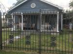
Houston, TX
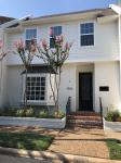
Houston, TX
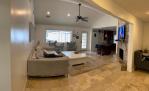
Houston, TX
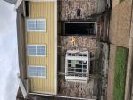
Houston, TX
Houston, TX

Houston, TX

Houston, TX
Houston, TX

Houston, TX
Houston, TX

Houston, TX

Houston, TX
Request disassociating your name from street-level assessment address

Recent home sales, price trends, and home value evaluator powered by Onboard Informatics
© 2024 Onboard Informatics. Information is deemed reliable but not guaranteed.
© 2024 Onboard Informatics. Information is deemed reliable but not guaranteed.
Some parts © 2024 Advameg, Inc.
Compilation, repackaging, or reproduction prohibited. Users are forewarned that it is incumbent upon them to verify information with the responsible state agency. Advameg, Inc. does not guarantee the data presented is up-to-date nor does it assume responsibility for updating it. Therefore any names, owners or addresses may have changed. Use of any information published here to contact the persons might be prohibited by the law.