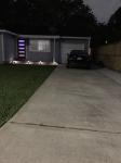
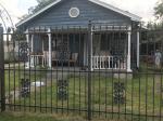
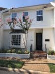
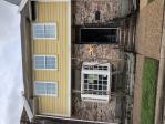
Property valuation of Burning Tree Drive, Houston, TX: 6627, 6631, 6703, 6707, 6710, 6711, 7302, 7306, 7310, 7314 (tax assessments)
Other nearby streets: Bellaire Boulevard (1)  Bellaire Boulevard (2)
  Leader Street (1)
  Leader Street (2)
  Leader Street (3)
Listed properties vs overall distribution of properties in Houston, TX:
Advertisements
6627 Burning Tree Drive
Houston, TX 77036
Find on map >>
Owner: LISSETTE A MARQUES
Land value: $73,698
Building value: $146,591
Extra features value: $4,932
Total value for property: $225,221
Assessments for tax year: 2015
Prior land value: $73,698
Prior building value: $127,297
Prior extra features value: $4,932
Prior total value for property: $205,927
Building area: 2,137 square feet
Land size: 10,270 square feet
State classification: Real, Residential, Single-Family
Neighborhood: Sharpstown
Year property was built: 1969
Condition / Desirability / Utility: Very Good
Cost and design: Extensive
Exterior wall: Brick / Veneer
Foundation type: Slab
Grade adjustment: B-
Heating / AC: Central Heat/AC
Physical condition: Average
6631 Burning Tree Drive
Houston, TX 77036
Find on map >>
Owner: RICHARD D SHELDON & DO NANCY SHELDON
Land value: $73,698
Building value: $163,008
Total value for property: $231,914
Assessments for tax year: 2015
Prior land value: $73,698
Prior building value: $141,475
Prior total value for property: $210,381
Building area: 2,465 square feet
Land size: 10,270 square feet
State classification: Real, Residential, Single-Family
Neighborhood: Sharpstown
Year property was built: 1966
Condition / Desirability / Utility: Very Good
Exterior wall: Brick / Veneer
Foundation type: Slab
Grade adjustment: B-
Heating / AC: Central Heat/AC
Physical condition: Average
6703 Burning Tree Drive
Houston, TX 77036
Find on map >>
Owner: B K THAYER
Land value: $73,794
Building value: $175,305
Extra features value: $6,385
Total value for property: $255,484
Assessments for tax year: 2015
Prior land value: $73,794
Prior building value: $154,351
Prior extra features value: $6,385
Prior total value for property: $234,530
Building area: 2,971 square feet
Land size: 10,400 square feet
State classification: Real, Residential, Single-Family
Neighborhood: Sharpstown
Year property was built: 1963
Condition / Desirability / Utility: Very Good
Exterior wall: Brick / Veneer
Foundation type: Slab
Grade adjustment: B-
Heating / AC: Central Heat/AC
Physical condition: Average
6707 Burning Tree Drive
Houston, TX 77036
Find on map >>
Owner: DONG XUE
Land value: $75,815
Building value: $169,185
Total value for property: $245,000
Assessments for tax year: 2015
Prior land value: $75,815
Prior building value: $149,299
Prior total value for property: $225,114
Building area: 2,728 square feet
Land size: 13,149 square feet
State classification: Real, Residential, Single-Family
Neighborhood: Sharpstown
Year property was built: 1967
Condition / Desirability / Utility: Very Good
Cost and design: Partial
Exterior wall: Brick / Veneer
Foundation type: Slab
Grade adjustment: B-
Heating / AC: Central Heat/AC
Physical condition: Average
6710 Burning Tree Drive
Houston, TX 77036
Find on map >>
Owner: PEGGY BEARD
Land value: $53,445
Building value: $160,161
Total value for property: $213,606
Assessments for tax year: 2015
Prior land value: $53,445
Prior building value: $141,217
Prior total value for property: $194,662
Building area: 2,897 square feet
Land size: 11,800 square feet
State classification: Real, Residential, Single-Family
Neighborhood: Sharpstown
Year property was built: 1963
Condition / Desirability / Utility: Good
Exterior wall: Brick / Veneer
Foundation type: Slab
Grade adjustment: B-
Heating / AC: Central Heat/AC
Physical condition: Average
6711 Burning Tree Drive
Houston, TX 77036
Find on map >>
Owner: M C BURTON
Land value: $74,863
Building value: $149,970
Total value for property: $224,833
Assessments for tax year: 2015
Prior land value: $74,863
Prior building value: $132,485
Prior total value for property: $207,348
Building area: 3,648 square feet
Land size: 28,830 square feet
State classification: Real, Residential, Single-Family
Neighborhood: Sharpstown
Year property was built: 1965
Condition / Desirability / Utility: Average
Exterior wall: Frame / Concrete block
Foundation type: Slab
Grade adjustment: B-
Heating / AC: Central Heat/AC
Physical condition: Average
7302 Burning Tree Drive
Houston, TX 77036
Find on map >>
Owner: CAN T LE
Land value: $45,144
Building value: $129,313
Total value for property: $174,457
Assessments for tax year: 2015
Prior land value: $45,144
Prior building value: $104,230
Prior total value for property: $149,374
Building area: 1,652 square feet
Land size: 8,640 square feet
State classification: Real, Residential, Single-Family
Neighborhood: Sharpstown
Year property was built: 1966
Condition / Desirability / Utility: Average
Exterior wall: Brick / Veneer
Foundation type: Slab
Grade adjustment: C+
Heating / AC: Central Heat/AC
Physical condition: Average
7306 Burning Tree Drive
Houston, TX 77036
Find on map >>
Owner: JENNIFER COOPER
Land value: $44,568
Building value: $132,594
Extra features value: $1,103
Total value for property: $178,265
Assessments for tax year: 2015
Prior land value: $44,568
Prior building value: $108,018
Prior total value for property: $152,586
Building area: 2,110 square feet
Land size: 7,680 square feet
State classification: Real, Residential, Single-Family
Neighborhood: Sharpstown
Year property was built: 1966
Condition / Desirability / Utility: Good
Cost and design: Extensive
Exterior wall: Brick / Veneer
Exterior wall: Aluminum / Vinyl
Foundation type: Slab
Grade adjustment: C+
Heating / AC: Central Heat/AC
Physical condition: Good
7310 Burning Tree Drive
Houston, TX 77036
Find on map >>
Owner: MARGARET NGUYEN & TOM VU NGUYEN
Land value: $44,568
Building value: $93,879
Total value for property: $123,647
Assessments for tax year: 2015
Prior land value: $44,568
Prior building value: $77,157
Prior total value for property: $106,925
Building area: 1,480 square feet
Land size: 7,680 square feet
State classification: Real, Residential, Single-Family
Neighborhood: Sharpstown
Year property was built: 1966
Condition / Desirability / Utility: Fair
Exterior wall: Brick / Veneer
Foundation type: Slab
Grade adjustment: C+
Heating / AC: Central Heat/AC
Physical condition: Fair
7314 Burning Tree Drive
Houston, TX 77036
Find on map >>
Owner: THIRTEENTHSPACE LLC
Land value: $44,424
Building value: $125,157
Extra features value: $401
Total value for property: $169,982
Assessments for tax year: 2015
Prior land value: $44,424
Prior building value: $100,756
Prior extra features value: $401
Prior total value for property: $145,581
Building area: 1,956 square feet
Land size: 7,440 square feet
State classification: Real, Residential, Single-Family
Neighborhood: Sharpstown
Year property was built: 1966
Condition / Desirability / Utility: Average
Cost and design: Extensive
Exterior wall: Brick / Veneer
Foundation type: Slab
Grade adjustment: C+
Heating / AC: Central Heat/AC
Physical condition: Average
Other nearby streets: Bellaire Boulevard (1)  Bellaire Boulevard (2)
  Leader Street (1)
  Leader Street (2)
  Leader Street (3)

Recent posts about Houston, Texas on our local forum with over 2,400,000 registered users. Houston is mentioned 165,460 times on our forum:
 | Houston to take over Chicago? (61 replies) |
 | Houston CORE developments thread (767 replies) |
 | Houston thoughts from someone who lives in DFW (63 replies) |
 | Houston's economic diversity Thread .. (1271 replies) |
 | Why I left Houston--why did YOU? (133 replies) |
 | Why is Houston so ghetto? (339 replies) |

Settings
X


