Please register to participate in our discussions with 2 million other members - it's free and quick! Some forums can only be seen by registered members. After you create your account, you'll be able to customize options and access all our 15,000 new posts/day with fewer ads.
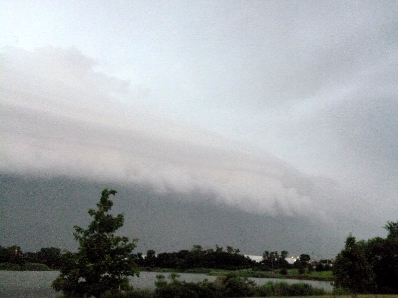
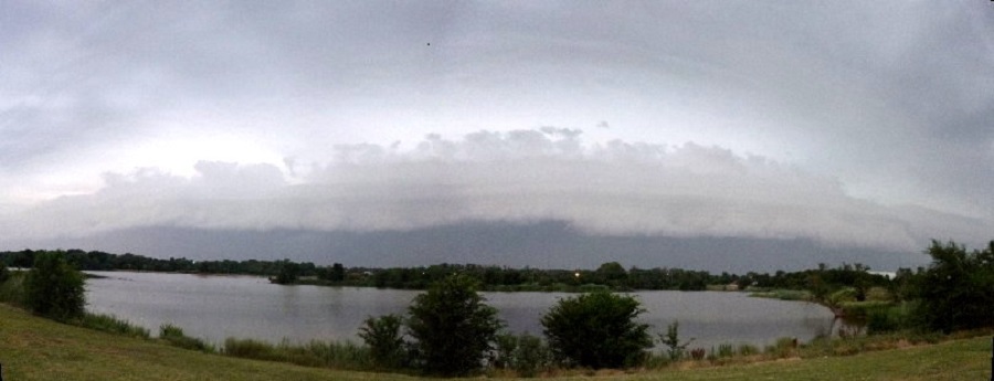
Much of northern Oklahoma had this view last Thursday evening, 6/27/13, of a approaching shelf cloud with a gust front with winds typically in the 40-60 mph range. Notice the upper portion showing pancaking layers of the clouds. They are believed caused by very strong upper level winds, interfering with the updrafts. The picture only shows the right end of the entire cloud formation that spread from west to north. Storm was probably traveling about 50 mph.
Shelf clouds are awesome weather sights. Let's see examples of some more, hopefully even more spectacular looking.
I took this shot a few weeks back, here in NC. We had 50-60 mph wind gusts a few minutes after I took the photo which lasted for about 10-15 minutes.
Sent from my DROID RAZR using Tapatalk 2
Please register to post and access all features of our very popular forum. It is free and quick. Over $68,000 in prizes has already been given out to active posters on our forum. Additional giveaways are planned.
Detailed information about all U.S. cities, counties, and zip codes on our site: City-data.com.

 Please register to participate in our discussions with 2 million other members - it's free and quick! Some forums can only be seen by registered members. After you create your account, you'll be able to customize options and access all our 15,000 new posts/day with fewer ads.