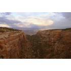
Suggestion needed for Colorado fall foliage tour (Denver, Grand Junction: rental car, appointed)
Please register to participate in our discussions with 2 million other members - it's free and quick! Some forums can only be seen by registered members. After you create your account, you'll be able to customize options and access all our 15,000 new posts/day with fewer ads.
My parents and I will visit Colorado in the last week of Sept. We want to drive around to see Colorado's famous fall foliage. For some reason, we will rent a car from Glennwood Springs (or Grand Junction), and spend 5 days and depart from Denver airport on the 6th day. As my mom cannot hike a long way (at most a couple miles) due to her knee problem, I tentatively chose some the following places to visit: Aspen, Crested Butte, Breckenridge, Mt Evans. Here are my preliminary plan:
Day 1: Glennwood Springs -> visit Crested Butte. Since I learned the road between Crested Butte and Gunnison is also beautiful (is it true?), I decided to stay at Gunnison.
Day 2. Gunnison -> another day in Crested Butte -> drive back to Carbondale and stay.
Day 3. Carbondale -> visit and stay at Aspen
Day 4. Continue visiting Aspen in the AM. In the PM take Independence Pass -> Twin Lake -> stay at Frisco
Day 5. Visit Breckenridge and then Mt Evans, then -> Denver
Day 6. City Park in Denver in the AM, and depart in the PM.
Since I have never been to Denver before. I would appreciate much if anyone can give me some advice on my plan.
1. Do I miss any interesting places? (Durango area is too far I think..) Is Vail worth to visit given that I will have been to Crested Butte and Aspen?
2. Are my plan routes optimal? I also just read the east side (downhill) of Independence pass is very scare. How bad is it?
3. I read in late Sept, the last 5 miles to Mt Evans will be closed. Then will it still be worth to visit Mt Evans at the time?
4. If I do not visit Mt Evans, I will have one extra day, where do you recommend me to visit?
The gravel / dirt road into Crested Butte from the west might be an option for the entry leg into Crested Butte if you and your passengers are not real sensitive about bouncing and rattling a little (not a lot).
I'd skip Mt Evans. If isn't especially worthwhile if you are after fall foliage.
You could substitute a drive from Ridgway to Telluride into day 2. Very good color in places. Last Dollar Road is famous for fall color.
Or spend time driving north of the interstate on day 5. Perhaps up to Steamboat. Good color on that route, trees and shrubs.
A couple things to consider about a rental car. There are not many car rental agencies in Glenwood and you may incur a substantial one way drop off fee picking it up there and dropping it off in Denver. Most car rental agreements will not allow you to drive on dirt roads, people do it all the time, but know the risk and responsibility.
Independence Pass is a twisty road, I don't find it scary, some do. There are you-tube videos that you can search to see for yourself. Keep an eye on the weather, it's not a fun drive in the snow.
Kebler Pass into Crested Butte is a good choice for autumn aspen color; you'll be driving through some lovely country, and quite large aspen groves.
Weather in late September can be changeable, possibly even with snow. Although odds are in your favor, well into October. As far as when aspen begin turning, and height of their color, that is variable from year to year. In late September one is kind of pushing this, at least in the high country; but of course that slightly missed (and past peak) at higher elevations can be prime lower down.
Last I drove it—some time ago—Kebler Pass was a decent dirt road, fine for any type of vehicle. Aside from being graded dirt, not near as daunting as some paved, such as US 550 between Durango and Ouray, or Independence Pass.
Independence Pass is a great drive, and if with the interest than not to be missed. Yes, as with other various mountain roads in Colorado, with its share of places where one could easily go flying off into space (and then way down below). So the idea is to drive at the speed limit, not yack on the phone, pay attention—and remain on the pavement. Then you'll be fine. Either direction is great, although one tends to hug the side of the mountain more if westbound (towards Aspen).
The last road section to the summit of Mt. Evans is open until Labor Day, and then all bets are off. It depends on the weather. So it may be open in late September, or not. There are possibly better options if fall color is the objective.
Your itinerary seems basically feasible. You may wish to spend more time in Breckenridge, if shopping and visiting a quaint ski town sound enticing.
From there, you might want to take something of a detour, and instead of heading down I-70, drive north from Silverthorne to Kremmling. From there east until near Granby, but then turning north to Grand Lake. The color may be variable, as one is in the high country, but a lovely drive. The town of Grand Lake is worth at least a brief visit, and no detour at all. From there one enters Rocky Mountain National Park, and on across the top of this quite beautiful park on the highest continuous road in the US: Trail Ridge Road (highest point, 12,183 feet). At its crest you'll be observing the fall foliage in miniature, as no trees but the minute plants of that alpine environment. But the road drops back into timber on the far side, and then into the magnificent setting of Estes Park.
Do check just prior, as an early snow could close Trail Ridge Road, if probably briefly for hours or a day or two. But most likely open. If without a national park pass, then also expect to pay $20 per vehicle to enter the park (good for seven days). Do note that if opting to skip Independence Pass due its mountainous nature, then one will be no more keen on Trail Ridge Road. Otherwise, both are fantastic.
Aside from just this portion of the drive being so lovely, then in consequence the chance to continue from Estes Park south on CO 7 (and then one road designation after another) on the scenically designated Peak to Peak road. In running more or less due south to Black Hawk, and soon after I-70 just east of Idaho Springs, this road parallels the mountains of the Front Range, within and on their high flank. It is a lovely drive all the way, and can be a good place to observe fall color. In various places along this route, also with good panoramic vantages.
Once rejoining I-70, it is an easy matter on into Denver; from that junction one could probably reach DIA in about an hour.
September is one of the loveliest months in Colorado. You probably will not be disappointed, save possibly in not being able to remain long enough.
As far as I understand, the best 2 routes to Crested Butte are Kebler Pass and Ohio Pass. Do I miss anything? Any better alternatives?
Is Ohio Pass worse than Kebler Pass? Is it also a dirty road? I read some people mention it is "scary" in some parts?
BTW I also wonder how bad the road is for going though Independence Pass to Twin Lakes.. I read that the drive down the east side is really scary..
Also sorry for not being clear enough.. Visiting Mt Evans is not for fall foliage. How is the scene if the last 5 miles is closed?
Thanks.
I would stay off of the dirt/gravel roads. Late Sept. the weather at the higher elevations can start to get sketchy and it's best if you are not familiar with those roads, to stay off them. Those roads are not really built for casual touristy gazing. Rental car companies will not usually cover you on those roads and in addition you are out in the wilderness, so if anything goes wrong, you've got problems. Stick to the paved state and US highways.
Definitely on Independence Pass you need to be on the ball driving as some parts narrow down to less than 2 lanes and there certainly some parts very high up.
Mt. Evans doesn't have much in the way of aspens in that area, so there isn't much foliage and if the last 5 miles is closed when you are there, I wouldn't bother.
Vail is very nice in September and worth a visit.
Also keep in mind that aspens are variable due to elevation, location and weather. And early snow or windy day can strip leaves quickly. Some places leaves might still be green, in other parts past peak.
Location: We_tside PNW (Columbia Gorge) / CO / SA TX / Thailand
34,722 posts, read 58,054,000 times
Reputation: 46190
Quote:
Originally Posted by wanneroo
I would stay off of the dirt/gravel roads. Late Sept. the weather at the higher elevations can start to get sketchy ...
UNLESS you luck out... AND are of Ralley skill.
I got a Subaru Impreza Sport for $10/day priceline deal. It had 300 miles on it and was black and pristine (when I picked it up). It had 1200 additional MTN road / gravel road use on it when I dropped it off, AND it got REALLY dirty on the snow / mud backroads..
Watch the 'leaf reports' (several online resources for entire US including great info on CO, NM, UT, WY . Have a few alternative routes. Wind / snow / drought can make short work of fall colors. The Chama train is pretty impressive in the 'right' fall. For CO I prefer Crested Butte > Glenwood + routes mentioned, OR Steamboat, or Southern CO and Northern NM. A lot depends on the weather and yrs vary. I try to make it the last week in Sept, so I can be on the East coast the next week (usually fly to Manchester, NH VERY cheap on SWA), then take flights on dow to PA, VA, and SC. getting back to PNW by end of Oct to catch their colors BEFORE rain (first week in Nov).
Spring is similar schedule but different terrain, chasing desert wildlfowers.
Mt. Evans doesn't have much in the way of aspens in that area, so there isn't much foliage and if the last 5 miles is closed when you are there, I wouldn't bother.
Personally, I find the east side of Independence Pass much better than the western side. We drove the entire route in our VW van. It's not really a 4 wheel drive road, like so many other Colorado mountain roads. The only parts we were scared of were the very narrow sections on the western side, towards Aspen. It's very tight with a larger vehicle and on more than one instance I thought we were going to hit the cars coming towards us!
Personally, I would do as NW Crow suggested, and do the drive over to Telluride. IMO, this is one of the most scenic drives in all of Colorado, and North America. The aspens in the western half of the state are big and there are a lot more of them. If your goal is to catch the fall color change, I don't think this route should be missed. I will actually be doing that drive during the first week of September. Hoping we catch the beginning of the color change.
Perhaps a few others with more recent experience can lend their opinions on Kebler Pass; it has been some time since I last drove it. However, unless quite a bit changed—if possible, but I doubt it—then it was a fairly wide and perfectly fine, decently graded, dirt road. Nothing to be concerned with in any vehicle. As with any dirt road, one will pick up some dust, but that is what car washes are for.
There are dirt roads—and then dirt roads. Colorado has some that no one should be driving on, Jeep or not, unless with the requisite skill. The west side of Engineer Pass comes to mind, although there with just a good chance of getting high centered or quickly losing your oil pan. On other roads, perfect places to make one little mistake, put a wheel off—and then you and the vehicle down half the mountainside.
Kebler Pass is at the other end of that gnarly spectrum. One might not want to attempt it with snow, but that possibility raises all kinds of questions with the itinerary. Not to mention dirt roads can be easier to drive on in snow than pavement. One look at the map should easily inform why any of this matters. Crested Butte is isolated, and all the more so from the rest of this proposed route, unless approached from the north. Anything else is a big detour.
As for Independence Pass, it is a two-lane, paved, state highway. A mountainous one, yes, with a few narrow places, but nothing that cannot be safely driven by anyone with a driver's license (being a rather broad statement, given the requirements for that). Basically no big deal, unless from Kansas and freaking out that they would build roads through the mountains; if that the case, one might reconsider the route, or if even I-70 too dramatic.
By the way, one of the more narrow sections of that road—where opposing traffic can safely pass one another—is shortly east of Aspen. It is memorable and scenic, often with short if abrupt cliff of rock to one side, and then a good drop off to the other; as I recall, most of that section is included with a guardrail, often built of stone. At times there can be small waterfalls falling across and down these rock cliffs. With some few places provided to pull off the road, a good place to get out the camera.
As for Telluride, well worth the drive. The only problem is the San Juan Mountains are almost a destination in themselves, being geographically so far removed from the Front Range. If willing to push it and do a lot of driving, then possible, and certainly scenic enough. To give some idea, the 1969 film True Grit had many scenes placed along the north side of the San Juans. Some of it was filmed in Ridgway, but also closer to and within the mountains, taking excellent advantage of the autumn colors.
If doing this, then on a rather long drive one might "pop" on over to Telluride. Although do not be surprised then if the temptation to further explore, and see all the more magnificent country between there and Ouray, Silverton, Durango, etc. That could take some time. One could easily spend the entire week there. Or not. But do consider distances, as well as the enticement of that once discovered.
Please register to post and access all features of our very popular forum. It is free and quick. Over $68,000 in prizes has already been given out to active posters on our forum. Additional giveaways are planned.
Detailed information about all U.S. cities, counties, and zip codes on our site: City-data.com.

 Please register to participate in our discussions with 2 million other members - it's free and quick! Some forums can only be seen by registered members. After you create your account, you'll be able to customize options and access all our 15,000 new posts/day with fewer ads.