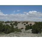
Well, BF and I got back for a week in ABQ and think we've found a couple of house possibilities in Placitas! Very exciting, and both houses are great but with different pros and cons, of course. Both are up on the mesa (Indian Flats?) by BLM land -- we have horses and need trail riding space. Anyone have any words on the water situation up there? The one has a 400ft well (drilled in 2004, I think) and a grey water and catchment system. There seems to be quite a few plots available for development in the area, which has stalled, naturally.
If there such thing as well insurance?!?
I've found some info, trying to make sense of it:
USGS OFR 98-487 -- McCraw
Albuquerque Basin
Geologic mapping has been concentrated in the Albuquerque basin due to the current concerns over ground-water availability and quality in New Mexico's largest metropolitan area. The USGS is leading an impressive cooperative effort (the Middle Rio Grande Basin Study -- MRGBS) among various federal, state, tribal, and municipal agencies to gather and interpret geographic, hydrologic, and geologic data in order to identify, quantify, and better manage the region's water resources. Approximately 20 of our 36 total STATEMAP 7.5-minute quads lie within the MRGBS area. These are complemented by 12 NCGMP FEDMAP quads and 2 NCGMP EDMAP quads. Subsurface (borehole, geophysical) data are incorporated into these STATEMAP quads, thus greatly enhancing their value for MRGBS hydrogeologic modeling and model refinement.
At the northern end of the basin in the Placitas area, NMBMMR is conducting an extensive water resources assessment for Sandoval County. The Placitas 7.5-minute quadrangle (OF-DM 2), mapped at 1:12,000, is the cornerstone underlying these studies. The area extends from the basin across rift-margin faults into the Paleozoic and Proterozoic bedrock of the northern terminus of the Sandia Mountains. Ground water is found in a series of confined and unconfined, compartmentalized aquifers, where faults behave as both barriers and conduits for ground-water flow. In a setting of such geological complexity, OF-DM 2 has provided the framework for a thorough hydrogeochemical and hydrologic sampling and monitoring program designed to evaluate locations and rates of mountain front recharge, delineate aquifer zones, characterize water quality, and assess resource sustainability given current and future development trends.
Finally, basin STATEMAP quadrangles are being utilized by NMBMMR to compile a 1:50,000 map of the greater Albuquerque metropolitan area, depicting both surface and subsurface geology. This compilation will provide a series of critical, accurate Arc/Info coverages for input into the city's GIS database. Given the direct applicability of this digital product for ground-water resource sustainability assessment, it is greatly anticipated by city and regional planners.
http://www.sandovalcounty.com/uploadfiles/April30.pdf (broken link)
Existing Water Resources
Placitas Water Issues
Water in the Placitas Planning area presents a complex problem. Geology in the area, both
surface and subsurface, aggravates the problems of sparse rainfall and the random nature of
snowmelt as renewable / sustainable sources of water for the area.
Over recent decades, several studies have been completed for numerous reasons. Chief among
them are studies by developers who are required to prove water supplies suitable for 100 years
before sub-division permits are approved. This requirement is in accordance with Appendix A
of the Sandoval County Subdivision Ordinance; areas of the County not under Appendix A are
not required to show 100 year supplies and are only required to meet a lesser standard. In
August 2002, (updated in January 2008) Peggy Johnson and Andrew Campbell co-authored
“Hydrogeology and Water Resources of the Placitas Area, Sandoval County, New Mexico.”
This study covered an extended area and was less constrained by individual development areas
to which developers limit their studies. In addition, the fact that Johnson and Campbell are
from New Mexico Tech, a State University, lends an element of disinterest and objectivity.
This is not to cast aspersions or suggestions that other studies are not prepared with the highest
ethical conduct or professionalism; they are just constrained to smaller areas of interest.
In view of the different areas covered by the various studies, and the fact that they were
conducted for different reasons, the County contracted with Intera, Incorporated, to collect and
evaluate these studies and deliver a report based on the collective findings of these efforts. This study was delivered in August 2008, and briefed at the Placitas community planning meeting
held in September. (See map)
The conclusions of the study are that water availability in the Placitas area varies. There are
sections where water is relatively abundant, areas where water availability is challenged, and
areas between these extremes. In Placitas, like most areas, water is greatly influenced by
geology. Local structure is complex; it is characterized by faulting associated with the Rio
Grande Rift zone.
Over time, numerous solutions to the water issues in Placitas have been developed. In the
territorial and colonial periods, surface water from springs and streams was largely the solution
of choice. Over time, additional demands were met through the development of wells. Today,
the increasing populations have caused a move toward systems using shared wells to meet the
water needs of the area. While there are still individual domestic wells, the needs of water
resource management are driving away from that option as the preferred method.
There are about 14 area water systems plus Las Acequias de Placitas. Further, there are
numerous old, single lot domestic wells, shared wells, springs and streams in the area used as
water sources in the community. As such, there is not a simple definition of the water situation
from a demand point of view any more than there is an easy way to characterize the supply side
of the equation. Given continuing growth of the area and a desire to maximize the utility of the
available water and encourage conservation practices, the County will encourage shared wells
and community water systems.

 Please register to participate in our discussions with 2 million other members - it's free and quick! Some forums can only be seen by registered members. After you create your account, you'll be able to customize options and access all our 15,000 new posts/day with fewer ads.