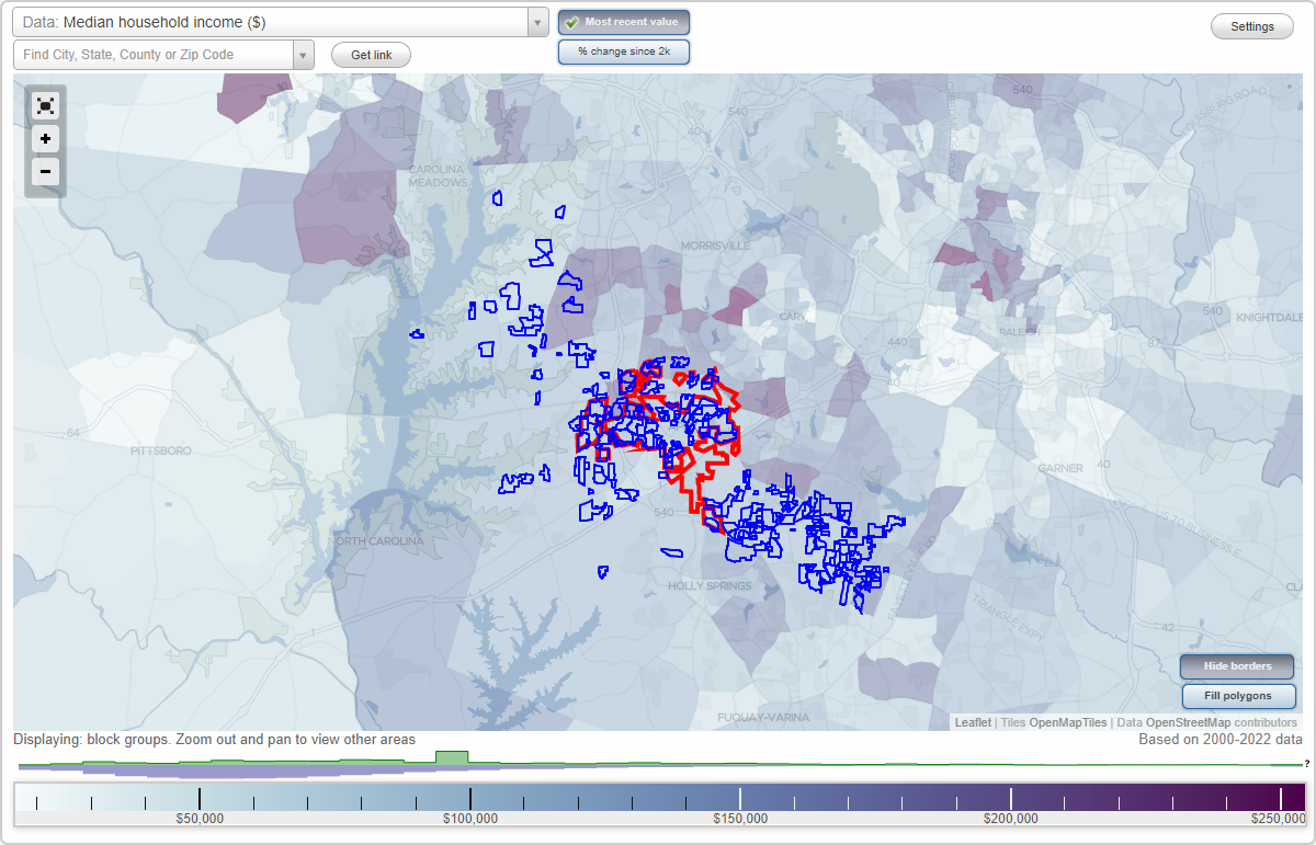
Apex, North Carolina Neighborhood Map - Income, House Prices, Occupations, Boundaries
Settings
X

- City boundary
- Neighborhood boundaries
Business Search - 14 Million verified businesses
Abbington - Summercrest Neighborhoods:
Abbington, Airington, Allendale Acres, Amherst, Amherst, Amity Fields, Arbor Commons Townhomes, Autumn Range, Bayfield Run, Beaver Creek, Beaver Creek Crossings, Beckett Crossing, Beckwith Farms, Bella Casa, Bella Serra, Belle Point, Belle Ridge, Belle Ridge North, Belmont, Belmont Estates, Bladestone, Bradley, Briarwood Farms, Brighton Woods, Brittany Trace, Brookfield, Brookshire, Buckingham, Bungalow Park at Scotts Mills, Burnside, Caitlin Pond, Cameron Park, Carriage Downs, Carriage Village, Cary Oaks, Castlereagh, Castlewood, Center Heights, Center Park, Centerfield, Chapel Ridge, Chapel View Farms, Chari Heights, Charleston Village, Chatham Glenn, Churchill Estates, Cityside Townhomes, Clairmont, Colvin Estates, Cooke, Copperleaf, Courtyard at Salem Oaks, Creeks Bend, Creekside, Creekside Park, Creekwood Bluffs, Crocketts Ridge, Crooked Brook, Crowsdale, Damont Hills, Deerfield Park, Denman Woods, Dogwood Acres, Dogwood Ridge, Eagles Nest, Elizabeth Woods, Englewood Forest, Fair Oaks, Fairstone, Fairview Road, Fairview Wooded Acres, Falcons Reach, Farrells Creek, Forest Springs, Friendship Acres, Germaine Street, Gilchrist Landing, Glen Arbor, Glen Arbor, Glendale, Golders Green, Green Level Farms, Green Plains, Green at Scotts Mill, Greenbrier, Greenwood Acres, Greg Penny, Grenadier, Greyhawk, Groves, Gypsy Woods, Haddon Hall, Haddon Place, Hallmark, Halstead, Heatherwood Townhomes, Heavner Tract, Heritage Oaks, Herndon Estates, Hickory Creek, Hickory Trace, Highland Creek, Highland Farms, Hillcrest, Holland Crossings, Holland Farm, Holly Hill, Holly Run, Hollybrook, Homestead Park, Howell, Hunter Valley, Indian Hills, Indian Trails, Iron Gate, Ivory Hills, James Street Station, Jamison Park, Jenmar Acres, Justice Heights, Kelly Glen, Kildaire Estates, Kilt Valley, Kirkwood, Knollwood, L'Hermitage at Beaver Creek, Lakefield, Lands Helton Homes, Laurel Park, Les Arbres, Lexington, Lynnhaven, Madden Crossing, Mannsfield, Markham Plantation, Maynards Way, Meadow Lake, Meadow Lake Farms, Merion, Milton Teresa Clowers, Miramonte, Montclair, New Hope Estates, Newbury Park, North East New Hope, Oak Chase, Old Mill Village, Old Pierce Place, Old Sturbridge Village, Old Thompson Creek, Olive Farms, Orchard Knoll, Oxford Greene, Parkway Station, Patricia Edwards, Paynes Landing, Peakway Village, Pearson Farms, Pebblestone, Perry Farms, Perry Hills, Perry Village, Pinefield, Pleasant Plains, Pricewood Farms, Ramblewood, Rancho Verde, Reedy Creek Farms, Rollingwood Estates, Rose Garden, Royal Senter Ridge, Running Cedar, Rustic Mill, Saint James Village, Salem Creek Townhomes, Salem Oaks, Salem Woods, Sancroft, Saponi Hills, Sawgrass, Sawyers Mill, Scots Laurel, Scotts Mill, Seagroves Farm, Sedgemoor, Shadow Creek, Shepherds Vineyard, Sleepy Valley, South Lake, South Pointe, Southwoods, Sterling at Buckhingham, Stone Point, Stonebridge, Stratford at Abbington, Sugarland Run, Summer Chill, Summer Oaks, Summer Oaks Ph2, SummercrestAbbington neighborhood in Apex statistics: (Find on map)
Area: 0.237 square miles
Roads and streets: Kellyridge Dr; Lyndenbury Dr; Chanticlair Dr; Lansbrooke Ln; Witheridge Ct; Chilcott Ln; Kentbury Ln; Wendhurst Ct; Yatesdale Ct; Langshire Ct; Hillantrae Ln; Wexleigh St; Delmayne Dr; Duncroft Ct; Rayanne Ct; Buckhaven Ct; Avoncroft Ct; Strawthorne Ct; Glenshire Ct; Erlwood Ct; Madison Hill Ct; Chantilly Ct; Timberlea Ct.
Abbington neighborhood detailed profile
Airington neighborhood in Apex statistics: (Find on map)
Area: 0.007 square miles
Airington neighborhood detailed profile
Area: 0.007 square miles
Airington neighborhood detailed profile
Allendale Acres neighborhood in Apex statistics: (Find on map)
Area: 0.025 square miles
Allendale Acres neighborhood detailed profile
Area: 0.025 square miles
Allendale Acres neighborhood detailed profile
Amherst neighborhood in Apex statistics: (Find on map)
Area: 0.122 square miles
Roads and streets: Glastonbury Rd; Thurrock Dr; Morecambe Way; Basildon Ct; Birkenhead Ct; Matlock Ct; Leicester Ct.
Amherst neighborhood detailed profile
Area: 0.122 square miles
Roads and streets: Glastonbury Rd; Thurrock Dr; Morecambe Way; Basildon Ct; Birkenhead Ct; Matlock Ct; Leicester Ct.
Amherst neighborhood detailed profile
Amity Fields neighborhood in Apex statistics: (Find on map)
Area: 0.012 square miles
Amity Fields neighborhood detailed profile
Area: 0.012 square miles
Amity Fields neighborhood detailed profile
Arbor Commons Townhomes neighborhood in Apex statistics: (Find on map)
Area: 0.006 square miles
Arbor Commons Townhomes neighborhood detailed profile
Area: 0.006 square miles
Arbor Commons Townhomes neighborhood detailed profile
Autumn Range neighborhood in Apex statistics: (Find on map)
Area: 0.005 square miles
Autumn Range neighborhood detailed profile
Area: 0.005 square miles
Autumn Range neighborhood detailed profile
Bayfield Run neighborhood in Apex statistics: (Find on map)
Area: 0.020 square miles
Roads and streets: Baybark Cir; Everard Ct.
Bayfield Run neighborhood detailed profile
Area: 0.020 square miles
Roads and streets: Baybark Cir; Everard Ct.
Bayfield Run neighborhood detailed profile
Beaver Creek neighborhood in Apex statistics: (Find on map)
Area: 0.126 square miles
Roads and streets: Beaver Trl.
Beaver Creek neighborhood detailed profile
Area: 0.126 square miles
Roads and streets: Beaver Trl.
Beaver Creek neighborhood detailed profile
Beaver Creek Crossings neighborhood in Apex statistics: (Find on map)
Area: 0.077 square miles
Beaver Creek Crossings neighborhood detailed profile
Area: 0.077 square miles
Beaver Creek Crossings neighborhood detailed profile
Beckett Crossing neighborhood in Apex statistics: (Find on map)
Area: 0.104 square miles
Roads and streets: Fairfax Woods Dr; Celandine Dr; Mossy Glade Cir; Cairphilly Castle Ct; Gopher Ln; Red Barn Way; Alderwood Ct; River Dee Ct; Argus Ct; Celestine Pl; Parsifal Pl; Avonlea Ct.
Beckett Crossing neighborhood detailed profile
Area: 0.104 square miles
Roads and streets: Fairfax Woods Dr; Celandine Dr; Mossy Glade Cir; Cairphilly Castle Ct; Gopher Ln; Red Barn Way; Alderwood Ct; River Dee Ct; Argus Ct; Celestine Pl; Parsifal Pl; Avonlea Ct.
Beckett Crossing neighborhood detailed profile
Beckwith Farms neighborhood in Apex statistics: (Find on map)
Area: 0.296 square miles
Beckwith Farms neighborhood detailed profile
Area: 0.296 square miles
Beckwith Farms neighborhood detailed profile
Bella Casa neighborhood in Apex statistics: (Find on map)
Area: 0.026 square miles
Roads and streets: Franconia Way; Pastro Ct; Terasina Ct.
Bella Casa neighborhood detailed profile
Area: 0.026 square miles
Roads and streets: Franconia Way; Pastro Ct; Terasina Ct.
Bella Casa neighborhood detailed profile
Bella Serra neighborhood in Apex statistics: (Find on map)
Area: 0.035 square miles
Roads and streets: Evans Rd (State Rd 1147).
Bella Serra neighborhood detailed profile
Area: 0.035 square miles
Roads and streets: Evans Rd (State Rd 1147).
Bella Serra neighborhood detailed profile
Belle Point neighborhood in Apex statistics: (Find on map)
Area: 0.063 square miles
Belle Point neighborhood detailed profile
Area: 0.063 square miles
Belle Point neighborhood detailed profile
Belle Ridge neighborhood in Apex statistics: (Find on map)
Area: 0.067 square miles
Belle Ridge neighborhood detailed profile
Area: 0.067 square miles
Belle Ridge neighborhood detailed profile
Belle Ridge North neighborhood in Apex statistics: (Find on map)
Area: 0.034 square miles
Belle Ridge North neighborhood detailed profile
Area: 0.034 square miles
Belle Ridge North neighborhood detailed profile
Belmont neighborhood in Apex statistics: (Find on map)
Area: 0.080 square miles
Roads and streets: Henderson Rd.
Belmont neighborhood detailed profile
Area: 0.080 square miles
Roads and streets: Henderson Rd.
Belmont neighborhood detailed profile
Belmont Estates neighborhood in Apex statistics: (Find on map)
Area: 0.073 square miles
Roads and streets: Brantley Dr; Brad Ct.
Belmont Estates neighborhood detailed profile
Area: 0.073 square miles
Roads and streets: Brantley Dr; Brad Ct.
Belmont Estates neighborhood detailed profile
Bladestone neighborhood in Apex statistics: (Find on map)
Area: 0.016 square miles
Roads and streets: Bladestone Ct; Twin Circle Ct.
Bladestone neighborhood detailed profile
Area: 0.016 square miles
Roads and streets: Bladestone Ct; Twin Circle Ct.
Bladestone neighborhood detailed profile
Bradley neighborhood in Apex statistics: (Find on map)
Area: 0.050 square miles
Roads and streets: Anterbury Dr; Dual Parks Rd; Forthview Way; Baberton Way; Apex Pewy; Shackleton Rd; Fanwood Ct; Eldon Ln.
Other features: Little Br.
Bradley neighborhood detailed profile
Area: 0.050 square miles
Roads and streets: Anterbury Dr; Dual Parks Rd; Forthview Way; Baberton Way; Apex Pewy; Shackleton Rd; Fanwood Ct; Eldon Ln.
Other features: Little Br.
Bradley neighborhood detailed profile
Briarwood Farms neighborhood in Apex statistics: (Find on map)
Area: 0.146 square miles
Roads and streets: Derry Down Ln; Stephenson Rd (State Rd 1302); Westford Way; Thriftwood Dr; Cherrystone Ln; Lynnford Dr; Cockle Burr Dr; Little White Pine Ct; Teardrop Cir; Turnbuckle Ct; Carlotta Ct; Bizzle Ct (Bizzell Ct); Geoffrey Way (Geoffrey Ct); Peach Stone Ct.
Briarwood Farms neighborhood detailed profile
Brighton Woods neighborhood in Apex statistics: (Find on map)
Area: 0.056 square miles
Roads and streets: New Brighton Dr.
Brighton Woods neighborhood detailed profile
Area: 0.056 square miles
Roads and streets: New Brighton Dr.
Brighton Woods neighborhood detailed profile
Brittany Trace neighborhood in Apex statistics: (Find on map)
Area: 0.032 square miles
Roads and streets: Woodbriar St; Blanchard St; Pate St; Royal Hunt Ct; Brittany Point Ct; Hilt Ct; Graybark Ct.
Brittany Trace neighborhood detailed profile
Area: 0.032 square miles
Roads and streets: Woodbriar St; Blanchard St; Pate St; Royal Hunt Ct; Brittany Point Ct; Hilt Ct; Graybark Ct.
Brittany Trace neighborhood detailed profile
Brookfield neighborhood in Apex statistics: (Find on map)
Area: 0.080 square miles
Roads and streets: Pinewood Dr; Fallen Oak Dr; E Beechmont Cir; Norwood Ln; Charred Oak Cir; W Beechmont Cir; Black Oak Ct; Autumnwood Cir; Fair Oaks Ln.
Brookfield neighborhood detailed profile
Area: 0.080 square miles
Roads and streets: Pinewood Dr; Fallen Oak Dr; E Beechmont Cir; Norwood Ln; Charred Oak Cir; W Beechmont Cir; Black Oak Ct; Autumnwood Cir; Fair Oaks Ln.
Brookfield neighborhood detailed profile
Brookshire neighborhood in Apex statistics: (Find on map)
Area: 0.037 square miles
Roads and streets: Floresta Dr; Castelaine Cir.
Brookshire neighborhood detailed profile
Area: 0.037 square miles
Roads and streets: Floresta Dr; Castelaine Cir.
Brookshire neighborhood detailed profile
Buckingham neighborhood in Apex statistics: (Find on map)
Area: 0.438 square miles
Roads and streets: Buckingham Way; W Sterlington Pl; Parliament Pl; Kingsway Dr; E Lady Diana Ct; Downing Pl; W Lady Diana Ct; Mellonsbury Dr; Palace Ct; Sunny Brae Ct; E Sterlington Pl; S Wellonsburg Pl; Surry Dale Ct; Glentanner Ct; Bray Ct; Tewdsbury Ct.
Buckingham neighborhood detailed profile
Bungalow Park at Scotts Mills neighborhood in Apex statistics: (Find on map)
Area: 0.029 square miles
Roads and streets: Bungalow Park Dr; Mica Lamp Ct; Hst District Ln; Restoration Way; Milk Paint Aly; Handhewn St; Forest Crest Ct; Porchside Dr.
Bungalow Park at Scotts Mills neighborhood detailed profile
Area: 0.029 square miles
Roads and streets: Bungalow Park Dr; Mica Lamp Ct; Hst District Ln; Restoration Way; Milk Paint Aly; Handhewn St; Forest Crest Ct; Porchside Dr.
Bungalow Park at Scotts Mills neighborhood detailed profile
Burnside neighborhood in Apex statistics: (Find on map)
Area: 0.052 square miles
Burnside neighborhood detailed profile
Area: 0.052 square miles
Burnside neighborhood detailed profile
Caitlin Pond neighborhood in Apex statistics: (Find on map)
Area: 0.053 square miles
Caitlin Pond neighborhood detailed profile
Area: 0.053 square miles
Caitlin Pond neighborhood detailed profile
Cameron Park neighborhood in Apex statistics: (Find on map)
Area: 0.136 square miles
Roads and streets: Vatersay Dr; Cameron Glen Dr; Dalgarven Dr; White Dogwood Rd; Town Side Dr; Manderston Ln; Stenness Ct; Telford Ln; Kenneil Ct; Talisker Ct; Latheron Ct; Gullane Ct; Dunvegan Ct; Glen Cairn Ct; Menteith Ct; Kylesku Ct; Lethaby Ct; Keppoch Ct.
Cameron Park neighborhood detailed profile
Carriage Downs neighborhood in Apex statistics: (Find on map)
Area: 0.029 square miles
Roads and streets: Kellerhis Dr; Caley Rd; Henson Pl; Troyer Pl.
Carriage Downs neighborhood detailed profile
Area: 0.029 square miles
Roads and streets: Kellerhis Dr; Caley Rd; Henson Pl; Troyer Pl.
Carriage Downs neighborhood detailed profile
Carriage Village neighborhood in Apex statistics: (Find on map)
Area: 0.060 square miles
Carriage Village neighborhood detailed profile
Area: 0.060 square miles
Carriage Village neighborhood detailed profile
Cary Oaks neighborhood in Apex statistics: (Find on map)
Area: 0.023 square miles
Roads and streets: Cary Oaks Dr; Holly Stream Ct; State Rd 1152 (Holly Springs Rd).
Cary Oaks neighborhood detailed profile
Area: 0.023 square miles
Roads and streets: Cary Oaks Dr; Holly Stream Ct; State Rd 1152 (Holly Springs Rd).
Cary Oaks neighborhood detailed profile
Castlereagh neighborhood in Apex statistics: (Find on map)
Area: 0.092 square miles
Other features: Reedy Br.
Castlereagh neighborhood detailed profile
Area: 0.092 square miles
Other features: Reedy Br.
Castlereagh neighborhood detailed profile
Castlewood neighborhood in Apex statistics: (Find on map)
Area: 0.186 square miles
Roads and streets: Thorn Hollow Dr; Fern Valley Ln; Persimmon Pl; Wild Cherry Dr; Sandy Hills Ct; Hibiscus Ct.
Castlewood neighborhood detailed profile
Area: 0.186 square miles
Roads and streets: Thorn Hollow Dr; Fern Valley Ln; Persimmon Pl; Wild Cherry Dr; Sandy Hills Ct; Hibiscus Ct.
Castlewood neighborhood detailed profile
Center Heights neighborhood in Apex statistics: (Find on map)
Area: 0.004 square miles
Center Heights neighborhood detailed profile
Area: 0.004 square miles
Center Heights neighborhood detailed profile
Center Park neighborhood in Apex statistics: (Find on map)
Area: 0.004 square miles
Center Park neighborhood detailed profile
Area: 0.004 square miles
Center Park neighborhood detailed profile
Centerfield neighborhood in Apex statistics: (Find on map)
Area: 0.010 square miles
Centerfield neighborhood detailed profile
Area: 0.010 square miles
Centerfield neighborhood detailed profile
Chapel Ridge neighborhood in Apex statistics: (Find on map)
Area: 0.149 square miles
Roads and streets: Chapel Ridge Rd; Clark Farm Rd; Barnside Ln.
Chapel Ridge neighborhood detailed profile
Area: 0.149 square miles
Roads and streets: Chapel Ridge Rd; Clark Farm Rd; Barnside Ln.
Chapel Ridge neighborhood detailed profile
Chapel View Farms neighborhood in Apex statistics: (Find on map)
Area: 0.134 square miles
Roads and streets: Chapel View Dr; Shady Lane Cir; Dry Creek Ct.
Chapel View Farms neighborhood detailed profile
Area: 0.134 square miles
Roads and streets: Chapel View Dr; Shady Lane Cir; Dry Creek Ct.
Chapel View Farms neighborhood detailed profile
Chari Heights neighborhood in Apex statistics: (Find on map)
Area: 0.028 square miles
Chari Heights neighborhood detailed profile
Area: 0.028 square miles
Chari Heights neighborhood detailed profile
Charleston Village neighborhood in Apex statistics: (Find on map)
Area: 0.183 square miles
Roads and streets: Castleburg Dr; Battlewood Rd; Templeton Gap Dr; Keokuk Ct; Catskill Ct; Beaudet Ln; Housatonic Ct; Passaic Way; Cumberland Gap Ct; Patapsco Dr; Sassacus Ln; Battery Wagner Dr; Weehawken Pl; Ironsides Ln; Battery Bee Ln; Baysdale Ln; Shell Point Way.
Other features: Beaver Crk.
Charleston Village neighborhood detailed profile
Chatham Glenn neighborhood in Apex statistics: (Find on map)
Area: 0.081 square miles
Roads and streets: Chatham Glen Dr.
Chatham Glenn neighborhood detailed profile
Area: 0.081 square miles
Roads and streets: Chatham Glen Dr.
Chatham Glenn neighborhood detailed profile
Churchill Estates neighborhood in Apex statistics: (Find on map)
Area: 0.087 square miles
Roads and streets: Churchill Falls Pl; Cambridge Hall Loop; Westbury Hill Ln; Hanson Walk Ln; Feldon River Ct; Tyne River Ct; Meadowhaven Dr; Wedge Porr Ct.
Churchill Estates neighborhood detailed profile
Area: 0.087 square miles
Roads and streets: Churchill Falls Pl; Cambridge Hall Loop; Westbury Hill Ln; Hanson Walk Ln; Feldon River Ct; Tyne River Ct; Meadowhaven Dr; Wedge Porr Ct.
Churchill Estates neighborhood detailed profile
Cityside Townhomes neighborhood in Apex statistics: (Find on map)
Area: 0.011 square miles
Cityside Townhomes neighborhood detailed profile
Area: 0.011 square miles
Cityside Townhomes neighborhood detailed profile
Clairmont neighborhood in Apex statistics: (Find on map)
Area: 0.039 square miles
Roads and streets: E Chatham St; Briarcliff St; Avery Le Cir; George Pl; Waddell Ct.
Clairmont neighborhood detailed profile
Area: 0.039 square miles
Roads and streets: E Chatham St; Briarcliff St; Avery Le Cir; George Pl; Waddell Ct.
Clairmont neighborhood detailed profile
Colvin Estates neighborhood in Apex statistics: (Find on map)
Area: 0.017 square miles
Colvin Estates neighborhood detailed profile
Area: 0.017 square miles
Colvin Estates neighborhood detailed profile
Cooke neighborhood in Apex statistics: (Find on map)
Area: 0.011 square miles
Cooke neighborhood detailed profile
Area: 0.011 square miles
Cooke neighborhood detailed profile
Copperleaf neighborhood in Apex statistics: (Find on map)
Area: 0.215 square miles
Copperleaf neighborhood detailed profile
Area: 0.215 square miles
Copperleaf neighborhood detailed profile
Courtyard at Salem Oaks neighborhood in Apex statistics: (Find on map)
Area: 0.003 square miles
Courtyard at Salem Oaks neighborhood detailed profile
Area: 0.003 square miles
Courtyard at Salem Oaks neighborhood detailed profile
Creeks Bend neighborhood in Apex statistics: (Find on map)
Area: 0.340 square miles
Roads and streets: Silver Stirrup Ln; Hazelhurst Cir; Snafflebit Ln.
Other features: Little White Oak Crk.
Creeks Bend neighborhood detailed profile
Area: 0.340 square miles
Roads and streets: Silver Stirrup Ln; Hazelhurst Cir; Snafflebit Ln.
Other features: Little White Oak Crk.
Creeks Bend neighborhood detailed profile
Creekside neighborhood in Apex statistics: (Find on map)
Area: 0.047 square miles
Roads and streets: Creek Glen Way; Sunny Creek Ln; Valley Rush Dr; Creekside Hills Dr; Evening Star Dr.
Creekside neighborhood detailed profile
Area: 0.047 square miles
Roads and streets: Creek Glen Way; Sunny Creek Ln; Valley Rush Dr; Creekside Hills Dr; Evening Star Dr.
Creekside neighborhood detailed profile
Creekside Park neighborhood in Apex statistics: (Find on map)
Area: 0.093 square miles
Creekside Park neighborhood detailed profile
Area: 0.093 square miles
Creekside Park neighborhood detailed profile
Creekwood Bluffs neighborhood in Apex statistics: (Find on map)
Area: 0.014 square miles
Creekwood Bluffs neighborhood detailed profile
Area: 0.014 square miles
Creekwood Bluffs neighborhood detailed profile
Crocketts Ridge neighborhood in Apex statistics: (Find on map)
Area: 0.143 square miles
Roads and streets: Brasstown Ln; Frissell Ave; Pilot Mountain Ct; Rocky Mountain Way; Woodlands Creek Way; Jerimouth Dr; Edinburgh Downs Ln; Driskill Ct; Copper Ridge Ct; Carvers Creek Ln; Crocketts Ct; Mountain Ct; Chimney Rock Ct.
Crocketts Ridge neighborhood detailed profile
Crooked Brook neighborhood in Apex statistics: (Find on map)
Area: 0.024 square miles
Roads and streets: Crooked Brook Trl.
Crooked Brook neighborhood detailed profile
Area: 0.024 square miles
Roads and streets: Crooked Brook Trl.
Crooked Brook neighborhood detailed profile
Crowsdale neighborhood in Apex statistics: (Find on map)
Area: 0.119 square miles
Roads and streets: Merrimac Dr (State Rd 1530); Brently Dr (State Rd 1544); Ten Ten Rd (State Rd 1010); Monitor Ct (State Rd 1520); Kelly Ct (State Rd 1531); Lawdraker Rd (State Rd 1388); Cary Ct.
Crowsdale neighborhood detailed profile
Area: 0.119 square miles
Roads and streets: Merrimac Dr (State Rd 1530); Brently Dr (State Rd 1544); Ten Ten Rd (State Rd 1010); Monitor Ct (State Rd 1520); Kelly Ct (State Rd 1531); Lawdraker Rd (State Rd 1388); Cary Ct.
Crowsdale neighborhood detailed profile
Damont Hills neighborhood in Apex statistics: (Find on map)
Area: 0.013 square miles
Roads and streets: Bryn Mawr Ct.
Damont Hills neighborhood detailed profile
Area: 0.013 square miles
Roads and streets: Bryn Mawr Ct.
Damont Hills neighborhood detailed profile
Deerfield Park neighborhood in Apex statistics: (Find on map)
Area: 0.262 square miles
Roads and streets: Deermeadow Dr; Doeskin Dr; Doemont Dr; Buckwood Dr; Doe Ln; Pineslope Dr; Buckskin Ln; Astor Valley Cir; Huskfield Ct; Buckhorn Dr; Lower Creek Ct; Whitetail Dr; Fawnview Ct; Deerborn Dr.
Deerfield Park neighborhood detailed profile
Area: 0.262 square miles
Roads and streets: Deermeadow Dr; Doeskin Dr; Doemont Dr; Buckwood Dr; Doe Ln; Pineslope Dr; Buckskin Ln; Astor Valley Cir; Huskfield Ct; Buckhorn Dr; Lower Creek Ct; Whitetail Dr; Fawnview Ct; Deerborn Dr.
Deerfield Park neighborhood detailed profile
Denman Woods neighborhood in Apex statistics: (Find on map)
Area: 0.012 square miles
Roads and streets: Denman Dr.
Denman Woods neighborhood detailed profile
Area: 0.012 square miles
Roads and streets: Denman Dr.
Denman Woods neighborhood detailed profile
Dogwood Acres neighborhood in Apex statistics: (Find on map)
Area: 0.026 square miles
Dogwood Acres neighborhood detailed profile
Area: 0.026 square miles
Dogwood Acres neighborhood detailed profile
Dogwood Ridge neighborhood in Apex statistics: (Find on map)
Area: 0.180 square miles
Roads and streets: White Dogwood Rd; Big Leaf Loop; Silky Dogwood Trl; Capitata Xing; Red Twig Rd; Tartarian Trl; White Cloud Cir; Willow Leaf Way; Purple Glory Dr; Pendula Path; Red Sunset Dr; Royal Red Trl; Cherokee Sunset Rd; Rosabella Ln; Xanthacarpa Ct; Redwater Branch Ct; White Kousa Pl; Alba Trl; Sweetwater Red Ct; Goldspot Ct; Summer Stars St; Gigantea Ln; Pink Cherokee Ct; Yellow Rainbow Ct.
Dogwood Ridge neighborhood detailed profile
Eagles Nest neighborhood in Apex statistics: (Find on map)
Area: 0.012 square miles
Eagles Nest neighborhood detailed profile
Area: 0.012 square miles
Eagles Nest neighborhood detailed profile
Elizabeth Woods neighborhood in Apex statistics: (Find on map)
Area: 0.019 square miles
Roads and streets: Wesley Ct.
Elizabeth Woods neighborhood detailed profile
Area: 0.019 square miles
Roads and streets: Wesley Ct.
Elizabeth Woods neighborhood detailed profile
Englewood Forest neighborhood in Apex statistics: (Find on map)
Area: 0.057 square miles
Population: 172
Population density:
Median household income in 2021:
Median rent in in 2021:
Male vs Females
Median age
Average estimated value of detached houses in 2021 (94.8% of all units):
Most popular occupations of males: sales and office occupations (49.1%); service occupations (14.6%); construction, extraction, and maintenance occupations (10.7%); production occupations (10.7%); material moving occupations (6.7%); transportation occupations (4.2%); business and financial operations occupations (2.7%)
Most popular occupations of females: service occupations (30.2%); sales and office occupations (25.7%); education, training, and library occupations (10.7%); farming, fishing, and forestry occupations (10.3%); production occupations (10.1%); management occupations (except farmers) (8.3%); material moving occupations (5.2%)
Roads and streets: Engelwood Dr.
Englewood Forest neighborhood detailed profile
Area: 0.057 square miles
Population: 172
Population density:
| Englewood Forest: | 3,031 people per square mile |
| Apex: | 5,511 people per square mile |
Median household income in 2021:
| Englewood Forest: | $84,307 |
| Apex: | $121,313 |
Median rent in in 2021:
| Englewood Forest: | $673 |
| Apex: | $1,352 |
Male vs Females
| Males: | 89 |
| Females: | 82 |
Median age
| Males: | 23.4 years |
| Females: | 48.5 years |
Average estimated value of detached houses in 2021 (94.8% of all units):
| Englewood Forest: | $192,067 |
| North Carolina: | $316,354 |
Most popular occupations of males: sales and office occupations (49.1%); service occupations (14.6%); construction, extraction, and maintenance occupations (10.7%); production occupations (10.7%); material moving occupations (6.7%); transportation occupations (4.2%); business and financial operations occupations (2.7%)
Most popular occupations of females: service occupations (30.2%); sales and office occupations (25.7%); education, training, and library occupations (10.7%); farming, fishing, and forestry occupations (10.3%); production occupations (10.1%); management occupations (except farmers) (8.3%); material moving occupations (5.2%)
Roads and streets: Engelwood Dr.
Englewood Forest neighborhood detailed profile
Fair Oaks neighborhood in Apex statistics: (Find on map)
Area: 0.129 square miles
Roads and streets: Dutch Elm Dr; Monarch Birch Dr.
Fair Oaks neighborhood detailed profile
Area: 0.129 square miles
Roads and streets: Dutch Elm Dr; Monarch Birch Dr.
Fair Oaks neighborhood detailed profile
Fairstone neighborhood in Apex statistics: (Find on map)
Area: 0.043 square miles
Roads and streets: Cornerstone Ridge Dr; New Brighton Dr; Peak Ct; Sentimental Ln.
Fairstone neighborhood detailed profile
Area: 0.043 square miles
Roads and streets: Cornerstone Ridge Dr; New Brighton Dr; Peak Ct; Sentimental Ln.
Fairstone neighborhood detailed profile
Fairview Road neighborhood in Apex statistics: (Find on map)
Area: 0.003 square miles
Roads and streets: Fair Spring Ct.
Fairview Road neighborhood detailed profile
Area: 0.003 square miles
Roads and streets: Fair Spring Ct.
Fairview Road neighborhood detailed profile
Fairview Wooded Acres neighborhood in Apex statistics: (Find on map)
Area: 0.209 square miles
Roads and streets: S Carroll St (State Rd 1483); State Rd 1484 (Ashley Rd); Fairhaven St (State Rd 1533); State Rd 1485 (Oakland Dr); Newhaven St (State Rd 1534); Sammons Ct; State Rd 1535 (N Bell Haven St); State Rd 1483 (N Carroll St); Spring St (State Rd 1486); State Rd 1487 (Sunrise Ave); State Rd 1535 (S Bell Haven St).
Fairview Wooded Acres neighborhood detailed profile
Falcons Reach neighborhood in Apex statistics: (Find on map)
Area: 0.020 square miles
Falcons Reach neighborhood detailed profile
Area: 0.020 square miles
Falcons Reach neighborhood detailed profile
Farrells Creek neighborhood in Apex statistics: (Find on map)
Area: 0.087 square miles
Roads and streets: Farrells Creek Rd.
Farrells Creek neighborhood detailed profile
Area: 0.087 square miles
Roads and streets: Farrells Creek Rd.
Farrells Creek neighborhood detailed profile
Forest Springs neighborhood in Apex statistics: (Find on map)
Area: 0.127 square miles
Forest Springs neighborhood detailed profile
Area: 0.127 square miles
Forest Springs neighborhood detailed profile
Friendship Acres neighborhood in Apex statistics: (Find on map)
Area: 0.018 square miles
Friendship Acres neighborhood detailed profile
Area: 0.018 square miles
Friendship Acres neighborhood detailed profile
Germaine Street neighborhood in Apex statistics: (Find on map)
Area: 0.006 square miles
Germaine Street neighborhood detailed profile
Area: 0.006 square miles
Germaine Street neighborhood detailed profile
Gilchrist Landing neighborhood in Apex statistics: (Find on map)
Area: 0.015 square miles
Gilchrist Landing neighborhood detailed profile
Area: 0.015 square miles
Gilchrist Landing neighborhood detailed profile
Glen Arbor neighborhood in Apex statistics: (Find on map)
Area: 0.011 square miles
Roads and streets: Arbor Valley Ln; Spring Gate Ct; Spring Arbor Ct.
Glen Arbor neighborhood detailed profile
Area: 0.011 square miles
Roads and streets: Arbor Valley Ln; Spring Gate Ct; Spring Arbor Ct.
Glen Arbor neighborhood detailed profile
Glendale neighborhood in Apex statistics: (Find on map)
Area: 0.070 square miles
Roads and streets: Ringgold Dr; Glendale Dr.
Glendale neighborhood detailed profile
Area: 0.070 square miles
Roads and streets: Ringgold Dr; Glendale Dr.
Glendale neighborhood detailed profile
Golders Green neighborhood in Apex statistics: (Find on map)
Area: 0.031 square miles
Roads and streets: Nottinghill Walk; Knightsborough Way; Hampsted Heath Ln.
Golders Green neighborhood detailed profile
Area: 0.031 square miles
Roads and streets: Nottinghill Walk; Knightsborough Way; Hampsted Heath Ln.
Golders Green neighborhood detailed profile
Green Level Farms neighborhood in Apex statistics: (Find on map)
Area: 0.171 square miles
Other features: Clark Br.
Green Level Farms neighborhood detailed profile
Area: 0.171 square miles
Other features: Clark Br.
Green Level Farms neighborhood detailed profile
Green Plains neighborhood in Apex statistics: (Find on map)
Area: 0.042 square miles
Green Plains neighborhood detailed profile
Area: 0.042 square miles
Green Plains neighborhood detailed profile
Green at Scotts Mill neighborhood in Apex statistics: (Find on map)
Area: 0.113 square miles
Roads and streets: Homegate Cir; Town Home Dr; Village Loop Dr; Long Gate Way; Village Commons Ln; Town Side Dr; Oak Pine Dr; Providence Green Ln; Garden Plaza Way; Heritage Village Ln; Terrace Green Ln; Preservation Ln; Lanewood Way; Churchwood Dr; Gardenside Way.
Green at Scotts Mill neighborhood detailed profile
Greenbrier neighborhood in Apex statistics: (Find on map)
Area: 0.074 square miles
Roads and streets: Kelly West Dr; Averroe Dr; Brierridge Dr; Cranwell Ct; Burham Ct; Bonhill Ct; Shalon Ct; Garrity Ct; Fallon Ct; Montvale Ct.
Greenbrier neighborhood detailed profile
Area: 0.074 square miles
Roads and streets: Kelly West Dr; Averroe Dr; Brierridge Dr; Cranwell Ct; Burham Ct; Bonhill Ct; Shalon Ct; Garrity Ct; Fallon Ct; Montvale Ct.
Greenbrier neighborhood detailed profile
Greenwood Acres neighborhood in Apex statistics: (Find on map)
Area: 0.023 square miles
Roads and streets: Goolsby Ct.
Greenwood Acres neighborhood detailed profile
Area: 0.023 square miles
Roads and streets: Goolsby Ct.
Greenwood Acres neighborhood detailed profile
Greg Penny neighborhood in Apex statistics: (Find on map)
Area: 0.015 square miles
Roads and streets: Hammerstone Way.
Greg Penny neighborhood detailed profile
Area: 0.015 square miles
Roads and streets: Hammerstone Way.
Greg Penny neighborhood detailed profile
Grenadier neighborhood in Apex statistics: (Find on map)
Area: 0.070 square miles
Roads and streets: Chaumont Dr; Rosiere Dr; Frontenac Ct.
Grenadier neighborhood detailed profile
Area: 0.070 square miles
Roads and streets: Chaumont Dr; Rosiere Dr; Frontenac Ct.
Grenadier neighborhood detailed profile
Greyhawk neighborhood in Apex statistics: (Find on map)
Area: 0.085 square miles
Roads and streets: (Greyhawk Pl); Van Gogh Ln; State Rd 1010 (Ten Ten Rd); Broadwing Way; Hawks Ridge Ct; Soaring Hawk Pl; Wingspan Ct.
Other features: Dutchmans Br.
Greyhawk neighborhood detailed profile
Area: 0.085 square miles
Roads and streets: (Greyhawk Pl); Van Gogh Ln; State Rd 1010 (Ten Ten Rd); Broadwing Way; Hawks Ridge Ct; Soaring Hawk Pl; Wingspan Ct.
Other features: Dutchmans Br.
Greyhawk neighborhood detailed profile
Groves neighborhood in Apex statistics: (Find on map)
Area: 0.019 square miles
Groves neighborhood detailed profile
Area: 0.019 square miles
Groves neighborhood detailed profile
Gypsy Woods neighborhood in Apex statistics: (Find on map)
Area: 0.008 square miles
Gypsy Woods neighborhood detailed profile
Area: 0.008 square miles
Gypsy Woods neighborhood detailed profile
Haddon Hall neighborhood in Apex statistics: (Find on map)
Area: 0.018 square miles
Roads and streets: Kings Castle Dr; Marquis Ct; Brittley Way.
Haddon Hall neighborhood detailed profile
Area: 0.018 square miles
Roads and streets: Kings Castle Dr; Marquis Ct; Brittley Way.
Haddon Hall neighborhood detailed profile
Haddon Place neighborhood in Apex statistics: (Find on map)
Area: 0.052 square miles
Roads and streets: Brittley Way; Charlion Downs Ln; Tribayne Ct; Frenchurch Way (); Maubrey Ct; Obridge Ct.
Haddon Place neighborhood detailed profile
Area: 0.052 square miles
Roads and streets: Brittley Way; Charlion Downs Ln; Tribayne Ct; Frenchurch Way (); Maubrey Ct; Obridge Ct.
Haddon Place neighborhood detailed profile
Hallmark neighborhood in Apex statistics: (Find on map)
Area: 0.272 square miles
Roads and streets: Ellinwood Dr; Woodmill Run; Briarhurst Way; Grayling Dr; Brookewater Pl; Wyckford Pl; Gum Leaf Dr; Hartwood Ct; Darewood Ct; Rollsby Ct; Huntcliff Ct; Thane Ct; Midstream Ct; Becton Ct; Millyork Ct.
Other features: Rocky Br.
Hallmark neighborhood detailed profile
Halstead neighborhood in Apex statistics: (Find on map)
Area: 0.017 square miles
Roads and streets: Cortland Dr.
Halstead neighborhood detailed profile
Area: 0.017 square miles
Roads and streets: Cortland Dr.
Halstead neighborhood detailed profile
Heatherwood Townhomes neighborhood in Apex statistics: (Find on map)
Area: 0.028 square miles
Roads and streets: Heatherwood Dr; Sanair Ct; Altair Cir; Halsmer Ct.
Heatherwood Townhomes neighborhood detailed profile
Area: 0.028 square miles
Roads and streets: Heatherwood Dr; Sanair Ct; Altair Cir; Halsmer Ct.
Heatherwood Townhomes neighborhood detailed profile
Heavner Tract neighborhood in Apex statistics: (Find on map)
Area: 0.085 square miles
Heavner Tract neighborhood detailed profile
Area: 0.085 square miles
Heavner Tract neighborhood detailed profile
Heritage Oaks neighborhood in Apex statistics: (Find on map)
Area: 0.013 square miles
Heritage Oaks neighborhood detailed profile
Area: 0.013 square miles
Heritage Oaks neighborhood detailed profile
Herndon Estates neighborhood in Apex statistics: (Find on map)
Area: 0.017 square miles
Herndon Estates neighborhood detailed profile
Area: 0.017 square miles
Herndon Estates neighborhood detailed profile
Hickory Creek neighborhood in Apex statistics: (Find on map)
Area: 0.033 square miles
Roads and streets: 1390 (Whistleberry Ct); Willowdale Ct.
Hickory Creek neighborhood detailed profile
Area: 0.033 square miles
Roads and streets: 1390 (Whistleberry Ct); Willowdale Ct.
Hickory Creek neighborhood detailed profile
Hickory Trace neighborhood in Apex statistics: (Find on map)
Area: 0.110 square miles
Hickory Trace neighborhood detailed profile
Area: 0.110 square miles
Hickory Trace neighborhood detailed profile
Highland Creek neighborhood in Apex statistics: (Find on map)
Area: 0.055 square miles
Highland Creek neighborhood detailed profile
Area: 0.055 square miles
Highland Creek neighborhood detailed profile
Highland Farms neighborhood in Apex statistics: (Find on map)
Area: 0.213 square miles
Highland Farms neighborhood detailed profile
Area: 0.213 square miles
Highland Farms neighborhood detailed profile
Hillcrest neighborhood in Apex statistics: (Find on map)
Area: 0.039 square miles
Roads and streets: Jovel Ct.
Hillcrest neighborhood detailed profile
Area: 0.039 square miles
Roads and streets: Jovel Ct.
Hillcrest neighborhood detailed profile
Holland Crossings neighborhood in Apex statistics: (Find on map)
Area: 0.183 square miles
Roads and streets: Bergen Ave; Grassy Point Rd; Kinship Ln; Piney Woods Ln; Saddle River Rd; New Timber Path; Buttermilk Way; Quisisana Rd; Blushing Rose Way; Tobacco Farm Dr; Yellow Jasmine Path; Caristonia Way; Woolard Way; Hearth Side Ct; Alice Ct; Grazing Meadows Ct; Walnut Hill Ct; Atkinson Ct; Eastview St; Seagroves Ct; Hawks Nest Way.
Other features: Beaver Crk.
Holland Crossings neighborhood detailed profile
Holland Farm neighborhood in Apex statistics: (Find on map)
Area: 0.062 square miles
Roads and streets: Leeway Farm Rd.
Holland Farm neighborhood detailed profile
Area: 0.062 square miles
Roads and streets: Leeway Farm Rd.
Holland Farm neighborhood detailed profile
Holly Hill neighborhood in Apex statistics: (Find on map)
Area: 0.082 square miles
Roads and streets: Cateswood Ct.
Holly Hill neighborhood detailed profile
Area: 0.082 square miles
Roads and streets: Cateswood Ct.
Holly Hill neighborhood detailed profile
Holly Run neighborhood in Apex statistics: (Find on map)
Area: 0.018 square miles
Roads and streets: Holly Run Rd.
Holly Run neighborhood detailed profile
Area: 0.018 square miles
Roads and streets: Holly Run Rd.
Holly Run neighborhood detailed profile
Hollybrook neighborhood in Apex statistics: (Find on map)
Area: 0.125 square miles
Roads and streets: Holly Brook Dr; Coralberry Cir; Brook Cross Dr; Inkberry Ct; Crossvine Ct.
Hollybrook neighborhood detailed profile
Area: 0.125 square miles
Roads and streets: Holly Brook Dr; Coralberry Cir; Brook Cross Dr; Inkberry Ct; Crossvine Ct.
Hollybrook neighborhood detailed profile
Homestead Park neighborhood in Apex statistics: (Find on map)
Area: 0.100 square miles
Roads and streets: Homestead Park Dr; Evening Star Dr; Homesong Way; Shining Star Ct; Summer Days Ct; Checker Ct; Lazy Days Ct; Green Grass Ct; Breezemere Ct; Happy Days Ct.
Homestead Park neighborhood detailed profile
Area: 0.100 square miles
Roads and streets: Homestead Park Dr; Evening Star Dr; Homesong Way; Shining Star Ct; Summer Days Ct; Checker Ct; Lazy Days Ct; Green Grass Ct; Breezemere Ct; Happy Days Ct.
Homestead Park neighborhood detailed profile
Howell neighborhood in Apex statistics: (Find on map)
Area: 0.140 square miles
Roads and streets: Kenneth Ridge Ct; Farm Pond Rd; Howell Rd.
Howell neighborhood detailed profile
Area: 0.140 square miles
Roads and streets: Kenneth Ridge Ct; Farm Pond Rd; Howell Rd.
Howell neighborhood detailed profile
Hunter Valley neighborhood in Apex statistics: (Find on map)
Area: 0.032 square miles
Roads and streets: Windcrest Dr; Gablefield Ln; Winterhill Dr.
Hunter Valley neighborhood detailed profile
Area: 0.032 square miles
Roads and streets: Windcrest Dr; Gablefield Ln; Winterhill Dr.
Hunter Valley neighborhood detailed profile
Indian Hills neighborhood in Apex statistics: (Find on map)
Area: 0.041 square miles
Indian Hills neighborhood detailed profile
Area: 0.041 square miles
Indian Hills neighborhood detailed profile
Indian Trails neighborhood in Apex statistics: (Find on map)
Area: 0.054 square miles
Roads and streets: Apache Ln; Indian Trl; Cherokee Ct.
Indian Trails neighborhood detailed profile
Area: 0.054 square miles
Roads and streets: Apache Ln; Indian Trl; Cherokee Ct.
Indian Trails neighborhood detailed profile
Iron Gate neighborhood in Apex statistics: (Find on map)
Area: 0.054 square miles
Roads and streets: Irongate Dr; River Cir.
Iron Gate neighborhood detailed profile
Area: 0.054 square miles
Roads and streets: Irongate Dr; River Cir.
Iron Gate neighborhood detailed profile
Ivory Hills neighborhood in Apex statistics: (Find on map)
Area: 0.099 square miles
Ivory Hills neighborhood detailed profile
Area: 0.099 square miles
Ivory Hills neighborhood detailed profile
James Street Station neighborhood in Apex statistics: (Find on map)
Area: 0.050 square miles
Roads and streets: James St Exd.
James Street Station neighborhood detailed profile
Area: 0.050 square miles
Roads and streets: James St Exd.
James Street Station neighborhood detailed profile
Jamison Park neighborhood in Apex statistics: (Find on map)
Area: 0.252 square miles
Roads and streets: Grandbridge Dr; Summer Brook Dr; Jamison Park Dr; Knollcreek Dr (5427); Wesley Ridge Dr (5084); Jamison Woods Ln; Elmswick Ct; Claridge Ct; Westleigh Ct.
Jamison Park neighborhood detailed profile
Area: 0.252 square miles
Roads and streets: Grandbridge Dr; Summer Brook Dr; Jamison Park Dr; Knollcreek Dr (5427); Wesley Ridge Dr (5084); Jamison Woods Ln; Elmswick Ct; Claridge Ct; Westleigh Ct.
Jamison Park neighborhood detailed profile
Jenmar Acres neighborhood in Apex statistics: (Find on map)
Area: 0.017 square miles
Jenmar Acres neighborhood detailed profile
Area: 0.017 square miles
Jenmar Acres neighborhood detailed profile
Justice Heights neighborhood in Apex statistics: (Find on map)
Area: 0.020 square miles
Roads and streets: Lynch St; Bullock Ct; Abraham Cir.
Justice Heights neighborhood detailed profile
Area: 0.020 square miles
Roads and streets: Lynch St; Bullock Ct; Abraham Cir.
Justice Heights neighborhood detailed profile
Kelly Glen neighborhood in Apex statistics: (Find on map)
Area: 0.052 square miles
Roads and streets: Kelly Glen Dr; Beaver Trl; Grand Barton Ct; Melbry Ct.
Kelly Glen neighborhood detailed profile
Area: 0.052 square miles
Roads and streets: Kelly Glen Dr; Beaver Trl; Grand Barton Ct; Melbry Ct.
Kelly Glen neighborhood detailed profile
Kildaire Estates neighborhood in Apex statistics: (Find on map)
Area: 0.095 square miles
Roads and streets: Brook Cross Dr; Summer Ridge Ct; Morning Mist Ct; Daysprings Ct; Ferrington Ct.
Kildaire Estates neighborhood detailed profile
Area: 0.095 square miles
Roads and streets: Brook Cross Dr; Summer Ridge Ct; Morning Mist Ct; Daysprings Ct; Ferrington Ct.
Kildaire Estates neighborhood detailed profile
Kilt Valley neighborhood in Apex statistics: (Find on map)
Area: 0.034 square miles
Roads and streets: Ness Dr; Kildee Ct.
Kilt Valley neighborhood detailed profile
Area: 0.034 square miles
Roads and streets: Ness Dr; Kildee Ct.
Kilt Valley neighborhood detailed profile
Kirkwood neighborhood in Apex statistics: (Find on map)
Area: 0.112 square miles
Roads and streets: Meadow Gate Dr; Fox Shadow Dr; Fox Terrace Dr.
Kirkwood neighborhood detailed profile
Area: 0.112 square miles
Roads and streets: Meadow Gate Dr; Fox Shadow Dr; Fox Terrace Dr.
Kirkwood neighborhood detailed profile
Knollwood neighborhood in Apex statistics: (Find on map)
Area: 0.127 square miles
Roads and streets: Maple Ave; Cone Ave; Knollwood Dr; Brooklyn Rd; Dogwood Ln; Sycamore St; Greenleaf St; Oak St; Boxwood Ln; Holly St; Chestnut St.
Knollwood neighborhood detailed profile
Area: 0.127 square miles
Roads and streets: Maple Ave; Cone Ave; Knollwood Dr; Brooklyn Rd; Dogwood Ln; Sycamore St; Greenleaf St; Oak St; Boxwood Ln; Holly St; Chestnut St.
Knollwood neighborhood detailed profile
L'Hermitage at Beaver Creek neighborhood in Apex statistics: (Find on map)
Area: 0.036 square miles
Roads and streets: Grande Maison Dr; Grande Chateau Ln; Pierre Pl; Caley Rd; Alsace Dr; Monaco Ter; Evian Ct.
L'Hermitage at Beaver Creek neighborhood detailed profile
Area: 0.036 square miles
Roads and streets: Grande Maison Dr; Grande Chateau Ln; Pierre Pl; Caley Rd; Alsace Dr; Monaco Ter; Evian Ct.
L'Hermitage at Beaver Creek neighborhood detailed profile
Lakefield neighborhood in Apex statistics: (Find on map)
Area: 0.005 square miles
Lakefield neighborhood detailed profile
Area: 0.005 square miles
Lakefield neighborhood detailed profile
Lands Helton Homes neighborhood in Apex statistics: (Find on map)
Area: 0.001 square miles
Lands Helton Homes neighborhood detailed profile
Area: 0.001 square miles
Lands Helton Homes neighborhood detailed profile
Laurel Park neighborhood in Apex statistics: (Find on map)
Area: 0.101 square miles
Population: 231
Population density:
Median household income in 2021:
Median rent in in 2021:
Male vs Females
Median age
Most popular occupations of males: management occupations (except farmers) (21.3%); sales and office occupations (19.3%); service occupations (17.2%); architecture and engineering occupations (13.3%); computer and mathematical occupations (11.5%); education, training, and library occupations (6.0%); business and financial operations occupations (3.7%)
Most popular occupations of females: sales and office occupations (24.3%); business and financial operations occupations (14.8%); production occupations (13.4%); healthcare practitioners and technical occupations (11.6%); service occupations (11.4%); education, training, and library occupations (9.3%); management occupations (except farmers) (4.3%)
Roads and streets: Laurel Park Pl; Talloway Dr; Royal Berry Ct.
Laurel Park neighborhood detailed profile
Area: 0.101 square miles
Population: 231
Population density:
| Laurel Park: | 2,285 people per square mile |
| Apex: | 5,511 people per square mile |
Median household income in 2021:
| Laurel Park: | $139,227 |
| Apex: | $121,313 |
Median rent in in 2021:
| Laurel Park: | $1,613 |
| Apex: | $1,352 |
Male vs Females
| Males: | 129 |
| Females: | 102 |
Median age
| Males: | 39.8 years |
| Females: | 51.8 years |
Most popular occupations of males: management occupations (except farmers) (21.3%); sales and office occupations (19.3%); service occupations (17.2%); architecture and engineering occupations (13.3%); computer and mathematical occupations (11.5%); education, training, and library occupations (6.0%); business and financial operations occupations (3.7%)
Most popular occupations of females: sales and office occupations (24.3%); business and financial operations occupations (14.8%); production occupations (13.4%); healthcare practitioners and technical occupations (11.6%); service occupations (11.4%); education, training, and library occupations (9.3%); management occupations (except farmers) (4.3%)
Roads and streets: Laurel Park Pl; Talloway Dr; Royal Berry Ct.
Laurel Park neighborhood detailed profile
Les Arbres neighborhood in Apex statistics: (Find on map)
Area: 0.020 square miles
Roads and streets: Treewood Ln; Les Arbres Dr.
Les Arbres neighborhood detailed profile
Area: 0.020 square miles
Roads and streets: Treewood Ln; Les Arbres Dr.
Les Arbres neighborhood detailed profile
Lexington neighborhood in Apex statistics: (Find on map)
Area: 0.043 square miles
Roads and streets: Lexington Farm Rd; Shackleton Rd; Canterbury Brook Ln; Lexington Ridge Ln; Lexington Pointe Ln; Dunn Ridge Ln.
Lexington neighborhood detailed profile
Area: 0.043 square miles
Roads and streets: Lexington Farm Rd; Shackleton Rd; Canterbury Brook Ln; Lexington Ridge Ln; Lexington Pointe Ln; Dunn Ridge Ln.
Lexington neighborhood detailed profile
Lynnhaven neighborhood in Apex statistics: (Find on map)
Area: 0.335 square miles
Roads and streets: Mountainbrook Rd; Splitrock Trl; Eastridge Dr; Lynnhaven Dr; Cedar Glen Ct; Meadowview Ct; Ten Ten Rd (State Rd 1010); Crestwood Ct.
Lynnhaven neighborhood detailed profile
Area: 0.335 square miles
Roads and streets: Mountainbrook Rd; Splitrock Trl; Eastridge Dr; Lynnhaven Dr; Cedar Glen Ct; Meadowview Ct; Ten Ten Rd (State Rd 1010); Crestwood Ct.
Lynnhaven neighborhood detailed profile
Madden Crossing neighborhood in Apex statistics: (Find on map)
Area: 0.010 square miles
Madden Crossing neighborhood detailed profile
Area: 0.010 square miles
Madden Crossing neighborhood detailed profile
Mannsfield neighborhood in Apex statistics: (Find on map)
Area: 0.014 square miles
Mannsfield neighborhood detailed profile
Area: 0.014 square miles
Mannsfield neighborhood detailed profile
Markham Plantation neighborhood in Apex statistics: (Find on map)
Area: 0.205 square miles
Markham Plantation neighborhood detailed profile
Area: 0.205 square miles
Markham Plantation neighborhood detailed profile
Maynards Way neighborhood in Apex statistics: (Find on map)
Area: 0.005 square miles
Maynards Way neighborhood detailed profile
Area: 0.005 square miles
Maynards Way neighborhood detailed profile
Meadow Lake neighborhood in Apex statistics: (Find on map)
Area: 0.034 square miles
Roads and streets: Steven Cir; Meadow Lake Dr; Shannon Cir.
Meadow Lake neighborhood detailed profile
Area: 0.034 square miles
Roads and streets: Steven Cir; Meadow Lake Dr; Shannon Cir.
Meadow Lake neighborhood detailed profile
Meadow Lake Farms neighborhood in Apex statistics: (Find on map)
Area: 0.113 square miles
Roads and streets: .
Other features: Rocky Ford Br.
Meadow Lake Farms neighborhood detailed profile
Area: 0.113 square miles
Roads and streets: .
Other features: Rocky Ford Br.
Meadow Lake Farms neighborhood detailed profile
Merion neighborhood in Apex statistics: (Find on map)
Area: 0.180 square miles
Roads and streets: Merion Station Dr; Colby Chase Dr; Lianfair Ln; Righters Mill Way; Ballytore Dr; Chaswold Ct; Hardenridge Ct.
Merion neighborhood detailed profile
Area: 0.180 square miles
Roads and streets: Merion Station Dr; Colby Chase Dr; Lianfair Ln; Righters Mill Way; Ballytore Dr; Chaswold Ct; Hardenridge Ct.
Merion neighborhood detailed profile
Milton Teresa Clowers neighborhood in Apex statistics: (Find on map)
Area: 0.009 square miles
Milton Teresa Clowers neighborhood detailed profile
Area: 0.009 square miles
Milton Teresa Clowers neighborhood detailed profile
Miramonte neighborhood in Apex statistics: (Find on map)
Area: 0.125 square miles
Roads and streets: Straywhite Ave; October Glory Ln; Storemont Way; Presenteer Trl; Gallent Hedge Trl; Shumard Oak Ln; Trackimire Ln; Dinsorette Ln; Moss Mountain Ln; Lacuna Woods Ln; Minnifer Ct; High Ramble Ln; Fargale Ln; Forrymast Trl; Portwind Ln; Alpharetta Trl.
Other features: Middle Crk.
Miramonte neighborhood detailed profile
Montclair neighborhood in Apex statistics: (Find on map)
Area: 0.039 square miles
Roads and streets: Hasbrouck Dr; Jerryanne Ct; Sir Brennan Ct; Hoboken Ct; Dumont Ct.
Montclair neighborhood detailed profile
Area: 0.039 square miles
Roads and streets: Hasbrouck Dr; Jerryanne Ct; Sir Brennan Ct; Hoboken Ct; Dumont Ct.
Montclair neighborhood detailed profile
New Hope Estates neighborhood in Apex statistics: (Find on map)
Area: 0.095 square miles
Roads and streets: Hope Hill Ln.
New Hope Estates neighborhood detailed profile
Area: 0.095 square miles
Roads and streets: Hope Hill Ln.
New Hope Estates neighborhood detailed profile
Newbury Park neighborhood in Apex statistics: (Find on map)
Area: 0.032 square miles
Roads and streets: McKenzie Meadow Ln; Riley Oaks Ln.
Newbury Park neighborhood detailed profile
Area: 0.032 square miles
Roads and streets: McKenzie Meadow Ln; Riley Oaks Ln.
Newbury Park neighborhood detailed profile
North East New Hope neighborhood in Apex statistics: (Find on map)
Area: 0.006 square miles
North East New Hope neighborhood detailed profile
Area: 0.006 square miles
North East New Hope neighborhood detailed profile
Oak Chase neighborhood in Apex statistics: (Find on map)
Area: 0.043 square miles
Roads and streets: Willow Trace Ct; Winding Oak Way; Branch Creek Way; Oak Branch Dr; Mossy Rock Way.
Oak Chase neighborhood detailed profile
Area: 0.043 square miles
Roads and streets: Willow Trace Ct; Winding Oak Way; Branch Creek Way; Oak Branch Dr; Mossy Rock Way.
Oak Chase neighborhood detailed profile
Old Mill Village neighborhood in Apex statistics: (Find on map)
Area: 0.035 square miles
Roads and streets: Sawcut Ln; Grindstone Dr; Old Mill Village Dr; Grainery Way.
Old Mill Village neighborhood detailed profile
Area: 0.035 square miles
Roads and streets: Sawcut Ln; Grindstone Dr; Old Mill Village Dr; Grainery Way.
Old Mill Village neighborhood detailed profile
Old Pierce Place neighborhood in Apex statistics: (Find on map)
Area: 0.094 square miles
Roads and streets: Lockley Rd (Lockley St); Holly Springs Rd (State Rd 1152); Old Center St; Circle Dr.
Old Pierce Place neighborhood detailed profile
Area: 0.094 square miles
Roads and streets: Lockley Rd (Lockley St); Holly Springs Rd (State Rd 1152); Old Center St; Circle Dr.
Old Pierce Place neighborhood detailed profile
Old Sturbridge Village neighborhood in Apex statistics: (Find on map)
Area: 0.074 square miles
Roads and streets: Westwood Ln; Old Sturbridge Dr; State Rd 1386 (Bells Lake Rd); Salem Dr.
Old Sturbridge Village neighborhood detailed profile
Area: 0.074 square miles
Roads and streets: Westwood Ln; Old Sturbridge Dr; State Rd 1386 (Bells Lake Rd); Salem Dr.
Old Sturbridge Village neighborhood detailed profile
Old Thompson Creek neighborhood in Apex statistics: (Find on map)
Area: 0.201 square miles
Roads and streets: Goldfinch Ln; Aongbird Ct.
Other features: Rocky Ford Br.
Old Thompson Creek neighborhood detailed profile
Area: 0.201 square miles
Roads and streets: Goldfinch Ln; Aongbird Ct.
Other features: Rocky Ford Br.
Old Thompson Creek neighborhood detailed profile
Olive Farms neighborhood in Apex statistics: (Find on map)
Area: 0.093 square miles
Olive Farms neighborhood detailed profile
Area: 0.093 square miles
Olive Farms neighborhood detailed profile
Orchard Knoll neighborhood in Apex statistics: (Find on map)
Area: 0.122 square miles
Roads and streets: Orchard Knoll Dr; Tavernier Ct; Braywood Ct.
Orchard Knoll neighborhood detailed profile
Area: 0.122 square miles
Roads and streets: Orchard Knoll Dr; Tavernier Ct; Braywood Ct.
Orchard Knoll neighborhood detailed profile
Oxford Greene neighborhood in Apex statistics: (Find on map)
Area: 0.051 square miles
Roads and streets: Oxford Green Dr.
Oxford Greene neighborhood detailed profile
Area: 0.051 square miles
Roads and streets: Oxford Green Dr.
Oxford Greene neighborhood detailed profile
Parkway Station neighborhood in Apex statistics: (Find on map)
Area: 0.022 square miles
Roads and streets: Candun Dr.
Parkway Station neighborhood detailed profile
Area: 0.022 square miles
Roads and streets: Candun Dr.
Parkway Station neighborhood detailed profile
Patricia Edwards neighborhood in Apex statistics: (Find on map)
Area: 0.013 square miles
Patricia Edwards neighborhood detailed profile
Area: 0.013 square miles
Patricia Edwards neighborhood detailed profile
Paynes Landing neighborhood in Apex statistics: (Find on map)
Area: 0.017 square miles
Paynes Landing neighborhood detailed profile
Area: 0.017 square miles
Paynes Landing neighborhood detailed profile
Peakway Village neighborhood in Apex statistics: (Find on map)
Area: 0.015 square miles
Roads and streets: Sharp Top Trl.
Peakway Village neighborhood detailed profile
Area: 0.015 square miles
Roads and streets: Sharp Top Trl.
Peakway Village neighborhood detailed profile
Pearson Farms neighborhood in Apex statistics: (Find on map)
Area: 0.162 square miles
Roads and streets: Patterson Grove Rd; Pearson Farms Rd; Heathwood Dairy Rd; Chenworth Dr; Olde Walker Mill Rd; Hillcroft Ct; Kelvington Pl; Garden Gate Pl; Albertson Pl; Albritton Pl; Benoit Pl; Brandenton Way; Brycker Ct; Shawcroft Ct; Pennington Way.
Other features: Beaver Crk.
Pearson Farms neighborhood detailed profile
Pebblestone neighborhood in Apex statistics: (Find on map)
Area: 0.023 square miles
Pebblestone neighborhood detailed profile
Area: 0.023 square miles
Pebblestone neighborhood detailed profile
Perry Farms neighborhood in Apex statistics: (Find on map)
Area: 0.075 square miles
Roads and streets: Shackleton Rd; Estate Dr; Grand Helton Ct; Mattney Ln; Perry Farms Dr; Handel Ln; Sparta Ln; Teulon Way; Interior Ct.
Perry Farms neighborhood detailed profile
Area: 0.075 square miles
Roads and streets: Shackleton Rd; Estate Dr; Grand Helton Ct; Mattney Ln; Perry Farms Dr; Handel Ln; Sparta Ln; Teulon Way; Interior Ct.
Perry Farms neighborhood detailed profile
Perry Hills neighborhood in Apex statistics: (Find on map)
Area: 0.014 square miles
Roads and streets: Sparta Ln.
Perry Hills neighborhood detailed profile
Area: 0.014 square miles
Roads and streets: Sparta Ln.
Perry Hills neighborhood detailed profile
Perry Village neighborhood in Apex statistics: (Find on map)
Area: 0.006 square miles
Roads and streets: Maple Shade Ln; Napleton Cir; Aladdin Cir.
Perry Village neighborhood detailed profile
Area: 0.006 square miles
Roads and streets: Maple Shade Ln; Napleton Cir; Aladdin Cir.
Perry Village neighborhood detailed profile
Pinefield neighborhood in Apex statistics: (Find on map)
Area: 0.045 square miles
Pinefield neighborhood detailed profile
Area: 0.045 square miles
Pinefield neighborhood detailed profile
Pleasant Plains neighborhood in Apex statistics: (Find on map)
Area: 0.092 square miles
Pleasant Plains neighborhood detailed profile
Area: 0.092 square miles
Pleasant Plains neighborhood detailed profile
Pricewood Farms neighborhood in Apex statistics: (Find on map)
Area: 0.116 square miles
Pricewood Farms neighborhood detailed profile
Area: 0.116 square miles
Pricewood Farms neighborhood detailed profile
Ramblewood neighborhood in Apex statistics: (Find on map)
Area: 0.057 square miles
Ramblewood neighborhood detailed profile
Area: 0.057 square miles
Ramblewood neighborhood detailed profile
Rancho Verde neighborhood in Apex statistics: (Find on map)
Area: 0.087 square miles
Rancho Verde neighborhood detailed profile
Area: 0.087 square miles
Rancho Verde neighborhood detailed profile
Reedy Creek Farms neighborhood in Apex statistics: (Find on map)
Area: 0.036 square miles
Reedy Creek Farms neighborhood detailed profile
Area: 0.036 square miles
Reedy Creek Farms neighborhood detailed profile
Rollingwood Estates neighborhood in Apex statistics: (Find on map)
Area: 0.028 square miles
Rollingwood Estates neighborhood detailed profile
Area: 0.028 square miles
Rollingwood Estates neighborhood detailed profile
Rose Garden neighborhood in Apex statistics: (Find on map)
Area: 0.003 square miles
Rose Garden neighborhood detailed profile
Area: 0.003 square miles
Rose Garden neighborhood detailed profile
Royal Senter Ridge neighborhood in Apex statistics: (Find on map)
Area: 0.190 square miles
Roads and streets: Maxton Crest Dr; Choplinshire Way; Glashields Way; Glenrothes Cove; Tiltonshire Ln; Knightshire Dr; Viscount Ln.
Royal Senter Ridge neighborhood detailed profile
Area: 0.190 square miles
Roads and streets: Maxton Crest Dr; Choplinshire Way; Glashields Way; Glenrothes Cove; Tiltonshire Ln; Knightshire Dr; Viscount Ln.
Royal Senter Ridge neighborhood detailed profile
Running Cedar neighborhood in Apex statistics: (Find on map)
Area: 0.014 square miles
Roads and streets: Narnia Dr.
Running Cedar neighborhood detailed profile
Area: 0.014 square miles
Roads and streets: Narnia Dr.
Running Cedar neighborhood detailed profile
Rustic Mill neighborhood in Apex statistics: (Find on map)
Area: 0.018 square miles
Rustic Mill neighborhood detailed profile
Area: 0.018 square miles
Rustic Mill neighborhood detailed profile
Saint James Village neighborhood in Apex statistics: (Find on map)
Area: 0.022 square miles
Roads and streets: Old London Way; Brashear Ct; Manter Ln; Branum Ct; Paradox Ct.
Saint James Village neighborhood detailed profile
Area: 0.022 square miles
Roads and streets: Old London Way; Brashear Ct; Manter Ln; Branum Ct; Paradox Ct.
Saint James Village neighborhood detailed profile
Salem Creek Townhomes neighborhood in Apex statistics: (Find on map)
Area: 0.012 square miles
Salem Creek Townhomes neighborhood detailed profile
Area: 0.012 square miles
Salem Creek Townhomes neighborhood detailed profile
Salem Oaks neighborhood in Apex statistics: (Find on map)
Area: 0.021 square miles
Roads and streets: Abbey Oak Ln; Tracey Creek Ct; Beech Hollow Pl.
Salem Oaks neighborhood detailed profile
Area: 0.021 square miles
Roads and streets: Abbey Oak Ln; Tracey Creek Ct; Beech Hollow Pl.
Salem Oaks neighborhood detailed profile
Salem Woods neighborhood in Apex statistics: (Find on map)
Area: 0.066 square miles
Roads and streets: Pinedale Rd; Greenlea Dr; Fair Weather Ct; Care Free Cove.
Salem Woods neighborhood detailed profile
Area: 0.066 square miles
Roads and streets: Pinedale Rd; Greenlea Dr; Fair Weather Ct; Care Free Cove.
Salem Woods neighborhood detailed profile
Sancroft neighborhood in Apex statistics: (Find on map)
Area: 0.059 square miles
Roads and streets: Sancroft Dr; Ashmill Ct; Lexham Ct.
Sancroft neighborhood detailed profile
Area: 0.059 square miles
Roads and streets: Sancroft Dr; Ashmill Ct; Lexham Ct.
Sancroft neighborhood detailed profile
Saponi Hills neighborhood in Apex statistics: (Find on map)
Area: 0.026 square miles
Roads and streets: State Rd 1302 (Stephenson Rd).
Saponi Hills neighborhood detailed profile
Area: 0.026 square miles
Roads and streets: State Rd 1302 (Stephenson Rd).
Saponi Hills neighborhood detailed profile
Sawgrass neighborhood in Apex statistics: (Find on map)
Area: 0.014 square miles
Sawgrass neighborhood detailed profile
Area: 0.014 square miles
Sawgrass neighborhood detailed profile
Sawyers Mill neighborhood in Apex statistics: (Find on map)
Area: 0.160 square miles
Roads and streets: Porchaven Ln; Locust Grove Dr (5087); 5086 (Knottsberry Way).
Sawyers Mill neighborhood detailed profile
Area: 0.160 square miles
Roads and streets: Porchaven Ln; Locust Grove Dr (5087); 5086 (Knottsberry Way).
Sawyers Mill neighborhood detailed profile
Scots Laurel neighborhood in Apex statistics: (Find on map)
Area: 0.055 square miles
Roads and streets: Bally Shannon Way; Butterbiggins Ln; Grenoch Valley Ln; Havelock Ct.
Scots Laurel neighborhood detailed profile
Area: 0.055 square miles
Roads and streets: Bally Shannon Way; Butterbiggins Ln; Grenoch Valley Ln; Havelock Ct.
Scots Laurel neighborhood detailed profile
Scotts Mill neighborhood in Apex statistics: (Find on map)
Area: 0.250 square miles
Roads and streets: Scotts Ridge Trl; Magnolia Breeze Ct; Cedar Wynd Dr; Rushing Wind Way; Pine Nut Ln; Country Valley Ct; Maple Creek Ct; Hickory View Ln; Oak Pine Dr; Acorn Hill Ln; Timber Cut Ln; Cypress View Way; Pine Mill Ln; Curley Maple Ct; Cedar Trail Ln; Burnt Pine Ct; Skinny Pine Ct; Rustic Pine Ct; Rushing Breeze Ct; Pine Cut Ln; Briarberry Ct; Cresttop Ln; Cedar Twig Ct; Maple Crest Ct; White Magnolia Ct; Pine Knob Ct; Forestcrest Ct; Hickory Valley Ct; Hawkscrest Ct; Shady Ridge Ct; Willow Branch Ct; Hickory Bottom Ct; Fern Berry Ct; Pine Tag Ct; Old Hollytree Ct; Willow Knoll Ct; Myrtle View Ct.
Scotts Mill neighborhood detailed profile
Seagroves Farm neighborhood in Apex statistics: (Find on map)
Area: 0.102 square miles
Seagroves Farm neighborhood detailed profile
Area: 0.102 square miles
Seagroves Farm neighborhood detailed profile
Sedgemoor neighborhood in Apex statistics: (Find on map)
Area: 0.048 square miles
Roads and streets: Kildaton Pl.
Sedgemoor neighborhood detailed profile
Area: 0.048 square miles
Roads and streets: Kildaton Pl.
Sedgemoor neighborhood detailed profile
Shadow Creek neighborhood in Apex statistics: (Find on map)
Area: 0.122 square miles
Shadow Creek neighborhood detailed profile
Area: 0.122 square miles
Shadow Creek neighborhood detailed profile
Shepherds Vineyard neighborhood in Apex statistics: (Find on map)
Area: 0.246 square miles
Roads and streets: Wellstone Cir; Chimney Hill Dr; Apache Ln; Smokewood Dr; New Dover Rd; Eastham Dr; New Yarmouth Way; Bridgeham Way; New Chester Ct; Lindfield Ct; Old Cask Way; Oakwell Ct; Lantern Light Ct; Old Carriage Ct; Elmstead Ct; Charington Ct; Springhill Ct; Old Hill Ct.
Shepherds Vineyard neighborhood detailed profile
Sleepy Valley neighborhood in Apex statistics: (Find on map)
Area: 0.072 square miles
Roads and streets: Sleepy Valley Rd.
Sleepy Valley neighborhood detailed profile
Area: 0.072 square miles
Roads and streets: Sleepy Valley Rd.
Sleepy Valley neighborhood detailed profile
South Lake neighborhood in Apex statistics: (Find on map)
Area: 0.040 square miles
Roads and streets: Sky Meadow Dr.
South Lake neighborhood detailed profile
Area: 0.040 square miles
Roads and streets: Sky Meadow Dr.
South Lake neighborhood detailed profile
South Pointe neighborhood in Apex statistics: (Find on map)
Area: 0.027 square miles
South Pointe neighborhood detailed profile
Area: 0.027 square miles
South Pointe neighborhood detailed profile
Southwoods neighborhood in Apex statistics: (Find on map)
Area: 0.047 square miles
Roads and streets: Surry Ridge Cir; Cavatina Ct.
Southwoods neighborhood detailed profile
Area: 0.047 square miles
Roads and streets: Surry Ridge Cir; Cavatina Ct.
Southwoods neighborhood detailed profile
Sterling at Buckhingham neighborhood in Apex statistics: (Find on map)
Area: 0.022 square miles
Roads and streets: N Wellonsburg Pl.
Sterling at Buckhingham neighborhood detailed profile
Area: 0.022 square miles
Roads and streets: N Wellonsburg Pl.
Sterling at Buckhingham neighborhood detailed profile
Stone Point neighborhood in Apex statistics: (Find on map)
Area: 0.068 square miles
Roads and streets: State Rd 1749 (Ernest Stone Rd); Stone Point Rd; Folkner Trl.
Stone Point neighborhood detailed profile
Area: 0.068 square miles
Roads and streets: State Rd 1749 (Ernest Stone Rd); Stone Point Rd; Folkner Trl.
Stone Point neighborhood detailed profile
Stonebridge neighborhood in Apex statistics: (Find on map)
Area: 0.036 square miles
Other features: Camp Br.
Stonebridge neighborhood detailed profile
Area: 0.036 square miles
Other features: Camp Br.
Stonebridge neighborhood detailed profile
Stratford at Abbington neighborhood in Apex statistics: (Find on map)
Area: 0.075 square miles
Roads and streets: Bryant Pond Ln; Spurwood Ct; Rothwood Way.
Stratford at Abbington neighborhood detailed profile
Area: 0.075 square miles
Roads and streets: Bryant Pond Ln; Spurwood Ct; Rothwood Way.
Stratford at Abbington neighborhood detailed profile
Sugarland Run neighborhood in Apex statistics: (Find on map)
Area: 0.032 square miles
Roads and streets: Milky Way Dr; Lemon Drop Cir; Sweet Tart Ln; Gumdrop Path; Sugarland Dr.
Sugarland Run neighborhood detailed profile
Area: 0.032 square miles
Roads and streets: Milky Way Dr; Lemon Drop Cir; Sweet Tart Ln; Gumdrop Path; Sugarland Dr.
Sugarland Run neighborhood detailed profile
Summer Chill neighborhood in Apex statistics: (Find on map)
Area: 0.136 square miles
Roads and streets: Neodak Rd; Wisteria Ln.
Summer Chill neighborhood detailed profile
Area: 0.136 square miles
Roads and streets: Neodak Rd; Wisteria Ln.
Summer Chill neighborhood detailed profile
Summer Oaks neighborhood in Apex statistics: (Find on map)
Area: 0.039 square miles
Roads and streets: Summer Oaks Dr; S Pointe Dr.
Summer Oaks neighborhood detailed profile
Area: 0.039 square miles
Roads and streets: Summer Oaks Dr; S Pointe Dr.
Summer Oaks neighborhood detailed profile
Summer Oaks Ph2 neighborhood in Apex statistics: (Find on map)
Area: 0.025 square miles
Summer Oaks Ph2 neighborhood detailed profile
Area: 0.025 square miles
Summer Oaks Ph2 neighborhood detailed profile
Summercrest neighborhood in Apex statistics: (Find on map)
Area: 0.046 square miles
Population: 7
Population density:
Median household income in 2021:
Median rent in in 2021:
Male vs Females
Median age
Most popular occupations of males: management occupations (except farmers) (18.7%); computer and mathematical occupations (17.1%); business and financial operations occupations (16.1%); architecture and engineering occupations (15.8%); service occupations (14.8%); sales and office occupations (6.8%); healthcare practitioners and technical occupations (5.7%)
Most popular occupations of females: management occupations (except farmers) (23.8%); healthcare practitioners and technical occupations (20.5%); education, training, and library occupations (16.8%); legal occupations (12.2%); computer and mathematical occupations (8.6%); sales and office occupations (6.9%); service occupations (6.6%)
Summercrest neighborhood detailed profile
Area: 0.046 square miles
Population: 7
Population density:
| Summercrest: | 153 people per square mile |
| Apex: | 5,511 people per square mile |
Median household income in 2021:
| Summercrest: | $165,604 |
| Apex: | $121,313 |
Median rent in in 2021:
| Summercrest: | $1,391 |
| Apex: | $1,352 |
Male vs Females
| Males: | 4 |
| Females: | 3 |
Median age
| Males: | 38.0 years |
| Females: | 52.0 years |
Most popular occupations of males: management occupations (except farmers) (18.7%); computer and mathematical occupations (17.1%); business and financial operations occupations (16.1%); architecture and engineering occupations (15.8%); service occupations (14.8%); sales and office occupations (6.8%); healthcare practitioners and technical occupations (5.7%)
Most popular occupations of females: management occupations (except farmers) (23.8%); healthcare practitioners and technical occupations (20.5%); education, training, and library occupations (16.8%); legal occupations (12.2%); computer and mathematical occupations (8.6%); sales and office occupations (6.9%); service occupations (6.6%)
Summercrest neighborhood detailed profile