Sedgwick, Maine
Submit your own pictures of this town and show them to the world
- OSM Map
- General Map
- Google Map
- MSN Map
Population change since 2000: +8.5%
 |
| Males: 593 | |
| Females: 603 |
| Median resident age: | 45.9 years |
| Maine median age: | 43.0 years |
Zip codes: 04676.
| Sedgwick: | $63,883 |
| ME: | $69,543 |
Estimated per capita income in 2022: $40,145 (it was $19,772 in 2000)
Sedgwick town income, earnings, and wages data
Estimated median house or condo value in 2022: $299,846 (it was $104,700 in 2000)
| Sedgwick: | $299,846 |
| ME: | $290,600 |
Mean prices in 2022: all housing units: $379,336; detached houses: $396,802; townhouses or other attached units: $600,716; in 2-unit structures: $274,479; in 3-to-4-unit structures: $212,346; in 5-or-more-unit structures: $146,369; mobile homes: $158,183; occupied boats, rvs, vans, etc.: $16,454
Detailed information about poverty and poor residents in Sedgwick, ME


- 1,16397.2%White alone
- 211.8%Hispanic
- 60.5%Asian alone
- 30.3%Black alone
- 20.2%Two or more races
- 10.08%American Indian alone

Races in Sedgwick detailed stats: ancestries, foreign born residents, place of birth
According to our research of Maine and other state lists, there were 4 registered sex offenders living in Sedgwick, Maine as of May 23, 2024.
The ratio of all residents to sex offenders in Sedgwick is 299 to 1.
 Recent articles from our blog. Our writers, many of them Ph.D. graduates or candidates, create easy-to-read articles on a wide variety of topics.

 | Traditional Maine food? (114 replies) |
| Affordable small-house community midcoast (11 replies) |
| Blue Hill - midcoast or downeast? (27 replies) |
| Secondhand winter gear, coats/ boots etc? (near Blue Hill) (19 replies) |
| Snow Removal, firewood, internet - Brooksville (10 replies) |
| Does Portland check all these boxes? (plus question about homeless) (15 replies) |
Latest news from Sedgwick, ME collected exclusively by city-data.com from local newspapers, TV, and radio stations
Sedgwick, ME City Guides:
Ancestries: English (26.0%), United States (13.0%), Irish (11.9%), German (8.3%), French (6.2%), Scottish (3.5%).
Current Local Time: EST time zone
Incorporated on 01/14/1789
Elevation: 39 feet
Land area: 27.0 square miles.
Population density: 44 people per square mile (very low).
18 residents are foreign born
| This town: | 1.6% |
| Maine: | 2.9% |
| Sedgwick town: | 1.1% ($1,162) |
| Maine: | 1.5% ($1,417) |
Nearest city with pop. 50,000+: Portland, ME  (92.8 miles , pop. 64,249).
Nearest city with pop. 200,000+: Boston, MA (185.3 miles , pop. 589,141).
Nearest city with pop. 1,000,000+: Bronx, NY (358.7 miles , pop. 1,332,650).
Nearest cities:
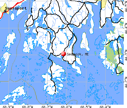
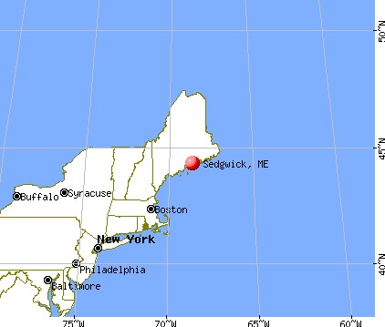
), ), Latitude: 44.32 N, Longitude: 68.64 W
Area code: 207


| Here: | 3.2% |
| Maine: | 3.4% |


- Construction (14.4%)
- Health care (12.4%)
- Educational services (9.2%)
- Agriculture, forestry, fishing & hunting (5.2%)
- Professional, scientific, technical services (5.2%)
- Food & beverage stores (4.6%)
- Transportation equipment (4.0%)

- Construction (23.9%)
- Agriculture, forestry, fishing & hunting (7.6%)
- Transportation equipment (7.2%)
- Professional, scientific, technical services (5.8%)
- Health care (5.4%)
- Educational services (4.3%)
- Repair & maintenance (4.0%)

- Health care (21.0%)
- Educational services (15.2%)
- Food & beverage stores (7.6%)
- Publishing, motion picture & sound recording industries (4.9%)
- Professional, scientific, technical services (4.5%)
- Private households (4.5%)
- Real estate & rental & leasing (4.0%)

- Carpenters (7.0%)
- Preschool, kindergarten, elementary, and middle school teachers (5.4%)
- Cashiers (4.8%)
- Building and grounds cleaning and maintenance occupations (4.0%)
- Assemblers and fabricators (3.4%)
- Other sales and related occupations, including supervisors (3.2%)
- Other office and administrative support workers, including supervisors (3.2%)

- Carpenters (12.7%)
- Assemblers and fabricators (6.2%)
- Driver/sales workers and truck drivers (5.4%)
- Vehicle and mobile equipment mechanics, installers, and repairers (4.3%)
- Fishing, hunting, and forestry occupations (4.3%)
- Computer specialists (3.6%)
- Retail sales workers, except cashiers (3.3%)

- Preschool, kindergarten, elementary, and middle school teachers (10.3%)
- Cashiers (9.8%)
- Nursing, psychiatric, and home health aides (5.8%)
- Building and grounds cleaning and maintenance occupations (5.8%)
- Other sales and related occupations, including supervisors (4.5%)
- Information and record clerks, except customer service representatives (4.0%)
- Waiters and waitresses (3.6%)
Average climate in Sedgwick, Maine
Based on data reported by over 4,000 weather stations


(lower is better)

Air Quality Index (AQI) level in 2023 was 61.9. This is about average.
| City: | 61.9 |
| U.S.: | 72.6 |

Carbon Monoxide (CO) [ppm] level in 2023 was 0.172. This is significantly better than average. Closest monitor was 19.3 miles away from the city center.
| City: | 0.172 |
| U.S.: | 0.251 |


Sulfur Dioxide (SO2) [ppb] level in 2023 was 0.0636. This is significantly better than average. Closest monitor was 14.1 miles away from the city center.
| City: | 0.0636 |
| U.S.: | 1.5147 |

Ozone [ppb] level in 2023 was 36.9. This is about average. Closest monitor was 9.0 miles away from the city center.
| City: | 36.9 |
| U.S.: | 33.3 |


Particulate Matter (PM2.5) [µg/m3] level in 2023 was 4.90. This is significantly better than average. Closest monitor was 19.3 miles away from the city center.
| City: | 4.90 |
| U.S.: | 8.11 |
Earthquake activity:
Sedgwick-area historical earthquake activity is significantly above Maine state average. It is 80% smaller than the overall U.S. average.On 10/16/2012 at 23:12:25, a magnitude 4.7 (4.7 ML, Depth: 10.0 mi, Class: Light, Intensity: IV - V) earthquake occurred 112.1 miles away from Sedgwick center
On 4/20/2002 at 10:50:47, a magnitude 5.3 (5.3 ML, Depth: 3.0 mi, Class: Moderate, Intensity: VI - VII) earthquake occurred 249.9 miles away from Sedgwick center
On 4/20/2002 at 10:50:47, a magnitude 5.2 (5.2 MB, 4.2 MS, 5.2 MW, 5.0 MW) earthquake occurred 250.9 miles away from Sedgwick center
On 1/19/1982 at 00:14:42, a magnitude 4.7 (4.5 MB, 4.7 MD, 4.5 LG) earthquake occurred 157.9 miles away from the city center
On 10/7/1983 at 10:18:46, a magnitude 5.3 (5.1 MB, 5.3 LG, 5.1 ML) earthquake occurred 283.9 miles away from the city center
On 2/26/1999 at 03:38:43, a magnitude 3.8 (3.8 LG, Depth: 2.0 mi, Class: Light, Intensity: II - III) earthquake occurred 44.6 miles away from Sedgwick center
Magnitude types: regional Lg-wave magnitude (LG), body-wave magnitude (MB), duration magnitude (MD), local magnitude (ML), surface-wave magnitude (MS), moment magnitude (MW)
Natural disasters:
The number of natural disasters in Hancock County (18) is near the US average (15).Major Disasters (Presidential) Declared: 11
Emergencies Declared: 6
Causes of natural disasters: Floods: 9, Storms: 8, Snows: 5, Blizzard: 1, Heavy Rain: 1, Hurricane: 1, Ice Storm: 1, Landslide: 1, Snowfall: 1, Wind: 1, Winter Storm: 1, Other: 2 (Note: some incidents may be assigned to more than one category).

Colleges/universities with over 2000 students nearest to Sedgwick:
- Husson University (about 36 miles; Bangor, ME; Full-time enrollment: 2,421)
- University of Maine (about 40 miles; Orono, ME; FT enrollment: 8,931)
- University of Maine at Augusta (about 58 miles; Augusta, ME; FT enrollment: 3,204)
- University of Maine at Farmington (about 78 miles; Farmington, ME; FT enrollment: 2,036)
- Southern Maine Community College (about 92 miles; South Portland, ME; FT enrollment: 4,666)
- University of Southern Maine (about 94 miles; Portland, ME; FT enrollment: 6,647)
- Saint Joseph's College of Maine (about 98 miles; Standish, ME; FT enrollment: 2,010)
Public elementary/middle school in Sedgwick:
- SEDGWICK ELEMENTARY SCHOOL (Location: 272 SNOWS COVE ROAD, Grades: KG-8)
Points of interest:
Notable locations in Sedgwick: Sedgwick Town Landing (A), Sedgwick Volunteer Fire Department Sargentville Station (B), Sedgwick Volunteer Fire Department Ridge Road Station (C). Display/hide their locations on the map
Churches in Sedgwick include: Eccemoccin Church (A), Number Three Chapel (B), First Baptist Church (C). Display/hide their locations on the map
Cemeteries: Rural Cemetery (1), Pine Grove Cemetery (2), Camp Stream Cemetery (3), Carters Point Cemetery (4), Forest Home Cemetery (5). Display/hide their locations on the map
Lakes and swamps: Mill Pond (A), Black Pond (B), Frost Pond (C), John Gray Pond (D), Clapps Meadow (E), Frost Pond Bog (F). Display/hide their locations on the map
Streams, rivers, and creeks: Meadow Brook (A), Deep Bridge Brook (B), Snow Brook (C), Camp Stream (D). Display/hide their locations on the map
Tourist attraction: Art @ The Flower Farm (Cultural Attractions- Events- & Facilities; 1785 N. Sedgwick Road) (1). Display/hide its approximate location on the map
Birthplace of: Warren C. Philbrook - Politician.
| This town: | 2.3 people |
| Maine: | 2.3 people |
| This town: | 65.0% |
| Whole state: | 62.9% |
| This town: | 8.9% |
| Whole state: | 9.4% |
Likely homosexual households (counted as self-reported same-sex unmarried-partner households)
- Lesbian couples: 0.2% of all households
- Gay men: 0.6% of all households
| This town: | 8.5% |
| Whole state: | 10.9% |
| This town: | 0.7% |
| Whole state: | 4.1% |
For population 15 years and over in Sedgwick:

- Never married: 21.7%
- Now married: 61.0%
- Separated: 0.2%
- Widowed: 7.5%
- Divorced: 9.5%
For population 25 years and over in Sedgwick:
- High school or higher: 86.8%
- Bachelor's degree or higher: 28.6%
- Graduate or professional degree: 12.7%
- Unemployed: 4.4%
- Mean travel time to work (commute): 24.5 minutes


| Here: | 11.7 |
| Maine average: | 11.2 |


Graphs represent county-level data. Detailed 2008 Election Results
Religion statistics for Sedgwick, ME (based on Hancock County data)


| Religion | Adherents | Congregations |
|---|---|---|
| Mainline Protestant | 4,691 | 58 |
| Catholic | 2,523 | 9 |
| Evangelical Protestant | 1,288 | 23 |
| Other | 820 | 11 |
| None | 45,096 | - |
Food Environment Statistics:
| Here: | 6.01 / 10,000 pop. |
| Maine: | 2.80 / 10,000 pop. |
| This county: | 1.69 / 10,000 pop. |
| Maine: | 2.20 / 10,000 pop. |
| This county: | 4.89 / 10,000 pop. |
| Maine: | 5.75 / 10,000 pop. |
| Hancock County: | 21.61 / 10,000 pop. |
| Maine: | 11.02 / 10,000 pop. |
| Hancock County: | 7.4% |
| State: | 8.2% |
| This county: | 25.4% |
| Maine: | 25.0% |
Businesses in Sedgwick, ME
- U-Haul: 1
Strongest AM radio stations in Sedgwick:
- WDEA (1370 AM; 5 kW; ELLSWORTH, ME; Owner: CUMULUS LICENSING CORP.)
- WZON (620 AM; 5 kW; BANGOR, ME; Owner: THE ZONE CORPORATION)
- WABI (910 AM; 5 kW; BANGOR, ME; Owner: CLEAR CHANNEL BROADCASTING LICENSES, INC.)
- WSKW (1160 AM; 10 kW; SKOWHEGAN, ME; Owner: MOUNTAIN WIRELESS, INCORPORATED)
- WRKO (680 AM; 50 kW; BOSTON, MA; Owner: ENTERCOM BOSTON LICENSE, LLC)
- WEEI (850 AM; 50 kW; BOSTON, MA; Owner: ENTERCOM BOSTON LICENSE, LLC)
- WBZ (1030 AM; 50 kW; BOSTON, MA; Owner: INFINITY BROADCASTING OPERATIONS, INC.)
- WTME (780 AM; 10 kW; RUMFORD, ME; Owner: MOUNTAIN VALLEY BROADCASTING, INC.)
- WCRN (830 AM; 50 kW; WORCESTER, MA; Owner: CARTER BROADCASTING CORPORATION)
- WFAU (1280 AM; 5 kW; GARDINER, ME; Owner: CAPSTAR TX LIMITED PARTNERSHIP)
- WNNZ (640 AM; 50 kW; WESTFIELD, MA; Owner: CLEAR CHANNEL BROADCASTING LICENSES, INC.)
- WMTW (870 AM; 10 kW; GORHAM, ME; Owner: RADIO PARTNERS OF MAINE, L.P.)
- WKOX (1200 AM; 50 kW; FRAMINGHAM, MA; Owner: CAPSTAR TX LIMITED PARTNERSHIP)
Strongest FM radio stations in Sedgwick:
- WERU-FM (89.9 FM; BLUE HILL, ME; Owner: SALT POND COMMUNITY B/C COMPANY)
- WFZX (101.7 FM; SEARSPORT, ME; Owner: CLEAR CHANNEL BROADCASTING LICENSES, INC.)
- WBFB (104.7 FM; BELFAST, ME; Owner: CLEAR CHANNEL BROADCASTING LICENSES, INC.)
- WWMJ (95.7 FM; ELLSWORTH, ME; Owner: CUMULUS LICENSING CORP.)
- WMEP (90.5 FM; CAMDEN, ME; Owner: MAINE PUBLIC BROADCASTING CORP.)
- WQSS (102.5 FM; CAMDEN, ME; Owner: CLEAR CHANNEL BROADCASTING LICENSES, INC.)
- WKIT-FM (100.3 FM; BREWER, ME; Owner: THE ZONE CORPORATION)
- WWBX (97.1 FM; BANGOR, ME; Owner: CLEAR CHANNEL BROADCASTING LICENSES, INC.)
- WNSX (97.7 FM; WINTER HARBOR, ME; Owner: CLEAR CHANNEL BROADCASTING LICENSES, INC.)
- WMCM (103.3 FM; ROCKLAND, ME; Owner: CLEAR CHANNEL BROADCASTING LICENSES, INC.)
- WMEH (90.9 FM; BANGOR, ME; Owner: MAINE PUBLIC BROADCASTING CORPORATION)
- WEZQ (92.9 FM; BANGOR, ME; Owner: CUMULUS LICENSING CORP.)
- WLKE (99.1 FM; BAR HARBOR, ME; Owner: CLEAR CHANNEL BROADCASTING LICENSES, INC.)
- WBYA (105.5 FM; ISLESBORO, ME; Owner: MARINER BROADCASTING LIMTED PARTNERSHIP)
- WBQX (106.9 FM; THOMASTON, ME; Owner: MARINER BROADCASTING LIMITED PARTNER)
- WBQI (107.7 FM; BAR HARBOR, ME; Owner: MARINER BROADCASTING, L.P.)
TV broadcast stations around Sedgwick:
- WCKD-LP (Channel 30; BANGOR/DEDHAM, ME; Owner: J. MCLEOD, ME FAMILY B/CING., INC.)
- Sedgwick, Maine
- Fatal accident count10
- Vehicles involved in fatal accidents15
- Fatal accidents involving drunk persons:4
- Fatalities10
- Persons involved in fatal accidents23
- Pedestrians involved in fatal accidents0
- Maine average
- Fatal accident count1196
- Vehicles involved in fatal accidents1641
- Fatal accidents involving drunk persons525
- Fatalities1316
- Persons involved in fatal accidents2683
- Pedestrians involved in fatal accidents61
FCC Registered Cell Phone Towers:
1- 467 Ridge Rd (Lat: 44.362722 Lon: -68.619500), Type: Ltower, Structure height: 57.9 m, Call Sign: KNKN831
Assigned Frequencies: 869.040 MHz, 869.040 MHz, 869.040 MHz, 824.040 MHz, 824.040 MHz, 824.040 MHz, 890.010 MHz, 890.010 MHz, 890.010 MHz, 845.010 MHz, 845.010 MHz, 845.010 MHzGrant Date: 09/22/2020, Expiration Date: 10/01/2030, Certifier: Michael P GogginRegistrant: At&t Services, Inc., 208 S Akard St, 20f, Dallas, TX 75202, Phone: (855) 699-7073, Fax: (214) 746-6410, Email:
FCC Registered Antenna Towers:
5- Mark L Gartley, 3200 Ridge Road (Lat: 44.362722 Lon: -68.619500), Type: 57.9, Overall height: 54.8 m, Registrant: Holland & Knight LLP, Pconnolly@hklaw.Com, , Washi-ngton, Phone: (202) 862-5989
- Mark L Gartley, 3200 Ridge Road (Lat: 44.362722 Lon: -68.619500), Type: 57.9, Overall height: 54.8 m, Registrant: Holland & Knight LLP, Pconnolly@hklaw.Com, , Washi-ngton, Phone: (202) 862-5989
- Cayla Gamble, 3200 Ridge Road (Lat: 44.362722 Lon: -68.619500), Type: 57.9, Structure height: 23009 m, Overall height: 54.9 m, Registrant: Holland & Knight LLP, Peter.Connolly@hklaw.Com, , Washi-ngton, Phone: (202) 862-5989
- Cayla Gamble, 3200 Ridge Road (Lat: 44.362722 Lon: -68.619500), Type: 57.9, Structure height: 23009 m, Overall height: 54.9 m, Registrant: Holland & Knight LLP, Peter.Connolly@hklaw.Com, , Washi-ngton, Phone: (202) 862-5989
- Cayla Gamble, 3200 Ridge Road (Lat: 44.362722 Lon: -68.619500), Type: 57.9, Structure height: 23009 m, Overall height: 54.9 m, Registrant: Wilkinson Barker Knauer, LLP, Gwerner@wbklaw.Com, , Washi-ngton, Phone: (202) 383-3420
FCC Registered Broadcast Land Mobile Towers:
1- 3200 Ridge Road (Lat: 44.362722 Lon: -68.619500), Type: Ltower, Structure height: 54.8 m, Overall height: 57.9 m, Call Sign: WPMY839,
Assigned Frequencies: 154.130 MHz, Grant Date: 01/19/2024, Expiration Date: 04/05/2034, Certifier: David A Carter, Registrant: Browns Comm, Suite B 162 Bangor Rd, Ellsworth, ME 04605, Phone: (207) 667-2254, Fax: (207) 667-6335, Email:
FCC Registered Maritime Coast & Aviation Ground Towers:
1- Rt 172 N Sedgwick Rd (Lat: 44.331750 Lon: -68.592806), Type: Building, Overall height: 6 m, Call Sign: WHD623, Licensee ID: L00021510,
Assigned Frequencies: 156.450 MHz, 156.800 MHz, 156.950 MHz, Grant Date: 12/07/1999, Expiration Date: 12/21/2004, Cancellation Date: 02/26/2005, Registrant: James N Anderson, Rr1 Box 2290 Rt 172 N Sedgwick Rd, Sedgwick, ME 04676
FCC Registered Amateur Radio Licenses:
8 (See the full list of FCC Registered Amateur Radio Licenses in Sedgwick)FAA Registered Aircraft:
2- Aircraft: CESSNA 172M (Category: Land, Seats: 4, Weight: Up to 12,499 Pounds, Speed: 108 mph), Engine: LYCOMING 0-320 SERIES (180 HP) (4 Cycle)
N-Number: 172JB, N172JB, N-172JB, Serial Number: 17262206, Year manufactured: 1973, Airworthiness Date: 09/17/1973, Certificate Issue Date: 11/20/2015
Registrant (Individual): Jonathan R Wood, 63 Christy Hill Rd Box 63, Sedgwick, ME 04676
Deregistered: Cancel Date: 11/18/1980 - Aircraft: CESSNA 150C (Category: Land, Seats: 2, Weight: Up to 12,499 Pounds, Speed: 90 mph), Engine: CONT MOTOR 0-200 SERIES (100 HP) (Reciprocating)
N-Number: 2003Z, N2003Z, N-2003Z, Serial Number: 15059803, Year manufactured: 1963, Airworthiness Date: 01/17/1963, Certificate Issue Date: 09/01/2015
Registrant (Individual): Paul Behnken, 607 N Sedgwick Rd, Sedgwick, ME 04676

- 68.4%Fuel oil, kerosene, etc.
- 19.4%Wood
- 8.3%Bottled, tank, or LP gas
- 3.4%Electricity
- 0.5%Solar energy

- 51.2%Fuel oil, kerosene, etc.
- 21.2%Electricity
- 20.0%Wood
- 7.5%Bottled, tank, or LP gas
Sedgwick compared to Maine state average:
- Unemployed percentage significantly below state average.
- Black race population percentage significantly below state average.
- Foreign-born population percentage significantly below state average.
- Renting percentage below state average.
- Length of stay since moving in significantly above state average.
- Number of rooms per house significantly below state average.
- House age significantly below state average.