Warren, Michigan Neighborhood Map - Income, House Prices, Occupations, Boundaries
Settings
X

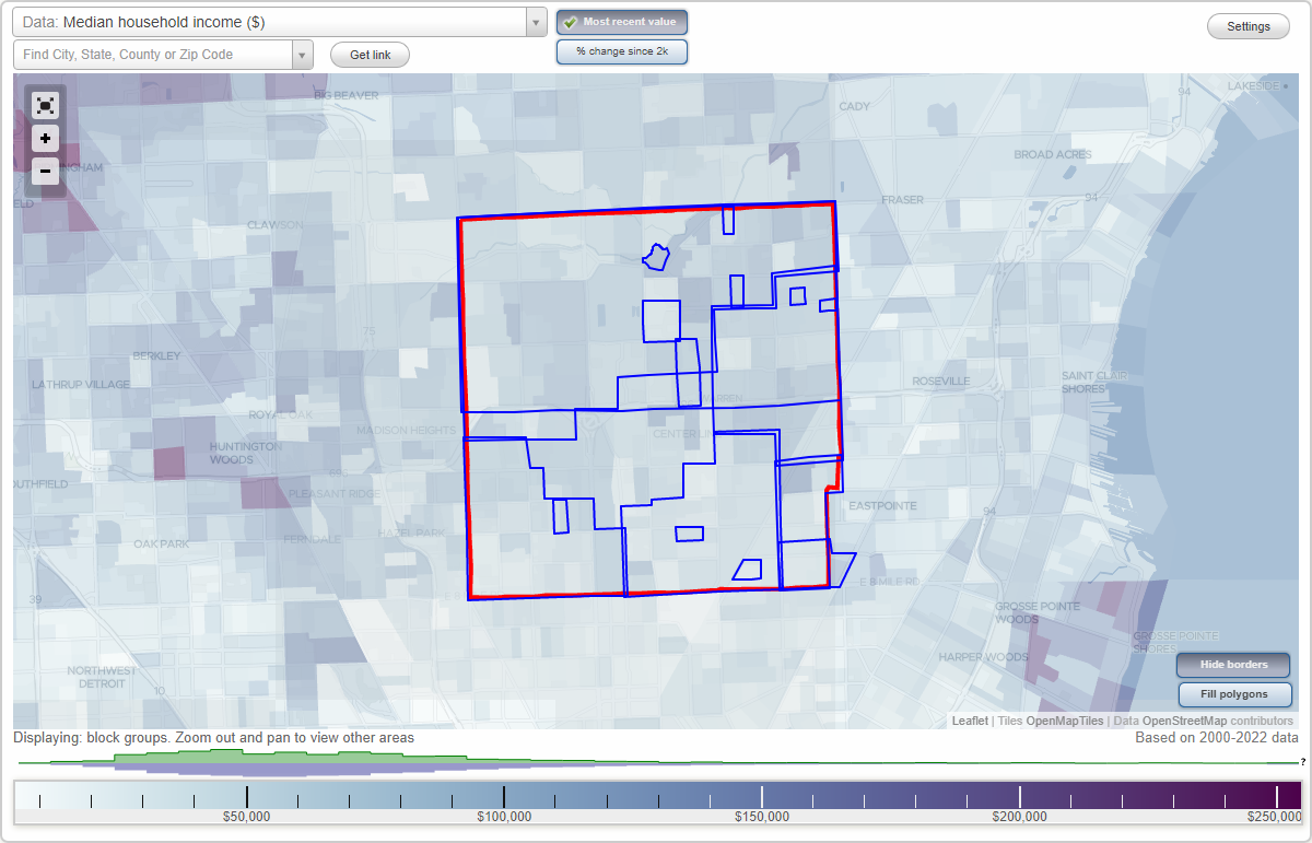
- City boundary
- Neighborhood boundaries
Business Search - 14 Million verified businesses
Neighborhoods:
Bear Creek Village, Beierman Farms, Belangers Garden, Bella Vista Estates, Berkshire Manor, Blossom, Downtown, East Detroit, Fairlane Estates, Fitzgerald, Lorraine, North Warren, Northampton Square, Van Dyke, Warren Con, Warren Woods, WarrendaleBear Creek Village neighborhood in Warren statistics: (Find on map)
Area: 0.104 square miles
Population: 441
Population density:
Median household income in 2021:
Median rent in in 2021:
Male vs Females
Median age
Most popular occupations of males: production occupations (37.6%); material moving occupations (13.2%); management occupations (except farmers) (12.1%); architecture and engineering occupations (9.4%); service occupations (8.5%); computer and mathematical occupations (7.9%); sales and office occupations (5.0%)
Most popular occupations of females: legal occupations (42.3%); sales and office occupations (19.0%); service occupations (8.0%); education, training, and library occupations (7.1%); healthcare practitioners and technical occupations (6.0%); management occupations (except farmers) (4.5%); architecture and engineering occupations (4.2%)
Highways in this neighborhood: State Hwy 53 (Earl Memorial Hwy, Van Dyke Ave).
Roads and streets: Bear Creek Blvd; Chicago Rd; Creek Side Dr; Willow Ln; Willow Ct; Green Meadow Ln; Dogwood Ln; Bear Creek Dr; Forest Ln; Juniper Ln; Hickory Ln; Ivy Ln; Ivy Ct; Crabapple Ln; Edgewater Ln; Villa Ln; Oak Tree Ln; Oak Tree Ct; Forest Ct; Mulberry Ln; Pine Tree Ct; Oaktree Ln.
Other features: Red Run Crk; Bear Crk.
Bear Creek Village neighborhood detailed profile
Area: 0.104 square miles
Population: 441
Population density:
| Bear Creek Village (Bear Creek): | 4,251 people per square mile |
| Warren: | 4,029 people per square mile |
Median household income in 2021:
| Bear Creek Village (Bear Creek): | $74,167 |
| Warren: | $60,042 |
Median rent in in 2021:
| Bear Creek Village (Bear Creek): | $892 |
| Warren: | $857 |
Male vs Females
| Males: | 207 |
| Females: | 234 |
Median age
| Males: | 55.2 years |
| Females: | 55.2 years |
Most popular occupations of males: production occupations (37.6%); material moving occupations (13.2%); management occupations (except farmers) (12.1%); architecture and engineering occupations (9.4%); service occupations (8.5%); computer and mathematical occupations (7.9%); sales and office occupations (5.0%)
Most popular occupations of females: legal occupations (42.3%); sales and office occupations (19.0%); service occupations (8.0%); education, training, and library occupations (7.1%); healthcare practitioners and technical occupations (6.0%); management occupations (except farmers) (4.5%); architecture and engineering occupations (4.2%)
Highways in this neighborhood: State Hwy 53 (Earl Memorial Hwy, Van Dyke Ave).
Roads and streets: Bear Creek Blvd; Chicago Rd; Creek Side Dr; Willow Ln; Willow Ct; Green Meadow Ln; Dogwood Ln; Bear Creek Dr; Forest Ln; Juniper Ln; Hickory Ln; Ivy Ln; Ivy Ct; Crabapple Ln; Edgewater Ln; Villa Ln; Oak Tree Ln; Oak Tree Ct; Forest Ct; Mulberry Ln; Pine Tree Ct; Oaktree Ln.
Other features: Red Run Crk; Bear Crk.
Bear Creek Village neighborhood detailed profile
Beierman Farms neighborhood in Warren statistics: (Find on map)
Area: 0.117 square miles
Population: 498
Population density:
Median household income in 2021:
Median rent in in 2021:
Male vs Females
Median age
Average estimated value of detached houses in 2021 (100.0% of all units):
Most popular occupations of males: sales and office occupations (18.8%); production occupations (18.6%); service occupations (15.9%); arts, design, entertainment, sports, and media occupations (9.9%); healthcare practitioners and technical occupations (5.7%); transportation occupations (4.5%); material moving occupations (4.2%)
Most popular occupations of females: sales and office occupations (28.5%); education, training, and library occupations (21.8%); service occupations (14.5%); production occupations (14.5%); business and financial operations occupations (7.4%); healthcare practitioners and technical occupations (7.1%); management occupations (except farmers) (3.6%)
Roads and streets: Audrey Ave; Masch Ave; Beierman Ave; E 9 Mile Rd; Stephens Rd (Stephens Dr); Stephens Rd.
Beierman Farms neighborhood detailed profile
Area: 0.117 square miles
Population: 498
Population density:
| Beierman Farms: | 4,244 people per square mile |
| Warren: | 4,029 people per square mile |
Median household income in 2021:
| Beierman Farms: | $65,358 |
| Warren: | $60,042 |
Median rent in in 2021:
| Beierman Farms: | $1,029 |
| Warren: | $857 |
Male vs Females
| Males: | 222 |
| Females: | 276 |
Median age
| Males: | 47.3 years |
| Females: | 45.2 years |
Average estimated value of detached houses in 2021 (100.0% of all units):
| Beierman Farms: | $113,162 |
| Warren: | $135,351 |
Most popular occupations of males: sales and office occupations (18.8%); production occupations (18.6%); service occupations (15.9%); arts, design, entertainment, sports, and media occupations (9.9%); healthcare practitioners and technical occupations (5.7%); transportation occupations (4.5%); material moving occupations (4.2%)
Most popular occupations of females: sales and office occupations (28.5%); education, training, and library occupations (21.8%); service occupations (14.5%); production occupations (14.5%); business and financial operations occupations (7.4%); healthcare practitioners and technical occupations (7.1%); management occupations (except farmers) (3.6%)
Roads and streets: Audrey Ave; Masch Ave; Beierman Ave; E 9 Mile Rd; Stephens Rd (Stephens Dr); Stephens Rd.
Beierman Farms neighborhood detailed profile
Belangers Garden neighborhood in Warren statistics: (Find on map)
Area: 0.093 square miles
Population: 762
Population density:
Median household income in 2021:
Median rent in in 2021:
Male vs Females
Median age
Housing prices:
Average estimated value of detached houses in 2021 (82.0% of all units):
Average estimated value of mobile home in 2021 (1.4% of all units):
Most popular occupations of males: sales and office occupations (37993.2%); material moving occupations (24535.5%); management occupations (except farmers) (15629.3%); healthcare practitioners and technical occupations (6330.5%); farming, fishing, and forestry occupations (4945.7%); production occupations (66.2%); service occupations (9.6%)
Most popular occupations of females: architecture and engineering occupations (29474.4%); management occupations (except farmers) (25357.6%); education, training, and library occupations (3172.2%); healthcare practitioners and technical occupations (3169.3%); sales and office occupations (34.7%); service occupations (21.4%); arts, design, entertainment, sports, and media occupations (18.4%)
Roads and streets: 9 Mile Rd; Dodge Ave; Maxwell Ave; Ford Ave; Cadillac Ave; Marmon Ave; Campbell Ave; Lorraine Ave; Mac Arthur Blvd.
Belangers Garden neighborhood detailed profile
Area: 0.093 square miles
Population: 762
Population density:
| Belangers Garden: | 8,192 people per square mile |
| Warren: | 4,029 people per square mile |
Median household income in 2021:
| Belangers Garden: | $37,778 |
| Warren: | $60,042 |
Median rent in in 2021:
| Belangers Garden: | $834 |
| Warren: | $857 |
Male vs Females
| Males: | 444 |
| Females: | 317 |
Median age
| Males: | 35.4 years |
| Females: | 38.1 years |
Housing prices:
Average estimated value of detached houses in 2021 (82.0% of all units):
| Belangers Garden: | $69,505 |
| Warren: | $135,351 |
Average estimated value of mobile home in 2021 (1.4% of all units):
| Belangers Garden: | $355,042 |
| Warren: | $86,379 |
Most popular occupations of males: sales and office occupations (37993.2%); material moving occupations (24535.5%); management occupations (except farmers) (15629.3%); healthcare practitioners and technical occupations (6330.5%); farming, fishing, and forestry occupations (4945.7%); production occupations (66.2%); service occupations (9.6%)
Most popular occupations of females: architecture and engineering occupations (29474.4%); management occupations (except farmers) (25357.6%); education, training, and library occupations (3172.2%); healthcare practitioners and technical occupations (3169.3%); sales and office occupations (34.7%); service occupations (21.4%); arts, design, entertainment, sports, and media occupations (18.4%)
Roads and streets: 9 Mile Rd; Dodge Ave; Maxwell Ave; Ford Ave; Cadillac Ave; Marmon Ave; Campbell Ave; Lorraine Ave; Mac Arthur Blvd.
Belangers Garden neighborhood detailed profile
Bella Vista Estates neighborhood in Warren statistics: (Find on map)
Area: 0.047 square miles
Population: 320
Population density:
Median household income in 2021:
Median rent in in 2021:
Male vs Females
Median age
Housing prices:
Average estimated value of detached houses in 2021 (29.2% of all units):
Average estimated value of townhouses or other attached units in 2021 (24.6% of all units):
Average estimated '21 value of housing units in 3-to-4-unit structures (13.1% of all units):
Average estimated '21 value of housing units in 5-or-more-unit structures (0.8% of all units):
Most popular occupations of males: sales and office occupations (29.8%); service occupations (25.8%); transportation occupations (14.8%); healthcare practitioners and technical occupations (7.3%); production occupations (4.8%); management occupations (except farmers) (4.4%); material moving occupations (2.8%)
Most popular occupations of females: service occupations (33.6%); sales and office occupations (30.0%); computer and mathematical occupations (17.9%); education, training, and library occupations (6.4%); construction, extraction, and maintenance occupations (3.0%); healthcare practitioners and technical occupations (2.7%); business and financial operations occupations (2.4%)
Roads and streets: Common Rd; Lane Dr; Jacobs Dr; Hayes Rd; Gloede Dr; Ledford Dr; Keller Dr; Lane Ct.
Other features: Ruhl Drn.
Bella Vista Estates neighborhood detailed profile
Area: 0.047 square miles
Population: 320
Population density:
| Bella Vista Estates: | 6,809 people per square mile |
| Warren: | 4,029 people per square mile |
Median household income in 2021:
| Bella Vista Estates: | $64,898 |
| Warren: | $60,042 |
Median rent in in 2021:
| Bella Vista Estates: | $834 |
| Warren: | $857 |
Male vs Females
| Males: | 132 |
| Females: | 188 |
Median age
| Males: | 45.3 years |
| Females: | 32.5 years |
Housing prices:
Average estimated value of detached houses in 2021 (29.2% of all units):
| Bella Vista Estates: | $35,460 |
| Warren: | $135,351 |
Average estimated value of townhouses or other attached units in 2021 (24.6% of all units):
| This neighborhood: | $176,701 |
| city: | $216,583 |
Average estimated '21 value of housing units in 3-to-4-unit structures (13.1% of all units):
| Bella Vista Estates: | $109,087 |
| city: | $130,744 |
Average estimated '21 value of housing units in 5-or-more-unit structures (0.8% of all units):
| Bella Vista Estates: | $48,278 |
| Warren: | $60,269 |
Most popular occupations of males: sales and office occupations (29.8%); service occupations (25.8%); transportation occupations (14.8%); healthcare practitioners and technical occupations (7.3%); production occupations (4.8%); management occupations (except farmers) (4.4%); material moving occupations (2.8%)
Most popular occupations of females: service occupations (33.6%); sales and office occupations (30.0%); computer and mathematical occupations (17.9%); education, training, and library occupations (6.4%); construction, extraction, and maintenance occupations (3.0%); healthcare practitioners and technical occupations (2.7%); business and financial operations occupations (2.4%)
Roads and streets: Common Rd; Lane Dr; Jacobs Dr; Hayes Rd; Gloede Dr; Ledford Dr; Keller Dr; Lane Ct.
Other features: Ruhl Drn.
Bella Vista Estates neighborhood detailed profile
Berkshire Manor neighborhood in Warren statistics: (Find on map)
Area: 0.115 square miles
Highways in this neighborhood: State Hwy 97 (Groesbeck Hwy).
Roads and streets: Vernon Ave; Prospect Ave; Couwlier Ave; Sherman Ave; Sarsfield Ave; Sidonie Ave; Waltham Rd; Fairfield Ave; Marie Ave; Helle Ave; Edom Ave.
Berkshire Manor neighborhood detailed profile
Area: 0.115 square miles
Highways in this neighborhood: State Hwy 97 (Groesbeck Hwy).
Roads and streets: Vernon Ave; Prospect Ave; Couwlier Ave; Sherman Ave; Sarsfield Ave; Sidonie Ave; Waltham Rd; Fairfield Ave; Marie Ave; Helle Ave; Edom Ave.
Berkshire Manor neighborhood detailed profile
Blossom neighborhood in Warren statistics: (Find on map)
Area: 0.060 square miles
Population: 254
Population density:
Median household income in 2021:
Median rent in in 2021:
Male vs Females
Median age
Housing prices:
Average estimated value of detached houses in 2021 (33.0% of all units):
Average estimated value of townhouses or other attached units in 2021 (37.7% of all units):
Average estimated '21 value of housing units in 3-to-4-unit structures (44.3% of all units):
Average estimated '21 value of housing units in 5-or-more-unit structures (2.8% of all units):
Most popular occupations of males: business and financial operations occupations (233.7%); construction, extraction, and maintenance occupations (41.2%); sales and office occupations (26.6%); service occupations (8.1%); production occupations (6.7%); transportation occupations (4.8%); healthcare practitioners and technical occupations (4.0%)
Most popular occupations of females: arts, design, entertainment, sports, and media occupations (75.2%); legal occupations (58.1%); service occupations (31.0%); transportation occupations (20.5%); production occupations (17.8%); sales and office occupations (17.2%); architecture and engineering occupations (17.1%)
Roads and streets: Castle Ave; Autumn Ln; Sharon Ln; Common Rd; Blossom Ln; April Ln.
Other features: Harrington Drn.
Blossom neighborhood detailed profile
Area: 0.060 square miles
Population: 254
Population density:
| Blossom: | 4,237 people per square mile |
| Warren: | 4,029 people per square mile |
Median household income in 2021:
| Blossom: | $60,794 |
| Warren: | $60,042 |
Median rent in in 2021:
| Blossom: | $807 |
| Warren: | $857 |
Male vs Females
| Males: | 119 |
| Females: | 135 |
Median age
| Males: | 42.7 years |
| Females: | 32.0 years |
Housing prices:
Average estimated value of detached houses in 2021 (33.0% of all units):
| Blossom: | $180,782 |
| Warren: | $135,351 |
Average estimated value of townhouses or other attached units in 2021 (37.7% of all units):
| This neighborhood: | $176,701 |
| city: | $216,583 |
Average estimated '21 value of housing units in 3-to-4-unit structures (44.3% of all units):
| Blossom: | $109,087 |
| city: | $130,744 |
Average estimated '21 value of housing units in 5-or-more-unit structures (2.8% of all units):
| Blossom: | $48,278 |
| Warren: | $60,269 |
Most popular occupations of males: business and financial operations occupations (233.7%); construction, extraction, and maintenance occupations (41.2%); sales and office occupations (26.6%); service occupations (8.1%); production occupations (6.7%); transportation occupations (4.8%); healthcare practitioners and technical occupations (4.0%)
Most popular occupations of females: arts, design, entertainment, sports, and media occupations (75.2%); legal occupations (58.1%); service occupations (31.0%); transportation occupations (20.5%); production occupations (17.8%); sales and office occupations (17.2%); architecture and engineering occupations (17.1%)
Roads and streets: Castle Ave; Autumn Ln; Sharon Ln; Common Rd; Blossom Ln; April Ln.
Other features: Harrington Drn.
Blossom neighborhood detailed profile
Downtown neighborhood in Warren statistics: (Find on map)
Area: 0.384 square miles
Population: 955
Population density:
Median household income in 2021:
Median rent in in 2021:
Male vs Females
Median age
Housing prices:
Average estimated value of detached houses in 2021 (23.7% of all units):
Average estimated value of mobile home in 2021 (3.0% of all units):
Most popular occupations of males: transportation occupations (41.3%); material moving occupations (16.3%); service occupations (14.4%); sales and office occupations (8.8%); production occupations (8.6%); architecture and engineering occupations (4.9%); education, training, and library occupations (2.3%)
Most popular occupations of females: arts, design, entertainment, sports, and media occupations (25.1%); business and financial operations occupations (22.7%); sales and office occupations (18.5%); service occupations (12.7%); material moving occupations (10.7%); management occupations (except farmers) (3.7%); education, training, and library occupations (2.7%)
Highways in this neighborhood: State Hwy 53 (Earl Memorial Hwy, Van Dyke Ave).
Roads and streets: S Kennedy Cir; Common Rd; E 12 Mile Rd; S Civic Center Blvd; N Civic Center Dr; Lorraine Ave; Racine Rd; Cole Dr; Community Blvd; Park Place Dr; Kennedy Cir N; City Center Dr; Terrace Ct; Estate Plaza Dr; Texas Ct; Riviera Heights Dr; Lund Ave; Longview Ave; New Horizon Blvd; Metropolitan Ave; E West Blvd; Tucson Ct; Phoenix Ct; Jefferson Ct; Lorraine Ct.
Downtown neighborhood detailed profile
Area: 0.384 square miles
Population: 955
Population density:
| Downtown: | 2,485 people per square mile |
| Warren: | 4,029 people per square mile |
Median household income in 2021:
| Downtown: | $72,619 |
| Warren: | $60,042 |
Median rent in in 2021:
| Downtown: | $997 |
| Warren: | $857 |
Male vs Females
| Males: | 423 |
| Females: | 531 |
Median age
| Males: | 35.0 years |
| Females: | 45.6 years |
Housing prices:
Average estimated value of detached houses in 2021 (23.7% of all units):
| Downtown: | $180,260 |
| Warren: | $135,351 |
Average estimated value of mobile home in 2021 (3.0% of all units):
| Downtown: | $2,219 |
| Warren: | $86,379 |
Most popular occupations of males: transportation occupations (41.3%); material moving occupations (16.3%); service occupations (14.4%); sales and office occupations (8.8%); production occupations (8.6%); architecture and engineering occupations (4.9%); education, training, and library occupations (2.3%)
Most popular occupations of females: arts, design, entertainment, sports, and media occupations (25.1%); business and financial operations occupations (22.7%); sales and office occupations (18.5%); service occupations (12.7%); material moving occupations (10.7%); management occupations (except farmers) (3.7%); education, training, and library occupations (2.7%)
Highways in this neighborhood: State Hwy 53 (Earl Memorial Hwy, Van Dyke Ave).
Roads and streets: S Kennedy Cir; Common Rd; E 12 Mile Rd; S Civic Center Blvd; N Civic Center Dr; Lorraine Ave; Racine Rd; Cole Dr; Community Blvd; Park Place Dr; Kennedy Cir N; City Center Dr; Terrace Ct; Estate Plaza Dr; Texas Ct; Riviera Heights Dr; Lund Ave; Longview Ave; New Horizon Blvd; Metropolitan Ave; E West Blvd; Tucson Ct; Phoenix Ct; Jefferson Ct; Lorraine Ct.
Downtown neighborhood detailed profile
East Detroit neighborhood in Warren statistics: (Find on map)
Area: 1.824 square miles
Population: 12,801
Population density:
Median household income in 2021:
Median rent in in 2021:
Male vs Females
Median age
Housing prices:
Average estimated value of detached houses in 2021 (94.6% of all units):
Average estimated value of townhouses or other attached units in 2021 (5.2% of all units):
Most popular occupations of males: production occupations (22.2%); sales and office occupations (17.4%); service occupations (13.8%); material moving occupations (11.6%); construction, extraction, and maintenance occupations (9.7%); transportation occupations (7.6%); architecture and engineering occupations (2.5%)
Most popular occupations of females: sales and office occupations (45.3%); service occupations (19.8%); production occupations (12.9%); healthcare practitioners and technical occupations (5.6%); education, training, and library occupations (5.4%); business and financial operations occupations (3.8%); management occupations (except farmers) (2.8%)
Highways in this neighborhood: State Hwy 102 (8 Mile Rd, E 8 Mile Rd); Groesbeck Hwy (State Hwy 97).
Roads and streets: Schoenherr Rd; E 10 Mile Rd; Stephens Rd; Wellington Ave; Columbus Ave; Lauren Ave; Bolam Ave; E 9 Mile Rd; Toepfer Rd; Knox Ave; Hendricks Ave; Stewart Ave; Leonard Ave; Marshall Ave; Elroy Ave; Blackett Ave; Chesterfield Ave; Doyle Ave; Hobart Ave; Sherman Ave; Couwlier Ave; Shirley Ave; Eastwood Blvd; Lawson Ave; Dexter Blvd; la Salle Blvd; Nummer St; Hayes Ave; Melody; Willard Ave; Ehlert Ave; Roseberry Ave; Weller Ave; Grabar Sq; Allyn Ave; Linus Dr; Cottage Ln; Gentner St; Ida Ave; Julius Ave; Berry Ave; Eleanor Ave; Sidonie Ave; Myola Ave; Alberta Ave; Mona Ave; Freeman St; Montrose Ave; Prairie Ln; Eastwood Ave; Merriweather Pl; la Salle Ave; Nummer Ave; Myrand St; Eelcoo Ave; Pingree Ave; Eastwood Ct; Dexter Ct; Doyle; Stephens Dr (Stephens Rd); Nehls St; Burr Ave; Butte Ave.
Railroad features: Conrail RR.
Highways in this neighborhood: State Hwy 102 (E 8 Mile Rd, 8 Mile Rd).
East Detroit neighborhood detailed profile
Area: 1.824 square miles
Population: 12,801
Population density:
| East Detroit: | 7,017 people per square mile |
| Warren: | 4,029 people per square mile |
Median household income in 2021:
| East Detroit: | $50,716 |
| Warren: | $60,042 |
Median rent in in 2021:
| East Detroit: | $797 |
| Warren: | $857 |
Male vs Females
| Males: | 6,032 |
| Females: | 6,768 |
Median age
| Males: | 36.2 years |
| Females: | 35.1 years |
Housing prices:
Average estimated value of detached houses in 2021 (94.6% of all units):
| East Detroit: | $74,132 |
| Warren: | $135,351 |
Average estimated value of townhouses or other attached units in 2021 (5.2% of all units):
| This neighborhood: | $111,568 |
| city: | $216,583 |
Most popular occupations of males: production occupations (22.2%); sales and office occupations (17.4%); service occupations (13.8%); material moving occupations (11.6%); construction, extraction, and maintenance occupations (9.7%); transportation occupations (7.6%); architecture and engineering occupations (2.5%)
Most popular occupations of females: sales and office occupations (45.3%); service occupations (19.8%); production occupations (12.9%); healthcare practitioners and technical occupations (5.6%); education, training, and library occupations (5.4%); business and financial operations occupations (3.8%); management occupations (except farmers) (2.8%)
Highways in this neighborhood: State Hwy 102 (8 Mile Rd, E 8 Mile Rd); Groesbeck Hwy (State Hwy 97).
Roads and streets: Schoenherr Rd; E 10 Mile Rd; Stephens Rd; Wellington Ave; Columbus Ave; Lauren Ave; Bolam Ave; E 9 Mile Rd; Toepfer Rd; Knox Ave; Hendricks Ave; Stewart Ave; Leonard Ave; Marshall Ave; Elroy Ave; Blackett Ave; Chesterfield Ave; Doyle Ave; Hobart Ave; Sherman Ave; Couwlier Ave; Shirley Ave; Eastwood Blvd; Lawson Ave; Dexter Blvd; la Salle Blvd; Nummer St; Hayes Ave; Melody; Willard Ave; Ehlert Ave; Roseberry Ave; Weller Ave; Grabar Sq; Allyn Ave; Linus Dr; Cottage Ln; Gentner St; Ida Ave; Julius Ave; Berry Ave; Eleanor Ave; Sidonie Ave; Myola Ave; Alberta Ave; Mona Ave; Freeman St; Montrose Ave; Prairie Ln; Eastwood Ave; Merriweather Pl; la Salle Ave; Nummer Ave; Myrand St; Eelcoo Ave; Pingree Ave; Eastwood Ct; Dexter Ct; Doyle; Stephens Dr (Stephens Rd); Nehls St; Burr Ave; Butte Ave.
Railroad features: Conrail RR.
Highways in this neighborhood: State Hwy 102 (E 8 Mile Rd, 8 Mile Rd).
East Detroit neighborhood detailed profile
Fairlane Estates neighborhood in Warren statistics: (Find on map)
Area: 0.100 square miles
Population: 454
Population density:
Median household income in 2021:
Median rent in in 2021:
Male vs Females
Median age
Housing prices:
Average estimated value of detached houses in 2021 (100.0% of all units):
Average estimated value of townhouses or other attached units in 2021 (1.2% of all units):
Most popular occupations of males: material moving occupations (441.5%); community and social services occupations (114.7%); healthcare practitioners and technical occupations (87.0%); service occupations (22.3%); sales and office occupations (18.6%); management occupations (except farmers) (15.8%); architecture and engineering occupations (8.4%)
Most popular occupations of females: business and financial operations occupations (525.7%); transportation occupations (134.7%); arts, design, entertainment, sports, and media occupations (114.7%); sales and office occupations (41.1%); service occupations (11.1%); computer and mathematical occupations (10.6%); healthcare practitioners and technical occupations (7.8%)
Roads and streets: Pinto Dr; Roan Dr; Palomino Dr; Muriel Dr; E 13 Mile Rd; Common Rd; Rosselo Ave; Alger Dr.
Fairlane Estates neighborhood detailed profile
Area: 0.100 square miles
Population: 454
Population density:
| Fairlane Estates: | 4,518 people per square mile |
| Warren: | 4,029 people per square mile |
Median household income in 2021:
| Fairlane Estates: | $74,904 |
| Warren: | $60,042 |
Median rent in in 2021:
| Fairlane Estates: | $819 |
| Warren: | $857 |
Male vs Females
| Males: | 241 |
| Females: | 212 |
Median age
| Males: | 39.7 years |
| Females: | 43.3 years |
Housing prices:
Average estimated value of detached houses in 2021 (100.0% of all units):
| Fairlane Estates: | $159,298 |
| Warren: | $135,351 |
Average estimated value of townhouses or other attached units in 2021 (1.2% of all units):
| This neighborhood: | $109,250 |
| city: | $216,583 |
Most popular occupations of males: material moving occupations (441.5%); community and social services occupations (114.7%); healthcare practitioners and technical occupations (87.0%); service occupations (22.3%); sales and office occupations (18.6%); management occupations (except farmers) (15.8%); architecture and engineering occupations (8.4%)
Most popular occupations of females: business and financial operations occupations (525.7%); transportation occupations (134.7%); arts, design, entertainment, sports, and media occupations (114.7%); sales and office occupations (41.1%); service occupations (11.1%); computer and mathematical occupations (10.6%); healthcare practitioners and technical occupations (7.8%)
Roads and streets: Pinto Dr; Roan Dr; Palomino Dr; Muriel Dr; E 13 Mile Rd; Common Rd; Rosselo Ave; Alger Dr.
Fairlane Estates neighborhood detailed profile
Fitzgerald neighborhood in Warren statistics: (Find on map)
Area: 4.922 square miles
Population: 28,228
Population density:
Median household income in 2021:
Median rent in in 2021:
Male vs Females
Median age
Housing prices:
Average estimated value of detached houses in 2021 (68.4% of all units):
Average estimated value of townhouses or other attached units in 2021 (12.2% of all units):
Average estimated value of mobile home in 2021 (24.2% of all units):
Most popular occupations of males: service occupations (25.5%); production occupations (17.2%); sales and office occupations (13.5%); material moving occupations (8.5%); business and financial operations occupations (6.1%); construction, extraction, and maintenance occupations (6.0%); transportation occupations (5.5%)
Most popular occupations of females: sales and office occupations (28.5%); service occupations (23.0%); production occupations (14.7%); healthcare practitioners and technical occupations (7.1%); education, training, and library occupations (6.6%); business and financial operations occupations (5.9%); management occupations (except farmers) (3.7%)
Limited-access highways (interstate or state) in this neighborhood: I- 696 (Walter P Reuther Fwy).
Highways in this neighborhood: State Hwy 102 (E 8 Mile Rd).
Roads and streets: Mound Rd; Stephens Dr (Stephens Rd); Dequindre Rd; Ryan Rd; E 9 Mile Rd; Toepfer Rd; Warner Ave; Bart Ave; Warren Manor Apartment; E 10 Mile Rd; Masch Ave; Cunningham Ave; Audrey Ave; Frazho Rd; Morrissey Ave; Thomas St; Los Angeles Ave; Garrick Ave; 9 Mile Rd; Le Fever Ave; Sherwood Ave; Cyman Ave; Curie Ave; Otis Ave; Eureka Ave; Jarvis Ave; Panama Ave; Stolzenfeld Ave; Michael Ave; Hayden St; Elza St; Rome Ave; Pearl Ave; Woodbridge Rd; Virginia Ave; Dallas Ave; Alvina Ave; Wasmund Ave; Capitol Ave; Berkshire Ave; Waltz Ave; Shady Ln (Capitol Ave); Emmons Ave; John B Ave; Poplar Ave; Dolores Ave; N Lafayette Blvd; Hill St; Sunset Ave; Behrendt Ave; Doepfer Rd; Christopher Ave; Atlantic Ave; Panama St; Blackmar Ave; Syracuse Ave; Oak St; Greenhill Rd; Warren Trailor Park; Doncea Dr; Wexford Ave; Beierman Ave; Pinewood St; Norbert Ave; Logue Ave; Karam Ct; Ira Blvd; S Lafayette Blvd; Hudson Ave; Hill Ave; Concept Dr; Marcy St; Maple St; Bruce St; Methuen Ave; Guenther; Romano St; Albany Ave; Esch Dr; Chase Dr; Woodruff Ave; Curie St; Goulson Ave; Jeannie Ct; Joanne Ave; Karen Ave; Woodrow Wilson Ave; Billette Dr; Kenney Ave; Riggs Ave; Kendall Rd; Minerva St; Kate Ave; Kathleen Ave; Dean St; Colendale St (Nita St); Peppertree Ln; Centerwood Dr; Chalk Farm Rd W; Hebe Ave; Timberline Dr; Whitehall Ct; Chestnut St; Bach St; Reba Ave; Old Kent Rd N; Lark Ave; Reynolds Ave; Cline St; Westbrook St; Chalk Farm Rd N; Thomas Dr; Shipston Ct N; Shipston Ct S; Joliet Ave; Dormont Ave; Ada Ave; Winifred Ave; Marlin Ave; Prescott Ave; S Seaton Circuit St; N Seaton Circuit St; Kiefer Ave; Old Kent Rd W; Schultes Ave; Plumhoff Ave; Oxford Rd; E Seaton Circuit St; W Seaton Circuit St; McMillan Ave; Grunalt Ave; Glenita St; Bach Ave; Urbanek Ave; Tanney Ave; June Ave; Bartholomaei Ave; Cadillac Ave; Main St; Tony St; Flo St; Wick Ave; Zerita St; Snapfinger Aly; Leda Dr; Joseph St; Cour Ville St; Cour Renee St; Cour Retta St; Cour Louis St; Cour Marie St; Conners Ave; Lark Ct; Princess Ct; Connie Ln; Jade Ct; Tobsal Ct; Mart Ct; Stephens Rd; Lila Ct; Cheshire Ct; Haverford Ct; 1st St; Fox Ct; London St; Cardigan Ct; Bradford Ct; Shipston Ct; Lafayette Blvd S; Pete St; E London St; Lee St; Studebaker Ave; Mac St.
Railroad features: Conrail RR (Csx RR & Norfolk Southern Rlwy); Csx RR & Norfolk Southern Rlwy (Penn Central RR).
Other features: Bear Creek Ditch.
Other features: Toll Drn; Hartsig Drn; Kutchey Drn; Sharkey Drn.
Other features: Bear Creek Drn.
Limited-access highways (interstate or state) in this neighborhood: I- 696.
Roads and streets: Dequindre Rd.
Highways in this neighborhood: State Hwy 102 (E 8 Mile Rd, 8 Mile Rd).
Roads and streets: Dequindre St; Gable Ave.
Fitzgerald neighborhood detailed profile
Area: 4.922 square miles
Population: 28,228
Population density:
| Fitzgerald: | 5,735 people per square mile |
| Warren: | 4,029 people per square mile |
Median household income in 2021:
| Fitzgerald: | $46,891 |
| Warren: | $60,042 |
Median rent in in 2021:
| Fitzgerald: | $834 |
| Warren: | $857 |
Male vs Females
| Males: | 13,551 |
| Females: | 14,677 |
Median age
| Males: | 38.9 years |
| Females: | 40.1 years |
Housing prices:
Average estimated value of detached houses in 2021 (68.4% of all units):
| Fitzgerald: | $101,733 |
| Warren: | $135,351 |
Average estimated value of townhouses or other attached units in 2021 (12.2% of all units):
| This neighborhood: | $133,250 |
| city: | $216,583 |
Average estimated value of mobile home in 2021 (24.2% of all units):
| Fitzgerald: | $20,884 |
| Warren: | $86,379 |
Most popular occupations of males: service occupations (25.5%); production occupations (17.2%); sales and office occupations (13.5%); material moving occupations (8.5%); business and financial operations occupations (6.1%); construction, extraction, and maintenance occupations (6.0%); transportation occupations (5.5%)
Most popular occupations of females: sales and office occupations (28.5%); service occupations (23.0%); production occupations (14.7%); healthcare practitioners and technical occupations (7.1%); education, training, and library occupations (6.6%); business and financial operations occupations (5.9%); management occupations (except farmers) (3.7%)
Limited-access highways (interstate or state) in this neighborhood: I- 696 (Walter P Reuther Fwy).
Highways in this neighborhood: State Hwy 102 (E 8 Mile Rd).
Roads and streets: Mound Rd; Stephens Dr (Stephens Rd); Dequindre Rd; Ryan Rd; E 9 Mile Rd; Toepfer Rd; Warner Ave; Bart Ave; Warren Manor Apartment; E 10 Mile Rd; Masch Ave; Cunningham Ave; Audrey Ave; Frazho Rd; Morrissey Ave; Thomas St; Los Angeles Ave; Garrick Ave; 9 Mile Rd; Le Fever Ave; Sherwood Ave; Cyman Ave; Curie Ave; Otis Ave; Eureka Ave; Jarvis Ave; Panama Ave; Stolzenfeld Ave; Michael Ave; Hayden St; Elza St; Rome Ave; Pearl Ave; Woodbridge Rd; Virginia Ave; Dallas Ave; Alvina Ave; Wasmund Ave; Capitol Ave; Berkshire Ave; Waltz Ave; Shady Ln (Capitol Ave); Emmons Ave; John B Ave; Poplar Ave; Dolores Ave; N Lafayette Blvd; Hill St; Sunset Ave; Behrendt Ave; Doepfer Rd; Christopher Ave; Atlantic Ave; Panama St; Blackmar Ave; Syracuse Ave; Oak St; Greenhill Rd; Warren Trailor Park; Doncea Dr; Wexford Ave; Beierman Ave; Pinewood St; Norbert Ave; Logue Ave; Karam Ct; Ira Blvd; S Lafayette Blvd; Hudson Ave; Hill Ave; Concept Dr; Marcy St; Maple St; Bruce St; Methuen Ave; Guenther; Romano St; Albany Ave; Esch Dr; Chase Dr; Woodruff Ave; Curie St; Goulson Ave; Jeannie Ct; Joanne Ave; Karen Ave; Woodrow Wilson Ave; Billette Dr; Kenney Ave; Riggs Ave; Kendall Rd; Minerva St; Kate Ave; Kathleen Ave; Dean St; Colendale St (Nita St); Peppertree Ln; Centerwood Dr; Chalk Farm Rd W; Hebe Ave; Timberline Dr; Whitehall Ct; Chestnut St; Bach St; Reba Ave; Old Kent Rd N; Lark Ave; Reynolds Ave; Cline St; Westbrook St; Chalk Farm Rd N; Thomas Dr; Shipston Ct N; Shipston Ct S; Joliet Ave; Dormont Ave; Ada Ave; Winifred Ave; Marlin Ave; Prescott Ave; S Seaton Circuit St; N Seaton Circuit St; Kiefer Ave; Old Kent Rd W; Schultes Ave; Plumhoff Ave; Oxford Rd; E Seaton Circuit St; W Seaton Circuit St; McMillan Ave; Grunalt Ave; Glenita St; Bach Ave; Urbanek Ave; Tanney Ave; June Ave; Bartholomaei Ave; Cadillac Ave; Main St; Tony St; Flo St; Wick Ave; Zerita St; Snapfinger Aly; Leda Dr; Joseph St; Cour Ville St; Cour Renee St; Cour Retta St; Cour Louis St; Cour Marie St; Conners Ave; Lark Ct; Princess Ct; Connie Ln; Jade Ct; Tobsal Ct; Mart Ct; Stephens Rd; Lila Ct; Cheshire Ct; Haverford Ct; 1st St; Fox Ct; London St; Cardigan Ct; Bradford Ct; Shipston Ct; Lafayette Blvd S; Pete St; E London St; Lee St; Studebaker Ave; Mac St.
Railroad features: Conrail RR (Csx RR & Norfolk Southern Rlwy); Csx RR & Norfolk Southern Rlwy (Penn Central RR).
Other features: Bear Creek Ditch.
Other features: Toll Drn; Hartsig Drn; Kutchey Drn; Sharkey Drn.
Other features: Bear Creek Drn.
Limited-access highways (interstate or state) in this neighborhood: I- 696.
Roads and streets: Dequindre Rd.
Highways in this neighborhood: State Hwy 102 (E 8 Mile Rd, 8 Mile Rd).
Roads and streets: Dequindre St; Gable Ave.
Fitzgerald neighborhood detailed profile
Lorraine neighborhood in Warren statistics: (Find on map)
Area: 0.393 square miles
Population: 2,668
Population density:
Median household income in 2021:
Median rent in in 2021:
Male vs Females
Median age
Average estimated value of detached houses in 2021 (94.7% of all units):
Most popular occupations of males: production occupations (17.2%); management occupations (except farmers) (15.1%); sales and office occupations (13.3%); material moving occupations (10.8%); transportation occupations (9.0%); architecture and engineering occupations (8.4%); service occupations (6.9%)
Most popular occupations of females: sales and office occupations (43.3%); healthcare practitioners and technical occupations (10.7%); management occupations (except farmers) (9.3%); education, training, and library occupations (8.5%); service occupations (8.1%); farming, fishing, and forestry occupations (6.5%); business and financial operations occupations (4.6%)
Limited-access highways (interstate or state) in this neighborhood: Walter P Reuther Fwy (I- 696).
Roads and streets: Los Olas Dr; Lorraine Ave; E 11 Mile Rd; Gilbert Dr; Campbell Rd; Campbell Dr; Aline Dr; Palm Beach Dr; Martin Rd; E 12 Mile Rd; Irvington Dr; Gerald Dr; Garbor Ave; Newland Dr; Campbell Ct; Gail Dr.
Lorraine neighborhood detailed profile
Area: 0.393 square miles
Population: 2,668
Population density:
| Lorraine: | 6,790 people per square mile |
| Warren: | 4,029 people per square mile |
Median household income in 2021:
| Lorraine: | $69,944 |
| Warren: | $60,042 |
Median rent in in 2021:
| Lorraine: | $805 |
| Warren: | $857 |
Male vs Females
| Males: | 1,268 |
| Females: | 1,399 |
Median age
| Males: | 38.9 years |
| Females: | 48.4 years |
Average estimated value of detached houses in 2021 (94.7% of all units):
| Lorraine: | $148,415 |
| Warren: | $135,351 |
Most popular occupations of males: production occupations (17.2%); management occupations (except farmers) (15.1%); sales and office occupations (13.3%); material moving occupations (10.8%); transportation occupations (9.0%); architecture and engineering occupations (8.4%); service occupations (6.9%)
Most popular occupations of females: sales and office occupations (43.3%); healthcare practitioners and technical occupations (10.7%); management occupations (except farmers) (9.3%); education, training, and library occupations (8.5%); service occupations (8.1%); farming, fishing, and forestry occupations (6.5%); business and financial operations occupations (4.6%)
Limited-access highways (interstate or state) in this neighborhood: Walter P Reuther Fwy (I- 696).
Roads and streets: Los Olas Dr; Lorraine Ave; E 11 Mile Rd; Gilbert Dr; Campbell Rd; Campbell Dr; Aline Dr; Palm Beach Dr; Martin Rd; E 12 Mile Rd; Irvington Dr; Gerald Dr; Garbor Ave; Newland Dr; Campbell Ct; Gail Dr.
Lorraine neighborhood detailed profile
North Warren neighborhood in Warren statistics: (Find on map)
Area: 19.398 square miles
Population: 89,197
Population density:
Median household income in 2021:
Median rent in in 2021:
Male vs Females
Median age
Housing prices:
Average estimated value of detached houses in 2021 (79.2% of all units):
Average estimated value of townhouses or other attached units in 2021 (15.5% of all units):
Average estimated '21 value of housing units in 3-to-4-unit structures (7.1% of all units):
Average estimated '21 value of housing units in 5-or-more-unit structures (7.9% of all units):
Average estimated value of mobile home in 2021 (3.2% of all units):
Most popular occupations of males: production occupations (15.1%); sales and office occupations (13.2%); service occupations (13.0%); management occupations (except farmers) (9.1%); material moving occupations (7.8%); transportation occupations (7.0%); construction, extraction, and maintenance occupations (6.6%)
Most popular occupations of females: sales and office occupations (30.3%); service occupations (19.1%); healthcare practitioners and technical occupations (10.8%); management occupations (except farmers) (7.4%); business and financial operations occupations (6.9%); education, training, and library occupations (5.7%); production occupations (4.6%)
Limited-access highways (interstate or state) in this neighborhood: I- 696 (Walter P Reuther Fwy).
Highways in this neighborhood: Earl Memorial Hwy (State Hwy 53, Van Dyke Ave); Groesbeck Hwy (State Hwy 97).
Roads and streets: E 11 Mile Rd; Conrail R R Yard; E 14 Mile Rd (E Fourteen Mile Rd); Common Rd; Martin Rd; Mound Rd; Chicago Rd; E 12 Mile Rd; E 13 Mile Rd; 13 Mile Rd; Masonic Blvd; Hayes Rd; Hoover Rd; Schoenherr Rd; Ryan Rd; Dequindre Rd; 12 Mile Rd; Roan Dr; Newport Dr; Palomino Dr; Gilbert Dr; Gloede Dr; Murthum Ave; Dover Ave; Lorraine Ave; Racine Rd; Parkview Blvd; Bunert Rd; Arden Ave; Sutherland Ave; Bradner Dr; Wagner Dr; Pinto Dr; Universal Dr; Garbor Ave; Kennedy Cir N; Colpaert Dr; S Kennedy Cir; Alger Ave; Flanders Ave; Fairfield Dr; Irvington Dr; Marlow Dr; Gerald Dr; Geoffry Dr; Chippewa Dr; Parent Ave; Eiffel Ave; Adams Ave; Canterbury Dr; Desmond Dr; Ohmer Dr; Moulin Ave; Warner Ave; Milton Ave; Potomac St; Jenny Dr; Aline Dr; Tecla Dr; Cromie Dr; Fountain View Apartment; Iroquois Dr; Peck Dr; Carol Ave; Bonnie Dr; Arsenal Ave; Linda St; Stricker Dr; Arlinton Manor Apartment; Lund Ave; Merrick Ave; Seneca Dr; Marilyn Dr; Buchanan Ave; Los Olas Dr; Cousino Dr; Shawn Dr; Streefkerk Dr; Irene Ave; Hartlein Dr; Bade Dr; Girard Dr; Rosenbusch Dr; Beechwood Dr; Ridgefield Ave; Lutz Ave; Walter Ave; Malvina Dr; Leisure Dr; Cunningham Dr; Wexford Dr; Audrey Ave; Wellston Dr; Lancaster Woods Apartment; Walker Ave; S Civic Center Blvd; Cambridge Dr; Rosselo Ave; Meadowbrook Dr; Lorna Ave; Elmer Ave; Anna Ave; Adler Dr; Beebe Ave; Gerald St; Olive St; Hillcrest Ct (Hillcrest Ave); Francine St; Campbell Ave; N Civic Center Dr; Iowa Dr; Gail Dr; James Dr; Bear Creek Blvd; Lancaster Dr; Norma Dr; Farnum Ave; Castle Ave; Sylvan Ave; Tank Ave; Boewe Dr; Marian Ave; Stanley Ave; Lachene Ave; Thomas Ave; Liberty Dr; Otter St; Stanley Dr; Warkop Ave; Talbot Dr; Joyce Dr; Melva Dr; Bretz Dr; el Capitan Dr; Grobbel Ave; Ivanhoe Dr; Darlene St; Tuxedo Dr; Linderman Ave; Newcastle Dr; Panama St; Alger St; Van Laan Dr; Gruenburg Dr; Palmer Woods Dr; Christine St; Regal Dr; Earl Dr; Dell Ln; Firwood Dr; Nancy Dr; Jean Rd; Hoerning Ave; Washington Blvd; Imperial Dr; Campbell Rd; Chard Ave; Miller Dr; Revere Ave; Norwood Ave; Farnum Ct; Vermont Ave; Hollingsworth Ave; Sudbury Dr; Adams Dr; David Givens St; Santa Anna Dr; Hanover Dr; Gainsborough Dr; Fred St; Girard St; Buckingham Dr; James St; Dowland St; Edison Dr; Orvylle Dr; Campbell Dr; Dawson Ave; Suburban Dr; Knapp Ave; Grinsell Dr; Irma St; Susan Ave; Ruehle Ave; Apolonia Dr; Nelson Dr; Grobbel Dr; Autumn Ln; Palm Beach Dr; Blair Dr; Dawson Dr; Walker Dr; Knollwood Dr; Reid Dr; Edwin Dr; Casmere Ave; George Merrelli Ave; Parker Cir; Evelyn Ave; Columbus Dr; Holmes Dr; Lutz Dr; Reader Dr; Marla Dr; Warner St; Pembroke Dr; Lowe Dr; St Onge Cir; Moceri Cir; Austin Dr; Granada Plz; Pagels Dr; Coventry Pl; Elmgrove Ave; Muriel Dr; Ventura Dr; Harrison Dr; Longview Ave; Linville Dr; Coachlite Manor Condominium; Marrocco Dr; Armanda Dr; Frank Dr; Oakview Dr; Northampton Dr; Glenwood Cir; Cosgrove Dr; Lyons Cir W; Pauline St; Parkside Dr; Hawthorne Dr; St Annes Dr; Heathdale Ave; Marian St; Barber Ave; Whitley Cir; Burssens Dr; Saratoga Ave; Marcia Ave; Hughes Dr; Shackett Ave; Haverhill Dr; Kingsley Dr; Dunn Dr; Scarborough Dr; Primrose Dr; Hayman Dr; Valley Dr; Chalfonte Dr; E Nottingham Cir; Karam Blvd; Pleasant Dr; Briarcliff Dr; Maple Lane Cir; Morgan Dr; Greenbriar Ave; Gardendale Dr; Holden Dr; Perry Cir; Hartford Dr; Saint Louise Dr; Edwood Dr; Gerald Ave; Shaw Dr; Hartwick Dr; Hettenberger Ave; Peck Ave; Acton Dr; la Grande Plz; Louise Dr; Geraldine Dr; Fina Dr; Stratford Dr; Huntington Dr; Crestwood Dr; Westbrook Ave; Hartsig Ave; Fenwick Dr; Red Maple Dr; Arden Dr; Beth Dr; Blossom Ln; Tropea Dr; Ward Ave; Valenti Dr; St Vincent Ave; Diena Dr; Potomac Ave; Marlene Dr; Darryl Dr; Anna St; Cole Dr; Canterbury Ln; Winters Dr; Community Blvd; Welsh Dr; Exeter Dr; Carion Dr; la Rose Dr; Norwood Dr; Park Place Dr; Enterprise Ct; Barclay Sq; Lyons Cir E; Runey Dr; Greentree Dr; Barfield Dr; Dawn Dr; Patricia Ave; Pall Dr; New Horizon Blvd; Bruggeman Dr; Sadler Dr; George Dr; Woodhouse Dr; Lane Dr; Schauer Dr; Lyons Cir S; Busko Ave; W Nottingham Cir; Brockington Dr; 7th St; Mac Kenzie Cir W; Applewood Dr; Yvonne Dr; Madison Ave; Rugby Dr; Newland Dr; Wauketa Ave; Denmar Dr; City Center Dr; Shady Dr; Jacobs Dr; Dowland Dr; Harder Dr; Aleta Cir; Brohl Dr; Claeys Dr; Penrose Dr; Moroso Dr; Jenny Ave; Trembleton Ave; Convention Blvd; Birchcrest Dr; Bicsak Dr; Revere Dr; Robinwood Blvd; Wareham Dr; Carmody Dr; Freda Dr; Yorkshire Ln; Shampo Dr; Queens Ct; Shelbourne Dr; Gander Ave; Garbor Dr; Norrid Cir; Harrington Dr; Broadmoor Dr; Davy St; Clarpointe Dr; Halmich Dr; Baldwin Ave; Seyburn Ave; Townsend Ave; Barbary Ct; Sharon Ln; Haupt Dr; Underwood Dr; Sheffield Dr; Blancke Dr; Winslow Ave; Roman Ct; N Grand Oaks Dr; Charles Dr; Collins Dr; Meadowbrooke Ln; University Ave; Bryson's Cove Dr; Warner Dr; Kevin Cir; Vegas Dr; Maddox Dr; Bon Brae Dr; Robertson Dr; Matilda Ave; Hanford Dr; S Grand Oaks Dr; Nutmeg Ct; Universal Dr N; Chicago Rd S; Newbern Dr; Merideth Dr; Kelsey Dr; Wixson Dr; Lowe Ave; Loretta Ave; Strathmoor Dr; Bristol Dr; de Mott Dr; Meadow Lane Dr; Balfour Dr; Scrivo Dr; Audubon Dr; Roselawn Dr; Steele Dr; Tefft Dr; Baird Ave; Bates Dr; Denton Dr; Amber Le Dr; Artesian Dr; Stoney Brook Ln; Queens Ct E; Walter Ct; Meckl Dr; Winterfield Dr; Virginia Dr; Besmore Dr; Terrace Ct; Dartmouth Dr; N Tuxedo Dr; Red Run Dr; Estate Plaza Dr; Lloyd Dr; Anita Dr; S Tuxedo Dr; Mac Kenzie Cir E; Nicholas Ct; Sunrise Dr; McGrath Dr; Mark Adam Ln; Stilwell Dr; la Chene Dr; Glen Dr; Durham Dr; Mirage Ct; Berwyn Dr; Creek Side Dr; Birchtree Dr; Raphael Ter; Pine Ridge Dr; Lachene Dr; Brown Dr; Belleau Dr; Wolgast Dr; Mavis Dr; Dorothy Ln; Helen Dr; Edward Griggs Blvd; Dearden Dr; Edward Griggs; Brixham Dr; Texas Ct; St Edmund Dr; Edna Dr; McConnell Ct; Flynn Ave; Lebanon Dr; Huff Dr; Cedars Dr; Kingswood Dr; Kensington Dr; Regency Ct; Hayes Blvd (Hayes Rd); River Dr; Kensington Blvd (Kensington Dr); Ray Dr; Lexington Hts (Lexington St); College Park Dr; Riviera Heights Dr; Lincoln Dr; Malvina Ct; Filmore Ave; Sabrina Ct; Universal Dr C; Donald Ct; Campbell Ct; Dohran Dr; Craig Ct; Wauketa Dr; Mystic Ln; Heatherwood Ct; Villa Ct; Mark Adam Lange; Diegel Rd; Villa Pointe Dr; Capri Dr; Valley Blvd; Rolf Dr; Dundee Dr; Somerset Ln; Ironwood Dr; Edgeton Dr; Matilda Ct; Evelyn Ct; Lyons Cir N; Yvette Dr; Aspen Dr; Red Oaks Dr; Arnold Dr; Mary Ann Dr; Dowland Ct; Sebastian Dr; Willow Ln; Wareham Ct; Eaton Dr; Guy Ct; Kenneth Dr; Joseph Leonard Ct; Miami Dr; Hawaii Dr; Warner Ct; Beech Nut Dr; Willow Ct; Pinehill Dr; Eldorado Ter; Green Meadow Ln; Regency Dr; Dominic Dr; McAlpine Dr; Eckstein St; Dwight Dr; Cara Donna St; Zink Dr; Metropolitan Ave; Dogwood Ln; Smith Dr; Palco Dr; Winchester Ave; Marino Dr; Cloverly Ct; Weier Dr; Bear Creek Dr; E West Blvd; Thornwood Ct; Surow Dr; North St; Elderwood Dr; Sunny Ln; Tuxedo Ct; Karns Dr; Burssens Ct; Concord Ave; Hollywood Blvd; Penrose Ct; Forest Ln; Irvington Dr (Irvington Ct); Edwin Ct; Racine Ct; Irene Ct; West Ave; Hanford Ct; East Ave; Ledford Dr; Eldorado Plz; Busko Cir; Glenoaks Ct; Juniper Ln; Bennington Ave; Raymond Dr; Sankuer Dr; Justin St; Gallo Ln; Keller Dr; Larkspur Ct; April Ln; Binney Dr; Jay Dr; Hickory Ct; Robinette Ave; Lachene Ct; Spruce Ct; E Fort Lauderdale St; Tucson Ct; Check Dr; Bayberry Ct; Barcroft Way; Wisteria Ct; Mararet Ct; Dimas Dr; Universal Dr W; Hickory Ln; Ivy Ln; Janet Ave; Wilcox Ct; Lynn Ct; Stout Ave; Ivy Ct; Sheridan Ct; Amel Dr; Haff Ct; Kingswood Ct; Crabapple Ln; Winnie Ave; Hawaii St; Phoenix Ct; Mase Dr; Elm Tree Ln; Addelia St; Railroad St; Pineview Ct; 12 1/2 Mile Rd; Center Dr; Tara Dr; Bramble Ct; Madeline Dr; Lynch Ct; Callahan St; Abe Dr; Cedar Ridge Ct; Center St; Martha Dr; Yonka Dr; Winters Ct; Palm Dr; Lorraine Ct; Firethorn Ct; Dennis Ln; Caradonna St; Jane Ct; Edgewater Ln; Rose Ct; Villa Ln; Alger Dr; Jan Dr; Roy Dr; Bon Mar Dr; Elly Ct; Angela Dr; John Michael Cir; Ken Ct; Shelley Dr; Sycamore Dr; Arsenal St; Fayette Dr; Seneca Ct; Sherwood Ave; Short Dr; Hanley Dr; San Francisco St; Dwyer St; Don Ct; Busko Ct; Hughes Ct; Paul Ct; Oak Tree Ln; Lee St; White Oaks Dr; Oak Tree Ct; Forest Ct; Holly Ct; Cromie Ct; Mary Ct; Betty Dr; Kelly Dr; Joseph Anthony Ct; Bates Ct; Louise Ct; Lane Ct; Novak Ave; Farnum Cir; Maple Lane Ct E; Jefferson Ct; Eiffel Ct; Gloria Ct; Scott Ct; Panama Ave; la Chene Ave; Mulberry Ln; Clairpointe Dr; Franklin Ct; Trafalga Dr; Pine Tree Ct; Geoffery Dr; Roan Ave; E Fourteen Mile Rd; Exeter Ct; Geraldine Ct; Capri Ct; Cambridge Ct; School Dr; Bradner Ave; Oaktree Ln; Edna Ct; Meadowbrook Ln.
Railroad features: Penn Central RR (Csx RR & Norfolk Southern Rlwy); Conrail RR (Csx RR & Norfolk Southern Rlwy).
Other features: Red Run Crk; Bear Crk; Harrington Drn; Meckler Drn; Mc Coy Drn; Schroeder Drn; Smith Drn; Meirow Drn; Big Beaver Crk; McCoy Drn; Ruhl Drn; Miller Drn.
Other features: Grobel Ditch.
Other features: Bunert Drn; Rinke Drn.
Roads and streets: Dequindre Rd; Fontaine Ave; Elliott Ave; Moulin Ave; Oakland Dr.
Other features: Red Run Drn.
North Warren neighborhood detailed profile
Area: 19.398 square miles
Population: 89,197
Population density:
| North Warren (North): | 4,598 people per square mile |
| Warren: | 4,029 people per square mile |
Median household income in 2021:
| North Warren (North): | $63,636 |
| Warren: | $60,042 |
Median rent in in 2021:
| North Warren (North): | $883 |
| Warren: | $857 |
Male vs Females
| Males: | 44,149 |
| Females: | 45,048 |
Median age
| Males: | 41.6 years |
| Females: | 44.9 years |
Housing prices:
Average estimated value of detached houses in 2021 (79.2% of all units):
| North Warren (North): | $172,270 |
| Warren: | $135,351 |
Average estimated value of townhouses or other attached units in 2021 (15.5% of all units):
| This neighborhood: | $148,732 |
| city: | $216,583 |
Average estimated '21 value of housing units in 3-to-4-unit structures (7.1% of all units):
| North Warren (North): | $101,192 |
| city: | $130,744 |
Average estimated '21 value of housing units in 5-or-more-unit structures (7.9% of all units):
| North Warren (North): | $179,273 |
| Warren: | $60,269 |
Average estimated value of mobile home in 2021 (3.2% of all units):
| North Warren (North): | $2,219 |
| Warren: | $86,379 |
Most popular occupations of males: production occupations (15.1%); sales and office occupations (13.2%); service occupations (13.0%); management occupations (except farmers) (9.1%); material moving occupations (7.8%); transportation occupations (7.0%); construction, extraction, and maintenance occupations (6.6%)
Most popular occupations of females: sales and office occupations (30.3%); service occupations (19.1%); healthcare practitioners and technical occupations (10.8%); management occupations (except farmers) (7.4%); business and financial operations occupations (6.9%); education, training, and library occupations (5.7%); production occupations (4.6%)
Limited-access highways (interstate or state) in this neighborhood: I- 696 (Walter P Reuther Fwy).
Highways in this neighborhood: Earl Memorial Hwy (State Hwy 53, Van Dyke Ave); Groesbeck Hwy (State Hwy 97).
Roads and streets: E 11 Mile Rd; Conrail R R Yard; E 14 Mile Rd (E Fourteen Mile Rd); Common Rd; Martin Rd; Mound Rd; Chicago Rd; E 12 Mile Rd; E 13 Mile Rd; 13 Mile Rd; Masonic Blvd; Hayes Rd; Hoover Rd; Schoenherr Rd; Ryan Rd; Dequindre Rd; 12 Mile Rd; Roan Dr; Newport Dr; Palomino Dr; Gilbert Dr; Gloede Dr; Murthum Ave; Dover Ave; Lorraine Ave; Racine Rd; Parkview Blvd; Bunert Rd; Arden Ave; Sutherland Ave; Bradner Dr; Wagner Dr; Pinto Dr; Universal Dr; Garbor Ave; Kennedy Cir N; Colpaert Dr; S Kennedy Cir; Alger Ave; Flanders Ave; Fairfield Dr; Irvington Dr; Marlow Dr; Gerald Dr; Geoffry Dr; Chippewa Dr; Parent Ave; Eiffel Ave; Adams Ave; Canterbury Dr; Desmond Dr; Ohmer Dr; Moulin Ave; Warner Ave; Milton Ave; Potomac St; Jenny Dr; Aline Dr; Tecla Dr; Cromie Dr; Fountain View Apartment; Iroquois Dr; Peck Dr; Carol Ave; Bonnie Dr; Arsenal Ave; Linda St; Stricker Dr; Arlinton Manor Apartment; Lund Ave; Merrick Ave; Seneca Dr; Marilyn Dr; Buchanan Ave; Los Olas Dr; Cousino Dr; Shawn Dr; Streefkerk Dr; Irene Ave; Hartlein Dr; Bade Dr; Girard Dr; Rosenbusch Dr; Beechwood Dr; Ridgefield Ave; Lutz Ave; Walter Ave; Malvina Dr; Leisure Dr; Cunningham Dr; Wexford Dr; Audrey Ave; Wellston Dr; Lancaster Woods Apartment; Walker Ave; S Civic Center Blvd; Cambridge Dr; Rosselo Ave; Meadowbrook Dr; Lorna Ave; Elmer Ave; Anna Ave; Adler Dr; Beebe Ave; Gerald St; Olive St; Hillcrest Ct (Hillcrest Ave); Francine St; Campbell Ave; N Civic Center Dr; Iowa Dr; Gail Dr; James Dr; Bear Creek Blvd; Lancaster Dr; Norma Dr; Farnum Ave; Castle Ave; Sylvan Ave; Tank Ave; Boewe Dr; Marian Ave; Stanley Ave; Lachene Ave; Thomas Ave; Liberty Dr; Otter St; Stanley Dr; Warkop Ave; Talbot Dr; Joyce Dr; Melva Dr; Bretz Dr; el Capitan Dr; Grobbel Ave; Ivanhoe Dr; Darlene St; Tuxedo Dr; Linderman Ave; Newcastle Dr; Panama St; Alger St; Van Laan Dr; Gruenburg Dr; Palmer Woods Dr; Christine St; Regal Dr; Earl Dr; Dell Ln; Firwood Dr; Nancy Dr; Jean Rd; Hoerning Ave; Washington Blvd; Imperial Dr; Campbell Rd; Chard Ave; Miller Dr; Revere Ave; Norwood Ave; Farnum Ct; Vermont Ave; Hollingsworth Ave; Sudbury Dr; Adams Dr; David Givens St; Santa Anna Dr; Hanover Dr; Gainsborough Dr; Fred St; Girard St; Buckingham Dr; James St; Dowland St; Edison Dr; Orvylle Dr; Campbell Dr; Dawson Ave; Suburban Dr; Knapp Ave; Grinsell Dr; Irma St; Susan Ave; Ruehle Ave; Apolonia Dr; Nelson Dr; Grobbel Dr; Autumn Ln; Palm Beach Dr; Blair Dr; Dawson Dr; Walker Dr; Knollwood Dr; Reid Dr; Edwin Dr; Casmere Ave; George Merrelli Ave; Parker Cir; Evelyn Ave; Columbus Dr; Holmes Dr; Lutz Dr; Reader Dr; Marla Dr; Warner St; Pembroke Dr; Lowe Dr; St Onge Cir; Moceri Cir; Austin Dr; Granada Plz; Pagels Dr; Coventry Pl; Elmgrove Ave; Muriel Dr; Ventura Dr; Harrison Dr; Longview Ave; Linville Dr; Coachlite Manor Condominium; Marrocco Dr; Armanda Dr; Frank Dr; Oakview Dr; Northampton Dr; Glenwood Cir; Cosgrove Dr; Lyons Cir W; Pauline St; Parkside Dr; Hawthorne Dr; St Annes Dr; Heathdale Ave; Marian St; Barber Ave; Whitley Cir; Burssens Dr; Saratoga Ave; Marcia Ave; Hughes Dr; Shackett Ave; Haverhill Dr; Kingsley Dr; Dunn Dr; Scarborough Dr; Primrose Dr; Hayman Dr; Valley Dr; Chalfonte Dr; E Nottingham Cir; Karam Blvd; Pleasant Dr; Briarcliff Dr; Maple Lane Cir; Morgan Dr; Greenbriar Ave; Gardendale Dr; Holden Dr; Perry Cir; Hartford Dr; Saint Louise Dr; Edwood Dr; Gerald Ave; Shaw Dr; Hartwick Dr; Hettenberger Ave; Peck Ave; Acton Dr; la Grande Plz; Louise Dr; Geraldine Dr; Fina Dr; Stratford Dr; Huntington Dr; Crestwood Dr; Westbrook Ave; Hartsig Ave; Fenwick Dr; Red Maple Dr; Arden Dr; Beth Dr; Blossom Ln; Tropea Dr; Ward Ave; Valenti Dr; St Vincent Ave; Diena Dr; Potomac Ave; Marlene Dr; Darryl Dr; Anna St; Cole Dr; Canterbury Ln; Winters Dr; Community Blvd; Welsh Dr; Exeter Dr; Carion Dr; la Rose Dr; Norwood Dr; Park Place Dr; Enterprise Ct; Barclay Sq; Lyons Cir E; Runey Dr; Greentree Dr; Barfield Dr; Dawn Dr; Patricia Ave; Pall Dr; New Horizon Blvd; Bruggeman Dr; Sadler Dr; George Dr; Woodhouse Dr; Lane Dr; Schauer Dr; Lyons Cir S; Busko Ave; W Nottingham Cir; Brockington Dr; 7th St; Mac Kenzie Cir W; Applewood Dr; Yvonne Dr; Madison Ave; Rugby Dr; Newland Dr; Wauketa Ave; Denmar Dr; City Center Dr; Shady Dr; Jacobs Dr; Dowland Dr; Harder Dr; Aleta Cir; Brohl Dr; Claeys Dr; Penrose Dr; Moroso Dr; Jenny Ave; Trembleton Ave; Convention Blvd; Birchcrest Dr; Bicsak Dr; Revere Dr; Robinwood Blvd; Wareham Dr; Carmody Dr; Freda Dr; Yorkshire Ln; Shampo Dr; Queens Ct; Shelbourne Dr; Gander Ave; Garbor Dr; Norrid Cir; Harrington Dr; Broadmoor Dr; Davy St; Clarpointe Dr; Halmich Dr; Baldwin Ave; Seyburn Ave; Townsend Ave; Barbary Ct; Sharon Ln; Haupt Dr; Underwood Dr; Sheffield Dr; Blancke Dr; Winslow Ave; Roman Ct; N Grand Oaks Dr; Charles Dr; Collins Dr; Meadowbrooke Ln; University Ave; Bryson's Cove Dr; Warner Dr; Kevin Cir; Vegas Dr; Maddox Dr; Bon Brae Dr; Robertson Dr; Matilda Ave; Hanford Dr; S Grand Oaks Dr; Nutmeg Ct; Universal Dr N; Chicago Rd S; Newbern Dr; Merideth Dr; Kelsey Dr; Wixson Dr; Lowe Ave; Loretta Ave; Strathmoor Dr; Bristol Dr; de Mott Dr; Meadow Lane Dr; Balfour Dr; Scrivo Dr; Audubon Dr; Roselawn Dr; Steele Dr; Tefft Dr; Baird Ave; Bates Dr; Denton Dr; Amber Le Dr; Artesian Dr; Stoney Brook Ln; Queens Ct E; Walter Ct; Meckl Dr; Winterfield Dr; Virginia Dr; Besmore Dr; Terrace Ct; Dartmouth Dr; N Tuxedo Dr; Red Run Dr; Estate Plaza Dr; Lloyd Dr; Anita Dr; S Tuxedo Dr; Mac Kenzie Cir E; Nicholas Ct; Sunrise Dr; McGrath Dr; Mark Adam Ln; Stilwell Dr; la Chene Dr; Glen Dr; Durham Dr; Mirage Ct; Berwyn Dr; Creek Side Dr; Birchtree Dr; Raphael Ter; Pine Ridge Dr; Lachene Dr; Brown Dr; Belleau Dr; Wolgast Dr; Mavis Dr; Dorothy Ln; Helen Dr; Edward Griggs Blvd; Dearden Dr; Edward Griggs; Brixham Dr; Texas Ct; St Edmund Dr; Edna Dr; McConnell Ct; Flynn Ave; Lebanon Dr; Huff Dr; Cedars Dr; Kingswood Dr; Kensington Dr; Regency Ct; Hayes Blvd (Hayes Rd); River Dr; Kensington Blvd (Kensington Dr); Ray Dr; Lexington Hts (Lexington St); College Park Dr; Riviera Heights Dr; Lincoln Dr; Malvina Ct; Filmore Ave; Sabrina Ct; Universal Dr C; Donald Ct; Campbell Ct; Dohran Dr; Craig Ct; Wauketa Dr; Mystic Ln; Heatherwood Ct; Villa Ct; Mark Adam Lange; Diegel Rd; Villa Pointe Dr; Capri Dr; Valley Blvd; Rolf Dr; Dundee Dr; Somerset Ln; Ironwood Dr; Edgeton Dr; Matilda Ct; Evelyn Ct; Lyons Cir N; Yvette Dr; Aspen Dr; Red Oaks Dr; Arnold Dr; Mary Ann Dr; Dowland Ct; Sebastian Dr; Willow Ln; Wareham Ct; Eaton Dr; Guy Ct; Kenneth Dr; Joseph Leonard Ct; Miami Dr; Hawaii Dr; Warner Ct; Beech Nut Dr; Willow Ct; Pinehill Dr; Eldorado Ter; Green Meadow Ln; Regency Dr; Dominic Dr; McAlpine Dr; Eckstein St; Dwight Dr; Cara Donna St; Zink Dr; Metropolitan Ave; Dogwood Ln; Smith Dr; Palco Dr; Winchester Ave; Marino Dr; Cloverly Ct; Weier Dr; Bear Creek Dr; E West Blvd; Thornwood Ct; Surow Dr; North St; Elderwood Dr; Sunny Ln; Tuxedo Ct; Karns Dr; Burssens Ct; Concord Ave; Hollywood Blvd; Penrose Ct; Forest Ln; Irvington Dr (Irvington Ct); Edwin Ct; Racine Ct; Irene Ct; West Ave; Hanford Ct; East Ave; Ledford Dr; Eldorado Plz; Busko Cir; Glenoaks Ct; Juniper Ln; Bennington Ave; Raymond Dr; Sankuer Dr; Justin St; Gallo Ln; Keller Dr; Larkspur Ct; April Ln; Binney Dr; Jay Dr; Hickory Ct; Robinette Ave; Lachene Ct; Spruce Ct; E Fort Lauderdale St; Tucson Ct; Check Dr; Bayberry Ct; Barcroft Way; Wisteria Ct; Mararet Ct; Dimas Dr; Universal Dr W; Hickory Ln; Ivy Ln; Janet Ave; Wilcox Ct; Lynn Ct; Stout Ave; Ivy Ct; Sheridan Ct; Amel Dr; Haff Ct; Kingswood Ct; Crabapple Ln; Winnie Ave; Hawaii St; Phoenix Ct; Mase Dr; Elm Tree Ln; Addelia St; Railroad St; Pineview Ct; 12 1/2 Mile Rd; Center Dr; Tara Dr; Bramble Ct; Madeline Dr; Lynch Ct; Callahan St; Abe Dr; Cedar Ridge Ct; Center St; Martha Dr; Yonka Dr; Winters Ct; Palm Dr; Lorraine Ct; Firethorn Ct; Dennis Ln; Caradonna St; Jane Ct; Edgewater Ln; Rose Ct; Villa Ln; Alger Dr; Jan Dr; Roy Dr; Bon Mar Dr; Elly Ct; Angela Dr; John Michael Cir; Ken Ct; Shelley Dr; Sycamore Dr; Arsenal St; Fayette Dr; Seneca Ct; Sherwood Ave; Short Dr; Hanley Dr; San Francisco St; Dwyer St; Don Ct; Busko Ct; Hughes Ct; Paul Ct; Oak Tree Ln; Lee St; White Oaks Dr; Oak Tree Ct; Forest Ct; Holly Ct; Cromie Ct; Mary Ct; Betty Dr; Kelly Dr; Joseph Anthony Ct; Bates Ct; Louise Ct; Lane Ct; Novak Ave; Farnum Cir; Maple Lane Ct E; Jefferson Ct; Eiffel Ct; Gloria Ct; Scott Ct; Panama Ave; la Chene Ave; Mulberry Ln; Clairpointe Dr; Franklin Ct; Trafalga Dr; Pine Tree Ct; Geoffery Dr; Roan Ave; E Fourteen Mile Rd; Exeter Ct; Geraldine Ct; Capri Ct; Cambridge Ct; School Dr; Bradner Ave; Oaktree Ln; Edna Ct; Meadowbrook Ln.
Railroad features: Penn Central RR (Csx RR & Norfolk Southern Rlwy); Conrail RR (Csx RR & Norfolk Southern Rlwy).
Other features: Red Run Crk; Bear Crk; Harrington Drn; Meckler Drn; Mc Coy Drn; Schroeder Drn; Smith Drn; Meirow Drn; Big Beaver Crk; McCoy Drn; Ruhl Drn; Miller Drn.
Other features: Grobel Ditch.
Other features: Bunert Drn; Rinke Drn.
Roads and streets: Dequindre Rd; Fontaine Ave; Elliott Ave; Moulin Ave; Oakland Dr.
Other features: Red Run Drn.
North Warren neighborhood detailed profile
Northampton Square neighborhood in Warren statistics: (Find on map)
Area: 0.069 square miles
Population: 79
Population density:
Median household income in 2021:
Median rent in in 2021:
Male vs Females
Median age
Housing prices:
Average estimated value of detached houses in 2021 (41.2% of all units):
Average estimated value of townhouses or other attached units in 2021 (114.7% of all units):
Average estimated '21 value of housing units in 3-to-4-unit structures (2.9% of all units):
Most popular occupations of males: legal occupations (633.1%); community and social services occupations (211.8%); production occupations (21.0%); management occupations (except farmers) (15.9%); sales and office occupations (13.3%); architecture and engineering occupations (13.0%); farming, fishing, and forestry occupations (6.1%)
Most popular occupations of females: community and social services occupations (1062.2%); arts, design, entertainment, sports, and media occupations (307.8%); life, physical, and social science occupations (186.0%); production occupations (25.9%); sales and office occupations (24.2%); service occupations (13.6%); healthcare practitioners and technical occupations (12.0%)
Roads and streets: Newcastle Dr; Coventry Pl; Northampton Dr; E Fourteen Mile Rd (E 14 Mile Rd); Sheffield Dr; Lee St.
Other features: Rinke Drn; Smith Drn.
Northampton Square neighborhood detailed profile
Area: 0.069 square miles
Population: 79
Population density:
| Northampton Square (Northampton): | 1,152 people per square mile |
| Warren: | 4,029 people per square mile |
Median household income in 2021:
| Northampton Square (Northampton): | $57,946 |
| Warren: | $60,042 |
Median rent in in 2021:
| Northampton Square (Northampton): | $964 |
| Warren: | $857 |
Male vs Females
| Males: | 34 |
| Females: | 45 |
Median age
| Males: | 42.4 years |
| Females: | 43.7 years |
Housing prices:
Average estimated value of detached houses in 2021 (41.2% of all units):
| Northampton Square (Northampton): | $138,611 |
| Warren: | $135,351 |
Average estimated value of townhouses or other attached units in 2021 (114.7% of all units):
| This neighborhood: | $136,900 |
| city: | $216,583 |
Average estimated '21 value of housing units in 3-to-4-unit structures (2.9% of all units):
| Northampton Square (Northampton): | $94,340 |
| city: | $130,744 |
Most popular occupations of males: legal occupations (633.1%); community and social services occupations (211.8%); production occupations (21.0%); management occupations (except farmers) (15.9%); sales and office occupations (13.3%); architecture and engineering occupations (13.0%); farming, fishing, and forestry occupations (6.1%)
Most popular occupations of females: community and social services occupations (1062.2%); arts, design, entertainment, sports, and media occupations (307.8%); life, physical, and social science occupations (186.0%); production occupations (25.9%); sales and office occupations (24.2%); service occupations (13.6%); healthcare practitioners and technical occupations (12.0%)
Roads and streets: Newcastle Dr; Coventry Pl; Northampton Dr; E Fourteen Mile Rd (E 14 Mile Rd); Sheffield Dr; Lee St.
Other features: Rinke Drn; Smith Drn.
Northampton Square neighborhood detailed profile
Van Dyke neighborhood in Warren statistics: (Find on map)
Area: 5.182 square miles
Population: 32,374
Population density:
Median household income in 2021:
Median rent in in 2021:
Male vs Females
Median age
Housing prices:
Average estimated value of detached houses in 2021 (75.4% of all units):
Average estimated value of townhouses or other attached units in 2021 (6.2% of all units):
Average estimated value of mobile home in 2021 (8.7% of all units):
Most popular occupations of males: production occupations (18.8%); service occupations (17.8%); sales and office occupations (14.3%); material moving occupations (11.6%); construction, extraction, and maintenance occupations (9.6%); management occupations (except farmers) (7.4%); transportation occupations (4.4%)
Most popular occupations of females: service occupations (33.8%); sales and office occupations (31.5%); production occupations (7.4%); material moving occupations (5.2%); architecture and engineering occupations (5.0%); education, training, and library occupations (4.4%); business and financial operations occupations (4.2%)
Highways in this neighborhood: E 8 Mile Rd (State Hwy 102, 8 Mile Rd); State Hwy 97 (Groesbeck Hwy); Earl Memorial Hwy (Van Dyke Ave, State Hwy 53).
Roads and streets: Toepfer Rd; Hoover Rd; Schoenherr Rd; Republic Ave; Timken Ave; Stephens Rd (Stephens Dr); Continental Ave; E 10 Mile Rd; Prospect Ave; Maxwell Ave; Dodge Ave; Cadillac Ave; Lozier Ave; Studebaker Ave; Paige Ave; 9 Mile Rd; E 9 Mile Rd; Fisher Ave; Hupp Ave; Chalmers Ave; Rivard Ave; Jackson Ave; Sherman Ave; Ford Ave; Lorraine Ave; Wagner Ave; Hudson Ave; Federal Ave; Sherwood Ave; Packard Ave; Frazho Rd; Memphis Ave; Campbell Ave; Marmon Ave; Westminster Ave; Meadow Ave; Orchard Ave; Jewett Ave; Essex Ave; Peters Ave; Automobile Blvd; Mac Arthur Blvd; Chapp Ave; Couwlier Ave; Sidonie Ave; Amber Ave; Sharrow Ave; Coleen Ave; Vernon Ave; Kaltz Ave; Georgiana Ave; Sarsfield Ave; Yacht Ave; Fairfield Ave; Fisk Ave; Helle Ave; Mac Arthur Ave; Engleman Rd; Ascension Ave; Mullin Ave; Marie Ave; Gibson Dr; Nagel St; Waltham Rd; Marilyn Ave; Blackstone Ave; Tallman Ave; Forterra Dr; Harold St; Rubin Rd; Ready Ave; Heussner Ave; Griffin Ave; Saint Andrews Ave; Belmont Ave; Roan Ave; Palomino Ave; Regency Park Dr; Winfield Ave; Garson Ave; Avondale Ave; Conners Ave; Antoinette Ave; Hillock Ave; Zagaiski Ave; Theut Ave; Highland Dr; Hovey St; Julius Ave; Young Ave; Metter Ave; Superior Ave; Commerce St; Charlotte Ave; Cloie Dr; Schmeman Ave; Marigold Ave; Hesse Ave; Oaklane St; Ocalla Dr; Edgemont Ave; Rayburn Dr; Lawrence Ave; Stephens Rd; Edom Ave; Brainwood Ave; Brainbridge Ave; Rosemarie Ave; Industrial Hwy; Unity Dr; Wahl St; State Park St; Crimson Ct; Globe Ave; Becker Ave; Victory Ave; Louisiana Ave; Gibson Ave; Park Cir; Afton Dr; Mruk Ave; Coolidge Ave; Konczal Ave; Schultz St; Asphalt Dr; Motor City Trailer Park; Sterling St.
Railroad features: Conrail RR (Csx RR & Norfolk Southern Rlwy); Csx RR & Norfolk Southern Rlwy.
Other features: Harrington Drn.
Highways in this neighborhood: State Hwy 102 (E 8 Mile Rd, 8 Mile Rd).
Roads and streets: Bramford St.
Van Dyke neighborhood detailed profile
Area: 5.182 square miles
Population: 32,374
Population density:
| Van Dyke (Piper Van Dyke): | 6,248 people per square mile |
| Warren: | 4,029 people per square mile |
Median household income in 2021:
| Van Dyke (Piper Van Dyke): | $42,902 |
| Warren: | $60,042 |
Median rent in in 2021:
| Van Dyke (Piper Van Dyke): | $828 |
| Warren: | $857 |
Male vs Females
| Males: | 14,801 |
| Females: | 17,572 |
Median age
| Males: | 37.4 years |
| Females: | 40.1 years |
Housing prices:
Average estimated value of detached houses in 2021 (75.4% of all units):
| Van Dyke (Piper Van Dyke): | $114,530 |
| Warren: | $135,351 |
Average estimated value of townhouses or other attached units in 2021 (6.2% of all units):
| This neighborhood: | $111,568 |
| city: | $216,583 |
Average estimated value of mobile home in 2021 (8.7% of all units):
| Van Dyke (Piper Van Dyke): | $355,042 |
| Warren: | $86,379 |
Most popular occupations of males: production occupations (18.8%); service occupations (17.8%); sales and office occupations (14.3%); material moving occupations (11.6%); construction, extraction, and maintenance occupations (9.6%); management occupations (except farmers) (7.4%); transportation occupations (4.4%)
Most popular occupations of females: service occupations (33.8%); sales and office occupations (31.5%); production occupations (7.4%); material moving occupations (5.2%); architecture and engineering occupations (5.0%); education, training, and library occupations (4.4%); business and financial operations occupations (4.2%)
Highways in this neighborhood: E 8 Mile Rd (State Hwy 102, 8 Mile Rd); State Hwy 97 (Groesbeck Hwy); Earl Memorial Hwy (Van Dyke Ave, State Hwy 53).
Roads and streets: Toepfer Rd; Hoover Rd; Schoenherr Rd; Republic Ave; Timken Ave; Stephens Rd (Stephens Dr); Continental Ave; E 10 Mile Rd; Prospect Ave; Maxwell Ave; Dodge Ave; Cadillac Ave; Lozier Ave; Studebaker Ave; Paige Ave; 9 Mile Rd; E 9 Mile Rd; Fisher Ave; Hupp Ave; Chalmers Ave; Rivard Ave; Jackson Ave; Sherman Ave; Ford Ave; Lorraine Ave; Wagner Ave; Hudson Ave; Federal Ave; Sherwood Ave; Packard Ave; Frazho Rd; Memphis Ave; Campbell Ave; Marmon Ave; Westminster Ave; Meadow Ave; Orchard Ave; Jewett Ave; Essex Ave; Peters Ave; Automobile Blvd; Mac Arthur Blvd; Chapp Ave; Couwlier Ave; Sidonie Ave; Amber Ave; Sharrow Ave; Coleen Ave; Vernon Ave; Kaltz Ave; Georgiana Ave; Sarsfield Ave; Yacht Ave; Fairfield Ave; Fisk Ave; Helle Ave; Mac Arthur Ave; Engleman Rd; Ascension Ave; Mullin Ave; Marie Ave; Gibson Dr; Nagel St; Waltham Rd; Marilyn Ave; Blackstone Ave; Tallman Ave; Forterra Dr; Harold St; Rubin Rd; Ready Ave; Heussner Ave; Griffin Ave; Saint Andrews Ave; Belmont Ave; Roan Ave; Palomino Ave; Regency Park Dr; Winfield Ave; Garson Ave; Avondale Ave; Conners Ave; Antoinette Ave; Hillock Ave; Zagaiski Ave; Theut Ave; Highland Dr; Hovey St; Julius Ave; Young Ave; Metter Ave; Superior Ave; Commerce St; Charlotte Ave; Cloie Dr; Schmeman Ave; Marigold Ave; Hesse Ave; Oaklane St; Ocalla Dr; Edgemont Ave; Rayburn Dr; Lawrence Ave; Stephens Rd; Edom Ave; Brainwood Ave; Brainbridge Ave; Rosemarie Ave; Industrial Hwy; Unity Dr; Wahl St; State Park St; Crimson Ct; Globe Ave; Becker Ave; Victory Ave; Louisiana Ave; Gibson Ave; Park Cir; Afton Dr; Mruk Ave; Coolidge Ave; Konczal Ave; Schultz St; Asphalt Dr; Motor City Trailer Park; Sterling St.
Railroad features: Conrail RR (Csx RR & Norfolk Southern Rlwy); Csx RR & Norfolk Southern Rlwy.
Other features: Harrington Drn.
Highways in this neighborhood: State Hwy 102 (E 8 Mile Rd, 8 Mile Rd).
Roads and streets: Bramford St.
Van Dyke neighborhood detailed profile
Warren Con neighborhood in Warren statistics: (Find on map)
Area: 15.615 square miles
Population: 72,834
Population density:
Median household income in 2021:
Median rent in in 2021:
Male vs Females
Median age
Housing prices:
Average estimated value of detached houses in 2021 (76.8% of all units):
Average estimated value of townhouses or other attached units in 2021 (15.6% of all units):
Average estimated '21 value of housing units in 3-to-4-unit structures (3.5% of all units):
Average estimated '21 value of housing units in 5-or-more-unit structures (8.9% of all units):
Average estimated value of mobile home in 2021 (3.9% of all units):
Most popular occupations of males: production occupations (16.2%); service occupations (13.1%); sales and office occupations (12.2%); management occupations (except farmers) (10.1%); material moving occupations (8.6%); transportation occupations (6.4%); architecture and engineering occupations (5.9%)
Most popular occupations of females: sales and office occupations (29.9%); service occupations (19.0%); healthcare practitioners and technical occupations (11.4%); management occupations (except farmers) (7.9%); business and financial operations occupations (6.7%); education, training, and library occupations (5.4%); production occupations (4.4%)
Limited-access highways (interstate or state) in this neighborhood: I- 696 (Walter P Reuther Fwy).
Highways in this neighborhood: Earl Memorial Hwy (Van Dyke Ave, State Hwy 53).
Roads and streets: Conrail R R Yard; E 14 Mile Rd (E Fourteen Mile Rd); E 11 Mile Rd; Mound Rd; Chicago Rd; Common Rd; E 13 Mile Rd; 13 Mile Rd; Martin Rd; Masonic Blvd; Ryan Rd; Dequindre Rd; Hoover Rd; E 12 Mile Rd; 12 Mile Rd; Frazho Rd; Murthum Ave; Parkview Blvd; Schoenherr Rd; Gilbert Dr; Arden Ave; Warner Ave; Lorraine Ave; Universal Dr; Kennedy Cir N; Colpaert Dr; S Kennedy Cir; Wexford Dr; Marlow Dr; Bernice Ave; Chippewa Dr; Parent Ave; Hayes Rd; Adams Ave; Dover Ave; Canterbury Dr; Desmond Dr; Ohmer Dr; Racine Rd; Milton Ave; Cunningham Dr; Gerald Dr; Gloede Dr; Jenny Dr; Aline Dr; Audrey Ave; Cromie Dr; Iroquois Dr; Peck Dr; Linda St; Stricker Dr; Arlinton Manor Apartment; Lund Ave; Merrick Ave; Roan Dr; Seneca Dr; Buchanan Ave; Cousino Dr; Shawn Dr; Streefkerk Dr; Hartlein Dr; Palomino Dr; Girard Dr; Grobbel Ave; Beechwood Dr; Lutz Ave; Newport Dr; Irene Ave; Wellston Dr; Walker Ave; Tecla Dr; S Civic Center Blvd; Cambridge Dr; Rosselo Ave; Meadowbrook Dr; Pinto Dr; Elmer Ave; Anna Ave; Beebe Ave; Gerald St; Eiffel Ave; Olive St; Patricia Ave; Hillcrest Ct (Hillcrest Ave); Francine St; Campbell Ave; N Civic Center Dr; Haverhill Dr; James Dr; Bear Creek Blvd; Lancaster Dr; Boewe Dr; Los Olas Dr; Marian Ave; Merideth Dr; Ridgefield Ave; Stanley Ave; Thomas Ave; Liberty Dr; Otter St; Warkop Ave; Lorna Ave; Moulin Ave; Irvington Dr; Bretz Dr; Bunert Rd; el Capitan Dr; Darlene St; Tuxedo Dr; Rosenbusch Dr; Linderman Ave; Newcastle Dr; Panama St; Alger St; McKinley Ave; Van Laan Dr; Gruenburg Dr; Palmer Woods Dr; Christine St; Regal Dr; Earl Dr; Dell Ln; Thomas St; Nancy Dr; Washington Blvd; Chard Ave; Miller Dr; Revere Ave; Norwood Ave; Hollingsworth Ave; Sudbury Dr; Adams Dr; David Givens St; Fairfield Dr; Hanover Dr; Gainsborough Dr; Fred St; Girard St; Buckingham Dr; Donna Ave; James St; Dowland St; Orvylle Dr; Iowa Dr; Campbell Dr; Dawson Ave; Knapp Ave; Grinsell Dr; Irma St; Ruehle Ave; Apolonia Dr; Kelsey Dr; Nelson Dr; Grobbel Dr; Geoffry Dr; Palm Beach Dr; Blair Dr; Dawson Dr; Walker Dr; Knollwood Dr; Reid Dr; Edwin Dr; Casmere Ave; Parker Cir; Columbus Dr; Holmes Dr; Lutz Dr; Reader Dr; Marla Dr; Warner St; Pembroke Dr; Crystal Ave; Lowe Dr; Potomac Ave; Moceri Cir; Austin Dr; Pagels Dr; Coventry Pl; Elmgrove Ave; Muriel Dr; Ventura Dr; Longview Ave; Linville Dr; Coachlite Manor Condominium; Frank Dr; Oakview Dr; Northampton Dr; Cosgrove Dr; Lyons Cir W; Pauline St; Parkside Dr; Hawthorne Dr; St Annes Dr; Wagner Dr; Heathdale Ave; Marian St; Stanley Dr; Marilyn Dr; Whitley Cir; Walter Ave; Burssens Dr; Saratoga Ave; Arsenal Ave; Tank Ave; Hughes Dr; Kingsley Dr; Dunn Dr; Hayman Dr; Valley Dr; Chalfonte Dr; E Nottingham Cir; Karam Blvd; Briarcliff Dr; Maple Lane Cir; Morgan Dr; Greenbriar Ave; Gardendale Dr; Holden Dr; Perry Cir; Hartford Dr; Saint Louise Dr; Edwood Dr; Gerald Ave; Shaw Dr; Woodingham Dr; Hartwick Dr; Peck Ave; Acton Dr; Louise Dr; Geraldine Dr; Stratford Dr; Westbrook Ave; Fenwick Dr; Red Maple Dr; Arden Dr; Virginia Ave; Tropea Dr; Ward Ave; St Vincent Ave; Marlene Dr; Darryl Dr; Anna St; Augustina Dr; Cole Dr; Canterbury Ln; Winters Dr; Community Blvd; Evelyn Ave; Welsh Dr; Exeter Dr; Carion Dr; Norwood Dr; Park Place Dr; Enterprise Ct; Barclay Sq; Lyons Cir E; Runey Dr; Greentree Dr; Barfield Dr; Dawn Dr; Pall Dr; New Horizon Blvd; Bruggeman Dr; Firwood Dr; Sadler Dr; George Dr; Woodhouse Dr; Schauer Dr; Lyons Cir S; Grace Dr; W Nottingham Cir; 7th St; Menge Ave; Mac Kenzie Cir W; Antonia Ln; Applewood Dr; Eureka Dr; Madison Ave; Rugby Dr; Albert J Dr; Shell Ct; Newland Dr; Wauketa Ave; City Center Dr; Shady Dr; Dowland Dr; Harder Dr; Aleta Cir; Claeys Dr; Penrose Dr; Jenny Ave; Busch Ave; Trembleton Ave; Convention Blvd; Birchcrest Dr; Bicsak Dr; Revere Dr; Robinwood Blvd; Wareham Dr; Carmody Dr; Freda Dr; Bradner Dr; Shampo Dr; Garbor Dr; Norrid Cir; Eureka Rd; Davy St; Halmich Dr; Masch Dr; Barbary Ct; Haupt Dr; Underwood Dr; Sheffield Dr; Blancke Dr; Roman Ct; N Grand Oaks Dr; Charles Dr; Collins Dr; Curie Ave; Meadowbrooke Ln; University Ave; Marcia Ave; Dora Dr; Bryson's Cove Dr; Warner Dr; Kevin Cir; Vegas Dr; Maddox Dr; Hill Ave; Robertson Dr; Hanford Dr; S Grand Oaks Dr; Nutmeg Ct; Universal Dr N; Chicago Rd S; Newbern Dr; Wixson Dr; Lowe Ave; Loretta Ave; Strathmoor Dr; Bristol Dr; Meadow Lane Dr; Scrivo Dr; Audubon Dr; Tefft Dr; Bates Dr; Denton Dr; Amber Le Dr; Artesian Dr; Stoney Brook Ln; Meckl Dr; Winterfield Dr; Virginia Dr; Besmore Dr; Terrace Ct; N Tuxedo Dr; Red Run Dr; Estate Plaza Dr; Lloyd Dr; Anita Dr; S Tuxedo Dr; Mac Kenzie Cir E; Nicholas Ct; Sunrise Dr; McGrath Dr; Mark Adam Ln; Stilwell Dr; la Chene Dr; Durham Dr; Mirage Ct; Berwyn Dr; Creek Side Dr; Birchtree Dr; Buster Dr; Pine Ridge Dr; Lachene Dr; Brown Dr; Belleau Dr; Wolgast Dr; Helen Dr; Edward Griggs Blvd; Dearden Dr; Edward Griggs; Brixham Dr; Texas Ct; Edna Dr; McConnell Ct; Flynn Ave; Lebanon Dr; Cedars Dr; Kingswood Dr; Kensington Dr; River Dr; Kensington Blvd (Kensington Dr); Lexington Hts (Lexington St); Colman Dr; E Maple; Riviera Heights Dr; Lincoln Dr; Filmore Ave; Sabrina Ct; Universal Dr C; Wauketa Dr; Mystic Ln; Heatherwood Ct; Villa Ct; Mark Adam Lange; Diegel Rd; Capri Dr; Valley Blvd; Rolf Dr; Dundee Dr; McKinley Rd; Ironwood Dr; Edgeton Dr; Matilda Ct; Lyons Cir N; Gail Dr; Red Oaks Dr; Mary Ann Dr; Dowland Ct; Sebastian Dr; Willow Ln; Wareham Ct; Eaton Dr; Guy Ct; Kenneth Dr; Joseph Leonard Ct; Daniela Dr; Alger Ave; Warner Ct; Beech Nut Dr; Willow Ct; Joe Dr; Pinehill Dr; Lamont Ct; Colony Ct; Green Meadow Ln; Dominic Dr; McAlpine Dr; Eckstein St; Dwight Dr; Metropolitan Ave; Dogwood Ln; Smith Dr; Winchester Ave; Nicola Dr; Cloverly Ct; Bear Creek Dr; E West Blvd; Thornwood Ct; Surow Dr; Sunny Ln; Tuxedo Ct; Karns Dr; Burssens Ct; Forest Ln; Villa Calabrese; Glenoaks Ct; Juniper Ln; Bennington Ave; Raymond Dr; Sylvan Ave; Sankuer Dr; Gallo Ln; Birch; Larkspur Ct; St Josaphat Dr; Binney Dr; Jay Dr; Hickory Ct; Robinette Ave; Francesca Dr; Lachene Ct; Spruce Ct; Tucson Ct; Check Dr; Karen Ave; Bayberry Ct; Wisteria Ct; Mararet Ct; Dimas Dr; Universal Dr W; Hickory Ln; Ivy Ln; Janet Ave; Walter Ct; Bernice Rd; Wilcox Ct; Lynn Ct; Andriths Ave; Ivy Ct; Amel Dr; Haff Ct; Kingswood Ct; Crabapple Ln; Winnie Ave; Phoenix Ct; Mase Dr; Eckert; Elm Tree Ln; Railroad St; Pineview Ct; 12 1/2 Mile Rd; Center Dr; Norwich Ct; Tara Dr; Bramble Ct; Madeline Dr; Lynch Ct; Callahan St; Abe Dr; Cedar Ridge Ct; Martha Dr; Yonka Dr; Winters Ct; Palm Dr; Lorraine Ct; Firethorn Ct; Dennis Ln; Oak; Edgewater Ln; Villa Ln; Alger Dr; Roy Dr; Elly Ct; John Michael Cir; Shelley Dr; Sycamore Dr; Seneca Ct; Short Dr; Hanley Dr; Menge Ct; Sherwood Ln; Potomac Ct; Don Ct; E Maple St; Ada Dr; 4th; Hughes Ct; Paul Ct; Oak Tree Ln; Lee St; John Paul Ct; White Oaks Dr; Christina Ct; Oak Tree Ct; Forest Ct; Holly Ct; Cromie Ct; Mary Ct; Betty Dr; Kelly Dr; Joseph Anthony Ct; Bates Ct; Louise Ct; Novak Ave; Maple Lane Ct E; Jefferson Ct; Eiffel Ct; Gloria Ct; Scott Ct; Panama Ave; la Chene Ave; Mulberry Ln; Lillian Ct; Franklin Ct; Sunburst Ct; Pine Tree Ct; Main; E Fourteen Mile Rd; Exeter Ct; Wexford Rd; Geraldine Ct; Capri Ct; Curie Ct; Cambridge Ct; School Dr; Oaktree Ln; Donald Ct; Edna Ct; Meadowbrook Ln.
Railroad features: Penn Central RR (Csx RR & Norfolk Southern Rlwy).
Other features: Red Run Crk; Bear Crk; Meckler Drn; Mc Coy Drn; Schroeder Drn; Smith Drn; Meirow Drn; Big Beaver Crk; McCoy Drn; Harrington Drn; Miller Drn; Beaver Crk.
Other features: Grobel Ditch; Bear Creek Ditch.
Other features: Rinke Drn.
Limited-access highways (interstate or state) in this neighborhood: I- 696.
Roads and streets: Dequindre Rd; Elliott Ave; Fontaine Ave; Moulin Ave; Oakland Dr.
Other features: Red Run Drn.
Warren Con neighborhood detailed profile
Area: 15.615 square miles
Population: 72,834
Population density:
| Warren Con: | 4,664 people per square mile |
| Warren: | 4,029 people per square mile |
Median household income in 2021:
| Warren Con: | $63,352 |
| Warren: | $60,042 |
Median rent in in 2021:
| Warren Con: | $853 |
| Warren: | $857 |
Male vs Females
| Males: | 35,765 |
| Females: | 37,069 |
Median age
| Males: | 42.6 years |
| Females: | 46.6 years |
Housing prices:
Average estimated value of detached houses in 2021 (76.8% of all units):
| Warren Con: | $170,798 |
| Warren: | $135,351 |
Average estimated value of townhouses or other attached units in 2021 (15.6% of all units):
| This neighborhood: | $146,395 |
| city: | $216,583 |
Average estimated '21 value of housing units in 3-to-4-unit structures (3.5% of all units):
| Warren Con: | $94,360 |
| city: | $130,744 |
Average estimated '21 value of housing units in 5-or-more-unit structures (8.9% of all units):
| Warren Con: | $48,278 |
| Warren: | $60,269 |
Average estimated value of mobile home in 2021 (3.9% of all units):
| Warren Con: | $2,219 |
| Warren: | $86,379 |
Most popular occupations of males: production occupations (16.2%); service occupations (13.1%); sales and office occupations (12.2%); management occupations (except farmers) (10.1%); material moving occupations (8.6%); transportation occupations (6.4%); architecture and engineering occupations (5.9%)
Most popular occupations of females: sales and office occupations (29.9%); service occupations (19.0%); healthcare practitioners and technical occupations (11.4%); management occupations (except farmers) (7.9%); business and financial operations occupations (6.7%); education, training, and library occupations (5.4%); production occupations (4.4%)
Limited-access highways (interstate or state) in this neighborhood: I- 696 (Walter P Reuther Fwy).
Highways in this neighborhood: Earl Memorial Hwy (Van Dyke Ave, State Hwy 53).
Roads and streets: Conrail R R Yard; E 14 Mile Rd (E Fourteen Mile Rd); E 11 Mile Rd; Mound Rd; Chicago Rd; Common Rd; E 13 Mile Rd; 13 Mile Rd; Martin Rd; Masonic Blvd; Ryan Rd; Dequindre Rd; Hoover Rd; E 12 Mile Rd; 12 Mile Rd; Frazho Rd; Murthum Ave; Parkview Blvd; Schoenherr Rd; Gilbert Dr; Arden Ave; Warner Ave; Lorraine Ave; Universal Dr; Kennedy Cir N; Colpaert Dr; S Kennedy Cir; Wexford Dr; Marlow Dr; Bernice Ave; Chippewa Dr; Parent Ave; Hayes Rd; Adams Ave; Dover Ave; Canterbury Dr; Desmond Dr; Ohmer Dr; Racine Rd; Milton Ave; Cunningham Dr; Gerald Dr; Gloede Dr; Jenny Dr; Aline Dr; Audrey Ave; Cromie Dr; Iroquois Dr; Peck Dr; Linda St; Stricker Dr; Arlinton Manor Apartment; Lund Ave; Merrick Ave; Roan Dr; Seneca Dr; Buchanan Ave; Cousino Dr; Shawn Dr; Streefkerk Dr; Hartlein Dr; Palomino Dr; Girard Dr; Grobbel Ave; Beechwood Dr; Lutz Ave; Newport Dr; Irene Ave; Wellston Dr; Walker Ave; Tecla Dr; S Civic Center Blvd; Cambridge Dr; Rosselo Ave; Meadowbrook Dr; Pinto Dr; Elmer Ave; Anna Ave; Beebe Ave; Gerald St; Eiffel Ave; Olive St; Patricia Ave; Hillcrest Ct (Hillcrest Ave); Francine St; Campbell Ave; N Civic Center Dr; Haverhill Dr; James Dr; Bear Creek Blvd; Lancaster Dr; Boewe Dr; Los Olas Dr; Marian Ave; Merideth Dr; Ridgefield Ave; Stanley Ave; Thomas Ave; Liberty Dr; Otter St; Warkop Ave; Lorna Ave; Moulin Ave; Irvington Dr; Bretz Dr; Bunert Rd; el Capitan Dr; Darlene St; Tuxedo Dr; Rosenbusch Dr; Linderman Ave; Newcastle Dr; Panama St; Alger St; McKinley Ave; Van Laan Dr; Gruenburg Dr; Palmer Woods Dr; Christine St; Regal Dr; Earl Dr; Dell Ln; Thomas St; Nancy Dr; Washington Blvd; Chard Ave; Miller Dr; Revere Ave; Norwood Ave; Hollingsworth Ave; Sudbury Dr; Adams Dr; David Givens St; Fairfield Dr; Hanover Dr; Gainsborough Dr; Fred St; Girard St; Buckingham Dr; Donna Ave; James St; Dowland St; Orvylle Dr; Iowa Dr; Campbell Dr; Dawson Ave; Knapp Ave; Grinsell Dr; Irma St; Ruehle Ave; Apolonia Dr; Kelsey Dr; Nelson Dr; Grobbel Dr; Geoffry Dr; Palm Beach Dr; Blair Dr; Dawson Dr; Walker Dr; Knollwood Dr; Reid Dr; Edwin Dr; Casmere Ave; Parker Cir; Columbus Dr; Holmes Dr; Lutz Dr; Reader Dr; Marla Dr; Warner St; Pembroke Dr; Crystal Ave; Lowe Dr; Potomac Ave; Moceri Cir; Austin Dr; Pagels Dr; Coventry Pl; Elmgrove Ave; Muriel Dr; Ventura Dr; Longview Ave; Linville Dr; Coachlite Manor Condominium; Frank Dr; Oakview Dr; Northampton Dr; Cosgrove Dr; Lyons Cir W; Pauline St; Parkside Dr; Hawthorne Dr; St Annes Dr; Wagner Dr; Heathdale Ave; Marian St; Stanley Dr; Marilyn Dr; Whitley Cir; Walter Ave; Burssens Dr; Saratoga Ave; Arsenal Ave; Tank Ave; Hughes Dr; Kingsley Dr; Dunn Dr; Hayman Dr; Valley Dr; Chalfonte Dr; E Nottingham Cir; Karam Blvd; Briarcliff Dr; Maple Lane Cir; Morgan Dr; Greenbriar Ave; Gardendale Dr; Holden Dr; Perry Cir; Hartford Dr; Saint Louise Dr; Edwood Dr; Gerald Ave; Shaw Dr; Woodingham Dr; Hartwick Dr; Peck Ave; Acton Dr; Louise Dr; Geraldine Dr; Stratford Dr; Westbrook Ave; Fenwick Dr; Red Maple Dr; Arden Dr; Virginia Ave; Tropea Dr; Ward Ave; St Vincent Ave; Marlene Dr; Darryl Dr; Anna St; Augustina Dr; Cole Dr; Canterbury Ln; Winters Dr; Community Blvd; Evelyn Ave; Welsh Dr; Exeter Dr; Carion Dr; Norwood Dr; Park Place Dr; Enterprise Ct; Barclay Sq; Lyons Cir E; Runey Dr; Greentree Dr; Barfield Dr; Dawn Dr; Pall Dr; New Horizon Blvd; Bruggeman Dr; Firwood Dr; Sadler Dr; George Dr; Woodhouse Dr; Schauer Dr; Lyons Cir S; Grace Dr; W Nottingham Cir; 7th St; Menge Ave; Mac Kenzie Cir W; Antonia Ln; Applewood Dr; Eureka Dr; Madison Ave; Rugby Dr; Albert J Dr; Shell Ct; Newland Dr; Wauketa Ave; City Center Dr; Shady Dr; Dowland Dr; Harder Dr; Aleta Cir; Claeys Dr; Penrose Dr; Jenny Ave; Busch Ave; Trembleton Ave; Convention Blvd; Birchcrest Dr; Bicsak Dr; Revere Dr; Robinwood Blvd; Wareham Dr; Carmody Dr; Freda Dr; Bradner Dr; Shampo Dr; Garbor Dr; Norrid Cir; Eureka Rd; Davy St; Halmich Dr; Masch Dr; Barbary Ct; Haupt Dr; Underwood Dr; Sheffield Dr; Blancke Dr; Roman Ct; N Grand Oaks Dr; Charles Dr; Collins Dr; Curie Ave; Meadowbrooke Ln; University Ave; Marcia Ave; Dora Dr; Bryson's Cove Dr; Warner Dr; Kevin Cir; Vegas Dr; Maddox Dr; Hill Ave; Robertson Dr; Hanford Dr; S Grand Oaks Dr; Nutmeg Ct; Universal Dr N; Chicago Rd S; Newbern Dr; Wixson Dr; Lowe Ave; Loretta Ave; Strathmoor Dr; Bristol Dr; Meadow Lane Dr; Scrivo Dr; Audubon Dr; Tefft Dr; Bates Dr; Denton Dr; Amber Le Dr; Artesian Dr; Stoney Brook Ln; Meckl Dr; Winterfield Dr; Virginia Dr; Besmore Dr; Terrace Ct; N Tuxedo Dr; Red Run Dr; Estate Plaza Dr; Lloyd Dr; Anita Dr; S Tuxedo Dr; Mac Kenzie Cir E; Nicholas Ct; Sunrise Dr; McGrath Dr; Mark Adam Ln; Stilwell Dr; la Chene Dr; Durham Dr; Mirage Ct; Berwyn Dr; Creek Side Dr; Birchtree Dr; Buster Dr; Pine Ridge Dr; Lachene Dr; Brown Dr; Belleau Dr; Wolgast Dr; Helen Dr; Edward Griggs Blvd; Dearden Dr; Edward Griggs; Brixham Dr; Texas Ct; Edna Dr; McConnell Ct; Flynn Ave; Lebanon Dr; Cedars Dr; Kingswood Dr; Kensington Dr; River Dr; Kensington Blvd (Kensington Dr); Lexington Hts (Lexington St); Colman Dr; E Maple; Riviera Heights Dr; Lincoln Dr; Filmore Ave; Sabrina Ct; Universal Dr C; Wauketa Dr; Mystic Ln; Heatherwood Ct; Villa Ct; Mark Adam Lange; Diegel Rd; Capri Dr; Valley Blvd; Rolf Dr; Dundee Dr; McKinley Rd; Ironwood Dr; Edgeton Dr; Matilda Ct; Lyons Cir N; Gail Dr; Red Oaks Dr; Mary Ann Dr; Dowland Ct; Sebastian Dr; Willow Ln; Wareham Ct; Eaton Dr; Guy Ct; Kenneth Dr; Joseph Leonard Ct; Daniela Dr; Alger Ave; Warner Ct; Beech Nut Dr; Willow Ct; Joe Dr; Pinehill Dr; Lamont Ct; Colony Ct; Green Meadow Ln; Dominic Dr; McAlpine Dr; Eckstein St; Dwight Dr; Metropolitan Ave; Dogwood Ln; Smith Dr; Winchester Ave; Nicola Dr; Cloverly Ct; Bear Creek Dr; E West Blvd; Thornwood Ct; Surow Dr; Sunny Ln; Tuxedo Ct; Karns Dr; Burssens Ct; Forest Ln; Villa Calabrese; Glenoaks Ct; Juniper Ln; Bennington Ave; Raymond Dr; Sylvan Ave; Sankuer Dr; Gallo Ln; Birch; Larkspur Ct; St Josaphat Dr; Binney Dr; Jay Dr; Hickory Ct; Robinette Ave; Francesca Dr; Lachene Ct; Spruce Ct; Tucson Ct; Check Dr; Karen Ave; Bayberry Ct; Wisteria Ct; Mararet Ct; Dimas Dr; Universal Dr W; Hickory Ln; Ivy Ln; Janet Ave; Walter Ct; Bernice Rd; Wilcox Ct; Lynn Ct; Andriths Ave; Ivy Ct; Amel Dr; Haff Ct; Kingswood Ct; Crabapple Ln; Winnie Ave; Phoenix Ct; Mase Dr; Eckert; Elm Tree Ln; Railroad St; Pineview Ct; 12 1/2 Mile Rd; Center Dr; Norwich Ct; Tara Dr; Bramble Ct; Madeline Dr; Lynch Ct; Callahan St; Abe Dr; Cedar Ridge Ct; Martha Dr; Yonka Dr; Winters Ct; Palm Dr; Lorraine Ct; Firethorn Ct; Dennis Ln; Oak; Edgewater Ln; Villa Ln; Alger Dr; Roy Dr; Elly Ct; John Michael Cir; Shelley Dr; Sycamore Dr; Seneca Ct; Short Dr; Hanley Dr; Menge Ct; Sherwood Ln; Potomac Ct; Don Ct; E Maple St; Ada Dr; 4th; Hughes Ct; Paul Ct; Oak Tree Ln; Lee St; John Paul Ct; White Oaks Dr; Christina Ct; Oak Tree Ct; Forest Ct; Holly Ct; Cromie Ct; Mary Ct; Betty Dr; Kelly Dr; Joseph Anthony Ct; Bates Ct; Louise Ct; Novak Ave; Maple Lane Ct E; Jefferson Ct; Eiffel Ct; Gloria Ct; Scott Ct; Panama Ave; la Chene Ave; Mulberry Ln; Lillian Ct; Franklin Ct; Sunburst Ct; Pine Tree Ct; Main; E Fourteen Mile Rd; Exeter Ct; Wexford Rd; Geraldine Ct; Capri Ct; Curie Ct; Cambridge Ct; School Dr; Oaktree Ln; Donald Ct; Edna Ct; Meadowbrook Ln.
Railroad features: Penn Central RR (Csx RR & Norfolk Southern Rlwy).
Other features: Red Run Crk; Bear Crk; Meckler Drn; Mc Coy Drn; Schroeder Drn; Smith Drn; Meirow Drn; Big Beaver Crk; McCoy Drn; Harrington Drn; Miller Drn; Beaver Crk.
Other features: Grobel Ditch; Bear Creek Ditch.
Other features: Rinke Drn.
Limited-access highways (interstate or state) in this neighborhood: I- 696.
Roads and streets: Dequindre Rd; Elliott Ave; Fontaine Ave; Moulin Ave; Oakland Dr.
Other features: Red Run Drn.
Warren Con neighborhood detailed profile
Warren Woods neighborhood in Warren statistics: (Find on map)
Area: 5.258 square miles
Population: 22,682
Population density:
Median household income in 2021:
Median rent in in 2021:
Male vs Females
Median age
Housing prices:
Average estimated value of detached houses in 2021 (74.7% of all units):
Average estimated value of townhouses or other attached units in 2021 (9.2% of all units):
Average estimated '21 value of housing units in 3-to-4-unit structures (16.5% of all units):
Average estimated '21 value of housing units in 5-or-more-unit structures (7.4% of all units):
Most popular occupations of males: sales and office occupations (16.2%); service occupations (14.0%); production occupations (12.4%); construction, extraction, and maintenance occupations (9.9%); management occupations (except farmers) (8.1%); transportation occupations (8.0%); architecture and engineering occupations (6.4%)
Most popular occupations of females: sales and office occupations (30.1%); service occupations (23.4%); education, training, and library occupations (7.1%); healthcare practitioners and technical occupations (6.5%); business and financial operations occupations (6.4%); management occupations (except farmers) (6.3%); production occupations (5.5%)
Limited-access highways (interstate or state) in this neighborhood: I- 696 (Walter P Reuther Fwy).
Highways in this neighborhood: Groesbeck Hwy (State Hwy 97).
Roads and streets: E 11 Mile Rd; Schoenherr Rd; Martin Rd; Common Rd; E 12 Mile Rd; Hayes Rd; Frazho Rd; Bunert Rd; Hoover Rd; Flanders Ave; Newport Dr; Sutherland Ave; Palomino Dr; Roan Dr; E 10 Mile Rd; E 13 Mile Rd; Bradner Dr; Hayes Blvd (Hayes Rd); Alger Ave; Gloede Dr; Herbert Ave; Dover Ave; Wagner Dr; Champaign Ave; Fountain View Apartment; Carol Ave; Bonnie Dr; Racine Rd; Bade Dr; Stamford Ave; Malvina Dr; Leisure Dr; Fairfield Dr; Lancaster Woods Apartment; Geoffry Dr; Pinto Dr; Adler Dr; Norma Dr; Irvington Dr; Castle Ave; Lachene Ave; Talbot Dr; Joyce Dr; Melva Dr; Ivanhoe Dr; Regency Club Dr; Rosenbusch Blvd; Tecla Ave; Firwood Ave; Hoerning Ave; Imperial Dr; Fairfield Ave; Newport Ave; Edison Dr; Suburban Dr; Marilyn Dr; Susan Ave; Wagner Ave; Moulin Ave; Autumn Ln; Eiffel Ave; St Onge Cir; Walter Ave; Granada Plz; Hartill Ave; Bloomfield Ave; Harrison Dr; Marrocco Dr; Armanda Dr; Glenwood Cir; Carney St; Barber Ave; Shackett Ave; Burgundy Ave; Bernice Ave; Scarborough Dr; Brainbridge Ave; Primrose Dr; Grey Ave; Alvin Ave; McKinley Dr; Pleasant Dr; McKinley Ave; Easy St; Hovey Ave; la Grande Plz; Fina Dr; Huntington Dr; Crestwood Dr; Beth Dr; Blossom Ln; Valenti Dr; Diena Dr; Lane Dr; Bonnie Ave; Brockington Dr; Ridgefield Ave; Regency Club Ln; Yvonne Dr; Roan Ave; Harold St; Malvina Ave; Jacobs Dr; Brohl Dr; Moroso Dr; Rosenbusch Dr; Firwood Dr; Stanley Dr; Yorkshire Ln; Queens Ct; Shelbourne Dr; Gander Ave; Harrington Dr; Broadmoor Dr; Clarpointe Dr; Gerald Dr; Marilyn Ave; Sharon Ln; Palomino Ave; Bon Brae Dr; Matilda Ave; Tecla Dr; de Mott Dr; Balfour Dr; Roselawn Dr; Steele Dr; Queens Ct E; Farnum Ave; Iowa Dr; Glen Dr; Raphael Ter; Mavis Dr; Dorothy Ln; Lira Ln; St Edmund Dr; Industrial Hwy; Regency Club Ct; Huff Dr; Regency Ct; Ray Dr; Potomac Ave; College Park Dr; Malvina Ct; Harold Ave; Dohran Dr; Craig Ct; Villa Pointe Dr; Somerset Ln; Yvette Dr; Aspen Dr; Arnold Dr; Miami Dr; Hawaii Dr; Eldorado Ter; Regency Dr; Norma Ave; Cara Donna St; Dover Ct; Zink Dr; Palco Dr; Marino Dr; Weier Dr; Elderwood Dr; Hollywood Blvd; Penrose Ct; Irvington Dr (Irvington Ct); Edwin Ct; Racine Ct; Irene Ct; Walter Ct; Hanford Ct; Ledford Dr; Eldorado Plz; Achyl Ave; Keller Dr; April Ln; E Fort Lauderdale St; Barcroft Way; Baird Ave; Sheridan Ct; Hawaii St; Addelia St; Caradonna St; Jane Ct; Rose Ct; Jan Dr; Bon Mar Dr; Angela Dr; Sutherland; Ken Ct; Brainwood Ave; Sharrow Ave; Fayette Dr; San Francisco St; Irene Ave; Lane Ct; Clairpointe Dr; Trafalga Dr; Geoffery Dr; Thrift St; Bradner Ave.
Railroad features: Conrail RR (Csx RR & Norfolk Southern Rlwy).
Other features: Harrington Drn; Ruhl Drn; Bunert Drn; Schroeder Drn.
Warren Woods neighborhood detailed profile
Area: 5.258 square miles
Population: 22,682
Population density:
| Warren Woods: | 4,314 people per square mile |
| Warren: | 4,029 people per square mile |
Median household income in 2021:
| Warren Woods: | $65,806 |
| Warren: | $60,042 |
Median rent in in 2021:
| Warren Woods: | $844 |
| Warren: | $857 |
Male vs Females
| Males: | 10,872 |
| Females: | 11,809 |
Median age
| Males: | 40.0 years |
| Females: | 41.2 years |
Housing prices:
Average estimated value of detached houses in 2021 (74.7% of all units):
| Warren Woods: | $141,916 |
| Warren: | $135,351 |
Average estimated value of townhouses or other attached units in 2021 (9.2% of all units):
| This neighborhood: | $111,568 |
| city: | $216,583 |
Average estimated '21 value of housing units in 3-to-4-unit structures (16.5% of all units):
| Warren Woods: | $109,087 |
| city: | $130,744 |
Average estimated '21 value of housing units in 5-or-more-unit structures (7.4% of all units):
| Warren Woods: | $48,278 |
| Warren: | $60,269 |
Most popular occupations of males: sales and office occupations (16.2%); service occupations (14.0%); production occupations (12.4%); construction, extraction, and maintenance occupations (9.9%); management occupations (except farmers) (8.1%); transportation occupations (8.0%); architecture and engineering occupations (6.4%)
Most popular occupations of females: sales and office occupations (30.1%); service occupations (23.4%); education, training, and library occupations (7.1%); healthcare practitioners and technical occupations (6.5%); business and financial operations occupations (6.4%); management occupations (except farmers) (6.3%); production occupations (5.5%)
Limited-access highways (interstate or state) in this neighborhood: I- 696 (Walter P Reuther Fwy).
Highways in this neighborhood: Groesbeck Hwy (State Hwy 97).
Roads and streets: E 11 Mile Rd; Schoenherr Rd; Martin Rd; Common Rd; E 12 Mile Rd; Hayes Rd; Frazho Rd; Bunert Rd; Hoover Rd; Flanders Ave; Newport Dr; Sutherland Ave; Palomino Dr; Roan Dr; E 10 Mile Rd; E 13 Mile Rd; Bradner Dr; Hayes Blvd (Hayes Rd); Alger Ave; Gloede Dr; Herbert Ave; Dover Ave; Wagner Dr; Champaign Ave; Fountain View Apartment; Carol Ave; Bonnie Dr; Racine Rd; Bade Dr; Stamford Ave; Malvina Dr; Leisure Dr; Fairfield Dr; Lancaster Woods Apartment; Geoffry Dr; Pinto Dr; Adler Dr; Norma Dr; Irvington Dr; Castle Ave; Lachene Ave; Talbot Dr; Joyce Dr; Melva Dr; Ivanhoe Dr; Regency Club Dr; Rosenbusch Blvd; Tecla Ave; Firwood Ave; Hoerning Ave; Imperial Dr; Fairfield Ave; Newport Ave; Edison Dr; Suburban Dr; Marilyn Dr; Susan Ave; Wagner Ave; Moulin Ave; Autumn Ln; Eiffel Ave; St Onge Cir; Walter Ave; Granada Plz; Hartill Ave; Bloomfield Ave; Harrison Dr; Marrocco Dr; Armanda Dr; Glenwood Cir; Carney St; Barber Ave; Shackett Ave; Burgundy Ave; Bernice Ave; Scarborough Dr; Brainbridge Ave; Primrose Dr; Grey Ave; Alvin Ave; McKinley Dr; Pleasant Dr; McKinley Ave; Easy St; Hovey Ave; la Grande Plz; Fina Dr; Huntington Dr; Crestwood Dr; Beth Dr; Blossom Ln; Valenti Dr; Diena Dr; Lane Dr; Bonnie Ave; Brockington Dr; Ridgefield Ave; Regency Club Ln; Yvonne Dr; Roan Ave; Harold St; Malvina Ave; Jacobs Dr; Brohl Dr; Moroso Dr; Rosenbusch Dr; Firwood Dr; Stanley Dr; Yorkshire Ln; Queens Ct; Shelbourne Dr; Gander Ave; Harrington Dr; Broadmoor Dr; Clarpointe Dr; Gerald Dr; Marilyn Ave; Sharon Ln; Palomino Ave; Bon Brae Dr; Matilda Ave; Tecla Dr; de Mott Dr; Balfour Dr; Roselawn Dr; Steele Dr; Queens Ct E; Farnum Ave; Iowa Dr; Glen Dr; Raphael Ter; Mavis Dr; Dorothy Ln; Lira Ln; St Edmund Dr; Industrial Hwy; Regency Club Ct; Huff Dr; Regency Ct; Ray Dr; Potomac Ave; College Park Dr; Malvina Ct; Harold Ave; Dohran Dr; Craig Ct; Villa Pointe Dr; Somerset Ln; Yvette Dr; Aspen Dr; Arnold Dr; Miami Dr; Hawaii Dr; Eldorado Ter; Regency Dr; Norma Ave; Cara Donna St; Dover Ct; Zink Dr; Palco Dr; Marino Dr; Weier Dr; Elderwood Dr; Hollywood Blvd; Penrose Ct; Irvington Dr (Irvington Ct); Edwin Ct; Racine Ct; Irene Ct; Walter Ct; Hanford Ct; Ledford Dr; Eldorado Plz; Achyl Ave; Keller Dr; April Ln; E Fort Lauderdale St; Barcroft Way; Baird Ave; Sheridan Ct; Hawaii St; Addelia St; Caradonna St; Jane Ct; Rose Ct; Jan Dr; Bon Mar Dr; Angela Dr; Sutherland; Ken Ct; Brainwood Ave; Sharrow Ave; Fayette Dr; San Francisco St; Irene Ave; Lane Ct; Clairpointe Dr; Trafalga Dr; Geoffery Dr; Thrift St; Bradner Ave.
Railroad features: Conrail RR (Csx RR & Norfolk Southern Rlwy).
Other features: Harrington Drn; Ruhl Drn; Bunert Drn; Schroeder Drn.
Warren Woods neighborhood detailed profile
Warrendale neighborhood in Warren statistics: (Find on map)
Area: 0.777 square miles
Population: 6,354
Population density:
Median household income in 2021:
Median rent in in 2021:
Male vs Females
Median age
Average estimated value of detached houses in 2021 (95.6% of all units):
Most popular occupations of males: sales and office occupations (23.6%); production occupations (18.7%); service occupations (17.6%); material moving occupations (12.3%); transportation occupations (8.7%); construction, extraction, and maintenance occupations (8.6%); education, training, and library occupations (3.0%)
Most popular occupations of females: sales and office occupations (41.9%); service occupations (23.1%); production occupations (14.2%); business and financial operations occupations (5.0%); healthcare practitioners and technical occupations (4.4%); education, training, and library occupations (2.8%); management occupations (except farmers) (2.7%)
Highways in this neighborhood: State Hwy 102 (8 Mile Rd, E 8 Mile Rd); S Gratiot Ave (State Hwy 3, Gratiot Ave).
Roads and streets: Toepfer Rd; Leonard Ave; Schoenherr Rd; Sherman Ave; Toepfer Dr; Couwlier Ave; Beechwood Ave; Eastwood Blvd; Dexter Blvd; Elroy Ave; la Salle Blvd; Nummer St; Allyn Ave; Ehlert Ave; Wellington Ave; Lincoln Ave; Veronica Ave; Gentner St; Ida Ave; Julius Ave; Sidonie Ave; Agnes Ave; Lydia Ave; Freeman St; Jacob Ave; Collinson Ave; Montrose Ave; Hayes Ave; Juliana Ave; Ego Ave; la Salle Ave; Weller Ave; Nummer Ave; Myrand St; Eelcoo Ave; Birchwood Ave; Eastwood Ct; Dexter Ct; Hayes Rd; Burr Ave; Butte Ave; Crescentwood Ave.
Highways in this neighborhood: State Hwy 102 (E 8 Mile Rd, 8 Mile Rd).
Warrendale neighborhood detailed profile
Area: 0.777 square miles
Population: 6,354
Population density:
| Warrendale: | 8,181 people per square mile |
| Warren: | 4,029 people per square mile |
Median household income in 2021:
| Warrendale: | $49,514 |
| Warren: | $60,042 |
Median rent in in 2021:
| Warrendale: | $849 |
| Warren: | $857 |
Male vs Females
| Males: | 3,014 |
| Females: | 3,339 |
Median age
| Males: | 34.6 years |
| Females: | 31.3 years |
Average estimated value of detached houses in 2021 (95.6% of all units):
| Warrendale: | $74,753 |
| Warren: | $135,351 |
Most popular occupations of males: sales and office occupations (23.6%); production occupations (18.7%); service occupations (17.6%); material moving occupations (12.3%); transportation occupations (8.7%); construction, extraction, and maintenance occupations (8.6%); education, training, and library occupations (3.0%)
Most popular occupations of females: sales and office occupations (41.9%); service occupations (23.1%); production occupations (14.2%); business and financial operations occupations (5.0%); healthcare practitioners and technical occupations (4.4%); education, training, and library occupations (2.8%); management occupations (except farmers) (2.7%)
Highways in this neighborhood: State Hwy 102 (8 Mile Rd, E 8 Mile Rd); S Gratiot Ave (State Hwy 3, Gratiot Ave).
Roads and streets: Toepfer Rd; Leonard Ave; Schoenherr Rd; Sherman Ave; Toepfer Dr; Couwlier Ave; Beechwood Ave; Eastwood Blvd; Dexter Blvd; Elroy Ave; la Salle Blvd; Nummer St; Allyn Ave; Ehlert Ave; Wellington Ave; Lincoln Ave; Veronica Ave; Gentner St; Ida Ave; Julius Ave; Sidonie Ave; Agnes Ave; Lydia Ave; Freeman St; Jacob Ave; Collinson Ave; Montrose Ave; Hayes Ave; Juliana Ave; Ego Ave; la Salle Ave; Weller Ave; Nummer Ave; Myrand St; Eelcoo Ave; Birchwood Ave; Eastwood Ct; Dexter Ct; Hayes Rd; Burr Ave; Butte Ave; Crescentwood Ave.
Highways in this neighborhood: State Hwy 102 (E 8 Mile Rd, 8 Mile Rd).
Warrendale neighborhood detailed profile