Portland, Maine Neighborhood Map - Income, House Prices, Occupations, Boundaries
Settings
X

- City boundary
- Neighborhood boundaries
Business Search - 14 Million verified businesses
Neighborhoods:
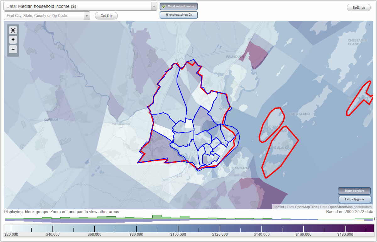
Back Cove, Deering Center, Downtown, East Bayside, East Deering, East End, Libbytown, Nasons Corner, North Deering, Oakdale, Parkside, Riverton, Rosemont, Stroudwater, Valley Street, West Bayside, West EndBack Cove neighborhood in Portland statistics: (Find on map)
Area: 1.221 square miles
Population: 2,768
Population density:
Median household income in 2021:
Median rent in in 2021:
Male vs Females
Median age
Housing prices:
Average estimated value of detached houses in 2021 (49.7% of all units):
Average estimated value of townhouses or other attached units in 2021 (5.2% of all units):
Average estimated value of housing units in 2-unit structures in 2021 (15.6% of all units):
Average estimated '21 value of housing units in 3-to-4-unit structures (9.6% of all units):
Average estimated '21 value of housing units in 5-or-more-unit structures (82.7% of all units):
Most popular occupations of males: management occupations (except farmers) (21.2%); sales and office occupations (19.5%); computer and mathematical occupations (7.3%); education, training, and library occupations (6.4%); business and financial operations occupations (6.3%); construction, extraction, and maintenance occupations (5.3%); community and social services occupations (5.1%)
Most popular occupations of females: management occupations (except farmers) (23.0%); sales and office occupations (18.8%); healthcare practitioners and technical occupations (12.4%); service occupations (8.7%); business and financial operations occupations (8.1%); arts, design, entertainment, sports, and media occupations (8.0%); education, training, and library occupations (7.5%)
Highways in this neighborhood: US Hwy 1 (Baxter Blvd); State Rte 100 (US Hwy 302, Forest Ave); State Rte 9 (Walton St).
Roads and streets: Ocean Ave; Clifton St; Murray St; Vannah Ave; Tamarlane; Read St; Coyle St; Hersey St; Codman St; Parsons Rd; Back Cove Estates Rd; Chenery St; Woodfords St; Mackworth St; Carlyle Rd; Austin St; Bay View Dr; Brookside Rd; George St; Irving St; Ashmont St; Victor Rd; Vera St; Bay St; Torrey St; Pya Rd; Deering Ave; Wellwood Rd; Mayland St; Belmont St; Sawyer St; Lloyd Ave; Melrose St; Arlington St; Rosedale St; Glengarden St; Hall St; Ocean Port Ave; Loraine St; Revere St; Lincoln St; Bryant St; Kineo St; Brookside Ln; Bayview Ter; Fernald St; Grace St; Arlington Pl; Grace St Pl; Walton Ct; Dudley St; Clairmont Ct; Gerald Ave; Frye St; Bay View Ter; Bay St Exd; Derby Rd.
Other features: Fall Brk.
Back Cove neighborhood detailed profile
Area: 1.221 square miles
Population: 2,768
Population density:
| Back Cove: | 2,268 people per square mile |
| Portland: | 3,222 people per square mile |
Median household income in 2021:
| Back Cove: | $67,145 |
| Portland: | $70,244 |
Median rent in in 2021:
| Back Cove: | $1,431 |
| Portland: | $1,225 |
Male vs Females
| Males: | 1,231 |
| Females: | 1,536 |
Median age
| Males: | 37.2 years |
| Females: | 36.5 years |
Housing prices:
Average estimated value of detached houses in 2021 (49.7% of all units):
| Back Cove: | $420,917 |
| Portland: | $478,832 |
Average estimated value of townhouses or other attached units in 2021 (5.2% of all units):
| This neighborhood: | $192,107 |
| city: | $359,212 |
Average estimated value of housing units in 2-unit structures in 2021 (15.6% of all units):
| This neighborhood: | $398,150 |
| Portland: | $769,715 |
Average estimated '21 value of housing units in 3-to-4-unit structures (9.6% of all units):
| Back Cove: | $717,159 |
| city: | $472,807 |
Average estimated '21 value of housing units in 5-or-more-unit structures (82.7% of all units):
| Back Cove: | $148,637 |
| Portland: | $477,662 |
Most popular occupations of males: management occupations (except farmers) (21.2%); sales and office occupations (19.5%); computer and mathematical occupations (7.3%); education, training, and library occupations (6.4%); business and financial operations occupations (6.3%); construction, extraction, and maintenance occupations (5.3%); community and social services occupations (5.1%)
Most popular occupations of females: management occupations (except farmers) (23.0%); sales and office occupations (18.8%); healthcare practitioners and technical occupations (12.4%); service occupations (8.7%); business and financial operations occupations (8.1%); arts, design, entertainment, sports, and media occupations (8.0%); education, training, and library occupations (7.5%)
Highways in this neighborhood: US Hwy 1 (Baxter Blvd); State Rte 100 (US Hwy 302, Forest Ave); State Rte 9 (Walton St).
Roads and streets: Ocean Ave; Clifton St; Murray St; Vannah Ave; Tamarlane; Read St; Coyle St; Hersey St; Codman St; Parsons Rd; Back Cove Estates Rd; Chenery St; Woodfords St; Mackworth St; Carlyle Rd; Austin St; Bay View Dr; Brookside Rd; George St; Irving St; Ashmont St; Victor Rd; Vera St; Bay St; Torrey St; Pya Rd; Deering Ave; Wellwood Rd; Mayland St; Belmont St; Sawyer St; Lloyd Ave; Melrose St; Arlington St; Rosedale St; Glengarden St; Hall St; Ocean Port Ave; Loraine St; Revere St; Lincoln St; Bryant St; Kineo St; Brookside Ln; Bayview Ter; Fernald St; Grace St; Arlington Pl; Grace St Pl; Walton Ct; Dudley St; Clairmont Ct; Gerald Ave; Frye St; Bay View Ter; Bay St Exd; Derby Rd.
Other features: Fall Brk.
Back Cove neighborhood detailed profile
Deering Center neighborhood in Portland statistics: (Find on map)
Area: 0.643 square miles
Population: 4,282
Population density:
Median household income in 2021:
Median rent in in 2021:
Male vs Females
Median age
Housing prices:
Average estimated value of detached houses in 2021 (36.1% of all units):
Average estimated value of townhouses or other attached units in 2021 (7.4% of all units):
Average estimated value of housing units in 2-unit structures in 2021 (27.2% of all units):
Most popular occupations of males: service occupations (18.6%); management occupations (except farmers) (13.6%); production occupations (12.3%); sales and office occupations (10.1%); computer and mathematical occupations (9.2%); healthcare practitioners and technical occupations (6.2%); business and financial operations occupations (6.0%)
Most popular occupations of females: education, training, and library occupations (22.4%); sales and office occupations (20.5%); management occupations (except farmers) (11.3%); community and social services occupations (9.9%); healthcare practitioners and technical occupations (9.4%); service occupations (6.7%); business and financial operations occupations (5.7%)
Highways in this neighborhood: Stevens Ave (State Rte 9); US Hwy 302 (State Rte 100, Forest Ave); Brighton Ave (State Rte 25).
Roads and streets: Woodford St; Pleasant Ave; Ludlow St; Concord St; Clinton St; Hartley St; Brentwood St; Columbia Rd; Mabel St; Alba St; Best St; Phipps Rd; Edgeworth Ave; Hamblet Ave; Westminster Ave; Leland St; Lawn Ave; Jeanne St; Glenwood Ave; Rosemont Ave; Leeman St; Access Rd; Madeline St; Norwood St; Berkeley St; Hale St; Bartlett St; W Concord St; Richardson St; Tremont St; Hillis St; Fuller St; Saunders St; Orkney St; Leonard St; Higgins St; Glenridge St; Holly St; Crosby St; Wingate Dr; Nevens St; Amherst St; Caldwell St; James St; Glenridge; Florence St; Bedell St; Jeanne Ct; Newman St; Merriam St; Glenridge Dr; Percival St; Marlow St; Hunt St; Matthews St; Hyde St; Gay St; Columbia Ter.
Railroad features: Portland Terminal RR.
Deering Center neighborhood detailed profile
Area: 0.643 square miles
Population: 4,282
Population density:
| Deering Center: | 6,658 people per square mile |
| Portland: | 3,222 people per square mile |
Median household income in 2021:
| Deering Center: | $82,016 |
| Portland: | $70,244 |
Median rent in in 2021:
| Deering Center: | $1,332 |
| Portland: | $1,225 |
Male vs Females
| Males: | 1,958 |
| Females: | 2,323 |
Median age
| Males: | 36.2 years |
| Females: | 43.2 years |
Housing prices:
Average estimated value of detached houses in 2021 (36.1% of all units):
| Deering Center: | $358,365 |
| Portland: | $478,832 |
Average estimated value of townhouses or other attached units in 2021 (7.4% of all units):
| This neighborhood: | $192,107 |
| city: | $359,212 |
Average estimated value of housing units in 2-unit structures in 2021 (27.2% of all units):
| This neighborhood: | $333,033 |
| Portland: | $769,715 |
Most popular occupations of males: service occupations (18.6%); management occupations (except farmers) (13.6%); production occupations (12.3%); sales and office occupations (10.1%); computer and mathematical occupations (9.2%); healthcare practitioners and technical occupations (6.2%); business and financial operations occupations (6.0%)
Most popular occupations of females: education, training, and library occupations (22.4%); sales and office occupations (20.5%); management occupations (except farmers) (11.3%); community and social services occupations (9.9%); healthcare practitioners and technical occupations (9.4%); service occupations (6.7%); business and financial operations occupations (5.7%)
Highways in this neighborhood: Stevens Ave (State Rte 9); US Hwy 302 (State Rte 100, Forest Ave); Brighton Ave (State Rte 25).
Roads and streets: Woodford St; Pleasant Ave; Ludlow St; Concord St; Clinton St; Hartley St; Brentwood St; Columbia Rd; Mabel St; Alba St; Best St; Phipps Rd; Edgeworth Ave; Hamblet Ave; Westminster Ave; Leland St; Lawn Ave; Jeanne St; Glenwood Ave; Rosemont Ave; Leeman St; Access Rd; Madeline St; Norwood St; Berkeley St; Hale St; Bartlett St; W Concord St; Richardson St; Tremont St; Hillis St; Fuller St; Saunders St; Orkney St; Leonard St; Higgins St; Glenridge St; Holly St; Crosby St; Wingate Dr; Nevens St; Amherst St; Caldwell St; James St; Glenridge; Florence St; Bedell St; Jeanne Ct; Newman St; Merriam St; Glenridge Dr; Percival St; Marlow St; Hunt St; Matthews St; Hyde St; Gay St; Columbia Ter.
Railroad features: Portland Terminal RR.
Deering Center neighborhood detailed profile
Downtown neighborhood in Portland statistics: (Find on map)
Area: 1.159 square miles
Population: 2,336
Population density:
Median household income in 2021:
Median rent in in 2021:
Male vs Females
Median age
Housing prices:
Average estimated value of detached houses in 2021 (20.6% of all units):
Average estimated value of townhouses or other attached units in 2021 (12.9% of all units):
Average estimated value of housing units in 2-unit structures in 2021 (11.0% of all units):
Average estimated '21 value of housing units in 3-to-4-unit structures (10.9% of all units):
Average estimated '21 value of housing units in 5-or-more-unit structures (30.0% of all units):
Most popular occupations of males: business and financial operations occupations (19.8%); healthcare practitioners and technical occupations (12.9%); service occupations (10.1%); computer and mathematical occupations (9.3%); arts, design, entertainment, sports, and media occupations (8.2%); management occupations (except farmers) (6.6%); architecture and engineering occupations (6.4%)
Most popular occupations of females: service occupations (32.0%); sales and office occupations (22.7%); management occupations (except farmers) (18.2%); healthcare practitioners and technical occupations (5.6%); architecture and engineering occupations (4.5%); education, training, and library occupations (3.1%); business and financial operations occupations (3.0%)
Highways in this neighborhood: US Hwy 1a (Commercial St); State Rte 77 (High St); State Rte 77 (Casco Bay Brg).
Roads and streets: Spring St; Congress St; Fore St; Free St; Federal St; Portland Fish Pier; Pearl St; Market St; Center St; Middle St; Chandlers Wharf; Pleasant St; Portland Pier; Exchange St; Browns Wharf; Temple St; Cross St; Danforth St; Oak St; Union Wharf; Maple St; Wharf St; Silver St; Widgery Wharf; Newberry St; Custom House Wharf; York St; Park St; Milk St; Summer St; Foundary Ln; Preble St; Chandler Wharf (Central Wharf); Church St; Casco St; Wrights Wharf; W Commercial St; Monument Way (Monument Sq); Cotton St; Union St; Shepley St; Brown St; Spring Street Pl; High Street Ct; Avon St; South St; Moulton St; Custom House St; Portland Sq; Long Wharf; Hobsons Pier.
Railroad features: Boston and Maine RR; Canadian National Rlwy.
Downtown neighborhood detailed profile
Area: 1.159 square miles
Population: 2,336
Population density:
| Downtown: | 2,015 people per square mile |
| Portland: | 3,222 people per square mile |
Median household income in 2021:
| Downtown: | $61,749 |
| Portland: | $70,244 |
Median rent in in 2021:
| Downtown: | $1,237 |
| Portland: | $1,225 |
Male vs Females
| Males: | 1,291 |
| Females: | 1,045 |
Median age
| Males: | 38.1 years |
| Females: | 38.1 years |
Housing prices:
Average estimated value of detached houses in 2021 (20.6% of all units):
| Downtown: | $820,644 |
| Portland: | $478,832 |
Average estimated value of townhouses or other attached units in 2021 (12.9% of all units):
| This neighborhood: | $1,032,857 |
| city: | $359,212 |
Average estimated value of housing units in 2-unit structures in 2021 (11.0% of all units):
| This neighborhood: | $1,832,432 |
| Portland: | $769,715 |
Average estimated '21 value of housing units in 3-to-4-unit structures (10.9% of all units):
| Downtown: | $576,829 |
| city: | $472,807 |
Average estimated '21 value of housing units in 5-or-more-unit structures (30.0% of all units):
| Downtown: | $150,367 |
| Portland: | $477,662 |
Most popular occupations of males: business and financial operations occupations (19.8%); healthcare practitioners and technical occupations (12.9%); service occupations (10.1%); computer and mathematical occupations (9.3%); arts, design, entertainment, sports, and media occupations (8.2%); management occupations (except farmers) (6.6%); architecture and engineering occupations (6.4%)
Most popular occupations of females: service occupations (32.0%); sales and office occupations (22.7%); management occupations (except farmers) (18.2%); healthcare practitioners and technical occupations (5.6%); architecture and engineering occupations (4.5%); education, training, and library occupations (3.1%); business and financial operations occupations (3.0%)
Highways in this neighborhood: US Hwy 1a (Commercial St); State Rte 77 (High St); State Rte 77 (Casco Bay Brg).
Roads and streets: Spring St; Congress St; Fore St; Free St; Federal St; Portland Fish Pier; Pearl St; Market St; Center St; Middle St; Chandlers Wharf; Pleasant St; Portland Pier; Exchange St; Browns Wharf; Temple St; Cross St; Danforth St; Oak St; Union Wharf; Maple St; Wharf St; Silver St; Widgery Wharf; Newberry St; Custom House Wharf; York St; Park St; Milk St; Summer St; Foundary Ln; Preble St; Chandler Wharf (Central Wharf); Church St; Casco St; Wrights Wharf; W Commercial St; Monument Way (Monument Sq); Cotton St; Union St; Shepley St; Brown St; Spring Street Pl; High Street Ct; Avon St; South St; Moulton St; Custom House St; Portland Sq; Long Wharf; Hobsons Pier.
Railroad features: Boston and Maine RR; Canadian National Rlwy.
Downtown neighborhood detailed profile
East Bayside neighborhood in Portland statistics: (Find on map)
Area: 0.590 square miles
Population: 2,122
Population density:
Median household income in 2021:
Median rent in in 2021:
Male vs Females
Median age
Housing prices:
Average estimated value of detached houses in 2021 (7.7% of all units):
Average estimated value of housing units in 2-unit structures in 2021 (8.4% of all units):
Average estimated '21 value of housing units in 3-to-4-unit structures (19.1% of all units):
Average estimated '21 value of housing units in 5-or-more-unit structures (13.1% of all units):
Most popular occupations of males: sales and office occupations (28.3%); service occupations (15.6%); healthcare practitioners and technical occupations (10.3%); production occupations (9.6%); management occupations (except farmers) (7.6%); transportation occupations (7.0%); material moving occupations (4.5%)
Most popular occupations of females: service occupations (30.0%); sales and office occupations (12.7%); management occupations (except farmers) (11.7%); education, training, and library occupations (9.7%); healthcare practitioners and technical occupations (8.5%); arts, design, entertainment, sports, and media occupations (8.2%); business and financial operations occupations (7.4%)
Limited-access highways (interstate or state) in this neighborhood: I- 295.
Highways in this neighborhood: Franklin St (US Hwy 1a); Washington Ave (State Rte 26); US Hwy 1a (Commercial St).
Roads and streets: Anderson St; Marginal Way; Fox St; India St; Federal St; Cumberland Ave; Newbury St; Fore St; Cove St; Congress St; Oxford St; Smith St; Middle St; Mayo St; Hampshire St; Sewage Plant Rd; Diamond St; Greenleaf St; Boyd St; Hammond St; Madison St; Plowman St; N Boyd St; Everett St; Cleeve St; Hancock St; Locust St; Winthrop St; Mountfort St; Gould St; Monroe St; Bayside Ter; Montgomery St; E Lancaster St; Bay Side Ter; Monroe Ct.
Railroad features: Portland Terminal RR.
East Bayside neighborhood detailed profile
Area: 0.590 square miles
Population: 2,122
Population density:
| East Bayside (India Street): | 3,597 people per square mile |
| Portland: | 3,222 people per square mile |
Median household income in 2021:
| East Bayside (India Street): | $55,693 |
| Portland: | $70,244 |
Median rent in in 2021:
| East Bayside (India Street): | $1,104 |
| Portland: | $1,225 |
Male vs Females
| Males: | 1,088 |
| Females: | 1,033 |
Median age
| Males: | 38.2 years |
| Females: | 33.2 years |
Housing prices:
Average estimated value of detached houses in 2021 (7.7% of all units):
| East Bayside (India Street): | $423,179 |
| Portland: | $478,832 |
Average estimated value of housing units in 2-unit structures in 2021 (8.4% of all units):
| This neighborhood: | $300,909 |
| Portland: | $769,715 |
Average estimated '21 value of housing units in 3-to-4-unit structures (19.1% of all units):
| East Bayside (India Street): | $149,531 |
| city: | $472,807 |
Average estimated '21 value of housing units in 5-or-more-unit structures (13.1% of all units):
| East Bayside (India Street): | $211,858 |
| Portland: | $477,662 |
Most popular occupations of males: sales and office occupations (28.3%); service occupations (15.6%); healthcare practitioners and technical occupations (10.3%); production occupations (9.6%); management occupations (except farmers) (7.6%); transportation occupations (7.0%); material moving occupations (4.5%)
Most popular occupations of females: service occupations (30.0%); sales and office occupations (12.7%); management occupations (except farmers) (11.7%); education, training, and library occupations (9.7%); healthcare practitioners and technical occupations (8.5%); arts, design, entertainment, sports, and media occupations (8.2%); business and financial operations occupations (7.4%)
Limited-access highways (interstate or state) in this neighborhood: I- 295.
Highways in this neighborhood: Franklin St (US Hwy 1a); Washington Ave (State Rte 26); US Hwy 1a (Commercial St).
Roads and streets: Anderson St; Marginal Way; Fox St; India St; Federal St; Cumberland Ave; Newbury St; Fore St; Cove St; Congress St; Oxford St; Smith St; Middle St; Mayo St; Hampshire St; Sewage Plant Rd; Diamond St; Greenleaf St; Boyd St; Hammond St; Madison St; Plowman St; N Boyd St; Everett St; Cleeve St; Hancock St; Locust St; Winthrop St; Mountfort St; Gould St; Monroe St; Bayside Ter; Montgomery St; E Lancaster St; Bay Side Ter; Monroe Ct.
Railroad features: Portland Terminal RR.
East Bayside neighborhood detailed profile
East Deering neighborhood in Portland statistics: (Find on map)
Area: 1.327 square miles
Population: 1,999
Population density:
Median household income in 2021:
Median rent in in 2021:
Male vs Females
Median age
Housing prices:
Average estimated value of detached houses in 2021 (34.3% of all units):
Average estimated value of housing units in 2-unit structures in 2021 (25.8% of all units):
Most popular occupations of males: production occupations (24.4%); sales and office occupations (16.5%); management occupations (except farmers) (12.8%); business and financial operations occupations (10.7%); construction, extraction, and maintenance occupations (9.7%); computer and mathematical occupations (7.4%); education, training, and library occupations (5.4%)
Most popular occupations of females: service occupations (25.2%); management occupations (except farmers) (21.4%); sales and office occupations (14.7%); healthcare practitioners and technical occupations (8.9%); community and social services occupations (8.7%); education, training, and library occupations (6.9%); arts, design, entertainment, sports, and media occupations (5.1%)
Limited-access highways (interstate or state) in this neighborhood: State Rte 26 (I- 295).
Highways in this neighborhood: State Rte 26 (Washington Ave); Baxter Blvd (US Hwy 1); US Hwy 1; Martin Point Brg (US Hwy 1).
Roads and streets: Veranda St; Sherwood St; Presumpscot St; Providence St; Front St; E Kidder St; Illsley St; Arcadia St; Fernald Ter; S Grafton St; Pembroke St; Inverness St; Oakley St; Olympia St; Wordsworth St; Prentiss St; Hawthorne St; Beanpot Cir; Randall St; Johansen St; Berkshire Rd; Kensington St; Hodgins St; Bates St; Savoy St; Windsor Ter; Fernald St; W Kidder St; Ashley Ln; Alton St; W Presumpscot St W; Galvin St; Berwick St; Morse St; Wellstone Dr; Marine Hospital Rd; Bismark St; Dalton St; Hanson St; Victoria St; Oregon St; Vaill St; Whittier St; Summer Pl; Cummings St; Lennox St; Watson St; Briarwood Ln; Richmond St; Upland St; Churchill St; Saint Jude St; Jordan St; Fairfield St; Lynda Rd; Sylvia Rd; Sullivan St; Bates Ct; Cleveland St; Island St; Arundel Rd; True St; Saint St; Cranston St; Chester St; Fayette St; Helene St; Kendall St; Corless.
Railroad features: Canadian National Rlwy.
East Deering neighborhood detailed profile
Area: 1.327 square miles
Population: 1,999
Population density:
| East Deering: | 1,507 people per square mile |
| Portland: | 3,222 people per square mile |
Median household income in 2021:
| East Deering: | $67,113 |
| Portland: | $70,244 |
Median rent in in 2021:
| East Deering: | $1,174 |
| Portland: | $1,225 |
Male vs Females
| Males: | 971 |
| Females: | 1,028 |
Median age
| Males: | 36.1 years |
| Females: | 37.1 years |
Housing prices:
Average estimated value of detached houses in 2021 (34.3% of all units):
| East Deering: | $420,031 |
| Portland: | $478,832 |
Average estimated value of housing units in 2-unit structures in 2021 (25.8% of all units):
| This neighborhood: | $409,789 |
| Portland: | $769,715 |
Most popular occupations of males: production occupations (24.4%); sales and office occupations (16.5%); management occupations (except farmers) (12.8%); business and financial operations occupations (10.7%); construction, extraction, and maintenance occupations (9.7%); computer and mathematical occupations (7.4%); education, training, and library occupations (5.4%)
Most popular occupations of females: service occupations (25.2%); management occupations (except farmers) (21.4%); sales and office occupations (14.7%); healthcare practitioners and technical occupations (8.9%); community and social services occupations (8.7%); education, training, and library occupations (6.9%); arts, design, entertainment, sports, and media occupations (5.1%)
Limited-access highways (interstate or state) in this neighborhood: State Rte 26 (I- 295).
Highways in this neighborhood: State Rte 26 (Washington Ave); Baxter Blvd (US Hwy 1); US Hwy 1; Martin Point Brg (US Hwy 1).
Roads and streets: Veranda St; Sherwood St; Presumpscot St; Providence St; Front St; E Kidder St; Illsley St; Arcadia St; Fernald Ter; S Grafton St; Pembroke St; Inverness St; Oakley St; Olympia St; Wordsworth St; Prentiss St; Hawthorne St; Beanpot Cir; Randall St; Johansen St; Berkshire Rd; Kensington St; Hodgins St; Bates St; Savoy St; Windsor Ter; Fernald St; W Kidder St; Ashley Ln; Alton St; W Presumpscot St W; Galvin St; Berwick St; Morse St; Wellstone Dr; Marine Hospital Rd; Bismark St; Dalton St; Hanson St; Victoria St; Oregon St; Vaill St; Whittier St; Summer Pl; Cummings St; Lennox St; Watson St; Briarwood Ln; Richmond St; Upland St; Churchill St; Saint Jude St; Jordan St; Fairfield St; Lynda Rd; Sylvia Rd; Sullivan St; Bates Ct; Cleveland St; Island St; Arundel Rd; True St; Saint St; Cranston St; Chester St; Fayette St; Helene St; Kendall St; Corless.
Railroad features: Canadian National Rlwy.
East Deering neighborhood detailed profile
East End neighborhood in Portland statistics: (Find on map)
Area: 0.596 square miles
Population: 5,180
Population density:
Median household income in 2021:
Median rent in in 2021:
Male vs Females
Median age
Housing prices:
Average estimated value of detached houses in 2021 (13.1% of all units):
Average estimated value of housing units in 2-unit structures in 2021 (10.9% of all units):
Most popular occupations of males: sales and office occupations (21.0%); computer and mathematical occupations (12.0%); management occupations (except farmers) (11.4%); construction, extraction, and maintenance occupations (9.3%); arts, design, entertainment, sports, and media occupations (6.6%); business and financial operations occupations (5.6%); education, training, and library occupations (5.2%)
Most popular occupations of females: service occupations (20.3%); sales and office occupations (17.5%); management occupations (except farmers) (11.8%); healthcare practitioners and technical occupations (9.7%); education, training, and library occupations (9.4%); community and social services occupations (8.5%); arts, design, entertainment, sports, and media occupations (6.2%)
Limited-access highways (interstate or state) in this neighborhood: I- 295 (State Rte 26).
Roads and streets: Eastern Promenade; North St; Sheridan St; Congress St; Cutter St; Morning St; St Lawrence St; Monument St; Atlantic St; Vesper St; Munjoy St; Quebec St; Walnut St; Fore St; Cumberland Ave; Melbourne St; Waterville St; Wilson St; Kellogg St; Montreal St; Emerson St; Merrill St; Turner St; Moody St; Adams St; Howard St; Lafayette St; Romasco Ln; O Brion St; Beckett St; Willis St; Sumner Ct; Ponce St; Gilbert Ln; Washington Pl; Sherbrooke St; Marion St; Hanson S Ln; Munjoy S.
Railroad features: Canadian National Rlwy.
East End neighborhood detailed profile
Area: 0.596 square miles
Population: 5,180
Population density:
| East End: | 8,689 people per square mile |
| Portland: | 3,222 people per square mile |
Median household income in 2021:
| East End: | $59,591 |
| Portland: | $70,244 |
Median rent in in 2021:
| East End: | $1,262 |
| Portland: | $1,225 |
Male vs Females
| Males: | 2,283 |
| Females: | 2,896 |
Median age
| Males: | 39.1 years |
| Females: | 35.2 years |
Housing prices:
Average estimated value of detached houses in 2021 (13.1% of all units):
| East End: | $420,031 |
| Portland: | $478,832 |
Average estimated value of housing units in 2-unit structures in 2021 (10.9% of all units):
| This neighborhood: | $409,789 |
| Portland: | $769,715 |
Most popular occupations of males: sales and office occupations (21.0%); computer and mathematical occupations (12.0%); management occupations (except farmers) (11.4%); construction, extraction, and maintenance occupations (9.3%); arts, design, entertainment, sports, and media occupations (6.6%); business and financial operations occupations (5.6%); education, training, and library occupations (5.2%)
Most popular occupations of females: service occupations (20.3%); sales and office occupations (17.5%); management occupations (except farmers) (11.8%); healthcare practitioners and technical occupations (9.7%); education, training, and library occupations (9.4%); community and social services occupations (8.5%); arts, design, entertainment, sports, and media occupations (6.2%)
Limited-access highways (interstate or state) in this neighborhood: I- 295 (State Rte 26).
Roads and streets: Eastern Promenade; North St; Sheridan St; Congress St; Cutter St; Morning St; St Lawrence St; Monument St; Atlantic St; Vesper St; Munjoy St; Quebec St; Walnut St; Fore St; Cumberland Ave; Melbourne St; Waterville St; Wilson St; Kellogg St; Montreal St; Emerson St; Merrill St; Turner St; Moody St; Adams St; Howard St; Lafayette St; Romasco Ln; O Brion St; Beckett St; Willis St; Sumner Ct; Ponce St; Gilbert Ln; Washington Pl; Sherbrooke St; Marion St; Hanson S Ln; Munjoy S.
Railroad features: Canadian National Rlwy.
East End neighborhood detailed profile
Libbytown neighborhood in Portland statistics: (Find on map)
Area: 1.120 square miles
Population: 1,812
Population density:
Median household income in 2021:
Median rent in in 2021:
Male vs Females
Median age
Average estimated value of detached houses in 2021 (40.8% of all units):
Most popular occupations of males: sales and office occupations (40.2%); business and financial operations occupations (11.7%); service occupations (9.5%); management occupations (except farmers) (8.5%); arts, design, entertainment, sports, and media occupations (7.3%); computer and mathematical occupations (7.1%); community and social services occupations (6.1%)
Most popular occupations of females: service occupations (29.0%); education, training, and library occupations (18.3%); healthcare practitioners and technical occupations (14.5%); sales and office occupations (11.3%); life, physical, and social science occupations (5.4%); business and financial operations occupations (5.1%); management occupations (except farmers) (4.8%)
Limited-access highways (interstate or state) in this neighborhood: I- 295.
Highways in this neighborhood: State Rte 9 (Congress St, State Rte 22); US Hwy 1; State Rte 22 (Park Ave).
Roads and streets: Massachusetts Ave; Westland Ave; Douglass Cir; Saint James St; Hobart St; Thompsons Pt; County Way; Danforth St; Fenway St; Powsland St; Sewall St; Ogdensburg St; Caribou St; Frederick St; Willow Ln; Marston St; Burnham St; Osgood St; Frost St; Phillips Rd; Lowell St; Mitton St; Westfield St; Greeley St; Huntress St; Chandler St; Brewer St; Hemlock St; Elizabeth Rd; Cherry St; Davis St; Cliff St.
Railroad features: Portland Terminal RR.
Libbytown neighborhood detailed profile
Area: 1.120 square miles
Population: 1,812
Population density:
| Libbytown: | 1,618 people per square mile |
| Portland: | 3,222 people per square mile |
Median household income in 2021:
| Libbytown: | $65,836 |
| Portland: | $70,244 |
Median rent in in 2021:
| Libbytown: | $1,084 |
| Portland: | $1,225 |
Male vs Females
| Males: | 910 |
| Females: | 902 |
Median age
| Males: | 36.0 years |
| Females: | 33.2 years |
Average estimated value of detached houses in 2021 (40.8% of all units):
| Libbytown: | $423,660 |
| Portland: | $478,832 |
Most popular occupations of males: sales and office occupations (40.2%); business and financial operations occupations (11.7%); service occupations (9.5%); management occupations (except farmers) (8.5%); arts, design, entertainment, sports, and media occupations (7.3%); computer and mathematical occupations (7.1%); community and social services occupations (6.1%)
Most popular occupations of females: service occupations (29.0%); education, training, and library occupations (18.3%); healthcare practitioners and technical occupations (14.5%); sales and office occupations (11.3%); life, physical, and social science occupations (5.4%); business and financial operations occupations (5.1%); management occupations (except farmers) (4.8%)
Limited-access highways (interstate or state) in this neighborhood: I- 295.
Highways in this neighborhood: State Rte 9 (Congress St, State Rte 22); US Hwy 1; State Rte 22 (Park Ave).
Roads and streets: Massachusetts Ave; Westland Ave; Douglass Cir; Saint James St; Hobart St; Thompsons Pt; County Way; Danforth St; Fenway St; Powsland St; Sewall St; Ogdensburg St; Caribou St; Frederick St; Willow Ln; Marston St; Burnham St; Osgood St; Frost St; Phillips Rd; Lowell St; Mitton St; Westfield St; Greeley St; Huntress St; Chandler St; Brewer St; Hemlock St; Elizabeth Rd; Cherry St; Davis St; Cliff St.
Railroad features: Portland Terminal RR.
Libbytown neighborhood detailed profile
Nasons Corner neighborhood in Portland statistics: (Find on map)
Area: 1.308 square miles
Population: 2,437
Population density:
Median household income in 2021:
Median rent in in 2021:
Male vs Females
Median age
Housing prices:
Average estimated value of detached houses in 2021 (62.4% of all units):
Average estimated value of townhouses or other attached units in 2021 (7.6% of all units):
Most popular occupations of males: management occupations (except farmers) (17.3%); computer and mathematical occupations (12.9%); service occupations (11.8%); healthcare practitioners and technical occupations (9.6%); legal occupations (9.5%); transportation occupations (7.7%); construction, extraction, and maintenance occupations (6.1%)
Most popular occupations of females: service occupations (29.3%); management occupations (except farmers) (27.7%); sales and office occupations (21.2%); education, training, and library occupations (7.7%); healthcare practitioners and technical occupations (6.4%); arts, design, entertainment, sports, and media occupations (2.6%); community and social services occupations (2.5%)
Limited-access highways (interstate or state) in this neighborhood: I- 95.
Highways in this neighborhood: Brighton Ave (State Rte 25); Main St (State Rte 25).
Roads and streets: Holm Ave; Taft Ave; Rand Rd; Riverside St; Capisic St; Warwick St; Ludlow St; Rowe Ave; Woodfield Rd; Dennet St; Four Winds Rd; Birchvale Dr; Webb St; Riggs St; Wayside Rd; Longwood Dr; Sunset Ln; Hillcrest Ave; City Hospital Dr; Pinecrest Rd; Birchwood Dr; Dorset St; Purchase St; Groveside Rd; Larrabee Rd; Mayer Rd; Devon St; Kent St; Candlewyck Ter; Glenhaven Rd W; Essex St; Winding Way; Josslyn St; Popham St; Woodvale St; Godfrey St; Starbird Rd; Lucas St; Orono Rd; Glenhaven Rd E; Campbell Rd; Candlewyck Rd; Dale St; Celebration Ct; Sandy Ter; David Rd; Little Rd; Brookview Ter; Penwood Dr; Raymond Rd; Greenlawn Ave; Poe St; Albion St; Presnell St; Harmon Rd; Sonnet Ln; Riverside Ct; Terrace Ave; Cabot St; Levia St; Halet St; Harvey St; Meadowbrook Ln; Ludlow Ter; Meriline Ave; Starlight Rd; Lomond St; Dale Ct; Wessex St; Violette Ave; Robin St; Longwood Ter; Cedarhurst Ln; Donald St; Violette Hill St; Almon Ave; Gorges St; Lorenzo St; Pinebrook Ln.
Railroad features: Portland Terminal RR.
Other features: Capisic Brk.
Nasons Corner neighborhood detailed profile
Area: 1.308 square miles
Population: 2,437
Population density:
| Nasons Corner: | 1,864 people per square mile |
| Portland: | 3,222 people per square mile |
Median household income in 2021:
| Nasons Corner: | $73,857 |
| Portland: | $70,244 |
Median rent in in 2021:
| Nasons Corner: | $367 |
| Portland: | $1,225 |
Male vs Females
| Males: | 1,350 |
| Females: | 1,087 |
Median age
| Males: | 37.0 years |
| Females: | 41.8 years |
Housing prices:
Average estimated value of detached houses in 2021 (62.4% of all units):
| Nasons Corner: | $277,659 |
| Portland: | $478,832 |
Average estimated value of townhouses or other attached units in 2021 (7.6% of all units):
| This neighborhood: | $278,654 |
| city: | $359,212 |
Most popular occupations of males: management occupations (except farmers) (17.3%); computer and mathematical occupations (12.9%); service occupations (11.8%); healthcare practitioners and technical occupations (9.6%); legal occupations (9.5%); transportation occupations (7.7%); construction, extraction, and maintenance occupations (6.1%)
Most popular occupations of females: service occupations (29.3%); management occupations (except farmers) (27.7%); sales and office occupations (21.2%); education, training, and library occupations (7.7%); healthcare practitioners and technical occupations (6.4%); arts, design, entertainment, sports, and media occupations (2.6%); community and social services occupations (2.5%)
Limited-access highways (interstate or state) in this neighborhood: I- 95.
Highways in this neighborhood: Brighton Ave (State Rte 25); Main St (State Rte 25).
Roads and streets: Holm Ave; Taft Ave; Rand Rd; Riverside St; Capisic St; Warwick St; Ludlow St; Rowe Ave; Woodfield Rd; Dennet St; Four Winds Rd; Birchvale Dr; Webb St; Riggs St; Wayside Rd; Longwood Dr; Sunset Ln; Hillcrest Ave; City Hospital Dr; Pinecrest Rd; Birchwood Dr; Dorset St; Purchase St; Groveside Rd; Larrabee Rd; Mayer Rd; Devon St; Kent St; Candlewyck Ter; Glenhaven Rd W; Essex St; Winding Way; Josslyn St; Popham St; Woodvale St; Godfrey St; Starbird Rd; Lucas St; Orono Rd; Glenhaven Rd E; Campbell Rd; Candlewyck Rd; Dale St; Celebration Ct; Sandy Ter; David Rd; Little Rd; Brookview Ter; Penwood Dr; Raymond Rd; Greenlawn Ave; Poe St; Albion St; Presnell St; Harmon Rd; Sonnet Ln; Riverside Ct; Terrace Ave; Cabot St; Levia St; Halet St; Harvey St; Meadowbrook Ln; Ludlow Ter; Meriline Ave; Starlight Rd; Lomond St; Dale Ct; Wessex St; Violette Ave; Robin St; Longwood Ter; Cedarhurst Ln; Donald St; Violette Hill St; Almon Ave; Gorges St; Lorenzo St; Pinebrook Ln.
Railroad features: Portland Terminal RR.
Other features: Capisic Brk.
Nasons Corner neighborhood detailed profile
North Deering neighborhood in Portland statistics: (Find on map)
Area: 3.748 square miles
Population: 7,742
Population density:
Median household income in 2021:
Median rent in in 2021:
Male vs Females
Median age
Housing prices:
Average estimated value of detached houses in 2021 (72.2% of all units):
Average estimated value of townhouses or other attached units in 2021 (9.3% of all units):
Most popular occupations of males: management occupations (except farmers) (15.1%); service occupations (15.1%); sales and office occupations (13.1%); construction, extraction, and maintenance occupations (7.0%); community and social services occupations (6.3%); business and financial operations occupations (6.2%); education, training, and library occupations (6.0%)
Most popular occupations of females: sales and office occupations (22.3%); service occupations (17.5%); healthcare practitioners and technical occupations (13.9%); management occupations (except farmers) (13.4%); education, training, and library occupations (11.5%); business and financial operations occupations (8.0%); community and social services occupations (5.8%)
Highways in this neighborhood: Allen Ave (State Rte 100); State Rte 26 (State Rte 100, Auburn St); Ocean Ave (State Rte 9); State Rte 100 (US Hwy 302, Forest Ave); State Rte 9 (Walton St).
Roads and streets: Washington Ave; Summit St; Ray St; Canco Rd; Maine Ave; Hope Ln; Palmer Ave; Lester Dr; Woodlawn Ave; Regan Ln (Northwood Dr); Lambert St; Deepwood Dr; Virginia St; Curtis Rd; Read St; Delaware Ct; Pheasant Hill Dr; Alice St; Hennessy Dr; Summit Park Ave; Plymouth St; Christy Rd; Greenwood Ln; Pineloch Dr; Parsons Pond Dr; Lyseth Moore Dr; Rainbow Mall Rd; Abby Ln; Shepherd Ln; Bramblewood Dr; Huntington Ave; Alpine Rd; Penn Ave (Pennsylvania Ave); Racine Ave; Northwood Dr; Roaring Brook Rd; Dole Dr; Pennell Ave; Carter St; Crestview Dr; Rustic Ln; Primrose Ln; Continental Dr; Bartley Ave; Harvard St; Bell St; Longview Dr; Vermont Ave; Chesley Ave; Brook Rd; Deering Run Dr; Florida Ave; Garsoe Dr; Country Ln; Gertrude Ave; Yale St; Caron St; Haverty Park; University St; Jackson St; Skylark Rd; Marlborough Rd; Edgewood Ave; Ledgewood Dr; Allison Ave; Frost Hill Rd; Mugwhy; Coolidge Ave; Cypress St; Clayton St; Mona Rd; Morrill St; Merrymeeting Dr; Stonecrest Dr; Old Birch Ln; Autumn Ln; Berry Ave; Clapboard Rd; Nicholas Ct; Quaker Ln; Melody Ln; Overset Rd; Samuel Rd; Fall Ln; Hillside Rd; Bernard Rd; Nevada Ave; Sumac St; Graystone Ln; Tremaine St; Maplewood St; W Lynne Ave; Sturdivant Dr; Jersey Ave; Alfred Rd; Majors Ct; Quarry Rd; Lawrence Ave; Felicia Ln; Heather Rd; Wendy Way; Demerest St; Martin Rd; Sanborn St; Woodmere Rd; Dakota St; Nottingham Ave; Apple Ledge Dr; Slemons Rd; Sara Ln; Van Vechten St; Byfield Rd; Fieldstone Ct; Humbolt St; Kansas Ave; Panoramic View Dr; Georgia St; Knight St; Whaleboat Rd; Patricia Ln; Fisher St; Wakely Ct; White Birch Ln; Daggett St; Adelaide St; Loring Ave; Chapman St; University Park; Braddish Ct; Abbott St; Huntington N; Dresden Ct; Meadow Ln; Alice Ct; Cushing Ct; Liberty Way; Copley Woods Circle Prvt; Farmhouse; Wyoming Ave; Talbot St; Cambridge St; Haverty's; Porch St; Cottage Park Rd; Bramhall Ct; Brewster St; Juniper St; Quiet Ln; Kenneth St; Copley Woods Cir; Cresfeld Ter; Morgan Ct; Shingle Way; Toronita St; Bonny St; Auburn Ter; Ivaloo St; Braeburn Rd; Auburndale Ter (Huntington N); Fobes St; Ashlar Ct; Olde Birch Ln; Drake St; Texas St; Graham Ter; Dingley Ct; Whitehead; Pamela Rd; Pineledge Ter; Ohio St; Old Barn Ln; Cornell St; Junior St; Applebee Ct; Gable Ct; Riverside St; Anthony Rd; Edgecomb Ct; Beachwood Rd; Burnside Ave; Sullivan Ct; Wildwood Cir; Idaho St; Short St; Settlers Ct; Old Campus Dr; Princeton St; Tampa St; Magnolia St; Whitehead Cir; Appletree Ct.
Railroad features: Portland Terminal RR.
Other features: Fall Brk.
North Deering neighborhood detailed profile
Area: 3.748 square miles
Population: 7,742
Population density:
| North Deering: | 2,066 people per square mile |
| Portland: | 3,222 people per square mile |
Median household income in 2021:
| North Deering: | $80,771 |
| Portland: | $70,244 |
Median rent in in 2021:
| North Deering: | $1,101 |
| Portland: | $1,225 |
Male vs Females
| Males: | 3,708 |
| Females: | 4,033 |
Median age
| Males: | 38.8 years |
| Females: | 46.2 years |
Housing prices:
Average estimated value of detached houses in 2021 (72.2% of all units):
| North Deering: | $314,024 |
| Portland: | $478,832 |
Average estimated value of townhouses or other attached units in 2021 (9.3% of all units):
| This neighborhood: | $197,679 |
| city: | $359,212 |
Most popular occupations of males: management occupations (except farmers) (15.1%); service occupations (15.1%); sales and office occupations (13.1%); construction, extraction, and maintenance occupations (7.0%); community and social services occupations (6.3%); business and financial operations occupations (6.2%); education, training, and library occupations (6.0%)
Most popular occupations of females: sales and office occupations (22.3%); service occupations (17.5%); healthcare practitioners and technical occupations (13.9%); management occupations (except farmers) (13.4%); education, training, and library occupations (11.5%); business and financial operations occupations (8.0%); community and social services occupations (5.8%)
Highways in this neighborhood: Allen Ave (State Rte 100); State Rte 26 (State Rte 100, Auburn St); Ocean Ave (State Rte 9); State Rte 100 (US Hwy 302, Forest Ave); State Rte 9 (Walton St).
Roads and streets: Washington Ave; Summit St; Ray St; Canco Rd; Maine Ave; Hope Ln; Palmer Ave; Lester Dr; Woodlawn Ave; Regan Ln (Northwood Dr); Lambert St; Deepwood Dr; Virginia St; Curtis Rd; Read St; Delaware Ct; Pheasant Hill Dr; Alice St; Hennessy Dr; Summit Park Ave; Plymouth St; Christy Rd; Greenwood Ln; Pineloch Dr; Parsons Pond Dr; Lyseth Moore Dr; Rainbow Mall Rd; Abby Ln; Shepherd Ln; Bramblewood Dr; Huntington Ave; Alpine Rd; Penn Ave (Pennsylvania Ave); Racine Ave; Northwood Dr; Roaring Brook Rd; Dole Dr; Pennell Ave; Carter St; Crestview Dr; Rustic Ln; Primrose Ln; Continental Dr; Bartley Ave; Harvard St; Bell St; Longview Dr; Vermont Ave; Chesley Ave; Brook Rd; Deering Run Dr; Florida Ave; Garsoe Dr; Country Ln; Gertrude Ave; Yale St; Caron St; Haverty Park; University St; Jackson St; Skylark Rd; Marlborough Rd; Edgewood Ave; Ledgewood Dr; Allison Ave; Frost Hill Rd; Mugwhy; Coolidge Ave; Cypress St; Clayton St; Mona Rd; Morrill St; Merrymeeting Dr; Stonecrest Dr; Old Birch Ln; Autumn Ln; Berry Ave; Clapboard Rd; Nicholas Ct; Quaker Ln; Melody Ln; Overset Rd; Samuel Rd; Fall Ln; Hillside Rd; Bernard Rd; Nevada Ave; Sumac St; Graystone Ln; Tremaine St; Maplewood St; W Lynne Ave; Sturdivant Dr; Jersey Ave; Alfred Rd; Majors Ct; Quarry Rd; Lawrence Ave; Felicia Ln; Heather Rd; Wendy Way; Demerest St; Martin Rd; Sanborn St; Woodmere Rd; Dakota St; Nottingham Ave; Apple Ledge Dr; Slemons Rd; Sara Ln; Van Vechten St; Byfield Rd; Fieldstone Ct; Humbolt St; Kansas Ave; Panoramic View Dr; Georgia St; Knight St; Whaleboat Rd; Patricia Ln; Fisher St; Wakely Ct; White Birch Ln; Daggett St; Adelaide St; Loring Ave; Chapman St; University Park; Braddish Ct; Abbott St; Huntington N; Dresden Ct; Meadow Ln; Alice Ct; Cushing Ct; Liberty Way; Copley Woods Circle Prvt; Farmhouse; Wyoming Ave; Talbot St; Cambridge St; Haverty's; Porch St; Cottage Park Rd; Bramhall Ct; Brewster St; Juniper St; Quiet Ln; Kenneth St; Copley Woods Cir; Cresfeld Ter; Morgan Ct; Shingle Way; Toronita St; Bonny St; Auburn Ter; Ivaloo St; Braeburn Rd; Auburndale Ter (Huntington N); Fobes St; Ashlar Ct; Olde Birch Ln; Drake St; Texas St; Graham Ter; Dingley Ct; Whitehead; Pamela Rd; Pineledge Ter; Ohio St; Old Barn Ln; Cornell St; Junior St; Applebee Ct; Gable Ct; Riverside St; Anthony Rd; Edgecomb Ct; Beachwood Rd; Burnside Ave; Sullivan Ct; Wildwood Cir; Idaho St; Short St; Settlers Ct; Old Campus Dr; Princeton St; Tampa St; Magnolia St; Whitehead Cir; Appletree Ct.
Railroad features: Portland Terminal RR.
Other features: Fall Brk.
North Deering neighborhood detailed profile
Oakdale neighborhood in Portland statistics: (Find on map)
Area: 0.667 square miles
Population: 3,814
Population density:
Median household income in 2021:
Median rent in in 2021:
Male vs Females
Median age
Housing prices:
Average estimated value of detached houses in 2021 (33.8% of all units):
Average estimated value of housing units in 2-unit structures in 2021 (15.0% of all units):
Average estimated '21 value of housing units in 3-to-4-unit structures (28.9% of all units):
Average estimated '21 value of housing units in 5-or-more-unit structures (12.4% of all units):
Most popular occupations of males: sales and office occupations (21.0%); service occupations (13.7%); management occupations (except farmers) (9.4%); community and social services occupations (7.4%); material moving occupations (7.2%); transportation occupations (7.1%); education, training, and library occupations (6.5%)
Most popular occupations of females: service occupations (19.1%); education, training, and library occupations (16.9%); sales and office occupations (15.6%); healthcare practitioners and technical occupations (9.2%); management occupations (except farmers) (8.4%); business and financial operations occupations (6.4%); computer and mathematical occupations (3.8%)
Limited-access highways (interstate or state) in this neighborhood: I- 295.
Highways in this neighborhood: State Rte 100 (Forest Ave, US Hwy 302, US Hwy 1); Baxter Blvd (US Hwy 1); Brighton Ave (State Rte 25); State Rte 22 (Park Ave); State St Exn (State Rte 77).
Roads and streets: Preble St; Deering Ave; Falmouth St; Dartmouth St; Saint John St; Noyes St; Washburn Ave; William St; Pitt St; Bedford St; Oakdale St; Marginal Way; Granite St; Fessenden St; Deerfield Rd; Longfellow St; Devonshire St; Payson St; Woodmont St; Exeter St; Ricker Park; Deane St; Winslow St; Durham St; Kenwood St; Roberts St; Chamberlain Ave; Belmeade Rd; Fenwick St; Sheffield St; Wood Rd; Wadsworth St; Conant St; Surrenden St; Bank St; Holwell St; Catherine St; Grand St; Freeman St; Indian Ln; Paper St; Grasmere Rd.
Railroad features: Portland Terminal RR.
Oakdale neighborhood detailed profile
Area: 0.667 square miles
Population: 3,814
Population density:
| Oakdale: | 5,722 people per square mile |
| Portland: | 3,222 people per square mile |
Median household income in 2021:
| Oakdale: | $61,775 |
| Portland: | $70,244 |
Median rent in in 2021:
| Oakdale: | $1,343 |
| Portland: | $1,225 |
Male vs Females
| Males: | 1,566 |
| Females: | 2,248 |
Median age
| Males: | 39.8 years |
| Females: | 36.5 years |
Housing prices:
Average estimated value of detached houses in 2021 (33.8% of all units):
| Oakdale: | $219,019 |
| Portland: | $478,832 |
Average estimated value of housing units in 2-unit structures in 2021 (15.0% of all units):
| This neighborhood: | $278,415 |
| Portland: | $769,715 |
Average estimated '21 value of housing units in 3-to-4-unit structures (28.9% of all units):
| Oakdale: | $67,397 |
| city: | $472,807 |
Average estimated '21 value of housing units in 5-or-more-unit structures (12.4% of all units):
| Oakdale: | $82,286 |
| Portland: | $477,662 |
Most popular occupations of males: sales and office occupations (21.0%); service occupations (13.7%); management occupations (except farmers) (9.4%); community and social services occupations (7.4%); material moving occupations (7.2%); transportation occupations (7.1%); education, training, and library occupations (6.5%)
Most popular occupations of females: service occupations (19.1%); education, training, and library occupations (16.9%); sales and office occupations (15.6%); healthcare practitioners and technical occupations (9.2%); management occupations (except farmers) (8.4%); business and financial operations occupations (6.4%); computer and mathematical occupations (3.8%)
Limited-access highways (interstate or state) in this neighborhood: I- 295.
Highways in this neighborhood: State Rte 100 (Forest Ave, US Hwy 302, US Hwy 1); Baxter Blvd (US Hwy 1); Brighton Ave (State Rte 25); State Rte 22 (Park Ave); State St Exn (State Rte 77).
Roads and streets: Preble St; Deering Ave; Falmouth St; Dartmouth St; Saint John St; Noyes St; Washburn Ave; William St; Pitt St; Bedford St; Oakdale St; Marginal Way; Granite St; Fessenden St; Deerfield Rd; Longfellow St; Devonshire St; Payson St; Woodmont St; Exeter St; Ricker Park; Deane St; Winslow St; Durham St; Kenwood St; Roberts St; Chamberlain Ave; Belmeade Rd; Fenwick St; Sheffield St; Wood Rd; Wadsworth St; Conant St; Surrenden St; Bank St; Holwell St; Catherine St; Grand St; Freeman St; Indian Ln; Paper St; Grasmere Rd.
Railroad features: Portland Terminal RR.
Oakdale neighborhood detailed profile
Parkside neighborhood in Portland statistics: (Find on map)
Area: 0.214 square miles
Population: 3,511
Population density:
Median household income in 2021:
Median rent in in 2021:
Male vs Females
Median age
Housing prices:
Average estimated value of detached houses in 2021 (3.1% of all units):
Average estimated value of townhouses or other attached units in 2021 (4.5% of all units):
Average estimated value of housing units in 2-unit structures in 2021 (4.3% of all units):
Average estimated '21 value of housing units in 3-to-4-unit structures (12.6% of all units):
Average estimated '21 value of housing units in 5-or-more-unit structures (12.4% of all units):
Most popular occupations of males: service occupations (18.5%); sales and office occupations (14.0%); production occupations (11.8%); transportation occupations (7.6%); business and financial operations occupations (6.9%); computer and mathematical occupations (5.3%); arts, design, entertainment, sports, and media occupations (5.2%)
Most popular occupations of females: sales and office occupations (24.5%); service occupations (21.2%); management occupations (except farmers) (14.1%); education, training, and library occupations (10.9%); business and financial operations occupations (10.0%); arts, design, entertainment, sports, and media occupations (6.6%); community and social services occupations (5.0%)
Highways in this neighborhood: State Rte 77 (High St); State Rte 77 (State St); State Rte 22 (Park Ave, US Hwy 1); State Rte 100 (US Hwy 1, US Hwy 302, Forest Ave); State St Exn (State Rte 77).
Roads and streets: Deering St; Congress St; Brackett St; Cumberland Ave; Sherman St; Grant St; Mellen St; Pine St; Dow St; Neal St; Mac Millan Rd; Carleton St; Walker St; Avon St; Avon Pl; Horton Pl; Deering Oaks.
Railroad features: Portland Terminal RR.
Parkside neighborhood detailed profile
Area: 0.214 square miles
Population: 3,511
Population density:
| Parkside: | 16,387 people per square mile |
| Portland: | 3,222 people per square mile |
Median household income in 2021:
| Parkside: | $66,721 |
| Portland: | $70,244 |
Median rent in in 2021:
| Parkside: | $1,182 |
| Portland: | $1,225 |
Male vs Females
| Males: | 1,861 |
| Females: | 1,649 |
Median age
| Males: | 37.6 years |
| Females: | 34.2 years |
Housing prices:
Average estimated value of detached houses in 2021 (3.1% of all units):
| Parkside: | $820,644 |
| Portland: | $478,832 |
Average estimated value of townhouses or other attached units in 2021 (4.5% of all units):
| This neighborhood: | $1,032,857 |
| city: | $359,212 |
Average estimated value of housing units in 2-unit structures in 2021 (4.3% of all units):
| This neighborhood: | $1,832,432 |
| Portland: | $769,715 |
Average estimated '21 value of housing units in 3-to-4-unit structures (12.6% of all units):
| Parkside: | $576,829 |
| city: | $472,807 |
Average estimated '21 value of housing units in 5-or-more-unit structures (12.4% of all units):
| Parkside: | $153,993 |
| Portland: | $477,662 |
Most popular occupations of males: service occupations (18.5%); sales and office occupations (14.0%); production occupations (11.8%); transportation occupations (7.6%); business and financial operations occupations (6.9%); computer and mathematical occupations (5.3%); arts, design, entertainment, sports, and media occupations (5.2%)
Most popular occupations of females: sales and office occupations (24.5%); service occupations (21.2%); management occupations (except farmers) (14.1%); education, training, and library occupations (10.9%); business and financial operations occupations (10.0%); arts, design, entertainment, sports, and media occupations (6.6%); community and social services occupations (5.0%)
Highways in this neighborhood: State Rte 77 (High St); State Rte 77 (State St); State Rte 22 (Park Ave, US Hwy 1); State Rte 100 (US Hwy 1, US Hwy 302, Forest Ave); State St Exn (State Rte 77).
Roads and streets: Deering St; Congress St; Brackett St; Cumberland Ave; Sherman St; Grant St; Mellen St; Pine St; Dow St; Neal St; Mac Millan Rd; Carleton St; Walker St; Avon St; Avon Pl; Horton Pl; Deering Oaks.
Railroad features: Portland Terminal RR.
Parkside neighborhood detailed profile
Riverton neighborhood in Portland statistics: (Find on map)
Area: 3.691 square miles
Population: 4,221
Population density:
Median household income in 2021:
Median rent in in 2021:
Male vs Females
Median age
Housing prices:
Average estimated value of detached houses in 2021 (81.5% of all units):
Average estimated value of townhouses or other attached units in 2021 (1.2% of all units):
Average estimated value of housing units in 2-unit structures in 2021 (21.5% of all units):
Most popular occupations of males: management occupations (except farmers) (19.2%); computer and mathematical occupations (11.2%); service occupations (10.6%); sales and office occupations (8.6%); healthcare practitioners and technical occupations (7.9%); production occupations (7.2%); business and financial operations occupations (6.2%)
Most popular occupations of females: sales and office occupations (29.5%); service occupations (19.0%); management occupations (except farmers) (17.3%); education, training, and library occupations (11.1%); material moving occupations (7.4%); healthcare practitioners and technical occupations (4.7%); business and financial operations occupations (4.5%)
Limited-access highways (interstate or state) in this neighborhood: I- 95.
Highways in this neighborhood: US Hwy 302 (Forest Ave); Allen Ave (State Rte 100).
Roads and streets: Riverside St; Warren Ave; Riverside Industrial Pkwy; Lane Ave; Stevens Ave; Industrial Way; Hicks St; Lexington Ave; Dorothy St; Broadway; Harris Ave; Belfort St; Newton St; Bishop St; Tucker Ave; W Commonwealth Dr; Saugus St; Commonwealth Dr; Milton St; Euclid Ave; Leighton Ave; Verrill St; Avalon Rd; Riverton Dr; Epping St; McAllister Farms Rd; Wall St; Milliken St; Evergreen Dr; Bailey Ave; Dibiase St; Beverly St; 9th St; Maggie Ln; College St; Waldron Way; Farnham St; Buca Run Rd; Homestead Ave; Label Ave; Aldworth St; Luke St; Farragut St; Stuart St; Bishop St Exd; Newell Ave; Lynn St; Goodridge Ave; Randolph St; Iffley St; Braintree St; 8th St; Ingalls Rd; Saville St; Eastlawn Rd; Grove St; Tarbell Ave; 6th St; Dover Ave; Libby St; Hemingway St; Castine Ave; Springbrook Way; Eastman Ave; Wendell St; Westlawn Rd; New St; Hingham St; Newcomb St; Arthur St; Wilkie St; Wyndham St; Pinecrest Rd; Harmony St; Mayfield St; Eleanor St; Dedham St; 5th St; Beal St; Wirt St; Trundy Rd; Rice Rd; Beaumont St; Brandon St; Tyler St; Woodbury St; Range St; Ardmore St; Booth Rd; Goodale St; Forest Cir; Dayton St; Pari Pl; Haskell St; Barclay Ave; Waldron; Elbert Ln; Haskell Rd; View St; Sloan Rd; Blossom Rd; Meadow Rd; Hillcrest Cir; Fiske St; Avalon Ter; 7th St; Castine; Belden St; Pinewood Rd; King St.
Railroad features: Boston and Maine RR; Portland Terminal RR.
Riverton neighborhood detailed profile
Area: 3.691 square miles
Population: 4,221
Population density:
| Riverton: | 1,144 people per square mile |
| Portland: | 3,222 people per square mile |
Median household income in 2021:
| Riverton: | $78,009 |
| Portland: | $70,244 |
Median rent in in 2021:
| Riverton: | $1,325 |
| Portland: | $1,225 |
Male vs Females
| Males: | 2,216 |
| Females: | 2,005 |
Median age
| Males: | 36.4 years |
| Females: | 48.6 years |
Housing prices:
Average estimated value of detached houses in 2021 (81.5% of all units):
| Riverton: | $313,754 |
| Portland: | $478,832 |
Average estimated value of townhouses or other attached units in 2021 (1.2% of all units):
| This neighborhood: | $194,489 |
| city: | $359,212 |
Average estimated value of housing units in 2-unit structures in 2021 (21.5% of all units):
| This neighborhood: | $346,792 |
| Portland: | $769,715 |
Most popular occupations of males: management occupations (except farmers) (19.2%); computer and mathematical occupations (11.2%); service occupations (10.6%); sales and office occupations (8.6%); healthcare practitioners and technical occupations (7.9%); production occupations (7.2%); business and financial operations occupations (6.2%)
Most popular occupations of females: sales and office occupations (29.5%); service occupations (19.0%); management occupations (except farmers) (17.3%); education, training, and library occupations (11.1%); material moving occupations (7.4%); healthcare practitioners and technical occupations (4.7%); business and financial operations occupations (4.5%)
Limited-access highways (interstate or state) in this neighborhood: I- 95.
Highways in this neighborhood: US Hwy 302 (Forest Ave); Allen Ave (State Rte 100).
Roads and streets: Riverside St; Warren Ave; Riverside Industrial Pkwy; Lane Ave; Stevens Ave; Industrial Way; Hicks St; Lexington Ave; Dorothy St; Broadway; Harris Ave; Belfort St; Newton St; Bishop St; Tucker Ave; W Commonwealth Dr; Saugus St; Commonwealth Dr; Milton St; Euclid Ave; Leighton Ave; Verrill St; Avalon Rd; Riverton Dr; Epping St; McAllister Farms Rd; Wall St; Milliken St; Evergreen Dr; Bailey Ave; Dibiase St; Beverly St; 9th St; Maggie Ln; College St; Waldron Way; Farnham St; Buca Run Rd; Homestead Ave; Label Ave; Aldworth St; Luke St; Farragut St; Stuart St; Bishop St Exd; Newell Ave; Lynn St; Goodridge Ave; Randolph St; Iffley St; Braintree St; 8th St; Ingalls Rd; Saville St; Eastlawn Rd; Grove St; Tarbell Ave; 6th St; Dover Ave; Libby St; Hemingway St; Castine Ave; Springbrook Way; Eastman Ave; Wendell St; Westlawn Rd; New St; Hingham St; Newcomb St; Arthur St; Wilkie St; Wyndham St; Pinecrest Rd; Harmony St; Mayfield St; Eleanor St; Dedham St; 5th St; Beal St; Wirt St; Trundy Rd; Rice Rd; Beaumont St; Brandon St; Tyler St; Woodbury St; Range St; Ardmore St; Booth Rd; Goodale St; Forest Cir; Dayton St; Pari Pl; Haskell St; Barclay Ave; Waldron; Elbert Ln; Haskell Rd; View St; Sloan Rd; Blossom Rd; Meadow Rd; Hillcrest Cir; Fiske St; Avalon Ter; 7th St; Castine; Belden St; Pinewood Rd; King St.
Railroad features: Boston and Maine RR; Portland Terminal RR.
Riverton neighborhood detailed profile
Rosemont neighborhood in Portland statistics: (Find on map)
Area: 0.756 square miles
Population: 4,910
Population density:
Median household income in 2021:
Median rent in in 2021:
Male vs Females
Median age
Housing prices:
Average estimated value of detached houses in 2021 (58.1% of all units):
Average estimated value of townhouses or other attached units in 2021 (5.9% of all units):
Average estimated value of housing units in 2-unit structures in 2021 (14.2% of all units):
Average estimated '21 value of housing units in 3-to-4-unit structures (15.5% of all units):
Average estimated '21 value of housing units in 5-or-more-unit structures (8.5% of all units):
Most popular occupations of males: sales and office occupations (24.5%); management occupations (except farmers) (16.6%); service occupations (10.7%); transportation occupations (8.2%); business and financial operations occupations (7.7%); education, training, and library occupations (7.4%); production occupations (5.6%)
Most popular occupations of females: sales and office occupations (21.5%); healthcare practitioners and technical occupations (14.5%); education, training, and library occupations (12.2%); management occupations (except farmers) (11.7%); service occupations (10.0%); community and social services occupations (7.1%); arts, design, entertainment, sports, and media occupations (5.6%)
Highways in this neighborhood: Brighton Ave (State Rte 25); State Rte 9 (Stevens Ave); State Rte 22 (Congress St, State Rte 9).
Roads and streets: Capisic St; Prospect St; Bancroft St; Bradley St; Caleb St; Craigie St; Edwards St; Wolcott St; Colonial Rd; Frost St; Rockland Ave; Montrose Ave; Frances St; Beacon St; Whitney Ave; Rackleff St; Highland St; Revere St; Ashmont St; Longfellow St; Elizabeth Rd; Orland St; Machigonne St; Redlon Rd (Redlon Park Rd); Runnells St; Haywood St; Eastfield Rd; St George St; Dirigo St; Kenilworth St; Lincoln St; Fairmount St; Scott St; Coyle St; Anson Rd; Riverview St; Belfield St; Belknap St; Fleetwood St; Seeley Ave; Twin Knolls Ln; Stone Ledge Rd; Glenwood Ave; Rabbit Run; Bolton St; Coachlight Ln; Motley St; Hollis Rd; Hastings St; Caroline Rd; Wayne St; Deblois St; June St; Fairview St; Macy St; Mason St; Rudman Rd; Ivy St; Cobbert Rd; Fellows St; Colonial Ct; Stoneledge Dr; Bancroft Ct; Boody St; Allmonte Rd.
Railroad features: Portland Terminal RR.
Other features: Capisic Brk.
Rosemont neighborhood detailed profile
Area: 0.756 square miles
Population: 4,910
Population density:
| Rosemont: | 6,497 people per square mile |
| Portland: | 3,222 people per square mile |
Median household income in 2021:
| Rosemont: | $73,107 |
| Portland: | $70,244 |
Median rent in in 2021:
| Rosemont: | $1,430 |
| Portland: | $1,225 |
Male vs Females
| Males: | 2,540 |
| Females: | 2,369 |
Median age
| Males: | 38.3 years |
| Females: | 38.1 years |
Housing prices:
Average estimated value of detached houses in 2021 (58.1% of all units):
| Rosemont: | $311,201 |
| Portland: | $478,832 |
Average estimated value of townhouses or other attached units in 2021 (5.9% of all units):
| This neighborhood: | $238,287 |
| city: | $359,212 |
Average estimated value of housing units in 2-unit structures in 2021 (14.2% of all units):
| This neighborhood: | $333,033 |
| Portland: | $769,715 |
Average estimated '21 value of housing units in 3-to-4-unit structures (15.5% of all units):
| Rosemont: | $149,531 |
| city: | $472,807 |
Average estimated '21 value of housing units in 5-or-more-unit structures (8.5% of all units):
| Rosemont: | $198,828 |
| Portland: | $477,662 |
Most popular occupations of males: sales and office occupations (24.5%); management occupations (except farmers) (16.6%); service occupations (10.7%); transportation occupations (8.2%); business and financial operations occupations (7.7%); education, training, and library occupations (7.4%); production occupations (5.6%)
Most popular occupations of females: sales and office occupations (21.5%); healthcare practitioners and technical occupations (14.5%); education, training, and library occupations (12.2%); management occupations (except farmers) (11.7%); service occupations (10.0%); community and social services occupations (7.1%); arts, design, entertainment, sports, and media occupations (5.6%)
Highways in this neighborhood: Brighton Ave (State Rte 25); State Rte 9 (Stevens Ave); State Rte 22 (Congress St, State Rte 9).
Roads and streets: Capisic St; Prospect St; Bancroft St; Bradley St; Caleb St; Craigie St; Edwards St; Wolcott St; Colonial Rd; Frost St; Rockland Ave; Montrose Ave; Frances St; Beacon St; Whitney Ave; Rackleff St; Highland St; Revere St; Ashmont St; Longfellow St; Elizabeth Rd; Orland St; Machigonne St; Redlon Rd (Redlon Park Rd); Runnells St; Haywood St; Eastfield Rd; St George St; Dirigo St; Kenilworth St; Lincoln St; Fairmount St; Scott St; Coyle St; Anson Rd; Riverview St; Belfield St; Belknap St; Fleetwood St; Seeley Ave; Twin Knolls Ln; Stone Ledge Rd; Glenwood Ave; Rabbit Run; Bolton St; Coachlight Ln; Motley St; Hollis Rd; Hastings St; Caroline Rd; Wayne St; Deblois St; June St; Fairview St; Macy St; Mason St; Rudman Rd; Ivy St; Cobbert Rd; Fellows St; Colonial Ct; Stoneledge Dr; Bancroft Ct; Boody St; Allmonte Rd.
Railroad features: Portland Terminal RR.
Other features: Capisic Brk.
Rosemont neighborhood detailed profile
Stroudwater neighborhood in Portland statistics: (Find on map)
Area: 2.510 square miles
Population: 739
Population density:
Median household income in 2021:
Median rent in in 2021:
Male vs Females
Median age
Housing prices:
Average estimated value of detached houses in 2021 (95.3% of all units):
Average estimated value of townhouses or other attached units in 2021 (7.6% of all units):
Most popular occupations of males: sales and office occupations (25.4%); management occupations (except farmers) (16.3%); education, training, and library occupations (15.6%); service occupations (12.5%); transportation occupations (7.8%); material moving occupations (6.7%); production occupations (5.0%)
Most popular occupations of females: sales and office occupations (28.1%); healthcare practitioners and technical occupations (19.4%); business and financial operations occupations (17.2%); community and social services occupations (16.8%); legal occupations (7.9%); service occupations (6.3%); education, training, and library occupations (3.8%)
Limited-access highways (interstate or state) in this neighborhood: I- 95.
Highways in this neighborhood: State Rte 22 (Congress St); State Rte 9 (Johnson Rd).
Roads and streets: Westbrook St; Jetport Access Rd; Hutchins; Al McKay Ave; Hutchins Dr; Rand Rd; River's Edge Dr; Garrison St; Pine Tree Industrial Pkwy; Stroudwater Rd; Partridge Cir; Cobb Ave; Westbrook Arterial; Blueberry Rd; Kingsmark Ln; Jetprot Access Rd; Old Mast Rd; Tide Mill Rd; Penrith Rd; Roundabout Ln; Partridge Rd; Spar Ln; Pierce Ave; Captain's Lndg; Swan St; Garrison St Exn; Heritage Ct; Buttonwood Ln; Waldo St; International Pkwy; Buttonwood; Yellowbird Rd.
Other features: Stroudwater Riv.
Other features: Portland International Jetport.
Other features: Dobson Crk; Long Crk.
Stroudwater neighborhood detailed profile
Area: 2.510 square miles
Population: 739
Population density:
| Stroudwater: | 294 people per square mile |
| Portland: | 3,222 people per square mile |
Median household income in 2021:
| Stroudwater: | $62,161 |
| Portland: | $70,244 |
Median rent in in 2021:
| Stroudwater: | $1,138 |
| Portland: | $1,225 |
Male vs Females
| Males: | 358 |
| Females: | 381 |
Median age
| Males: | 41.1 years |
| Females: | 35.6 years |
Housing prices:
Average estimated value of detached houses in 2021 (95.3% of all units):
| Stroudwater: | $423,649 |
| Portland: | $478,832 |
Average estimated value of townhouses or other attached units in 2021 (7.6% of all units):
| This neighborhood: | $278,654 |
| city: | $359,212 |
Most popular occupations of males: sales and office occupations (25.4%); management occupations (except farmers) (16.3%); education, training, and library occupations (15.6%); service occupations (12.5%); transportation occupations (7.8%); material moving occupations (6.7%); production occupations (5.0%)
Most popular occupations of females: sales and office occupations (28.1%); healthcare practitioners and technical occupations (19.4%); business and financial operations occupations (17.2%); community and social services occupations (16.8%); legal occupations (7.9%); service occupations (6.3%); education, training, and library occupations (3.8%)
Limited-access highways (interstate or state) in this neighborhood: I- 95.
Highways in this neighborhood: State Rte 22 (Congress St); State Rte 9 (Johnson Rd).
Roads and streets: Westbrook St; Jetport Access Rd; Hutchins; Al McKay Ave; Hutchins Dr; Rand Rd; River's Edge Dr; Garrison St; Pine Tree Industrial Pkwy; Stroudwater Rd; Partridge Cir; Cobb Ave; Westbrook Arterial; Blueberry Rd; Kingsmark Ln; Jetprot Access Rd; Old Mast Rd; Tide Mill Rd; Penrith Rd; Roundabout Ln; Partridge Rd; Spar Ln; Pierce Ave; Captain's Lndg; Swan St; Garrison St Exn; Heritage Ct; Buttonwood Ln; Waldo St; International Pkwy; Buttonwood; Yellowbird Rd.
Other features: Stroudwater Riv.
Other features: Portland International Jetport.
Other features: Dobson Crk; Long Crk.
Stroudwater neighborhood detailed profile
Valley Street neighborhood in Portland statistics: (Find on map)
Area: 0.263 square miles
Population: 882
Population density:
Median household income in 2021:
Median rent in in 2021:
Male vs Females
Median age
Housing prices:
Average estimated value of detached houses in 2021 (7.3% of all units):
Average estimated value of townhouses or other attached units in 2021 (2.3% of all units):
Average estimated value of housing units in 2-unit structures in 2021 (7.9% of all units):
Average estimated '21 value of housing units in 3-to-4-unit structures (39.4% of all units):
Average estimated '21 value of housing units in 5-or-more-unit structures (1.8% of all units):
Most popular occupations of males: service occupations (31.6%); sales and office occupations (19.3%); computer and mathematical occupations (15.4%); material moving occupations (7.1%); management occupations (except farmers) (5.4%); production occupations (4.9%); business and financial operations occupations (2.5%)
Most popular occupations of females: education, training, and library occupations (21.9%); computer and mathematical occupations (21.7%); service occupations (18.1%); sales and office occupations (17.2%); healthcare practitioners and technical occupations (5.5%); transportation occupations (5.3%); life, physical, and social science occupations (3.7%)
Highways in this neighborhood: US Hwy 1 (Valley St); US Hwy 1 (Saint John St); US Hwy 1 (Park Ave, State Rte 22); Deering Ave; US Hwy 1.
Roads and streets: Congress St; Gilman St; Bramhall St; Grant St; Forest St; A St; Ellsworth St; Crescent St; Boynton St; Charles St; D St; Weymouth St; Western Promenade; Hill St; Bramhall Pl; Russell St; C St; Wescott St; Brackett St; Gilman Pl.
Railroad features: Portland Terminal RR.
Valley Street neighborhood detailed profile
Area: 0.263 square miles
Population: 882
Population density:
| Valley Street: | 3,353 people per square mile |
| Portland: | 3,222 people per square mile |
Median household income in 2021:
| Valley Street: | $66,659 |
| Portland: | $70,244 |
Median rent in in 2021:
| Valley Street: | $1,099 |
| Portland: | $1,225 |
Male vs Females
| Males: | 453 |
| Females: | 429 |
Median age
| Males: | 36.4 years |
| Females: | 33.0 years |
Housing prices:
Average estimated value of detached houses in 2021 (7.3% of all units):
| Valley Street: | $820,644 |
| Portland: | $478,832 |
Average estimated value of townhouses or other attached units in 2021 (2.3% of all units):
| This neighborhood: | $1,032,857 |
| city: | $359,212 |
Average estimated value of housing units in 2-unit structures in 2021 (7.9% of all units):
| This neighborhood: | $1,832,432 |
| Portland: | $769,715 |
Average estimated '21 value of housing units in 3-to-4-unit structures (39.4% of all units):
| Valley Street: | $576,829 |
| city: | $472,807 |
Average estimated '21 value of housing units in 5-or-more-unit structures (1.8% of all units):
| Valley Street: | $179,032 |
| Portland: | $477,662 |
Most popular occupations of males: service occupations (31.6%); sales and office occupations (19.3%); computer and mathematical occupations (15.4%); material moving occupations (7.1%); management occupations (except farmers) (5.4%); production occupations (4.9%); business and financial operations occupations (2.5%)
Most popular occupations of females: education, training, and library occupations (21.9%); computer and mathematical occupations (21.7%); service occupations (18.1%); sales and office occupations (17.2%); healthcare practitioners and technical occupations (5.5%); transportation occupations (5.3%); life, physical, and social science occupations (3.7%)
Highways in this neighborhood: US Hwy 1 (Valley St); US Hwy 1 (Saint John St); US Hwy 1 (Park Ave, State Rte 22); Deering Ave; US Hwy 1.
Roads and streets: Congress St; Gilman St; Bramhall St; Grant St; Forest St; A St; Ellsworth St; Crescent St; Boynton St; Charles St; D St; Weymouth St; Western Promenade; Hill St; Bramhall Pl; Russell St; C St; Wescott St; Brackett St; Gilman Pl.
Railroad features: Portland Terminal RR.
Valley Street neighborhood detailed profile
West Bayside neighborhood in Portland statistics: (Find on map)
Area: 0.210 square miles
Population: 1,901
Population density:
Median household income in 2021:
Median rent in in 2021:
Male vs Females
Median age
Housing prices:
Average estimated value of detached houses in 2021 (1.2% of all units):
Average estimated value of housing units in 2-unit structures in 2021 (6.0% of all units):
Average estimated '21 value of housing units in 3-to-4-unit structures (17.7% of all units):
Average estimated '21 value of housing units in 5-or-more-unit structures (32.2% of all units):
Most popular occupations of males: service occupations (38.1%); material moving occupations (13.7%); sales and office occupations (12.5%); management occupations (except farmers) (8.0%); healthcare practitioners and technical occupations (6.3%); transportation occupations (4.9%); business and financial operations occupations (4.8%)
Most popular occupations of females: service occupations (33.7%); management occupations (except farmers) (30.6%); education, training, and library occupations (8.3%); sales and office occupations (7.3%); arts, design, entertainment, sports, and media occupations (4.8%); community and social services occupations (4.1%); production occupations (3.5%)
Highways in this neighborhood: US Hwy 1a (Franklin St).
Roads and streets: Cumberland Ave; Kennebec St; Marginal Way; Lancaster St; Oxford St; Elm St; Somerset St; Portland St; Parris St; Preble St; Pearl St; Chestnut St; Hanover St; Alder St; Stone St; Myrtle St; Brattle St; Cedar St; Mechanic Pl; Wilmot St; Chapel St; Hall Ct.
Railroad features: Portland Terminal RR.
West Bayside neighborhood detailed profile
Area: 0.210 square miles
Population: 1,901
Population density:
| West Bayside: | 9,063 people per square mile |
| Portland: | 3,222 people per square mile |
Median household income in 2021:
| West Bayside: | $57,082 |
| Portland: | $70,244 |
Median rent in in 2021:
| West Bayside: | $1,220 |
| Portland: | $1,225 |
Male vs Females
| Males: | 1,090 |
| Females: | 811 |
Median age
| Males: | 36.9 years |
| Females: | 33.9 years |
Housing prices:
Average estimated value of detached houses in 2021 (1.2% of all units):
| West Bayside: | $2,817,863 |
| Portland: | $478,832 |
Average estimated value of housing units in 2-unit structures in 2021 (6.0% of all units):
| This neighborhood: | $165,728 |
| Portland: | $769,715 |
Average estimated '21 value of housing units in 3-to-4-unit structures (17.7% of all units):
| West Bayside: | $421,679 |
| city: | $472,807 |
Average estimated '21 value of housing units in 5-or-more-unit structures (32.2% of all units):
| West Bayside: | $129,065 |
| Portland: | $477,662 |
Most popular occupations of males: service occupations (38.1%); material moving occupations (13.7%); sales and office occupations (12.5%); management occupations (except farmers) (8.0%); healthcare practitioners and technical occupations (6.3%); transportation occupations (4.9%); business and financial operations occupations (4.8%)
Most popular occupations of females: service occupations (33.7%); management occupations (except farmers) (30.6%); education, training, and library occupations (8.3%); sales and office occupations (7.3%); arts, design, entertainment, sports, and media occupations (4.8%); community and social services occupations (4.1%); production occupations (3.5%)
Highways in this neighborhood: US Hwy 1a (Franklin St).
Roads and streets: Cumberland Ave; Kennebec St; Marginal Way; Lancaster St; Oxford St; Elm St; Somerset St; Portland St; Parris St; Preble St; Pearl St; Chestnut St; Hanover St; Alder St; Stone St; Myrtle St; Brattle St; Cedar St; Mechanic Pl; Wilmot St; Chapel St; Hall Ct.
Railroad features: Portland Terminal RR.
West Bayside neighborhood detailed profile
West End neighborhood in Portland statistics: (Find on map)
Area: 0.428 square miles
Population: 5,592
Population density:
Median household income in 2021:
Median rent in in 2021:
Male vs Females
Median age
Housing prices:
Average estimated value of detached houses in 2021 (10.8% of all units):
Average estimated value of townhouses or other attached units in 2021 (4.8% of all units):
Average estimated value of housing units in 2-unit structures in 2021 (9.9% of all units):
Average estimated '21 value of housing units in 3-to-4-unit structures (26.8% of all units):
Average estimated '21 value of housing units in 5-or-more-unit structures (29.5% of all units):
Most popular occupations of males: management occupations (except farmers) (18.8%); sales and office occupations (16.6%); service occupations (12.8%); business and financial operations occupations (9.3%); arts, design, entertainment, sports, and media occupations (7.8%); construction, extraction, and maintenance occupations (6.5%); transportation occupations (5.2%)
Most popular occupations of females: sales and office occupations (26.4%); service occupations (16.3%); management occupations (except farmers) (12.0%); business and financial operations occupations (9.4%); arts, design, entertainment, sports, and media occupations (8.9%); healthcare practitioners and technical occupations (8.9%); education, training, and library occupations (7.2%)
Highways in this neighborhood: US Hwy 1a (Commercial St); State St (State Rte 77); Casco Bay Brg (State Rte 77); Saint John St (US Hwy 1a).
Roads and streets: Danforth St; Spring St; Pine St; Brackett St; Vaughan St; West St; Clark St; Western Promenade; York St; Carroll St; Emery St; Park St; Neal St; Salem St; Gray St; Spruce St; Chadwick St; Bowdoin St; Thomas St; Clifford St; Winter St; Cushman St; Tate St; Tyng St; Carleton St; Taylor St; Orchard St; Fletcher St; Storer St; May St; Blyth Ct; Briggs St; Stetsons Ct; School St; Orange St; Lewis St; Bond St; High St; Dermot Ct; Stratton Pl; Guilford Ct; Nye St; Grayhurst Park; Houlton St; Danforth Pl.
Railroad features: Boston and Maine RR.
West End neighborhood detailed profile
Area: 0.428 square miles
Population: 5,592
Population density:
| West End: | 13,067 people per square mile |
| Portland: | 3,222 people per square mile |
Median household income in 2021:
| West End: | $59,710 |
| Portland: | $70,244 |
Median rent in in 2021:
| West End: | $1,257 |
| Portland: | $1,225 |
Male vs Females
| Males: | 2,603 |
| Females: | 2,989 |
Median age
| Males: | 35.2 years |
| Females: | 33.1 years |
Housing prices:
Average estimated value of detached houses in 2021 (10.8% of all units):
| West End: | $820,644 |
| Portland: | $478,832 |
Average estimated value of townhouses or other attached units in 2021 (4.8% of all units):
| This neighborhood: | $1,032,857 |
| city: | $359,212 |
Average estimated value of housing units in 2-unit structures in 2021 (9.9% of all units):
| This neighborhood: | $1,832,432 |
| Portland: | $769,715 |
Average estimated '21 value of housing units in 3-to-4-unit structures (26.8% of all units):
| West End: | $576,829 |
| city: | $472,807 |
Average estimated '21 value of housing units in 5-or-more-unit structures (29.5% of all units):
| West End: | $152,379 |
| Portland: | $477,662 |
Most popular occupations of males: management occupations (except farmers) (18.8%); sales and office occupations (16.6%); service occupations (12.8%); business and financial operations occupations (9.3%); arts, design, entertainment, sports, and media occupations (7.8%); construction, extraction, and maintenance occupations (6.5%); transportation occupations (5.2%)
Most popular occupations of females: sales and office occupations (26.4%); service occupations (16.3%); management occupations (except farmers) (12.0%); business and financial operations occupations (9.4%); arts, design, entertainment, sports, and media occupations (8.9%); healthcare practitioners and technical occupations (8.9%); education, training, and library occupations (7.2%)
Highways in this neighborhood: US Hwy 1a (Commercial St); State St (State Rte 77); Casco Bay Brg (State Rte 77); Saint John St (US Hwy 1a).
Roads and streets: Danforth St; Spring St; Pine St; Brackett St; Vaughan St; West St; Clark St; Western Promenade; York St; Carroll St; Emery St; Park St; Neal St; Salem St; Gray St; Spruce St; Chadwick St; Bowdoin St; Thomas St; Clifford St; Winter St; Cushman St; Tate St; Tyng St; Carleton St; Taylor St; Orchard St; Fletcher St; Storer St; May St; Blyth Ct; Briggs St; Stetsons Ct; School St; Orange St; Lewis St; Bond St; High St; Dermot Ct; Stratton Pl; Guilford Ct; Nye St; Grayhurst Park; Houlton St; Danforth Pl.
Railroad features: Boston and Maine RR.
West End neighborhood detailed profile