Please register to participate in our discussions with 2 million other members - it's free and quick! Some forums can only be seen by registered members. After you create your account, you'll be able to customize options and access all our 15,000 new posts/day with fewer ads.
I was looking at some of the updated aerial images of NH on Mapquest. It has the tornado damage track that occurred last year. You can also see which towns have lax zoning by the types of developments that they allow. For example, I definitely wouldn't want to own a property west of the Newfound Lake area. That area looks fairly scary in terms of overdevelopment on the new aerial images. It is nice to have aerial photos when you often can't see as much when driving on the ground level.
Last edited by GraniteStater; 09-26-2009 at 10:28 PM..
Nice maps. I was just looking at my new piece of land on google maps, and noticed it didn't have the 200' of right of way road that was put in before the land went up for sale in Jan. On mapquest, it's there. Really nice! I'll gawk at that from now on.
Nice maps. I was just looking at my new piece of land on google maps, and noticed it didn't have the 200' of right of way road that was put in before the land went up for sale in Jan. On mapquest, it's there. Really nice! I'll gawk at that from now on.
The thing that is really hard to determine when looking at the maps are the scale of some logging operations. Many operations are "selectively cut" which can often be good when done properly while others seem a bit more overzealous. The spider web feature often indicates past operations. I also don't understand why Hebron or Groton, NH decided to go on a crazy road building spree.
The thing that is really hard to determine when looking at the maps are the scale of some logging operations. Many operations are "selectively cut" which can often be good when done properly while others seem a bit more overzealous. The spider web feature often indicates past operations. I also don't understand why Hebron or Groton, NH decided to go on a crazy road building spree.
The right of way will actually be the first 200 feet of my driveway. Before it was cut in, there was no access to the property, so I'm glad it's there!
The 84 acres next to me is truly selectively logged, though. The recent Mapquest image shows no clearcutting and no discernable roads.
The right of way will actually be the first 200 feet of my driveway. Before it was cut in, there was no access to the property, so I'm glad it's there!
The 84 acres next to me is truly selectively logged, though. The recent Mapquest image shows no clearcutting and no discernable roads.
^
That sounds good.
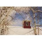
Here is an example of a very overzealous logging operations/new construction of roads/housing developments. Map of Hebron, NH by MapQuest
This is when I specifically have a problem with "extreme" forms of the Live Free or Die attitude. Some people can't quite grasp how the large-scale landuse change impacts others around them, including other neighbors.
I have only lived in NH a relatively short time, but I have observed enormous differences from town to town with regard to zoning, landuse policies, as well as how much residential development they allow compared to conserving a specific number of acres of land for residents to use via trails, etc.
Generally speaking the more affluent the town the stricter the zoning. The poor towns will sell anything for a tax gain.
Exactly. The developers will exert much more power with a "poorer" town with a low equalized tax rate.
Please register to post and access all features of our very popular forum. It is free and quick. Over $68,000 in prizes has already been given out to active posters on our forum. Additional giveaways are planned.
Detailed information about all U.S. cities, counties, and zip codes on our site: City-data.com.

 Please register to participate in our discussions with 2 million other members - it's free and quick! Some forums can only be seen by registered members. After you create your account, you'll be able to customize options and access all our 15,000 new posts/day with fewer ads.