Bridge Statistics for Menomonee Falls, Wisconsin (WI)
Condition, Traffic, Stress, Structural Evaluation, Project Costs
- National Bridge Inventory (NBI) Statistics
- 44Number of bridges
- 315ft / 95.7mTotal length
- $2,807,000Total costs
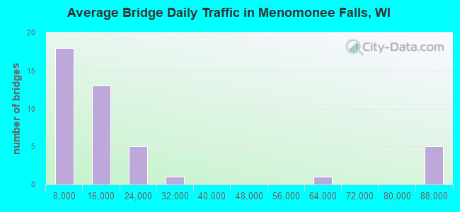
- 804,845Total average daily traffic
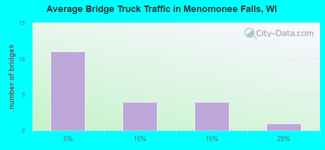
- 46,482Total average daily truck traffic
- National Bridge Inventory (NBI) Registered Bridges for Menomonee Falls
- No street view available for this location
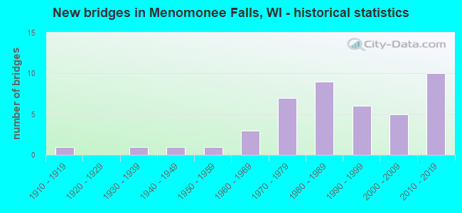
- New bridges - historical statistics
- 11910-1919
- 11930-1939
- 11940-1949
- 11950-1959
- 31960-1969
- 71970-1979
- 91980-1989
- 61990-1999
- 52000-2009
- 102010-2019

- Reconstructed bridges - Historical Statistics
- 11960-1969
- 01970-1979
- 01980-1989
- 21990-1999
- 02000-2009
- 12010-2019
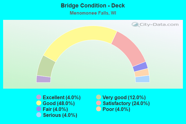
- Bridge Condition - Deck
- 4.0%Excellent
- 12.0%Very good
- 48.0%Good
- 24.0%Satisfactory
- 4.0%Fair
- 4.0%Poor
- 4.0%Serious
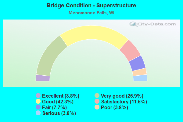
- Bridge Condition - Superstructure
- 3.8%Excellent
- 26.9%Very good
- 42.3%Good
- 11.5%Satisfactory
- 7.7%Fair
- 3.8%Poor
- 3.8%Serious
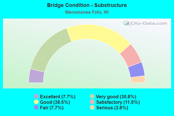
- Bridge Condition - Substructure
- 7.7%Excellent
- 30.8%Very good
- 38.5%Good
- 11.5%Satisfactory
- 7.7%Fair
- 3.8%Serious
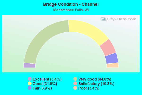
- Bridge Condition - Channel
- 3.4%Excellent
- 44.8%Very good
- 31.0%Good
- 10.3%Satisfactory
- 6.9%Fair
- 3.4%Poor
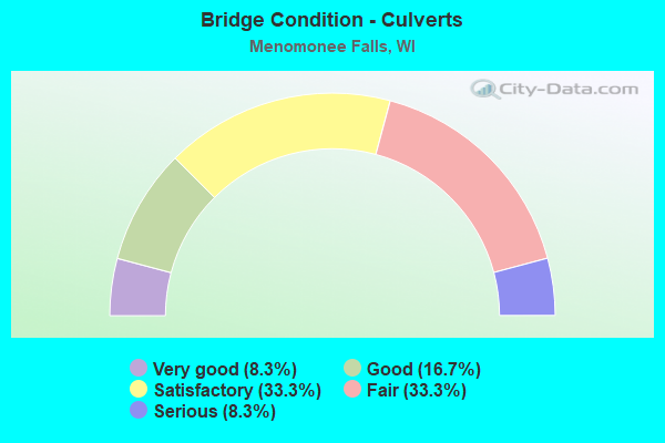
- Bridge Condition - Culverts
- 8.3%Very good
- 16.7%Good
- 33.3%Satisfactory
- 33.3%Fair
- 8.3%Serious
Find on map >> Show street view
Structure Number: B670338, Location: AT PILGRIM ROAD (Lat: 43.182489, Lng: -88.102086), Route carried "under" structure: Interstate 41, Year Built: 2015, Structure Length: 0. m, Average Daily Traffic: 84,700 (year 2019), Truck Traffic: 12%, Features Intersected: IH 41/USH 45, Facility Carried by Structure: LRD PILGRIM RD NB
Minimum Vertical Clearance: 5.76m (18.90ft), Kilometerpoint: 0.000, Lanes on structure: 2, Lanes under structure: 8, Material/Design: Prestressed concrete continuous, Design/Construction: Stringer/Multi-beam, Length of Maximum Span: 31.2m (102.4ft)
Find on map >> Show street view
Structure Number: B670948, Location: 1.3M E JCT STH 164 (Lat: 43.133294, Lng: -88.184389), Route carried "under" structure: State highway 74, Year Built: 1911, Structure Length: 0. m, Average Daily Traffic: 14,100 (year 2019), Truck Traffic: 3%, Features Intersected: STH 74, Facility Carried by Structure: CNW RR
Minimum Vertical Clearance: 6.78m (22.24ft), Kilometerpoint: 0.000, Lanes under structure: 2, Material/Design: Steel, Design/Construction: Stringer/Multi-beam, Length of Maximum Span: 19.5m (64.0ft)