Upper Clinton Hill neighborhood in Newark, New Jersey (NJ), 07108, 07112 detailed profile
Settings
X


Business Search - 14 Million verified businesses
Area: 0.767 square miles
Population: 22,045
Population density:
| Upper Clinton Hill: | 28,743 people per square mile |
| Newark: | 12,831 people per square mile |

- 17,22568.2%Black
- 3,95015.6%Hispanic or Latino
- 1,4055.6%Two or more races
- 7953.1%Some other race
- 7362.9%American Indian
- 7072.8%Asian
- 4351.7%White

Distribution of median household income
![Distribution of median household income]()
- 1,642Less than $10,000
- 1,514$10,000 to $19,999
- 1,270$20,000 to $29,999
- 1,199$30,000 to $39,999
- 1,327$40,000 to $49,999
- 743$50,000 to $59,999
- 865$60,000 to $74,999
- 631$75,000 to $99,999
- 618$100,000 to $124,999
- 275$125,000 to $149,999
- 475$150,000 to $199,999
- 443$200,000 or more

Distribution of owner-occupied house/condo value
![Distribution of owner-occupied house/condo value]()
- 441Less than $50,000
- 571$50,000 to $99,999
- 409$100,000 to $149,999
- 790$150,000 to $199,999
- 665$200,000 to $249,999
- 527$250,000 to $299,999
- 648$300,000 to $399,999
- 401$400,000 to $499,999
- 419$500,000 to $749,999
- 182$750,000 to $999,999
- 1,252$1,000,000 or more

Distribution of rent paid by renters
![Distribution of rent paid by renters]()
- 2,681Less than $100
- 1,953$100 to $199
- 1,442$200 to $299
- 704$300 to $399
- 764$400 to $499
- 1,119$500 to $599
- 699$600 to $699
- 599$700 to $799
- 420$800 to $899
- 427$900 to $999
- 989$1,000 to $1,249
- 1,181$1,250 to $1,499
- 1,379$1,500 to $1,999
- 1,336$2,000 or more

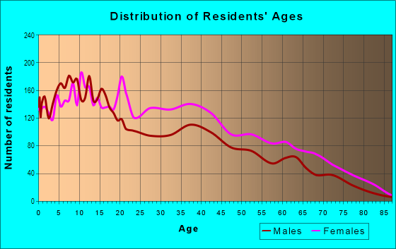
| Males: | 9,678 |
| Females: | 12,366 |
Males:
| This neighborhood: | 27.7 years |
| Whole city: | 33.9 years |
| This neighborhood: | 35.2 years |
| Whole city: | 36.0 years |
Average household size:
| Upper Clinton Hill: | 8.8 people |
| Newark: | 2.6 people |
Percentage of family households:
| Upper Clinton Hill: | 50.7% |
| Newark: | 47.4% |
| Here: | 20.4% |
| Newark: | 30.2% |
Percentage of married-couple families with children (among all households):
| Upper Clinton Hill: | 11.9% |
| Newark: | 18.2% |
Percentage of single-mother households (among all households):
| Upper Clinton Hill: | 23.3% |
| Newark: | 14.8% |
Percentage of never married males 15 years old and over:
Percentage of never married females 15 years old and over:
| Upper Clinton Hill: | 21.9% |
| Newark: | 24.8% |
Percentage of never married females 15 years old and over:
| Upper Clinton Hill: | 35.5% |
| city: | 25.2% |
Percentage of people that speak English not well or not at all:
| Upper Clinton Hill: | 4.0% |
| Newark: | 15.2% |
Percentage of people born in this state:
Percentage of people born in another U.S. state:
Percentage of native residents but born outside the U.S.:
Percentage of foreign born residents:
| Here: | 58.0% |
| Newark: | 47.9% |
Percentage of people born in another U.S. state:
| Upper Clinton Hill: | 20.6% |
| Newark: | 11.7% |
Percentage of native residents but born outside the U.S.:
| Here: | 4.1% |
| city: | 5.5% |
Percentage of foreign born residents:
| Here: | 17.8% |
| Newark: | 34.9% |

Owner-occupied
Renter-occupied


- Rooms in owner-occupied houses and condos in Upper Clinton Hill
- 1251 room
- 02 rooms
- 4103 rooms
- 6254 rooms
- 6025 rooms
- 5036 rooms
- 4937 rooms
- 5638 rooms
- 6089+ rooms

- Rooms in renter-occupied apartments in Upper Clinton Hill
- 6431 room
- 2252 rooms
- 1,0903 rooms
- 1,4734 rooms
- 2,3175 rooms
- 1,1406 rooms
- 3967 rooms
- 4958 rooms
- 3579+ rooms
Owner-occupied
Renter-occupied

- Bedrooms in owner-occupied houses and condos in Upper Clinton Hill
- 125no bedroom
- 1961 bedroom
- 5342 bedrooms
- 1,0803 bedrooms
- 3754 bedrooms
- 5485+ bedrooms

- Bedrooms in renter-occupied apartments in Upper Clinton Hill
- 645no bedroom
- 9061 bedroom
- 1,9762 bedrooms
- 2,5313 bedrooms
- 7554 bedrooms
- 4505+ bedrooms
Average number of cars or other vehicles available in houses/condos:
Average number of cars or other vehicles available in apartments:
| This neighborhood: | |
| Newark: |
Average number of cars or other vehicles available in apartments:
| Here: | 0.8 |
| city: | 0.8 |
Percentage of units with a mortgage:
| Upper Clinton Hill: | 71.3% |
| Newark: | 65.4% |
Average estimated value of detached houses in 2022 (13.7% of all units):
| Upper Clinton Hill: | $1,314,146 |
| Newark: | $412,982 |

- Year house built in Upper Clinton Hill
- 2062020 or later
- 7982010 to 2019
- 1,4692000 to 2009
- 1,3321990 to 1999
- 4531980 to 1989
- 1,3551970 to 1979
- 9661960 to 1969
- 1,2261950 to 1959
- 1,0151940 to 1949
- 2,6291939 or earlier

City-data.com crime index for city in 2020 (higher means more crime):
| City: | 273.7 |
| U.S. average: | 219.5 |
Travel time to work (commute)
![Travel time to work (commute)]()
- 133Less than 5 minutes
- 5305 to 9 minutes
- 62210 to 14 minutes
- 1,59415 to 19 minutes
- 1,08220 to 24 minutes
- 24425 to 29 minutes
- 79030 to 34 minutes
- 12235 to 39 minutes
- 31540 to 44 minutes
- 78445 to 59 minutes
- 1,17460 to 89 minutes
- 55090 or more minutes

Means of transportation to work
![Means of transportation to work]()
- 54.6%4,384Drove a car alone
- 7.8%629Carpooled
- 20.9%1,674Bus
- 7.6%612Subway or elevated rail
- 7.7%619Long-distance train or commuter rail
- 5.0%404Light rail, streetcar or trolley
- 4.4%354Taxi
- 6.2%494Walked
- 9.2%738Other means
- 6.6%528Worked at home

Time leaving home to go to work
![Time leaving home to go to work]()
- 43512:00 a.m. to 4:59 a.m.
- 4555:00 a.m. to 5:29 a.m.
- 2365:30 a.m. to 5:59 a.m.
- 8366:00 a.m. to 6:29 a.m.
- 5726:30 a.m. to 6:59 a.m.
- 8817:00 a.m. to 7:29 a.m.
- 7417:30 a.m. to 7:59 a.m.
- 8418:00 a.m. to 8:29 a.m.
- 3648:30 a.m. to 8:59 a.m.
- 4559:00 a.m. to 9:59 a.m.
- 22910:00 a.m. to 10:59 a.m.
- 31111:00 a.m. to 11:59 a.m.
- 81412:00 p.m. to 3:59 p.m.
- 1,2524:00 p.m. to 11:59 p.m.

Occupations of males:
- Percentage of males in management occupations (except farmers):
Here: 10.3% city: 4.7%
- Percentage of males in business and financial operations occupations:
Here: 1.5% city: 3.2%
- Percentage of males in computer and mathematical occupations:
Here: 3.8% city: 3.1%
- Percentage of males in community and social services occupations:
Here: 1.4% city: 1.5%
- Percentage of males in education, training, and library occupations:
Here: 2.5% city: 2.0%
- Percentage of males in service occupations:
Here: 21.8% city: 18.4%
- Percentage of males in sales and office occupations:
Here: 20.5% city: 13.2%
- Percentage of males in construction, extraction, and maintenance occupations:
Here: 4.9% city: 18.9%
- Percentage of males in production occupations:
Here: 4.3% city: 6.5%
- Percentage of males in transportation occupations:
Here: 10.7% city: 12.5%
- Percentage of males in material moving occupations:
Here: 12.8% city: 7.0%
Occupations of females:
- Percentage of females in management occupations (except farmers):
Here: 8.6% city: 7.3%
- Percentage of females in business and financial operations occupations:
Here: 3.2% city: 3.9%
- Percentage of females in life, physical, and social science occupations:
Here: 1.1% city: 0.7%
- Percentage of females in community and social services occupations:
Here: 3.8% city: 2.5%
- Percentage of females in education, training, and library occupations:
Here: 2.7% city: 7.1%
- Percentage of females in healthcare practitioners and technical occupations:
Here: 6.3% city: 4.8%
- Percentage of females in service occupations:
Here: 32.5% city: 30.4%
- Percentage of females in sales and office occupations:
Here: 27.7% city: 27.3%
- Percentage of females in production occupations:
Here: 2.3% city: 5.2%
- Percentage of females in transportation occupations:
Here: 2.1% city: 1.9%
- Percentage of females in material moving occupations:
Here: 7.5% city: 5.4%
Education in this neighborhood (subdivision or community):
- Percentage of people 3 years and older in K-12 schools:
Upper Clinton Hill: 32.6% Newark: 17.5%
- Percentage of people 3 years and older in undergraduate colleges:
Upper Clinton Hill: 9.7% Newark: 6.3%
- Percentage of people 3 years and older in grad. or professional schools:
Upper Clinton Hill: 4.1% Newark: 1.5%
- Percentage of students K-12 enrolled in private schools:
Upper Clinton Hill: 25.4% Newark: 6.6%
Percentage of population below poverty level:
| Upper Clinton Hill: | 34.2% |
| Newark: | 24.0% |
Percentage of married-couple families with both working:
| Upper Clinton Hill: | 102.8% |
| Newark: | 57.9% |

- 63.0%Utility gas
- 19.9%Electricity
- 7.5%Fuel oil, kerosene, etc.
- 4.8%Bottled, tank, or LP gas
- 4.7%No fuel used
Limited-access highways (interstate or state) in this neighborhood:
I- 78
Length: 0.09 miles
Direction: E-W
Direction: E-W
Roads and streets:
Clinton Ave
Length: 1.20 miles
Direction: E-W
Address range: 484 to 864
Direction: E-W
Address range: 484 to 864
Hawthorne Ave
Length: 1.07 miles
Directions: E-W, SE-NW
Address range: 211 to 564
Directions: E-W, SE-NW
Address range: 211 to 564
Madison Ave
Length: 1.01 miles
Direction: E-W
Address range: 110 to 373
Direction: E-W
Address range: 110 to 373
Fabyan Pl
Length: 0.82 miles
Directions: E-W, SW-NE
Address range: 1 to 245
Directions: E-W, SW-NE
Address range: 1 to 245
Chadwick Ave
Length: 0.81 miles
Directions: N-S, SW-NE
Address range: 11 to 318
Directions: N-S, SW-NE
Address range: 11 to 318
Seymour Ave
Length: 0.76 miles
Directions: N-S, SE-NW, SW-NE
Address range: 1 to 299
Directions: N-S, SE-NW, SW-NE
Address range: 1 to 299
Bergen St
Length: 0.69 miles
Directions: N-S, SW-NE
Address range: 561 to 817
Directions: N-S, SW-NE
Address range: 561 to 817
W Runyon St
Length: 0.64 miles
Direction: E-W
Address range: 173 to 398
Direction: E-W
Address range: 173 to 398
Avon Ave
Length: 0.55 miles
Direction: E-W
Address range: 206 to 505
Direction: E-W
Address range: 206 to 505
Leslie St
Length: 0.50 miles
Direction: SW-NE
Address range: 1 to 198
Direction: SW-NE
Address range: 1 to 198
Clinton Pl
Length: 0.47 miles
Directions: N-S, SW-NE
Address range: 1 to 237
Directions: N-S, SW-NE
Address range: 1 to 237
Nye Ave
Length: 0.43 miles
Directions: E-W, SE-NW
Address range: 151 to 267
Directions: E-W, SE-NW
Address range: 151 to 267
Osborne Ter
Length: 0.43 miles
Directions: N-S, SW-NE
Address range: 1 to 168
Directions: N-S, SW-NE
Address range: 1 to 168
Hedden Ter
Length: 0.40 miles
Directions: E-W, N-S
Address range: 1 to 158
Directions: E-W, N-S
Address range: 1 to 158
S 19th St
Length: 0.37 miles
Direction: N-S
Address range: 804 to 951
Direction: N-S
Address range: 804 to 951
S 18th St
Length: 0.37 miles
Direction: N-S
Address range: 802 to 998
Direction: N-S
Address range: 802 to 998
Wainwright St
Length: 0.36 miles
Directions: E-W, SW-NE
Address range: 1 to 118
Directions: E-W, SW-NE
Address range: 1 to 118
Tillinghast St
Length: 0.34 miles
Direction: E-W
Address range: 1 to 104
Direction: E-W
Address range: 1 to 104
S 20th St
Length: 0.34 miles
Direction: N-S
Address range: 800 to 998
Direction: N-S
Address range: 800 to 998
Girard Pl
Length: 0.34 miles
Directions: N-S, SW-NE
Address range: 1 to 111
Directions: N-S, SW-NE
Address range: 1 to 111
Treacy Ave
Length: 0.34 miles
Directions: N-S, SW-NE
Address range: 2 to 130
Directions: N-S, SW-NE
Address range: 2 to 130
Schley St
Length: 0.33 miles
Direction: SW-NE
Address range: 1 to 127
Direction: SW-NE
Address range: 1 to 127
Homestead Park
Length: 0.29 miles
Directions: E-W, N-S, SE-NW, SW-NE
Address range: 1 to 72
Directions: E-W, N-S, SE-NW, SW-NE
Address range: 1 to 72
Cypress St
Length: 0.28 miles
Directions: E-W, SE-NW, SW-NE
Address range: 1 to 80
Directions: E-W, SE-NW, SW-NE
Address range: 1 to 80
Rose Ter
Length: 0.28 miles
Direction: E-W
Address range: 1 to 84
Direction: E-W
Address range: 1 to 84
Baldwin Ave
Length: 0.28 miles
Direction: SW-NE
Address range: 1 to 110
Direction: SW-NE
Address range: 1 to 110
Shanley Ave
Length: 0.28 miles
Direction: SW-NE
Address range: 21 to 130
Direction: SW-NE
Address range: 21 to 130
Farley Ave
Length: 0.28 miles
Direction: N-S
Address range: 1 to 110
Direction: N-S
Address range: 1 to 110
S 10th St
Length: 0.28 miles
Direction: N-S
Address range: 739 to 848
Direction: N-S
Address range: 739 to 848
Ingraham Pl
Length: 0.27 miles
Directions: N-S, SW-NE
Address range: 1 to 110
Directions: N-S, SW-NE
Address range: 1 to 110
Millington Ave
Length: 0.25 miles
Direction: E-W
Address range: 1 to 99
Direction: E-W
Address range: 1 to 99
Dewey St (Sarah Vaughn Pl)
Length: 0.25 miles
Directions: E-W, SW-NE
Address range: 1 to 64
Directions: E-W, SW-NE
Address range: 1 to 64
Bragaw Ave
Length: 0.25 miles
Directions: E-W, SE-NW
Address range: 110 to 133
Directions: E-W, SE-NW
Address range: 110 to 133
Beverly St
Length: 0.24 miles
Direction: SE-NW
Address range: 1 to 79
Direction: SE-NW
Address range: 1 to 79
S 17th St
Length: 0.22 miles
Direction: N-S
Address range: 850 to 939
Direction: N-S
Address range: 850 to 939
Voorhees St
Length: 0.22 miles
Direction: SE-NW
Address range: 1 to 69
Direction: SE-NW
Address range: 1 to 69
Hobson St
Length: 0.22 miles
Directions: N-S, SE-NW, SW-NE
Address range: 9 to 92
Directions: N-S, SE-NW, SW-NE
Address range: 9 to 92
S 16th St
Length: 0.22 miles
Direction: N-S
Address range: 846 to 933
Direction: N-S
Address range: 846 to 933
Van Ness Pl
Length: 0.21 miles
Directions: E-W, N-S, SW-NE
Address range: 1 to 98
Directions: E-W, N-S, SW-NE
Address range: 1 to 98
S 15th St
Length: 0.20 miles
Direction: N-S
Address range: 821 to 904
Direction: N-S
Address range: 821 to 904
Nairn Pl
Length: 0.20 miles
Direction: N-S
Address range: 1 to 99
Direction: N-S
Address range: 1 to 99
S 14th St
Length: 0.19 miles
Direction: N-S
Address range: 833 to 915
Direction: N-S
Address range: 833 to 915
White Ter
Length: 0.18 miles
Direction: E-W
Address range: 1 to 46
Direction: E-W
Address range: 1 to 46
S 13th St
Length: 0.18 miles
Direction: N-S
Address range: 819 to 899
Direction: N-S
Address range: 819 to 899
Yates Ave
Length: 0.17 miles
Direction: SE-NW
Address range: 1 to 52
Direction: SE-NW
Address range: 1 to 52
S 12th St
Length: 0.17 miles
Direction: N-S
Address range: 809 to 883
Direction: N-S
Address range: 809 to 883
Demarest St
Length: 0.16 miles
Direction: SW-NE
Address range: 1 to 54
Direction: SW-NE
Address range: 1 to 54
Vernon Ave
Length: 0.15 miles
Direction: E-W
Address range: 1 to 56
Direction: E-W
Address range: 1 to 56
Montgomery Ave
Length: 0.15 miles
Direction: SW-NE
Address range: 2 to 90
Direction: SW-NE
Address range: 2 to 90
S 11th St
Length: 0.15 miles
Direction: N-S
Address range: 817 to 887
Direction: N-S
Address range: 817 to 887
Randolph Pl
Length: 0.15 miles
Direction: E-W
Address range: 1 to 53
Direction: E-W
Address range: 1 to 53
W Bigelow St
Length: 0.13 miles
Direction: E-W
Address range: 274 to 313
Direction: E-W
Address range: 274 to 313
Hopkins Pl
Length: 0.13 miles
Direction: E-W
Address range: 1 to 32
Direction: E-W
Address range: 1 to 32
Wolcott Ter
Length: 0.12 miles
Direction: SW-NE
Address range: 1 to 56
Direction: SW-NE
Address range: 1 to 56
Goodwin Ave
Length: 0.12 miles
Directions: E-W, SW-NE
Address range: 2 to 42
Directions: E-W, SW-NE
Address range: 2 to 42
Leo Pl
Length: 0.11 miles
Direction: SW-NE
Address range: 1 to 54
Direction: SW-NE
Address range: 1 to 54
Reeves Pl
Length: 0.10 miles
Direction: SW-NE
Address range: 1 to 32
Direction: SW-NE
Address range: 1 to 32
Patten Pl
Length: 0.10 miles
Direction: E-W
Address range: 1 to 28
Direction: E-W
Address range: 1 to 28
Huntington Ter
Length: 0.10 miles
Directions: E-W, SW-NE
Address range: 1 to 31
Directions: E-W, SW-NE
Address range: 1 to 31
Schuyler Ave
Length: 0.10 miles
Directions: N-S, SW-NE
Address range: 1 to 30
Directions: N-S, SW-NE
Address range: 1 to 30
Fessenden Pl
Length: 0.08 miles
Directions: E-W, N-S, SE-NW
Address range: 1 to 26
Directions: E-W, N-S, SE-NW
Address range: 1 to 26
Fabyan Brg
Length: 0.07 miles
Direction: N-S
Direction: N-S
Seymour Pl
Length: 0.07 miles
Directions: E-W, SW-NE
Directions: E-W, SW-NE
Schuyler Pl
Length: 0.06 miles
Direction: E-W
Address range: 1 to 20
Direction: E-W
Address range: 1 to 20
Hazel Pl
Length: 0.04 miles
Direction: N-S
Address range: 1 to 30
Direction: N-S
Address range: 1 to 30
Lyons Ave
Length: 0.04 miles
Direction: SE-NW
Address range: 452 to 465
Direction: SE-NW
Address range: 452 to 465
Motley Pl
Length: 0.03 miles
Directions: E-W, N-S, SE-NW, SW-NE
Address range: 1 to 24
Directions: E-W, N-S, SE-NW, SW-NE
Address range: 1 to 24
Westervelt Pl
Length: 0.03 miles
Direction: E-W
Address range: 1 to 8
Direction: E-W
Address range: 1 to 8
Stetcher St
Length: 0.00 miles
Direction: SW-NE
Direction: SW-NE