Property valuation of N Howard Street, Akron, OH (tax assessments)
Other nearby streets: N Howard Street (1)  N Howard Street (2)
N Howard Street (3)
N Howard Street (4)
N Howard Street (5)
N Howard Street (2)
N Howard Street (3)
N Howard Street (4)
N Howard Street (5)
N Howard Street (2)
N Howard Street (3)
N Howard Street (4)
N Howard Street (5)
Listed properties vs overall distribution of properties in Akron, OH:
Advertisements
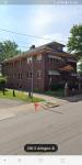
N Howard Street
Akron, OH
Find on map >>
Owner: PATRICIATRUSTEE STAAB
Land value: $1,560
Total value for property: $1,560
Class: Residential
Land use: Residential, Vacant Land, Lot
Land area: 2,840 square feet
Land frontage: 66 feet
Land depth: 43 feet
Land depth table: 150 feet
Land depth factor: 0.53
Square footage: 2,838 square feet
Reason: Reappraisal
Assessments for tax year: 2009
Sales:
-
Sale date: 06/23/1999
Price: $124,500
Old owner name: D L MILLENDER & CILISTENE MILLENDER
New owner name: PATRICIATRUSTEE STAAB
Validity: Life Estate
-
Sale date: 06/23/1999
Price: $90,000
Old owner name: RONALD GRINDER
New owner name: D L MILLENDER & CILISTENE MILLENDER
Validity: Land Contract
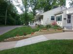
N Howard Street
Akron, OH 44308
Find on map >>
Owner: TESTA ENTERPRISES INC
Building value: $6,240
Land value: $6,420
Total value for property: $12,660
Class: Residential
Land use: Condominium
Land area: 213 square feet
Land depth factor: 1.00
Square footage: 214 square feet
Reason: Reappraisal
Assessments for tax year: 2009
Sale date: 03/30/2007
Old owner name: TESTA ENTERPRISES INC
New owner name: TESTA ENTERPRISES INC
N Howard Street
Akron, OH 44308
Find on map >>
Owner: TESTA ENTERPRISES INC
Building value: $6,240
Land value: $6,090
Total value for property: $12,330
Class: Residential
Land use: Condominium
Land area: 204 square feet
Land depth factor: 1.00
Square footage: 203 square feet
Reason: Reappraisal
Assessments for tax year: 2009
Sale date: 03/30/2007
Old owner name: TESTA ENTERPRISES INC
New owner name: TESTA ENTERPRISES INC
N Howard Street
Akron, OH
Find on map >>
Owner: CITY OF AKRON OHIO
Land value: $53,950
Total value for property: $53,950
Class: Exempt
Land use: Exempt Property Owned By Municipals
Land area: 16,600 square feet
Land depth factor: 1.00
Square footage: 16,600 square feet
Reason: Reappraisal
Assessments for tax year: 2009
N Howard Street
Akron, OH
Find on map >>
Owner: CITY OF AKRON OHIO
Land value: $9,750
Total value for property: $9,750
Class: Exempt
Land use: Exempt Property Owned By Municipals
Land area: 3,001 square feet
Land depth factor: 1.00
Square footage: 3,000 square feet
Reason: Reappraisal
Assessments for tax year: 2009
N Howard Street
Akron, OH 44308
Find on map >>
Owner: EUGENE HEYDEN TRUSTEE
Building value: $7,680
Land value: $14,070
Total value for property: $21,750
Class: Residential
Land use: Condominium
Land area: 470 square feet
Land depth factor: 1.00
Square footage: 469 square feet
Reason: Reappraisal
Assessments for tax year: 2009
Sales:
-
Sale date: 03/30/2007
Old owner name: TESTA ENTERPRISES INC
New owner name: TESTA ENTERPRISES INC
-
Sale date: 08/14/2007
Old owner name: TESTA ENTERPRISES INC
New owner name: EUGENE HEYDEN
-
Sale date: 03/12/2008
Old owner name: EUGENE HEYDEN
New owner name: EUGENE HEYDEN TRUSTEE
N Howard Street
Akron, OH 44308
Find on map >>
Owner: TESTA ENTERPRISES INC
Building value: $6,240
Land value: $5,310
Total value for property: $11,550
Class: Residential
Land use: Condominium
Land area: 178 square feet
Land depth factor: 1.00
Square footage: 177 square feet
Reason: Reappraisal
Assessments for tax year: 2009
Sale date: 03/30/2007
Old owner name: TESTA ENTERPRISES INC
New owner name: TESTA ENTERPRISES INC
N Howard Street
Akron, OH 44308
Find on map >>
Owner: TESTA ENTERPRISES INC
Building value: $6,240
Land value: $8,160
Total value for property: $14,400
Class: Residential
Land use: Condominium
Land area: 270 square feet
Land depth factor: 1.00
Square footage: 272 square feet
Reason: Reappraisal
Assessments for tax year: 2009
Sale date: 03/30/2007
Old owner name: TESTA ENTERPRISES INC
New owner name: TESTA ENTERPRISES INC
N Howard Street
Akron, OH
Find on map >>
Owner: ERNEST L KIRALY
Land value: $2,250
Total value for property: $2,250
Class: Residential
Land use: Residential, Vacant Land, Lot
Land area: 5,941 square feet
Land frontage: 66 feet
Land depth: 90 feet
Land depth table: 150 feet
Land depth factor: 0.77
Square footage: 5,940 square feet
Reason: Reappraisal
Assessments for tax year: 2009
Sales:
-
Sale date: 11/17/1992
Old owner name: OBIE GEORGE DARNELL & ALICE DARNELL
New owner name: JAMES ANDREWS & MARYANN ANDREWS
-
Sale date: 06/27/2003
Price: $3,500
Old owner name: JAMES ANDREWS & MARYANN ANDREWS
New owner name: JAMES W ANDREWS & ERNEST L KIRALY
-
Sale date: 03/03/2004
Old owner name: JAMES W ANDREWS & ERNEST L KIRALY
New owner name: MARY ANN ANDREWS & ERNEST L KIRALY
-
Sale date: 03/03/2004
Old owner name: MARY ANN ANDREWS & ERNEST L KIRALY
New owner name: MARY ANN ANDREWS & ERNEST L KIRALY
-
Sale date: 06/01/2004
Price: $3,500
Old owner name: MARY ANN ANDREWS & ERNEST L KIRALY
New owner name: ERNEST L KIRALY
Other nearby streets: N Howard Street (1)
N Howard Street (2)
N Howard Street (3)
N Howard Street (4)
N Howard Street (5)
N Howard Street (2)
N Howard Street (3)
N Howard Street (4)
N Howard Street (5)

Recent posts about Akron, Ohio on our local forum with over 2,400,000 registered users. Akron is mentioned 2,692 times on our forum:
 | possible move to Akron Ohio (5 replies) |
| Safe/good parts of Akron? (4 replies) |
| Tell me about Akron area (17 replies) |
| Relationship between Akron and Cleveland (14 replies) |
| Akron vs Dayton? (4 replies) |
| Safe & affordable places in Akron for young woman (5 replies) |

Settings
X

Recently Added Photos

Akron, OH
Akron, OH

Akron, OH

Akron, OH

Akron, OH
Akron, OH

Akron, OH

Akron, OH

Akron, OH

Akron, OH

Akron, OH

Akron, OH
Request disassociating your name from street-level assessment address

Recent home sales, price trends, and home value evaluator powered by Onboard Informatics
© 2024 Onboard Informatics. Information is deemed reliable but not guaranteed.
© 2024 Onboard Informatics. Information is deemed reliable but not guaranteed.
Some parts © 2024 Advameg, Inc.
Compilation, repackaging, or reproduction prohibited. Users are forewarned that it is incumbent upon them to verify information with the responsible state agency. Advameg, Inc. does not guarantee the data presented is up-to-date nor does it assume responsibility for updating it. Therefore any names, owners or addresses may have changed. Use of any information published here to contact the persons might be prohibited by the law.