Property valuation of N 12th Avenue, Safety Harbor, FL: 175, 335, 345, 355, 620, 640, 641, 651, 660, 661 (tax assessments)
Other nearby streets: N 6th Street  Woodbridge Court (1)
Woodbridge Court (2)
Woodbridge Court (3)
Woodbridge Court (4)
Woodbridge Court (1)
Woodbridge Court (2)
Woodbridge Court (3)
Woodbridge Court (4)
Woodbridge Court (1)
Woodbridge Court (2)
Woodbridge Court (3)
Woodbridge Court (4)
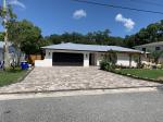
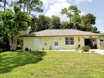
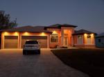
Listed properties vs overall distribution of properties in Safety Harbor, FL:
Advertisements
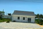
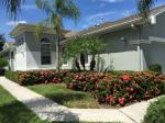
175 N 12th Avenue
Safety Harbor, FL 34695
Find on map >>
Owner: KIARALINDA & TODD RAMQUIST
Total buildings value: $59,523
Total land value: $51,402
Market value for property: $110,925
Millage rate: 20.0648
The amount of taxes assessed for this parcel: $2,225
Parcel type: Residential
Assessments for tax year: 2016
Building type: Single Family
Foundation: Continuous Footing
Floor system: Slab On Grade
Number of stories in the building: 1
The number of living units: 1
Quality factor for this building: Average
Gross area of the building: 1,032 square feet
Year property was built: 1974
Effective age: 24 years
Heating: Central Duct
Cooling type: Cooling (Central)
Size of the land given in width by hength: 50x100 feet
Land's use: Single Family
Land's use according to the future land use plan: Ac - Activity Center
Sales:
-
Sale date: 01/27/2005
Price: $120,000
Vacant or improved sale: Improved
Old owner: LINDA S MANLEY
New owner: PHILLIP KOHAN
-
Sale date: 11/21/2005
Price: $155,000
Vacant or improved sale: Improved
Old owner: PHILLIP KOHAN
New owner: MARK YELLICO
-
Sale date: 12/03/2007
Price: $92,000
Vacant or improved sale: Improved
Old owner: WELLS FARGO BANK N A
New owner: TODD RAMQUIST
335 N 12th Avenue
Safety Harbor, FL 34695
Find on map >>
Owner: KARA RADABAUGH & REGINO RODRIGUEZ
Total buildings value: $85,663
Total land value: $86,909
Total extra features value: $2,844
Market value for property: $175,416
Millage rate: 20.0648
The amount of taxes assessed for this parcel: $3,519
Parcel type: Residential
Assessments for tax year: 2016
Building type: Single Family
Foundation: Continuous Footing
Floor system: Slab On Grade
Number of stories in the building: 1
The number of living units: 1
Quality factor for this building: Fair
Gross area of the building: 2,830 square feet
Year property was built: 1972
Effective age: 34 years
Heating: Central Duct
Cooling type: Cooling (Central)
Size of the land given in width by hength: 110x100 feet
Land's use: Single Family
Land's use according to the future land use plan: Rlm - Residential Low Medium
Sales:
Extra features:
Safety Harbor, FL 34695
Find on map >>
Owner: KARA RADABAUGH & REGINO RODRIGUEZ
Total buildings value: $85,663
Total land value: $86,909
Total extra features value: $2,844
Market value for property: $175,416
Millage rate: 20.0648
The amount of taxes assessed for this parcel: $3,519
Parcel type: Residential
Assessments for tax year: 2016
Building type: Single Family
Foundation: Continuous Footing
Floor system: Slab On Grade
Number of stories in the building: 1
The number of living units: 1
Quality factor for this building: Fair
Gross area of the building: 2,830 square feet
Year property was built: 1972
Effective age: 34 years
Heating: Central Duct
Cooling type: Cooling (Central)
Size of the land given in width by hength: 110x100 feet
Land's use: Single Family
Land's use according to the future land use plan: Rlm - Residential Low Medium
Sales:
-
Sale date: 08/10/1987
Price: $63,000
-
Sale date: 02/28/1989
Price: $60,000
Vacant or improved sale: Improved
Old owner: ROBERT N TORRES
New owner: JEANNE K MOORE
-
Sale date: 11/18/2005
Price: $280,000
Vacant or improved sale: Improved
Old owner: JEANNE K MOORE TR
New owner: GARY W STRATTON
-
Sale date: 03/04/2016
Price: $280,000
Vacant or improved sale: Improved
Old owner: RISA L STRATTON
New owner: RODRIGUEZ REGINO
Extra features:
-
Description of the extra feature: Shed
Value of the extra feature: $1,800
Year extra feature was added to the roll: 1980
-
Description of the extra feature: Shed
Value of the extra feature: $2,880
Year extra feature was added to the roll: 1995
-
Description of the extra feature: Porch
Value of the extra feature: $1,170
Year extra feature was added to the roll: 1972
345 N 12th Avenue
Safety Harbor, FL 34695
Find on map >>
Owner: ANN L COURCHAINE & JOHN D DEDELL
Total buildings value: $76,894
Total land value: $57,593
Total extra features value: $2,517
Market value for property: $137,003
Millage rate: 20.0648
The amount of taxes assessed for this parcel: $2,748
Parcel type: Residential
Assessments for tax year: 2016
Size of the land given in width by hength: 55x100 feet
Land's use: Single Family
Land's use according to the future land use plan: Rlm - Residential Low Medium
Sales:
Extra features:
Safety Harbor, FL 34695
Find on map >>
Owner: ANN L COURCHAINE & JOHN D DEDELL
Total buildings value: $76,894
Total land value: $57,593
Total extra features value: $2,517
Market value for property: $137,003
Millage rate: 20.0648
The amount of taxes assessed for this parcel: $2,748
Parcel type: Residential
Assessments for tax year: 2016
Size of the land given in width by hength: 55x100 feet
Land's use: Single Family
Land's use according to the future land use plan: Rlm - Residential Low Medium
Sales:
-
Sale date: 04/25/1995
Price: $105,000
Vacant or improved sale: Improved
Old owner: HOUSEHOLD RLTY CORP
New owner: THEODORE H KWALWASSER
-
Sale date: 10/29/1997
Price: $81,900
Vacant or improved sale: Improved
Old owner: THEODORE H KWALWASSER
New owner: CALEB F SEYMOUR
-
Sale date: 02/22/2013
Price: $145,000
Vacant or improved sale: Improved
Old owner: CLAUDIA BLALI
New owner: DEDELL JOHN D
Extra features:
-
Description of the extra feature: Patio/Deck
Value of the extra feature: $3,036
Year extra feature was added to the roll: 2000
-
Description of the extra feature: Shed
Value of the extra feature: $1,152
Year extra feature was added to the roll: 2000
355 N 12th Avenue
Safety Harbor, FL 34695
Find on map >>
Owner: CLIFTON HARRIS
Total buildings value: $134,285
Total land value: $49,011
Market value for property: $183,296
Millage rate: 20.0648
The amount of taxes assessed for this parcel: $3,677
Parcel type: Residential
Assessments for tax year: 2016
Size of the land given in width by hength: 55x100 feet
Land's use: Single Family
Land's use according to the future land use plan: Rlm - Residential Low Medium
Sales:
-
Sale date: 04/25/1995
Price: $105,000
Vacant or improved sale: Improved
Old owner: HOUSEHOLD RLTY CORP
New owner: THEODORE H KWALWASSER
-
Sale date: 10/29/1997
Price: $81,900
Vacant or improved sale: Vacant
Old owner: THEODORE H KWALWASSER
New owner: CALEB F SEYMOUR
-
Sale date: 06/03/2004
Price: $66,500
Vacant or improved sale: Improved
Old owner: THEODORE H KWALWASSER
New owner: CLIFTON HARRIS
-
Sale date: 06/10/2004
Price: $133,000
Vacant or improved sale: Improved
Old owner: THEODORE H KWALWASSER
New owner: CLIFTON HARRIS
620 N 12th Avenue
Safety Harbor, FL 34695
Find on map >>
Owner: TERECETA L JONES
Total buildings value: $41,928
Total land value: $11,915
Total extra features value: $1,300
Market value for property: $55,143
Millage rate: 20.0648
The amount of taxes assessed for this parcel: $1,106
Parcel type: Residential
Assessments for tax year: 2016
Building type: Single Family
Foundation: Continuous Footing
Floor system: Slab On Grade
Number of stories in the building: 1
The number of living units: 1
Quality factor for this building: Average
Gross area of the building: 1,240 square feet
Year property was built: 1962
Effective age: 43 years
Heating: Central Duct
Cooling type: Cooling (Central)
Size of the land given in width by hength: 62x93 feet
Land's use: Single Family
Land's use according to the future land use plan: Rlm - Residential Low Medium
Sales:
Value of the extra feature: $3,150
Year extra feature was added to the roll: 1995
Safety Harbor, FL 34695
Find on map >>
Owner: TERECETA L JONES
Total buildings value: $41,928
Total land value: $11,915
Total extra features value: $1,300
Market value for property: $55,143
Millage rate: 20.0648
The amount of taxes assessed for this parcel: $1,106
Parcel type: Residential
Assessments for tax year: 2016
Building type: Single Family
Foundation: Continuous Footing
Floor system: Slab On Grade
Number of stories in the building: 1
The number of living units: 1
Quality factor for this building: Average
Gross area of the building: 1,240 square feet
Year property was built: 1962
Effective age: 43 years
Heating: Central Duct
Cooling type: Cooling (Central)
Size of the land given in width by hength: 62x93 feet
Land's use: Single Family
Land's use according to the future land use plan: Rlm - Residential Low Medium
Sales:
-
Sale date: 12/09/1994
Price: $18,000
Vacant or improved sale: Improved
Old owner: FORD CONSUMER FIN CO INC
New owner: STEVE LEVI
-
Sale date: 01/18/1995
Price: $39,900
Vacant or improved sale: Improved
Old owner: STEVE LEVI
New owner: ANGELO M GREEN
-
Sale date: 09/19/2003
Price: $1,400
Vacant or improved sale: Improved
Old owner: ANGELO M GREEN
New owner: TERRY L JONES
Value of the extra feature: $3,150
Year extra feature was added to the roll: 1995
640 N 12th Avenue
Safety Harbor, FL 34695
Find on map >>
Owner: ELIAS DAVIS EST
Total buildings value: $43,158
Total land value: $11,489
Total extra features value: $2,528
Market value for property: $57,175
Millage rate: 20.0648
The amount of taxes assessed for this parcel: $1,147
Parcel type: Residential
Assessments for tax year: 2016
Building type: Single Family
Foundation: Continuous Footing
Floor system: Slab On Grade
Number of stories in the building: 1
The number of living units: 1
Quality factor for this building: Average
Gross area of the building: 1,515 square feet
Year property was built: 1963
Effective age: 43 years
Heating: Central Duct
Cooling type: Cooling (Central)
Size of the land given in width by hength: 60x93 feet
Land's use: Single Family
Land's use according to the future land use plan: Rlm - Residential Low Medium
Extra features:
-
Description of the extra feature: Patio/Deck
Value of the extra feature: $1,944
Year extra feature was added to the roll: 1990
-
Description of the extra feature: Shed
Value of the extra feature: $2,700
Year extra feature was added to the roll: 1994
-
Description of the extra feature: Bbq
Value of the extra feature: $1,000
Year extra feature was added to the roll: 1970
641 N 12th Avenue
Safety Harbor, FL 34695
Find on map >>
Owner: AMERICAN DREAM PETROLEUM INC
Total buildings value: $77,701
Total land value: $13,145
Total extra features value: $17,644
Market value for property: $108,490
Millage rate: 20.0648
The amount of taxes assessed for this parcel: $2,176
Parcel type: Residential
Assessments for tax year: 2016
Building type: Single Family
Foundation: Continuous Footing
Floor system: Slab On Grade
Number of stories in the building: 1
The number of living units: 1
Quality factor for this building: Average
Gross area of the building: 2,532 square feet
Year property was built: 1965
Effective age: 38 years
Heating: Central Duct
Cooling type: Cooling (Central)
Size of the land given in width by hength: 66x102 feet
Land's use: Single Family
Land's use according to the future land use plan: Rlm - Residential Low Medium
Sales:
Extra features:
Safety Harbor, FL 34695
Find on map >>
Owner: AMERICAN DREAM PETROLEUM INC
Total buildings value: $77,701
Total land value: $13,145
Total extra features value: $17,644
Market value for property: $108,490
Millage rate: 20.0648
The amount of taxes assessed for this parcel: $2,176
Parcel type: Residential
Assessments for tax year: 2016
Building type: Single Family
Foundation: Continuous Footing
Floor system: Slab On Grade
Number of stories in the building: 1
The number of living units: 1
Quality factor for this building: Average
Gross area of the building: 2,532 square feet
Year property was built: 1965
Effective age: 38 years
Heating: Central Duct
Cooling type: Cooling (Central)
Size of the land given in width by hength: 66x102 feet
Land's use: Single Family
Land's use according to the future land use plan: Rlm - Residential Low Medium
Sales:
-
Sale date: 08/18/1999
Price: $1,000
Vacant or improved sale: Improved
Old owner: CURTIS WHITE
New owner: HOUSEHOLD FINANCE CORP III
-
Sale date: 03/10/2000
Price: $58,000
Vacant or improved sale: Improved
Old owner: HOUSEHOLD FIN CORP III
New owner: BELLEAIR GROUP INC
-
Sale date: 09/14/2000
Price: $76,800
Vacant or improved sale: Improved
Old owner: BELLEAIR GROUP INC
New owner: ROSETTA MERRICKS
-
Sale date: 10/11/2004
Price: $70,200
Vacant or improved sale: Improved
Old owner: ROSETTA MERRICKS
New owner: CURTIS WHITE
-
Sale date: 06/25/2015
Price: $109,000
Vacant or improved sale: Improved
Old owner: CURTIS WHITE
New owner: U S BANK NATIONAL ASSOCIATION TRUSTEE
-
Sale date: 10/05/2015
Price: $85,000
Vacant or improved sale: Improved
Old owner: U S BANK NATIONAL ASSOCIATION TRUSTEE
New owner: AMERICAN DREAM PETROLEUM INC
Extra features:
-
Description of the extra feature: Patio/Deck
Value of the extra feature: $1,350
Year extra feature was added to the roll: 1995
-
Description of the extra feature: Pool
Value of the extra feature: $28,000
Year extra feature was added to the roll: 1995
-
Description of the extra feature: Enclosure
Value of the extra feature: $8,250
Year extra feature was added to the roll: 1995
-
Description of the extra feature: Shed
Value of the extra feature: $1,800
Year extra feature was added to the roll: 2002
-
Description of the extra feature: Fireplace
Value of the extra feature: $3,000
Year extra feature was added to the roll: 1965
651 N 12th Avenue
Safety Harbor, FL 34695
Find on map >>
Owner: T A H 2015-1 BORROWER LLC
Total buildings value: $40,926
Total land value: $13,197
Total extra features value: $631
Market value for property: $54,754
Millage rate: 20.0648
The amount of taxes assessed for this parcel: $1,098
Parcel type: Residential
Assessments for tax year: 2016
Building type: Single Family
Foundation: Continuous Footing
Floor system: Slab On Grade
Number of stories in the building: 1
The number of living units: 1
Quality factor for this building: Average
Gross area of the building: 1,161 square feet
Year property was built: 1963
Effective age: 43 years
Heating: Central Duct
Cooling type: Cooling (Central)
Size of the land given in width by hength: 66x103 feet
Land's use: Single Family
Land's use according to the future land use plan: Rlm - Residential Low Medium
Sales:
Value of the extra feature: $1,530
Year extra feature was added to the roll: 1995
Safety Harbor, FL 34695
Find on map >>
Owner: T A H 2015-1 BORROWER LLC
Total buildings value: $40,926
Total land value: $13,197
Total extra features value: $631
Market value for property: $54,754
Millage rate: 20.0648
The amount of taxes assessed for this parcel: $1,098
Parcel type: Residential
Assessments for tax year: 2016
Building type: Single Family
Foundation: Continuous Footing
Floor system: Slab On Grade
Number of stories in the building: 1
The number of living units: 1
Quality factor for this building: Average
Gross area of the building: 1,161 square feet
Year property was built: 1963
Effective age: 43 years
Heating: Central Duct
Cooling type: Cooling (Central)
Size of the land given in width by hength: 66x103 feet
Land's use: Single Family
Land's use according to the future land use plan: Rlm - Residential Low Medium
Sales:
-
Sale date: 04/18/2003
Price: $60,600
Vacant or improved sale: Improved
Old owner: WAYMON GRAY ET AL
New owner: SAFETY HARBOR CENTRE INC
-
Sale date: 10/25/2004
Price: $108,000
Vacant or improved sale: Improved
Old owner: SAFETY HARBOR CENTRE INC
New owner: ROBERT OWENS
-
Sale date: 09/11/2013
Price: $56,300
Vacant or improved sale: Improved
Old owner: ROBERTA OWENS
New owner: FEDERAL NATIONAL MORTGAGE ASSOCIATION
-
Sale date: 04/10/2014
Price: $73,500
Vacant or improved sale: Improved
Old owner: FEDERAL NATIONAL MORTGAGE ASSOCIATION
New owner: SFRH SF RENTAL LP
Value of the extra feature: $1,530
Year extra feature was added to the roll: 1995
660 N 12th Avenue
Safety Harbor, FL 34695
Find on map >>
Owner: JESSE THOMPSON
Total buildings value: $45,791
Total land value: $11,494
Total extra features value: $2,123
Market value for property: $59,408
Millage rate: 20.0648
The amount of taxes assessed for this parcel: $1,192
Parcel type: Residential
Assessments for tax year: 2016
Building type: Single Family
Foundation: Continuous Footing
Floor system: Slab On Grade
Number of stories in the building: 1
The number of living units: 1
Quality factor for this building: Average
Gross area of the building: 1,237 square feet
Year property was built: 1963
Effective age: 43 years
Heating: Central Duct
Cooling type: Cooling (Central)
Size of the land given in width by hength: 60x93 feet
Land's use: Single Family
Land's use according to the future land use plan: Rlm - Residential Low Medium
Description of the extra feature: Fireplace
Value of the extra feature: $6,000
Year extra feature was added to the roll: 1963
661 N 12th Avenue
Safety Harbor, FL 34695
Find on map >>
Owner: LEO BATTLE
Total buildings value: $53,009
Total land value: $13,610
Total extra features value: $506
Market value for property: $67,125
Millage rate: 20.0648
The amount of taxes assessed for this parcel: $1,346
Parcel type: Residential
Assessments for tax year: 2016
Building type: Single Family
Foundation: Continuous Footing
Floor system: Slab On Grade
Number of stories in the building: 1
The number of living units: 1
Quality factor for this building: Average
Gross area of the building: 2,381 square feet
Year property was built: 1962
Effective age: 48 years
Heating: Unit/Space/Wall/Floor
Cooling type: None
Size of the land given in width by hength: 66x104 feet
Land's use: Single Family
Land's use according to the future land use plan: Rlm - Residential Low Medium
Description of the extra feature: Shed
Value of the extra feature: $1,500
Year extra feature was added to the roll: 1962
Other nearby streets: N 6th Street
Woodbridge Court (1)
Woodbridge Court (2)
Woodbridge Court (3)
Woodbridge Court (4)
Woodbridge Court (1)
Woodbridge Court (2)
Woodbridge Court (3)
Woodbridge Court (4)

Recent posts about Safety Harbor, Florida on our local forum with over 2,400,000 registered users. Safety Harbor is mentioned 3,086 times on our forum:
 | Safety Harbor vs. East Lake vs. Palm Harbor (27 replies) |
| Safety Harbor Input (14 replies) |
| Thinking about a house in Safety Harbor. (7 replies) |
| 2019 Train Noise in Safety Harbor? (9 replies) |
| New Port Richey, Palm Harbor or Dunedin (68 replies) |
| Safety Harbor vs. Gulfport (8 replies) |
Settings
X

Recently Added Photos

Brandon, FL
Valrico, FL
Punta Gorda, FL

Titusville, FL

Plant City, FL
Port Orange, FL
Mexico Beach, FL
Rockledge, FL
Port Charlotte, FL
Port Charlotte, FL
Tampa, FL
Green Cove Springs, FL
Request disassociating your name from street-level assessment address

Recent home sales, price trends, and home value evaluator powered by Onboard Informatics
© 2024 Onboard Informatics. Information is deemed reliable but not guaranteed.
© 2024 Onboard Informatics. Information is deemed reliable but not guaranteed.
Some parts © 2024 Advameg, Inc.
Compilation, repackaging, or reproduction prohibited. Users are forewarned that it is incumbent upon them to verify information with the responsible state agency. Advameg, Inc. does not guarantee the data presented is up-to-date nor does it assume responsibility for updating it. Therefore any names, owners or addresses may have changed. Use of any information published here to contact the persons might be prohibited by the law.