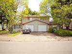
Property valuation of Taylor Road, Central Point, OR: 3358, 3360, 3360, 3376, 3396 (tax assessments)
Other nearby streets: Old Military Road  Old Stage Road (1)
  Old Stage Road (2)
  Taylor Road (1)
  Taylor Road (2)
Listed properties vs overall distribution of properties in Central Point, OR:
Advertisements
3358 Taylor Road
Central Point, OR
Find on map >>
Owner: WILLIAM B/GENESSE I DYER
Land market value: $157,780 (it was $129,740 in 2011)
Improvements market value: $179,440 (it was $138,540 in 2011)
Total market value for property: $337,220 (it was $268,280 in 2011)
Assessments for tax year: 2016
Property use: Residence - One Story
Property class: Improved H&b Use Farm, Rcvg Farm Def, Zoned Efu
Land size: 259,617 square feet
Total improvements area: 1,402 square feet
Zoning: County- Exclusive Farm Use
Improvements:
- Type: Residence
Description: One story
Area: 1,402 square feet
Year built: 1976
Effective year built: 1976
3360 Taylor Road
Central Point, OR
Find on map >>
Owner: ALAN L FRAZIER SR & LINDA J FRAZIER
Land market value: $175,240 (it was $139,570 in 2011)
Improvements market value: $351,310 (it was $283,620 in 2011)
Total market value for property: $526,550 (it was $423,190 in 2011)
Assessments for tax year: 2016
Property use: Manf Strct - Double Wide
Property class: M S H&b Use Farm Land, Rcvng Farm Def, Zoned Efu
Land size: 320,601 square feet
Total improvements area: 4,500 square feet
Zoning: County- Exclusive Farm Use
Improvements:
- Type: Residence
Description: Residential Other Improvements
Year built: 1900
Effective year built: 1900
- Type: Residence
Description: Two story
Area: 3,156 square feet
Year built: 2004
Effective year built: 2004
- Type: Manf Strct
Description: Double wide
Area: 1,344 square feet
Year built: 1969
Effective year built: 1969
3360 Taylor Road
Central Point, OR
Find on map >>
Owner: ALAN LESLIE FRAZIER & LINDA JEAN FRAZIER
Assessments for tax year: 2016
Property class: M S H&b Use Farm Land, Rcvng Farm Def, Zoned Efu
Zoning: County- Exclusive Farm Use
Central Point, OR
Find on map >>
Owner: ALAN LESLIE FRAZIER & LINDA JEAN FRAZIER
Assessments for tax year: 2016
Property class: M S H&b Use Farm Land, Rcvng Farm Def, Zoned Efu
Zoning: County- Exclusive Farm Use
3376 Taylor Road
Central Point, OR
Find on map >>
Owner: MARGARET RUTH RAMBO & GEORGE WESLEY RAMBO
Assessments for tax year: 2016
Property class: Improved H&b Use Farm, Rcvg Farm Def, Zoned Efu
Zoning: County- Exclusive Farm Use
Central Point, OR
Find on map >>
Owner: MARGARET RUTH RAMBO & GEORGE WESLEY RAMBO
Assessments for tax year: 2016
Property class: Improved H&b Use Farm, Rcvg Farm Def, Zoned Efu
Zoning: County- Exclusive Farm Use
3396 Taylor Road
Central Point, OR
Find on map >>
Owner: GEORGE W/MARGARET R RAMBO
Land market value: $137,240 (it was $119,840 in 2011)
Improvements market value: $244,950 (it was $196,710 in 2011)
Total market value for property: $382,190 (it was $316,550 in 2011)
Assessments for tax year: 2016
Property use: Manf Strct - Double Wide
Property class: Improved H&b Use Farm, Rcvg Farm Def, Zoned Efu
Land size: 396,831 square feet
Total improvements area: 3,690 square feet
Zoning: County- Exclusive Farm Use
Improvements:
- Type: Residence
Description: Two story
Area: 2,346 square feet
Year built: 1888
Effective year built: 1988
- Type: Manf Strct
Description: Double wide
Area: 1,344 square feet
Year built: 1978
Effective year built: 1978
Other nearby streets: Old Military Road  Old Stage Road (1)
  Old Stage Road (2)
  Taylor Road (1)
  Taylor Road (2)

Recent posts about Central Point, Oregon on our local forum with over 2,400,000 registered users. Central Point is mentioned 341 times on our forum:
 | Is the Coos Bay/Florence area the "Last Hidden Gem" of Oregon?? (106 replies) |
 | Commute from Ashland to Central Point Oregon (11 replies) |
 | Best place to live in Oregon (not including Portland) (88 replies) |
 | Grants pass/ roseburg (38 replies) |
 | Grants Pass Oregon/ similar places (38 replies) |
 | Central Point/Medford and driving time to Ashland question (2 replies) |

Settings
X


