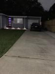
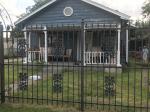
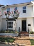
Property valuation of Moonmist Drive, Houston, TX: 5906, 5907, 5910, 5911, 5914, 5915, 5918, 5919, 5922, 5923 (tax assessments)
Other nearby streets: High Star Drive (1)  High Star Drive (2)
  Hornwood Drive
  Moonmist Drive (1)
  Moonmist Drive (2)
Listed properties vs overall distribution of properties in Houston, TX:
Advertisements
5906 Moonmist Drive
Houston, TX 77081
Find on map >>
Owner: GEROLYN C GEORGE
Land value: $72,293
Building value: $55,931
Total value for property: $128,224
Assessments for tax year: 2015
Prior land value: $62,937
Prior building value: $46,953
Prior total value for property: $109,890
Building area: 1,234 square feet
Land size: 8,505 square feet
State classification: Real, Residential, Single-Family
Neighborhood: Shenandoah
Year property was built: 1958
Condition / Desirability / Utility: Average
Exterior wall: Brick / Veneer
Foundation type: Slab
Grade adjustment: C+
Heating / AC: Central Heat/AC
Physical condition: Average
5907 Moonmist Drive
Houston, TX 77081
Find on map >>
Owner: SANTIAGO LUNA
Land value: $74,588
Building value: $71,553
Extra features value: $1,134
Total value for property: $147,275
Assessments for tax year: 2015
Prior land value: $64,935
Prior building value: $61,247
Prior extra features value: $1,134
Prior total value for property: $127,316
Building area: 1,818 square feet
Land size: 8,775 square feet
State classification: Real, Residential, Single-Family
Neighborhood: Shenandoah
Year property was built: 1959
Condition / Desirability / Utility: Average
Exterior wall: Brick / Veneer
Foundation type: Slab
Grade adjustment: C+
Heating / AC: Central Heat/AC
Physical condition: Average
5910 Moonmist Drive
Houston, TX 77081
Find on map >>
Owner: FESSAHIE KIROS & MEHRET KIROS
Land value: $73,440
Building value: $63,240
Total value for property: $136,680
Assessments for tax year: 2015
Prior land value: $63,936
Prior building value: $53,042
Prior total value for property: $116,978
Building area: 1,554 square feet
Land size: 8,640 square feet
State classification: Real, Residential, Single-Family
Neighborhood: Shenandoah
Year property was built: 1958
Condition / Desirability / Utility: Average
Exterior wall: Brick / Veneer
Foundation type: Slab
Grade adjustment: C+
Heating / AC: Central Heat
Physical condition: Average
5911 Moonmist Drive
Houston, TX 77081
Find on map >>
Owner: PAUL DAVID GRIFFITHS
Land value: $74,588
Building value: $79,377
Total value for property: $153,965
Assessments for tax year: 2015
Prior land value: $64,935
Prior building value: $67,931
Prior total value for property: $132,866
Building area: 1,741 square feet
Land size: 8,775 square feet
State classification: Real, Residential, Single-Family
Neighborhood: Shenandoah
Year property was built: 1959
Condition / Desirability / Utility: Average
Cost and design: Partial
Exterior wall: Brick / Veneer
Foundation type: Slab
Grade adjustment: C+
Heating / AC: Central Heat/AC
Physical condition: Average
5914 Moonmist Drive
Houston, TX 77081
Find on map >>
Owner: FAMILY RICE TRUST
Land value: $73,440
Building value: $59,353
Extra features value: $5,851
Total value for property: $138,644
Assessments for tax year: 2015
Prior land value: $63,936
Prior building value: $49,817
Prior extra features value: $5,851
Prior total value for property: $119,604
Building area: 1,519 square feet
Land size: 8,640 square feet
State classification: Real, Residential, Single-Family
Neighborhood: Shenandoah
Year property was built: 1958
Condition / Desirability / Utility: Average
Exterior wall: Brick / Veneer
Foundation type: Slab
Grade adjustment: C+
Heating / AC: Central Heat/AC
Physical condition: Average
5915 Moonmist Drive
Houston, TX 77081
Find on map >>
Owner: GARY BARNES & D BARNES
Land value: $74,588
Building value: $39,350
Total value for property: $113,938
Assessments for tax year: 2015
Prior land value: $64,935
Prior building value: $51,061
Prior total value for property: $115,996
Building area: 1,377 square feet
Land size: 8,775 square feet
State classification: Real, Residential, Single-Family
Neighborhood: Shenandoah
Year property was built: 1959
Condition / Desirability / Utility: Average
Exterior wall: Brick / Veneer
Foundation type: Slab
Grade adjustment: C+
Heating / AC: Central Heat/AC
Physical condition: Average
5918 Moonmist Drive
Houston, TX 77081
Find on map >>
Owner: GRIFFITHS TRUST
Land value: $73,440
Building value: $67,667
Total value for property: $141,107
Assessments for tax year: 2015
Prior land value: $63,936
Prior building value: $56,770
Prior total value for property: $120,706
Building area: 1,800 square feet
Land size: 8,640 square feet
State classification: Real, Residential, Single-Family
Neighborhood: Shenandoah
Year property was built: 1958
Condition / Desirability / Utility: Average
Exterior wall: Brick / Veneer
Foundation type: Slab
Grade adjustment: C+
Heating / AC: Central Heat/AC
Physical condition: Average
5919 Moonmist Drive
Houston, TX 77081
Find on map >>
Owner: LUIS A CHACON & BLANCA A CHACON
Land value: $74,588
Building value: $69,749
Total value for property: $144,337
Assessments for tax year: 2015
Prior land value: $64,935
Prior building value: $59,709
Prior total value for property: $124,644
Building area: 1,391 square feet
Land size: 8,775 square feet
State classification: Real, Residential, Single-Family
Neighborhood: Shenandoah
Year property was built: 1959
Condition / Desirability / Utility: Average
Exterior wall: Brick / Veneer
Foundation type: Slab
Grade adjustment: C+
Heating / AC: Central Heat/AC
Physical condition: Average
5922 Moonmist Drive
Houston, TX 77081
Find on map >>
Owner: BRIAN C ZHOU
Land value: $73,440
Building value: $51,995
Total value for property: $112,395
Assessments for tax year: 2015
Prior land value: $63,936
Prior building value: $44,612
Prior total value for property: $95,508
Building area: 1,304 square feet
Land size: 8,640 square feet
State classification: Real, Residential, Single-Family
Neighborhood: Shenandoah
Year property was built: 1958
Condition / Desirability / Utility: Fair
Exterior wall: Brick / Veneer
Foundation type: Slab
Grade adjustment: C+
Heating / AC: Central Heat/AC
Physical condition: Average
5923 Moonmist Drive
Houston, TX 77081
Find on map >>
Owner: PATRICK F CORTE
Land value: $74,588
Building value: $63,412
Total value for property: $138,000
Assessments for tax year: 2015
Prior land value: $64,935
Prior building value: $64,565
Prior total value for property: $129,500
Building area: 1,260 square feet
Land size: 8,775 square feet
State classification: Real, Residential, Single-Family
Neighborhood: Shenandoah
Year property was built: 1959
Condition / Desirability / Utility: Average
Exterior wall: Brick / Veneer
Foundation type: Slab
Grade adjustment: C+
Heating / AC: Central Heat/AC
Physical condition: Average
Other nearby streets: High Star Drive (1)  High Star Drive (2)
  Hornwood Drive
  Moonmist Drive (1)
  Moonmist Drive (2)

Recent posts about Houston, Texas on our local forum with over 2,400,000 registered users. Houston is mentioned 165,460 times on our forum:
 | Houston to take over Chicago? (61 replies) |
 | Houston CORE developments thread (767 replies) |
 | Houston thoughts from someone who lives in DFW (63 replies) |
 | Houston's economic diversity Thread .. (1271 replies) |
 | Why I left Houston--why did YOU? (133 replies) |
 | Why is Houston so ghetto? (339 replies) |

Settings
X


