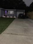
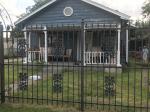
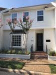
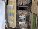
Property valuation of Hazard Street, Houston, TX: 1918 #4, 1919, 1921, 1922, 2000 #6, 2001 #5, 2005, 2008, 2009, 2010 (tax assessments)
Other nearby streets: Hazard Street (1)  Hazard Street (2)
  Mcduffie Street (1)
  Mcduffie Street (2)
  Welch Street
Listed properties vs overall distribution of properties in Houston, TX:
Advertisements
1918 Hazard Street #4
Houston, TX 77019
Find on map >>
Owner: JAMES E PIEHL & ANN M PIEHL
Land value: $325,000
Building value: $129,213
Total value for property: $454,213
Assessments for tax year: 2015
Prior land value: $300,000
Prior building value: $113,803
Prior total value for property: $413,803
Building area: 3,520 square feet
Land size: 5,000 square feet
State classification: Real, Residential, Multi-Family
Neighborhood: Greenway
Year property was built: 1934
Construction type: Wood / Steel Joist
Cooling type: None
Economic obsolescence: Normal
Exterior wall: Brick / Stone
Functional utility: Fair
Heating type: None
Partition type: Normal
Physical condition: Good
Plumbing type: Adequate
Sprinkler type: None
1919 Hazard Street
Houston, TX 77019
Find on map >>
Owner: JUAN RACINE & ANNA M RACINE
Land value: $410,000
Building value: $10,000
Total value for property: $420,000
Assessments for tax year: 2015
Prior land value: $390,000
Prior building value: $10,000
Prior total value for property: $400,000
Building area: 3,058 square feet
Land size: 5,000 square feet
State classification: Real, Residential, Two-Family
Neighborhood: Wain/Windsor
Year property was built: 1930
Condition / Desirability / Utility: Average
Cost and design: Economic misimprovement
Exterior wall: Brick / Veneer
Foundation type: Crawl Space
Grade adjustment: C
Heating / AC: Central Heat/AC
Physical condition: Average
1921 Hazard Street
Houston, TX 77019
Find on map >>
Owner: CLEAR LAKE SHORES PROPERTIES
Land value: $373,100
Building value: $5,729
Total value for property: $378,829
Assessments for tax year: 2015
Prior land value: $354,900
Prior building value: $36,952
Prior total value for property: $391,852
Building area: 2,720 square feet
Land size: 3,500 square feet
State classification: Real, Residential, Two-Family
Neighborhood: Wain/Windsor
Year property was built: 1930
Condition / Desirability / Utility: Poor
Cost and design: Economic misimprovement
Exterior wall: Brick / Veneer
Foundation type: Crawl Space
Grade adjustment: C
Heating / AC: Central Heat/AC
Physical condition: Poor
1922 Hazard Street
Houston, TX 77019
Find on map >>
Owner: NIKOLAY KOSTOV
Land value: $410,000
Building value: $7,591
Extra features value: $4,265
Total value for property: $421,856
Assessments for tax year: 2015
Prior land value: $390,000
Prior building value: $56,781
Prior extra features value: $4,265
Prior total value for property: $451,046
Building area: 2,048 square feet
Land size: 5,000 square feet
State classification: Real, Residential, Two-Family
Neighborhood: Wain/Windsor
Year property was built: 1940
Condition / Desirability / Utility: Average
Cost and design: Economic misimprovement
Exterior wall: Brick / Veneer
Foundation type: Crawl Space
Grade adjustment: C
Heating / AC: Central Heat/AC
Physical condition: Average
2000 Hazard Street #6
Houston, TX 77019
Find on map >>
Owner: OWNER CURRENT
Land value: $487,500
Building value: $92,541
Total value for property: $580,041
Assessments for tax year: 2015
Prior land value: $450,000
Prior building value: $90,050
Prior total value for property: $540,050
Building area: 4,608 square feet
Land size: 7,500 square feet
State classification: Real, Residential, Multi-Family
Neighborhood: Greenway
Year property was built: 1963
Construction type: Wood / Steel Joist
Cooling type: None
Economic obsolescence: Normal
Exterior wall: Masonry / Frame
Functional utility: Average / Normal
Heating type: None
Market adjustment: 25% Market Adjustment
Partition type: Normal
Physical condition: Average / Normal
Plumbing type: Adequate
Sprinkler type: None
2001 Hazard Street #5
Houston, TX 77019
Find on map >>
Owner: JUAN RACINE & ANNA M RACINE
Land value: $325,000
Building value: $110,500
Total value for property: $435,500
Assessments for tax year: 2015
Prior land value: $300,000
Prior building value: $80,000
Prior total value for property: $380,000
Building area: 4,648 square feet
Land size: 5,000 square feet
State classification: Real, Residential, Multi-Family
Neighborhood: Greenway
Year property was built: 1955
Construction type: Wood / Steel Joist
Cooling type: None
Economic obsolescence: Normal
Exterior wall: Brick / Stone
Functional utility: Average / Normal
Heating type: None
Partition type: Normal
Physical condition: Average / Normal
Plumbing type: Adequate
Sprinkler type: None
2005 Hazard Street
Houston, TX 77019
Find on map >>
Owner: GEOFFREY K RUSSELL
Land value: $410,000
Building value: $90,000
Total value for property: $500,000
Assessments for tax year: 2015
Prior land value: $390,000
Prior building value: $86,500
Prior total value for property: $476,500
Building area: 2,048 square feet
Land size: 5,000 square feet
State classification: Real, Residential, Two-Family
Neighborhood: Wain/Windsor
Year property was built: 1938
Condition / Desirability / Utility: Good
Cost and design: Partial
Exterior wall: Brick / Veneer
Foundation type: Crawl Space
Grade adjustment: C+
Heating / AC: Central Heat/AC
Physical condition: Good
2008 Hazard Street
Houston, TX 77019
Find on map >>
Owner: KEVIN J MCMICHAEL & CATHERINE C MCMICHAEL
Land value: $145,480
Building value: $608,905
Total value for property: $754,385
Assessments for tax year: 2015
Prior land value: $127,295
Prior building value: $562,782
Prior total value for property: $690,077
Building area: 3,420 square feet
Land size: 2,387 square feet
State classification: Real, Residential, Single-Family
Neighborhood: Hyde
Year property was built: 2005
Condition / Desirability / Utility: Average
Cost and design: New / Rebuilt
Exterior wall: Stucco
Foundation type: Slab
Grade adjustment: A-
Heating / AC: Central Heat/AC
Physical condition: Average
2009 Hazard Street
Houston, TX 77019
Find on map >>
Owner: A SHAWN & PATTERSON C GENEVIEVE
Land value: $145,520
Building value: $377,297
Total value for property: $522,817
Assessments for tax year: 2015
Prior land value: $127,330
Prior building value: $353,733
Prior total value for property: $481,063
Building area: 2,974 square feet
Land size: 2,388 square feet
State classification: Real, Residential, Single-Family
Neighborhood: Hyde
Year property was built: 1997
Condition / Desirability / Utility: Average
Cost and design: New / Rebuilt
Exterior wall: Stucco
Foundation type: Slab
Grade adjustment: B
Heating / AC: Central Heat/AC
Physical condition: Average
2010 Hazard Street
Houston, TX 77019
Find on map >>
Owner: STEPHEN N DEVOS & BRENDA L DEVOS
Land value: $145,480
Building value: $608,905
Total value for property: $754,385
Assessments for tax year: 2015
Prior land value: $127,295
Prior building value: $562,782
Prior total value for property: $690,077
Building area: 3,420 square feet
Land size: 2,387 square feet
State classification: Real, Residential, Single-Family
Neighborhood: Hyde
Year property was built: 2005
Condition / Desirability / Utility: Average
Cost and design: New / Rebuilt
Exterior wall: Stucco
Foundation type: Slab
Grade adjustment: A-
Heating / AC: Central Heat/AC
Physical condition: Average
Other nearby streets: Hazard Street (1)  Hazard Street (2)
  Mcduffie Street (1)
  Mcduffie Street (2)
  Welch Street

Recent posts about Houston, Texas on our local forum with over 2,400,000 registered users. Houston is mentioned 165,460 times on our forum:
 | Houston to take over Chicago? (61 replies) |
 | Houston CORE developments thread (767 replies) |
 | Houston thoughts from someone who lives in DFW (63 replies) |
 | Houston's economic diversity Thread .. (1271 replies) |
 | Why I left Houston--why did YOU? (133 replies) |
 | Why is Houston so ghetto? (339 replies) |

Settings
X


