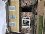
Property valuation of Branard Street, Houston, TX: 502, 504, 505, 506, 508 #16, 509, 513, 514, 515, 519 #16 (tax assessments)
Other nearby streets: Branard Street  Garrott Street
  Sul Ross Street
  W Main Street (1)
  W Main Street (2)
Listed properties vs overall distribution of properties in Houston, TX:
Advertisements
502 Branard Street
Houston, TX 77006
Find on map >>
Owner: PAUL THERIOT WAYNE TRUST
Land value: $140,000
Building value: $137,959
Total value for property: $277,959
Assessments for tax year: 2015
Prior land value: $120,000
Prior building value: $113,960
Prior total value for property: $233,960
Building area: 1,712 square feet
Land size: 2,500 square feet
State classification: Real, Residential, Single-Family
Neighborhood: Montrose
Year property was built: 1976
Condition / Desirability / Utility: Average
Exterior wall: Frame / Concrete block
Foundation type: Slab
Grade adjustment: C+
Heating / AC: Central Heat/AC
Physical condition: Average
504 Branard Street
Houston, TX 77006
Find on map >>
Owner: OWNER CURRENT
Land value: $337,500
Building value: $292,570
Total value for property: $630,070
Assessments for tax year: 2015
Prior land value: $281,250
Prior building value: $316,201
Prior extra features value: $3,917
Prior total value for property: $601,368
Building area: 2,312 square feet
Land size: 6,250 square feet
State classification: Real, Residential, Single-Family
Neighborhood: Moyne/Others
Year property was built: 1918
Condition / Desirability / Utility: Very Good
Cost and design: Partial
Exterior wall: Stucco
Foundation type: Crawl Space
Grade adjustment: B-
Heating / AC: Central Heat/AC
Physical condition: Very Good
505 Branard Street
Houston, TX 77006
Find on map >>
Owner: BILLY F AGEE
Land value: $311,250
Building value: $236,654
Extra features value: $4,166
Total value for property: $552,070
Assessments for tax year: 2015
Prior land value: $259,375
Prior building value: $242,073
Prior extra features value: $4,166
Prior total value for property: $505,614
Building area: 4,062 square feet
Land size: 5,375 square feet
State classification: Real, Residential, Single-Family
Neighborhood: Moyne/Others
Year property was built: 1970
Condition / Desirability / Utility: Average
Exterior wall: Brick / Veneer
Foundation type: Slab
Grade adjustment: B-
Heating / AC: Central Heat/AC
Physical condition: Good
506 Branard Street
Houston, TX 77006
Find on map >>
Owner: JOHN M CRAIN & CATHERINE L CRAIN
Land value: $300,000
Building value: $63,899
Total value for property: $361,607
Assessments for tax year: 2015
Prior land value: $250,000
Prior building value: $64,302
Prior total value for property: $312,010
Building area: 2,042 square feet
Land size: 5,000 square feet
State classification: Real, Residential, Single-Family
Neighborhood: Moyne/Others
Year property was built: 1920
Condition / Desirability / Utility: Poor
Exterior wall: Stucco
Foundation type: Crawl Space
Grade adjustment: B-
Heating / AC: Central Heat/AC
Physical condition: Fair
508 Branard Street #16
Houston, TX 77006
Find on map >>
Owner: 510BRANARD LLC
Land value: $853,125
Building value: $251,875
Total value for property: $1,105,000
Assessments for tax year: 2015
Prior land value: $787,500
Prior building value: $203,906
Prior total value for property: $991,406
Building area: 11,682 square feet
Land size: 13,125 square feet
State classification: Real, Residential, Multi-Family
Neighborhood: Greenway
Year property was built: 1962
Construction type: Wood / Steel Joist
Cooling type: None
Economic obsolescence: Normal
Exterior wall: Brick / Stone
Functional utility: Average / Normal
Heating type: None
Market adjustment: 10% Market Adjustment
Partition type: Normal
Physical condition: Average / Normal
Plumbing type: Adequate
Sprinkler type: None
509 Branard Street
Houston, TX 77006
Find on map >>
Owner: MELINDA JACKSON
Land value: $337,500
Building value: $158,082
Total value for property: $495,582
Assessments for tax year: 2015
Prior land value: $281,250
Prior building value: $118,750
Prior total value for property: $400,000
Building area: 3,345 square feet
Land size: 6,250 square feet
State classification: Real, Residential, Single-Family
Neighborhood: Moyne/Others
Year property was built: 1946
Condition / Desirability / Utility: Average
Exterior wall: Aluminum / Vinyl
Foundation type: Crawl Space
Grade adjustment: B-
Heating / AC: Central Heat/AC
Physical condition: Average
513 Branard Street
Houston, TX 77006
Find on map >>
Owner: DAVID W MCCREA
Land value: $431,250
Building value: $315,625
Total value for property: $746,875
Assessments for tax year: 2015
Prior land value: $359,375
Prior building value: $315,625
Prior total value for property: $675,000
Building area: 3,773 square feet
Land size: 9,375 square feet
State classification: Real, Residential, Single-Family
Neighborhood: Moyne/Others
Year property was built: 1917
Condition / Desirability / Utility: Good
Cost and design: Partial
Exterior wall: Stucco
Foundation type: Crawl Space
Grade adjustment: B-
Heating / AC: Central Heat/AC
Physical condition: Good
514 Branard Street
Houston, TX 77006
Find on map >>
Owner: PETER HARRIS
Land value: $337,500
Building value: $192,500
Total value for property: $530,000
Assessments for tax year: 2015
Prior land value: $281,250
Prior building value: $222,495
Prior total value for property: $503,745
Building area: 2,920 square feet
Land size: 6,250 square feet
State classification: Real, Residential, Two-Family
Neighborhood: Moyne/Others
Year property was built: 1946
Condition / Desirability / Utility: Average
Cost and design: Partial
Exterior wall: Stucco
Foundation type: Crawl Space
Grade adjustment: B-
Heating / AC: None
Physical condition: Average
515 Branard Street
Houston, TX 77006
Find on map >>
Owner: DONALD WHITTLE
Land value: $431,250
Building value: $94,721
Total value for property: $525,971
Assessments for tax year: 2015
Prior land value: $359,375
Prior building value: $95,086
Prior total value for property: $454,461
Building area: 2,346 square feet
Land size: 9,375 square feet
State classification: Real, Residential, Single-Family
Neighborhood: Moyne/Others
Year property was built: 1917
Condition / Desirability / Utility: Fair
Exterior wall: Stucco
Foundation type: Crawl Space
Grade adjustment: B-
Heating / AC: Central Heat/AC
Physical condition: Fair
519 Branard Street #16
Houston, TX 77006
Find on map >>
Owner: BRANARD COMPLEX LLC
Land value: $609,375
Building value: $302,625
Total value for property: $912,000
Assessments for tax year: 2015
Prior land value: $562,500
Prior building value: $334,014
Prior total value for property: $896,514
Building area: 12,496 square feet
Land size: 9,375 square feet
State classification: Real, Residential, Multi-Family
Neighborhood: Greenway
Year property was built: 1959
Construction type: Wood / Steel Joist
Cooling type: None
Economic obsolescence: Normal
Exterior wall: None
Exterior wall: Masonry / Frame
Functional utility: Average / Normal
Heating type: None
Partition type: Normal
Physical condition: Average / Normal
Plumbing type: Adequate
Sprinkler type: None
Other nearby streets: Branard Street  Garrott Street
  Sul Ross Street
  W Main Street (1)
  W Main Street (2)

Recent posts about Houston, Texas on our local forum with over 2,400,000 registered users. Houston is mentioned 165,460 times on our forum:
 | Houston to take over Chicago? (61 replies) |
 | Houston CORE developments thread (767 replies) |
 | Houston thoughts from someone who lives in DFW (63 replies) |
 | Houston's economic diversity Thread .. (1271 replies) |
 | Why I left Houston--why did YOU? (133 replies) |
 | Why is Houston so ghetto? (339 replies) |

Settings
X


