Property valuation of Branston Road, Ooltewah, TN: 5002, 5003, 5008, 5011, 5019, 5020, 5023, 5024 (tax assessments)

Listed properties vs overall distribution of properties in Ooltewah, TN:
Advertisements
Branston Road
Ooltewah, TN
Find on map >>
First owner: PLACE HOMEOWNERS STRATFORD
Second owner: ASSOC
Appraised land value: $150,600
Total appraised value for property: $150,600
Assessments for tax year: 2014
Property type: Community Lot
Land use: Community lots, Playgrounds and athletic areas
Lands:
Sales:
Ooltewah, TN
Find on map >>
First owner: PLACE HOMEOWNERS STRATFORD
Second owner: ASSOC
Appraised land value: $150,600
Total appraised value for property: $150,600
Assessments for tax year: 2014
Property type: Community Lot
Land use: Community lots, Playgrounds and athletic areas
Lands:
-
Land use: Residential
Calculation method: Per Acre
Land area: 750 square feet
Road type: Asphalt
Utilities: All
Sales:
-
Sale date: 12/21/1976
Sale type: Quitclaim Deed
-
Sale date: 02/07/2013
Sale type: Quitclaim Deed
Branston Road
Ooltewah, TN
Find on map >>
First owner: PLACE HOMEOWNERS STRATFORD
Second owner: ASSOC
Appraised land value: $1,000
Total appraised value for property: $1,000
Assessments for tax year: 2014
Property type: Community Lot
Land use: Community lots, Playgrounds and athletic areas
Lands:
Sales:
Ooltewah, TN
Find on map >>
First owner: PLACE HOMEOWNERS STRATFORD
Second owner: ASSOC
Appraised land value: $1,000
Total appraised value for property: $1,000
Assessments for tax year: 2014
Property type: Community Lot
Land use: Community lots, Playgrounds and athletic areas
Lands:
-
Land use: Residential
Calculation method: Site Cost
Road type: Asphalt
Utilities: All
Sales:
-
Sale date: 12/21/1976
Sale type: Quitclaim Deed
-
Sale date: 02/07/2013
Sale type: Quitclaim Deed
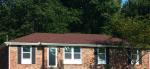
5002 Branston Road
Ooltewah, TN
Find on map >>
First owner: WILLIAM C HANKINS & ELIZABETH A HANKINS
Appraised land value: $50,000 (it was $50,000 in 2010)
Appraised building value: $234,700 (it was $263,100 in 2010)
Total appraised value for property: $284,700 (it was $313,100 in 2010)
Assessments for tax year: 2014
Property type: Residential
Land use: One Family Household Unit
Buildings:
Lands:
Sales:
Ooltewah, TN
Find on map >>
First owner: WILLIAM C HANKINS & ELIZABETH A HANKINS
Appraised land value: $50,000 (it was $50,000 in 2010)
Appraised building value: $234,700 (it was $263,100 in 2010)
Total appraised value for property: $284,700 (it was $313,100 in 2010)
Assessments for tax year: 2014
Property type: Residential
Land use: One Family Household Unit
Buildings:
-
Current use: Residential
Year built: 1989
Effective year built: 1989
Base area: 2,819 square feet
Total adjusted area: 3,644 square feet
Lands:
-
Land use: Residential
Land area: 100 square feet
Road type: Asphalt
Utilities: All
Sales:
-
Sale date: 06/04/1991
Sale type: Quitclaim Deed
-
Sale date: 05/05/1995
Sale type: Assumption Deed
-
Sale date: 01/29/1999
Sale type: Warranty Deed
-
Sale date: 06/20/2000
Sale type: Warranty Deed
Sale confirmation: Limited Confirmed Sale
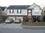
5003 Branston Road
Ooltewah, TN
Find on map >>
First owner: SHAWN NELSON
Second owner: KATHERINE NELSON
Appraised land value: $50,000 (it was $50,000 in 2010)
Appraised building value: $263,700 (it was $281,300 in 2010)
Total appraised value for property: $313,700 (it was $331,300 in 2010)
Assessments for tax year: 2014
Property type: Residential
Land use: One Family Household Unit
Buildings:
Lands:
Sales:
Ooltewah, TN
Find on map >>
First owner: SHAWN NELSON
Second owner: KATHERINE NELSON
Appraised land value: $50,000 (it was $50,000 in 2010)
Appraised building value: $263,700 (it was $281,300 in 2010)
Total appraised value for property: $313,700 (it was $331,300 in 2010)
Assessments for tax year: 2014
Property type: Residential
Land use: One Family Household Unit
Buildings:
-
Current use: Residential
Year built: 1988
Effective year built: 1988
Base area: 3,062 square feet
Total adjusted area: 3,979 square feet
Lands:
-
Land use: Residential
Land area: 100 square feet
Road type: Asphalt
Utilities: All
Sales:
-
Sale date: 12/21/1976
Sale type: Quitclaim Deed
-
Sale date: 07/22/1987
Sale type: Warranty Deed
-
Sale date: 10/16/1995
Sale type: Warranty Deed
-
Sale date: 08/04/2003
Sale type: Warranty Deed
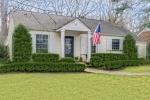
5008 Branston Road
Ooltewah, TN
Find on map >>
First owner: DALE H PARKS & EVA M PARKS
Appraised land value: $50,000 (it was $50,000 in 2010)
Appraised building value: $220,300 (it was $234,700 in 2010)
Total appraised value for property: $270,300 (it was $284,700 in 2010)
Assessments for tax year: 2014
Property type: Residential
Land use: One Family Household Unit
Buildings:
Lands:
Sales:
Ooltewah, TN
Find on map >>
First owner: DALE H PARKS & EVA M PARKS
Appraised land value: $50,000 (it was $50,000 in 2010)
Appraised building value: $220,300 (it was $234,700 in 2010)
Total appraised value for property: $270,300 (it was $284,700 in 2010)
Assessments for tax year: 2014
Property type: Residential
Land use: One Family Household Unit
Buildings:
-
Current use: Residential
Year built: 1984
Effective year built: 1984
Base area: 1,180 square feet
Total adjusted area: 3,435 square feet
Lands:
-
Land use: Residential
Land area: 100 square feet
Road type: Asphalt
Utilities: All
Sales:
-
Sale date: 12/21/1976
Sale type: Quitclaim Deed
-
Sale date: 11/01/1985
Sale type: Warranty Deed
Sale confirmation: Limited Confirmed Sale
-
Sale date: 04/30/1998
Sale type: Warranty Deed
Sale confirmation: Limited Confirmed Sale
-
Sale date: 12/30/1998
Sale type: Warranty Deed
Sale confirmation: Limited Confirmed Sale
5011 Branston Road
Ooltewah, TN
Find on map >>
First owner: ALEX MALON & MARYANN S MALON
Appraised land value: $50,000 (it was $50,000 in 2010)
Appraised building value: $190,400 (it was $195,500 in 2010)
Total appraised value for property: $240,400 (it was $245,500 in 2010)
Assessments for tax year: 2014
Property type: Residential
Land use: One Family Household Unit
Buildings:
Lands:
Sales:
Ooltewah, TN
Find on map >>
First owner: ALEX MALON & MARYANN S MALON
Appraised land value: $50,000 (it was $50,000 in 2010)
Appraised building value: $190,400 (it was $195,500 in 2010)
Total appraised value for property: $240,400 (it was $245,500 in 2010)
Assessments for tax year: 2014
Property type: Residential
Land use: One Family Household Unit
Buildings:
-
Current use: Residential
Year built: 1984
Effective year built: 1984
Base area: 1,746 square feet
Total adjusted area: 2,784 square feet
Lands:
-
Land use: Residential
Land area: 100 square feet
Road type: Asphalt
Utilities: All
Sales:
-
Sale date: 12/21/1976
Sale type: Quitclaim Deed
-
Sale date: 10/26/1984
Sale type: Quitclaim Deed
5019 Branston Road
Ooltewah, TN
Find on map >>
First owner: LEE R MILLER & LYNN W MILLER
Appraised land value: $50,000 (it was $50,000 in 2010)
Appraised building value: $212,100 (it was $225,100 in 2010)
Total appraised value for property: $262,100 (it was $275,100 in 2010)
Assessments for tax year: 2014
Property type: Residential
Land use: One Family Household Unit
Buildings:
Lands:
Sales:
Ooltewah, TN
Find on map >>
First owner: LEE R MILLER & LYNN W MILLER
Appraised land value: $50,000 (it was $50,000 in 2010)
Appraised building value: $212,100 (it was $225,100 in 2010)
Total appraised value for property: $262,100 (it was $275,100 in 2010)
Assessments for tax year: 2014
Property type: Residential
Land use: One Family Household Unit
Buildings:
-
Current use: Residential
Year built: 1988
Effective year built: 1988
Base area: 1,486 square feet
Total adjusted area: 3,096 square feet
Lands:
-
Land use: Residential
Land area: 100 square feet
Road type: Asphalt
Utilities: All
Sales:
-
Sale date: 12/21/1976
Sale type: Quitclaim Deed
-
Sale date: 03/15/1979
Sale type: Quitclaim Deed
-
Sale date: 07/15/1982
Sale type: Quitclaim Deed
-
Sale date: 12/19/1986
Sale type: Warranty Deed
Sale confirmation: Limited Confirmed Sale
5020 Branston Road
Ooltewah, TN
Find on map >>
First owner: DAVID M YOUNG & LAUREN D YOUNG
Appraised land value: $50,000 (it was $50,000 in 2010)
Appraised building value: $226,600 (it was $235,900 in 2010)
Total appraised value for property: $276,600 (it was $285,900 in 2010)
Assessments for tax year: 2014
Property type: Residential
Land use: One Family Household Unit
Buildings:
Lands:
Sales:
Ooltewah, TN
Find on map >>
First owner: DAVID M YOUNG & LAUREN D YOUNG
Appraised land value: $50,000 (it was $50,000 in 2010)
Appraised building value: $226,600 (it was $235,900 in 2010)
Total appraised value for property: $276,600 (it was $285,900 in 2010)
Assessments for tax year: 2014
Property type: Residential
Land use: One Family Household Unit
Buildings:
-
Current use: Residential
Year built: 1987
Effective year built: 1987
Base area: 1,440 square feet
Total adjusted area: 3,238 square feet
Lands:
-
Land use: Residential
Land area: 100 square feet
Road type: Asphalt
Utilities: All
Sales:
-
Sale date: 12/21/1976
Sale type: Quitclaim Deed
-
Sale date: 04/24/1986
Sale type: Warranty Deed
-
Sale date: 05/04/1995
Sale type: Warranty Deed
-
Sale date: 07/03/2003
Sale type: Warranty Deed
5023 Branston Road
Ooltewah, TN
Find on map >>
First owner: JAMES W WRINKLE & HELGA WRINKLE
Appraised land value: $50,000 (it was $50,000 in 2010)
Appraised building value: $169,500 (it was $180,200 in 2010)
Total appraised value for property: $219,500 (it was $230,200 in 2010)
Assessments for tax year: 2014
Property type: Residential
Land use: One Family Household Unit
Buildings:
Lands:
Sales:
Ooltewah, TN
Find on map >>
First owner: JAMES W WRINKLE & HELGA WRINKLE
Appraised land value: $50,000 (it was $50,000 in 2010)
Appraised building value: $169,500 (it was $180,200 in 2010)
Total appraised value for property: $219,500 (it was $230,200 in 2010)
Assessments for tax year: 2014
Property type: Residential
Land use: One Family Household Unit
Buildings:
-
Current use: Residential
Year built: 1979
Effective year built: 1979
Base area: 2,030 square feet
Total adjusted area: 2,886 square feet
Lands:
-
Land use: Residential
Land area: 100 square feet
Road type: Asphalt
Utilities: All
Sales:
-
Sale date: 12/15/1977
Sale type: Quitclaim Deed
-
Sale date: 03/20/1987
Sale type: Warranty Deed
Sale confirmation: Limited Confirmed Sale
5024 Branston Road
Ooltewah, TN
Find on map >>
First owner: SAM L HARVEY III & DANA R HARVEY
Appraised land value: $50,000 (it was $50,000 in 2010)
Appraised building value: $281,700 (it was $281,700 in 2010)
Total appraised value for property: $331,700 (it was $331,700 in 2010)
Assessments for tax year: 2014
Property type: Residential
Land use: One Family Household Unit
Buildings:
Lands:
Sales:
Ooltewah, TN
Find on map >>
First owner: SAM L HARVEY III & DANA R HARVEY
Appraised land value: $50,000 (it was $50,000 in 2010)
Appraised building value: $281,700 (it was $281,700 in 2010)
Total appraised value for property: $331,700 (it was $331,700 in 2010)
Assessments for tax year: 2014
Property type: Residential
Land use: One Family Household Unit
Buildings:
-
Current use: Residential
Year built: 1989
Effective year built: 1989
Base area: 2,541 square feet
Total adjusted area: 3,658 square feet
Appraised value: $272,000
-
Current use: Residential
Year built: 1995
Effective year built: 1995
Base area: 648 square feet
Total adjusted area: 648 square feet
Appraised value: $9,700
Lands:
-
Land use: Residential
Land area: 100 square feet
Road type: Asphalt
Utilities: All
Sales:
-
Sale date: 04/02/1987
Sale type: Warranty Deed
Sale confirmation: Limited Confirmed Sale
-
Sale date: 08/14/1992
Sale type: Warranty Deed
Sale confirmation: Limited Confirmed Sale
-
Sale date: 07/28/2004
Sale type: Warranty Deed
Sale confirmation: Limited Confirmed Sale
-
Sale date: 06/30/2010
Sale type: Warranty Deed
Sale confirmation: Limited Confirmed Sale

Recent posts about Ooltewah, Tennessee on our local forum with over 2,400,000 registered users. Ooltewah is mentioned 754 times on our forum:
 | Ooltewah built on a trash dump? (3 replies) |
| Thoughts and opinions on Ooltewah (3 replies) |
| Property taxes- Hamilton county, Ooltewah address ? (2 replies) |
| Ooltewah & Surrounding Crime (0 replies) |
| Ooltewah vs. Central (or other) High schools (2 replies) |
| Maybe Moving To Ooltewah (0 replies) |

Settings
X

Recently Added Photos

Ooltewah, TN

Ooltewah, TN
Nashville, TN

Nashville, TN

Nashville, TN

Nashville, TN

Nashville, TN
Nashville, TN

Nashville, TN

Nashville, TN

Nashville, TN
Nashville, TN
Request disassociating your name from street-level assessment address

Recent home sales, price trends, and home value evaluator powered by Onboard Informatics
© 2024 Onboard Informatics. Information is deemed reliable but not guaranteed.
© 2024 Onboard Informatics. Information is deemed reliable but not guaranteed.
Some parts © 2024 Advameg, Inc.
Compilation, repackaging, or reproduction prohibited. Users are forewarned that it is incumbent upon them to verify information with the responsible state agency. Advameg, Inc. does not guarantee the data presented is up-to-date nor does it assume responsibility for updating it. Therefore any names, owners or addresses may have changed. Use of any information published here to contact the persons might be prohibited by the law.