


Interactive Photo Map of Downtown Raleigh
Posted 08-08-2008 at 09:40 AM by North_Raleigh_Guy
A few months ago I started to link my pictures to a map of Downtown Raleigh I created using Google Maps. This is an ongoing project which I hope to refine over time. Click on the map image below and it will take you to the interactive Google map with links to pictures of Downtown Raleigh neighborhoods and landmarks that I have photographed. You can click on the place markers and a picture of the neighborhood or landmark will "pop-up". I will add to this map as I take more pictures in the future.
Click on the Map pictured below to be taken to the "Interactive Photo Map":
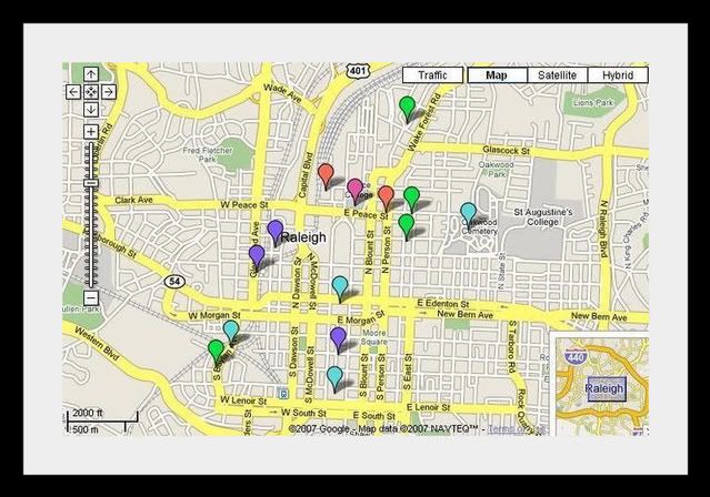
Click on the Map pictured below to be taken to the "Interactive Photo Map":
Total Comments 3
Comments
-


Good Job, NRG!Posted 08-08-2008 at 08:18 PM by MikeJaquish

-
Right on, North Raleigh Guy! Nice project!Posted 08-27-2008 at 12:25 PM by poogie777

-
Frickin' fantastic, NRG. Love it! I gotta look into this. It's a lot of fun and informative. Thanks for putting this together.
 Posted 11-05-2008 at 11:49 PM by CaliBoy


